Kingston Norman Rogers Airport (CYGK / YGK)
Empty legs and charters from Kingston
CYGK airport at a glance
- ICAO code
- CYGK
- IATA code
- YGK
- City
- Kingston
- Region
- Ontario
- Country
- Canada
- Elevation
- 305 ft (93 m)
- Time zone
- America/Toronto (UTC-5)
- Coordinates
- 44.2253° N, 76.5969° W
- Empty legs from
- 1
- Empty legs to
- 2
Weather & airport info CYGK
Current weather
Marginal visual conditions (MVFR)observed 03 Nov, 17:24 UTC- Wind
- 9 kt (17 km/h) from south (190°)
- Visibility
- 10 km or more
- Clouds
- few clouds at 800 ft, overcast at 1,600 ft
- Temperature
- 14 °C (dew point 12 °C)
- Pressure (QNH)
- 1,020 hPa
Original weather report (METAR)
SPECI CYGK 031724Z 19009KT 15SM FEW008 OVC016 14/12 A3013 RMK SF2SC6 SLP207
Forecast (TAF)
- 03 Nov, 21:00–00:00 UTCfrom8 kt (15 km/h) from south (180°) · visibility 10 km or more · overcast at 3,000 ft
- 03 Nov, 21:00–00:00 UTCtemporarilyovercast at 2,000 ft
- 04 Nov, 00:00–01:00 UTCfrom8 kt (15 km/h) from south (180°) · visibility 10 km or more · broken clouds at 4,000 ft
Original forecast (TAF)
TAF AMD CYGK 031630Z 0316/0401 19010KT 5SM -RA -DZ BR BKN003 OVC012 TEMPO 0316/0318 P6SM NSW SCT012 BKN040 FM031800 18010G20KT P6SM SCT006 OVC012 TEMPO 0318/0321 SCT012 BKN040 PROB30 0318/0321 BKN006 OVC012 FM032100 18008KT P6SM OVC030 TEMPO 0321/0324 OVC020 FM040000 18008KT P6SM BKN040 RMK NXT FCST BY 032000Z
Airport
- Elevation
- 305 ft (93 m)
- Sunrise / Sunset
- 06:45 / 16:54 local time
Runways
| Runway | Length | Surface | Lighted |
|---|---|---|---|
| 01/19 | 1,829 m (6,001 ft) | asphalt | yes |
| 07/25 | 1,199 m (3,933 ft) | asphalt | yes |
For information only, not for flight planning. Weather can change quickly; always rely on official reports. Sources: aviationweather.gov (NOAA), OurAirports.
Airport map CYGK
Full screen →Runways white, taxiways yellow with designators, closed taxiways and runways per NOTAM in red.
Official charts
Aerodrome, approach and ground charts are published by the national air navigation service in its AIP:
NAV CANADA →For information only, not for navigation. Always use current official charts and NOTAMs.
Current NOTAMs for CYGK(6)
NOTAMs (Notices to Air Missions) announce short-term changes at an airport: closed runways or taxiways, unserviceable approach aids, obstacles, airspace restrictions.
- Out of servicePAPI: unserviceableJ6785/26· until 22 Dec, 17:00 UTC (estimated)
The Precision Approach Path Indicator (PAPI) for runway 01 is out of service. The PAPI helps pilots find the correct glide path for landing.
Show original text
PAPI 01 U/S
J6785/26 NOTAMR J4265/26
 Q) CZYZ/QLPAS/IV/BO/A/000/999/4414N07636W005
 A) CYGK B) 2609291256 C) 2612221700EST
 E) PAPI 01 U/S
- NoticePAPIJ7678/26· until 22 Jan, 11:15 UTC
The Precision Approach Path Indicator (PAPI) for runway 19 is set to continuous intensity 1. The PAPI helps pilots maintain the correct approach angle to the runway.
Show original text
PAPI 19 ON CONTINUOUS INTST 1
J7678/26 NOTAMN
 Q) CZYZ/QLPXX/IV/BO/A/000/999/4414N07636W005
 A) CYGK B) 2611030400 C) 2701221115
 D) DAILY 0400-1115
 E) PAPI 19 ON CONTINUOUS INTST 1
Hours: DAILY 0400-1115
- NoticePAPIJ7681/26· until 22 Jan, 11:15 UTC
The Abbreviated Precision Approach Path Indicators (APAPI) for runways 07 and 25 are continuously set to intensity 1. These lights help pilots maintain the correct approach angle to the runway.
Show original text
APAPI 07 AND 25 ON CONTINUOUSLY INTST 1
J7681/26 NOTAMN
 Q) CZYZ/QLPXX/IV/BO/A/000/999/4414N07636W005
 A) CYGK B) 2611030400 C) 2701221115
 D) DAILY 0400-1115
 E) APAPI 07 AND 25 ON CONTINUOUSLY INTST 1
Hours: DAILY 0400-1115
- NoticeInstrument approach procedure: changedJ6791/26· until 22 Dec, 17:00 UTC (estimated)
For the RNAV(GNSS) approach to runway 01, LPV and LNAV/VNAV minima are not authorized. The published distance/altitude table and the published constant descent angle are not valid.
Show original text
RNAV(GNSS) RWY 01 APCH: LPV AND LNAV/VNAV MINIMA: NOT AUTH PUBLISHED DIST/ALT TABLE NOT VALID PUBLISHED CONSTANT DESCENT ANGLE NOT VALID
J6791/26 NOTAMR J4268/26
 Q) CZYZ/QPICH/I/NBO/A/000/999/4414N07636W005
 A) CYGK B) 2609291359 C) 2612221700EST
 E) RNAV(GNSS) RWY 01 APCH:
 LPV AND LNAV/VNAV MINIMA: NOT AUTH
 PUBLISHED DIST/ALT TABLE NOT VALID
 PUBLISHED CONSTANT DESCENT ANGLE NOT VALID
- NoticeStandard instrument departure: changedJ6790/26· until 22 Dec, 17:00 UTC (estimated)
For the departure procedures on runway 19 in the airport chart, no assessment has been made. Pilots are responsible for obstacle and terrain avoidance.
Show original text
AD CHART: DEP PROC: RWY 19: NOT ASSESSED. PILOT RESPONSIBLE FOR OBST AND TERRAIN AVOIDANCE
J6790/26 NOTAMR J4267/26
 Q) CZYZ/QPDCH/I/NBO/A/000/999/4414N07636W005
 A) CYGK B) 2609291356 C) 2612221700EST
 E) AD CHART: DEP PROC: RWY 19: NOT ASSESSED.
 PILOT RESPONSIBLE FOR OBST AND TERRAIN AVOIDANCE
- NoticeDeclared distances: changedJ6786/26· until 22 Dec, 17:00 UTC (estimated)
Threshold 01 DISPLACED 663 ft DUE obstacle 1770 ft before threshold 01 on extended RCL 47 ft above ground 330 ft above sea level, MARKED by FLAGS and lighted. DECLARED DIST with runway 01/19 LENGTH REDUCED: runway 01: TORA 5780 TODA 6305 ASDA 6000 LDA 4958 runway 19: TORA 4958 TODA 5288 ASDA 6000 LDA 5000
Show original text
THR 01 DISPLACED 663FT DUE OBSTACLE 1770FT BFR THR 01 ON EXTENDED RCL 47FT AGL 330FT AMSL, MARKED BY FLAGS AND LGTD. DECLARED DIST WITH RWY 01/19 LENGTH REDUCED: RWY 01: TORA 5780 TODA 6305 ASDA 6000 LDA 4958 RWY 19: TORA 4958 TODA 5288 ASDA 6000 LDA 5000
J6786/26 NOTAMR J4266/26
 Q) CZYZ/QMDCH/IV/NBO/A/000/999/4414N07636W005
 A) CYGK B) 2609291258 C) 2612221700EST
 E) THR 01 DISPLACED 663FT DUE OBSTACLE 1770FT BFR THR 01 ON
 EXTENDED RCL 47FT AGL 330FT AMSL, MARKED BY FLAGS AND LGTD.
 DECLARED DIST WITH RWY 01/19 LENGTH REDUCED:
 RWY 01: TORA 5780 TODA 6305 ASDA 6000 LDA 4958
 RWY 19: TORA 4958 TODA 5288 ASDA 6000 LDA 5000
For information only, not for flight planning or operational use. Always rely on an official pre-flight briefing. This list may be incomplete or out of date. Explanations and expanded abbreviations are generated automatically. The original text is authoritative. Source: FAA NOTAM Management Service (SWIM).
Private jet traffic in Kingston Norman Rogers Airport (last 30 days)
- Arrivals
- 65
- Departures
- 33
- Different jets
- 43
Most frequent origins: Sudbury Airport (9), Lester B. Pearson International Airport (8), Ottawa Macdonald-Cartier International Airport (5), Thunder Bay Airport (4), Billy Bishop Toronto City Centre Airport (3).
Most frequent destinations: Sudbury Airport (11).
Most common aircraft types: Pilatus PC-12 (53), Dassault Falcon 900 (5), Bombardier Challenger 600/650 (5), Embraer Legacy 450/Praetor 500 (5), Pilatus PC-24 (5).
Friday is the busiest day.
Our own analysis of public ADS-B signals from business jets. Not every flight is received, and jets with a removal request are excluded.
Empty legs from CYGK
1 departures available
 CYGK · Kingston Norman Rogers Airport
* Total price incl. 10% service fee, converted to your selected currency. Price subject to operator confirmation.
Empty legs to CYGK
2 arrivals available
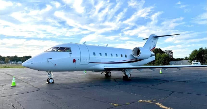 Sun, Nov 22in 19 daysTorontoCYYZ · Lester B. Pearson International AirportKingstonCYGK · Kingston Norman Rogers AirportChallenger 60410—$9,90022NovToronto → KingstonCYYZ → CYGK · in 19 daysChallenger 604 · 10 seats$9,900
 Thu, Dec 312:06LondonCYXU · London AirportKingstonCYGK · Kingston Norman Rogers AirportGulfstream G200142mOn request3DecLondon → KingstonCYXU → CYGK · 12:06Gulfstream G200 · 1 seat · 42mOn request
* Total price incl. 10% service fee, converted to your selected currency. Price subject to operator confirmation.
Map: Kingston Airport
View the location of Kingston – YGK/CYGK. Zoom in to explore the area around the airport.
About the airport
Kingston Norman Rogers Airport (YGK/CYGK) is the key private jet gateway for Kingston. PrivJet gives you instant access to charter flights and empty legs: fast, discreet and globally connected.
CYGK airport FAQ
Are there any restrictions at Kingston airport (CYGK) today?
There are currently 6 valid NOTAMs for Kingston (CYGK). Affected: PAPI: unserviceable. For information only, not for flight planning or operational use. Always rely on an official pre-flight briefing. This list may be incomplete or out of date.
What is the weather at Kingston airport (CYGK)?
According to the latest weather report for CYGK (METAR, 03 Nov, 17:24 UTC): Marginal visual conditions (MVFR). Wind 9 kt (17 km/h) from south (190°), visibility 10 km or more, temperature 14 °C (dew point 12 °C). For information only, not for flight planning. Weather can change quickly; always rely on official reports.
How long are the runways at Kingston airport (CYGK)?
Kingston (CYGK) has 2 runways: runway 01/19 with 1,829 m (6,001 ft), asphalt and runway 07/25 with 1,199 m (3,933 ft), asphalt. The longest is 1,829 m.
What are the airport codes of Kingston Norman Rogers Airport?
The ICAO code is CYGK and the IATA code is YGK. ICAO codes are used by air traffic control and pilots, e.g. in flight plans; IATA codes appear on tickets and baggage tags.
What is the elevation of CYGK airport?
Kingston Norman Rogers Airport sits at 305 ft (93 m) above sea level. Local time zone: America/Toronto.
Can I fly to CYGK by private jet?
Whether a private jet can operate into Kingston Norman Rogers Airport depends on runway length, opening hours, customs and immigration rules as well as slot and handling availability, among other things. PrivJet checks this with the operating carrier for every request.
Are there empty legs from or to CYGK?
There are currently 1 empty legs departing from and 2 arriving at Kingston Norman Rogers Airport. Empty legs are repositioning flights at heavily reduced prices; the list is updated several times a day.