Kelowna Airport (CYLW / YLW)
Empty legs and charters from Kelowna
CYLW airport at a glance
- ICAO code
- CYLW
- IATA code
- YLW
- City
- Kelowna
- Region
- British Columbia
- Country
- Canada
- Elevation
- 1,409 ft (429 m)
- Time zone
- America/Vancouver (UTC-7)
- Coordinates
- 49.9561° N, 119.3780° W
- Empty legs from
- 16
- Empty legs to
- 34
Weather & airport info CYLW
Current weather
Good visual conditions (VFR)observed 03 Nov, 15:16 UTC- Wind
- 2 kt (4 km/h) from north-northwest (340°)
- Visibility
- 10 km or more
- Clouds
- scattered clouds at 1,800 ft, broken clouds at 3,800 ft
- Temperature
- -1 °C (dew point -1 °C)
- Pressure (QNH)
- 1,022 hPa
Original weather report (METAR)
SPECI CYLW 031516Z AUTO 34002KT 9SM SCT018 BKN038 M01/M01 A3019 RMK SLP244
Forecast (TAF)
- 03 Nov, 14:00–19:00 UTCfrom3 kt (6 km/h) from variable directions · visibility 10 km or more · scattered clouds at 2,000 ft, broken clouds at 4,000 ft
- 03 Nov, 14:00–19:00 UTCtemporarilyovercast at 2,000 ft
- 03 Nov, 19:00–01:00 UTCfrom3 kt (6 km/h) from variable directions · visibility 10 km or more · broken clouds at 14,000 ft
Original forecast (TAF)
TAF CYLW 031240Z 0313/0401 VRB03KT P6SM FEW020 SCT180 TEMPO 0313/0314 BKN020 OVC180 FM031400 VRB03KT P6SM SCT020 BKN040 TEMPO 0314/0319 OVC020 FM031900 VRB03KT P6SM BKN140 RMK FCST BASED ON AUTO OBS. NXT FCST BY 031900Z
Airport
- Elevation
- 1,421 ft (433 m)
- Sunrise / Sunset
- 07:50 / 17:31 local time
Runways
| Runway | Length | Surface | Lighted |
|---|---|---|---|
| 16/34 | 2,713 m (8,900 ft) | asphalt | yes |
Radio frequencies
- ATIS: 127.5
- Ground: 121.7
- Tower: 119.6
For information only, not for flight planning. Weather can change quickly; always rely on official reports. Sources: aviationweather.gov (NOAA), OurAirports.
Airport map CYLW
Full screen →Runways white, taxiways yellow with designators, closed taxiways and runways per NOTAM in red.
Official charts
Aerodrome, approach and ground charts are published by the national air navigation service in its AIP:
NAV CANADA →For information only, not for navigation. Always use current official charts and NOTAMs.
Current NOTAMs for CYLW(7)
NOTAMs (Notices to Air Missions) announce short-term changes at an airport: closed runways or taxiways, unserviceable approach aids, obstacles, airspace restrictions.
- Out of serviceILS glide path: unserviceableI6245/26· until 06 Nov, 23:59 UTC (estimated)
ILS (instrument landing system) glide path runway 16 out of service
Show original text
ILS GP RWY 16 U/S
I6245/26 NOTAMN
 Q) CZVR/QIGAS/I/NBO/A/000/999/4957N11923W005
 A) CYLW B) 2611011650 C) 2611062359EST
 E) ILS GP RWY 16 U/S
- NoticeAerodromeA8998/26· until 03 Nov, 23:17 UTC
Runway surface condition 16 6/6/6 dry, dry, dry. valid Nov 03 1517 - Nov 03 2317. runway surface condition 34 6/6/6 dry, dry, dry. valid Nov 03 1517 - Nov 03 2317. additional NON-GRF/TALPA information: friction index (CRFI) 16 NR/NR/NR. friction index (CRFI) 34 NR/NR/NR.
Show original text
RSC 16 6/6/6 DRY, DRY, DRY. VALID NOV 03 1517 - NOV 03 2317. RSC 34 6/6/6 DRY, DRY, DRY. VALID NOV 03 1517 - NOV 03 2317. ADDN NON-GRF/TALPA INFO: CRFI 16 NR/NR/NR. CRFI 34 NR/NR/NR.
A8998/26 NOTAMR A8860/26
 Q) CZVR/QFAXX/IV/NBO/A/000/999/4957N11923W005
 A) CYLW B) 2611031517 C) 2611032317
 E) RSC 16 6/6/6 DRY, DRY, DRY. VALID NOV 03 1517 - NOV 03 2317.

 RSC 34 6/6/6 DRY, DRY, DRY. VALID NOV 03 1517 - NOV 03 2317.

 ADDN NON-GRF/TALPA INFO:
 CRFI 16 NR/NR/NR.
 CRFI 34 NR/NR/NR.
- NoticeAerodrome: available, prior permission requiredI6250/26· until 05 Nov, 12:00 UTC
Runway 16/34 and all taxiways are only available for medical evacuation flights and scheduled flights. A 60-minute prior permission is required. Please contact 250-807-4350 for this.
Show original text
RWY 16/34 AND ALL TWY AVBL 60MIN PPR FOR MEDEVAC AND SKED FLT ONLY CTC 250-807-4350.
I6250/26 NOTAMN
 Q) CZVR/QFAAP/IV/NBO/A/000/999/4957N11923W005
 A) CYLW B) 2611030659 C) 2611051200
 D) DAILY 0659-1200
 E) RWY 16/34 AND ALL TWY AVBL 60MIN PPR FOR MEDEVAC AND SKED FLT
 ONLY CTC 250-807-4350.
Hours: DAILY 0659-1200
- NoticeAerodrome: limited toI6013/26· until 06 Nov, 23:59 UTC (estimated)
The visibility (VIS) measurement in METAR weather reports is non-representative. The reported visibility values may not accurately reflect actual conditions.
Show original text
METAR VIS NON-REPRESENTATIVE
I6013/26 NOTAMR I5911/26
 Q) CZVR/QFMLT/IV/BO/A/000/999/4957N11923W005
 A) CYLW B) 2610231554 C) 2611062359EST
 E) METAR VIS NON-REPRESENTATIVE
- NoticeInstrument approach procedureI5962/26· permanent
Publications for the RNAV (RNP) Z approach to runway 34 must be amended: The operational note 'VGSI NOT COINCIDENT WITH THE RNAV GLIDEPATH' is to be deleted.
Show original text
AMEND PUBLICATIONS: . RNAV (RNP) Z RWY 34 APCH: DELETE OPS NOTE: VGSI NOT COINCIDENT WITH THE RNAV GLIDEPATH
I5962/26 NOTAMN
 Q) CZVR/QPIXX/I/NBO/A/000/999/4957N11923W005
 A) CYLW B) 2610201619 C) PERM
 E) AMEND PUBLICATIONS:
 .
 RNAV (RNP) Z RWY 34 APCH: DELETE OPS NOTE: VGSI NOT COINCIDENT
 WITH THE RNAV GLIDEPATH
- NoticeInstrument approach procedure: changedI5960/26· permanent
Publications for various RNAV (GNSS), RNAV (RNP), and LOC approaches to runways 16 and 34 must be amended to update the specified LPV, LNAV, RNP 0.10, RNP 0.20, and LOC/DME minima.
Show original text
AMEND PUBLICATIONS: . RNAV (GNSS) Z RWY 16 APCH: LPV MINIMA TO READ: 2281 (872) 2 1/2 . RNAV (GNSS) Y RWY 16 APCH: LNAV MINIMA TO READ: 2740 (1331) 2 1/2 . RNAV (GNSS) V RWY 16 APCH: LNAV MINIMA TO READ: 2620 (1211) 2 1/2 . RNAV (RNP) X RWY 16 APCH: RNP 0.10 MINIMA TO READ: 1779 (370) 1 . RNAV (RNP) Z RWY 34 APCH: RNP 0.10 MINIMA TO READ: 1806 (439) 1 RNP 0.20 MINIMA TO READ: 1872 (505) 1 1/4 . LOC Z RWY 16 APCH: LOC/DME MINIMA TO READ: 2800 (1391) 2 1/2 . LOC Y RWY 16 APCH: LOC/DME MINIMA TO READ: 2160 (751) 1 3/4
I5960/26 NOTAMN
 Q) CZVR/QPICH/I/NBO/A/000/999/4957N11923W005
 A) CYLW B) 2610201558 C) PERM
 E) AMEND PUBLICATIONS:
 .
 RNAV (GNSS) Z RWY 16 APCH:
 LPV MINIMA TO READ: 2281 (872) 2 1/2
 .
 RNAV (GNSS) Y RWY 16 APCH:
 LNAV MINIMA TO READ: 2740 (1331) 2 1/2
 .
 RNAV (GNSS) V RWY 16 APCH:
 LNAV MINIMA TO READ: 2620 (1211) 2 1/2
 .
 RNAV (RNP) X RWY 16 APCH:
 RNP 0.10 MINIMA TO READ: 1779 (370) 1
 .
 RNAV (RNP) Z RWY 34 APCH:
 RNP 0.10 MINIMA TO READ: 1806 (439) 1
 RNP 0.20 MINIMA TO READ: 1872 (505) 1 1/4
 .
 LOC Z RWY 16 APCH:
 LOC/DME MINIMA TO READ: 2800 (1391) 2 1/2
 .
 LOC Y RWY 16 APCH:
 LOC/DME MINIMA TO READ: 2160 (751) 1 3/4
- NoticeTaxiway edge lightsI5860/26· permanent
The Precision Approach Path Indicator (PAPI) lighting for runway 16 may only be used within 3 nautical miles of the threshold (THR). The PAPI for runway 34 may only be used within 2 nautical miles of the threshold (THR).
Show original text
AMEND PUBLICATIONS: LIGHTING TO READ: 16-AN(TE HI) P2 3.2DEG, 34-AN(TE ME) P2 3.1DEG PAPI LIMITATION/RESTRICTION. PAPI RWY 16 TO BE USED ONLY WITHIN 3NM OF THLD, PAPI RWY 34 TO BE USED ONLY WITHIN 2NM OF THLD
I5860/26 NOTAMR I3623/25
 Q) CZVR/QLYXX/IV/M/A/000/999/4957N11923W005
 A) CYLW B) 2610141726 C) PERM
 E) AMEND PUBLICATIONS: LIGHTING TO READ:
 16-AN(TE HI) P2 3.2DEG, 34-AN(TE ME) P2 3.1DEG
 PAPI LIMITATION/RESTRICTION. PAPI RWY 16 TO BE USED ONLY WITHIN
 3NM OF THLD, PAPI RWY 34 TO BE USED ONLY WITHIN 2NM OF THLD
For information only, not for flight planning or operational use. Always rely on an official pre-flight briefing. This list may be incomplete or out of date. Explanations and expanded abbreviations are generated automatically. The original text is authoritative. Source: FAA NOTAM Management Service (SWIM).
Private jet traffic in Kelowna Airport (last 30 days)
- Arrivals
- 296
- Departures
- 22
- Different jets
- 100
Most frequent origins: Vancouver International Airport (78), Calgary International Airport (29), Abbotsford Airport (8), Fort St John Airport (7), Victoria International Airport (7).
Most frequent destinations: Vancouver International Airport (4), Victoria International Airport (3).
Most common aircraft types: Beechcraft King Air 350 (56), Cessna Citation CJ3 (39), Pilatus PC-12 (30), Bombardier Global 5000/5500 (29), Learjet 31 (19).
Thursday is the busiest day.
Our own analysis of public ADS-B signals from business jets. Not every flight is received, and jets with a removal request are excluded.
Charter operators based here
Operators with a base at this airport.
- Alpine HelicoptersHelicopter
- Horizon Helicopter ServicesWhitehorse (Erik Nielsen International) (CYXY) · Helicopter
- Wildcat HelicoptersHelicopter
- Valhalla HelicoptersHelicopter
- Skyline HelicoptersHelicopter
- Coldstream HelicoptersHelicopter
- Graham AirHelicopter
- Hunter HelicoptersLangley (CYNJ) · Helicopter
- Okanagan Mountain HelicoptersHelicopter
- Carson AirTurboprop, Light jet
Empty legs from CYLW
16 departures available
- Sat, Nov 14in 11 daysKelownaCYLW · Kelowna AirportCalgaryCYYC · Calgary International AirportBombardier Learjet 45XR8—On request14NovKelowna → CalgaryCYLW → CYYC · in 11 daysBombardier Learjet 45XR · 8 seatsOn request
 Sat, Nov 1417:45KelownaCYLW · Kelowna AirportCalgaryCYYC · Calgary International AirportBombardier Learjet 45142m$4,62014NovKelowna → CalgaryCYLW → CYYC · 17:45Bombardier Learjet 45 · 1 seat · 42m$4,620
- Sat, Nov 14in 11 daysKelownaCYLW · Kelowna AirportCalgaryCYYC · Calgary International AirportLearjet Lear 459—CA$4,99014NovKelowna → CalgaryCYLW → CYYC · in 11 daysLearjet Lear 45 · 9 seatsCA$4,990
 Sun, Nov 2210:15KelownaCYLW · Kelowna AirportCalgaryCYYC · Calgary International AirportGulfstream G150142mOn request22NovKelowna → CalgaryCYLW → CYYC · 10:15Gulfstream G150 · 1 seat · 42mOn request
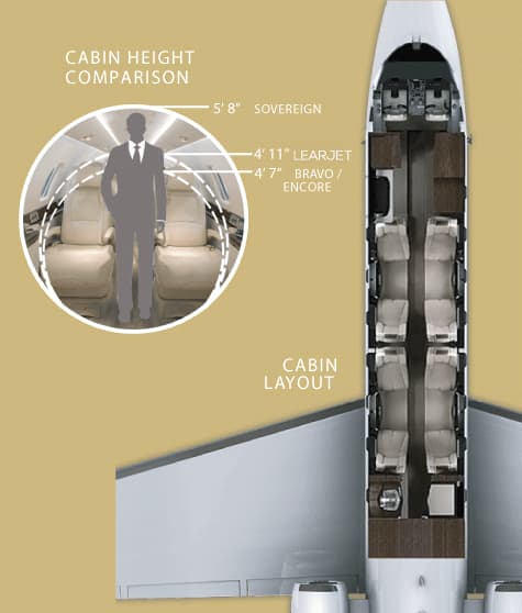 Thu, Dec 3in 30 daysKelownaCYLW · Kelowna AirportVancouverCYVR · Vancouver International AirportCessna Citation Sovereign142mOn request3DecKelowna → VancouverCYLW → CYVR · in 30 daysCessna Citation Sovereign · 1 seat · 42mOn request
 Sat, Dec 516:00KelownaCYLW · Kelowna International AirportVancouverCYVR · Vancouver International AirportCessna Citation Sovereign8—$4,6625DecKelowna → VancouverCYLW → CYVR · 16:00Cessna Citation Sovereign · 8 seats$4,662
 Sun, Dec 2009:35KelownaCYLW · Kelowna AirportCalgaryCYYC · Calgary International AirportCessna Citation Excel148mOn request20DecKelowna → CalgaryCYLW → CYYC · 09:35Cessna Citation Excel · 1 seat · 48mOn request
- Sun, Jan 3in 61 daysKelownaCYLWCalgaryCYYC · Calgary International AirportChallenger 300—1h 2mCA$7,0403JanKelowna → CalgaryCYLW → CYYC · in 61 daysChallenger 300 · 1h 2mCA$7,040
- Sun, Jan 322:06KelownaCYLWCalgaryCYYC · Calgary IntlBombardier Challenger 3009—CA$8,8003JanKelowna → CalgaryCYLW → CYYC · 22:06Bombardier Challenger 300 · 9 seatsCA$8,800
 CYLW · Kelowna Airport
* Total price incl. 10% service fee, converted to your selected currency. Price subject to operator confirmation.
Empty legs to CYLW
34 arrivals available
- Tue, Nov 3TodayPort AngelesKCLM · William R Fairchild International AirportKelownaCYLW · Kelowna AirportEmbraer Phenom 10041hOn request3NovPort Angeles → KelownaKCLM → CYLW · TodayEmbraer Phenom 100 · 4 seats · 1hOn request
 Fri, Nov 1320:00HaywardKHWD · Hayward Executive AirportKelownaCYLW · Kelowna AirportCessna Citation CJ312h 24mOn request13NovHayward → KelownaKHWD → CYLW · 20:00Cessna Citation CJ3 · 1 seat · 2h 24mOn request
- Fri, Nov 13in 10 daysHaywardKHWD · Hayward Executive AirportKelownaCYLW · Kelowna AirportCessna CJ37—On request13NovHayward → KelownaKHWD → CYLW · in 10 daysCessna CJ3 · 7 seatsOn request
- Sat, Nov 1401:00OaklandKOAK · Oakland IntlKelownaCYLWCessna Citation CJ36—On request14NovOakland → KelownaKOAK → CYLW · 01:00Cessna Citation CJ3 · 6 seatsOn request
- Sat, Nov 1401:00HaywardKHWD · Hayward ExecutiveKelownaCYLWCessna Citation CJ36—On request14NovHayward → KelownaKHWD → CYLW · 01:00Cessna Citation CJ3 · 6 seatsOn request
- Mon, Nov 1615:45VictoriaCYYJ · Victoria IntlKelownaCYLWBombardier Challenger 60410—On request16NovVictoria → KelownaCYYJ → CYLW · 15:45Bombardier Challenger 604 · 10 seatsOn request
- Thu, Nov 1908:00CalgaryCYYC · Calgary International AirportKelownaCYLW · Kelowna AirportGulfstream G150148mOn request19NovCalgary → KelownaCYYC → CYLW · 08:00Gulfstream G150 · 1 seat · 48mOn request
 Sat, Nov 2120:00CalgaryCYYC · Calgary International AirportKelownaCYLW · Kelowna International AirportGulfstream G1507—$6,89921NovCalgary → KelownaCYYC → CYLW · 20:00Gulfstream G150 · 7 seats$6,899
- Mon, Nov 23in 20 daysVancouverCYVR · Vancouver International AirportKelownaCYLW · Kelowna AirportCessna Citation Sovereign136mOn request23NovVancouver → KelownaCYVR → CYLW · in 20 daysCessna Citation Sovereign · 1 seat · 36mOn request
 KCLM · William R Fairchild International Airport
* Total price incl. 10% service fee, converted to your selected currency. Price subject to operator confirmation.
Map: Kelowna Airport
View the location of Kelowna – YLW/CYLW. Zoom in to explore the area around the airport.
About the airport
Kelowna Airport (YLW/CYLW) is the key private jet gateway for Kelowna. PrivJet gives you instant access to charter flights and empty legs: fast, discreet and globally connected.
CYLW airport FAQ
Are there any restrictions at Kelowna airport (CYLW) today?
There are currently 7 valid NOTAMs for Kelowna (CYLW). Affected: ILS glide path: unserviceable. For information only, not for flight planning or operational use. Always rely on an official pre-flight briefing. This list may be incomplete or out of date.
What is the weather at Kelowna airport (CYLW)?
According to the latest weather report for CYLW (METAR, 03 Nov, 15:16 UTC): Good visual conditions (VFR). Wind 2 kt (4 km/h) from north-northwest (340°), visibility 10 km or more, temperature -1 °C (dew point -1 °C). For information only, not for flight planning. Weather can change quickly; always rely on official reports.
How long are the runways at Kelowna airport (CYLW)?
Kelowna (CYLW) has one runway: runway 16/34 with 2,713 m (8,900 ft), asphalt.
What are the radio frequencies at Kelowna airport (CYLW)?
Frequencies at CYLW: Tower 119.6 MHz, Ground 121.7 MHz and ATIS 127.5 MHz. For information only. Always rely on the published AIP.
What are the airport codes of Kelowna Airport?
The ICAO code is CYLW and the IATA code is YLW. ICAO codes are used by air traffic control and pilots, e.g. in flight plans; IATA codes appear on tickets and baggage tags.
What is the elevation of CYLW airport?
Kelowna Airport sits at 1,409 ft (429 m) above sea level. Local time zone: America/Vancouver.
Can I fly to CYLW by private jet?
Whether a private jet can operate into Kelowna Airport depends on runway length, opening hours, customs and immigration rules as well as slot and handling availability, among other things. PrivJet checks this with the operating carrier for every request.
Are there empty legs from or to CYLW?
There are currently 16 empty legs departing from and 34 arriving at Kelowna Airport. Empty legs are repositioning flights at heavily reduced prices; the list is updated several times a day.