Algiers Houari Boumediene Airport (DAAG / ALG)
Empty legs and charters from Algiers
DAAG airport at a glance
- ICAO code
- DAAG
- IATA code
- ALG
- City
- Algiers
- Region
- Algiers
- Country
- Algeria
- Elevation
- 82 ft (25 m)
- Time zone
- Africa/Algiers (UTC+1)
- Coordinates
- 36.6910° N, 3.2154° E
- Empty legs from
- 2
- Empty legs to
- 1
Weather & airport info DAAG
Current weather
No current weather report is available for this airport.
Airport
- Elevation
- 82 ft (25 m)
- Sunrise / Sunset
- 07:12 / 17:48 local time
Runways
| Runway | Length | Surface | Lighted |
|---|---|---|---|
| 05/23 | 3,500 m (11,483 ft) | asphalt | yes |
| 09/27 | 3,500 m (11,483 ft) | asphalt | yes |
Radio frequencies
- Approach: 121.4
- Ground: 121.8
- Tower: 118.7
For information only, not for flight planning. Weather can change quickly; always rely on official reports. Sources: aviationweather.gov (NOAA), OurAirports.
Airport map DAAG
Full screen →Runways white, taxiways yellow with designators, closed taxiways and runways per NOTAM in red.
Official charts
Aerodrome, approach and ground charts are published by the national air navigation service in its AIP:
EUROCONTROL: nationale AIS-Websites →For information only, not for navigation. Always use current official charts and NOTAMs.
Current NOTAMs for DAAG(7)
NOTAMs (Notices to Air Missions) announce short-term changes at an airport: closed runways or taxiways, unserviceable approach aids, obstacles, airspace restrictions.
- Out of serviceAerodrome: unserviceableA2936/26· until 08 Nov, 08:30 UTC (estimated)
The runway lead-in lighting (LDI) for runway 05/23 is out of service.
Show original text
LDI RWY 05/23 U/S
A2936/26 NOTAMR A2354/26
 Q)DAAA/QFLAS/V/M/A/000/999/3642N00313E005
 A)DAAG B)2610080754 C)2611080830 EST
 E)LDI RWY 05/23 U/S
- Out of serviceNon-directional beacon: unserviceableA2897/26· until 06 Nov, 08:30 UTC (estimated)
The non-directional beacon (NDB) MAR 416KHZ is out of service. Beacons are navigation aids for aircraft.
Show original text
NDB MAR 416KHZ U/S.
A2897/26 NOTAMR A2648/26
 Q)DAAA/QNBAS/IV/NBO/AE/000/999/3642N00313E025
 A)DAAG B)2610050748 C)2611060830 EST
 E)NDB MAR 416KHZ U/S.
- NoticeRunway edge lightsA3146/26· permanent
The edge lighting spacing for runways 05/23 and 09/27 is 30 meters, not 60 meters. The stopway lighting length for runway 27 is 160 meters, not 310 meters.
Show original text
REF AIP ALGERIA PAGE AD2-DAAG-5 ITEM AD2.14 -RWY 05/23 AND RWY 09/27 EDGE LGT SPACING: READ 30M INSTEAD OF 60M -RWY 27 SWY LGT LEN: READ 160M INSTEAD OF 310M.
A3146/26 NOTAMN
 Q)DAAA/QLEXX/IV/NBO/A/000/999/3642N00313E005
 A)DAAG B)2610281220 C)PERM
 E)REF AIP ALGERIA PAGE AD2-DAAG-5 ITEM AD2.14
 -RWY 05/23 AND RWY 09/27 EDGE LGT SPACING:
  READ 30M INSTEAD OF 60M
 -RWY 27 SWY LGT LEN:
  READ 160M INSTEAD OF 310M.
- NoticeBurning or blowing gas: will take placeA2994/26· until 15 Dec, 08:00 UTC (estimated)
Flaring is occurring above a flare pot (obstacle) of a gas refinery with smoke propagation. The altitude is 120 meters.
Show original text
FLARING ABOVE FLARE POT (OBSTACLE) OF GAS REFINER WITH SMOKE GAZ PROPAGATION CHARACTERISTICS AS FLW: WGS84 COOR 364051.89N0030724.03E ALT: 120M REF: AIP PAGE AD2 DAAG 3 ITEM DAAG AD2.10.1
A2994/26 NOTAMR A2291/26
 Q)DAAA/QWSLW/IV/NBO/A/000/999/3642N00313E005
 A)DAAG B)2610140806 C)2612150800 EST
 E)FLARING ABOVE FLARE POT (OBSTACLE) OF GAS REFINER WITH SMOKE GAZ
 PROPAGATION
 CHARACTERISTICS AS FLW:
 WGS84 COOR 364051.89N0030724.03E
 ALT: 120M
 REF: AIP PAGE AD2 DAAG 3 ITEM DAAG AD2.10.1
- Out of serviceInstrument approach procedure: not availableA2962/26· until 07 Nov, 08:30 UTC (estimated)
A specific approach procedure (IAC1) for Algiers/Houari Boumediene Airport is suspended. This means pilots cannot use this particular procedure at the moment.
Show original text
PROCEDURE REF AIP AD2 DAAG-IAC1 SUSPENDED
A2962/26 NOTAMR A2729/26
 Q)DAAA/QPIAU/I/NBO/A/000/999/3642N00313E005
 A)DAAG B)2610110745 C)2611070830 EST
 E)PROCEDURE REF AIP AD2 DAAG-IAC1 SUSPENDED
- NoticeObstacle: erectedA2960/26· until 10 Dec, 08:30 UTC (estimated)
An obstacle (crane) has been erected near the airport. Its top is 38.60 meters high and it is marked and lit day and night.
Show original text
OBST (CRANE) ERECTED PSN:36414837N 003112157E RADIUS 45M HGT:38.60 M DAY MARKED AND NGT LGTD
A2960/26 NOTAMR A2529/26
 Q)DAAA/QOBCE/IV/M/A/000/999/3642N00313E005
 A)DAAG B)2610110741 C)2612100830 EST
 E)OBST (CRANE) ERECTED PSN:36414837N 003112157E
 RADIUS 45M
 HGT:38.60 M
 DAY MARKED AND NGT LGTD
- NoticeObstacle: erectedA2925/26· until 07 Dec, 08:30 UTC (estimated)
An obstacle has been erected near runway 09/27. It is 21 meters high and located 342 meters from the runway axis. It is lighted at night.
Show original text
OBSTACLE ERECTED IN FLW AREA PSN: 364141.41N 0031108.13E 364141.41N 0031107.81E 364141.29N 0031107.81E 364141.29N 0031108.13E HIGHT: 21M AT 342M OF THE AXIS RWY 09/27 NGT LIGHTED
A2925/26 NOTAMR A2347/26
 Q)DAAA/QOBCE/IV/NBO/AE/000/999/3642N00313E005
 A)DAAG B)2610070736 C)2612070830 EST
 E)OBSTACLE ERECTED IN FLW AREA
 PSN:
     364141.41N 0031108.13E
     364141.41N 0031107.81E
     364141.29N 0031107.81E
     364141.29N 0031108.13E
 HIGHT: 21M
 AT 342M OF THE AXIS RWY 09/27
 NGT LIGHTED
For information only, not for flight planning or operational use. Always rely on an official pre-flight briefing. This list may be incomplete or out of date. Explanations and expanded abbreviations are generated automatically. The original text is authoritative. Source: FAA NOTAM Management Service (SWIM).
Charter operators based here
Operators with a base at this airport.
- Tassili Travail AerienTurboprop, Helicopter
Empty legs from DAAG
2 departures available
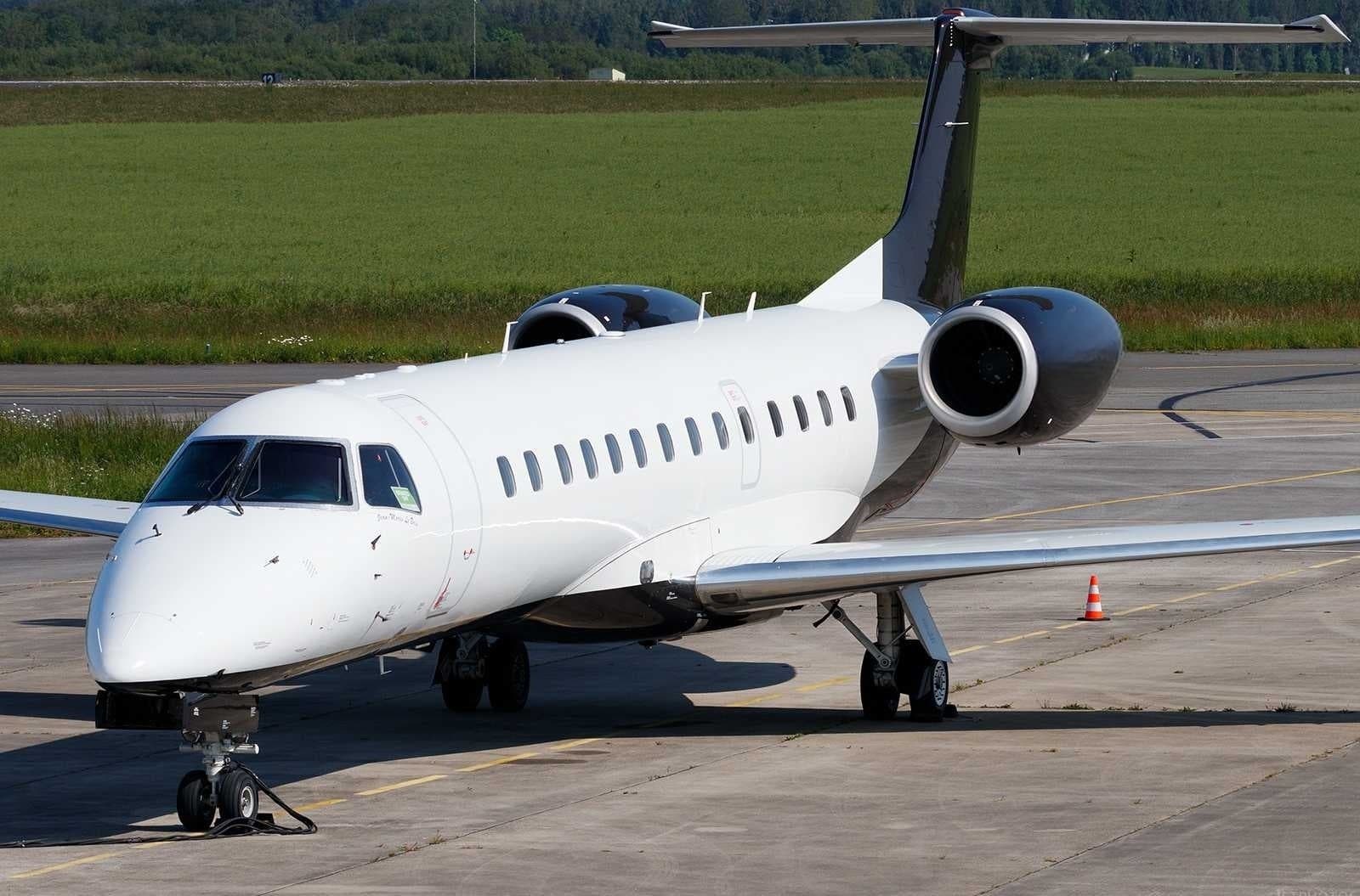 Thu, Nov 5in 2 daysAlgiers ProvinceDAAG · Houari Boumediene AirportParisLFPB · Paris-Le Bourget AirportERJ 13537—On request5NovAlgiers Province → ParisDAAG → LFPB · in 2 daysERJ 135 · 37 seatsOn request
- Fri, Nov 614:30AlgiersDAAG · Houari BoumedieneParisLFPB · Le BourgetEmbraer 135ER——On request6NovAlgiers → ParisDAAG → LFPB · 14:30Embraer 135EROn request
 DAAG · Houari Boumediene Airport
 LFPB · Paris-Le Bourget Airport
* Total price incl. 10% service fee, converted to your selected currency. Price subject to operator confirmation.
Empty legs to DAAG
1 arrivals available
* Total price incl. 10% service fee, converted to your selected currency. Price subject to operator confirmation.
Map: Algiers Airport
View the location of Algiers – ALG/DAAG. Zoom in to explore the area around the airport.
About the airport
Houari Boumediene Airport (ALG/DAAG) is the key private jet gateway for Algiers. PrivJet gives you instant access to charter flights and empty legs: fast, discreet and globally connected.
DAAG airport FAQ
Are there any restrictions at Algiers airport (DAAG) today?
There are currently 7 valid NOTAMs for Algiers (DAAG). Affected: Aerodrome: unserviceable; Non-directional beacon: unserviceable; Instrument approach procedure: not available. For information only, not for flight planning or operational use. Always rely on an official pre-flight briefing. This list may be incomplete or out of date.
How long are the runways at Algiers airport (DAAG)?
Algiers (DAAG) has 2 runways: runway 05/23 with 3,500 m (11,483 ft), asphalt and runway 09/27 with 3,500 m (11,483 ft), asphalt. The longest is 3,500 m.
What are the radio frequencies at Algiers airport (DAAG)?
Frequencies at DAAG: Tower 118.7 MHz and Ground 121.8 MHz. For information only. Always rely on the published AIP.
What are the airport codes of Houari Boumediene Airport?
The ICAO code is DAAG and the IATA code is ALG. ICAO codes are used by air traffic control and pilots, e.g. in flight plans; IATA codes appear on tickets and baggage tags.
What is the elevation of DAAG airport?
Houari Boumediene Airport sits at 82 ft (25 m) above sea level. Local time zone: Africa/Algiers.
Can I fly to DAAG by private jet?
Whether a private jet can operate into Houari Boumediene Airport depends on runway length, opening hours, customs and immigration rules as well as slot and handling availability, among other things. PrivJet checks this with the operating carrier for every request.
Are there empty legs from or to DAAG?
There are currently 2 empty legs departing from and 1 arriving at Houari Boumediene Airport. Empty legs are repositioning flights at heavily reduced prices; the list is updated several times a day.