Frankfurt am Main Airport (EDDF / FRA)
Empty legs and charters from Frankfurt am Main
EDDF airport at a glance
- ICAO code
- EDDF
- IATA code
- FRA
- City
- Frankfurt am Main
- Region
- Hesse
- Country
- Germany
- Elevation
- 364 ft (111 m)
- Time zone
- Europe/Berlin (UTC+1)
- Coordinates
- 50.0264° N, 8.5431° E
- Empty legs from
- 21
- Empty legs to
- 18
Private jet terminal & FBOs at Frankfurt am Main
- General Aviation Terminal (GAT), Building 514, Frankfurt AirportGeneral Aviation Terminal, Flughafen Frankfurt am Main, Geb. 514, 60547 Frankfurt, Germany
Weather & airport info EDDF
Current weather
Good visual conditions (VFR)observed 02 Nov, 23:20 UTC- Wind
- 6 kt (11 km/h) from east-northeast (70°)
- Visibility
- 10 km or more
- Clouds
- overcast at 4,500 ft
- Temperature
- 6 °C (dew point 1 °C)
- Pressure (QNH)
- 1,029 hPa
Original weather report (METAR)
METAR EDDF 022320Z AUTO 07006KT 9999 OVC045 06/01 Q1029 NOSIG
Forecast (TAF)
- 03 Nov, 00:00–06:00 UTC5 kt (9 km/h) from northeast (40°) · visibility 10 km or more · broken clouds at 4,500 ft
- 03 Nov, 06:00–06:00 UTCbecoming10 kt (19 km/h) from northeast (50°) · visibility 10 km or more · broken clouds at 4,500 ft
Original forecast (TAF)
TAF EDDF 022300Z 0300/0406 04005KT 9999 BKN045 BECMG 0306/0309 05010KT
Airport
- Elevation
- 364 ft (111 m)
- Sunrise / Sunset
- 07:18 / 17:00 local time
Runways
| Runway | Length | Surface | Lighted |
|---|---|---|---|
| 07C/25C | 4,000 m (13,123 ft) | asphalt | yes |
| 07R/25L | 4,000 m (13,123 ft) | concrete | yes |
| 18/36 | 4,000 m (13,123 ft) | concrete | yes |
| 07L/25R | 2,800 m (9,186 ft) | concrete | yes |
Radio frequencies
- Flight information: 119.15
- Flight information: 123.525
- ATIS: 118.03
- ATIS: 118.73
- Clearance: 122.035
- Ground: 121.805
- Tower: 119.905
- Tower: 124.855
For information only, not for flight planning. Weather can change quickly; always rely on official reports. Sources: aviationweather.gov (NOAA), OurAirports.
Airport map EDDF
Full screen →Runways white, taxiways yellow with designators, closed taxiways and runways per NOTAM in red.
Closed per NOTAM: RWY 7L/25R, RWY 18, RWY 7R/25L, TWY M*, TWY R*, TWY Y*, TWY W9*, TWY N14* (* partly closed)
Official charts
Aerodrome, approach and ground charts are published by the national air navigation service in its AIP:
DFS AIP Deutschland →For information only, not for navigation. Always use current official charts and NOTAMs.
Current NOTAMs for EDDF(23)
NOTAMs (Notices to Air Missions) announce short-term changes at an airport: closed runways or taxiways, unserviceable approach aids, obstacles, airspace restrictions.
- ClosedRunway: closedA5672/26· until 07 Nov, 03:45 UTC
Runway 07L/25R is closed.
Show original text
RWY 07L/25R CLSD.
A5672/26 NOTAMN
 Q) EDGG/QMRLC/IV/NBO/A /000/999/5002N00834E005
 A) EDDF B) 2611022200 C) 2611070345
 D) DAILY 2200-0345
 E) RWY 07L/25R CLSD.
Hours: DAILY 2200-0345
- ClosedRunway: closedA5673/26· until 07 Nov, 04:00 UTC
Runway 18 at Frankfurt/Main airport is closed. This means aircraft cannot use this runway at the moment.
Show original text
RWY 18 CLSD.
A5673/26 NOTAMN
 Q) EDGG/QMRLC/IV/NBO/A /000/999/5002N00834E005
 A) EDDF B) 2611022200 C) 2611070400
 D) DAILY 2200-0400
 E) RWY 18 CLSD.
Hours: DAILY 2200-0400
- ClosedRunway: closedA5674/26· until 07 Nov, 06:00 UTC
Runway 07R/25L at Frankfurt/Main Airport is closed.
Show original text
RWY 07R/25L CLSD.
A5674/26 NOTAMN
 Q) EDGG/QMRLC/IV/NBO/A /000/999/5002N00834E005
 A) EDDF B) 2611022200 C) 2611070600
 D) DAILY 2200-0600
 E) RWY 07R/25L CLSD.
Hours: DAILY 2200-0600
- ClosedTaxiway: closedA5677/26· until 03 Nov, 04:00 UTC
Taxiway M is closed between taxiway M9 and taxiway M21. Taxiways M9, M11, M13, M14, M15, M17, M19 and M24 are closed. Taxiway Y3 is closed between taxiway M29 and taxiway Y.
Show original text
TWY M CLSD BTN TWY M9 AND TWY M21. TWY M9, M11, M13, M14, M15, M17, M19 AND M24 CLSD. TWY Y3 CLSD BTN TWY M29 AND TWY Y.
A5677/26 NOTAMN
 Q) EDGG/QMXLC/IV/BO /A /000/999/5002N00834E005
 A) EDDF B) 2611022215 C) 2611030400
 E) TWY M CLSD BTN TWY M9 AND TWY M21.
 TWY M9, M11, M13, M14, M15, M17, M19 AND M24 CLSD.
 TWY Y3 CLSD BTN TWY M29 AND TWY Y.
- ClosedTaxiway: closedA5675/26· until 07 Nov, 06:00 UTC
Taxiway R is closed between taxiway S10 and taxiway S19, and also between taxiway S24 and taxiway R15.
Show original text
TWY R CLSD BTN TWY S10 AND TWY S19. TWY R CLSD BTN TWY S24 AND TWY R15.
A5675/26 NOTAMN
 Q) EDGG/QMXLC/IV/BO /A /000/999/5002N00834E005
 A) EDDF B) 2611022200 C) 2611070600
 D) DAILY 2200-0600
 E) TWY R CLSD BTN TWY S10 AND TWY S19.
 TWY R CLSD BTN TWY S24 AND TWY R15.
Hours: DAILY 2200-0600
- ClosedTaxiway: closedA5676/26· until 03 Nov, 04:00 UTC
Taxiway Y is closed between taxiway L and taxiway M. Taxiway Y1 is also closed.
Show original text
TWY Y CLSD BTN TWY L AND TWY M. TWY Y1 CLSD.
A5676/26 NOTAMN
 Q) EDGG/QMXLC/IV/BO /A /000/999/5002N00834E005
 A) EDDF B) 2611022200 C) 2611030400
 E) TWY Y CLSD BTN TWY L AND TWY M. TWY Y1 CLSD.
- ClosedTaxiway: closedA5678/26· until 03 Nov, 03:45 UTC
Taxiway N-EAST is closed between aircraft stand E9 and taxiway L. This means that this section of the taxiway cannot be used.
Show original text
TWY N-EAST CLSD BTN ACFT STAND E9 AND TWY L.
A5678/26 NOTAMN
 Q) EDGG/QMXLC/IV/BO /A /000/999/5002N00834E005
 A) EDDF B) 2611022145 C) 2611030345
 E) TWY N-EAST CLSD BTN ACFT STAND E9 AND TWY L.
- ClosedTaxiway: closedA5604/26· until 25 Jan, 08:00 UTC
Taxiway W south of DP2 is closed. Taxiway W9 is also closed. This may lead to aircraft being rerouted on the apron.
Show original text
TWY W SOUTH OF DP2 CLSD. TWY W9 CLSD.
A5604/26 NOTAMR A4450/26
 Q) EDGG/QMXLC/IV/BO /A /000/999/5002N00834E005
 A) EDDF B) 2610291339 C) 2701250800
 E) TWY W SOUTH OF DP2 CLSD. TWY W9 CLSD.
15 more NOTAMs
- ClosedTaxiway: closedA5188/26· permanent
Taxiway N14 north of taxiway N is closed. This means that this part of the taxiway cannot be used due to construction work or other activities.
Show original text
TWY N14 NORTH OF TWY N CLSD.
A5188/26 NOTAMN
 Q) EDGG/QMXLC/IV/BO /A /000/999/5002N00834E005
 A) EDDF B) 2610052100 C) PERM
 E) TWY N14 NORTH OF TWY N CLSD.
- ClosedAircraft stand: closedA5189/26· permanent
Aircraft stands F211, F212, F221, F222, F223, F224 and F225 at Frankfurt/Main airport are closed.
Show original text
ACFT STANDS F211, F212, F221, F222, F223, F224 AND F225 CLSD.
A5189/26 NOTAMN
 Q) EDGG/QMPLC/IV/BO /A /000/999/5002N00834E005
 A) EDDF B) 2610052100 C) PERM
 E) ACFT STANDS F211, F212, F221, F222, F223, F224 AND F225 CLSD.
- ClosedAircraft stand: closedA5038/26· until 13 Nov, 08:00 UTC
Aircraft stand A28 is closed due to work in progress.
Show original text
ACFT STAND A28 CLSD DUE TO WIP.
A5038/26 NOTAMR A3877/26
 Q) EDGG/QMPLC/IV/BO /A /000/999/5002N00834E005
 A) EDDF B) 2609291214 C) 2611130800
 E) ACFT STAND A28 CLSD DUE TO WIP.
- NoticeVOR/DME: on test, do not useA5294/26· from 05 Nov, 07:00 UTC · until 06 Nov, 14:00 UTC
The FRANKENSTEIN DVOR/DME (VHF omnidirectional radio range/distance measuring equipment) FKS 117.50MHZ/CH122X is out of service due to maintenance. It must not be used, as false indications are possible.
Show original text
FRANKENSTEIN DVOR/DME FKS 117.50MHZ/CH122X ON MAINT. DO NOT USE, FALSE INDICATION POSS.
A5294/26 NOTAMN
 Q) EDGG/QNMCT/IV/BO /AE/000/999/4947N00833E025
 A) EDDF B) 2611050700 C) 2611061400
 E) FRANKENSTEIN DVOR/DME FKS 117.50MHZ/CH122X ON MAINT. DO NOT USE,
 FALSE INDICATION POSS.
- Out of serviceStandard instrument departure: not availableA5596/26· from 05 Nov, 07:00 UTC · until 06 Nov, 14:00 UTC
The standard departure routes (SID) FKS 3C for runway 07, FKS 3Q for runway 25, and FKS 2B for runway 18 are temporarily suspended due to maintenance of the FKS DVOR/DME.
Show original text
SUSPENSION OF SID DUE TO MAINT OF FKS DVOR/DME: RWY07: FKS 3C TEMPO SUSPENDED. RWY25: FKS 3Q TEMPO SUSPENDED. RWY18: FKS 2B TEMPO SUSPENDED. REF AIP PAGES AD 2 EDDF 5-7-3 DATED 01 OCT 2026, 5-7-4 EFF 01 OCT 2026.
A5596/26 NOTAMN
 Q) EDGG/QPDAU/I /NBO/A /000/999/5002N00834E005
 A) EDDF B) 2611050700 C) 2611061400
 E) SUSPENSION OF SID DUE TO MAINT OF FKS DVOR/DME: RWY07: FKS 3C
 TEMPO
 SUSPENDED. RWY25: FKS 3Q TEMPO SUSPENDED. RWY18: FKS 2B TEMPO
 SUSPENDED. REF AIP PAGES AD 2 EDDF 5-7-3 DATED 01 OCT 2026,
 5-7-4 EFF 01 OCT 2026.
- Out of serviceInstrument approach procedure: not availableA5597/26· from 05 Nov, 07:00 UTC · until 06 Nov, 14:00 UTC
SUSPENSION of approach PROC due to maintenance of FKS DVOR/DME: runway 07C / 25C: all ILS (instrument landing system) X and localizer approach PROC TEMPO SUSPENDED. see AIP PAGES aerodrome 2 EDDF 4-2-6 EFF 01 Oct 2026, 4-2-13 DATED 01 Oct 2026.
Show original text
SUSPENSION OF APCH PROC DUE TO MAINT OF FKS DVOR/DME: RWY 07C / 25C: ALL ILS X AND LOC APCH PROC TEMPO SUSPENDED. REF AIP PAGES AD 2 EDDF 4-2-6 EFF 01 OCT 2026, 4-2-13 DATED 01 OCT 2026.
A5597/26 NOTAMN
 Q) EDGG/QPIAU/I /NBO/A /000/999/5002N00834E005
 A) EDDF B) 2611050700 C) 2611061400
 E) SUSPENSION OF APCH PROC DUE TO MAINT OF FKS DVOR/DME: RWY 07C /
 25C:
 ALL ILS X AND LOC APCH PROC TEMPO SUSPENDED. REF AIP PAGES AD 2
 EDDF 4-2-6 EFF 01 OCT 2026, 4-2-13 DATED 01 OCT 2026.
- Out of serviceStandard instrument departure: not availableA5265/26· until 05 Nov, 16:00 UTC
The standard departure route (SID) FKS 3C/3Q is suspended due to maintenance of the FRD DME radio beacon. The DME is a navigation system that helps aircraft determine their distance to a point.
Show original text
SID SUSPENDED DUE TO MAINT OF FRD DME: FKS 3C/3Q SUSPENDED. REF AIP AD2 EDDF 5-7-3 DATED 01 OCT 2026, 5-7-4 EFF 01 OCT 2026.
A5265/26 NOTAMN
 Q) EDGG/QPDAU/I /NBO/A /000/999/5002N00834E005
 A) EDDF B) 2611020700 C) 2611051600
 D) 02 03 0700-1600, 05 0800-1600
 E) SID SUSPENDED DUE TO MAINT OF FRD DME:
 FKS 3C/3Q SUSPENDED.
 REF AIP AD2 EDDF 5-7-3 DATED 01 OCT 2026, 5-7-4 EFF 01 OCT 2026.
Hours: 02 03 0700-1600, 05 0800-1600
- NoticeDME: on test, do not useA5293/26· until 05 Nov, 16:00 UTC
The FRED DME (distance measuring equipment) FRD 115.90MHZ/CH106X is out of service due to maintenance. It must not be used, as false indications are possible.
Show original text
FRED DME FRD 115.90MHZ/CH106X ON MAINT. DO NOT USE, FALSE INDICATION POSS.
A5293/26 NOTAMN
 Q) EDGG/QNDCT/IV/BO /AE/000/999/5002N00834E025
 A) EDDF B) 2611020700 C) 2611051600
 D) 02 03 0700-1600, 05 0800-1600
 E) FRED DME FRD 115.90MHZ/CH106X ON MAINT. DO NOT USE, FALSE
 INDICATION POSS.
Hours: 02 03 0700-1600, 05 0800-1600
- NoticeTaxiway: limited toA5603/26· until 27 Nov, 04:00 UTC
Taxiway L20 is limited to a maximum aircraft type with ICAO Code Letter C. Only aircraft of this size or smaller may use this taxiway.
Show original text
TWY L20 LTD TO MAX ACFT TYPE ICAO CODE LETTER C.
A5603/26 NOTAMR A4452/26
 Q) EDGG/QMXLT/IV/M  /A /000/999/5002N00834E005
 A) EDDF B) 2610291337 C) 2611270400
 E) TWY L20 LTD TO MAX ACFT TYPE ICAO CODE LETTER C.
- NoticeTaxiway: limited toA5472/26· permanent
Holding point T8 has been relocated. The use of taxiway T may be restricted by air traffic control for A380 aircraft taxiing northbound due to parallel approach operation on runway 25L.
Show original text
HLDG POINT T8 RELOCATED. USE OF TWY T MAY BE RESTRICTED BY ATC FOR A380 ACFT TYPES TAXIING NORTHBOUND DUE TO PARALLEL APCH OPERATION 25L.
A5472/26 NOTAMN
 Q) EDGG/QMXLT/IV/M  /A /000/999/5002N00834E005
 A) EDDF B) 2610220645 C) PERM
 E) HLDG POINT T8 RELOCATED. USE OF TWY T MAY BE RESTRICTED BY ATC
 FOR A380 ACFT TYPES TAXIING NORTHBOUND DUE TO PARALLEL APCH
 OPERATION 25L.
- NoticeAerodromeA5363/26· until 23 Dec, 11:00 UTC
DE-ICING of aircraft only POSS with DEACTIVATED BROADBAND/MICROWAVE FUNKTIONS of SATCOM SYSTEMS SUCH as ONBOARD INTERNET or TELEVISION. due to unknown RADIO EMISSION LEVEL. DE-ICING PROC REMAINS UNCHANGED.
Show original text
DE-ICING OF ACFT ONLY POSS WITH DEACTIVATED BROADBAND/MICROWAVE FUNKTIONS OF SATCOM SYSTEMS SUCH AS ONBOARD INTERNET OR TELEVISION. DUE TO UNKNOWN RADIO EMISSION LEVEL. DE-ICING PROC REMAINS UNCHANGED.
A5363/26 NOTAMN
 Q) EDGG/QFIXX/IV/NBO/A /000/999/5002N00834E005
 A) EDDF B) 2610152100 C) 2612231100
 E) DE-ICING OF ACFT ONLY POSS WITH DEACTIVATED BROADBAND/MICROWAVE
 FUNKTIONS OF SATCOM SYSTEMS SUCH AS ONBOARD INTERNET OR TELEVISION.
 DUE TO UNKNOWN RADIO EMISSION LEVEL. DE-ICING PROC REMAINS UNCHANGED.
- NoticeTaxiway: limited toA5305/26· until 30 Dec, 21:00 UTC
Taxiway S13 (between S11 and S19), taxiway S17 (south of S) and taxiway S19 (south of S) are not permitted for aircraft type A388.
Show original text
TWY S13 BTN S11 AND S19, TWY S17 SOUTH OF S AND TWY S19 SOUTH OF S NOT PERMITTED FOR ACFT TYPE A388.
A5305/26 NOTAMN
 Q) EDGG/QMXLT/IV/M  /A /000/999/5002N00834E005
 A) EDDF B) 2610121308 C) 2612302100
 E) TWY S13 BTN S11 AND S19, TWY S17 SOUTH OF S AND TWY S19 SOUTH OF S
 NOT PERMITTED FOR ACFT TYPE A388.
- NoticeGNSS airfield-specific operationsA5239/26· until 29 Dec, 09:20 UTC (estimated)
The GBAS (Ground Based Augmentation System), a system that enhances GPS accuracy for approaches, is downgraded to Category 1 only. This means it can only be used for approaches under specific conditions.
Show original text
GBAS DOWNGRADED TO CAT 1 ONLY.
A5239/26 NOTAMR A5029/26
 Q) EDGG/QGAXX/I /NBO/A /000/999/5002N00834E005
 A) EDDF B) 2610081100 C) 2612290920EST
 E) GBAS DOWNGRADED TO CAT 1 ONLY.
- NoticeObstacle: erectedA5027/26· until 05 Jan, 21:00 UTC (estimated)
A crane is located in the missed approach area of runway 25R. Its top is 374 ft above sea level, 75 ft above ground, and it is marked day and night.
Show original text
CRANE IN MISSED APCH AREA RWY 25R AT PSN 500206N 0082849E. ELEV 374FT/75FT AGL. DAY AND NIGHT MARKED.
A5027/26 NOTAMN
 Q) EDGG/QOBCE/IV/M  /AE/000/004/5002N00829E001
 A) EDDF B) 2610052100 C) 2701052100EST
 E) CRANE IN MISSED APCH AREA RWY 25R AT PSN 500206N 0082849E.
 ELEV 374FT/75FT AGL. DAY AND NIGHT MARKED.
- NoticeRunwayA5039/26· permanent
The touchdown zones of runway 07L/25R have been grinded.
Show original text
TOUCHDOWN ZONES OF RWY 07L/25R GRINDED.
A5039/26 NOTAMN
 Q) EDGG/QMRXX/IV/NBO/A /000/999/5002N00834E005
 A) EDDF B) 2609291216 C) PERM
 E) TOUCHDOWN ZONES OF RWY 07L/25R GRINDED.
For information only, not for flight planning or operational use. Always rely on an official pre-flight briefing. This list may be incomplete or out of date. Explanations and expanded abbreviations are generated automatically. The original text is authoritative. Source: FAA NOTAM Management Service (SWIM).
Private jet traffic in Frankfurt am Main International Airport (last 30 days)
- Arrivals
- 281
- Departures
- 244
- Different jets
- 227
Most frequent origins: Berlin Brandenburg Airport (15), Zurich Airport (14), Paris-Le Bourget Airport (10), Geneva Cointrin International Airport (8), Nice-Cote d'Azur Airport (7).
Most frequent destinations: Paris-Le Bourget Airport (10), Berlin Brandenburg Airport (10), Munich International Airport (9), Zurich Airport (7), Salzburg Airport (6).
Most common aircraft types: Cessna Citation Excel/XLS (62), Embraer Phenom 300 (58), Cessna Citation Latitude (49), Bombardier Challenger 350/3500 (34), Cessna Citation CJ2 (30).
Thursday is the busiest day.
Our own analysis of public ADS-B signals from business jets. Not every flight is received, and jets with a removal request are excluded.
Charter operators based here
Operators with a base at this airport.
- ACM Air CharterKarlsruhe/Baden-Baden (EDSB) · Heavy jet
- Premium JetBasel-Mulhouse (LFSB) · Super midsize jet, Heavy jet
- Spree Flug LuftfahrtBerlin (Brandenburg) (EDDB) · Light jet
Empty legs from EDDF
21 departures available
- Tue, Nov 316:45Frankfurt am MainEDDF · Frankfurt AirportStuttgartEDDSCessna Citation XLS+—45mOn request3NovFrankfurt am Main → StuttgartEDDF → EDDS · 16:45Cessna Citation XLS+ · 45mOn request
- Wed, Nov 408:55Frankfurt am MainEDDF · Frankfurt AirportLondonEGLC · London CityCessna Citation XLS+—1h 23mOn request4NovFrankfurt am Main → LondonEDDF → EGLC · 08:55Cessna Citation XLS+ · 1h 23mOn request
- Thu, Nov 5in 2 daysFrankfurt-am-MainEDDF · Frankfurt am Main International AirportGenevaLSGG · Geneva Cointrin International AirportHDJTSeats5——On request5NovFrankfurt-am-Main → GenevaEDDF → LSGG · in 2 daysHDJTSeats5On request
- Thu, Nov 512:00Frankfurt-am-MainEDDF · Frankfurt am Main International AirportGenevaLSGG · Geneva Cointrin International AirportHondaJet5—On request5NovFrankfurt-am-Main → GenevaEDDF → LSGG · 12:00HondaJet · 5 seatsOn request
- Fri, Nov 6in 3 daysFrankfurt-am-MainEDDF · Frankfurt am Main International AirportBrusselsEBBR · Brussels AirportEmbraer E545 Legacy 450——On request6NovFrankfurt-am-Main → BrusselsEDDF → EBBR · in 3 daysEmbraer E545 Legacy 450On request
- Fri, Nov 618:30Frankfurt am MainEDDF · Frankfurt AirportBerlinEDDB · Berlin Brandenburg AirportCessna Citation XLS+—1h 8m€6,4806NovFrankfurt am Main → BerlinEDDF → EDDB · 18:30Cessna Citation XLS+ · 1h 8m€6,480
- Fri, Nov 6in 3 daysFrankfurt-am-MainEDDF · Frankfurt am Main International AirportBrusselsEBBR · Brussels AirportEmbraer Legacy 4509—On request6NovFrankfurt-am-Main → BrusselsEDDF → EBBR · in 3 daysEmbraer Legacy 450 · 9 seatsOn request
- Fri, Nov 615:00Frankfurt am MainEDDF · Frankfurt AirportParisLFPB · Paris-Le Bourget AirportPilatus PC-128—$4,1806NovFrankfurt am Main → ParisEDDF → LFPB · 15:00Pilatus PC-12 · 8 seats$4,180
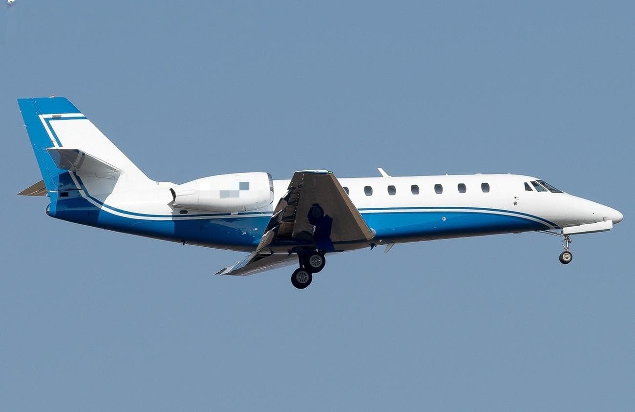 Wed, Nov 18in 15 daysFrankfurtEDDF · Frankfurt am Main International AirportVeniceLIPH · Treviso / Sant'Angelo AirportCitation Sovereign9—$8,34418NovFrankfurt → VeniceEDDF → LIPH · in 15 daysCitation Sovereign · 9 seats$8,344
 EDDF · Frankfurt Airport
 EGLC · London City
 LSGG · Geneva Cointrin International Airport
 EBBR · Brussels Airport
 LFPB · Paris-Le Bourget Airport
 LIPH · Treviso / Sant'Angelo Airport
* Total price incl. 10% service fee, converted to your selected currency. Price subject to operator confirmation.
Empty legs to EDDF
18 arrivals available
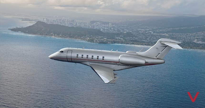 Wed, Nov 4TomorrowMunichEDDM · Munich International AirportFrankfurtEDDF · Frankfurt am Main International AirportChallenger 3508—On request4NovMunich → FrankfurtEDDM → EDDF · TomorrowChallenger 350 · 8 seatsOn request
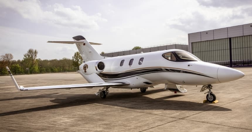 Thu, Nov 5in 2 daysBalatonLHSM · Sarmellek International AirportFrankfurtEDDF · Frankfurt am Main International AirportHondaJet4—$6,7495NovBalaton → FrankfurtLHSM → EDDF · in 2 daysHondaJet · 4 seats$6,749
- Fri, Nov 6in 3 daysNew York CityKTEB · TeterboroFrankfurt am MainEDDF · Frankfurt AirportGulfstream IV-SP—8h 33mOn request6NovNew York City → Frankfurt am MainKTEB → EDDF · in 3 daysGulfstream IV-SP · 8h 33mOn request
- Mon, Nov 917:15ZaventemEBBR · Brussels AirportFrankfurt am MainEDDF · Frankfurt AirportEmbraer Phenom 3007—$7,4809NovZaventem → Frankfurt am MainEBBR → EDDF · 17:15Embraer Phenom 300 · 7 seats$7,480
- Wed, Nov 1111:45ZaventemEBBR · Brussels AirportFrankfurt am MainEDDF · Frankfurt AirportPilatus PC-128—$4,29011NovZaventem → Frankfurt am MainEBBR → EDDF · 11:45Pilatus PC-12 · 8 seats$4,290
- Wed, Nov 18in 15 daysVeniceLIPH · Treviso / Sant'Angelo AirportFrankfurtEDDF · Frankfurt am Main International AirportCitation Sovereign9—$11,78018NovVenice → FrankfurtLIPH → EDDF · in 15 daysCitation Sovereign · 9 seats$11,780
- Thu, Nov 19in 16 daysFrankfurt am MainEDDF · Frankfurt AirportFrankfurt am MainEDDF · Frankfurt AirportGulfstream IV-SP—33mOn request19NovFrankfurt am Main → Frankfurt am MainEDDF → EDDF · in 16 daysGulfstream IV-SP · 33mOn request
- Thu, Nov 19in 16 daysLondonEGGW · London Luton AirportFrankfurt am MainEDDF · Frankfurt AirportGulfstream IV-SP—1h 23mOn request19NovLondon → Frankfurt am MainEGGW → EDDF · in 16 daysGulfstream IV-SP · 1h 23mOn request
- Thu, Nov 19in 16 daysNew York CityKTEB · TeterboroFrankfurt am MainEDDF · Frankfurt AirportGulfstream IV-SP—8h 33mOn request19NovNew York City → Frankfurt am MainKTEB → EDDF · in 16 daysGulfstream IV-SP · 8h 33mOn request
 LHSM · Sarmellek International Airport
 KTEB · Teterboro
* Total price incl. 10% service fee, converted to your selected currency. Price subject to operator confirmation.
Map: Frankfurt am Main Airport
View the location of Frankfurt am Main – FRA/EDDF. Zoom in to explore the area around the airport.
About the airport
Frankfurt am Main International Airport (FRA/EDDF) is the key private jet gateway for Frankfurt am Main. PrivJet gives you instant access to charter flights and empty legs: fast, discreet and globally connected.
EDDF airport FAQ
Are there any restrictions at Frankfurt am Main airport (EDDF) today?
There are currently 20 valid NOTAMs for Frankfurt am Main (EDDF). According to NOTAM, at least one runway or the aerodrome itself is closed. Affected: Runway: closed; Taxiway: closed; Aircraft stand: closed; Standard instrument departure: not available. 3 more NOTAMs start in the coming days. For information only, not for flight planning or operational use. Always rely on an official pre-flight briefing. This list may be incomplete or out of date.
What is the weather at Frankfurt am Main airport (EDDF)?
According to the latest weather report for EDDF (METAR, 02 Nov, 23:20 UTC): Good visual conditions (VFR). Wind 6 kt (11 km/h) from east-northeast (70°), visibility 10 km or more, temperature 6 °C (dew point 1 °C). For information only, not for flight planning. Weather can change quickly; always rely on official reports.
How long are the runways at Frankfurt am Main airport (EDDF)?
Frankfurt am Main (EDDF) has 4 runways: runway 07C/25C with 4,000 m (13,123 ft), asphalt, runway 07R/25L with 4,000 m (13,123 ft), concrete, runway 18/36 with 4,000 m (13,123 ft), concrete and runway 07L/25R with 2,800 m (9,186 ft), concrete. The longest is 4,000 m.
What are the radio frequencies at Frankfurt am Main airport (EDDF)?
Frequencies at EDDF: Tower 119.905 / 124.855 MHz, Ground 121.805 MHz and ATIS 118.03 / 118.73 MHz. For information only. Always rely on the published AIP.
What are the airport codes of Frankfurt am Main International Airport?
The ICAO code is EDDF and the IATA code is FRA. ICAO codes are used by air traffic control and pilots, e.g. in flight plans; IATA codes appear on tickets and baggage tags.
What is the elevation of EDDF airport?
Frankfurt am Main International Airport sits at 364 ft (111 m) above sea level. Local time zone: Europe/Berlin.
Where do private jets land at Frankfurt am Main?
Private jet passengers at EDDF are handled through General Aviation Terminal (GAT), Building 514, Frankfurt Airport (General Aviation Terminal, Flughafen Frankfurt am Main, Geb. 514, 60547 Frankfurt, Germany). The operator confirms the exact meeting point with your flight confirmation.
Can I fly to EDDF by private jet?
Whether a private jet can operate into Frankfurt am Main International Airport depends on runway length, opening hours, customs and immigration rules as well as slot and handling availability, among other things. PrivJet checks this with the operating carrier for every request.
Are there empty legs from or to EDDF?
There are currently 21 empty legs departing from and 18 arriving at Frankfurt am Main International Airport. Empty legs are repositioning flights at heavily reduced prices; the list is updated several times a day.