Hannover Airport (EDDV / HAJ)
Empty legs and charters from Hannover
EDDV airport at a glance
- ICAO code
- EDDV
- IATA code
- HAJ
- City
- Hannover
- Region
- Lower Saxony
- Country
- Germany
- Elevation
- 183 ft (56 m)
- Time zone
- Europe/Berlin (UTC+1)
- Coordinates
- 52.4611° N, 9.6851° E
- Empty legs from
- 7
- Empty legs to
- 7
Weather & airport info EDDV
Current weather
Marginal visual conditions (MVFR)observed 02 Nov, 23:20 UTC- Wind
- 3 kt (6 km/h) from northeast (50°)
- Visibility
- 10 km or more
- Clouds
- broken clouds at 3,000 ft, broken clouds at 4,900 ft
- Temperature
- 7 °C (dew point 6 °C)
- Pressure (QNH)
- 1,031 hPa
Original weather report (METAR)
METAR EDDV 022320Z AUTO 05003KT 9999 BKN030 BKN049 07/06 Q1031
Forecast (TAF)
- 03 Nov, 00:00–00:00 UTC5 kt (9 km/h) from east (80°) · visibility 10 km or more · broken clouds at 2,500 ft
- 03 Nov, 00:00–02:00 UTCtemporarily, 30 % probabilityvisibility 3 km · Light drizzle · broken clouds at 300 ft
- 03 Nov, 20:00–22:00 UTCtemporarily, 30 % probabilitybroken clouds at 1,200 ft
- 03 Nov, 22:00–00:00 UTCtemporarily, 40 % probabilitybroken clouds at 700 ft
Original forecast (TAF)
TAF EDDV 022300Z 0300/0324 08005KT 9999 BKN025 PROB30 TEMPO 0300/0302 3500 -DZ BKN003 PROB30 TEMPO 0320/0322 BKN012 PROB40 TEMPO 0322/0324 BKN007
Airport
- Elevation
- 183 ft (56 m)
- Sunrise / Sunset
- 07:20 / 16:49 local time
Runways
| Runway | Length | Surface | Lighted |
|---|---|---|---|
| 09L/27R | 3,790 m (12,434 ft) | concrete | yes |
| 09R/27L | 2,340 m (7,677 ft) | concrete | yes |
| 09C/27C | 777 m (2,548 ft) | asphalt | no |
Radio frequencies
- Flight information: 119.825
- Approach: 119.6
- ATIS: 136.575
- Ground: 121.955
- Tower: 120.18
- Tower: 120.405
For information only, not for flight planning. Weather can change quickly; always rely on official reports. Sources: aviationweather.gov (NOAA), OurAirports.
Airport map EDDV
Full screen →Runways white, taxiways yellow with designators, closed taxiways and runways per NOTAM in red.
Official charts
Aerodrome, approach and ground charts are published by the national air navigation service in its AIP:
DFS AIP Deutschland →For information only, not for navigation. Always use current official charts and NOTAMs.
Current NOTAMs for EDDV(8)
NOTAMs (Notices to Air Missions) announce short-term changes at an airport: closed runways or taxiways, unserviceable approach aids, obstacles, airspace restrictions.
- Out of serviceVOR/DME: unserviceableA5655/26· from 06 Nov, 08:00 UTC · until 06 Nov, 11:00 UTC
The Sarstedt DVOR/DME navigation system 'SAS' 114.45 MHz/channel 91Y is out of service.
Show original text
SARSTEDT DVOR/DME SAS 114.45MHZ/CH91Y OUT OF SERVICE.
A5655/26 NOTAMN
 Q) EDWW/QNMAS/IV/BO /AE/000/999/5215N00953E025
 A) EDDV B) 2611060800 C) 2611061100
 E) SARSTEDT DVOR/DME SAS 114.45MHZ/CH91Y OUT OF SERVICE.
- Out of serviceInstrument approach procedure: not availableA5428/26· from 06 Nov, 08:00 UTC · until 06 Nov, 11:00 UTC
Instrument approach procedures are suspended due to maintenance of the SAS VOR/DME. The instrument landing systems (ILS) X-RAY/LOC for runway 09R and 27L are temporarily suspended. The ILS X-RAY/LOC standard approach for runway 27R from the initial approach fix (IAF) SAS is temporarily suspended.
Show original text
INSTR APCH PROC SUSPENDED DUE TO MAIN OF SAS DVOR/DME: ILS X-RAY/LOC RWY 09R AND ILS X-RAY/LOC RWY 27L TEMPO SUSPENDED. ILS X-RAY/LOC RWY 27R STANDARD APCH FROM IAF SAS TEMPO SUSPENDED. REF AD 2 EDDV 4-2-7 WEF 09 JUL 2026, 4-2-13 WEF 27 NOV 2025, 4-2-18 DATED 06 AUG 2026.
A5428/26 NOTAMN
 Q) EDWW/QPIAU/I /NBO/A /000/999/5228N00941E005
 A) EDDV B) 2611060800 C) 2611061100
 E) INSTR APCH PROC SUSPENDED DUE TO MAIN OF SAS DVOR/DME:
 ILS X-RAY/LOC RWY 09R AND ILS X-RAY/LOC RWY 27L TEMPO SUSPENDED.
 ILS X-RAY/LOC RWY 27R STANDARD APCH FROM IAF SAS TEMPO SUSPENDED.
 REF AD 2 EDDV 4-2-7 WEF 09 JUL 2026, 4-2-13 WEF 27 NOV 2025, 4-2-18
 DATED 06 AUG 2026.
- NoticeObstacle: erectedA5580/26· from 03 Nov, 07:00 UTC · until 04 Nov, 14:00 UTC
A mobile crane is located near the airport. Its top is 307 feet above sea level, 132 feet above ground, and it is not ICAO marked.
Show original text
MOBILE CRANE AT PSN 522738N 0094057E. ELEV 307FT/132FT AGL. NOT ICAO MARKED.
A5580/26 NOTAMN
 Q) EDWW/QOBCE/IV/M  /AE/000/004/5228N00941E001
 A) EDDV B) 2611030700 C) 2611041400
 D) DAILY 0700-1400
 E) MOBILE CRANE AT PSN 522738N 0094057E.
 ELEV 307FT/132FT AGL. NOT ICAO MARKED.
Hours: DAILY 0700-1400
- NoticeObstacle: erectedA5248/26· until 31 Dec, 17:00 UTC
A mobile crane is located near Hannover airport; its top is 382 ft above sea level, 181 ft above ground. The crane is marked for day and night.
Show original text
MOBILE CRANE HANNOVER PSN 522736N 0094400E. ELEV 382FT/181FT AGL. DAY AND NIGHT MARKED.
A5248/26 NOTAMN
 Q) EDWW/QOBCE/IV/M  /AE/000/004/5228N00944E001
 A) EDDV B) 2610260500 C) 2612311700
 D) MON-FRI 0500-1700
 E) MOBILE CRANE HANNOVER PSN 522736N 0094400E. ELEV 382FT/181FT AGL.
 DAY AND NIGHT MARKED.
Hours: MON-FRI 0500-1700
- NoticeObstacle: erectedA5456/26· until 14 Dec, 16:00 UTC
A mobile crane is located in Langenhagen. Its top is 264 feet above sea level, 92 feet above ground, and it is marked for day and night.
Show original text
MOBILE CRANE AT PSN 522700N 0094417E, LANGENHAGEN. ELEV 264FT/92FT AGL. DAY AND NIGHT MARKED.
A5456/26 NOTAMN
 Q) EDWW/QOBCE/IV/M  /AE/000/003/5227N00944E001
 A) EDDV B) 2610260500 C) 2612141600
 E) MOBILE CRANE AT PSN 522700N 0094417E, LANGENHAGEN.
 ELEV 264FT/92FT AGL. DAY AND NIGHT MARKED.
- NoticeILS middle markerA5126/26· until 01 Jan, 12:00 UTC (estimated)
The Instrument Landing System (ILS) for runway 27R has a Middle Marker without remote control. It is recommended to check the DME reading in addition.
Show original text
ILS RWY 27R: MM WO REMOTE CONTROL, CHECK DME READING ADDN.
A5126/26 NOTAMR A4590/26
 Q) EDWW/QIMXX/I /BO /A /000/999/5228N00941E005
 A) EDDV B) 2610011334 C) 2701011200EST
 E) ILS RWY 27R: MM WO REMOTE CONTROL, CHECK DME READING ADDN.
- NoticeInstrument approach procedure: changedV0677/26· until 27 Nov, 12:00 UTC
The Standard Instrument Departure (SID) RNAV SID 09L WERRA 4Y at Hannover Airport has been changed. Aircraft should climb on course 088° to DV103, then turn right, proceed direct to DV104, to SAS, to NORTA, and finally to WERRA. The maximum speed is 210 knots until DV104.
Show original text
[US DOD PROCEDURAL NOTAM] STANDARD INSTRUMENT DEPARTURE (SID) CHANGED RNAV SID 09L WERRA 4Y TO CLIMB ON COURSE 088° TO DV103, RIGHT TURN, DIRECT TO DV104, TO SAS, TO NORTA, TO WERRA. MAX 210 KIAS UNTIL DV104.
V0677/26 NOTAMN
Q) EDWW/QPICH/I/BO/A/000/999/5227N00941E005
A) EDDV
B) 2609291900
C) 2611271200
E) [US DOD PROCEDURAL NOTAM] STANDARD INSTRUMENT DEPARTURE (SID) CHANGED RNAV SID 09L WERRA 4Y TO CLIMB ON COURSE 088° TO DV103, RIGHT TURN, DIRECT TO DV104, TO SAS, TO NORTA, TO WERRA. MAX 210 KIAS UNTIL DV104.
- NoticeObstacle: erectedA4966/26· until 22 Dec, 23:59 UTC (estimated)
A mobile crane in Langenhagen is an obstacle near the airport. Its top is 312 ft above sea level, 148 ft above ground, and it is marked day and night.
Show original text
MOBILE CRANE AT LANGENHAGEN, PSN 522731N 0094413E. ELEV 312FT/148FT AGL. DAY AND NIGHT MARKED.
A4966/26 NOTAMR A3392/26
 Q) EDWW/QOBCE/IV/M  /AE/000/004/5228N00944E001
 A) EDDV B) 2609250607 C) 2612222359EST
 E) MOBILE CRANE AT LANGENHAGEN, PSN 522731N 0094413E.
 ELEV 312FT/148FT AGL. DAY AND NIGHT MARKED.
For information only, not for flight planning or operational use. Always rely on an official pre-flight briefing. This list may be incomplete or out of date. Explanations and expanded abbreviations are generated automatically. The original text is authoritative. Source: FAA NOTAM Management Service (SWIM).
Private jet traffic in Hannover Airport (last 30 days)
- Arrivals
- 149
- Departures
- 140
- Different jets
- 80
Most frequent origins: Copenhagen Roskilde Airport (9), Hamburg Airport (7), Antalya International Airport (5), Nuremberg Airport (4), Cologne Bonn Airport (4).
Most frequent destinations: Copenhagen Roskilde Airport (9), Paris-Le Bourget Airport (6), Hamburg Airport (5), Berlin Brandenburg Airport (4), Cologne Bonn Airport (4).
Most common aircraft types: Cessna Citation V/Ultra/Encore (41), Cessna Citation Excel/XLS (41), Pilatus PC-12 (33), Piper M500/M600 (17), Cessna Citation Sovereign (16).
Tuesday is the busiest day.
Our own analysis of public ADS-B signals from business jets. Not every flight is received, and jets with a removal request are excluded.
Charter operators based here
Operators with a base at this airport.
- AerowestTurboprop, Light jet, Midsize jet
Empty legs from EDDV
7 departures available
 Tue, Nov 3TodayHannoverEDDV · Hannover AirportInverness-shireEGPE · Inverness AirportCitation XLS+8—On request3NovHannover → Inverness-shireEDDV → EGPE · TodayCitation XLS+ · 8 seatsOn request
 Tue, Nov 3TodayHannoverEDDV · Hannover AirportParisLFPB · Paris-Le Bourget AirportChallenger 60411—On request3NovHannover → ParisEDDV → LFPB · TodayChallenger 604 · 11 seatsOn request
 Mon, Nov 9in 6 daysHannoverEDDV · Hannover AirportLondonEGKB · London Biggin Hill AirportCitation CJ15—On request9NovHannover → LondonEDDV → EGKB · in 6 daysCitation CJ1 · 5 seatsOn request
 Wed, Nov 18in 15 daysHannoverEDDV · Hannover AirportParisLFPB · Paris-Le Bourget AirportCitation Mustang4—On request18NovHannover → ParisEDDV → LFPB · in 15 daysCitation Mustang · 4 seatsOn request
- Fri, Nov 20in 17 daysHannoverEDDV · Hannover AirportPalmaLEPA · Palma De Mallorca AirportCitation XLS+8—On request20NovHannover → PalmaEDDV → LEPA · in 17 daysCitation XLS+ · 8 seatsOn request
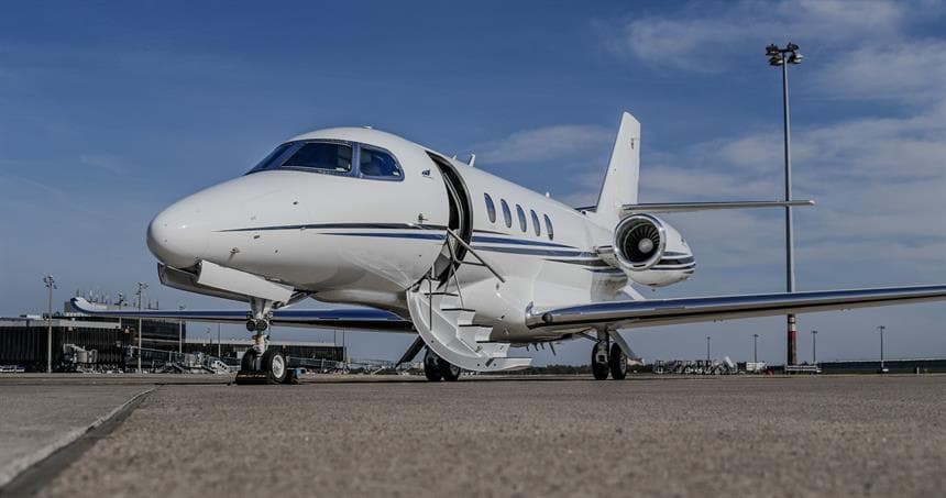 Fri, Nov 20in 17 daysHannoverEDDV · Hannover AirportRomeLIRA · Ciampino AirportCitation Latitude9—On request20NovHannover → RomeEDDV → LIRA · in 17 daysCitation Latitude · 9 seatsOn request
- Tue, Nov 2415:00HannoverEDDVBucharestLRBS · Aurel Vlaicu International AirportGulfstream G200—2h 28mOn request24NovHannover → BucharestEDDV → LRBS · 15:00Gulfstream G200 · 2h 28mOn request
 EDDV · Hannover Airport
 EGPE · Inverness Airport
 LFPB · Paris-Le Bourget Airport
 LEPA · Palma De Mallorca Airport
 LIRA · Ciampino Airport
 LRBS · Aurel Vlaicu International Airport
* Total price incl. 10% service fee, converted to your selected currency. Price subject to operator confirmation.
Empty legs to EDDV
7 arrivals available
- Thu, Nov 5in 2 daysIbizaLEIB · Ibiza AirportHannoverEDDV · Hannover AirportCitation XLS+8—On request5NovIbiza → HannoverLEIB → EDDV · in 2 daysCitation XLS+ · 8 seatsOn request
 Fri, Nov 6in 3 daysParisLFPB · Paris-Le Bourget AirportHannoverEDDV · Hannover AirportCitation Latitude9—On request6NovParis → HannoverLFPB → EDDV · in 3 daysCitation Latitude · 9 seatsOn request
- Sat, Nov 14in 11 daysPalmaLEPA · Palma De Mallorca AirportHannoverEDDV · Hannover AirportCitation XLS+8—On request14NovPalma → HannoverLEPA → EDDV · in 11 daysCitation XLS+ · 8 seatsOn request
- Tue, Nov 17in 14 daysBremenEDDW · Bremen AirportHannoverEDDV · Hannover AirportE50PSeats4——On request17NovBremen → HannoverEDDW → EDDV · in 14 daysE50PSeats4On request
- Tue, Nov 1711:00BremenEDDW · Bremen AirportHannoverEDDV · Hannover AirportEmbraer Phenom 1004—On request17NovBremen → HannoverEDDW → EDDV · 11:00Embraer Phenom 100 · 4 seatsOn request
- Thu, Nov 1917:00BucharestLRBS · Aurel Vlaicu International AirportHannoverEDDVGulfstream G200—2h 28mOn request19NovBucharest → HannoverLRBS → EDDV · 17:00Gulfstream G200 · 2h 28mOn request
- Fri, Nov 20in 17 daysBuochsLSZC · Buochs AirportHannoverEDDV · Hannover AirportCitation Mustang4—On request20NovBuochs → HannoverLSZC → EDDV · in 17 daysCitation Mustang · 4 seatsOn request
 LSZC · Buochs Airport
* Total price incl. 10% service fee, converted to your selected currency. Price subject to operator confirmation.
Map: Hannover Airport
View the location of Hannover – HAJ/EDDV. Zoom in to explore the area around the airport.
About the airport
Hannover Airport (HAJ/EDDV) is the key private jet gateway for Hannover. PrivJet gives you instant access to charter flights and empty legs: fast, discreet and globally connected.
EDDV airport FAQ
Are there any restrictions at Hannover airport (EDDV) today?
There are currently 5 valid NOTAMs for Hannover (EDDV). 3 more NOTAMs start in the coming days. For information only, not for flight planning or operational use. Always rely on an official pre-flight briefing. This list may be incomplete or out of date.
What is the weather at Hannover airport (EDDV)?
According to the latest weather report for EDDV (METAR, 02 Nov, 23:20 UTC): Marginal visual conditions (MVFR). Wind 3 kt (6 km/h) from northeast (50°), visibility 10 km or more, temperature 7 °C (dew point 6 °C). For information only, not for flight planning. Weather can change quickly; always rely on official reports.
How long are the runways at Hannover airport (EDDV)?
Hannover (EDDV) has 3 runways: runway 09L/27R with 3,790 m (12,434 ft), concrete, runway 09R/27L with 2,340 m (7,677 ft), concrete and runway 09C/27C with 777 m (2,548 ft), asphalt. The longest is 3,790 m.
What are the radio frequencies at Hannover airport (EDDV)?
Frequencies at EDDV: Tower 120.18 / 120.405 MHz, Ground 121.955 MHz and ATIS 136.575 MHz. For information only. Always rely on the published AIP.
What are the airport codes of Hannover Airport?
The ICAO code is EDDV and the IATA code is HAJ. ICAO codes are used by air traffic control and pilots, e.g. in flight plans; IATA codes appear on tickets and baggage tags.
What is the elevation of EDDV airport?
Hannover Airport sits at 183 ft (56 m) above sea level. Local time zone: Europe/Berlin.
Can I fly to EDDV by private jet?
Whether a private jet can operate into Hannover Airport depends on runway length, opening hours, customs and immigration rules as well as slot and handling availability, among other things. PrivJet checks this with the operating carrier for every request.
Are there empty legs from or to EDDV?
There are currently 7 empty legs departing from and 7 arriving at Hannover Airport. Empty legs are repositioning flights at heavily reduced prices; the list is updated several times a day.