Bournemouth Airport (EGHH / BOH)
Empty legs and charters from Bournemouth
EGHH airport at a glance
- ICAO code
- EGHH
- IATA code
- BOH
- City
- Bournemouth
- Region
- England
- Country
- United Kingdom
- Elevation
- 38 ft (12 m)
- Time zone
- Europe/London (UTC±0)
- Coordinates
- 50.7800° N, 1.8425° W
- Empty legs from
- 6
- Empty legs to
- 6
Weather & airport info EGHH
Current weather
Marginal visual conditions (MVFR)observed 02 Nov, 21:50 UTC- Wind
- 8 kt (15 km/h) from north (10°)
- Visibility
- 10 km or more
- Clouds
- broken clouds at 2,100 ft
- Temperature
- 10 °C (dew point 6 °C)
- Pressure (QNH)
- 1,036 hPa
Original weather report (METAR)
METAR EGHH 022150Z 01008KT 9999 BKN021 10/06 Q1036
Airport
- Elevation
- 38 ft (12 m)
- Sunrise / Sunset
- 07:01 / 16:39 local time
Runways
| Runway | Length | Surface | Lighted |
|---|---|---|---|
| 08/26 | 2,272 m (7,454 ft) | asphalt | yes |
Radio frequencies
- Approach: 119.475
- ATIS: 121.95
- Ground: 121.7
- Tower: 125.6
For information only, not for flight planning. Weather can change quickly; always rely on official reports. Sources: aviationweather.gov (NOAA), OurAirports.
Airport map EGHH
Full screen →Runways white, taxiways yellow with designators, closed taxiways and runways per NOTAM in red.
Closed per NOTAM: TWY AL
Official charts
Aerodrome, approach and ground charts are published by the national air navigation service in its AIP:
NATS UK AIP →For information only, not for navigation. Always use current official charts and NOTAMs.
Current NOTAMs for EGHH(9)
NOTAMs (Notices to Air Missions) announce short-term changes at an airport: closed runways or taxiways, unserviceable approach aids, obstacles, airspace restrictions.
- ClosedTaxiway: closedC7241/26· from 03 Nov, 08:30 UTC · until 03 Nov, 17:00 UTC
Taxiway Romeo is closed.
Show original text
TWY ROMEO CLSD
C7241/26 NOTAMN
 Q) EGTT/QMXLC/IV/BO /A /000/999/5047N00151W005
 A) EGHH B) 2611030830 C) 2611031700
 E) TWY ROMEO CLSD
- ClosedControl zone: deactivatedC7248/26· until 03 Nov, 01:00 UTC
The Bournemouth controlled airspace (CTR) and aerodrome traffic zone (ATZ) are deactivated, and the airport is closed. National Police Air Service flights may take place.
Show original text
BOURNEMOUTH CTR, ATZ DEACTIVATED. AD CLSD. NATIONAL POLICE AIR SERVICE FLIGHTS MAY TAKE PLACE.
C7248/26 NOTAMR C7247/26
 Q) EGTT/QACCD/IV/NBO/AE/000/021/5047N00151W009
 A) EGHH B) 2611022239 C) 2611030100
 E) BOURNEMOUTH CTR, ATZ DEACTIVATED. AD CLSD. NATIONAL POLICE AIR
 SERVICE FLIGHTS MAY TAKE PLACE.
- ClosedAircraft stand: closedC7140/26· until 24 Nov, 23:30 UTC
Stand 5 is closed.
Show original text
STAND 5 CLSD
C7140/26 NOTAMN
 Q) EGTT/QMPLC/IV/BO /A /000/999/5047N00151W005
 A) EGHH B) 2611020800 C) 2611242330
 E) STAND 5 CLSD
- ClosedTaxiway: closedC6369/26· until 25 Dec, 09:00 UTC
Taxiway Alpha is closed. This means aircraft cannot use this part of the airport.
Show original text
TWY ALPHA CLSD
C6369/26 NOTAMN
 Q) EGTT/QMXLC/IV/BO /A /000/999/5047N00151W005
 A) EGHH B) 2609250933 C) 2612250900
 E) TWY ALPHA CLSD
- NoticeModel flying: will take placeC6628/26· from 07 Nov, 19:30 UTC · until 08 Nov, 20:00 UTC
Fireworks will take place within a 0.5 nautical mile radius of Broadstone, Bournemouth. This may affect air traffic near Bournemouth Airport.
Show original text
FIREWORKS WI 0.5NM RADIUS OF 504550N 0015507W (BROADSTONE, BOURNEMOUTH). FOR INFO 07770 594889 / 07841 134296. AR-2026-9437/01.
C6628/26 NOTAMN
 Q) EGTT/QWZLW/IV/M  /AW/000/005/5046N00155W001
 A) EGHH B) 2611071930 C) 2611082000
 D) 1930-2000
 E) FIREWORKS WI 0.5NM RADIUS OF 504550N 0015507W (BROADSTONE,
 BOURNEMOUTH). FOR INFO 07770 594889 / 07841 134296.
 AR-2026-9437/01.
 F) SFC G) 500FT AMSL
Hours: 1930-2000
- NoticeWarning: will take placeC7177/26· from 07 Nov, 19:00 UTC · until 07 Nov, 21:00 UTC
LASER ACTIVITY within 1 NM radius of a defined point (ST LEONARDS). for information 07809 239645. AR-2026-10435/01.
Show original text
LASER ACTIVITY WI 1NM RADIUS OF 504929N 0014946W (ST LEONARDS). FOR INFO 07809 239645. AR-2026-10435/01.
C7177/26 NOTAMN
 Q) EGTT/QWOLW/IV/M  /AW/000/999/5049N00150W002
 A) EGHH B) 2611071900 C) 2611072100
 E) LASER ACTIVITY WI 1NM RADIUS OF 504929N 0014946W (ST LEONARDS).
 FOR INFO 07809 239645. AR-2026-10435/01.
 F) SFC G) UNL
- NoticeWarning: will take placeC6971/26· from 06 Nov, 15:00 UTC · until 06 Nov, 23:59 UTC
A laser display is taking place near Bournemouth, within a 1 nautical mile radius.
Show original text
LASER DISPLAY WI 1NM RADIUS OF 504353N 0015403W (BOURNEMOUTH). FOR INFO 07796 199884. AR-2026-10119/01.
C6971/26 NOTAMN
 Q) EGTT/QWOLW/IV/M  /AW/000/999/5044N00154W002
 A) EGHH B) 2611061500 C) 2611062359
 E) LASER DISPLAY WI 1NM RADIUS OF 504353N 0015403W (BOURNEMOUTH).
 FOR INFO 07796 199884. AR-2026-10119/01.
 F) SFC G) UNL
- NoticeObstacle: erectedC7189/26· from 04 Nov, 08:00 UTC · until 16 Dec, 18:00 UTC
A crane is in operation, 899 meters from Bournemouth Airport. Its maximum jib height is 88 feet above ground and 127 feet above sea level.
Show original text
CRANE OPR PSN 504659N 0015112W (297T 899M FM BOURNEMOUTH ARP) MAX JIB HGT 88FT AGL 127FT AMSL
C7189/26 NOTAMN
 Q) EGTT/QOBCE/IV/M  /AE/000/002/5047N00151W001
 A) EGHH B) 2611040800 C) 2612161800
 D) 0800-1800
 E) CRANE OPR PSN 504659N 0015112W (297T 899M FM BOURNEMOUTH ARP)
 MAX JIB HGT 88FT AGL 127FT AMSL
Hours: 0800-1800
1 more NOTAMs
- NoticeObstacle: erectedC7192/26· until 31 Dec, 18:00 UTC
Cranes are operating near Bournemouth airport. Their maximum jib height is 118 feet above ground and 152 feet above mean sea level.
Show original text
CRANES OPR WI 0.2NM OF PSN 504453N 0014914W (156T 3881M FM BOURNEMOUTH ARP) MAX JIB HGT 118FT AGL 152FT AMSL
C7192/26 NOTAMN
 Q) EGTT/QOBCE/IV/M  /AE/000/002/5045N00149W001
 A) EGHH B) 2610311400 C) 2612311800
 D) OCT 31 1400-1800, NOV 01-DEC 31 0800-1800
 E) CRANES OPR WI 0.2NM OF PSN 504453N 0014914W (156T 3881M FM
 BOURNEMOUTH ARP) MAX JIB HGT 118FT AGL 152FT AMSL
Hours: OCT 31 1400-1800, NOV 01-DEC 31 0800-1800
For information only, not for flight planning or operational use. Always rely on an official pre-flight briefing. This list may be incomplete or out of date. Explanations and expanded abbreviations are generated automatically. The original text is authoritative. Source: FAA NOTAM Management Service (SWIM).
Private jet traffic in Bournemouth Airport (last 30 days)
- Arrivals
- 189
- Departures
- 174
- Different jets
- 99
Most frequent origins: Guernsey Airport (12), Southampton Airport (7), London Biggin Hill Airport (6), Jersey Airport (6), Farnborough Airport (6).
Most frequent destinations: Guernsey Airport (16), Farnborough Airport (8), Southampton Airport (6), Newquay Cornwall Airport (5), Durham Tees Valley Airport (5).
Most common aircraft types: Dassault Falcon 20 (61), Beechcraft King Air 200/250 (54), Pilatus PC-12 (26), Cessna Citation Excel/XLS (25), Learjet 60 (23).
Monday is the busiest day.
Our own analysis of public ADS-B signals from business jets. Not every flight is received, and jets with a removal request are excluded.
Charter operators based here
Operators with a base at this airport.
- Planet Nine Private AirVan Nuys (KVNY) · Turboprop, Heavy jet
- 247 AviationBelfast International (EGAA) · Turboprop, Light jet, Piston aircraft
- Av8jet CharterOxford (London Oxford) (EGTK) · Light jet, Super midsize jet
- The Little Jet CompanyTurboprop, Light jet
- Bliss AviationHelicopter
Empty legs from EGHH
6 departures available
 Tue, Nov 3TodayBournemouthEGHH · Bournemouth AirportGenevaLSGG · Geneva Cointrin International AirportCitation Latitude8—On request3NovBournemouth → GenevaEGHH → LSGG · TodayCitation Latitude · 8 seatsOn request
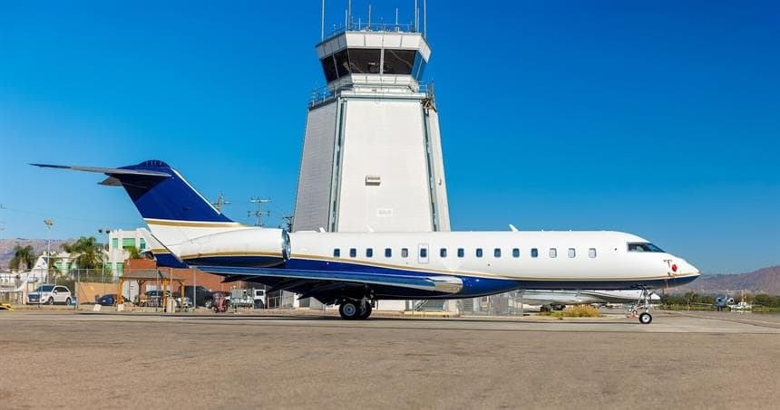 Wed, Nov 4TomorrowBournemouthEGHH · Bournemouth AirportNew YorkKTEB · Teterboro AirportGlobal Express XRS14—On request4NovBournemouth → New YorkEGHH → KTEB · TomorrowGlobal Express XRS · 14 seatsOn request
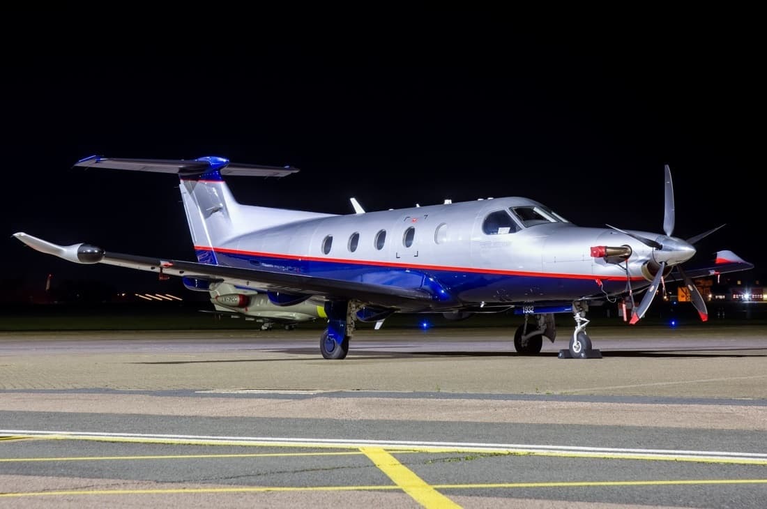 Sat, Nov 21in 18 daysBournemouthEGHH · Bournemouth AirportLausanne DistrictLSGL · Lausanne-la Blecherette AirportPilatus PC-126—On request21NovBournemouth → Lausanne DistrictEGHH → LSGL · in 18 daysPilatus PC-12 · 6 seatsOn request
- Sun, Nov 2212:10BournemouthEGHH · Bournemouth AirportLiverpoolEGGP · Liverpool John Lennon AirportPilatus PC-128—$4,18022NovBournemouth → LiverpoolEGHH → EGGP · 12:10Pilatus PC-12 · 8 seats$4,180
- Sun, Nov 22in 19 daysBournemouthEGHH · Bournemouth AirportLiverpoolEGGP · Liverpool John Lennon AirportPilatus PC12 PRO6—£93522NovBournemouth → LiverpoolEGHH → EGGP · in 19 daysPilatus PC12 PRO · 6 seats£935
 Wed, Nov 2501:10ChristchurchEGHH · Bournemouth AirportLiverpoolEGGP · Liverpool John Lennon AirportPilatus PC 128—$4,62925NovChristchurch → LiverpoolEGHH → EGGP · 01:10Pilatus PC 12 · 8 seats$4,629
 EGHH · Bournemouth Airport
 LSGG · Geneva Cointrin International Airport
 KTEB · Teterboro Airport
* Total price incl. 10% service fee, converted to your selected currency. Price subject to operator confirmation.
Empty legs to EGHH
6 arrivals available
 Fri, Nov 6in 3 daysNottinghamEGNX · East Midlands AirportBournemouthEGHH · Bournemouth AirportCitation CJ2+6—On request6NovNottingham → BournemouthEGNX → EGHH · in 3 daysCitation CJ2+ · 6 seatsOn request
- Fri, Nov 6in 3 daysZurichLSZH · Zurich AirportBournemouthEGHH · Bournemouth AirportPilatus PC-126—On request6NovZurich → BournemouthLSZH → EGHH · in 3 daysPilatus PC-12 · 6 seatsOn request
- Sun, Nov 1508:27LiverpoolEGGP · Liverpool John Lennon AirportBournemouthEGHH · Bournemouth AirportPilatus PC-128—$4,95015NovLiverpool → BournemouthEGGP → EGHH · 08:27Pilatus PC-12 · 8 seats$4,950
- Sun, Nov 1508:00LiverpoolEGGP · Liverpool John Lennon AirportBournemouthEGHH · Bournemouth AirportPilatus PC12 PRO6—£82515NovLiverpool → BournemouthEGGP → EGHH · 08:00Pilatus PC12 PRO · 6 seats£825
- Mon, Nov 1621:27LiverpoolEGGP · Liverpool John Lennon AirportChristchurchEGHH · Bournemouth AirportPilatus PC 128—$5,10816NovLiverpool → ChristchurchEGGP → EGHH · 21:27Pilatus PC 12 · 8 seats$5,108
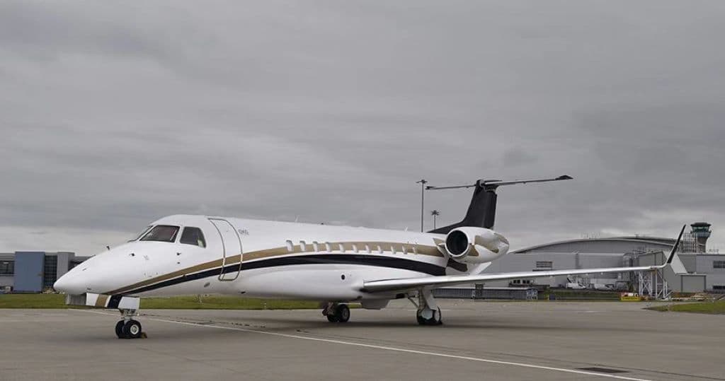 Fri, Nov 20in 17 daysLondonEGGW · London Luton AirportBournemouthEGHH · Bournemouth AirportLegacy 60013—On request20NovLondon → BournemouthEGGW → EGHH · in 17 daysLegacy 600 · 13 seatsOn request
* Total price incl. 10% service fee, converted to your selected currency. Price subject to operator confirmation.
Map: Bournemouth Airport
View the location of Bournemouth – BOH/EGHH. Zoom in to explore the area around the airport.
About the airport
Bournemouth Airport (BOH/EGHH) is the key private jet gateway for Bournemouth. PrivJet gives you instant access to charter flights and empty legs: fast, discreet and globally connected.
EGHH airport FAQ
Are there any restrictions at Bournemouth airport (EGHH) today?
There are currently 4 valid NOTAMs for Bournemouth (EGHH). Affected: Control zone: deactivated; Aircraft stand: closed; Taxiway: closed. 5 more NOTAMs start in the coming days. For information only, not for flight planning or operational use. Always rely on an official pre-flight briefing. This list may be incomplete or out of date.
What is the weather at Bournemouth airport (EGHH)?
According to the latest weather report for EGHH (METAR, 02 Nov, 21:50 UTC): Marginal visual conditions (MVFR). Wind 8 kt (15 km/h) from north (10°), visibility 10 km or more, temperature 10 °C (dew point 6 °C). For information only, not for flight planning. Weather can change quickly; always rely on official reports.
How long are the runways at Bournemouth airport (EGHH)?
Bournemouth (EGHH) has one runway: runway 08/26 with 2,272 m (7,454 ft), asphalt.
What are the radio frequencies at Bournemouth airport (EGHH)?
Frequencies at EGHH: Tower 125.6 MHz, Ground 121.7 MHz and ATIS 121.95 MHz. For information only. Always rely on the published AIP.
What are the airport codes of Bournemouth Airport?
The ICAO code is EGHH and the IATA code is BOH. ICAO codes are used by air traffic control and pilots, e.g. in flight plans; IATA codes appear on tickets and baggage tags.
What is the elevation of EGHH airport?
Bournemouth Airport sits at 38 ft (12 m) above sea level. Local time zone: Europe/London.
Can I fly to EGHH by private jet?
Whether a private jet can operate into Bournemouth Airport depends on runway length, opening hours, customs and immigration rules as well as slot and handling availability, among other things. PrivJet checks this with the operating carrier for every request.
Are there empty legs from or to EGHH?
There are currently 6 empty legs departing from and 6 arriving at Bournemouth Airport. Empty legs are repositioning flights at heavily reduced prices; the list is updated several times a day.