Southampton Airport (EGHI / SOU)
Empty legs and charters from Southampton
EGHI airport at a glance
- ICAO code
- EGHI
- IATA code
- SOU
- City
- Southampton
- Region
- England
- Country
- United Kingdom
- Elevation
- 44 ft (13 m)
- Time zone
- Europe/London (UTC±0)
- Coordinates
- 50.9503° N, 1.3568° W
- Empty legs from
- 4
- Empty legs to
- 1
Weather & airport info EGHI
Current weather
Good visual conditions (VFR)observed 03 Nov, 05:20 UTC- Wind
- 12 kt (22 km/h) from north (10°)
- Visibility
- 10 km or more
- Clouds
- no significant clouds
- Temperature
- 7 °C (dew point 5 °C)
- Pressure (QNH)
- 1,033 hPa
Original weather report (METAR)
METAR EGHI 030520Z AUTO 01012KT 9999 NCD 07/05 Q1033
Forecast (TAF)
- 03 Nov, 06:00–15:00 UTC12 kt (22 km/h) from north-northeast (20°) · visibility 10 km or more · few clouds at 2,000 ft
- 03 Nov, 06:00–09:00 UTCpossible, 30 % probabilityvisibility 8 km
Original forecast (TAF)
TAF EGHI 030501Z 0306/0315 02012KT 9999 FEW020 PROB30 0306/0309 8000
Airport
- Elevation
- 44 ft (13 m)
- Sunrise / Sunset
- 07:00 / 16:37 local time
Runways
| Runway | Length | Surface | Lighted |
|---|---|---|---|
| 02/20 | 1,887 m (6,191 ft) | asphalt | yes |
Radio frequencies
- Approach: 120.23
- Approach: 122.73
- ATIS: 130.88
- Tower: 118.205
For information only, not for flight planning. Weather can change quickly; always rely on official reports. Sources: aviationweather.gov (NOAA), OurAirports.
Airport map EGHI
Full screen →Runways white, taxiways yellow with designators, closed taxiways and runways per NOTAM in red.
Official charts
Aerodrome, approach and ground charts are published by the national air navigation service in its AIP:
NATS UK AIP →For information only, not for navigation. Always use current official charts and NOTAMs.
Current NOTAMs for EGHI(11)
NOTAMs (Notices to Air Missions) announce short-term changes at an airport: closed runways or taxiways, unserviceable approach aids, obstacles, airspace restrictions.
- ClosedTaxiway: closedC7246/26· from 03 Nov, 09:00 UTC · until 06 Nov, 16:00 UTC
Taxiway Alpha north of A6 is closed.
Show original text
TWY ALPHA NORTH OF A6 CLSD.
C7246/26 NOTAMN
 Q) EGTT/QMXLC/IV/BO /A /000/999/5057N00121W005
 A) EGHI B) 2611030900 C) 2611061600
 E) TWY ALPHA NORTH OF A6 CLSD.
- ClosedAircraft stand: closedC6517/26· until 30 Dec, 23:59 UTC
Stand 12 is closed.
Show original text
STAND 12 CLOSED
C6517/26 NOTAMN
 Q) EGTT/QMPLC/IV/BO /A /000/999/5057N00121W005
 A) EGHI B) 2610011518 C) 2612302359
 E) STAND 12 CLOSED
- NoticeModel flying: will take placeC7021/26· from 06 Nov, 19:30 UTC · until 06 Nov, 20:35 UTC
Fireworks are active within a 0.5 nautical mile radius of Southampton. For information, call 01794 884040 or 07788 185418.
Show original text
FIREWORKS WI 0.5NM RADIUS OF 505523N 0011914W (SOUTHAMPTON). FOR INFO 01794 884040 / 07788 185418. AR-2026-9293/01.
C7021/26 NOTAMN
 Q) EGTT/QWZLW/IV/M  /AW/000/006/5055N00119W001
 A) EGHI B) 2611061930 C) 2611062035
 E) FIREWORKS WI 0.5NM RADIUS OF 505523N 0011914W (SOUTHAMPTON).  FOR
 INFO 01794 884040 / 07788 185418. AR-2026-9293/01.
 F) SFC G) 600FT AMSL
- NoticeModel flying: will take placeC6950/26· from 06 Nov, 19:00 UTC · until 06 Nov, 19:15 UTC
Fireworks will take place within a 0.5 nautical mile radius of Eastleigh.
Show original text
FIREWORKS WI 0.5NM RADIUS OF 505745N 0012244W (EASTLEIGH). FOR INFO 07891 449728. AR-2026-9968/01.
C6950/26 NOTAMN
 Q) EGTT/QWZLW/IV/M  /AW/000/004/5058N00123W001
 A) EGHI B) 2611061900 C) 2611061915
 E) FIREWORKS WI 0.5NM RADIUS OF 505745N 0012244W (EASTLEIGH).
 FOR INFO 07891 449728. AR-2026-9968/01.
 F) SFC G) 400FT AMSL
- NoticeModel flying: will take placeC6629/26· from 04 Nov, 19:00 UTC · until 04 Nov, 19:15 UTC
Fireworks will take place within a 0.5 nautical mile radius of Chandler's Ford. This may affect air traffic near Southampton Airport.
Show original text
FIREWORKS WI 0.5NM RADIUS OF 505945N 0012304W (CHANDLER'S FORD). FOR INFO 01794 884080 / 07894 464208. AR-2026-9426/01.
C6629/26 NOTAMN
 Q) EGTT/QWZLW/IV/M  /AW/000/004/5100N00123W001
 A) EGHI B) 2611041900 C) 2611041915
 E) FIREWORKS WI 0.5NM RADIUS OF 505945N 0012304W (CHANDLER'S FORD).
 FOR INFO 01794 884080 / 07894 464208. AR-2026-9426/01.
 F) SFC G) 400FT AMSL
- NoticeModel flying: will take placeC6759/26· from 04 Nov, 18:45 UTC · until 04 Nov, 19:30 UTC
Fireworks are taking place within a 0.5 nautical mile radius of Eastleigh.
Show original text
FIREWORKS WI 0.5NM RADIUS OF 505844N 0012121W (EASTLEIGH). FOR INFO 07941 215982 / 07795 251358 / 07708 433502. AR-2026-9638/01.
C6759/26 NOTAMN
 Q) EGTT/QWZLW/IV/M  /AW/000/006/5059N00121W001
 A) EGHI B) 2611041845 C) 2611041930
 E) FIREWORKS WI 0.5NM RADIUS OF 505844N 0012121W (EASTLEIGH).  FOR
 INFO 07941 215982 / 07795 251358 / 07708 433502. AR-2026-9638/01.
 F) SFC G) 600FT AMSL
- NoticeDanger area: installedJ3777/26· until 01 Dec, 04:00 UTC
A temporary danger area has been established within a 1.61 nautical mile radius of Southampton City Centre. Beyond visual line of sight (BVLOS) drone operations are permitted within this area up to a maximum height of 400 feet above ground.
Show original text
TEMPO DANGER AREA (TDA) EGD182A INSTALLED WI 1.61NM RADIUS OF 505410N 0012419W (SOUTHAMPTON CITY CENTRE). BEYOND VISUAL LINE OF SIGHT (BVLOS) UAS OPS CONTAINED WHOLLY WI THE TDA. MAX HGT 400FT AGL. EMERG SERVICES ACFT MAY ENTER THE AIRSPACE IN ACCORDANCE WITH LOCAL DECONFLICTION AGREEMENTS. OPEN AND SPECIFIC CAT VLOS (VISUAL LINE OF SIGHT) UAS OPS ARE PERMITTED WI THE TDA WITHOUT PRIOR APPROVAL OR DECONFLICTION. OTHER NON-STANDARD FLIGHT, FLIGHT RESTRICTION ZONE OR CONTROLLED AIRSPACE APPROVALS MUST BE OBTAINED. OPERATORS ARE REMINDED OF THEIR RESPONSIBILITY UNDER CAP722 5.2.2.3 REGARDING OPR IN CLOSE PROXIMITY TO AN EMERG RESPONSE EFFORT. FOR INFO AROPS(AT)CAA.CO.UK. AR-2025-9505/18.
J3777/26 NOTAMN
 Q) EGTT/QRDCS/IV/BO /AW/000/006/5054N00124W002
 A) EGHI B) 2611010800 C) 2612010400
 D) 0800-0400
 E) TEMPO DANGER AREA (TDA) EGD182A INSTALLED WI 1.61NM RADIUS OF
 505410N 0012419W (SOUTHAMPTON CITY CENTRE). BEYOND VISUAL LINE OF
 SIGHT (BVLOS) UAS OPS CONTAINED WHOLLY WI THE TDA. MAX HGT 400FT
 AGL. EMERG SERVICES ACFT MAY ENTER THE AIRSPACE IN ACCORDANCE
 WITH LOCAL DECONFLICTION AGREEMENTS. OPEN AND SPECIFIC CAT VLOS
 (VISUAL LINE OF SIGHT) UAS OPS ARE PERMITTED WI THE TDA WITHOUT
 PRIOR APPROVAL OR DECONFLICTION. OTHER NON-STANDARD FLIGHT, FLIGHT
 RESTRICTION ZONE OR CONTROLLED AIRSPACE APPROVALS MUST BE
 OBTAINED.
 OPERATORS ARE REMINDED OF THEIR RESPONSIBILITY UNDER CAP722
 5.2.2.3
 REGARDING OPR IN CLOSE PROXIMITY TO AN EMERG RESPONSE EFFORT. FOR
 INFO AROPS(AT)CAA.CO.UK. AR-2025-9505/18.
 F) SFC G) 600FT AMSL
Hours: 0800-0400
- NoticeDanger area: installedJ3844/26· until 01 Dec, 04:00 UTC
A Temporary Danger Area (TDA) EGD182B has been established within a 1.61 nautical mile radius of Millbrook, Southampton. Drone operations are permitted within this area up to a maximum height of 400 feet above ground.
Show original text
TEMPO DANGER AREA (TDA) EGD182B INSTALLED WI 1.61NM RADIUS OF 505534N 0012653W (MILLBROOK, SOUTHAMPTON). BEYOND VISUAL LINE OF SIGHT (BVLOS) UAS OPS CONTAINED WHOLLY WI THE TDA. MAX HGT 400FT AGL. EMERG SERVICES ACFT MAY ENTER THE AIRSPACE IN ACCORDANCE WITH LOCAL DECONFLICTION AGREEMENTS. OPEN AND SPECIFIC CAT VISUAL LINE OF SIGHT (VLOS) UAS OPS ARE PERMITTED WI THE TDA WITHOUT PRIOR APPROVAL OR DECONFLICTION. OTHER NON-STANDARD FLIGHT, FLIGHT RESTRICTION ZONE OR CONTROLLED AIRSPACE APPROVALS MUST BE OBTAINED. OPERATORS ARE REMINDED OF THEIR RESPONSIBILITY UNDER CAP722 5.2.2.3 REGARDING OPR IN CLOSE PROXIMITY TO AN EMERG RESPONSE EFFORT. FOR INFO AROPS(AT)CAA.CO.UK. AR-2026-4167/06.
J3844/26 NOTAMN
 Q) EGTT/QRDCS/IV/BO /AW/000/007/5056N00127W003
 A) EGHI B) 2611010800 C) 2612010400
 D) 0800-0400
 E) TEMPO DANGER AREA (TDA) EGD182B INSTALLED WI 1.61NM RADIUS OF
 505534N 0012653W (MILLBROOK, SOUTHAMPTON). BEYOND VISUAL LINE OF
 SIGHT (BVLOS) UAS OPS CONTAINED WHOLLY WI THE TDA. MAX HGT 400FT
 AGL. EMERG SERVICES ACFT MAY ENTER THE AIRSPACE IN ACCORDANCE
 WITH LOCAL DECONFLICTION AGREEMENTS. OPEN AND SPECIFIC CAT VISUAL
 LINE OF SIGHT (VLOS) UAS OPS ARE PERMITTED WI THE TDA WITHOUT
 PRIOR APPROVAL OR DECONFLICTION. OTHER NON-STANDARD FLIGHT, FLIGHT
 RESTRICTION ZONE OR CONTROLLED AIRSPACE APPROVALS MUST BE
 OBTAINED. OPERATORS ARE REMINDED OF THEIR RESPONSIBILITY UNDER
 CAP722 5.2.2.3 REGARDING OPR IN CLOSE PROXIMITY TO AN EMERG
 RESPONSE EFFORT. FOR INFO AROPS(AT)CAA.CO.UK. AR-2026-4167/06.
 F) SFC G) 700FT AMSL
Hours: 0800-0400
3 more NOTAMs
- NoticeObstacle: erectedC7085/26· until 04 Nov, 17:00 UTC
A crane is operating in Eastleigh. Its maximum height is 35 ft above ground or 69.5 ft above mean sea level.
Show original text
CRANE OPR PSN 505851N 0012305W (EASTLEIGH). MAX HGT 35FT AGL / 69.5FT AMSL
C7085/26 NOTAMR C6606/26
 Q) EGTT/QOBCE/IV/M  /AE/000/001/5059N00123W001
 A) EGHI B) 2610270900 C) 2611041700
 E) CRANE OPR PSN 505851N 0012305W (EASTLEIGH).
 MAX HGT 35FT AGL / 69.5FT AMSL
- NoticeApronC6914/26· permanent
The pavement classification numbers (PCN) for the apron and taxiways are replaced with new PCR values. This affects stands 2-4, 5, 6-14 and taxiways A (between A1-A5), A (north of A5), B, and the taxiway cul-de-sac.
Show original text
REPLACE APRON PCN WITH PCR VALUES AS FOLLOWS: STAND 2-4 PCR 360/F/B/W/U STAND 5 PCR 560/R/C/W/T STAND 6-14 PCR 171/F/C/W/U REPLACE TWY PCN WITH PCR VALUES AS FOLLOWS: TWY A (BTN A1-A5) PCR 250/F/C/X/U TWY A (NORTH OF A5) PCR 290/F/C/X/U TWY B PCR 350/R/B/W/U TWY CUL-DE-SAC PCR 360/F/B/X/U UK AIP EGHI AD 2.8 REFERS.
C6914/26 NOTAMN
 Q) EGTT/QMNXX/IV/NBO/A /000/999/5057N00121W005
 A) EGHI B) 2610201031 C) PERM
 E) REPLACE APRON PCN WITH PCR VALUES AS FOLLOWS:
 STAND 2-4 PCR 360/F/B/W/U
 STAND 5 PCR 560/R/C/W/T
 STAND 6-14 PCR 171/F/C/W/U
 REPLACE TWY PCN WITH PCR VALUES AS FOLLOWS:
 TWY A (BTN A1-A5) PCR 250/F/C/X/U
 TWY A (NORTH OF A5) PCR 290/F/C/X/U
 TWY B PCR 350/R/B/W/U
 TWY CUL-DE-SAC PCR 360/F/B/X/U
 UK AIP EGHI AD 2.8 REFERS.
- NoticeRunwayC6907/26· permanent
The pavement classification number (PCN) for runway 02/20 is replaced with the new PCR value 550/R/B/X/U.
Show original text
REPLACE RWY 02/20 PCN WITH PCR 550/R/B/X/U. UK AIP EGHI AD 2.12 REFERS.
C6907/26 NOTAMN
 Q) EGTT/QMRXX/IV/NBO/A /000/999/5057N00121W005
 A) EGHI B) 2610200559 C) PERM
 E) REPLACE RWY 02/20 PCN WITH PCR 550/R/B/X/U. UK AIP EGHI AD 2.12
 REFERS.
For information only, not for flight planning or operational use. Always rely on an official pre-flight briefing. This list may be incomplete or out of date. Explanations and expanded abbreviations are generated automatically. The original text is authoritative. Source: FAA NOTAM Management Service (SWIM).
Private jet traffic in Southampton Airport (last 30 days)
- Arrivals
- 140
- Departures
- 134
- Different jets
- 89
Most frequent origins: Jersey Airport (19), Guernsey Airport (19), Bournemouth Airport (6), Farnborough Airport (4), East Midlands Airport (4).
Most frequent destinations: Jersey Airport (19), Guernsey Airport (19), Bournemouth Airport (7), Farnborough Airport (6), Paris-Le Bourget Airport (6).
Most common aircraft types: Beechcraft King Air 200/250 (56), Cessna Citation Excel/XLS (34), Embraer Phenom 300 (30), Beechcraft King Air 350 (24), Pilatus PC-12 (19).
Thursday is the busiest day.
Our own analysis of public ADS-B signals from business jets. Not every flight is received, and jets with a removal request are excluded.
Charter operators based here
Operators with a base at this airport.
- Planet Nine Private AirVan Nuys (KVNY) · Turboprop, Heavy jet
Empty legs from EGHI
4 departures available
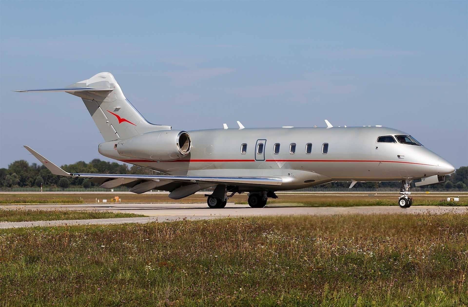 Tue, Nov 3TodaySouthamptonEGHI · Southampton AirportGenevaLSGG · Geneva Cointrin International AirportChallenger 3508—On request3NovSouthampton → GenevaEGHI → LSGG · TodayChallenger 350 · 8 seatsOn request
 Fri, Nov 6in 3 daysSouthamptonEGHI · Southampton AirportLondonEGGW · London Luton AirportFalcon 7X10—On request6NovSouthampton → LondonEGHI → EGGW · in 3 daysFalcon 7X · 10 seatsOn request
- Wed, Nov 1815:45SouthamptonEGHI · Southampton AirportSalzburgLOWS · Salzburg AirportPilatus PC-128—$7,04018NovSouthampton → SalzburgEGHI → LOWS · 15:45Pilatus PC-12 · 8 seats$7,040
- Wed, Dec 16in 43 daysSouthamptonEGHI · Southampton AirportHaverfordwestEGFE · Haverfordwest AirportKing Air 2006—€2,50016DecSouthampton → HaverfordwestEGHI → EGFE · in 43 daysKing Air 200 · 6 seats€2,500
 EGHI · Southampton Airport
 LSGG · Geneva Cointrin International Airport
 LOWS · Salzburg Airport
* Total price incl. 10% service fee, converted to your selected currency. Price subject to operator confirmation.
Empty legs to EGHI
1 arrivals available
* Total price incl. 10% service fee, converted to your selected currency. Price subject to operator confirmation.
Map: Southampton Airport
View the location of Southampton – SOU/EGHI. Zoom in to explore the area around the airport.
About the airport
Southampton Airport (SOU/EGHI) is the key private jet gateway for Southampton. PrivJet gives you instant access to charter flights and empty legs: fast, discreet and globally connected.
EGHI airport FAQ
Are there any restrictions at Southampton airport (EGHI) today?
There are currently 6 valid NOTAMs for Southampton (EGHI). Affected: Aircraft stand: closed. 5 more NOTAMs start in the coming days. For information only, not for flight planning or operational use. Always rely on an official pre-flight briefing. This list may be incomplete or out of date.
What is the weather at Southampton airport (EGHI)?
According to the latest weather report for EGHI (METAR, 03 Nov, 05:20 UTC): Good visual conditions (VFR). Wind 12 kt (22 km/h) from north (10°), visibility 10 km or more, temperature 7 °C (dew point 5 °C). For information only, not for flight planning. Weather can change quickly; always rely on official reports.
How long are the runways at Southampton airport (EGHI)?
Southampton (EGHI) has one runway: runway 02/20 with 1,887 m (6,191 ft), asphalt.
What are the radio frequencies at Southampton airport (EGHI)?
Frequencies at EGHI: Tower 118.205 MHz and ATIS 130.88 MHz. For information only. Always rely on the published AIP.
What are the airport codes of Southampton Airport?
The ICAO code is EGHI and the IATA code is SOU. ICAO codes are used by air traffic control and pilots, e.g. in flight plans; IATA codes appear on tickets and baggage tags.
What is the elevation of EGHI airport?
Southampton Airport sits at 44 ft (13 m) above sea level. Local time zone: Europe/London.
Can I fly to EGHI by private jet?
Whether a private jet can operate into Southampton Airport depends on runway length, opening hours, customs and immigration rules as well as slot and handling availability, among other things. PrivJet checks this with the operating carrier for every request.
Are there empty legs from or to EGHI?
There are currently 4 empty legs departing from and 1 arriving at Southampton Airport. Empty legs are repositioning flights at heavily reduced prices; the list is updated several times a day.