London Heathrow Airport (EGLL / LHR)
Empty legs and charters from London
EGLL airport at a glance
- ICAO code
- EGLL
- IATA code
- LHR
- City
- London
- Region
- England
- Country
- United Kingdom
- Elevation
- 83 ft (25 m)
- Time zone
- Europe/London (UTC±0)
- Coordinates
- 51.4706° N, 0.4619° W
- Empty legs from
- 1
- Empty legs to
- 0
Weather & airport info EGLL
Current weather
Marginal visual conditions (MVFR)observed 02 Nov, 22:20 UTC- Wind
- 8 kt (15 km/h) from north-northeast (30°)
- Visibility
- 10 km or more
- Clouds
- overcast at 1,400 ft
- Temperature
- 9 °C (dew point 8 °C)
- Pressure (QNH)
- 1,036 hPa
Original weather report (METAR)
METAR EGLL 022220Z AUTO 03008KT 350V060 9999 OVC014 09/08 Q1036
Forecast (TAF)
- 02 Nov, 21:00–00:00 UTC10 kt (19 km/h) from north-northeast (20°) · visibility 10 km or more · broken clouds at 2,000 ft
- 02 Nov, 23:00–10:00 UTCtemporarily, 40 % probabilitybroken clouds at 900 ft
- 03 Nov, 11:00–17:00 UTCtemporarily, 30 % probability15 kt (28 km/h) from northeast (40°), gusts up to 25 kt · visibility 6 km · Rain showers
- 03 Nov, 17:00–23:00 UTCtemporarily, 30 % probabilityvisibility 8 km · Light rain, light drizzle · broken clouds at 1,200 ft
Original forecast (TAF)
TAF AMD EGLL 022147Z 0221/0324 02010KT 9999 BKN020 PROB40 TEMPO 0221/0223 8000 -RA BKN009 PROB40 TEMPO 0223/0310 BKN009 PROB30 TEMPO 0311/0317 04015G25KT 6000 SHRA PROB30 TEMPO 0317/0323 8000 -RADZ BKN012
Airport
- Elevation
- 83 ft (25 m)
- Sunrise / Sunset
- 06:58 / 16:32 local time
Runways
| Runway | Length | Surface | Lighted |
|---|---|---|---|
| 09L/27R | 3,901 m (12,799 ft) | asphalt | yes |
| 09R/27L | 3,658 m (12,001 ft) | asphalt | yes |
Radio frequencies
- ATIS: 113.75
- ATIS: 115.1
- ATIS: 121.935
- ATIS: 128.075
- Clearance: 121.975
- Ground: 121.7
- Ground: 121.85
- Ground: 121.9
For information only, not for flight planning. Weather can change quickly; always rely on official reports. Sources: aviationweather.gov (NOAA), OurAirports.
Airport map EGLL
Full screen →Runways white, taxiways yellow with designators, closed taxiways and runways per NOTAM in red.
Closed per NOTAM: RWY 9L/27R, RWY 9R/27L, TWY LI, TWY A* (* partly closed)
Official charts
Aerodrome, approach and ground charts are published by the national air navigation service in its AIP:
NATS UK AIP →For information only, not for navigation. Always use current official charts and NOTAMs.
Current NOTAMs for EGLL(31)
NOTAMs (Notices to Air Missions) announce short-term changes at an airport: closed runways or taxiways, unserviceable approach aids, obstacles, airspace restrictions.
- ClosedRunway: closedA4394/26· from 03 Nov, 22:30 UTC · until 04 Nov, 04:00 UTC
Runways 09L/27R and 09R/27L are closed. The start of the runway closure will be delayed until scheduled movements are complete.
Show original text
RWY 09L/27R AND RWY 09R/27L CLSD. START OF RWY CLSD WILL BE DELAYED UNTIL SKED MOV ARE COMPLETE. MOV DELAYED INTO NIGHT QUOTA PERIOD ARE STILL SUBJ AD AUTHORITY APPROVAL. FOR INFO CTC AD DUTY MANAGER (020 8745 737)
A4394/26 NOTAMN
 Q) EGTT/QMRLC/IV/NBO/A /000/999/5129N00028W005
 A) EGLL B) 2611032230 C) 2611040400
 E) RWY 09L/27R AND RWY 09R/27L CLSD. START OF RWY CLSD WILL BE
 DELAYED UNTIL SKED MOV ARE COMPLETE. MOV DELAYED INTO NIGHT QUOTA
 PERIOD ARE STILL SUBJ AD AUTHORITY APPROVAL. FOR INFO CTC AD DUTY
 MANAGER (020 8745 737)
- ClosedRunway: closedA4393/26· until 03 Nov, 04:00 UTC
Runways 09L/27R and 09R/27L are closed. Runway 09R/27L can be made available for emergency traffic with 30 minutes notice.
Show original text
RWY 09L/27R AND RWY 09R/27L CLSD. RWY 09R/27L CAN BE MADE AVBL FOR EMERG TFC AT 30 MIN NOTICE. START OF RWY CLSD WILL BE DELAYED UNTIL SKED MOV ARE COMPLETE. MOV DELAYED INTO NIGHT QUOTA PERIOD ARE STILL SUBJ AD AUTHORITY APPROVAL. FOR INFO CTC AD DUTY MANAGER 020 8745 737
A4393/26 NOTAMN
 Q) EGTT/QMRLC/IV/NBO/A /000/999/5129N00028W005
 A) EGLL B) 2611022230 C) 2611030400
 E) RWY 09L/27R AND RWY 09R/27L CLSD. RWY 09R/27L CAN BE MADE AVBL
 FOR EMERG TFC AT 30 MIN NOTICE. START OF RWY CLSD WILL BE DELAYED
 UNTIL SKED MOV ARE COMPLETE. MOV DELAYED INTO NIGHT QUOTA PERIOD
 ARE STILL SUBJ AD AUTHORITY APPROVAL. FOR INFO CTC AD DUTY MANAGER
 020 8745 737
- ClosedObstacle: erectedA3995/26· from 09 Nov, 22:30 UTC · until 14 Nov, 04:30 UTC
A lit crane is operating near Heathrow Airport. Its top is 307 ft above sea level, 230 ft above ground; it will only operate when runway 09R/27L is closed and not during low visibility procedures.
Show original text
LIT CRANE OPR AT PSN 512739N 0002745W (HEATHROW AD). MAX HGT 230FT AGL, 307FT AMSL. CRANE WILL ONLY OPR WHEN RWY 09R/27L IS CLSD. NO OPS IN LVP. CRANE REF 2026091784.
A3995/26 NOTAMN
 Q) EGTT/QOBCE/IV/M  /AE/000/004/5128N00028W001
 A) EGLL B) 2611092230 C) 2611140430
 D) 2230-0430
 E) LIT CRANE OPR AT PSN 512739N 0002745W (HEATHROW AD).
 MAX HGT 230FT AGL, 307FT AMSL. CRANE WILL ONLY OPR
 WHEN RWY 09R/27L IS CLSD. NO OPS IN LVP. CRANE REF 2026091784.
Hours: 2230-0430
- ClosedObstacle: erectedA4352/26· until 27 Nov, 04:30 UTC
A lit crane is operating near London Heathrow Airport. Its maximum height is 66 feet above ground (150 feet above mean sea level). The crane will only operate when runway 09L/27R is closed and not during low visibility procedures.
Show original text
LIT CRANE OPR PSN 512850N 0002633W (HEATHROW). MAX HGT 66FT AGL, 150FT AMSL. CRANE WILL ONLY OPERATE WHEN RWY 09L/27R IS CLSD. NO CRANE OPR IN LVP REF 20261023153.
A4352/26 NOTAMN
 Q) EGTT/QOBCE/IV/M  /AE/000/002/5129N00027W001
 A) EGLL B) 2611022230 C) 2611270430
 E) LIT CRANE OPR PSN 512850N 0002633W (HEATHROW). MAX HGT 66FT AGL,
 150FT AMSL. CRANE WILL ONLY OPERATE WHEN RWY 09L/27R IS CLSD. NO
 CRANE OPR IN LVP REF 20261023153.
- ClosedObstacle: erectedA4130/26· permanent
Lit construction equipment is operating near Heathrow Airport, on taxiway A (North) between taxiway C and E. Its top is 111 feet above mean sea level (AMSL), 30 feet above ground level (AGL). It operates only when runway 09L/27R is closed and not in low visibility procedures (LVP).
Show original text
LIT CONSTRUCTION EQUIPMENT OPR AT PSN 512833N 0002826W (HEATHROW AD, TWY A(NORTH) BTN TWY C AND E). MAX HGT 30FT AGL/111FT AMSL. NO OPS IN LVP. ONLY OPR WHEN RWY 09L/27R IS CLOSED. CRANE REF 20261006129. UK EGLL OBST DATASET WEF 21 JAN 2027 REFERS.
A4130/26 NOTAMN
 Q) EGTT/QOBCE/IV/M  /AE/000/002/5129N00028W001
 A) EGLL B) 2611020000 C) PERM
 E) LIT CONSTRUCTION EQUIPMENT OPR AT PSN 512833N 0002826W
 (HEATHROW AD, TWY A(NORTH) BTN TWY C AND E). MAX HGT 30FT AGL/111FT
 AMSL. NO OPS IN LVP. ONLY OPR WHEN RWY 09L/27R IS CLOSED.
 CRANE REF 20261006129. UK EGLL OBST DATASET WEF 21 JAN 2027 REFERS.
- Out of serviceNon-directional beacon: unserviceableA4341/26· until 28 Nov, 12:00 UTC
The non-directional beacon (NDB) BUR/BURNHAM 421KHZ is out of service. An NDB is a navigation system that helps aircraft determine their position.
Show original text
NDB BUR/BURNHAM 421KHZ U/S
A4341/26 NOTAMR A4201/26
 Q) EGTT/QNBAS/IV/BO /A /000/999/5131N00041W005
 A) EGLL B) 2610301603 C) 2611281200
 E) NDB BUR/BURNHAM 421KHZ U/S
- ClosedTaxiway: closedA4164/26· until 15 Jan, 23:50 UTC
Taxiway link 35 is closed.
Show original text
TWY LINK 35 CLSD.
A4164/26 NOTAMN
 Q) EGTT/QMXLC/IV/BO /A /000/999/5129N00028W005
 A) EGLL B) 2610282350 C) 2701152350
 E) TWY LINK 35 CLSD.
- ClosedObstacle: erectedA3800/26· until 16 Dec, 04:30 UTC
A lit crane is operating near stand 258 at Heathrow Airport. Its maximum height is 92 ft above ground (171 ft above mean sea level). The crane will only operate when runway 09L/27R is closed and not during low visibility.
Show original text
LIT CRANE OPR WI AREA BOUNDED BY: 512828N 0002624W - 512828N 0002618W - 512825N 0002618W - 512825N 0002624W - 512828N 0002624W (HEATHROW STAND 258). MAX HGT 92FT AGL/171FT AMSL. NO CRANE OPR IN LVP. CRANE WILL ONLY OPR WHEN RWY 09L/27R IS CLSD. CRANE REF 2026090966
A3800/26 NOTAMN
 Q) EGTT/QOBCE/IV/M  /AE/000/002/5128N00026W001
 A) EGLL B) 2610182130 C) 2612160430
 D) OCT 18-23 2130-0330, 24 2130-0430, 25-DEC 15 2230-0430
 E) LIT CRANE OPR WI AREA BOUNDED BY:
 512828N 0002624W - 512828N 0002618W - 512825N 0002618W -
 512825N 0002624W - 512828N 0002624W (HEATHROW STAND 258). MAX HGT
 92FT AGL/171FT AMSL. NO CRANE OPR IN LVP. CRANE WILL ONLY OPR WHEN
 RWY 09L/27R IS CLSD. CRANE REF 2026090966
Hours: OCT 18-23 2130-0330, 24 2130-0430, 25-DEC 15 2230-0430
23 more NOTAMs
- ClosedTaxiway: closedA4069/26· until 16 Dec, 23:50 UTC
Runway 09L/27R entry/exit AB11/A11 is closed.
Show original text
RWY 09L/27R ENRTY/EXIT AB11/A11 CLSD.
A4069/26 NOTAMN
 Q) EGTT/QMXLC/IV/BO /A /000/999/5129N00028W005
 A) EGLL B) 2610140823 C) 2612162350
 E) RWY 09L/27R ENRTY/EXIT AB11/A11 CLSD.
- ClosedTaxiway: closedA3781/26· until 16 Dec, 23:50 UTC
Taxiway A North is closed between taxiway C and taxiway E.
Show original text
TWY A NORTH CLSD BTN TWY C AND TWY E.
A3781/26 NOTAMN
 Q) EGTT/QMXLC/IV/BO /A /000/999/5129N00028W005
 A) EGLL B) 2609302350 C) 2612162350
 E) TWY A NORTH CLSD BTN TWY C AND TWY E.
- NoticeUnmanned aircraft: will take placeA4387/26· from 08 Nov, 08:00 UTC · until 08 Nov, 18:00 UTC
An unmanned aircraft (drone) is operating within a 0.2 nautical mile radius of South Norwood, London. The maximum height is 500 feet above ground.
Show original text
UAS OPR WI 0.2NM RADIUS OF 512400N 0000519W (SOUTH NORWOOD, LONDON). MAX HGT 500FT AGL. FOR INFO 01992 924779. AR-2026-10461/01.
A4387/26 NOTAMN
 Q) EGTT/QWULW/IV/BO /AW/000/009/5124N00005W001
 A) EGLL B) 2611080800 C) 2611081800
 E) UAS OPR WI 0.2NM RADIUS OF 512400N 0000519W (SOUTH NORWOOD,
 LONDON). MAX HGT 500FT AGL. FOR INFO 01992 924779. AR-2026-10461/01.
 F) SFC G) 900FT AMSL
- NoticeModel flying: will take placeA4050/26· from 07 Nov, 19:30 UTC · until 07 Nov, 20:40 UTC
Fireworks will take place within a 0.5 nautical mile radius of Sunbury-on-Thames, near London Heathrow airport.
Show original text
FIREWORKS WI 0.5NM RADIUS OF 512509N 0002415W (SUNBURY-ON-THAMES). FOR INFO 01794 884040. AR-2026-9294/01.
A4050/26 NOTAMN
 Q) EGTT/QWZLW/IV/M  /AW/000/004/5125N00024W001
 A) EGLL B) 2611071930 C) 2611072040
 E) FIREWORKS WI 0.5NM RADIUS OF 512509N 0002415W
 (SUNBURY-ON-THAMES). FOR INFO 01794 884040. AR-2026-9294/01.
 F) SFC G) 400FT AMSL
- NoticeModel flying: will take placeA4221/26· from 07 Nov, 19:30 UTC · until 07 Nov, 19:45 UTC
FIREWORKS within 0.5 NM radius of a defined point (ASHFORD). for information 01784 424646. AR-2026-10212/01.
Show original text
FIREWORKS WI 0.5NM RADIUS OF 512538N 0002752W (ASHFORD). FOR INFO 01784 424646. AR-2026-10212/01.
A4221/26 NOTAMN
 Q) EGTT/QWZLW/IV/M  /AW/000/003/5126N00028W001
 A) EGLL B) 2611071930 C) 2611071945
 E) FIREWORKS WI 0.5NM RADIUS OF 512538N 0002752W (ASHFORD). FOR INFO
 01784 424646. AR-2026-10212/01.
 F) SFC G) 300FT AMSL
- NoticeModel flying: will take placeA4204/26· from 07 Nov, 19:00 UTC · until 07 Nov, 20:30 UTC
Fireworks activity will take place within a 0.5 nautical mile radius of position 512927N 0003752W (Eton).
Show original text
FIREWORKS WI 0.5NM RADIUS OF 512927N 0003752W (ETON). FOR INFO 07800 888930. AR-2026-9966/01.
A4204/26 NOTAMN
 Q) EGTT/QWZLW/IV/M  /AW/000/006/5129N00038W001
 A) EGLL B) 2611071900 C) 2611072030
 E) FIREWORKS WI 0.5NM RADIUS OF 512927N 0003752W (ETON). FOR INFO
 07800 888930. AR-2026-9966/01.
 F) SFC G) 600FT AMSL
- NoticeModel flying: will take placeA3854/26· from 07 Nov, 18:30 UTC · until 07 Nov, 19:00 UTC
Fireworks are taking place within a 0.5 nautical mile radius of 512607N 0002857W (Staines-upon-Thames). For more information, contact 07977924639 or 07917299496.
Show original text
FIREWORKS WI 0.5NM RADIUS OF 512607N 0002857W (STAINES-UPON-THAMES). FOR INFO 07977924639 / 07917299496. AR-2026-8820/01.
A3854/26 NOTAMN
 Q) EGTT/QWZLW/IV/M  /AW/000/003/5126N00029W001
 A) EGLL B) 2611071830 C) 2611071900
 E) FIREWORKS WI 0.5NM RADIUS OF 512607N 0002857W
 (STAINES-UPON-THAMES).  FOR INFO 07977924639 / 07917299496.
 AR-2026-8820/01.
 F) SFC G) 300FT AMSL
- NoticeObstacle: erectedA4094/26· from 07 Nov, 08:00 UTC · until 08 Nov, 17:00 UTC
A lit crane is operating near Heathrow airport. Its maximum height is 276 feet above ground (AGL) or 359 feet above mean sea level (AMSL).
Show original text
LIT CRANE OPR PSN 512917N 0003002W - 512916N 0003000W - 512915N 0003002W - 512915N 0003003W - 512917N 0003002W (HEATHROW). MAX HGT 276FT AGL / 359FT AMSL. NO CRANE OPR IN LVP. CRANE WILL ONLY OPR WHEN ON WESTERLY OPERATIONS. CRANE REF 20260916127.
A4094/26 NOTAMN
 Q) EGTT/QOBCE/IV/M  /AE/000/004/5129N00030W001
 A) EGLL B) 2611070800 C) 2611081700
 D) 0800-1700
 E) LIT CRANE OPR PSN 512917N 0003002W - 512916N 0003000W -
 512915N 0003002W - 512915N 0003003W - 512917N 0003002W (HEATHROW).
 MAX HGT 276FT AGL / 359FT AMSL. NO CRANE OPR IN LVP. CRANE WILL ONLY
 OPR WHEN ON WESTERLY OPERATIONS. CRANE REF 20260916127.
Hours: 0800-1700
- NoticeUnmanned aircraft: will take placeA4386/26· from 07 Nov, 08:00 UTC · until 07 Nov, 19:00 UTC
Drones (UAS) operating within BOUNDED area: - - - - - - - - - - (STAINES-UPON-THAMES). maximum height 179 ft above ground. for information 07727 242848. AR-2026-10482/01.
Show original text
UAS OPR WI BOUNDED AREA: 512635N 0002830W - 512639N 0002837W - 512645N 0002840W - 512650N 0002834W - 512653N 0002818W - 512649N 0002813W - 512645N 0002807W - 512641N 0002809W - 512638N 0002816W - 512635N 0002823W - 512635N 0002830W (STAINES-UPON-THAMES). MAX HGT 179FT AGL. FOR INFO 07727 242848. AR-2026-10482/01.
A4386/26 NOTAMN
 Q) EGTT/QWULW/IV/BO /AW/000/003/5127N00028W001
 A) EGLL B) 2611070800 C) 2611071900
 E) UAS OPR WI BOUNDED AREA:
 512635N 0002830W - 512639N 0002837W - 512645N 0002840W -
 512650N 0002834W - 512653N 0002818W - 512649N 0002813W -
 512645N 0002807W - 512641N 0002809W - 512638N 0002816W -
 512635N 0002823W - 512635N 0002830W (STAINES-UPON-THAMES). MAX HGT
 179FT AGL. FOR INFO 07727 242848. AR-2026-10482/01.
 F) SFC G) 300FT AMSL
- NoticeVORA4235/26· from 07 Nov, 07:00 UTC · until 08 Nov, 18:00 UTC
VOR/DME LON/LONDON 113.60 MHz CH83X THERE May be OBSERVATIONS of DVOR BEARING FLUCTUATIONS within the 250-290 DEG. MAG. SECTOR RADIALS from LONDON VOR/DME STATION, due to MOBILE crane in the VCY
Show original text
VOR/DME LON/LONDON 113.60MHZ CH83X THERE MAY BE OBSERVATIONS OF DVOR BEARING FLUCTUATIONS WI THE 250-290 DEG. MAG. SECTOR RADIALS FM LONDON VOR/DME STATION, DUE TO MOBILE CRANE IN THE VCY
A4235/26 NOTAMN
 Q) EGTT/QNVXX/IV/BO /AE/000/999/5129N00028W025
 A) EGLL B) 2611070700 C) 2611081800
 E) VOR/DME LON/LONDON 113.60MHZ CH83X THERE MAY BE OBSERVATIONS OF
 DVOR BEARING FLUCTUATIONS WI THE 250-290 DEG. MAG. SECTOR RADIALS FM
 LONDON VOR/DME STATION, DUE TO MOBILE CRANE IN THE VCY
- NoticeModel flying: will take placeA4237/26· from 06 Nov, 19:00 UTC · until 06 Nov, 19:30 UTC
Fireworks activity will take place within a 0.5 nautical mile radius of position 512535N 0003234W (Egham).
Show original text
FIREWORKS WI 0.5NM RADIUS OF 512535N 0003234W (EGHAM). FOR INFO 07305 003594 / 07796 336130 / 07808 644560. AR-2026-8817/01.
A4237/26 NOTAMN
 Q) EGTT/QWZLW/IV/M  /AW/000/004/5126N00033W001
 A) EGLL B) 2611061900 C) 2611061930
 E) FIREWORKS WI 0.5NM RADIUS OF 512535N 0003234W (EGHAM). FOR INFO
 07305 003594 / 07796 336130 / 07808 644560. AR-2026-8817/01.
 F) SFC G) 400FT AMSL
- NoticeOtherA4215/26· from 06 Nov, 12:00 UTC · until 07 Nov, 02:00 UTC
A searchlight display will take place within a 1 nautical mile radius of position 513034N 0001323W (White City, Hammersmith).
Show original text
SEARCHLIGHT DISPLAY WI 1NM RADIUS OF 513034N 0001323W (WHITE CITY, HAMMERSMITH). FOR INFO 07516 707007/07938 738602. AR-2026-10199/01.
A4215/26 NOTAMN
 Q) EGTT/QXXLW/IV/BO /AW/000/999/5131N00013W002
 A) EGLL B) 2611061200 C) 2611070200
 E) SEARCHLIGHT DISPLAY WI 1NM RADIUS OF 513034N 0001323W (WHITE
 CITY, HAMMERSMITH).  FOR INFO 07516 707007/07938 738602.
 AR-2026-10199/01.
 F) SFC G) UNL
- NoticeModel flying: will take placeA4124/26· from 05 Nov, 19:30 UTC · until 05 Nov, 20:00 UTC
Fireworks are taking place within a 0.5 nautical mile radius of Greenford, London. For more information, call 07515 173172.
Show original text
FIREWORKS WI 0.5NM RADIUS OF 513136N 0001947W (GREENFORD, LONDON). FOR INFO 07515 173172. AR-2026-8521/01.
A4124/26 NOTAMN
 Q) EGTT/QWZLW/IV/M  /AW/000/003/5132N00020W001
 A) EGLL B) 2611051930 C) 2611052000
 E) FIREWORKS WI 0.5NM RADIUS OF 513136N 0001947W (GREENFORD,
 LONDON).  FOR INFO 07515 173172. AR-2026-8521/01.
 F) SFC G) 300FT AMSL
- NoticeModel flying: will take placeA3851/26· from 05 Nov, 19:00 UTC · until 05 Nov, 19:30 UTC
Fireworks are taking place within a 0.5 nautical mile radius of 513117N 0002725W (Yiewsley). For more information, contact 07900 862403 or 07508 511812.
Show original text
FIREWORKS WI 0.5NM RADIUS OF 513117N 0002725W (YIEWSLEY). FOR INFO 07900 862403 / 07508 511812. AR-2026-8814/01.
A3851/26 NOTAMN
 Q) EGTT/QWZLW/IV/M  /AW/000/004/5131N00027W001
 A) EGLL B) 2611051900 C) 2611051930
 E) FIREWORKS WI 0.5NM RADIUS OF 513117N 0002725W (YIEWSLEY).  FOR
 INFO 07900 862403 / 07508 511812. AR-2026-8814/01.
 F) SFC G) 400FT AMSL
- NoticeModel flying: will take placeA3857/26· from 05 Nov, 18:45 UTC · until 05 Nov, 19:45 UTC
Fireworks will take place within a 0.5 nautical mile radius of 512857N 0002311W (Norwood Green).
Show original text
FIREWORKS WI 0.5NM RADIUS OF 512857N 0002311W (NORWOOD GREEN). FOR INFO 07903 933940 / 07899 693455. AR-2026-8560/01.
A3857/26 NOTAMN
 Q) EGTT/QWZLW/IV/M  /AW/000/002/5129N00023W001
 A) EGLL B) 2611051845 C) 2611051945
 E) FIREWORKS WI 0.5NM RADIUS OF 512857N 0002311W (NORWOOD GREEN).
 FOR INFO 07903 933940 / 07899 693455. AR-2026-8560/01.
 F) SFC G) 150FT AMSL
- NoticeWarning: will take placeA4340/26· from 05 Nov, 17:00 UTC · until 05 Nov, 21:30 UTC
A laser display is taking place within a 1 nautical mile radius of Harlesden, London. This may affect visibility.
Show original text
LASER DISPLAY WI 1NM RADIUS OF 513213N 0001431W (HARLESDEN, LONDON). FOR INFO 07711 855295. AR-2026-10439/01.
A4340/26 NOTAMN
 Q) EGTT/QWOLW/IV/M  /AW/000/999/5132N00015W002
 A) EGLL B) 2611051700 C) 2611052130
 E) LASER DISPLAY WI 1NM RADIUS OF 513213N 0001431W (HARLESDEN,
 LONDON). FOR INFO 07711 855295. AR-2026-10439/01.
 F) SFC G) UNL
- NoticeWarning: will take placeA4320/26· from 04 Nov, 17:30 UTC · until 04 Nov, 20:30 UTC
Lasers and fireworks are active within a 1 nautical mile radius of Bracknell. The fireworks reach a height of up to 300 feet above ground.
Show original text
LASERS, FIREWORKS WI 1NM RADIUS OF 512519N 0004602W (BRACKNELL). FIREWORKS UP TO 300FT AGL. FOR INFO 02034 220777. AR-2026-10405/01.
A4320/26 NOTAMN
 Q) EGTT/QWOLW/IV/M  /AW/000/999/5125N00046W002
 A) EGLL B) 2611041730 C) 2611042030
 E) LASERS, FIREWORKS WI 1NM RADIUS OF 512519N 0004602W (BRACKNELL).
 FIREWORKS UP TO 300FT AGL. FOR INFO 02034 220777.
 AR-2026-10405/01.
 F) SFC G) UNL
- NoticeUnmanned aircraft: will take placeA4391/26· from 04 Nov, 07:00 UTC · until 04 Nov, 16:29 UTC
Unmanned Aircraft Systems (UAS) are operating within a 0.3 nautical mile radius of 513047N 0001909W (West Ealing, London). The maximum height is 400 feet above ground.
Show original text
UAS OPR WI 0.3NM RADIUS OF 513047N 0001909W (WEST EALING, LONDON). MAX HGT 400FT AGL. FOR INFO 07944 161727 / 01206 696216. AR-2026-10498/01.
A4391/26 NOTAMN
 Q) EGTT/QWULW/IV/BO /AW/000/006/5131N00019W001
 A) EGLL B) 2611040700 C) 2611041629
 D) SR-SS
 E) UAS OPR WI 0.3NM RADIUS OF 513047N 0001909W (WEST EALING,
 LONDON). MAX HGT 400FT AGL. FOR INFO 07944 161727 / 01206 696216.
 AR-2026-10498/01.
 F) SFC G) 600FT AMSL
Hours: SR-SS
- NoticeModel flying: will take placeA4079/26· from 03 Nov, 18:30 UTC · until 03 Nov, 19:00 UTC
Fireworks will take place within a 0.5 nautical mile radius of Twickenham.
Show original text
FIREWORKS WI 0.5NM RADIUS OF 512713N 0001750W (TWICKENHAM). FOR INFO 020 89480195 / 07983 554207. AR-2026-9828/01.
A4079/26 NOTAMN
 Q) EGTT/QWZLW/IV/M  /AW/000/003/5127N00018W001
 A) EGLL B) 2611031830 C) 2611031900
 E) FIREWORKS WI 0.5NM RADIUS OF 512713N 0001750W (TWICKENHAM).  FOR
 INFO 020 89480195 / 07983 554207. AR-2026-9828/01.
 F) SFC G) 300FT AMSL
- NoticeVORA4232/26· until 14 Nov, 05:00 UTC
There may be observed VOR bearing fluctuations within the 155 to 195 degree magnetic sector radials from the London VOR/DME station, due to crane activity nearby. The VOR/DME LON/LONDON 113.60MHZ CH083X is a navigation system.
Show original text
VOR/DME LON/LONDON 113.60MHZ CH083X - THERE MAY BE OBS OF DVOR BEARING FLUCTUATIONS WI THE 155 - 195 DEG. MAG. SECTOR RADIALS FM THE LONDON VOR/DME STATION, DUE TO CRANE ACTIVITY IN THE VCY
A4232/26 NOTAMN
 Q) EGTT/QNVXX/IV/BO /AE/000/999/5129N00028W025
 A) EGLL B) 2610240849 C) 2611140500
 E) VOR/DME LON/LONDON 113.60MHZ CH083X - THERE MAY BE OBS OF DVOR
 BEARING FLUCTUATIONS WI THE 155 - 195 DEG. MAG. SECTOR RADIALS FM
 THE LONDON VOR/DME STATION, DUE TO CRANE ACTIVITY IN THE VCY
- NoticeUnmanned aircraft: will take placeA4081/26· until 15 Jan, 16:22 UTC
An unmanned aircraft system (UAS) is operating within a defined area near Iver, close to the airport. The maximum height is 260 feet above ground.
Show original text
UAS OPR WI AREA BOUNDED BY: 513047N 0003007W - 513046N 0002940W - 513034N 0002936W - 513032N 0003008W - 513047N 0003007W (IVER). MAX HGT 260FT AGL. FOR INFO 07745 966840. AR-2026-9855/01.
A4081/26 NOTAMN
 Q) EGTT/QWULW/IV/BO /AW/000/004/5131N00030W001
 A) EGLL B) 2610200634 C) 2701151622
 D) SR-SS
 E) UAS OPR WI AREA BOUNDED BY:
 513047N 0003007W - 513046N 0002940W - 513034N 0002936W -
 513032N 0003008W - 513047N 0003007W (IVER). MAX HGT 260FT AGL.
 FOR INFO 07745 966840. AR-2026-9855/01.
 F) SFC G) 400FT AMSL
Hours: SR-SS
- NoticeObstacle: erectedA4129/26· permanent
A lit crane is operating near London Heathrow Airport, north of Terminal 2A. Its top is 264 feet above sea level, 184 feet above ground. The crane is not in operation during low visibility procedures.
Show original text
LIT CRANE OPR AT PSN 512815N 0002659W (CRANWELL RD, HEATHROW AD CENTRAL TERMINAL AREA - NORTH OF TERMINAL 2A). MAX HGT 184FT AGL /264FT AMSL. NO OPS IN LVP. CRANE REF 20260416153. UK EGLL OBST DATASET WEF 21 JAN 2027 REFERS.
A4129/26 NOTAMN
 Q) EGTT/QOBCE/IV/M  /AE/000/003/5128N00027W001
 A) EGLL B) 2610191129 C) PERM
 E) LIT CRANE OPR AT PSN 512815N 0002659W (CRANWELL RD, HEATHROW AD
 CENTRAL TERMINAL AREA - NORTH OF TERMINAL 2A). MAX HGT 184FT AGL
 /264FT AMSL. NO OPS IN LVP. CRANE REF 20260416153. UK EGLL OBST
 DATASET WEF 21 JAN 2027 REFERS.
- NoticeRunwayA4061/26· until 15 Nov, 23:50 UTC
The mandatory information sign for Runway 27R at Taxiway A2 on the eastern side has been removed due to work in progress.
Show original text
RWY 27R MANDATORY INFO SIGN AT A2 ON EASTERN SIDE REMOVED DUE WIP
A4061/26 NOTAMR A3082/26
 Q) EGTT/QMRXX/IV/NBO/A /000/999/5129N00028W005
 A) EGLL B) 2610140648 C) 2611152350
 E) RWY 27R MANDATORY INFO SIGN AT A2 ON EASTERN SIDE REMOVED DUE WIP
For information only, not for flight planning or operational use. Always rely on an official pre-flight briefing. This list may be incomplete or out of date. Explanations and expanded abbreviations are generated automatically. The original text is authoritative. Source: FAA NOTAM Management Service (SWIM).
Private jet traffic in London Heathrow Airport (last 30 days)
- Arrivals
- 30
- Departures
- 29
- Different jets
- 10
Most frequent origins: Vienna International Airport (13), Luqa Airport (8).
Most frequent destinations: Vienna International Airport (13), Luqa Airport (8).
Most common aircraft types: Cessna Citation CJ2 (26), Learjet 60 (16), Gulfstream G280 (4).
Sunday is the busiest day.
Our own analysis of public ADS-B signals from business jets. Not every flight is received, and jets with a removal request are excluded.
Empty legs from EGLL
1 departures available
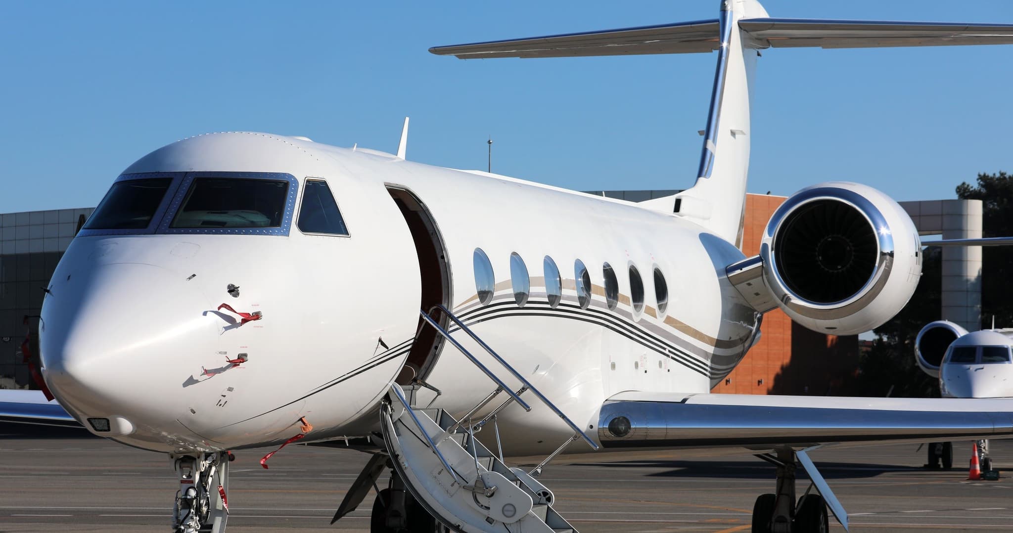
 EGLL · London Heathrow Airport
 UBBB · Heydar Aliyev International Airport
* Total price incl. 10% service fee, converted to your selected currency. Price subject to operator confirmation.
Empty legs to EGLL
0 arrivals available
No empty legs are currently available arriving at this airport.
Request tailored flightMap: London Airport
View the location of London – LHR/EGLL. Zoom in to explore the area around the airport.
About the airport
London Heathrow Airport (LHR/EGLL) is the key private jet gateway for London. PrivJet gives you instant access to charter flights and empty legs: fast, discreet and globally connected.
EGLL airport FAQ
Are there any restrictions at London airport (EGLL) today?
There are currently 12 valid NOTAMs for London (EGLL). According to NOTAM, at least one runway or the aerodrome itself is closed. Affected: Runway: closed; Obstacle: erected; Taxiway: closed; Non-directional beacon: unserviceable. 19 more NOTAMs start in the coming days. For information only, not for flight planning or operational use. Always rely on an official pre-flight briefing. This list may be incomplete or out of date.
What is the weather at London airport (EGLL)?
According to the latest weather report for EGLL (METAR, 02 Nov, 22:20 UTC): Marginal visual conditions (MVFR). Wind 8 kt (15 km/h) from north-northeast (30°), visibility 10 km or more, temperature 9 °C (dew point 8 °C). For information only, not for flight planning. Weather can change quickly; always rely on official reports.
How long are the runways at London airport (EGLL)?
London (EGLL) has 2 runways: runway 09L/27R with 3,901 m (12,799 ft), asphalt and runway 09R/27L with 3,658 m (12,001 ft), asphalt. The longest is 3,901 m.
What are the radio frequencies at London airport (EGLL)?
Frequencies at EGLL: Tower 118.5 / 118.7 MHz, Ground 121.7 / 121.85 MHz and ATIS 113.75 / 115.1 MHz. For information only. Always rely on the published AIP.
What are the airport codes of London Heathrow Airport?
The ICAO code is EGLL and the IATA code is LHR. ICAO codes are used by air traffic control and pilots, e.g. in flight plans; IATA codes appear on tickets and baggage tags.
What is the elevation of EGLL airport?
London Heathrow Airport sits at 83 ft (25 m) above sea level. Local time zone: Europe/London.
Can I fly to EGLL by private jet?
Whether a private jet can operate into London Heathrow Airport depends on runway length, opening hours, customs and immigration rules as well as slot and handling availability, among other things. PrivJet checks this with the operating carrier for every request.
Are there empty legs from or to EGLL?
There are currently 1 empty legs departing from and 0 arriving at London Heathrow Airport. Empty legs are repositioning flights at heavily reduced prices; the list is updated several times a day.