Leeds Bradford Airport (EGNM / LBA)
Empty legs and charters from Leeds
EGNM airport at a glance
- ICAO code
- EGNM
- IATA code
- LBA
- City
- Leeds
- Region
- England
- Country
- United Kingdom
- Elevation
- 681 ft (208 m)
- Time zone
- Europe/London (UTC±0)
- Coordinates
- 53.8659° N, 1.6606° W
- Empty legs from
- 7
- Empty legs to
- 8
Weather & airport info EGNM
Current weather
Good visual conditions (VFR)observed 03 Nov, 21:20 UTC- Wind
- 7 kt (13 km/h) from east-northeast (60°)
- Visibility
- 10 km or more
- Clouds
- scattered clouds at 3,000 ft, broken clouds at 4,000 ft
- Temperature
- 8 °C (dew point 6 °C)
- Pressure (QNH)
- 1,036 hPa
Original weather report (METAR)
METAR EGNM 032120Z 06007KT 020V090 9999 SCT030 BKN040 08/06 Q1036
Forecast (TAF)
- 03 Nov, 18:00–18:00 UTC9 kt (17 km/h) from northeast (50°) · visibility 10 km or more · scattered clouds at 3,500 ft
- 03 Nov, 21:00–00:00 UTCtemporarily, 30 % probabilityvisibility 8 km · Light rain · broken clouds at 1,200 ft
- 04 Nov, 00:00–13:00 UTCtemporarilyvisibility 6 km · Light rain, light rain, light drizzle · broken clouds at 1,200 ft
- 04 Nov, 00:00–12:00 UTCtemporarily, 30 % probabilityvisibility 4 km · Rain, drizzle · broken clouds at 400 ft
Original forecast (TAF)
TAF EGNM 031656Z 0318/0418 05009KT 9999 SCT035 PROB30 TEMPO 0321/0324 8000 -RA BKN012 TEMPO 0400/0413 6000 -RA -RADZ BKN012 PROB30 TEMPO 0400/0412 4000 RADZ BKN004
Airport
- Elevation
- 681 ft (208 m)
- Sunrise / Sunset
- 07:10 / 16:30 local time
Runways
| Runway | Length | Surface | Lighted |
|---|---|---|---|
| 14/32 | 2,250 m (7,381 ft) | concrete | yes |
Radio frequencies
- Approach: 123.38
- Approach: 134.58
- ATIS: 118.025
- Clearance: 121.805
- Tower: 120.305
For information only, not for flight planning. Weather can change quickly; always rely on official reports. Sources: aviationweather.gov (NOAA), OurAirports.
Airport map EGNM
Full screen →Runways white, taxiways yellow with designators, closed taxiways and runways per NOTAM in red.
Official charts
Aerodrome, approach and ground charts are published by the national air navigation service in its AIP:
NATS UK AIP →For information only, not for navigation. Always use current official charts and NOTAMs.
Current NOTAMs for EGNM(12)
NOTAMs (Notices to Air Missions) announce short-term changes at an airport: closed runways or taxiways, unserviceable approach aids, obstacles, airspace restrictions.
- ClosedAircraft stand: closedC6632/26· until 12 Nov, 00:00 UTC
Stand 1 is closed.
Show original text
STAND 1 CLOSED. NOTAM WILL BE SUPERSEDED BY AIP SUP WEF 12 NOV 2026.
C6632/26 NOTAMN
 Q) EGTT/QMPLC/IV/BO /A /000/999/5352N00140W005
 A) EGNM B) 2610071141 C) 2611120000
 E) STAND 1 CLOSED.
 NOTAM WILL BE SUPERSEDED BY AIP SUP WEF 12 NOV 2026.
- NoticeOtherC7261/26· from 10 Nov, 14:00 UTC · until 31 Dec, 23:00 UTC
A searchlight display is taking place within a 1 nautical mile radius of Swillington, West Yorkshire. This may affect visibility in the area.
Show original text
SEARCHLIGHT DISPLAY WI 1NM RADIUS OF 534703N 0012711W (SWILLINGTON, WEST YORKSHIRE). FOR INFO 07919 090990 / 01189 894519. AR-2026-10520/01.
C7261/26 NOTAMN
 Q) EGTT/QXXLW/IV/M  /AW/000/999/5347N00127W002
 A) EGNM B) 2611101400 C) 2612312300
 D) 1400-2300
 E) SEARCHLIGHT DISPLAY WI 1NM RADIUS OF 534703N 0012711W
 (SWILLINGTON, WEST YORKSHIRE).
 FOR INFO 07919 090990 / 01189 894519. AR-2026-10520/01.
 F) SFC G) UNL
Hours: 1400-2300
- NoticeUnmanned aircraft: will take placeC7233/26· from 07 Nov, 06:30 UTC · until 07 Nov, 16:30 UTC
Unmanned aircraft (drones) are operating within a 0.2 nautical mile radius of Beeston up to a maximum height of 500 feet above ground.
Show original text
UAS OPR WI 0.2NM RADIUS OF 534647N 0013428W (BEESTON). MAX HGT 500FT AGL. FOR INFO 01992 924779. AR-2026-10459/01.
C7233/26 NOTAMN
 Q) EGTT/QWULW/IV/BO /AW/000/007/5347N00134W001
 A) EGNM B) 2611070630 C) 2611071630
 E) UAS OPR WI 0.2NM RADIUS OF 534647N 0013428W (BEESTON). MAX HGT
 500FT AGL. FOR INFO 01992 924779. AR-2026-10459/01.
 F) SFC G) 700FT AMSL
- NoticeModel flying: will take placeC6515/26· from 06 Nov, 19:00 UTC · until 06 Nov, 20:00 UTC
Fireworks are taking place within a 0.5 nautical mile radius of Coney Park. For information, call 07581 432149.
Show original text
FIREWORKS WI 0.5NM RADIUS OF 535334N 0014151W (CONEY PARK). FOR INFO 07581 432149. AR-2026-9274/01.
C6515/26 NOTAMN
 Q) EGTT/QWZLW/IV/M  /AW/000/011/5354N00142W001
 A) EGNM B) 2611061900 C) 2611062000
 E) FIREWORKS WI 0.5NM RADIUS OF 535334N 0014151W (CONEY PARK).  FOR
 INFO 07581 432149. AR-2026-9274/01.
 F) SFC G) 1100FT AMSL
- NoticeModel flying: will take placeC7254/26· from 04 Nov, 19:00 UTC · until 04 Nov, 19:20 UTC
Fireworks are taking place within a 0.5 nautical mile radius of Horsforth. For more information, you can contact the provided phone numbers.
Show original text
FIREWORKS WI 0.5NM RADIUS OF 535037N 0013620W (HORSFORTH). FOR INFO 07860 786155 / 07871 412862. AR-2026-10277/01.
C7254/26 NOTAMN
 Q) EGTT/QWZLW/IV/M  /AW/000/008/5351N00136W001
 A) EGNM B) 2611041900 C) 2611041920
 E) FIREWORKS WI 0.5NM RADIUS OF 535037N 0013620W (HORSFORTH).
 FOR INFO 07860 786155 / 07871 412862. AR-2026-10277/01.
 F) SFC G) 800FT AMSL
- NoticeModel flying: will take placeC7255/26· from 04 Nov, 19:00 UTC · until 04 Nov, 19:15 UTC
There are fireworks within a 0.5 nautical mile radius of Horsforth. For more information, you can contact the provided phone numbers.
Show original text
FIREWORKS WI 0.5NM RADIUS OF 535022N 0013753W (HORSFORTH). FOR INFO 07717 276552 / 07814 749764. AR-2026-10262/01.
C7255/26 NOTAMN
 Q) EGTT/QWZLW/IV/M  /AW/000/009/5350N00138W001
 A) EGNM B) 2611041900 C) 2611041915
 E) FIREWORKS WI 0.5NM RADIUS OF 535022N 0013753W (HORSFORTH).
 FOR INFO 07717 276552 / 07814 749764. AR-2026-10262/01.
 F) SFC G) 900FT AMSL
- NoticeWarning: will take placeC6351/26· from 04 Nov, 16:00 UTC · until 23 Dec, 23:59 UTC
Lasers and searchlights are active within a one nautical mile radius of Tingley. This may affect visibility.
Show original text
LASERS, SEARCHLIGHTS WI 1NM RADIUS OF 534403N 0013323W (TINGLEY). FOR INFO 07917 669060. AR-2026-9016/01.
C6351/26 NOTAMN
 Q) EGTT/QWOLW/IV/M  /AW/000/999/5344N00133W002
 A) EGNM B) 2611041600 C) 2612232359
 D) 1600-2359
 E) LASERS, SEARCHLIGHTS WI 1NM RADIUS OF 534403N 0013323W (TINGLEY).
 FOR INFO 07917 669060. AR-2026-9016/01.
 F) SFC G) UNL
Hours: 1600-2359
- NoticeObstacle clearance altitude: changedC7229/26· until 04 Nov, 19:00 UTC
The minimum height for the instrument approach to runway 32 is increased due to a mobile crane near the airport. The instrument landing system (ILS) guides aircraft to the runway in poor visibility.
Show original text
INSTRUMENT APPROACH CHART - ILS/DME/NDB(L) RWY 32 II (CAT A/B/C/D). PROCEDURE OCA(H) INCREASED DUE MOBILE CRANE ACTIVITY. CAT A: OCA(H) 782 (120) CAT B: OCA(H) 798 (136) CAT C: OCA(H) 812 (150) CAT D: OCA(H) 822 (160))
C7229/26 NOTAMN
 Q) EGTT/QPOCH/I /NBO/A /000/999/5352N00140W005
 A) EGNM B) 2611030700 C) 2611041900
 D) 0700-1900
 E) INSTRUMENT APPROACH CHART - ILS/DME/NDB(L) RWY 32 II (CAT
 A/B/C/D).
 PROCEDURE OCA(H) INCREASED DUE MOBILE CRANE ACTIVITY.
 CAT A: OCA(H) 782 (120)
 CAT B: OCA(H) 798 (136)
 CAT C: OCA(H) 812 (150)
 CAT D: OCA(H) 822 (160))
Hours: 0700-1900
4 more NOTAMs
- NoticeObstacle clearance altitude: changedC7230/26· until 04 Nov, 19:00 UTC
The minimum height for the instrument approach to runway 14 (categories C/D) has been increased due to a mobile crane. The new minimum height for category C is 952 feet (278 feet above ground) and for category D is 962 feet (288 feet above ground).
Show original text
INSTRUMENT APPROACH CHART - ILS/DME Z RWY 14 (CAT C/D). PROCEDURE OCA(H) INCREASED DUE MOBILE CRANE ACTIVITY. CAT C: OCA(H) 952 (278) CAT D: OCA(H) 962 (288)
C7230/26 NOTAMN
 Q) EGTT/QPOCH/I /NBO/A /000/999/5352N00140W005
 A) EGNM B) 2611030700 C) 2611041900
 D) 0700-1900
 E) INSTRUMENT APPROACH CHART - ILS/DME Z RWY 14 (CAT C/D).
 PROCEDURE OCA(H) INCREASED DUE MOBILE CRANE ACTIVITY.
 CAT C: OCA(H) 952 (278)
 CAT D: OCA(H) 962 (288)
Hours: 0700-1900
- NoticeObstacle: erectedC7231/26· until 04 Nov, 19:00 UTC
A crane is operating near the Leeds Bradford airport terminal building. Its maximum height is 131 feet above ground (788 feet above mean sea level).
Show original text
CRANE OPR PSN 535210N 0013936W (LEEDS BRADFORD TERMINAL BUILDING). MAX HGT 131FT AGL/788FT AMSL)
C7231/26 NOTAMN
 Q) EGTT/QOBCE/IV/M  /AE/000/008/5352N00140W001
 A) EGNM B) 2611030700 C) 2611041900
 D) 0700-1900
 E) CRANE OPR PSN 535210N 0013936W (LEEDS BRADFORD TERMINAL
 BUILDING). MAX HGT 131FT AGL/788FT AMSL)
Hours: 0700-1900
- NoticeObstacle clearance altitude: changedC7232/26· until 04 Nov, 19:00 UTC
INSTRUMENT APPROACH CHART-ILS/DME Y runway 14 (category A/B). PROCEDURE OCA(H) INCREASED DUE MOBILE crane ACTIVITY. category A: OCA(H) 926 (252) category B: OCA(H) 939 (265)
Show original text
INSTRUMENT APPROACH CHART-ILS/DME Y RWY 14 (CAT A/B). PROCEDURE OCA(H) INCREASED DUE MOBILE CRANE ACTIVITY. CAT A: OCA(H) 926 (252) CAT B: OCA(H) 939 (265)
C7232/26 NOTAMN
 Q) EGTT/QPOCH/I /NBO/A /000/999/5352N00140W005
 A) EGNM B) 2611030700 C) 2611041900
 D) 0700-1900
 E) INSTRUMENT APPROACH CHART-ILS/DME Y RWY 14 (CAT A/B).
 PROCEDURE OCA(H) INCREASED DUE MOBILE CRANE ACTIVITY.
 CAT A: OCA(H) 926 (252)
 CAT B: OCA(H) 939 (265)
Hours: 0700-1900
- NoticeDanger area: installedJ3640/26· until 28 Nov, 23:59 UTC
A temporary danger area EGD394A has been established in Steander to Richmond Hill, Leeds. Within this area, drone operations beyond visual line of sight and without visual observers will take place up to a maximum height of 200 ft above ground.
Show original text
TEMPO DANGER AREA (TDA) EGD394A INSTALLED WI AREA BOUNDED BY STRAIGHT LINES JOINING: 534752N 0013142W - 534751N 0013132W - 534746N 0013130W - 534730N 0013036W - 534728N 0013040W - 534747N 0013137W - 534747N 0013150W - 534739N 0013239W - 534742N 0013240W - 534749N 0013147W - 534752N 0013142W (STEANDER TO RICHMOND HILL, LEEDS). BEYOND VISUAL LINE OF SIGHT (BVLOS) UAS OPS WITHOUT VISUAL OBSERVERS CONTAINED WHOLLY WI THE TDA. MAX HGT 200FT AGL. EMERG SERVICES ACFT MAY ENTER THE AIRSPACE IN ACCORDANCE WITH LOCAL DECONFLICTION AGREEMENTS. FOR INFO 07484 424457. AR-2025-9321/40.
J3640/26 NOTAMN
 Q) EGTT/QRDCS/IV/BO /AW/000/004/5348N00132W001
 A) EGNM B) 2610270700 C) 2611282359
 D) TUE-FRI 0700-2359, SAT 1300-2359
 E) TEMPO DANGER AREA (TDA) EGD394A INSTALLED WI AREA BOUNDED BY
 STRAIGHT LINES JOINING:
 534752N 0013142W - 534751N 0013132W - 534746N 0013130W -
 534730N 0013036W - 534728N 0013040W - 534747N 0013137W -
 534747N 0013150W - 534739N 0013239W - 534742N 0013240W -
 534749N 0013147W - 534752N 0013142W (STEANDER TO RICHMOND HILL,
 LEEDS). BEYOND VISUAL LINE OF SIGHT (BVLOS) UAS OPS WITHOUT VISUAL
 OBSERVERS CONTAINED WHOLLY WI THE TDA. MAX HGT 200FT AGL. EMERG
 SERVICES ACFT MAY ENTER THE AIRSPACE IN ACCORDANCE WITH LOCAL
 DECONFLICTION AGREEMENTS. FOR INFO 07484 424457. AR-2025-9321/40.
 F) SFC G) 400FT AMSL
Hours: TUE-FRI 0700-2359, SAT 1300-2359
For information only, not for flight planning or operational use. Always rely on an official pre-flight briefing. This list may be incomplete or out of date. Explanations and expanded abbreviations are generated automatically. The original text is authoritative. Source: FAA NOTAM Management Service (SWIM).
Private jet traffic in Leeds Bradford Airport (last 30 days)
- Arrivals
- 89
- Departures
- 83
- Different jets
- 74
Most frequent origins: London Luton Airport (4), Farnborough Airport (4).
Most frequent destinations: Farnborough Airport (4), Dublin Airport (3), London Biggin Hill Airport (3), East Midlands Airport (3), Palma De Mallorca Airport (3).
Most common aircraft types: Cessna Citation Excel/XLS (22), Pilatus PC-12 (21), Cessna Citation CJ2 (16), Beechjet 400/Hawker 400XP (14), Embraer Phenom 300 (14).
Monday is the busiest day.
Our own analysis of public ADS-B signals from business jets. Not every flight is received, and jets with a removal request are excluded.
Charter operators based here
Operators with a base at this airport.
Empty legs from EGNM
7 departures available
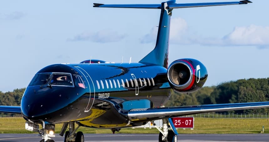 Wed, Nov 4TomorrowLeedsEGNM · Leeds Bradford AirportMilanLIML · Linate AirportERJ 135 VIP16—On request4NovLeeds → MilanEGNM → LIML · TomorrowERJ 135 VIP · 16 seatsOn request
 Wed, Nov 419:50LeedsEGNM · Leeds Bradford AirportLondonEGSS · London Stansted AirportEmbraer Praetor 6009—£7,3704NovLeeds → LondonEGNM → EGSS · 19:50Embraer Praetor 600 · 9 seats£7,370
 Fri, Nov 20in 17 daysLeeds BradfordEGNMLondon LutonEGGWCessna Citation Latitude945mOn request20NovLeeds Bradford → London LutonEGNM → EGGW · in 17 daysCessna Citation Latitude · 9 seats · 45mOn request
- Tue, Dec 115:00LeedsEGNM · Leeds BradfordKirmingtonEGNJ · HumbersideCessna Citation CJ3+—40mOn request1DecLeeds → KirmingtonEGNM → EGNJ · 15:00Cessna Citation CJ3+ · 40mOn request
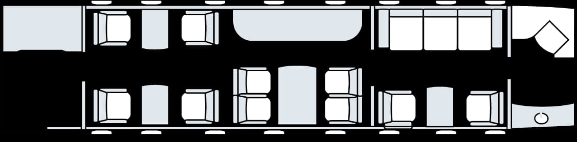 Sun, Dec 2018:52LeedsEGNM · Leeds Bradford AirportLondonEGGW · London Luton AirportEmbraer Legacy 60013—£9,90020DecLeeds → LondonEGNM → EGGW · 18:52Embraer Legacy 600 · 13 seats£9,900
 Sun, Jan 3in 61 daysLeeds BradfordEGNMBirmingham InternationalEGBBEmbraer Legacy 500840mOn request3JanLeeds Bradford → Birmingham InternationalEGNM → EGBB · in 61 daysEmbraer Legacy 500 · 8 seats · 40mOn request
- Sun, Jan 313:21LeedsEGNM · Leeds BradfordSouthend-on-SeaEGMC · SouthendEmbraer Legacy 600—57mOn request3JanLeeds → Southend-on-SeaEGNM → EGMC · 13:21Embraer Legacy 600 · 57mOn request
 EGNM · Leeds Bradford Airport
 LIML · Linate Airport
* Total price incl. 10% service fee, converted to your selected currency. Price subject to operator confirmation.
Empty legs to EGNM
8 arrivals available
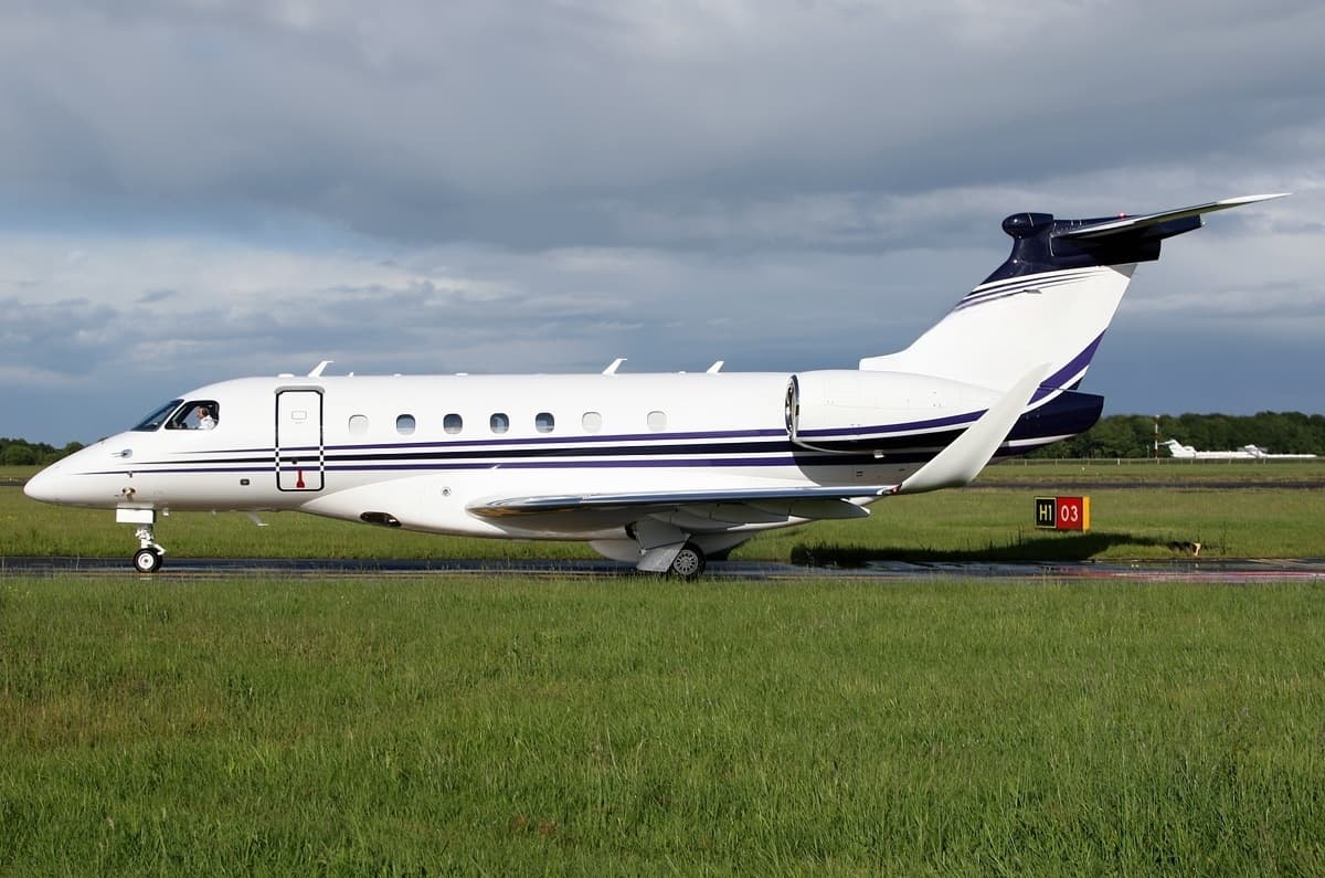 Tue, Nov 3TodayLondonEGGW · London Luton AirportLeedsEGNM · Leeds Bradford AirportPraetor 6009—On request3NovLondon → LeedsEGGW → EGNM · TodayPraetor 600 · 9 seatsOn request
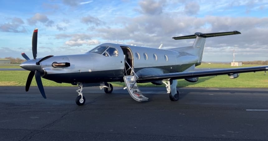 Thu, Nov 5in 2 daysLondonEGKB · London Biggin Hill AirportLeedsEGNM · Leeds Bradford AirportPilatus PC-126—$3,8895NovLondon → LeedsEGKB → EGNM · in 2 daysPilatus PC-12 · 6 seats$3,889
 Thu, Nov 12in 9 daysLondonEGGW · London Luton AirportLeedsEGNM · Leeds Bradford AirportCitation Latitude8—On request12NovLondon → LeedsEGGW → EGNM · in 9 daysCitation Latitude · 8 seatsOn request
 Wed, Nov 18in 15 daysLas PalmasGCLP · Gran Canaria AirportLeedsEGNM · Leeds Bradford AirportLegacy 5009—On request18NovLas Palmas → LeedsGCLP → EGNM · in 15 daysLegacy 500 · 9 seatsOn request
- Sat, Nov 21in 18 daysLondonEGLF · Farnborough AirportLeedsEGNM · Leeds Bradford AirportLegacy 5009—On request21NovLondon → LeedsEGLF → EGNM · in 18 daysLegacy 500 · 9 seatsOn request
- Sat, Dec 1912:00LondonEGGW · London Luton AirportLeedsEGNM · Leeds Bradford AirportEmbraer Legacy 60013—£9,90019DecLondon → LeedsEGGW → EGNM · 12:00Embraer Legacy 600 · 13 seats£9,900
- Mon, Dec 21in 48 daysBirmingham InternationalEGBBLeeds BradfordEGNMEmbraer Legacy 500840mOn request21DecBirmingham International → Leeds BradfordEGBB → EGNM · in 48 daysEmbraer Legacy 500 · 8 seats · 40mOn request
- Sun, Dec 2708:41Southend-on-SeaEGMC · SouthendLeedsEGNM · Leeds BradfordEmbraer Legacy 600—57mOn request27DecSouthend-on-Sea → LeedsEGMC → EGNM · 08:41Embraer Legacy 600 · 57mOn request
 GCLP · Gran Canaria Airport
* Total price incl. 10% service fee, converted to your selected currency. Price subject to operator confirmation.
Map: Leeds Airport
View the location of Leeds – LBA/EGNM. Zoom in to explore the area around the airport.
About the airport
Leeds Bradford Airport (LBA/EGNM) is the key private jet gateway for Leeds. PrivJet gives you instant access to charter flights and empty legs: fast, discreet and globally connected.
EGNM airport FAQ
Are there any restrictions at Leeds airport (EGNM) today?
There are currently 6 valid NOTAMs for Leeds (EGNM). Affected: Aircraft stand: closed. 6 more NOTAMs start in the coming days. For information only, not for flight planning or operational use. Always rely on an official pre-flight briefing. This list may be incomplete or out of date.
What is the weather at Leeds airport (EGNM)?
According to the latest weather report for EGNM (METAR, 03 Nov, 21:20 UTC): Good visual conditions (VFR). Wind 7 kt (13 km/h) from east-northeast (60°), visibility 10 km or more, temperature 8 °C (dew point 6 °C). For information only, not for flight planning. Weather can change quickly; always rely on official reports.
How long are the runways at Leeds airport (EGNM)?
Leeds (EGNM) has one runway: runway 14/32 with 2,250 m (7,381 ft), concrete.
What are the radio frequencies at Leeds airport (EGNM)?
Frequencies at EGNM: Tower 120.305 MHz and ATIS 118.025 MHz. For information only. Always rely on the published AIP.
What are the airport codes of Leeds Bradford Airport?
The ICAO code is EGNM and the IATA code is LBA. ICAO codes are used by air traffic control and pilots, e.g. in flight plans; IATA codes appear on tickets and baggage tags.
What is the elevation of EGNM airport?
Leeds Bradford Airport sits at 681 ft (208 m) above sea level. Local time zone: Europe/London.
Can I fly to EGNM by private jet?
Whether a private jet can operate into Leeds Bradford Airport depends on runway length, opening hours, customs and immigration rules as well as slot and handling availability, among other things. PrivJet checks this with the operating carrier for every request.
Are there empty legs from or to EGNM?
There are currently 7 empty legs departing from and 8 arriving at Leeds Bradford Airport. Empty legs are repositioning flights at heavily reduced prices; the list is updated several times a day.