Newcastle Airport (EGNT / NCL)
Empty legs and charters from Newcastle
EGNT airport at a glance
- ICAO code
- EGNT
- IATA code
- NCL
- City
- Newcastle
- Region
- England
- Country
- United Kingdom
- Elevation
- 266 ft (81 m)
- Time zone
- Europe/London (UTC±0)
- Coordinates
- 55.0375° N, 1.6917° W
- Empty legs from
- 3
- Empty legs to
- 5
Weather & airport info EGNT
Current weather
Good visual conditions (VFR)observed 03 Nov, 20:50 UTC- Wind
- 2 kt (4 km/h) from northeast (40°)
- Visibility
- 10 km or more
- Clouds
- few clouds at 1,700 ft
- Temperature
- 6 °C (dew point 5 °C)
- Pressure (QNH)
- 1,038 hPa
Original weather report (METAR)
METAR EGNT 032050Z 04002KT 9999 FEW017 06/05 Q1038
Forecast (TAF)
- 03 Nov, 18:00–18:00 UTC8 kt (15 km/h) from east-northeast (60°) · visibility 10 km or more · scattered clouds at 3,000 ft
- 04 Nov, 04:00–12:00 UTCtemporarily, 30 % probabilityvisibility 8 km · broken clouds at 1,400 ft
- 04 Nov, 12:00–18:00 UTCtemporarilyvisibility 6 km · Light rain, light drizzle · broken clouds at 1,400 ft
- 04 Nov, 14:00–18:00 UTCtemporarily, 30 % probabilitybroken clouds at 900 ft
Original forecast (TAF)
TAF EGNT 031656Z 0318/0418 06008KT 9999 SCT030 PROB30 TEMPO 0404/0412 8000 BKN014 TEMPO 0412/0418 6000 -RADZ BKN014 PROB30 TEMPO 0414/0418 BKN009
Airport
- Elevation
- 266 ft (81 m)
- Sunrise / Sunset
- 07:14 / 16:26 local time
Runways
| Runway | Length | Surface | Lighted |
|---|---|---|---|
| 07/25 | 2,330 m (7,644 ft) | asphalt | yes |
Radio frequencies
- Approach: 124.375
- ATIS: 118.375
- Ground: 121.725
- Tower: 119.7
For information only, not for flight planning. Weather can change quickly; always rely on official reports. Sources: aviationweather.gov (NOAA), OurAirports.
Airport map EGNT
Full screen →Runways white, taxiways yellow with designators, closed taxiways and runways per NOTAM in red.
Official charts
Aerodrome, approach and ground charts are published by the national air navigation service in its AIP:
NATS UK AIP →For information only, not for navigation. Always use current official charts and NOTAMs.
Current NOTAMs for EGNT(6)
NOTAMs (Notices to Air Missions) announce short-term changes at an airport: closed runways or taxiways, unserviceable approach aids, obstacles, airspace restrictions.
- Out of serviceAircraft standI7468/26· until 04 Dec, 17:00 UTC
Stand ENTRY GUIDANCE SYSTEM out of service on stands 1, 6, 9 and 12. aircraft SHOULD EXPECT MARSHALLING ONTO stand, MARSHALLER will be POSITIONED at HEAD of stand.
Show original text
STAND ENTRY GUIDANCE SYSTEM U/S ON STANDS 1, 6, 9 AND 12. ACFT SHOULD EXPECT MARSHALLING ONTO STAND, MARSHALLER WILL BE POSITIONED AT HEAD OF STAND.
I7468/26 NOTAMR I6769/26
 Q) EGPX/QMPXX/IV/BO /A /000/999/5502N00141W005
 A) EGNT B) 2610281618 C) 2612041700
 E) STAND ENTRY GUIDANCE SYSTEM U/S ON STANDS 1, 6, 9 AND 12.
 ACFT SHOULD EXPECT MARSHALLING ONTO STAND, MARSHALLER WILL BE
 POSITIONED AT HEAD OF STAND.
- ClosedAircraft stand: closedI7242/26· until 04 Dec, 17:00 UTC
Stand 30 is closed.
Show original text
STAND 30 CLOSED
I7242/26 NOTAMN
 Q) EGPX/QMPLC/IV/BO /A /000/999/5502N00141W005
 A) EGNT B) 2610270700 C) 2612041700
 E) STAND 30 CLOSED
- NoticeILS category IIII7295/26· from 09 Nov, 08:00 UTC · until 10 Nov, 18:00 UTC
The ILS CAT 3 approach, a system for landing in poor visibility, may not be available due to high voltage generator testing, but it will remain available during low visibility.
Show original text
ILS CAT 3 APCH MAY NOT BE AVBL DUE HIGH VOLTAGE GENERATOR TESTING. ILS CAT 3 WILL REMAIN AVBL DURING LOW VISIBILITY.
I7295/26 NOTAMN
 Q) EGPX/QIUXX/I /NBO/A /000/999/5502N00141W005
 A) EGNT B) 2611090800 C) 2611101800
 E) ILS CAT 3 APCH MAY NOT BE AVBL DUE HIGH VOLTAGE GENERATOR
 TESTING. ILS CAT 3 WILL REMAIN AVBL DURING LOW VISIBILITY.
- NoticeModel flying: will take placeI7274/26· from 07 Nov, 19:00 UTC · until 07 Nov, 19:30 UTC
Fireworks are taking place near Gosforth, within a 0.5 nautical mile radius.
Show original text
FIREWORKS WI 0.5NM RADIUS OF 550101N 0013812W (GOSFORTH). FOR INFO 077884 92264. AR-2026-9695/01.
I7274/26 NOTAMN
 Q) EGPX/QWZLW/IV/M  /AW/000/008/5501N00138W001
 A) EGNT B) 2611071900 C) 2611071930
 E) FIREWORKS WI 0.5NM RADIUS OF 550101N 0013812W (GOSFORTH). FOR
 INFO 077884 92264. AR-2026-9695/01.
 F) SFC G) 800FT AMSL
- NoticeModel flying: will take placeI7510/26· from 06 Nov, 19:30 UTC · until 06 Nov, 20:30 UTC
Fireworks and searchlights will be active within a 1 nautical mile radius of Longbenton. Fireworks will reach up to 800 feet above ground.
Show original text
FIREWORKS, SEARCHLIGHTS WI 1NM RADIUS OF 550159N 0013646W (LONGBENTON). FIREWORKS UP TO 800FT AGL. FOR INFO 07712 614680. AR-2026-10421/01.
I7510/26 NOTAMN
 Q) EGPX/QWZLW/IV/M  /AW/000/999/5502N00137W002
 A) EGNT B) 2611061930 C) 2611062030
 E) FIREWORKS, SEARCHLIGHTS WI 1NM RADIUS OF 550159N 0013646W
 (LONGBENTON). FIREWORKS UP TO 800FT AGL. FOR INFO 07712 614680.
 AR-2026-10421/01.
 F) SFC G) UNL
- NoticeAircraft standI7263/26· until 31 Dec, 23:59 UTC
Aircraft allocated to stands 12, 19, 21 or 25 must follow marshaller instructions at all times. A follow-me vehicle is available on request because apron line marking changes have not yet been applied to aircraft ground movement, parking, and docking charts.
Show original text
ACFT ALLOCATED TO STANDS 12, 19, 21 OR 25 SHALL FOLLOW MARSHALLER INSTRUCTIONS AT ALL TIMES. FOLLOW ME AVBL ON REQ DUE APRON LINE MARKING CHANGES NOT YET APPLIED TO ACFT GROUND MOVEMENT/PARKING/DOCKING CHART.
I7263/26 NOTAMR I6724/26
 Q) EGPX/QMPXX/IV/BO /A /000/999/5502N00141W005
 A) EGNT B) 2610220751 C) 2612312359
 E) ACFT ALLOCATED TO STANDS 12, 19, 21 OR 25 SHALL FOLLOW MARSHALLER
 INSTRUCTIONS AT ALL TIMES. FOLLOW ME AVBL ON REQ DUE APRON LINE
 MARKING CHANGES NOT YET APPLIED TO ACFT GROUND
 MOVEMENT/PARKING/DOCKING CHART.
For information only, not for flight planning or operational use. Always rely on an official pre-flight briefing. This list may be incomplete or out of date. Explanations and expanded abbreviations are generated automatically. The original text is authoritative. Source: FAA NOTAM Management Service (SWIM).
Private jet traffic in Newcastle Airport (last 30 days)
- Arrivals
- 117
- Departures
- 114
- Different jets
- 86
Most frequent origins: Farnborough Airport (10), Belfast International Airport (8), London Luton Airport (7), Amsterdam Airport Schiphol (7), London Biggin Hill Airport (5).
Most frequent destinations: Belfast International Airport (13), Farnborough Airport (8), London Biggin Hill Airport (7), London Luton Airport (5), Zurich Airport (5).
Most common aircraft types: Pilatus PC-12 (30), Learjet 45 (20), Cessna Citation CJ1/M2 (19), Cessna Citation Excel/XLS (18), Bombardier Challenger 350/3500 (17).
Monday is the busiest day.
Our own analysis of public ADS-B signals from business jets. Not every flight is received, and jets with a removal request are excluded.
Charter operators based here
Operators with a base at this airport.
- Northumbria HelicoptersGloucestershire (EGBJ) · Helicopter
- NaljetsLight jet, Piston aircraft
Empty legs from EGNT
3 departures available
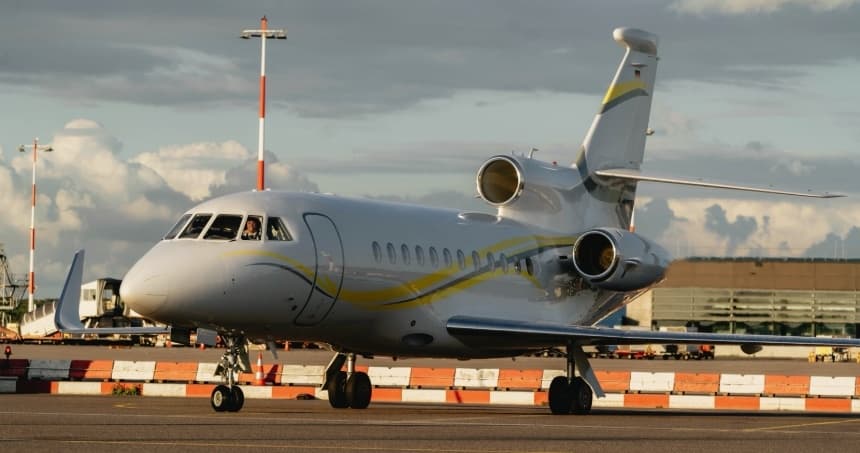 Wed, Nov 11in 8 daysNewcastle Upon TyneEGNT · Newcastle AirportLuxembourgELLX · Luxembourg-Findel International AirportFalcon 900LX14—On request11NovNewcastle Upon Tyne → LuxembourgEGNT → ELLX · in 8 daysFalcon 900LX · 14 seatsOn request
- Wed, Dec 2in 29 daysNewcastleEGNT · Newcastle AirportBirminghamEGBB · Birmingham International AirportPilatus PC12——On request2DecNewcastle → BirminghamEGNT → EGBB · in 29 daysPilatus PC12On request
- Wed, Dec 2in 29 daysNewcastleEGNT · Newcastle AirportBirminghamEGBB · Birmingham International AirportPilatus PC-12 NG——On request2DecNewcastle → BirminghamEGNT → EGBB · in 29 daysPilatus PC-12 NGOn request
 EGNT · Newcastle Airport
 ELLX · Luxembourg-Findel International Airport
* Total price incl. 10% service fee, converted to your selected currency. Price subject to operator confirmation.
Empty legs to EGNT
5 arrivals available
 Thu, Nov 5in 2 daysLondonEGLF · Farnborough AirportNewcastle Upon TyneEGNT · Newcastle AirportHondaJet5—On request5NovLondon → Newcastle Upon TyneEGLF → EGNT · in 2 daysHondaJet · 5 seatsOn request
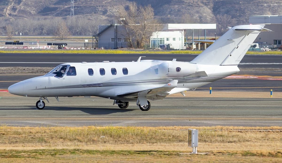 Sat, Nov 7in 4 daysParisLFPB · Paris-Le Bourget AirportNewcastle Upon TyneEGNT · Newcastle AirportCitation M26—On request7NovParis → Newcastle Upon TyneLFPB → EGNT · in 4 daysCitation M2 · 6 seatsOn request
 Sun, Nov 15in 12 daysStockholmESSB · Stockholm-Bromma AirportNewcastle Upon TyneEGNT · Newcastle AirportPhenom 3009—On request15NovStockholm → Newcastle Upon TyneESSB → EGNT · in 12 daysPhenom 300 · 9 seatsOn request
 Mon, Nov 16in 13 daysLondonEGKB · London Biggin Hill AirportNewcastle Upon TyneEGNT · Newcastle AirportCitation CJ15—On request16NovLondon → Newcastle Upon TyneEGKB → EGNT · in 13 daysCitation CJ1 · 5 seatsOn request
 Fri, Nov 20in 17 daysNowy Dwor MazowieckiEPMO · Warsaw Modlin AirportNewcastle Upon TyneEGNT · Newcastle AirportChallenger 60511—On request20NovNowy Dwor Mazowiecki → Newcastle Upon TyneEPMO → EGNT · in 17 daysChallenger 605 · 11 seatsOn request
 LFPB · Paris-Le Bourget Airport
 ESSB · Stockholm-Bromma Airport
 EPMO · Warsaw Modlin Airport
* Total price incl. 10% service fee, converted to your selected currency. Price subject to operator confirmation.
Map: Newcastle Airport
View the location of Newcastle – NCL/EGNT. Zoom in to explore the area around the airport.
About the airport
Newcastle Airport (NCL/EGNT) is the key private jet gateway for Newcastle. PrivJet gives you instant access to charter flights and empty legs: fast, discreet and globally connected.
EGNT airport FAQ
Are there any restrictions at Newcastle airport (EGNT) today?
There are currently 3 valid NOTAMs for Newcastle (EGNT). Affected: Aircraft stand: closed; Aircraft stand. 3 more NOTAMs start in the coming days. For information only, not for flight planning or operational use. Always rely on an official pre-flight briefing. This list may be incomplete or out of date.
What is the weather at Newcastle airport (EGNT)?
According to the latest weather report for EGNT (METAR, 03 Nov, 20:50 UTC): Good visual conditions (VFR). Wind 2 kt (4 km/h) from northeast (40°), visibility 10 km or more, temperature 6 °C (dew point 5 °C). For information only, not for flight planning. Weather can change quickly; always rely on official reports.
How long are the runways at Newcastle airport (EGNT)?
Newcastle (EGNT) has one runway: runway 07/25 with 2,330 m (7,644 ft), asphalt.
What are the radio frequencies at Newcastle airport (EGNT)?
Frequencies at EGNT: Tower 119.7 MHz, Ground 121.725 MHz and ATIS 118.375 MHz. For information only. Always rely on the published AIP.
What are the airport codes of Newcastle Airport?
The ICAO code is EGNT and the IATA code is NCL. ICAO codes are used by air traffic control and pilots, e.g. in flight plans; IATA codes appear on tickets and baggage tags.
What is the elevation of EGNT airport?
Newcastle Airport sits at 266 ft (81 m) above sea level. Local time zone: Europe/London.
Can I fly to EGNT by private jet?
Whether a private jet can operate into Newcastle Airport depends on runway length, opening hours, customs and immigration rules as well as slot and handling availability, among other things. PrivJet checks this with the operating carrier for every request.
Are there empty legs from or to EGNT?
There are currently 3 empty legs departing from and 5 arriving at Newcastle Airport. Empty legs are repositioning flights at heavily reduced prices; the list is updated several times a day.