Nottingham East Midlands Airport (EGNX / EMA)
Empty legs and charters from Nottingham
EGNX airport at a glance
- ICAO code
- EGNX
- IATA code
- EMA
- City
- Nottingham
- Region
- England
- Country
- United Kingdom
- Elevation
- 306 ft (93 m)
- Time zone
- Europe/London (UTC±0)
- Coordinates
- 52.8311° N, 1.3281° W
- Empty legs from
- 2
- Empty legs to
- 0
Weather & airport info EGNX
Current weather
No current weather report is available for this airport.
Airport
- Elevation
- 306 ft (93 m)
- Sunrise / Sunset
- 07:05 / 16:32 local time
Runways
| Runway | Length | Surface | Lighted |
|---|---|---|---|
| 09/27 | 2,894 m (9,495 ft) | asphalt | yes |
Radio frequencies
- Approach: 134.175
- ATIS: 122.675
- Ground: 121.9
- Tower: 124
For information only, not for flight planning. Weather can change quickly; always rely on official reports. Sources: aviationweather.gov (NOAA), OurAirports.
Airport map EGNX
Full screen →Runways white, taxiways yellow with designators, closed taxiways and runways per NOTAM in red.
Official charts
Aerodrome, approach and ground charts are published by the national air navigation service in its AIP:
NATS UK AIP →For information only, not for navigation. Always use current official charts and NOTAMs.
Current NOTAMs for EGNX(11)
NOTAMs (Notices to Air Missions) announce short-term changes at an airport: closed runways or taxiways, unserviceable approach aids, obstacles, airspace restrictions.
- Out of serviceLocator: unserviceableC7097/26· from 05 Nov, 08:00 UTC · until 05 Nov, 17:00 UTC
The locator EMW/EAST MIDLANDS 393KHZ is out of service. A locator is a radio beacon that helps pilots determine their position.
Show original text
LOCATOR EMW/EAST MIDLANDS 393KHZ U/S
C7097/26 NOTAMN
 Q) EGTT/QNLAS/IV/BO /A /000/999/5250N00127W005
 A) EGNX B) 2611050800 C) 2611051700
 E) LOCATOR EMW/EAST MIDLANDS 393KHZ U/S
- Out of serviceObstacle lights: unserviceableC6747/26· until 11 Jan, 11:00 UTC
A report indicates that multiple lights are out on a crane. The crane is located 300 feet above mean sea level.
Show original text
REPORT OF MULTI LIGHTS OUT CRANE OPR AT PSN 524636N 0011237W (LIMEHURST AVENUE, LOUGHBOROUGH) 300FT AMSL. AR-2026-9780/01.
C6747/26 NOTAMN
 Q) EGTT/QOLAS/IV/M  /AE/000/003/5247N00113W001
 A) EGNX B) 2610131100 C) 2701111100
 E) REPORT OF MULTI LIGHTS OUT CRANE OPR AT PSN 524636N 0011237W
 (LIMEHURST AVENUE, LOUGHBOROUGH) 300FT AMSL. AR-2026-9780/01.
- ClosedTaxiway: closedC6539/26· until 11 Nov, 23:59 UTC
Taxiway Tango is closed.
Show original text
TANGO TAXILANE CLOSED. NOTAM WILL BE SUPERSEDED BY AIP SUP WEF 12 NOV 2026.
C6539/26 NOTAMN
 Q) EGTT/QMXLC/IV/BO /A /000/999/5250N00120W005
 A) EGNX B) 2610120000 C) 2611112359
 E) TANGO TAXILANE CLOSED.
 NOTAM WILL BE SUPERSEDED BY AIP SUP WEF 12 NOV 2026.
- NoticeModel flying: will take placeC6927/26· from 07 Nov, 19:30 UTC · until 07 Nov, 20:30 UTC
Fireworks are taking place within a 0.5 nautical mile radius of Long Whatton. For more information, the provided phone numbers can be contacted.
Show original text
FIREWORKS WI 0.5NM RADIUS OF 524836N 0011741W (LONG WHATTON). FOR INFO 07738 134300 / 07704 096591. AR-2026-9986/01.
C6927/26 NOTAMN
 Q) EGTT/QWZLW/IV/M  /AW/000/004/5249N00118W001
 A) EGNX B) 2611071930 C) 2611072030
 E) FIREWORKS WI 0.5NM RADIUS OF 524836N 0011741W (LONG WHATTON).
 FOR INFO 07738 134300 / 07704 096591. AR-2026-9986/01.
 F) SFC G) 400FT AMSL
- NoticeModel flying: will take placeC6478/26· from 06 Nov, 19:30 UTC · until 06 Nov, 19:45 UTC
FIREWORKS within 0.5 NM radius of a defined point (SUTTON BONINGTON). for information 07938 001511 / 07776 235874. AR-2026-9172/01.
Show original text
FIREWORKS WI 0.5NM RADIUS OF 524911N 0011521W (SUTTON BONINGTON). FOR INFO 07938 001511 / 07776 235874. AR-2026-9172/01.
C6478/26 NOTAMN
 Q) EGTT/QWZLW/IV/M  /AW/000/006/5249N00115W001
 A) EGNX B) 2611061930 C) 2611061945
 E) FIREWORKS WI 0.5NM RADIUS OF 524911N 0011521W (SUTTON BONINGTON).
 FOR INFO 07938 001511 / 07776 235874. AR-2026-9172/01.
 F) SFC G) 600FT AMSL
- NoticeModel flying: will take placeC6490/26· from 06 Nov, 19:15 UTC · until 06 Nov, 20:00 UTC
Fireworks are taking place within a 0.3 nautical mile radius of Stapleford. This may affect visibility near the airport.
Show original text
FIREWORKS WI 0.3NM RADIUS OF 525447N 0011457W (STAPLEFORD). FOR INFO 07448 481731. AR-2026-5299/01.
C6490/26 NOTAMN
 Q) EGTT/QWZLW/IV/M  /AW/000/017/5255N00115W001
 A) EGNX B) 2611061915 C) 2611062000
 E) FIREWORKS WI 0.3NM RADIUS OF 525447N 0011457W (STAPLEFORD). FOR
 INFO 07448 481731. AR-2026-5299/01.
 F) SFC G) 1700FT AMSL
- NoticeModel flying: will take placeC6425/26· from 06 Nov, 18:30 UTC · until 06 Nov, 19:00 UTC
Fireworks will be set off within a 0.5 nautical mile radius of Foremark. This may affect visibility.
Show original text
FIREWORKS WI 0.5NM RADIUS OF 525010N 0013031W (FOREMARK). FOR INFO 07932 792447. AR-2026-8972/01.
C6425/26 NOTAMN
 Q) EGTT/QWZLW/IV/M  /AW/000/007/5250N00131W001
 A) EGNX B) 2611061830 C) 2611061900
 E) FIREWORKS WI 0.5NM RADIUS OF 525010N 0013031W (FOREMARK).  FOR
 INFO 07932 792447. AR-2026-8972/01.
 F) SFC G) 700FT AMSL
- NoticeWarning: will take placeC7148/26· from 06 Nov, 17:00 UTC · until 06 Nov, 20:30 UTC
A laser display is taking place near Loughborough, affecting an area with a 1 nautical mile radius.
Show original text
LASER DISPLAY WI 1NM RADIUS OF 524651N 0011357W (LOUGHBOROUGH). FOR INFO 0203 422 0777. AR-2026-10407/01.
C7148/26 NOTAMN
 Q) EGTT/QWOLW/IV/M  /AW/000/999/5247N00114W002
 A) EGNX B) 2611061700 C) 2611062030
 E) LASER DISPLAY WI 1NM RADIUS OF 524651N 0011357W (LOUGHBOROUGH).
 FOR INFO 0203 422 0777. AR-2026-10407/01.
 F) SFC G) UNL
3 more NOTAMs
- NoticeModel flying: will take placeC6882/26· from 05 Nov, 19:30 UTC · until 05 Nov, 20:00 UTC
Near the airport, within a 0.5 nautical mile radius of Long Eaton, fireworks are taking place. This may cause visibility issues.
Show original text
FIREWORKS WI 0.5NM RADIUS OF 525344N 0011703W (LONG EATON). FOR INFO 07515093854 / 00441462817640. AR-2026-9730/01.
C6882/26 NOTAMN
 Q) EGTT/QWZLW/IV/M  /AW/000/007/5254N00117W001
 A) EGNX B) 2611051930 C) 2611052000
 E) FIREWORKS WI 0.5NM RADIUS OF 525344N 0011703W (LONG EATON).  FOR
 INFO 07515093854 / 00441462817640. AR-2026-9730/01.
 F) SFC G) 700FT AMSL
- NoticeModel flying: will take placeC6880/26· from 05 Nov, 19:00 UTC · until 05 Nov, 20:00 UTC
Fireworks are taking place within a 0.5 nautical mile radius of Diseworth. This might affect flight operations near East Midlands Airport.
Show original text
FIREWORKS WI 0.5NM RADIUS OF 524901N 0012016W (DISEWORTH). FOR INFO 07802817691. AR-2026-9927/01.
C6880/26 NOTAMN
 Q) EGTT/QWZLW/IV/M  /AW/000/005/5249N00120W001
 A) EGNX B) 2611051900 C) 2611052000
 E) FIREWORKS WI 0.5NM RADIUS OF 524901N 0012016W (DISEWORTH).  FOR
 INFO 07802817691. AR-2026-9927/01.
 F) SFC G) 500FT AMSL
- NoticeModel flying: will take placeC6491/26· from 03 Nov, 18:45 UTC · until 03 Nov, 19:50 UTC
Fireworks are taking place within a 0.5 nautical mile radius of Rempstone. This may affect visibility near the airport.
Show original text
FIREWORKS WI 0.5NM RADIUS OF 524833N 0011020W (REMPSTONE). FOR INFO 07894 833026 / 01509 251500. AR-2026-6874/01.
C6491/26 NOTAMN
 Q) EGTT/QWZLW/IV/M  /AW/000/008/5249N00110W001
 A) EGNX B) 2611031845 C) 2611031950
 E) FIREWORKS WI 0.5NM RADIUS OF 524833N 0011020W (REMPSTONE).
 FOR INFO 07894 833026 / 01509 251500. AR-2026-6874/01.
 F) SFC G) 800FT AMSL
For information only, not for flight planning or operational use. Always rely on an official pre-flight briefing. This list may be incomplete or out of date. Explanations and expanded abbreviations are generated automatically. The original text is authoritative. Source: FAA NOTAM Management Service (SWIM).
Private jet traffic in East Midlands Airport (last 30 days)
- Arrivals
- 196
- Departures
- 194
- Different jets
- 89
Most frequent origins: Isle of Man Airport (33), Barrow Walney Island Airport (21), Guernsey Airport (15), London Biggin Hill Airport (7), Farnborough Airport (6).
Most frequent destinations: Isle of Man Airport (34), Barrow Walney Island Airport (22), Guernsey Airport (21), Glasgow International Airport (7), London Biggin Hill Airport (6).
Most common aircraft types: Beechcraft King Air 200/250 (143), Beechcraft King Air 350 (38), Cessna Citation Excel/XLS (26), Cessna Citation CJ2 (20), Beechjet 400/Hawker 400XP (19).
Monday is the busiest day.
Our own analysis of public ADS-B signals from business jets. Not every flight is received, and jets with a removal request are excluded.
Charter operators based here
Operators with a base at this airport.
- Executive Jet Management EuropeFarnborough (EGLF) · Midsize jet, Super midsize jet, Heavy jet
- CatreusLondon (Biggin Hill) (EGKB) · Light jet, Heavy jet
- RVL AviationTurboprop
- Isle-FlyTurboprop
- West Atlantic SwedenHeavy jet
Empty legs from EGNX
2 departures available
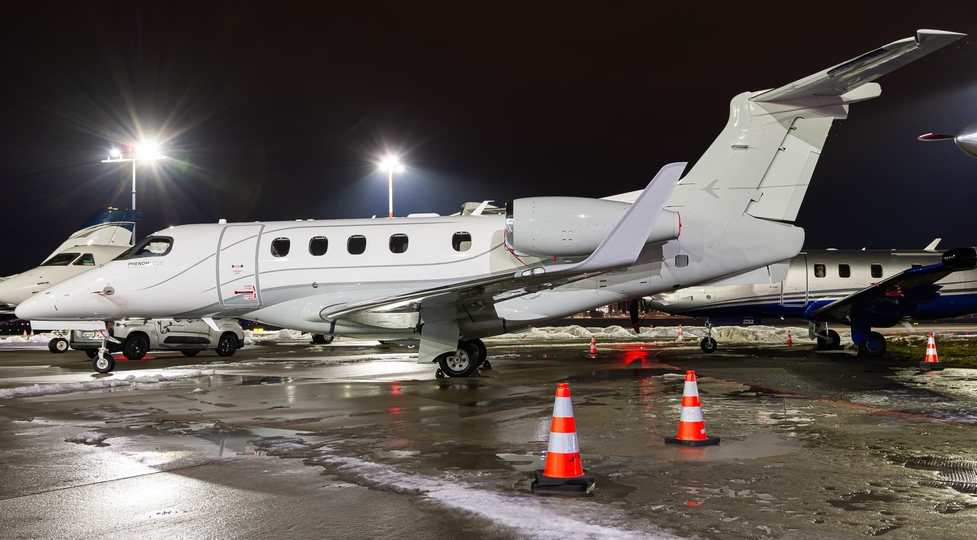 Tue, Nov 3TodayNottinghamEGNX · East Midlands AirportBarcelonaLEBL · Barcelona International AirportPhenom 3009—On request3NovNottingham → BarcelonaEGNX → LEBL · TodayPhenom 300 · 9 seatsOn request
 Fri, Nov 6in 3 daysNottinghamEGNX · East Midlands AirportBournemouthEGHH · Bournemouth AirportCitation CJ2+6—On request6NovNottingham → BournemouthEGNX → EGHH · in 3 daysCitation CJ2+ · 6 seatsOn request
 EGNX · East Midlands Airport
 LEBL · Barcelona International Airport
* Total price incl. 10% service fee, converted to your selected currency. Price subject to operator confirmation.
Empty legs to EGNX
0 arrivals available
No empty legs are currently available arriving at this airport.
Request tailored flightMap: Nottingham Airport
View the location of Nottingham – EMA/EGNX. Zoom in to explore the area around the airport.
About the airport
East Midlands Airport (EMA/EGNX) is the key private jet gateway for Nottingham. PrivJet gives you instant access to charter flights and empty legs: fast, discreet and globally connected.
EGNX airport FAQ
Are there any restrictions at Nottingham airport (EGNX) today?
There are currently 2 valid NOTAMs for Nottingham (EGNX). Affected: Taxiway: closed; Obstacle lights: unserviceable. 9 more NOTAMs start in the coming days. For information only, not for flight planning or operational use. Always rely on an official pre-flight briefing. This list may be incomplete or out of date.
How long are the runways at Nottingham airport (EGNX)?
Nottingham (EGNX) has one runway: runway 09/27 with 2,894 m (9,495 ft), asphalt.
What are the radio frequencies at Nottingham airport (EGNX)?
Frequencies at EGNX: Tower 124 MHz, Ground 121.9 MHz and ATIS 122.675 MHz. For information only. Always rely on the published AIP.
What are the airport codes of East Midlands Airport?
The ICAO code is EGNX and the IATA code is EMA. ICAO codes are used by air traffic control and pilots, e.g. in flight plans; IATA codes appear on tickets and baggage tags.
What is the elevation of EGNX airport?
East Midlands Airport sits at 306 ft (93 m) above sea level. Local time zone: Europe/London.
Can I fly to EGNX by private jet?
Whether a private jet can operate into East Midlands Airport depends on runway length, opening hours, customs and immigration rules as well as slot and handling availability, among other things. PrivJet checks this with the operating carrier for every request.
Are there empty legs from or to EGNX?
There are currently 2 empty legs departing from and 0 arriving at East Midlands Airport. Empty legs are repositioning flights at heavily reduced prices; the list is updated several times a day.