Inverness Airport (EGPE / INV)
Empty legs and charters from Inverness
EGPE airport at a glance
- ICAO code
- EGPE
- IATA code
- INV
- City
- Inverness
- Region
- Scotland
- Country
- United Kingdom
- Elevation
- 31 ft (9 m)
- Time zone
- Europe/London (UTC±0)
- Coordinates
- 57.5425° N, 4.0475° W
- Empty legs from
- 3
- Empty legs to
- 2
Weather & airport info EGPE
Current weather
No current weather report is available for this airport.
Forecast (TAF)
- 02 Nov, 21:00–06:00 UTC4 kt (7 km/h) from southwest (230°) · visibility 10 km or more · scattered clouds at 3,000 ft
- 03 Nov, 03:00–06:00 UTCpossible, 30 % probabilityvisibility 6 km
Original forecast (TAF)
TAF EGPE 021956Z 0221/0306 23004KT 9999 SCT030 PROB30 0303/0306 6000
Airport
- Elevation
- 31 ft (9 m)
- Sunrise / Sunset
- 07:32 / 16:27 local time
Runways
| Runway | Length | Surface | Lighted |
|---|---|---|---|
| 05/23 | 1,888 m (6,194 ft) | asphalt | yes |
| 11/29 | 701 m (2,300 ft) | asphalt | no |
Radio frequencies
- Approach: 122.605
- ATIS: 109.2
- Tower: 118.405
- Tower: 122.605
For information only, not for flight planning. Weather can change quickly; always rely on official reports. Sources: aviationweather.gov (NOAA), OurAirports.
Airport map EGPE
Full screen →Runways white, taxiways yellow with designators, closed taxiways and runways per NOTAM in red.
Official charts
Aerodrome, approach and ground charts are published by the national air navigation service in its AIP:
NATS UK AIP →For information only, not for navigation. Always use current official charts and NOTAMs.
Current NOTAMs for EGPE(4)
NOTAMs (Notices to Air Missions) announce short-term changes at an airport: closed runways or taxiways, unserviceable approach aids, obstacles, airspace restrictions.
- Out of serviceObstacle lights: unserviceableI7076/26· until 12 Nov, 21:45 UTC
An obstacle light on the anemometer mast (wind gauge) is out of service. The mast is 32 feet above ground and its top is 55 feet above sea level.
Show original text
OBST LIGHT U/S ON 23 ANEMOMOTER MAST PSN 573242.82N 0040219.56W (INVERNESS AD) 32FT AGL 55FT AMSL.
I7076/26 NOTAMN
 Q) EGPX/QOLAS/IV/M  /AE/000/001/5733N00402W001
 A) EGPE B) 2610151828 C) 2611122145
 E) OBST LIGHT U/S ON 23 ANEMOMOTER MAST PSN 573242.82N 0040219.56W
 (INVERNESS AD) 32FT AGL 55FT AMSL.
- NoticeAerodrome traffic zone: activatedI7529/26· from 06 Nov, 21:45 UTC · until 18 Dec, 22:00 UTC
The Inverness Aerodrome Traffic Zone (ATZ) is activated. Airport, Air Traffic Services, Meteorological, and Rescue and Fire Fighting Services hours of operation are extended, but the airport remains strictly Prior Permission Required (PPR).
Show original text
INVERNESS ATZ ACTIVATED. AD/ATS/MET/RFFS HR OF OPR EXTENDED AIRPORT REMAINS STRICTLY PPR.
I7529/26 NOTAMN
 Q) EGPX/QAZCA/IV/NBO/AE/000/021/5733N00403W003
 A) EGPE B) 2611062145 C) 2612182200
 D) FRI 2145-2200
 E) INVERNESS ATZ ACTIVATED. AD/ATS/MET/RFFS HR OF OPR
 EXTENDED AIRPORT REMAINS STRICTLY PPR.
Hours: FRI 2145-2200
- NoticeMissile, gun or rocket firing: will take placeI7588/26· from 05 Nov, 09:00 UTC · until 05 Nov, 16:00 UTC
Live firing is taking place within a 1.5 nautical mile radius of 573558N 0040325W (Fort George), increasing the air danger height.
Show original text
LIVE FIRING WI 1.5NM RADIUS OF 573558N 0040325W (FORT GEORGE). INCREASE TO AIR DANGER HEIGHT. FOR INFO 07423 018050. AR-2026-10492/01.
I7588/26 NOTAMN
 Q) EGPX/QWMLW/IV/BO /AW/000/011/5736N00403W002
 A) EGPE B) 2611050900 C) 2611051600
 E) LIVE FIRING WI 1.5NM RADIUS OF 573558N 0040325W (FORT GEORGE).
 INCREASE TO AIR DANGER HEIGHT. FOR INFO 07423 018050.
 AR-2026-10492/01.
 F) SFC G) 1100FT AMSL
- NoticeAerodrome: hours of service are nowI6808/26· permanent
The airport's operating hours and the availability of the Category 6 airport fire and rescue services have changed. Please note the new opening hours from Monday to Sunday.
Show original text
AD OPR HR AND RFFS CAT 6 HR CHANGED: MON-FRI 0645-2145 SAT 0645-2100 SUN 0645-2145 UK AIP EGPE AD 2.3, AD 2.6, AD 2.17, AD 2.18 REFERS.
I6808/26 NOTAMN
 Q) EGPX/QFAAH/IV/BO /A /000/999/5733N00403W005
 A) EGPE B) 2610250100 C) PERM
 E) AD OPR HR AND RFFS CAT 6 HR CHANGED:
 MON-FRI 0645-2145
 SAT 0645-2100
 SUN 0645-2145
 UK AIP EGPE AD 2.3, AD 2.6, AD 2.17, AD 2.18 REFERS.
For information only, not for flight planning or operational use. Always rely on an official pre-flight briefing. This list may be incomplete or out of date. Explanations and expanded abbreviations are generated automatically. The original text is authoritative. Source: FAA NOTAM Management Service (SWIM).
Private jet traffic in Inverness Airport (last 30 days)
- Arrivals
- 140
- Departures
- 75
- Different jets
- 92
Most frequent origins: Farnborough Airport (12), Paris-Le Bourget Airport (7), Stockholm-Bromma Airport (6), Glasgow International Airport (5), Stornoway Airport (5).
Most frequent destinations: Farnborough Airport (11), Aberdeen Dyce Airport (5), London Luton Airport (3), Glasgow International Airport (3), Oxford (Kidlington) Airport (3).
Most common aircraft types: Cessna Citation Excel/XLS (45), Pilatus PC-12 (25), Beechcraft King Air 200/250 (24), Embraer Legacy 500/Praetor 600 (16), Pilatus PC-24 (13).
Monday is the busiest day.
Our own analysis of public ADS-B signals from business jets. Not every flight is received, and jets with a removal request are excluded.
Charter operators based here
Operators with a base at this airport.
- PDG HelicoptersHelicopter
Empty legs from EGPE
3 departures available
- Fri, Nov 618:00InvernessEGPEKortrijkEBKT · Kortrijk-WevelgemCessna Citation CJ4——On request6NovInverness → KortrijkEGPE → EBKT · 18:00Cessna Citation CJ4On request
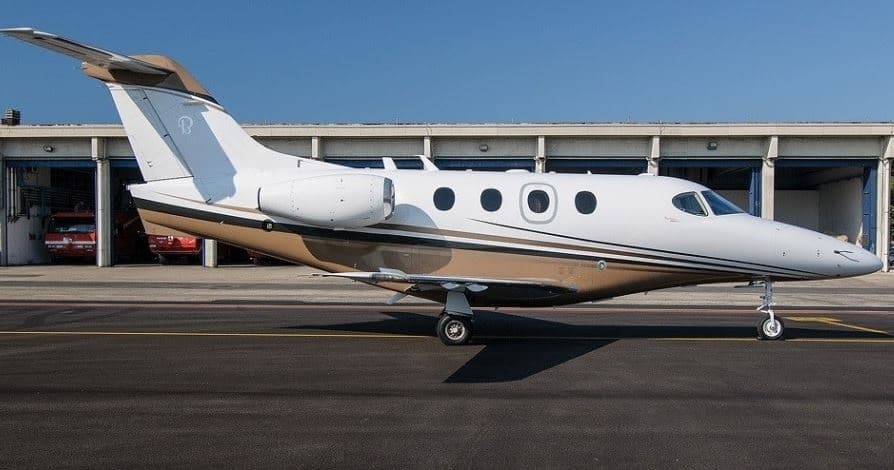 Fri, Nov 20in 17 daysInverness-shireEGPE · Inverness AirportVeronaLIPX · Verona / Villafranca AirportPremier I6—$12,63820NovInverness-shire → VeronaEGPE → LIPX · in 17 daysPremier I · 6 seats$12,638
- Thu, Dec 1018:00InvernessEGPE · Inverness AirportFarnboroughEGLF · Farnborough AirportPilatus PC-248—$16,17010DecInverness → FarnboroughEGPE → EGLF · 18:00Pilatus PC-24 · 8 seats$16,170
 EGPE
 EBKT · Kortrijk-Wevelgem
 LIPX · Verona / Villafranca Airport
* Total price incl. 10% service fee, converted to your selected currency. Price subject to operator confirmation.
Empty legs to EGPE
2 arrivals available
 Tue, Nov 3TodayHannoverEDDV · Hannover AirportInverness-shireEGPE · Inverness AirportCitation XLS+8—On request3NovHannover → Inverness-shireEDDV → EGPE · TodayCitation XLS+ · 8 seatsOn request
- Sun, Dec 1315:40LuxembourgELLX · Luxembourg-Findel International AirportInvernessEGPE · Inverness AirportPilatus PC-248—$24,31013DecLuxembourg → InvernessELLX → EGPE · 15:40Pilatus PC-24 · 8 seats$24,310
 EDDV · Hannover Airport
 ELLX · Luxembourg-Findel International Airport
* Total price incl. 10% service fee, converted to your selected currency. Price subject to operator confirmation.
Map: Inverness Airport
View the location of Inverness – INV/EGPE. Zoom in to explore the area around the airport.
About the airport
Inverness Airport (INV/EGPE) is the key private jet gateway for Inverness. PrivJet gives you instant access to charter flights and empty legs: fast, discreet and globally connected.
EGPE airport FAQ
Are there any restrictions at Inverness airport (EGPE) today?
There are currently 2 valid NOTAMs for Inverness (EGPE). Affected: Obstacle lights: unserviceable. 2 more NOTAMs start in the coming days. For information only, not for flight planning or operational use. Always rely on an official pre-flight briefing. This list may be incomplete or out of date.
How long are the runways at Inverness airport (EGPE)?
Inverness (EGPE) has 2 runways: runway 05/23 with 1,888 m (6,194 ft), asphalt and runway 11/29 with 701 m (2,300 ft), asphalt. The longest is 1,888 m.
What are the radio frequencies at Inverness airport (EGPE)?
Frequencies at EGPE: Tower 118.405 / 122.605 MHz and ATIS 109.2 MHz. For information only. Always rely on the published AIP.
What are the airport codes of Inverness Airport?
The ICAO code is EGPE and the IATA code is INV. ICAO codes are used by air traffic control and pilots, e.g. in flight plans; IATA codes appear on tickets and baggage tags.
What is the elevation of EGPE airport?
Inverness Airport sits at 31 ft (9 m) above sea level. Local time zone: Europe/London.
Can I fly to EGPE by private jet?
Whether a private jet can operate into Inverness Airport depends on runway length, opening hours, customs and immigration rules as well as slot and handling availability, among other things. PrivJet checks this with the operating carrier for every request.
Are there empty legs from or to EGPE?
There are currently 3 empty legs departing from and 2 arriving at Inverness Airport. Empty legs are repositioning flights at heavily reduced prices; the list is updated several times a day.