London Stansted Airport (EGSS / STN)
Empty legs and charters from London
EGSS airport at a glance
- ICAO code
- EGSS
- IATA code
- STN
- City
- London
- Region
- England
- Country
- United Kingdom
- Elevation
- 348 ft (106 m)
- Time zone
- Europe/London (UTC±0)
- Coordinates
- 51.8850° N, 0.2350° E
- Empty legs from
- 15
- Empty legs to
- 7
Private jet terminal & FBOs at London Stansted
- Harrods Aviation - The Knightsbridge (London Stansted)The Knightsbridge, First Avenue, London Stansted Airport, Stansted, Essex CM24 1QQ, United Kingdom
- Harrods Aviation - The Brompton (London Stansted)The Brompton, Ninth Avenue, London Stansted Airport, Stansted, Essex CM24 1AN, United Kingdom
- Inflite The Jet Centre (London Stansted)The Jet Centre, Hangar 1, London Stansted Airport, Essex CM24 1RY, United Kingdom
- Universal Aviation London StanstedUniversal House, Building 130, London Stansted Airport, Stansted CM24 1QH, United Kingdom
Weather & airport info EGSS
Current weather
Very poor visibility (LIFR)observed 02 Nov, 22:20 UTC- Wind
- 7 kt (13 km/h) from north (350°)
- Visibility
- 10 km or more
- Clouds
- broken clouds at 400 ft, broken clouds at 800 ft
- Temperature
- 7 °C (dew point 7 °C)
- Pressure (QNH)
- 1,035 hPa
Original weather report (METAR)
METAR EGSS 022220Z AUTO 35007KT 9999 BKN004 BKN008 07/07 Q1035
Forecast (TAF)
- 02 Nov, 22:00–00:00 UTC10 kt (19 km/h) from north (10°) · visibility 10 km or more · scattered clouds at 2,000 ft
- 03 Nov, 00:00–08:00 UTCtemporarily, 40 % probabilitybroken clouds at 700 ft
- 03 Nov, 08:00–10:00 UTCtemporarily, 30 % probabilitybroken clouds at 1,200 ft
- 03 Nov, 10:00–21:00 UTCtemporarily, 40 % probability15 kt (28 km/h) from northeast (40°), gusts up to 25 kt · visibility 5 km · Rain showers · broken clouds at 1,400 ft
Original forecast (TAF)
TAF AMD EGSS 022220Z 0222/0324 01010KT 9999 SCT020 PROB40 TEMPO 0222/0224 BKN004 PROB40 TEMPO 0300/0308 BKN007 PROB30 TEMPO 0308/0310 BKN012 PROB40 TEMPO 0310/0321 04015G25KT 4500 SHRA BKN014
Airport
- Elevation
- 348 ft (106 m)
- Sunrise / Sunset
- 06:56 / 16:28 local time
Runways
| Runway | Length | Surface | Lighted |
|---|---|---|---|
| 04/22 | 3,049 m (10,003 ft) | asphalt | yes |
Radio frequencies
- Approach: 120.625
- ATIS: 127.175
- Clearance: 121.95
- Ground: 121.725
- Tower: 123.8
For information only, not for flight planning. Weather can change quickly; always rely on official reports. Sources: aviationweather.gov (NOAA), OurAirports.
Airport map EGSS
Full screen →Runways white, taxiways yellow with designators, closed taxiways and runways per NOTAM in red.
Official charts
Aerodrome, approach and ground charts are published by the national air navigation service in its AIP:
NATS UK AIP →For information only, not for navigation. Always use current official charts and NOTAMs.
Current NOTAMs for EGSS(10)
NOTAMs (Notices to Air Missions) announce short-term changes at an airport: closed runways or taxiways, unserviceable approach aids, obstacles, airspace restrictions.
- ClosedRunway: closedA4287/26· from 09 Nov, 01:45 UTC · until 09 Nov, 05:45 UTC
Runway 04/22 is closed due to maintenance.
Show original text
RWY 04/22 CLSD DUE MAINT
A4287/26 NOTAMN
 Q) EGTT/QMRLC/IV/NBO/A /000/999/5153N00014E005
 A) EGSS B) 2611090145 C) 2611090545
 E) RWY 04/22 CLSD DUE MAINT
- ClosedRunway: closedA4286/26· from 08 Nov, 01:45 UTC · until 08 Nov, 05:45 UTC
Runway 04/22 is closed due to maintenance.
Show original text
RWY 04/22 CLSD DUE MAINT
A4286/26 NOTAMN
 Q) EGTT/QMRLC/IV/NBO/A /000/999/5153N00014E005
 A) EGSS B) 2611080145 C) 2611080545
 E) RWY 04/22 CLSD DUE MAINT
- Out of serviceATIS: operating frequency changedA4319/26· from 04 Nov, 08:00 UTC · until 04 Nov, 16:00 UTC
The Automatic Terminal Information Service (ATIS) frequency 114.550 MHz at London Stansted airport is out of service due to maintenance. ATIS is available on channel 127.180.
Show original text
ATIS STANSTED INFORMATION 114.550MHZ U/S DUE MAINT. ATIS AVBL ON CH127.180
A4319/26 NOTAMN
 Q) EGTT/QSACF/IV/BO /A /000/999/5153N00014E005
 A) EGSS B) 2611040800 C) 2611041600
 E) ATIS STANSTED INFORMATION 114.550MHZ U/S DUE MAINT. ATIS AVBL ON
 CH127.180
- NoticeModel flying: will take placeA4046/26· from 07 Nov, 18:45 UTC · until 07 Nov, 19:10 UTC
Fireworks are taking place within a 0.5 nautical mile radius of Sawbridgeworth.
Show original text
FIREWORKS WI 0.5NM RADIUS OF 514858N 0000914E (SAWBRIDGEWORTH). FOR INFO 07496 775496 / 07859 337666 / 07940 437133. AR-2026-9326/01.
A4046/26 NOTAMN
 Q) EGTT/QWZLW/IV/M  /AW/000/011/5149N00009E001
 A) EGSS B) 2611071845 C) 2611071910
 E) FIREWORKS WI 0.5NM RADIUS OF 514858N 0000914E (SAWBRIDGEWORTH).
 FOR INFO 07496 775496 / 07859 337666 / 07940 437133. AR-2026-9326/01.
 F) SFC G) 1100FT AMSL
- NoticeModel flying: will take placeA4214/26· from 07 Nov, 18:30 UTC · until 07 Nov, 19:00 UTC
Fireworks will take place within a 0.5 nautical mile radius of 515210N 0001124E (BISHOPS STORTFORD).
Show original text
FIREWORKS WI 0.5NM RADIUS OF 515210N 0001124E (BISHOPS STORTFORD). FOR INFO 07963 407213/07910 599075/07734 668895. AR-2026-9999/01.
A4214/26 NOTAMN
 Q) EGTT/QWZLW/IV/M  /AW/000/007/5152N00011E001
 A) EGSS B) 2611071830 C) 2611071900
 E) FIREWORKS WI 0.5NM RADIUS OF 515210N 0001124E (BISHOPS
 STORTFORD).  FOR INFO 07963 407213/07910 599075/07734 668895.
 AR-2026-9999/01.
 F) SFC G) 700FT AMSL
- NoticeModel flying: will take placeA4217/26· from 07 Nov, 18:00 UTC · until 07 Nov, 20:00 UTC
Fireworks will take place within a 0.5 nautical mile radius of 515654N 0002213E (THAXTED).
Show original text
FIREWORKS WI 0.5NM RADIUS OF 515654N 0002213E (THAXTED). FOR INFO 07773 771172. AR-2026-9085/01.
A4217/26 NOTAMN
 Q) EGTT/QWZLW/IV/M  /AW/000/005/5157N00022E001
 A) EGSS B) 2611071800 C) 2611072000
 E) FIREWORKS WI 0.5NM RADIUS OF 515654N 0002213E (THAXTED). FOR INFO
 07773 771172. AR-2026-9085/01.
 F) SFC G) 500FT AMSL
- NoticeUnmanned aircraft: will take placeA4041/26· from 07 Nov, 14:00 UTC · until 07 Nov, 23:59 UTC
A swarm of 100 unmanned aircraft systems (UAS) is operating within a 0.5 nautical mile radius of Bishop's Stortford, with a maximum height of 580 ft above ground.
Show original text
UAS SWARM OPR WI 0.5NM RADIUS OF 515218N 0000311E (BISHOP'S STORTFORD). SWARM MADE UP OF 100 UAS. MAX HGT 580FT AGL. FOR INFO 07706 693320. AR-2026-9654/01.
A4041/26 NOTAMN
 Q) EGTT/QWULW/IV/BO /AW/000/010/5152N00003E001
 A) EGSS B) 2611071400 C) 2611072359
 E) UAS SWARM OPR WI 0.5NM RADIUS OF 515218N 0000311E (BISHOP'S
 STORTFORD). SWARM MADE UP OF 100 UAS. MAX HGT 580FT AGL. FOR INFO
 07706 693320. AR-2026-9654/01.
 F) SFC G) 1000FT AMSL
- NoticeModel flying: will take placeA4067/26· from 06 Nov, 19:30 UTC · until 06 Nov, 19:55 UTC
Fireworks will take place within a 0.5 nautical mile radius of Elsenham. This may affect flight operations at London Stansted.
Show original text
FIREWORKS WI 0.5NM RADIUS OF 515457N 0001458E (ELSENHAM). FOR INFO 07739 668301 / 07375 552607. AR-2026-9687/01.
A4067/26 NOTAMN
 Q) EGTT/QWZLW/IV/M  /AW/000/007/5155N00015E001
 A) EGSS B) 2611061930 C) 2611061955
 E) FIREWORKS WI 0.5NM RADIUS OF 515457N 0001458E (ELSENHAM).
 FOR INFO 07739 668301 / 07375 552607. AR-2026-9687/01.
 F) SFC G) 700FT AMSL
2 more NOTAMs
- NoticeAerodromeA3986/26· until 21 Jan, 00:00 UTC
London Stansted Airport uses an Airport Collaborative Decision Making (A-CDM) system with the Network Management Operations Centre. Flight crews must contact Air Traffic Control for departure clearance within -5/+5 minutes of the valid Target Off-Block Time (TOBT). If the flight is ready outside this TOBT window, the flight crew must contact the ground handler first.
Show original text
AIRPORT COLLABORATIVE DECISION MAKING (ACDM) CONNECTED WITH NETWORK MANAGEMENT OPERATIONS CENTRE. DEPARTURE PLANNING INFO MESSAGES WITH FLIGHT DATA WILL BE SENT TO OPERATIONAL NETWORK MANAGEMENT SYSTEM. FLIGHT CREWS ARE REQUIRED TO CONTACT ATC FOR DEPARTURE CLEARANCE WITHIN VALID TARGET OFF-BLOCKS TIME (TOBT) -5/+5 MINS. WHEN THE FLIGHT IS READY OUTSIDE THE TOBT WINDOW, FLIGHT CREW SHALL CONTACT THE GROUND HANDLER BEFORE. PUSH AND/OR START-UP WILL BE ALLOCATED BASED ON TARGET START APPROVAL TIME (TSAT) +/-5 MINS.)
A3986/26 NOTAMN
 Q) EGTT/QFAXX/IV/NBO/A /000/999/5153N00014E005
 A) EGSS B) 2610121000 C) 2701210000
 E) AIRPORT COLLABORATIVE DECISION MAKING (ACDM) CONNECTED WITH
 NETWORK MANAGEMENT OPERATIONS CENTRE. DEPARTURE PLANNING INFO
 MESSAGES WITH FLIGHT DATA WILL BE SENT TO OPERATIONAL NETWORK
 MANAGEMENT SYSTEM. FLIGHT CREWS ARE REQUIRED TO CONTACT ATC FOR
 DEPARTURE CLEARANCE WITHIN VALID TARGET OFF-BLOCKS TIME (TOBT) -5/+5
 MINS. WHEN THE FLIGHT IS READY OUTSIDE THE TOBT WINDOW, FLIGHT CREW
 SHALL CONTACT THE GROUND HANDLER BEFORE. PUSH AND/OR START-UP WILL
 BE ALLOCATED BASED ON TARGET START APPROVAL TIME (TSAT) +/-5 MINS.)
- NoticeUnmanned aircraft: will take placeA3909/26· until 22 Nov, 22:00 UTC
The flying of large model aircraft is taking place within a 0.5 nautical mile radius of 515642N 0001607E (Henham).
Show original text
FLYING OF LARGE MODEL ACFT WI 0.5NM RADIUS OF 515642N 0001607E (HENHAM). FOR INFO 07847 427866. AR-2026-9371/02.
A3909/26 NOTAMN
 Q) EGTT/QWULW/IV/BO /AW/000/020/5157N00016E001
 A) EGSS B) 2610120700 C) 2611222200
 D) OCT 12-24 0700-2100, OCT 25-NOV 22 0800-2200
 E) FLYING OF LARGE MODEL ACFT WI 0.5NM RADIUS OF 515642N 0001607E
 (HENHAM).  FOR INFO 07847 427866. AR-2026-9371/02.
 F) SFC G) 2000FT AMSL
Hours: OCT 12-24 0700-2100, OCT 25-NOV 22 0800-2200
For information only, not for flight planning or operational use. Always rely on an official pre-flight briefing. This list may be incomplete or out of date. Explanations and expanded abbreviations are generated automatically. The original text is authoritative. Source: FAA NOTAM Management Service (SWIM).
Private jet traffic in London Stansted Airport (last 30 days)
- Arrivals
- 392
- Departures
- 355
- Different jets
- 267
Most frequent origins: Paris-Le Bourget Airport (28), Teterboro Airport (11), Dublin Airport (9), London Luton Airport (9), Belfast International Airport (7).
Most frequent destinations: Paris-Le Bourget Airport (18), Farnborough Airport (11), Dublin Airport (9), Belfast International Airport (9), Liverpool John Lennon Airport (8).
Most common aircraft types: Bombardier Challenger 350/3500 (176), Bombardier Global 6000/6500 (51), Embraer Phenom 300 (50), Gulfstream G550/GV (46), Bombardier Challenger 600/650 (45).
Sunday is the busiest day.
Our own analysis of public ADS-B signals from business jets. Not every flight is received, and jets with a removal request are excluded.
Charter operators based here
Operators with a base at this airport.
- Saxon Air CharterLondon (Biggin Hill) (EGKB) · Light jet, Midsize jet, Helicopter
- Empire Aviation GroupDubai International (OMDB) · Super midsize jet, Heavy jet
- Titan AirwaysHeavy jet
- Air Charter ScotlandMidsize jet, Super midsize jet
- 2Excel AviationHeavy jet
- AeronexusHeavy jet
- Oryx JetHeavy jet
Empty legs from EGSS
15 departures available
- Tue, Nov 3TodayLondonEGSS · London Stansted AirportPragueLKPR · Vaclav Havel AirportCessna Citation XLS——On request3NovLondon → PragueEGSS → LKPR · TodayCessna Citation XLSOn request
- Tue, Nov 312:00LondonEGSS · StanstedLeeds BradfordEGNMEmbraer Praetor 6009—£9,2133NovLondon → Leeds BradfordEGSS → EGNM · 12:00Embraer Praetor 600 · 9 seats£9,213
- Tue, Nov 3TodayLondonEGSS · London Stansted AirportPragueLKPR · Vaclav Havel AirportCitation XLS+——On request3NovLondon → PragueEGSS → LKPR · TodayCitation XLS+On request
 Thu, Nov 5in 2 daysLondonEGSS · London Stansted AirportAmmanOJAM · Amman-Marka International AirportChallenger 65012—$48,0705NovLondon → AmmanEGSS → OJAM · in 2 daysChallenger 650 · 12 seats$48,070
 Sat, Nov 7in 4 daysLondonEGSS · London Stansted AirportLiverpoolEGGP · Liverpool John Lennon AirportCitation M25—On request7NovLondon → LiverpoolEGSS → EGGP · in 4 daysCitation M2 · 5 seatsOn request
 Wed, Nov 11in 8 daysLondonEGSS · London Stansted AirportWarsawEPWA · Warsaw Chopin AirportGlobal 500014—On request11NovLondon → WarsawEGSS → EPWA · in 8 daysGlobal 5000 · 14 seatsOn request
- Wed, Nov 11in 8 daysLondonEGSS · London Stansted AirportWarsawEPWA · Warsaw Chopin AirportGlobal 5000——On request11NovLondon → WarsawEGSS → EPWA · in 8 daysGlobal 5000On request
- Thu, Nov 12in 9 daysLondonEGSS · StanstedPragueLKPR · RuzyneChallenger 604—1h 50mOn request12NovLondon → PragueEGSS → LKPR · in 9 daysChallenger 604 · 1h 50mOn request
- Thu, Nov 12in 9 daysLondonEGSS · London Stansted AirportPragueLKPR · Václav Havel Airport PragueBombardier Challenger 60411—On request12NovLondon → PragueEGSS → LKPR · in 9 daysBombardier Challenger 604 · 11 seatsOn request
 EGSS · London Stansted Airport
 LKPR · Vaclav Havel Airport
 OJAM · Amman-Marka International Airport
 EPWA · Warsaw Chopin Airport
* Total price incl. 10% service fee, converted to your selected currency. Price subject to operator confirmation.
Empty legs to EGSS
7 arrivals available
 Wed, Nov 419:50LeedsEGNM · Leeds Bradford AirportLondonEGSS · London Stansted AirportEmbraer Praetor 6009—£7,3704NovLeeds → LondonEGNM → EGSS · 19:50Embraer Praetor 600 · 9 seats£7,370
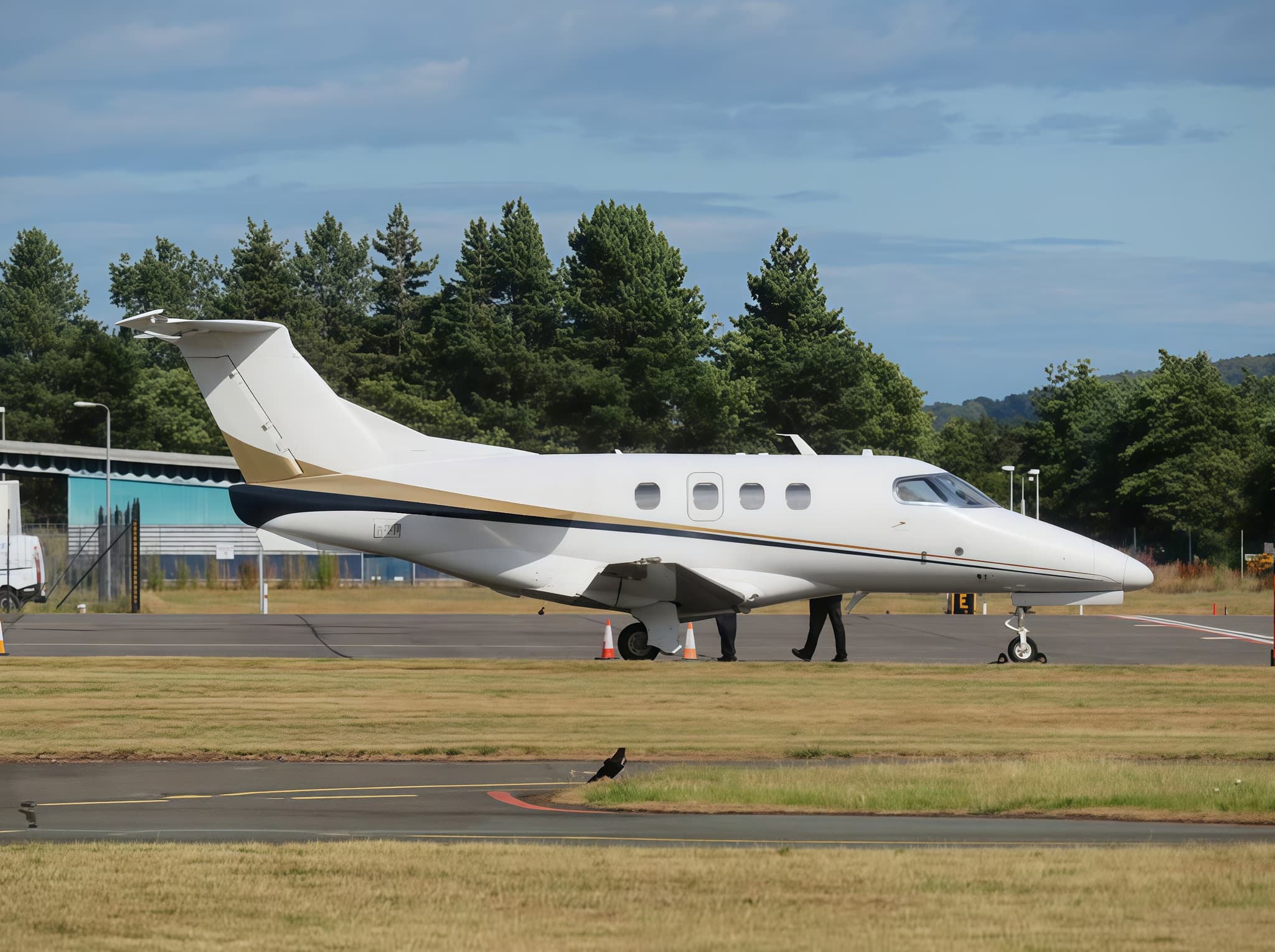 Mon, Nov 9in 6 daysEdinburghEGPH · Edinburgh AirportLondonEGSS · London Stansted AirportPhenom 1004—£1,2249NovEdinburgh → LondonEGPH → EGSS · in 6 daysPhenom 100 · 4 seats£1,224
- Mon, Nov 2311:00ViennaLOWW · Vienna International AirportLondonEGSS · London Stansted AirportEmbraer Praetor 6009—£11,66023NovVienna → LondonLOWW → EGSS · 11:00Embraer Praetor 600 · 9 seats£11,660
- Sun, Nov 2920:15AmsterdamEHAM · SchipholLondonEGSS · StanstedCessna Citation CJ3—1h 1mOn request29NovAmsterdam → LondonEHAM → EGSS · 20:15Cessna Citation CJ3 · 1h 1mOn request
- Wed, Dec 207:00AmsterdamEHAM · Amsterdam Airport SchipholLondonEGSS · London Stansted AirportCessna CJ37—€5,2802DecAmsterdam → LondonEHAM → EGSS · 07:00Cessna CJ3 · 7 seats€5,280
 Mon, Jan 11in 69 daysLondon LutonEGGWLondon StanstedEGSSEmbraer Legacy 6501340mOn request11JanLondon Luton → London StanstedEGGW → EGSS · in 69 daysEmbraer Legacy 650 · 13 seats · 40mOn request
- Wed, Jan 13in 71 daysBangor InternationalKBGRLondon StanstedEGSSEmbraer Legacy 650136h 5mOn request13JanBangor International → London StanstedKBGR → EGSS · in 71 daysEmbraer Legacy 650 · 13 seats · 6h 5mOn request
 LOWW · Vienna International Airport
 EHAM · Schiphol
 KBGR
* Total price incl. 10% service fee, converted to your selected currency. Price subject to operator confirmation.
Map: London Airport
View the location of London – STN/EGSS. Zoom in to explore the area around the airport.
About the airport
London Stansted Airport (STN/EGSS) is the key private jet gateway for London. PrivJet gives you instant access to charter flights and empty legs: fast, discreet and globally connected.
EGSS airport FAQ
Are there any restrictions at London airport (EGSS) today?
There are currently 2 valid NOTAMs for London (EGSS). 8 more NOTAMs start in the coming days. For information only, not for flight planning or operational use. Always rely on an official pre-flight briefing. This list may be incomplete or out of date.
What is the weather at London airport (EGSS)?
According to the latest weather report for EGSS (METAR, 02 Nov, 22:20 UTC): Very poor visibility (LIFR). Wind 7 kt (13 km/h) from north (350°), visibility 10 km or more, temperature 7 °C (dew point 7 °C). For information only, not for flight planning. Weather can change quickly; always rely on official reports.
How long are the runways at London airport (EGSS)?
London (EGSS) has one runway: runway 04/22 with 3,049 m (10,003 ft), asphalt.
What are the radio frequencies at London airport (EGSS)?
Frequencies at EGSS: Tower 123.8 MHz, Ground 121.725 MHz and ATIS 127.175 MHz. For information only. Always rely on the published AIP.
What are the airport codes of London Stansted Airport?
The ICAO code is EGSS and the IATA code is STN. ICAO codes are used by air traffic control and pilots, e.g. in flight plans; IATA codes appear on tickets and baggage tags.
What is the elevation of EGSS airport?
London Stansted Airport sits at 348 ft (106 m) above sea level. Local time zone: Europe/London.
Where do private jets land at London Stansted?
EGSS has 4 private jet terminals or FBOs: Harrods Aviation - The Knightsbridge (London Stansted), Harrods Aviation - The Brompton (London Stansted), Inflite The Jet Centre (London Stansted) and Universal Aviation London Stansted. Your flight confirmation says which one your operator uses.
Can I fly to EGSS by private jet?
Whether a private jet can operate into London Stansted Airport depends on runway length, opening hours, customs and immigration rules as well as slot and handling availability, among other things. PrivJet checks this with the operating carrier for every request.
Are there empty legs from or to EGSS?
There are currently 15 empty legs departing from and 7 arriving at London Stansted Airport. Empty legs are repositioning flights at heavily reduced prices; the list is updated several times a day.