Warsaw Chopin Airport (EPWA / WAW)
Empty legs and charters from Warsaw
EPWA airport at a glance
- ICAO code
- EPWA
- IATA code
- WAW
- City
- Warsaw
- Region
- Mazovia
- Country
- Poland
- Elevation
- 362 ft (110 m)
- Time zone
- Europe/Warsaw (UTC+1)
- Coordinates
- 52.1657° N, 20.9671° E
- Empty legs from
- 9
- Empty legs to
- 13
Weather & airport info EPWA
Current weather
Good visual conditions (VFR)observed 03 Nov, 01:00 UTC- Wind
- 5 kt (9 km/h) from north (10°)
- Visibility
- 10 km or more
- Clouds
- broken clouds at 3,300 ft
- Temperature
- 6 °C (dew point 4 °C)
- Pressure (QNH)
- 1,029 hPa
Original weather report (METAR)
METAR EPWA 030100Z 01005KT 9999 BKN033 06/04 Q1029 NOSIG
Forecast (TAF)
- 03 Nov, 00:00–00:00 UTC4 kt (7 km/h) from north-northeast (30°) · visibility 10 km or more · broken clouds at 3,000 ft
- 03 Nov, 02:00–08:00 UTCpossible, 40 % probabilityvisibility 3 km · Mist
- 03 Nov, 17:00–21:00 UTCpossible, 40 % probabilityLight rain · broken clouds at 1,200 ft
Original forecast (TAF)
TAF EPWA 022330Z 0300/0324 03004KT 9999 BKN030 PROB40 0302/0308 3000 BR PROB40 0317/0321 -RA BKN012
Airport
- Elevation
- 362 ft (110 m)
- Sunrise / Sunset
- 06:34 / 16:04 local time
Runways
| Runway | Length | Surface | Lighted |
|---|---|---|---|
| 15/33 | 3,690 m (12,106 ft) | asphalt | yes |
| 11/29 | 2,800 m (9,186 ft) | asphalt | yes |
Radio frequencies
- Approach: 125.055
- Approach: 128.805
- Approach: 129.38
- Approach: 135.93
- ATIS: 120.455
- ATIS: 123.43
- Clearance: 121.605
- Ground: 121.905
For information only, not for flight planning. Weather can change quickly; always rely on official reports. Sources: aviationweather.gov (NOAA), OurAirports.
Airport map EPWA
Full screen →Runways white, taxiways yellow with designators, closed taxiways and runways per NOTAM in red.
Closed per NOTAM: TWY ZO1, TWY O2*, TWY M* (* partly closed)
Official charts
Aerodrome, approach and ground charts are published by the national air navigation service in its AIP:
PAŻP AIP Polska →For information only, not for navigation. Always use current official charts and NOTAMs.
Current NOTAMs for EPWA(12)
NOTAMs (Notices to Air Missions) announce short-term changes at an airport: closed runways or taxiways, unserviceable approach aids, obstacles, airspace restrictions.
- ClosedAerodrome: closedA3082/26· from 05 Nov, 22:59 UTC · until 06 Nov, 03:00 UTC
The airport is closed for take-offs and landings.
Show original text
AD CLSD FOR TKOF AND LDG.
A3082/26 NOTAMN
 Q) EPWW/QFALC/IV/NBO/A /000/999/5210N02058E005
 A) EPWA B) 2611052259 C) 2611060300
 E) AD CLSD FOR TKOF AND LDG.
- Out of serviceVOR/DME: unserviceableA3037/26· from 04 Nov, 09:00 UTC · until 04 Nov, 15:00 UTC
The DVOR/DME WAR with frequency 114.9MHZ 96X is out of service due to maintenance. This system helps aircraft with navigation.
Show original text
DVOR/DME WAR 114.9MHZ 96X U/S DUE TO MAINT.
A3037/26 NOTAMN
 Q) EPWW/QNMAS/IV/BO /AE/000/999/5216N02039E025
 A) EPWA B) 2611040900 C) 2611041500
 E) DVOR/DME WAR 114.9MHZ 96X U/S DUE TO MAINT.
- Out of serviceInstrument approach procedure: not availableA3213/26· from 04 Nov, 09:00 UTC · until 04 Nov, 15:00 UTC
Due to the unserviceability of the Doppler VHF omnidirectional range (DVOR) and distance measuring equipment (DME) WAR, the missed approach segments of the instrument approach procedures ILS Z CAT II and III or LOC Z runway 33 and VOR runway 33 are not available at Warszawa/Okecie (EPWA) airport.
Show original text
DUE TO UNSERVICEABILITY OF DVOR AND DME WAR THE FOLLOWING SEGMENTS OF INSTRUMENT APPROACH PROCEDURES NOT AVBL: ILS Z CAT II AND III OR LOC Z RWY 33: MISSED APPROACH, VOR RWY 33: MISSED APPROACH.
A3213/26 NOTAMN
 Q) EPWW/QPIAU/I /NBO/A /000/999/5210N02058E005
 A) EPWA B) 2611040900 C) 2611041500
 E) DUE TO UNSERVICEABILITY OF DVOR AND DME WAR THE FOLLOWING
 SEGMENTS OF INSTRUMENT APPROACH PROCEDURES NOT AVBL:
 ILS Z CAT II AND III OR LOC Z RWY 33: MISSED APPROACH,
 VOR RWY 33: MISSED APPROACH.
- ClosedApron: closedA3212/26· until 16 Nov, 14:00 UTC
Apron 2 is closed. This may lead to changes in aircraft parking assignments.
Show original text
APN 2 CLOSED.
A3212/26 NOTAMN
 Q) EPWW/QMNLC/IV/BO /A /000/999/5210N02058E005
 A) EPWA B) 2611020730 C) 2611161400
 D) 02 0800-1400, 09 0800-1400, 16 0800-1400
 E) APN 2 CLOSED.
Hours: 02 0800-1400, 09 0800-1400, 16 0800-1400
- ClosedTaxiway: closedA3183/26· until 05 Nov, 11:00 UTC
Taxiway ZO1 is closed.
Show original text
TWY ZO1 CLOSED.
A3183/26 NOTAMR A3053/26
 Q) EPWW/QMXLC/IV/BO /A /000/999/5210N02058E005
 A) EPWA B) 2610291128 C) 2611051100
 E) TWY ZO1 CLOSED.
- ClosedTaxiway: closedA3182/26· until 03 Nov, 23:59 UTC (estimated)
Taxiway O2 is closed. Taxiway M between aircraft stand 15L and aircraft stand 16 is also closed.
Show original text
TWY O2 CLSD. TWY M BTN ACFT STAND 15L AND ACFT STAND 16 CLSD
A3182/26 NOTAMR A3074/26
 Q) EPWW/QMXLC/IV/BO /A /000/999/5210N02058E005
 A) EPWA B) 2610291124 C) 2611032359EST
 E) TWY O2 CLSD. TWY M BTN ACFT STAND 15L AND ACFT STAND 16 CLSD
- NoticeTemporary restricted area: activatedA3148/26· until 20 Jan, 23:59 UTC
A temporary reserved airspace, EPTR1045, is established in Warsaw. It is unclassified and extends from the ground to 1500 feet above mean sea level.
Show original text
TEMPORARY RESERVED AREA EPTR1045 - WARSZAWA. AIRSPACE UNCLASSIFIED. TIME OF ACT ACCORDING TO AIRSPACE USE PLAN. LATERAL LIMITS: 1. 521250N 0203032E, 2. 521305N 0202656E, 3. 521420N 0202526E, 4. 521529N 0202819E, 5. 521453N 0203155E, 1. 521250N 0203032E VERTICAL LIMITS: GND-1500FT AMSL CONTACT AVBL IN AIRSPACE MANAGEMENT CELL (AMC)
A3148/26 NOTAMN
 Q) EPWW/QRTCA/IV/BO /AW/000/015/5214N02029E003
 A) EPWA B) 2611030000 C) 2701202359
 E) TEMPORARY RESERVED AREA EPTR1045 - WARSZAWA.
 AIRSPACE UNCLASSIFIED.
 TIME OF ACT ACCORDING TO AIRSPACE USE PLAN.
 LATERAL LIMITS:
 1. 521250N 0203032E,
 2. 521305N 0202656E,
 3. 521420N 0202526E,
 4. 521529N 0202819E,
 5. 521453N 0203155E,
 1. 521250N 0203032E
 VERTICAL LIMITS:
 GND-1500FT AMSL
 CONTACT AVBL IN AIRSPACE MANAGEMENT CELL (AMC)
 F) GND G) 1500FT AMSL
- NoticeTaxiway: limited toA3220/26· until 05 Nov, 11:00 UTC
Aircraft CODE E TURN from taxiway Z1 INTO and taxiway M2 and from taxiway Z1 LEFT INTO taxiway A3 prohibited.
Show original text
ACFT CODE E TURN FM TWY Z1 INTO AND TWY M2 AND FM TWY Z1 LEFT INTO TWY A3 PROHIBITED.
A3220/26 NOTAMN
 Q) EPWW/QMXLT/IV/M  /A /000/999/5210N02058E005
 A) EPWA B) 2611021937 C) 2611051100
 E) ACFT CODE E TURN FM TWY Z1 INTO AND TWY M2 AND FM TWY Z1 LEFT
 INTO TWY A3 PROHIBITED.
4 more NOTAMs
- NoticeAerodrome: limited toA3219/26· until 03 Nov, 09:00 UTC
Due to a limited number of available aircraft stands, all diversions to EPWA airport must be approved by the airport operator authorities. This restriction does not apply to urgent and emergency situations.
Show original text
DUE TO LIMITED NUMBER OF ACFT STANDS AVBL ALL DIVERSIONS TO AD EPWA MUST BE APPROVED BY AD OPERATOR AUTHORITIES. RESTRICTION DOES NOT APPLY TO URGENT AND EMERGENCY SITUATIONS.
A3219/26 NOTAMN
 Q) EPWW/QFALT/IV/NBO/A /000/999/5210N02058E005
 A) EPWA B) 2611021600 C) 2611030900
 E) DUE TO LIMITED NUMBER OF ACFT STANDS AVBL ALL DIVERSIONS TO AD
 EPWA MUST BE APPROVED BY AD OPERATOR AUTHORITIES. RESTRICTION DOES
 NOT APPLY TO URGENT AND EMERGENCY SITUATIONS.
- NoticeAerodromeA3150/26· until 25 Nov, 23:59 UTC (estimated)
The conditions for starting and ending low visibility procedures at Warsaw/Okecie airport have changed. Operations will now commence when the runway visual range at the touchdown zone of the arrival runway falls below 800 meters, or any of the runway visual range measurements fall below 550 meters, or the cloud ceiling falls to or below 300 feet.
Show original text
REF AIP IFR AD 2 EPWA CHANGE OF INFORMATION IN POINTS: SHOULD BE: 7.1.2.1. LVP OPERATIONS WILL BE COMMENCED WHEN RVR TDZ ARR RWY FALLS BELOW 800M AND/OR ANY OF THE RVR FALLS BELOW 550 M AND/OR THE CLOUD CEILING FALLS TO OR BELOW 300 FT. 7.1.2.2. LVP WILL BE TERMINATED WHEN RVR TDZ ARR RWY INCREASE TO 800M OR MORE AND/OR ALL OF THE RVR INCREASE TO 550 M OR MORE AND THE CLOUD CEILING REACHES 300 FT OR MORE AND A CONTINUING IMPROVEMENT IS ANTICIPATED. INSTEAD OF: 7.1.2.1. LVP OPERATIONS WILL BE COMMENCED WHEN ANY OF THE RVR FALLS BELOW 550 M AND/OR THE CLOUD CEILING FALLS BELOW 200 FT. 7.1.2.2. LVP WILL BE TERMINATED WHEN ALL OF THE RVR INCREASE OVER 550 M AND THE CLOUD CEILING REACHES 200 FT OR MORE AND A CONTINUING IMPROVEMENT IS ANTICIPATED.
A3150/26 NOTAMR A2490/26
 Q) EPWW/QFAXX/IV/NBO/A /000/999/5210N02058E005
 A) EPWA B) 2610271319 C) 2611252359EST
 E) REF AIP IFR AD 2 EPWA CHANGE OF INFORMATION IN POINTS:
 SHOULD BE:
 7.1.2.1. LVP OPERATIONS WILL BE COMMENCED WHEN RVR TDZ ARR RWY FALLS
 BELOW 800M AND/OR ANY OF THE RVR FALLS BELOW 550 M AND/OR THE CLOUD
 CEILING FALLS TO OR BELOW 300 FT.
 7.1.2.2. LVP WILL BE TERMINATED WHEN RVR TDZ ARR RWY INCREASE TO
 800M OR MORE AND/OR ALL OF THE RVR INCREASE TO 550 M OR MORE AND THE
 CLOUD CEILING REACHES 300 FT OR MORE AND A CONTINUING IMPROVEMENT IS
 ANTICIPATED.
 INSTEAD OF:
 7.1.2.1. LVP OPERATIONS WILL BE COMMENCED WHEN ANY OF THE RVR FALLS
 BELOW 550 M AND/OR THE CLOUD CEILING FALLS BELOW 200 FT.
 7.1.2.2. LVP WILL BE TERMINATED WHEN ALL OF THE RVR INCREASE OVER
 550 M AND THE CLOUD CEILING REACHES 200 FT OR MORE AND A CONTINUING
 IMPROVEMENT IS ANTICIPATED.
- NoticeObstacle: erectedA3141/26· until 26 Jan, 23:59 UTC (estimated)
There are new aeronautical obstacles near runway threshold 15: buildings, trees, and groups of trees in the area from 124 meters to 1191 meters before threshold 15 along the runway centerline and up to 313 meters on both sides. The tallest group of trees is 33 feet above ground and 391 feet above mean sea level.
Show original text
NEW AERONAUTICAL OBSTACLES: BUILDINGS, TREES AND GROUPS OF TREES IN THE AREA FM 124M TO 1191M BEFORE THR15 ALONG RCL AND UP TO 313M ON BOTH SIDES OF RCL WHEN APPROACHING RWY 15. OBST (GROUP OF TREES) WITH THE GREATEST OBSTACLE LIMITATION SURFACES (OLS) PENETRATION: 521047.9N 0205706.6E HGT 33FT AGL/391FT AMSL
A3141/26 NOTAMR A3132/26
 Q) EPWW/QOBCE/IV/M  /A /000/999/5211N02057E005
 A) EPWA B) 2610270620 C) 2701262359EST
 E) NEW AERONAUTICAL OBSTACLES:
 BUILDINGS, TREES AND GROUPS OF TREES IN THE AREA FM 124M TO 1191M
 BEFORE THR15 ALONG RCL AND UP TO 313M ON BOTH SIDES OF RCL WHEN
 APPROACHING RWY 15.
 OBST (GROUP OF TREES) WITH THE GREATEST OBSTACLE LIMITATION SURFACES
 (OLS) PENETRATION: 521047.9N 0205706.6E
 HGT 33FT AGL/391FT AMSL
- NoticeObstacle: erectedA3094/26· until 20 Jan, 23:59 UTC
A group of cranes has been erected 1834 meters before the threshold of runway 15 and 355 meters left of the runway centerline. Their top is 482 feet above mean sea level (116 feet above ground) and they are marked for day and night.
Show original text
GROUP OF CRANES ERECTED : 521140.6N 0205652.08E LOCATED 1834M BEFORE THR 15 ALONG RCL AND 355M LEFT RCL APPROACHING RWY 15. HGT 482FT AMSL (HEIGHT 116FT AGL). DAY AND NIGHT MARKINGS PROVIDED.
A3094/26 NOTAMN
 Q) EPWW/QOBCE/IV/M  /AE/000/999/5212N02057E001
 A) EPWA B) 2610260500 C) 2701202359
 E) GROUP OF CRANES ERECTED
 : 521140.6N 0205652.08E
 LOCATED 1834M BEFORE THR 15 ALONG RCL AND 355M LEFT RCL APPROACHING
 RWY 15.
 HGT 482FT AMSL (HEIGHT 116FT AGL).
 DAY AND NIGHT MARKINGS PROVIDED.
For information only, not for flight planning or operational use. Always rely on an official pre-flight briefing. This list may be incomplete or out of date. Explanations and expanded abbreviations are generated automatically. The original text is authoritative. Source: FAA NOTAM Management Service (SWIM).
Private jet traffic in Warsaw Chopin Airport (last 30 days)
- Arrivals
- 276
- Departures
- 241
- Different jets
- 144
Most frequent origins: Poznan-Lawica Airport (13), John Paul II International Airport Krakow-Balice Airport (13), Katowice International Airport (11), Gdansk Lech Walesa Airport (8), Berlin Brandenburg Airport (8).
Most frequent destinations: John Paul II International Airport Krakow-Balice Airport (18), Rzeszow-Jasionka Airport (11), Gdansk Lech Walesa Airport (10), Poznan-Lawica Airport (9), Vaclav Havel Airport (9).
Most common aircraft types: Bombardier Challenger 600/650 (45), Learjet 75 (39), Pilatus PC-12 (39), Gulfstream G550/GV (37), Bombardier Challenger 350/3500 (35).
Our own analysis of public ADS-B signals from business jets. Not every flight is received, and jets with a removal request are excluded.
Charter operators based here
Operators with a base at this airport.
- AMC AviationWarsaw (Modlin) (EPMO) · Light jet, Midsize jet, Super midsize jet
- Jet StoryLight jet, Midsize jet, Super midsize jet
- SprintAirTurboprop
- Windrose Air JetcharterBerlin (Brandenburg) (EDDB) · Light jet, Midsize jet, Super midsize jet
- Enter Air Executive ServiceTurboprop
Empty legs from EPWA
9 departures available
 Tue, Nov 3TodayWarsawEPWA · Warsaw Chopin AirportLarnacaLCLK · Larnaca International AirportGulfstream G70017—On request3NovWarsaw → LarnacaEPWA → LCLK · TodayGulfstream G700 · 17 seatsOn request
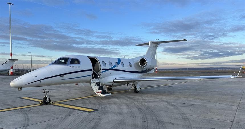 Tue, Nov 3TodayWarsawEPWA · Warsaw Chopin AirportNortholtEGWU · RAF NortholtPhenom 3008—On request3NovWarsaw → NortholtEPWA → EGWU · TodayPhenom 300 · 8 seatsOn request
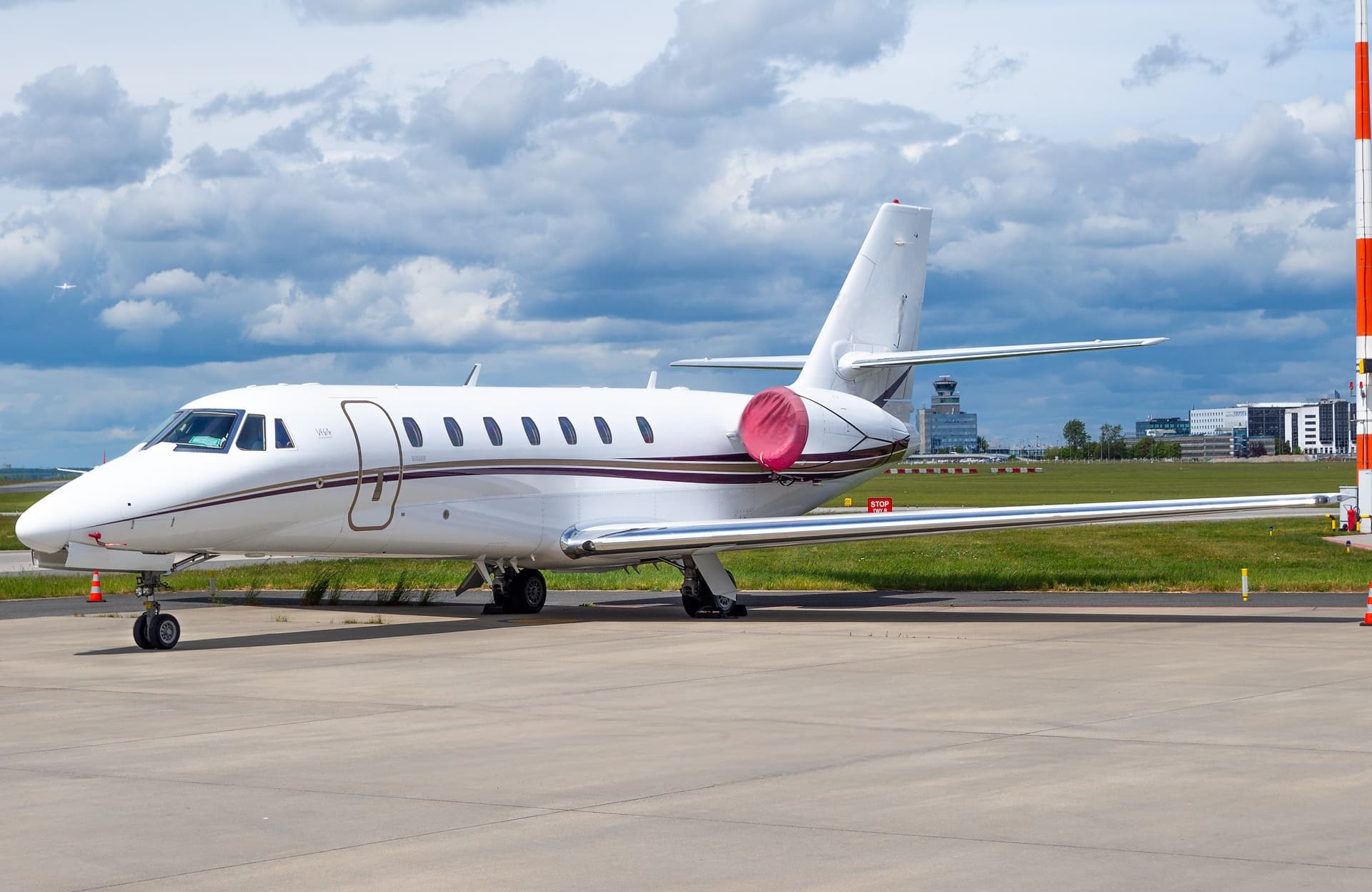 Tue, Nov 3TodayWarsawEPWA · Warsaw Chopin AirportAthensLGAV · Eleftherios Venizelos International AirportCitation Sovereign8—On request3NovWarsaw → AthensEPWA → LGAV · TodayCitation Sovereign · 8 seatsOn request
- Tue, Nov 308:00WarsawEPWA · ChopinPoznanEPPO · LawicaChallenger 300—53mOn request3NovWarsaw → PoznanEPWA → EPPO · 08:00Challenger 300 · 53mOn request
- Tue, Nov 3TodayWarsawEPWA · Warsaw Chopin AirportPoznanEPPO · Poznan-Lawica AirportChallenger 300——On request3NovWarsaw → PoznanEPWA → EPPO · TodayChallenger 300On request
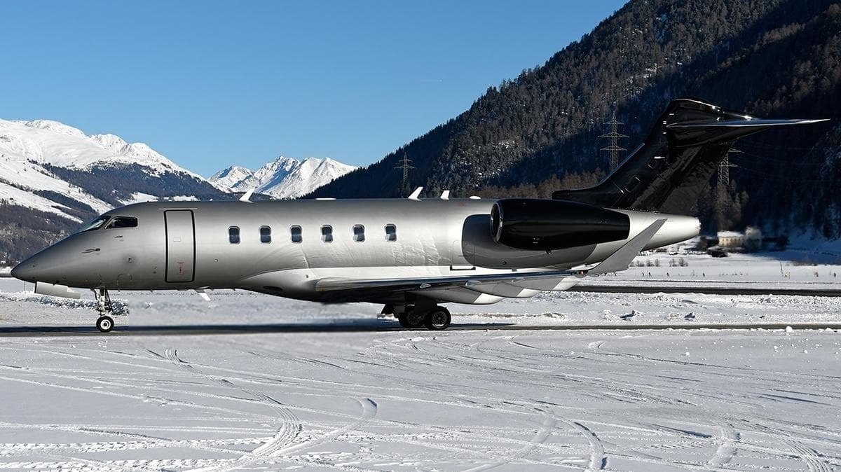 Fri, Nov 6in 3 daysWarsawEPWA · Warsaw Chopin AirportVeniceLIPZ · Venezia / Tessera - Marco Polo AirportChallenger 3509—On request6NovWarsaw → VeniceEPWA → LIPZ · in 3 daysChallenger 350 · 9 seatsOn request
- Wed, Nov 1116:00WarsawEPWA · ChopinKatowiceEPKT · Katowice-PyrzowiceGulfstream G280—1h 4mOn request11NovWarsaw → KatowiceEPWA → EPKT · 16:00Gulfstream G280 · 1h 4mOn request
- Fri, Nov 2006:15WarsawEPWA · ChopinBerlinEDDB · Berlin Brandenburg AirportChallenger 300—1h 11mOn request20NovWarsaw → BerlinEPWA → EDDB · 06:15Challenger 300 · 1h 11mOn request
- Tue, Dec 113:25WarsawEPWA · ChopinNortholtEGWUChallenger 300—2h 24mOn request1DecWarsaw → NortholtEPWA → EGWU · 13:25Challenger 300 · 2h 24mOn request
 EPWA · Warsaw Chopin Airport
 LCLK · Larnaca International Airport
 EGWU · RAF Northolt
 LGAV · Eleftherios Venizelos International Airport
 LIPZ · Venezia / Tessera - Marco Polo Airport
 EDDB · Berlin Brandenburg Airport
* Total price incl. 10% service fee, converted to your selected currency. Price subject to operator confirmation.
Empty legs to EPWA
13 arrivals available
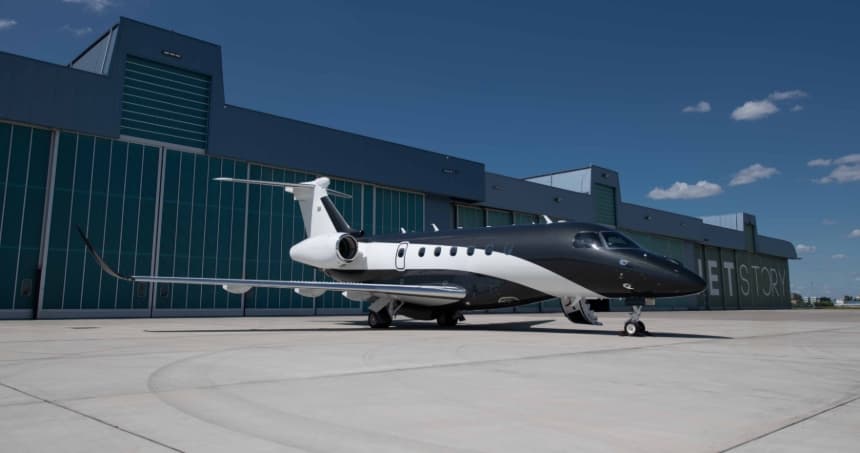 Tue, Nov 3TodayLondonEGLF · Farnborough AirportWarsawEPWA · Warsaw Chopin AirportPraetor 6009—On request3NovLondon → WarsawEGLF → EPWA · TodayPraetor 600 · 9 seatsOn request
 Wed, Nov 4TomorrowNassauMYNN · Lynden Pindling International AirportWarsawEPWA · Warsaw Chopin AirportGulfstream G650ER14—On request4NovNassau → WarsawMYNN → EPWA · TomorrowGulfstream G650ER · 14 seatsOn request
- Thu, Nov 504:00NassauMYNN · Lynden Pindling International AirportWarsawEPWA · Warsaw Chopin AirportGulfstream G650ER18—$178,2005NovNassau → WarsawMYNN → EPWA · 04:00Gulfstream G650ER · 18 seats$178,200
 Fri, Nov 6in 3 daysDusseldorfEDLN · Monchengladbach AirportWarsawEPWA · Warsaw Chopin AirportCitation CJ2+7—€8,1556NovDusseldorf → WarsawEDLN → EPWA · in 3 daysCitation CJ2+ · 7 seats€8,155
- Fri, Nov 611:15KatowiceEPKT · Katowice-PyrzowiceWarsawEPWA · ChopinGulfstream G280—1h 4mOn request6NovKatowice → WarsawEPKT → EPWA · 11:15Gulfstream G280 · 1h 4mOn request
- Fri, Nov 604:00NassauMYNN · Lynden Pindling International AirportWarsawEPWA · Warsaw Chopin AirportGulfstream G650ER18—$178,2006NovNassau → WarsawMYNN → EPWA · 04:00Gulfstream G650ER · 18 seats$178,200
- Sun, Nov 8in 5 daysVeniceLIPZ · Venezia / Tessera - Marco Polo AirportWarsawEPWA · Warsaw Chopin AirportChallenger 3509—On request8NovVenice → WarsawLIPZ → EPWA · in 5 daysChallenger 350 · 9 seatsOn request
- Sun, Nov 8in 5 daysTel AvivLLBG · Ben Gurion International AirportWarsawEPWA · Warsaw Chopin AirportGulfstream G70017—On request8NovTel Aviv → WarsawLLBG → EPWA · in 5 daysGulfstream G700 · 17 seatsOn request
 Wed, Nov 11in 8 daysLondonEGSS · London Stansted AirportWarsawEPWA · Warsaw Chopin AirportGlobal 500014—On request11NovLondon → WarsawEGSS → EPWA · in 8 daysGlobal 5000 · 14 seatsOn request
 MYNN · Lynden Pindling International Airport
 LLBG · Ben Gurion International Airport
* Total price incl. 10% service fee, converted to your selected currency. Price subject to operator confirmation.
Map: Warsaw Airport
View the location of Warsaw – WAW/EPWA. Zoom in to explore the area around the airport.
About the airport
Warsaw Chopin Airport (WAW/EPWA) is the key private jet gateway for Warsaw. PrivJet gives you instant access to charter flights and empty legs: fast, discreet and globally connected.
EPWA airport FAQ
Are there any restrictions at Warsaw airport (EPWA) today?
There are currently 9 valid NOTAMs for Warsaw (EPWA). Affected: Apron: closed; Taxiway: closed. 3 more NOTAMs start in the coming days. For information only, not for flight planning or operational use. Always rely on an official pre-flight briefing. This list may be incomplete or out of date.
What is the weather at Warsaw airport (EPWA)?
According to the latest weather report for EPWA (METAR, 03 Nov, 01:00 UTC): Good visual conditions (VFR). Wind 5 kt (9 km/h) from north (10°), visibility 10 km or more, temperature 6 °C (dew point 4 °C). For information only, not for flight planning. Weather can change quickly; always rely on official reports.
How long are the runways at Warsaw airport (EPWA)?
Warsaw (EPWA) has 2 runways: runway 15/33 with 3,690 m (12,106 ft), asphalt and runway 11/29 with 2,800 m (9,186 ft), asphalt. The longest is 3,690 m.
What are the radio frequencies at Warsaw airport (EPWA)?
Frequencies at EPWA: Tower 118.305 MHz, Ground 121.905 MHz and ATIS 120.455 / 123.43 MHz. For information only. Always rely on the published AIP.
What are the airport codes of Warsaw Chopin Airport?
The ICAO code is EPWA and the IATA code is WAW. ICAO codes are used by air traffic control and pilots, e.g. in flight plans; IATA codes appear on tickets and baggage tags.
What is the elevation of EPWA airport?
Warsaw Chopin Airport sits at 362 ft (110 m) above sea level. Local time zone: Europe/Warsaw.
Can I fly to EPWA by private jet?
Whether a private jet can operate into Warsaw Chopin Airport depends on runway length, opening hours, customs and immigration rules as well as slot and handling availability, among other things. PrivJet checks this with the operating carrier for every request.
Are there empty legs from or to EPWA?
There are currently 9 empty legs departing from and 13 arriving at Warsaw Chopin Airport. Empty legs are repositioning flights at heavily reduced prices; the list is updated several times a day.