Cape Town Airport (FACT / CPT)
Empty legs and charters from Cape Town
FACT airport at a glance
- ICAO code
- FACT
- IATA code
- CPT
- City
- Cape Town
- Region
- Western Cape
- Country
- South Africa
- Elevation
- 151 ft (46 m)
- Time zone
- Africa/Johannesburg (UTC+2)
- Coordinates
- 33.9648° S, 18.6017° E
- Empty legs from
- 15
- Empty legs to
- 8
Weather & airport info FACT
Current weather
Good visual conditions (VFR)observed 03 Nov, 02:00 UTC- Wind
- 7 kt (13 km/h) from southwest (230°)
- Visibility
- 10 km or more
- Clouds
- no significant clouds
- Temperature
- 17 °C (dew point 12 °C)
- Pressure (QNH)
- 1,013 hPa
Original weather report (METAR)
METAR FACT 030200Z 23007KT CAVOK 17/12 Q1013 NOSIG
Forecast (TAF)
- 03 Nov, 00:00–03:00 UTC14 kt (26 km/h) from south-southwest (200°) · visibility 10 km or more · few clouds at 4,000 ft
- 03 Nov, 03:00–06:00 UTCtemporarily3 kt (6 km/h) from variable directions
- 03 Nov, 20:00–23:00 UTCtemporarily, 30 % probabilityvisibility 4 km · Mist · no significant clouds
- 04 Nov, 03:00–06:00 UTCfrom3 kt (6 km/h) from variable directions · visibility 10 km or more · no significant weather · no significant clouds
Original forecast (TAF)
TAF FACT 022200Z 0300/0406 20014KT 9999 FEW040 TX27/0312Z TN14/0304Z TEMPO 0303/0306 VRB03KT PROB30 TEMPO 0320/0323 4000 BR NSC FM040300 VRB03KT CAVOK
Airport
- Elevation
- 151 ft (46 m)
- Sunrise / Sunset
- 05:43 / 19:14 local time
Runways
| Runway | Length | Surface | Lighted |
|---|---|---|---|
| 01/19 | 3,201 m (10,502 ft) | asphalt | yes |
| 16/34 | 1,701 m (5,581 ft) | asphalt | yes |
Radio frequencies
- Approach: 119.7
- Approach: 124.5
- ATIS: 127
- ATIS: 127.6
- Clearance: 122.1
- Ground: 121.9
- Tower: 118.1
For information only, not for flight planning. Weather can change quickly; always rely on official reports. Sources: aviationweather.gov (NOAA), OurAirports.
Airport map FACT
Full screen →Runways white, taxiways yellow with designators, closed taxiways and runways per NOTAM in red.
Official charts
Aerodrome, approach and ground charts are published by the national air navigation service in its AIP:
EUROCONTROL: nationale AIS-Websites →For information only, not for navigation. Always use current official charts and NOTAMs.
Current NOTAMs for FACT(6)
NOTAMs (Notices to Air Missions) announce short-term changes at an airport: closed runways or taxiways, unserviceable approach aids, obstacles, airspace restrictions.
- Out of serviceApproach lighting: unserviceableA3970/26· until 11 Jan, 22:00 UTC (estimated)
The outermost approach lighting system (PALS CAT III) on runway 01 is out of service. The remainder of the approach lighting system is available, and the instrument landing system (ILS) CAT IIIB operations are unaffected.
Show original text
15X OUTERMOST PALS CAT III ON RWY 01 U/S. REMAINDER PALS AVBL, ILS CAT IIIB OPS UNAFFECTED.
A3970/26 NOTAMR A2781/26
 Q) FACA/QLAAS/IV/NBO/A/000/999/3358S01836E005
 A) FACT B) 2610140846 C) 2701112200 EST
 E) 15X OUTERMOST PALS CAT III ON RWY 01 U/S. REMAINDER PALS AVBL, ILS
 CAT IIIB OPS UNAFFECTED.
- NoticeUnmanned aircraft: will take placeA4253/26· from 03 Nov, 06:00 UTC · until 03 Nov, 10:00 UTC
In Montague Gardens, Cape Town, drone operations (UAS OPS) are taking place beyond visual line of sight (BVLOS). The drones can fly up to 400 feet above ground.
Show original text
UPD MONTAGUE GARDENS, CAPE TOWN (335156S 0183123E, 335248S 0183256E, 335338S 0183330E): UAS OPS (400FT AGL) TAKING PLACE BEYOND VISUAL LINE OF SIGHT (BVLOS). FUA REF: AV23108.
A4253/26 NOTAMN
 Q)FACA/QWULW/IV/BO/AW/000/006/3353S01833E002
 A)FACT B)2611030600 C)2611031000
 E)UPD MONTAGUE GARDENS, CAPE TOWN (335156S 0183123E, 335248S
 0183256E, 335338S 0183330E): UAS OPS (400FT AGL) TAKING PLACE BEYOND
 VISUAL LINE OF SIGHT (BVLOS). FUA REF: AV23108.
 F)SFC G)505FT AMSL
- NoticeRunway centre line lightsA4167/26· until 25 Jan, 22:00 UTC (estimated)
Some runway centerline lights for runway 01/19 appear to be off-white.
Show original text
SOME RCLL 01/19 APPEAR TO BE OFF WHITE.
A4167/26 NOTAMR A2942/26
 Q) FACA/QLCXX/I/BO/A/000/999/3358S01836E005
 A) FACT B) 2610280625 C) 2701252200 EST
 E) SOME RCLL 01/19 APPEAR TO BE OFF WHITE.
- NoticeUnmanned aircraft: will take placeA4132/26· until 22 Jan, 23:59 UTC
DE TOREN, STELLENBOSCH, WESTERN CAPE (,,,): REMOTELY PILOTED aircraft SYSTEMS (RPAS) operations (400 ft above ground) TAKING PLACE BEYOND VISUAL LINE of SIGHT (BVLOS). FUA see AV 23/10-6.
Show original text
DE TOREN, STELLENBOSCH, WESTERN CAPE (335831S 0184513E, 335721S 0184446E, 335718S 0184515E, 335824S 0184549E): REMOTELY PILOTED AIRCRAFT SYSTEMS (RPAS) OPS (400FT AGL) TAKING PLACE BEYOND VISUAL LINE OF SIGHT (BVLOS). FUA REF AV 23/10-6.
A4132/26 NOTAMN
 Q)FACA/QWULW/IV/BO/AW/000/010/3358S01845E001
 A)FACT B)2610261000 C)2701222359
 E)DE TOREN, STELLENBOSCH, WESTERN CAPE (335831S 0184513E, 335721S
 0184446E, 335718S 0184515E, 335824S 0184549E): REMOTELY PILOTED
 AIRCRAFT SYSTEMS (RPAS) OPS (400FT AGL) TAKING PLACE BEYOND VISUAL
 LINE OF SIGHT (BVLOS). FUA REF AV 23/10-6.
 F)SFC G)947FT AMSL
- NoticeCaptive balloon or kite: will take placeA3799/26· until 02 Jan, 10:00 UTC (estimated)
A kite is active at 300 feet above ground on the short final approach to runway 19.
Show original text
KITE ACT (300FT AGL) TAKING PLACE ON SHORT FINAL APCH RWY 19.
A3799/26 NOTAMR A2677/26
 Q) FACA/QWCLW/IV/M/AW/000/028/3358S01836E001
 A) FACT B) 2610051415 C) 2701021000 EST
 E) KITE ACT (300FT AGL)  TAKING PLACE ON SHORT FINAL APCH RWY 19.
 F) SFC
 G) 2800FT AMSL
- Out of serviceInstrument approach procedure: not availableA3681/26· until 27 Dec, 10:00 UTC (estimated)
Several Instrument Approach Charts (IACs) and associated aeronautical data for runways 01 and 19 are suspended, including VOR Z RWY 01, RNAV (GNSS) RWY 01, and RNAV (GNSS) RWY 19.
Show original text
IAC VOR-01 VOR Z RWY 01 DATED 03 JAN 2019 SUSPENDED. IAC RNAV-05 RNAV (GNSS) RWY 01 DATED 23 MAY 2019 SUSPENDED. AERONAUTICAL DATA TABULATION RNAV-05A RNAV (GNSS) RWY 01 DATED 26 MAR 2020 SUSPENDED. IAC RNAV-06 RNAV (GNSS) RWY 19 DATED 24 MAY 2018 SUSPENDED. AERONAUTICAL DATA TABULATION RNAV-06A RNAV (GNSS) RWY 19 DATED 01 FEB 2018 SUSPENDED.
A3681/26 NOTAMR A2654/26
 Q) FACA/QPIAU/I/NBO/A/000/999/3358S01836E005
 A) FACT B) 2609290737 C) 2612271000 EST
 E) IAC VOR-01 VOR Z RWY 01 DATED 03 JAN 2019 SUSPENDED.
 IAC RNAV-05 RNAV (GNSS) RWY 01 DATED 23 MAY 2019 SUSPENDED.
 AERONAUTICAL DATA TABULATION RNAV-05A RNAV (GNSS) RWY 01 DATED 26 MAR
 2020 SUSPENDED.
 IAC RNAV-06 RNAV (GNSS) RWY 19 DATED 24 MAY 2018 SUSPENDED.
 AERONAUTICAL DATA TABULATION RNAV-06A RNAV (GNSS) RWY 19 DATED 01 FEB
 2018 SUSPENDED.
For information only, not for flight planning or operational use. Always rely on an official pre-flight briefing. This list may be incomplete or out of date. Explanations and expanded abbreviations are generated automatically. The original text is authoritative. Source: FAA NOTAM Management Service (SWIM).
Private jet traffic in Cape Town International Airport (last 30 days)
- Arrivals
- 316
- Departures
- 280
- Different jets
- 123
Most frequent origins: Lanseria Airport (8), Ysterplaat Air Force Base (4).
Most frequent destinations: O. R. Tambo International Airport (67), Lanseria Airport (42), Malmesbury Airport (3), Wonderboom Airport (3).
Most common aircraft types: Pilatus PC-12 (163), Bombardier Global 6000/6500 (66), Beechcraft King Air 350 (61), Beechcraft King Air 200/250 (38), Learjet 45 (20).
Monday is the busiest day.
Our own analysis of public ADS-B signals from business jets. Not every flight is received, and jets with a removal request are excluded.
Charter operators based here
Operators with a base at this airport.
- ExecuJet South AfricaJohannesburg (Lanseria) (FALA) · Turboprop, Light jet, Midsize jet
- CFSJohannesburg (O.R. Tambo Int'l) (FAOR) · Turboprop, Light jet
- National Airways Corporation (NAC)Johannesburg (Lanseria) (FALA) · Light jet, Super midsize jet, Helicopter
- Axis AviationVienna (Schwechat) (LOWW) · Light jet, Super midsize jet, Heavy jet
- Cape Town HelicoptersHelicopter
- Silvercross HelicoptersHelicopter
- Sport HelicoptersHelicopter
- MS AviationTurboprop
- Guardian AirJohannesburg (Lanseria) (FALA) · Turboprop, Midsize jet, Super midsize jet
- Aerios Global AviationHelicopter
- Civair Helicopters & AeroplanesTurboprop, Helicopter, Piston aircraft
- Base 4 AviationHelicopter
Empty legs from FACT
15 departures available
- Tue, Nov 3TodayCape TownFACT · Cape Town International AirportJohannesburgFALA · Lanseria AirportBombardier Learjet 45XR8—On request3NovCape Town → JohannesburgFACT → FALA · TodayBombardier Learjet 45XR · 8 seatsOn request
 Tue, Nov 315:00Cape TownFACT · Cape Town International AirportJohannesburgFALA · Lanseria AirportBombardier Learjet 458—ZAR 178,5303NovCape Town → JohannesburgFACT → FALA · 15:00Bombardier Learjet 45 · 8 seatsZAR 178,530
- Thu, Nov 511:10Cape TownFACT · Cape Town International AirportJohannesburgFALA · Lanseria International AirportBeechcraft King Air 2008—$8,8005NovCape Town → JohannesburgFACT → FALA · 11:10Beechcraft King Air 200 · 8 seats$8,800
 Thu, Nov 511:10Cape TownFACT · Cape Town International AirportJohannesburgFALA · Lanseria AirportBeechcraft (Hawker Beechcraft) King Air 2607—ZAR 126,7205NovCape Town → JohannesburgFACT → FALA · 11:10Beechcraft (Hawker Beechcraft) King Air 260 · 7 seatsZAR 126,720
- Thu, Nov 5in 2 daysCape TownFACT · Cape Town International AirportStockholmESSB · Stockholm-Bromma AirportFalcon 7X12—On request5NovCape Town → StockholmFACT → ESSB · in 2 daysFalcon 7X · 12 seatsOn request
- Tue, Nov 1011:55Cape TownFACT · Cape Town IntlJohannesburgFALA · LanseriaBeechcraft King Air B2007—ZAR 125,81310NovCape Town → JohannesburgFACT → FALA · 11:55Beechcraft King Air B200 · 7 seatsZAR 125,813
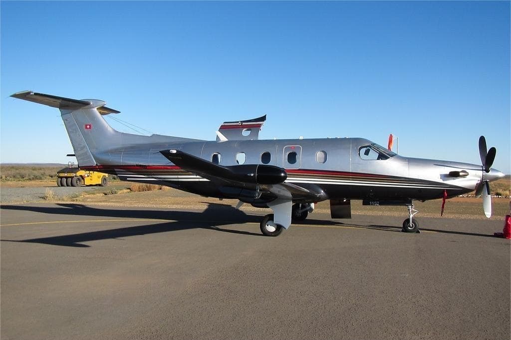 Wed, Nov 11in 8 daysCape TownFACT · Cape Town International AirportJohannesburgFAOR · O. R. Tambo International AirportPilatus PC-128—ZAR 93,61011NovCape Town → JohannesburgFACT → FAOR · in 8 daysPilatus PC-12 · 8 seatsZAR 93,610
 Wed, Nov 1108:00Cape TownFACT · Cape Town International AirportJohannesburgFAOR · OR Tambo International AirportPilatus PC-12 NGX8—ZAR 93,61011NovCape Town → JohannesburgFACT → FAOR · 08:00Pilatus PC-12 NGX · 8 seatsZAR 93,610
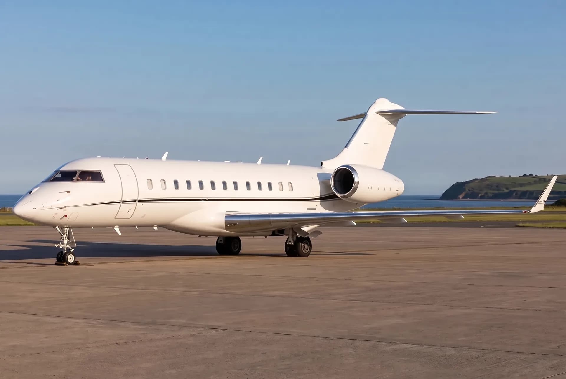 Fri, Dec 1814:30Cape TownFACT · Cape Town International AirportRheinmünsterEDSB · Karlsruhe Baden-Baden AirportBombardier Global Express XRS13—$265,97618DecCape Town → RheinmünsterFACT → EDSB · 14:30Bombardier Global Express XRS · 13 seats$265,976
 FACT · Cape Town International Airport
 ESSB · Stockholm-Bromma Airport
 EDSB · Karlsruhe Baden-Baden Airport
* Total price incl. 10% service fee, converted to your selected currency. Price subject to operator confirmation.
Empty legs to FACT
8 arrivals available
- Sat, Nov 7in 4 daysJohannesburgFAOR · O. R. Tambo International AirportCape TownFACT · Cape Town International AirportBombardier Global 6000122h€13,7977NovJohannesburg → Cape TownFAOR → FACT · in 4 daysBombardier Global 6000 · 12 seats · 2h€13,797
- Sun, Nov 808:00Plettenberg BayFAPGCape TownFACT · Cape Town IntlPilatus PC-12 NGX9—ZAR 67,6508NovPlettenberg Bay → Cape TownFAPG → FACT · 08:00Pilatus PC-12 NGX · 9 seatsZAR 67,650
- Sun, Nov 1508:00Plettenberg BayFAPGCape TownFACT · Cape Town IntlPilatus PC-12 NGX9—ZAR 67,65015NovPlettenberg Bay → Cape TownFAPG → FACT · 08:00Pilatus PC-12 NGX · 9 seatsZAR 67,650
- Sun, Nov 15in 12 daysParisLFPB · Paris-Le Bourget AirportCape TownFACT · Cape Town International AirportGlobal 600013—On request15NovParis → Cape TownLFPB → FACT · in 12 daysGlobal 6000 · 13 seatsOn request
 Tue, Nov 1711:35Port ElizabethFAPE · Port Elizabeth AirportCape TownFACT · Cape Town International AirportPilatus PC-12 NGX9—ZAR 70,95017NovPort Elizabeth → Cape TownFAPE → FACT · 11:35Pilatus PC-12 NGX · 9 seatsZAR 70,950
- Mon, Jan 11in 69 daysPlettenberg BayFAPG · Plettenberg Bay AirportCape TownFACT · Cape Town International AirportPilatus PC-128—ZAR 54,12011JanPlettenberg Bay → Cape TownFAPG → FACT · in 69 daysPilatus PC-12 · 8 seatsZAR 54,120
 Mon, Jan 1112:50Port LouisFIMP · Sir Seewoosagur Ramgoolam International AirportCape TownFACT · Cape Town International AirportBombardier Challenger 3508—ZAR 876,59011JanPort Louis → Cape TownFIMP → FACT · 12:50Bombardier Challenger 350 · 8 seatsZAR 876,590
- Mon, Jan 1110:40Plettenberg BayFAPG · Plettenberg Bay AirportCape TownFACT · Cape Town International AirportPilatus PC-12 NGX8—ZAR 54,12011JanPlettenberg Bay → Cape TownFAPG → FACT · 10:40Pilatus PC-12 NGX · 8 seatsZAR 54,120
 LFPB · Paris-Le Bourget Airport
* Total price incl. 10% service fee, converted to your selected currency. Price subject to operator confirmation.
Map: Cape Town Airport
View the location of Cape Town – CPT/FACT. Zoom in to explore the area around the airport.
About the airport
Cape Town International Airport (CPT/FACT) is the key private jet gateway for Cape Town. PrivJet gives you instant access to charter flights and empty legs: fast, discreet and globally connected.
FACT airport FAQ
Are there any restrictions at Cape Town airport (FACT) today?
There are currently 5 valid NOTAMs for Cape Town (FACT). Affected: Approach lighting: unserviceable; Instrument approach procedure: not available. 1 more NOTAM starts in the coming days. For information only, not for flight planning or operational use. Always rely on an official pre-flight briefing. This list may be incomplete or out of date.
What is the weather at Cape Town airport (FACT)?
According to the latest weather report for FACT (METAR, 03 Nov, 02:00 UTC): Good visual conditions (VFR). Wind 7 kt (13 km/h) from southwest (230°), visibility 10 km or more, temperature 17 °C (dew point 12 °C). For information only, not for flight planning. Weather can change quickly; always rely on official reports.
How long are the runways at Cape Town airport (FACT)?
Cape Town (FACT) has 2 runways: runway 01/19 with 3,201 m (10,502 ft), asphalt and runway 16/34 with 1,701 m (5,581 ft), asphalt. The longest is 3,201 m.
What are the radio frequencies at Cape Town airport (FACT)?
Frequencies at FACT: Tower 118.1 MHz, Ground 121.9 MHz and ATIS 127 / 127.6 MHz. For information only. Always rely on the published AIP.
What are the airport codes of Cape Town International Airport?
The ICAO code is FACT and the IATA code is CPT. ICAO codes are used by air traffic control and pilots, e.g. in flight plans; IATA codes appear on tickets and baggage tags.
What is the elevation of FACT airport?
Cape Town International Airport sits at 151 ft (46 m) above sea level. Local time zone: Africa/Johannesburg.
Can I fly to FACT by private jet?
Whether a private jet can operate into Cape Town International Airport depends on runway length, opening hours, customs and immigration rules as well as slot and handling availability, among other things. PrivJet checks this with the operating carrier for every request.
Are there empty legs from or to FACT?
There are currently 15 empty legs departing from and 8 arriving at Cape Town International Airport. Empty legs are repositioning flights at heavily reduced prices; the list is updated several times a day.