Johannesburg O. R. Tambo Airport (FAOR / JNB)
Empty legs and charters from Johannesburg
FAOR airport at a glance
- ICAO code
- FAOR
- IATA code
- JNB
- City
- Johannesburg
- Region
- Gauteng
- Country
- South Africa
- Elevation
- 5,558 ft (1,694 m)
- Time zone
- Africa/Johannesburg (UTC+2)
- Coordinates
- 26.1333° S, 28.2500° E
- Empty legs from
- 1
- Empty legs to
- 2
Weather & airport info FAOR
Current weather
Good visual conditions (VFR)observed 03 Nov, 09:00 UTC- Wind
- 12 kt (22 km/h) from west-northwest (300°)
- Visibility
- 10 km or more
- Clouds
- no significant clouds
- Temperature
- 26 °C (dew point 11 °C)
- Pressure (QNH)
- 1,023 hPa
Original weather report (METAR)
METAR FAOR 030900Z 30012KT CAVOK 26/11 Q1023 NOSIG
Forecast (TAF)
- 03 Nov, 09:00–16:00 UTCbecoming10 kt (19 km/h) from north-northwest (330°) · visibility 10 km or more · scattered clouds at 4,500 ft
- 03 Nov, 12:00–00:00 UTCtemporarily, 30 % probabilityLight thunderstorm with rain · few clouds at 4,000 ft
- 03 Nov, 14:00–19:00 UTCtemporarily, 40 % probability15 kt (28 km/h) from south (190°), gusts up to 25 kt · visibility 5 km · Thunderstorm with rain · few clouds at 3,500 ft
- 03 Nov, 16:00–20:00 UTCbecoming3 kt (6 km/h) from variable directions · visibility 10 km or more · scattered clouds at 4,500 ft
- 03 Nov, 20:00–06:00 UTCbecoming10 kt (19 km/h) from north-northeast (20°) · visibility 10 km or more · scattered clouds at 4,500 ft
Original forecast (TAF)
TAF FAOR 030400Z 0306/0412 33010KT CAVOK TX28/0313Z TN15/0403Z BECMG 0309/0311 SCT045 PROB30 TEMPO 0312/0324 -TSRA FEW040CB PROB40 TEMPO 0314/0319 19015G25KT 5000 TSRA FEW035CB BECMG 0316/0318 VRB03KT BECMG 0320/0322 02010KT PROB30 TEMPO 0323/0405 BKN006 BECMG 0406/0408 30008KT CAVOK
Airport
- Elevation
- 5,558 ft (1,694 m)
- Sunrise / Sunset
- 05:16 / 18:24 local time
Runways
| Runway | Length | Surface | Lighted |
|---|---|---|---|
| 03L/21R | 4,418 m (14,495 ft) | asphalt | yes |
| 03R/21L | 3,400 m (11,155 ft) | asphalt | yes |
Radio frequencies
- Approach: 123.7
- Approach: 124.5
- ATIS: 126.2
- Clearance: 121.7
- Ground: 121.9
- Tower: 118.1
- Tower: 118.6
For information only, not for flight planning. Weather can change quickly; always rely on official reports. Sources: aviationweather.gov (NOAA), OurAirports.
Airport map FAOR
Full screen →Runways white, taxiways yellow with designators, closed taxiways and runways per NOTAM in red.
Official charts
Aerodrome, approach and ground charts are published by the national air navigation service in its AIP:
EUROCONTROL: nationale AIS-Websites →For information only, not for navigation. Always use current official charts and NOTAMs.
Current NOTAMs for FAOR(14)
NOTAMs (Notices to Air Missions) announce short-term changes at an airport: closed runways or taxiways, unserviceable approach aids, obstacles, airspace restrictions.
- Out of servicePAPI: unserviceableA4262/26· until 04 Nov, 07:00 UTC
The PAPI (Precision Approach Path Indicator) on the eastern/right-hand side of runway 03R is out of service. The PAPI helps pilots maintain the correct glide path to the runway.
Show original text
PAPI (EASTERN/RIGHT-HAND SIDE) RWY 03R U/S.
A4262/26 NOTAMN
 Q)FAJA/QLPAS/IV/BO/A/000/999/2608S02815E005
 A)FAOR B)2611030744 C)2611040700
 E)PAPI (EASTERN/RIGHT-HAND SIDE) RWY 03R U/S.
- Out of serviceTerminal area surveillance radar: unserviceableA4209/26· until 11 Nov, 12:00 UTC (estimated)
The S-Band 2 primary and secondary surveillance radar in Johannesburg is out of service due to maintenance. These radar systems help detect and track aircraft.
Show original text
JOHANNESBURG S-BAND 2 PSR AND MSSR (260859.36387S 0281329.11187E): OFF DUE MAINT.
A4209/26 NOTAMN
 Q)FAJA/QCTAS/I/BO/AE/000/999/2609S02813E250
 A)FAOR B)2611021000 C)2611111200 EST
 E)JOHANNESBURG S-BAND 2 PSR AND MSSR (260859.36387S 0281329.11187E):
 OFF DUE MAINT.
- ClosedTaxiway: closedA4129/26· until 08 Nov, 21:59 UTC
Taxilane E (BEHIND parking stand E8 to E13 and F5 to F7) closed. aircraft PUSHING BACK from parking stand east of E9 and F5 MUST PULL FORWARD and only START ENG ONCE ALIGNED on taxilane ABM parking stand E1 and USE MNM BREAK-OFF THRUST due to MARKER BOARDS work in progress BEHIND.
Show original text
TXL E (BEHIND PRKG STAND E8 TO E13 AND F5 TO F7) CLSD. ACFT PUSHING BACK FM PRKG STAND EAST OF E9 AND F5 MUST PULL FORWARD AND ONLY START ENG ONCE ALIGNED ON TXL ABM PRKG STAND E1 AND USE MNM BREAK-OFF THRUST DUE TO MARKER BOARDS WIP BEHIND.
A4129/26 NOTAMR A4099/26
 Q)FAJA/QMXLC/IV/BO/A/000/999/2608S02815E005
 A)FAOR B)2610260709 C)2611082159
 E)
 TXL E (BEHIND PRKG STAND E8 TO E13 AND F5 TO F7) CLSD. ACFT PUSHING
 BACK FM PRKG STAND EAST OF E9 AND F5 MUST PULL FORWARD AND ONLY START
 ENG ONCE ALIGNED ON TXL ABM PRKG STAND E1 AND USE MNM BREAK-OFF
 THRUST DUE TO MARKER BOARDS WIP BEHIND.
- NoticeAeronautical information serviceF0172/26· until 12 Nov, 23:59 UTC
TRIGGER NOTAM-AIRAC AIP SUP S090/26 DATED 29 Oct 2026: CHARTS (WEF 29 Oct 2026-PERM).
Show original text
TRIGGER NOTAM-AIRAC AIP SUP S090/26 DATED 29 OCT 2026: CHARTS (WEF 29 OCT 2026-PERM).
F0172/26 NOTAMN
 Q)FAJA/QOATT/IV/BO/AE/000/999/2608S02815E005
 A)FAOR B)2610290001 C)2611122359
 E)TRIGGER NOTAM-AIRAC AIP SUP S090/26 DATED 29 OCT 2026: CHARTS (WEF
 29 OCT 2026-PERM).
- NoticeAeronautical information serviceA4097/26· until 14 Jan, 23:59 UTC
The departure routes DEP-04 and DEP-16 for Johannesburg International Airport were reprinted in Amendment 4/26 for printing purposes only. Notice S076/26, which withdraws DEP-04 and DEP-16, remains valid and will be incorporated in Amendment 1/27.
Show original text
FAOR DEP-04 AND DEP-16 REPRINTED IN AMDT 4/26 FOR PRINTING PURPOSES ONLY.S076/26 WHICH WITHDRAWS DEP-04 AND DEP-16 REMAINS VALID AND WILL BE INCORPORATED IN AMDT 1/27.
A4097/26 NOTAMN
 Q)FAJA/QOAXX/IV/BO/A/000/999/2608S02815E005
 A)FAOR B)2610231325 C)2701142359
 E)
 FAOR DEP-04 AND DEP-16 REPRINTED IN AMDT 4/26 FOR PRINTING PURPOSES
 ONLY.S076/26 WHICH WITHDRAWS DEP-04 AND DEP-16 REMAINS VALID AND WILL
 BE INCORPORATED IN AMDT 1/27.
- NoticeUnmanned aircraft: will take placeA4066/26· until 30 Nov, 11:00 UTC
Unmanned Aircraft System (UAS) operations are taking place near the airport, reaching up to 200 feet above ground.
Show original text
AF VAN WYK BOERDERY, FARM 412, ELANDSFONTEIN, EKURHULENI, GAUTENG (255904S 0281946E, 255906S 0281950E, 255908S 0281949E, 255905S 0281945E): UAS OPS (200FT AGL) TAKING PLACE. FUA REF: DN 20108
A4066/26 NOTAMN
 Q)FAJA/QWULW/IV/BO/AW/000/054/2600S02820E001
 A)FAOR B)2610230800 C)2611301100
 D)DLY 0800-1100
 E)AF VAN WYK BOERDERY, FARM 412, ELANDSFONTEIN, EKURHULENI, GAUTENG
 (255904S 0281946E, 255906S 0281950E, 255908S 0281949E, 255905S
 0281945E): UAS OPS (200FT AGL) TAKING PLACE.
 FUA REF: DN 20108
 F)SFC G)5325FT AMSL
Hours: DLY 0800-1100
- NoticeStandard instrument arrivalA3900/26· until 06 Jan, 10:00 UTC (estimated)
Several communication failure procedures for arrivals at Johannesburg Airport are temporarily suspended, including the AVAGO 1C and NIBEX 1B routes for runway 03R.
Show original text
THE FLW FAOR ARR COMMUNICATION FAILURE PROCEDURES ARE TEMPORARILY SUSPENDED: 1. ARR-08 AVAGO 1C RNAV (GNSS) RWY 03R DATED 15 MAY 2025 2. ARR-09 NIBEX 1B RNAV (GNSS) RWY 03R DATED 15 MAY 2025 3. ARR-18 AVAGO 1D RNAV (GNSS) RWY 21L DATED 17 APR 2025 4. ARR-19 NIBEX 1D RNAV (GNSS) RWY 21L DATED 15 MAY 2025 5. ARR-21 OKPIT 1C RNAV (GNSS) RWY 03R DATED 15 MAY 2025 6. ARR-22 UNPOM 1B RNAV (GNSS) RWY 21L DATED 15 MAY 2025 7. ARR-23 UNPOM 1A RNAV (GNSS) RWY 03R DATED 15 MAY 2025 8. ARR-25 OKPIT 1D RNAV (GNSS) RWY 03R DATED 15 MAY 2025.
A3900/26 NOTAMR A3848/26
 Q) FAJA/QPAXX/I/NBO/A/000/999/2608S02815E005
 A) FAOR B) 2610091041 C) 2701061000 EST
 E) THE FLW FAOR ARR COMMUNICATION FAILURE PROCEDURES ARE TEMPORARILY
 SUSPENDED:
 1. ARR-08 AVAGO 1C RNAV (GNSS) RWY 03R DATED 15 MAY 2025
 2. ARR-09 NIBEX 1B RNAV (GNSS) RWY 03R DATED 15 MAY 2025
 3. ARR-18 AVAGO 1D RNAV (GNSS) RWY 21L DATED 17 APR 2025
 4. ARR-19 NIBEX 1D RNAV (GNSS) RWY 21L DATED 15 MAY 2025
 5. ARR-21 OKPIT 1C RNAV (GNSS) RWY 03R DATED 15 MAY 2025
 6. ARR-22 UNPOM 1B RNAV (GNSS) RWY 21L DATED 15 MAY 2025
 7. ARR-23 UNPOM 1A RNAV (GNSS) RWY 03R DATED 15 MAY 2025
 8. ARR-25 OKPIT 1D RNAV (GNSS) RWY 03R DATED 15 MAY 2025.
- NoticeStandard instrument arrivalA3899/26· until 06 Jan, 10:00 UTC (estimated)
Aircraft arriving at Johannesburg airport on runway 22 should expect a heading of 027 after ETGAV for radar vectors to runway 21L. The communication failure procedure is temporarily suspended.
Show original text
TFC ON FAOR ARR-22 TO EXPECT HDG 027 AFTER ETGAV FOR RADAR VECTORS RWY21L. REF NOTAM A3848/26, TEMPORARY SUSPENSION OF COMMUNICATION FAILURE PROCEDURE.
A3899/26 NOTAMR A3856/26
 Q) FAJA/QPAXX/I/NBO/A/000/999/2608S02815E005
 A) FAOR B) 2610091040 C) 2701061000 EST
 E) TFC ON FAOR ARR-22 TO EXPECT HDG 027 AFTER ETGAV FOR RADAR VECTORS
 RWY21L.
 REF NOTAM A3848/26, TEMPORARY SUSPENSION OF COMMUNICATION FAILURE
 PROCEDURE.
6 more NOTAMs
- NoticeStandard instrument arrivalA3898/26· until 06 Jan, 10:00 UTC (estimated)
Aircraft on the FAOR ARR-23 arrival route should expect a heading of 214 degrees after ETLIG for radar vectors. For runway 03R, the communication failure procedure is temporarily suspended.
Show original text
TFC ON FAOR ARR-23 TO EXPECT HDG 214 AFTER ETLIG FOR RADAR VECTORS RWY 03R REF NOTAM A3848/26, TEMPORARY SUSPENSION OF COMMUNICATION FAILURE PROCEDURE.
A3898/26 NOTAMR A3857/26
 Q) FAJA/QPAXX/I/NBO/A/000/999/2608S02815E005
 A) FAOR B) 2610091039 C) 2701061000 EST
 E) TFC ON FAOR ARR-23 TO EXPECT HDG 214 AFTER ETLIG FOR RADAR VECTORS
 RWY 03R REF NOTAM A3848/26, TEMPORARY SUSPENSION OF COMMUNICATION
 FAILURE PROCEDURE.
- NoticeStandard instrument arrivalA3897/26· until 06 Jan, 10:00 UTC (estimated)
Traffic on the FAOR ARR-19 arrival should expect a heading of 034 after UVLOG for radar vectors to runway 21L. The communication failure procedure is temporarily suspended.
Show original text
TFC ON FAOR ARR-19 TO EXPECT HDG 034 AFTER UVLOG FOR RADAR VECTORS RWY21L. REF NOTAM A3848/26, TEMPORARY SUSPENSION OF COMMUNICATION FAILURE PROCEDURE.
A3897/26 NOTAMR A3858/26
 Q) FAJA/QPAXX/I/NBO/A/000/999/2608S02815E005
 A) FAOR B) 2610091038 C) 2701061000 EST
 E) TFC ON FAOR ARR-19 TO EXPECT HDG 034 AFTER UVLOG FOR RADAR VECTORS
 RWY21L.
 REF NOTAM A3848/26, TEMPORARY SUSPENSION OF COMMUNICATION FAILURE
 PROCEDURE.
- NoticeStandard instrument arrivalA3896/26· until 06 Jan, 10:00 UTC (estimated)
Arriving traffic on the 09 arrival route to Johannesburg airport should expect radar vectors to runway 03R after the VEKOP point. The communication failure procedure is temporarily suspended.
Show original text
TFC ON FAOR ARR-09 TO EXPECT RADAR VECTORS RWY 03R AFTER VEKOP. REF NOTAM A3848/26, TEMPORARY SUSPENSION OF COMMUNICATION FAILURE PROCEDURE.
A3896/26 NOTAMR A3859/26
 Q) FAJA/QPAXX/I/NBO/A/000/999/2608S02815E005
 A) FAOR B) 2610091037 C) 2701061000 EST
 E) TFC ON FAOR ARR-09 TO EXPECT RADAR VECTORS RWY 03R AFTER VEKOP.
 REF NOTAM A3848/26, TEMPORARY SUSPENSION OF COMMUNICATION FAILURE
 PROCEDURE.
- NoticeStandard instrument arrivalA3688/26· until 27 Dec, 10:00 UTC (estimated)
For the charted Standard Arrival Routes (STARs) for runways 03 and 21, pilots must comply with air traffic control level instructions and not with charted level restrictions. Inbound aircraft on a STAR must maintain the cleared flight level and request descent from air traffic control.
Show original text
CHARTED STARS RWY 03 AND RWY 21: COMPLY WITH ATC LVL INSTRUCTION AND NOT WITH CHARTED LVL RESTRICTION INBD ACFT ON STAR MUST MNTN CLR FL AND TO REQ DESCENT FM ATC.
A3688/26 NOTAMR A2815/26
 Q) FAJA/QPAXX/I/NBO/A/000/999/2608S02815E005
 A) FAOR B) 2609290741 C) 2612271000 EST
 E) CHARTED STARS RWY 03 AND RWY 21:
 COMPLY WITH ATC LVL INSTRUCTION AND NOT WITH CHARTED LVL RESTRICTION
 INBD ACFT ON STAR MUST MNTN CLR FL AND TO REQ DESCENT FM ATC.
- Out of serviceStandard instrument departure: not availableA3686/26· until 27 Dec, 10:00 UTC (estimated)
Several Standard Departure Routes (SIDs) and associated aeronautical data for runways 03L and 21R are suspended, including EGMEN 1 C, EGMEN 1 D, APDAK 1 D, and GEROX 1C.
Show original text
SID DEP-10 RNAV (GNSS) RWY 03L EGMEN 1 C DATED 10 JAN 2013 SUSPENDED. AERONAUTICAL DATA TABULATION DEP-10A RNAV (GNSS) RWY 03L EGMEN 1 C DATED 10 JAN 2013 SUSPENDED. SID DEP-21 RNAV (GNSS) RWY 21R EGMEN 1 D DATED 10 JAN 2013 SUSPENDED. AERONAUTICAL DATA TABULATION DEP-21A RNAV (GNSS) RWY 21R EGMEN 1 D DATED 10 JAN 2013 SUSPENDED. SID DEP-22 RNAV (GNSS) RWY 21R APDAK 1 D DATED 21 AUG 2014 SUSPENDED. AERONAUTICAL DATA TABULATION DEP-22A RNAV (GNSS) RWY 21R APDAK 1 D DATED 10 JAN 2013 SUSPENDED. SID DEP-23 RNAV (GNSS) RWY 21R GEROX 1C DATED 21 AUG 2014 SUSPENDED. AERONAUTICAL DATA TABULATION DEP-23A RNAV (GNSS) RWY 21R GEROX 1C DATED 10 JAN 2013 SUSPENDED.
A3686/26 NOTAMR A2887/26
 Q) FAJA/QPDAU/I/NBO/A/000/999/2608S02815E005
 A) FAOR B) 2609290740 C) 2612271000 EST
 E) SID DEP-10 RNAV (GNSS) RWY 03L EGMEN 1 C DATED 10 JAN 2013
 SUSPENDED.
 AERONAUTICAL DATA TABULATION DEP-10A RNAV (GNSS) RWY 03L EGMEN 1 C
 DATED 10 JAN 2013 SUSPENDED.
 SID DEP-21 RNAV (GNSS) RWY 21R EGMEN 1 D DATED 10 JAN 2013 SUSPENDED.
 AERONAUTICAL DATA TABULATION DEP-21A RNAV (GNSS) RWY 21R EGMEN 1 D
 DATED 10 JAN 2013 SUSPENDED.
 SID DEP-22 RNAV (GNSS) RWY 21R APDAK 1 D DATED 21 AUG 2014 SUSPENDED.
 AERONAUTICAL DATA TABULATION DEP-22A RNAV (GNSS) RWY 21R APDAK 1 D
 DATED 10 JAN 2013  SUSPENDED.
 SID DEP-23 RNAV (GNSS) RWY 21R GEROX 1C DATED 21 AUG 2014 SUSPENDED.
 AERONAUTICAL DATA TABULATION DEP-23A RNAV (GNSS) RWY 21R GEROX 1C
 DATED 10 JAN 2013 SUSPENDED.
- Out of serviceInstrument approach procedure: not availableA3685/26· until 27 Dec, 10:00 UTC (estimated)
IAC ILS (instrument landing system)-01 ILS (instrument landing system) Z runway 03L DATED 10 Jan 2013 SUSPENDED. IAC VOR beacon-01 VOR beacon Z runway 21R DATED 04 Apr 2013 SUSPENDED. IAC RNAV (area navigation)-01 RNAV (area navigation) (GNSS) runway 03R DATED 31 Dec 2020 SUSPENDED. AERONAUTICAL DATA TABULATION RNAV (area navigation)-01A RNAV (area navigation) (GNSS) runway 03R DATED 09 Jan 2014 SUSPENDED. IAC RNAV (area navigation)-02 RNAV (area navigation) (GNSS) runway 21L DATED 31 Dec 2020 SUSPENDED. AERONAUTICAL DATA TABULATION RNAV (area navigation)-02A RNAV (area navigation) (GNSS) runway 21L DATED 01 May 2014 SUSPENDED.
Show original text
IAC ILS-01 ILS Z RWY 03L DATED 10 JAN 2013 SUSPENDED. IAC VOR-01 VOR Z RWY 21R DATED 04 APR 2013 SUSPENDED. IAC RNAV-01 RNAV (GNSS) RWY 03R DATED 31 DEC 2020 SUSPENDED. AERONAUTICAL DATA TABULATION RNAV-01A RNAV (GNSS) RWY 03R DATED 09 JAN 2014 SUSPENDED. IAC RNAV-02 RNAV (GNSS) RWY 21L DATED 31 DEC 2020 SUSPENDED. AERONAUTICAL DATA TABULATION RNAV-02A RNAV (GNSS) RWY 21L DATED 01 MAY 2014 SUSPENDED.
A3685/26 NOTAMR A2888/26
 Q) FAJA/QPIAU/I/NBO/A/000/999/2608S02815E005
 A) FAOR B) 2609290739 C) 2612271000 EST
 E) IAC ILS-01 ILS Z RWY 03L DATED 10 JAN 2013 SUSPENDED.
 IAC VOR-01 VOR Z RWY 21R DATED 04 APR 2013 SUSPENDED.
 IAC RNAV-01 RNAV (GNSS) RWY 03R DATED 31 DEC 2020 SUSPENDED.
 AERONAUTICAL DATA TABULATION RNAV-01A RNAV (GNSS) RWY 03R DATED 09
 JAN 2014 SUSPENDED.
 IAC RNAV-02 RNAV (GNSS) RWY 21L DATED 31 DEC 2020 SUSPENDED.
 AERONAUTICAL DATA TABULATION RNAV-02A RNAV (GNSS) RWY 21L DATED 01
 MAY 2014 SUSPENDED.
For information only, not for flight planning or operational use. Always rely on an official pre-flight briefing. This list may be incomplete or out of date. Explanations and expanded abbreviations are generated automatically. The original text is authoritative. Source: FAA NOTAM Management Service (SWIM).
Private jet traffic in O. R. Tambo International Airport (last 30 days)
- Arrivals
- 321
- Departures
- 2
- Different jets
- 68
Most frequent origins: Cape Town International Airport (67), Lanseria Airport (5).
Most common aircraft types: Pilatus PC-12 (78), Beechcraft King Air 350 (74), Bombardier Global 6000/6500 (71), Beechcraft King Air 200/250 (27), Pilatus PC-24 (12).
Our own analysis of public ADS-B signals from business jets. Not every flight is received, and jets with a removal request are excluded.
Charter operators based here
Operators with a base at this airport.
- ExecuJet South AfricaJohannesburg (Lanseria) (FALA) · Turboprop, Light jet, Midsize jet
- CFSTurboprop, Light jet
- Federal AirlinesTurboprop, Super midsize jet
- AirlinkTurboprop
- CemAirTurboprop
- Fireblade AviationTurboprop, Heavy jet, Helicopter
- Avex Air TransportTurboprop, Super midsize jet
- Safair OperationsHeavy jet
- Unique Air CharterHeavy jet, Helicopter, Piston aircraft
- African Skies AviationTurboprop
- Fair AviationTurboprop
- Safomar Aviation OperationsHelicopter
Empty legs from FAOR
1 departures available
 FAOR · O. R. Tambo International Airport
* Total price incl. 10% service fee, converted to your selected currency. Price subject to operator confirmation.
Empty legs to FAOR
2 arrivals available
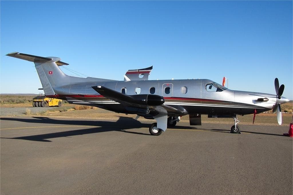 Wed, Nov 11in 8 daysCape TownFACT · Cape Town International AirportJohannesburgFAOR · O. R. Tambo International AirportPilatus PC-128—ZAR 93,61011NovCape Town → JohannesburgFACT → FAOR · in 8 daysPilatus PC-12 · 8 seatsZAR 93,610
 Wed, Nov 1108:00Cape TownFACT · Cape Town International AirportJohannesburgFAOR · OR Tambo International AirportPilatus PC-12 NGX8—ZAR 93,61011NovCape Town → JohannesburgFACT → FAOR · 08:00Pilatus PC-12 NGX · 8 seatsZAR 93,610
* Total price incl. 10% service fee, converted to your selected currency. Price subject to operator confirmation.
Map: Johannesburg Airport
View the location of Johannesburg – JNB/FAOR. Zoom in to explore the area around the airport.
About the airport
O. R. Tambo International Airport (JNB/FAOR) is the key private jet gateway for Johannesburg. PrivJet gives you instant access to charter flights and empty legs: fast, discreet and globally connected.
FAOR airport FAQ
Are there any restrictions at Johannesburg airport (FAOR) today?
There are currently 14 valid NOTAMs for Johannesburg (FAOR). Affected: Taxiway: closed; PAPI: unserviceable; Terminal area surveillance radar: unserviceable; Standard instrument departure: not available and 1 more. For information only, not for flight planning or operational use. Always rely on an official pre-flight briefing. This list may be incomplete or out of date.
What is the weather at Johannesburg airport (FAOR)?
According to the latest weather report for FAOR (METAR, 03 Nov, 09:00 UTC): Good visual conditions (VFR). Wind 12 kt (22 km/h) from west-northwest (300°), visibility 10 km or more, temperature 26 °C (dew point 11 °C). For information only, not for flight planning. Weather can change quickly; always rely on official reports.
How long are the runways at Johannesburg airport (FAOR)?
Johannesburg (FAOR) has 2 runways: runway 03L/21R with 4,418 m (14,495 ft), asphalt and runway 03R/21L with 3,400 m (11,155 ft), asphalt. The longest is 4,418 m.
What are the radio frequencies at Johannesburg airport (FAOR)?
Frequencies at FAOR: Tower 118.1 / 118.6 MHz, Ground 121.9 MHz and ATIS 126.2 MHz. For information only. Always rely on the published AIP.
What are the airport codes of O. R. Tambo International Airport?
The ICAO code is FAOR and the IATA code is JNB. ICAO codes are used by air traffic control and pilots, e.g. in flight plans; IATA codes appear on tickets and baggage tags.
What is the elevation of FAOR airport?
O. R. Tambo International Airport sits at 5,558 ft (1,694 m) above sea level. Local time zone: Africa/Johannesburg.
Can I fly to FAOR by private jet?
Whether a private jet can operate into O. R. Tambo International Airport depends on runway length, opening hours, customs and immigration rules as well as slot and handling availability, among other things. PrivJet checks this with the operating carrier for every request.
Are there empty legs from or to FAOR?
There are currently 1 empty legs departing from and 2 arriving at O. R. Tambo International Airport. Empty legs are repositioning flights at heavily reduced prices; the list is updated several times a day.