Tenerife Island Tenerife South Airport (GCTS / TFS)
Empty legs and charters from Tenerife Island
GCTS airport at a glance
- ICAO code
- GCTS
- IATA code
- TFS
- City
- Tenerife Island
- Region
- Canary Islands
- Country
- Spain
- Elevation
- 209 ft (64 m)
- Time zone
- Atlantic/Canary (UTC±0)
- Coordinates
- 28.0445° N, 16.5725° W
- Empty legs from
- 7
- Empty legs to
- 7
Weather & airport info GCTS
Current weather
Good visual conditions (VFR)observed 03 Nov, 06:30 UTC- Wind
- 10 kt (19 km/h) from east (80°)
- Visibility
- 10 km or more
- Clouds
- few clouds at 2,000 ft, scattered clouds at 10,000 ft
- Temperature
- 23 °C (dew point 14 °C)
- Pressure (QNH)
- 1,014 hPa
Original weather report (METAR)
METAR GCTS 030630Z 08010KT 9999 FEW020 SCT100 23/14 Q1014 NOSIG
Forecast (TAF)
- 03 Nov, 03:00–08:00 UTC4 kt (7 km/h) from north (360°) · visibility 10 km or more · few clouds at 11,000 ft
- 03 Nov, 08:00–18:00 UTCbecoming10 kt (19 km/h) from south-southwest (210°) · visibility 10 km or more · few clouds at 11,000 ft
- 03 Nov, 15:00–18:00 UTCtemporarily8 kt (15 km/h) from west (270°)
- 03 Nov, 15:00–20:00 UTCtemporarily, 30 % probabilityscattered clouds at 4,500 ft
- 03 Nov, 18:00–03:00 UTCbecoming5 kt (9 km/h) from northeast (40°) · visibility 10 km or more · few clouds at 11,000 ft
Original forecast (TAF)
TAF AMD GCTS 030256Z 0303/0403 36004KT 9999 FEW110 TX27/0314Z TN21/0402Z TEMPO 0303/0306 FEW080CB PROB30 TEMPO 0303/0306 29010KT 3500 SHRA SCT025TCU BECMG 0308/0310 21010KT TEMPO 0315/0318 27008KT PROB30 TEMPO 0315/0320 SCT045TCU BECMG 0318/0320 04005KT
Airport
- Elevation
- 209 ft (64 m)
- Sunrise / Sunset
- 07:18 / 18:20 local time
Runways
| Runway | Length | Surface | Lighted |
|---|---|---|---|
| 07/25 | 3,200 m (10,499 ft) | asphalt | yes |
Radio frequencies
- Approach: 120.3
- ATIS: 118.675
- Ground: 121.9
- Tower: 119
For information only, not for flight planning. Weather can change quickly; always rely on official reports. Sources: aviationweather.gov (NOAA), OurAirports.
Airport map GCTS
Full screen →Runways white, taxiways yellow with designators, closed taxiways and runways per NOTAM in red.
Official charts
Aerodrome, approach and ground charts are published by the national air navigation service in its AIP:
ENAIRE AIP España →For information only, not for navigation. Always use current official charts and NOTAMs.
Current NOTAMs for GCTS(12)
NOTAMs (Notices to Air Missions) announce short-term changes at an airport: closed runways or taxiways, unserviceable approach aids, obstacles, airspace restrictions.
- NoticeUnmanned aircraft: will take placeR3929/26· from 07 Nov, 00:00 UTC · until 03 Feb, 23:59 UTC
Unmanned aircraft will be operating in an area near Costa de Granadilla.
Show original text
UNMANNED ACFT WILL TAKE PLACE WI COORD: 280243N 0163230W - 280309N 0163116W - 280334N 0163127W - 280403N 0163054W - 280344N 0163007W - 280131N 0163212W - 280041N 0163438W - 280146N 0163513W - 280158N 0163441W - 280207N 0163316W - 280243N 0163230W COSTA DE GRANADILLA
R3929/26 NOTAMN
 Q) GCCC/QWULW/IV/BO /AW/000/002/2802N01632W003
 A) GCTS B) 2611070000 C) 2702032359
 D) 0000-2359
 E) UNMANNED ACFT WILL TAKE PLACE WI COORD:
 280243N 0163230W - 280309N 0163116W - 280334N 0163127W -
 280403N 0163054W - 280344N 0163007W - 280131N 0163212W -
 280041N 0163438W - 280146N 0163513W - 280158N 0163441W -
 280207N 0163316W - 280243N 0163230W
 COSTA DE GRANADILLA
 F) GND G) 00060M AGL
Hours: 0000-2359
- NoticeUnmanned aircraft: will take placeR3948/26· until 01 Jan, 16:00 UTC
Unmanned aircraft will be flying in an area near Granadilla de Abona.
Show original text
UNMANNED ACFT FLYING WI COORD 280419N 0163059W - 280415N 0163054W - 280403N 0163042W - 280356N 0163038W - 280407N 0163021W - 280421N 0163035W - 280427N 0163047W - 280419N 0163059W GRANADILLA DE ABONA
R3948/26 NOTAMN
 Q) GCCC/QWULW/IV/BO /AW/000/002/2804N01631W001
 A) GCTS B) 2611020800 C) 2701011600
 D) 0800-1600
 E) UNMANNED ACFT FLYING WI COORD
 280419N 0163059W - 280415N 0163054W - 280403N 0163042W -
 280356N 0163038W - 280407N 0163021W - 280421N 0163035W -
 280427N 0163047W - 280419N 0163059W
 GRANADILLA DE ABONA
 F) SFC G) 00060M AGL
Hours: 0800-1600
- NoticeUnmanned aircraft: will take placeR3949/26· until 20 Dec, 19:00 UTC
Unmanned aircraft will be operating in an area near Granadilla de Abona.
Show original text
UNMANNED ACFT WI COORD 280230N 0163237W - 280228N 0163231W - 280213N 0163229W - 280158N 0163223W - 280157N 0163246W - 280219N 0163250W - 280230N 0163237W GRANADILLA DE ABONA
R3949/26 NOTAMN
 Q) GCCC/QWULW/IV/BO /AW/000/002/2802N01633W001
 A) GCTS B) 2610310800 C) 2612201900
 D) 0800-1900
 E) UNMANNED ACFT WI COORD
 280230N 0163237W - 280228N 0163231W - 280213N 0163229W -
 280158N 0163223W - 280157N 0163246W - 280219N 0163250W -
 280230N 0163237W
 GRANADILLA DE ABONA
 F) SFC G) 00060M AGL
Hours: 0800-1900
- NoticeUnmanned aircraft: will take placeR3863/26· until 31 Dec, 21:00 UTC
Unmanned aircraft will be active within a 600-meter radius, centered on coordinates 280328N 0163653W in San Miguel de Abona.
Show original text
UNMANNED ACFT WILL TAKE PLACE WI 600M RADIUS CENTRED ON COORD: 280328N 0163653W SAN MIGUEL DE ABONA
R3863/26 NOTAMN
 Q) GCCC/QWULW/IV/BO /AW/000/003/2803N01637W001
 A) GCTS B) 2610260800 C) 2612312100
 D) 0800-2100
 E) UNMANNED ACFT WILL TAKE PLACE WI 600M RADIUS CENTRED ON COORD:
 280328N 0163653W
 SAN MIGUEL DE ABONA
 F) SFC G) 00070M AGL
Hours: 0800-2100
- NoticeUnmanned aircraft: will take placeR3825/26· until 22 Jan, 20:00 UTC
Unmanned aircraft are flying within an area near Tenerife Sur/Reina Sofia Airport.
Show original text
UNMANNED ACFT FLYING WI COORD 280524N 0163004W - 280501N 0162954W - 280456N 0163001W - 280515N 0163016W - 280524N 0163004W
R3825/26 NOTAMN
 Q) GCCC/QWULW/IV/BO /AW/000/003/2805N01630W001
 A) GCTS B) 2610260700 C) 2701222000
 D) 0700-2000
 E) UNMANNED ACFT FLYING WI COORD
 280524N 0163004W - 280501N 0162954W - 280456N 0163001W -
 280515N 0163016W - 280524N 0163004W
 F) GND G) 00070M AGL
Hours: 0700-2000
- NoticeUnmanned aircraft: will take placeR3826/26· until 22 Jan, 20:00 UTC
Unmanned aircraft are flying within an area near Tenerife Sur/Reina Sofia Airport.
Show original text
UNMANNED ACFT FLYING WI COORD 280524N 0163004W - 280534N 0162952W - 280515N 0162935W - 280501N 0162954W - 280524N 0163004W
R3826/26 NOTAMN
 Q) GCCC/QWULW/IV/BO /AW/000/003/2805N01630W001
 A) GCTS B) 2610260700 C) 2701222000
 D) 0700-2000
 E) UNMANNED ACFT FLYING WI COORD
 280524N 0163004W - 280534N 0162952W - 280515N 0162935W -
 280501N 0162954W - 280524N 0163004W
 F) GND G) 00080M AGL
Hours: 0700-2000
- NoticeUnmanned aircraft: will take placeR3613/26· until 30 Nov, 20:00 UTC
Unmanned aircraft will take place within a coordinated area near the airport.
Show original text
UNMANNED ACFT WILL TAKE PLACE WITH COORD: 280431N 0163048W - 280358N 0163033W - 280357N 0163039W - 280418N 0163100W - 280429N 0163054W - 280431N 0163048W
R3613/26 NOTAMN
 Q) GCCC/QWULW/IV/BO /AW/000/002/2804N01631W001
 A) GCTS B) 2610060700 C) 2611302000
 D) 0700-2000
 E) UNMANNED ACFT WILL TAKE PLACE WITH COORD:
 280431N 0163048W - 280358N 0163033W -
 280357N 0163039W - 280418N 0163100W -
 280429N 0163054W - 280431N 0163048W
 F) GND G) 00060M AGL
Hours: 0700-2000
- NoticeUnmanned aircraft: will take placeR3614/26· until 30 Nov, 20:00 UTC
Unmanned aircraft will take place within a coordinated area near the airport.
Show original text
UNMANNED ACFT WILL TAKE PLACE WITH COORD: 280431N 0163048W - 280433N 0163036W - 280454N 0163009W - 280454N 0162951W - 280403N 0162929W - 280358N 0163033W - 280431N 0163048W
R3614/26 NOTAMN
 Q) GCCC/QWULW/IV/BO /AW/000/003/2804N01630W001
 A) GCTS B) 2610060700 C) 2611302000
 D) 0700-2000
 E) UNMANNED ACFT WILL TAKE PLACE WITH COORD:
 280431N 0163048W - 280433N 0163036W - 280454N 0163009W -
 280454N 0162951W - 280403N 0162929W - 280358N 0163033W -
 280431N 0163048W
 F) GND G) 00070M AGL
Hours: 0700-2000
4 more NOTAMs
- NoticeUnmanned aircraft: will take placeR3615/26· until 30 Nov, 20:00 UTC
Unmanned aircraft will take place within a coordinated area near the airport.
Show original text
UNMANNED ACFT WILL TAKE PLACE WITH COORD: 280454N 0162951W - 280456N 0162932W - 280438N 0162908W - 280413N 0162914W - 280403N 0162929W - 280454N 0162951W
R3615/26 NOTAMN
 Q) GCCC/QWULW/IV/BO /AW/000/003/2804N01630W001
 A) GCTS B) 2610060700 C) 2611302000
 D) 0700-2000
 E) UNMANNED ACFT WILL TAKE PLACE WITH COORD:
 280454N 0162951W - 280456N 0162932W - 280438N 0162908W -
 280413N 0162914W - 280403N 0162929W - 280454N 0162951W
 F) GND G) 00080M AGL
Hours: 0700-2000
- NoticeInstrument approach procedure: changedV0870/26· until 26 Nov, 00:01 UTC
The landing minima for instrument approach procedures ILS Z runway 25 and ILS Y runway 25 have been increased. When the approach lighting system is inoperative, the runway visual range/visibility for categories ABC increases to 1200 meters, and for category D to 1300 meters.
Show original text
[US DOD PROCEDURAL NOTAM] INSTRUMENT APPROACH PROCEDURE AMENDMENT ILS Z RWY 25, ILS Y RWY 25 INCR LANDING MINIMA. RAISE S-ILS 25* CAT A 428/750M 219 (300-800M); CAT B 440/750M 231 (300-800M); CAT C 448/750M 239 (300-800M); CAT D 458/750M 249 (300-800M). CHG ASSOC LTG NOTE: *WHEN ALS INOP, INCR CAT ABC RVR/VIS TO 1200M; CAT D RVR/VIS TO 1300M.
V0870/26 NOTAMN
Q) GCCC/QPICH/I/BO/A/000/999/2802N01634W005
A) GCTS
B) 2609281457
C) 2611260001
E) [US DOD PROCEDURAL NOTAM] INSTRUMENT APPROACH PROCEDURE AMENDMENT ILS Z RWY 25, ILS Y RWY 25 INCR LANDING MINIMA. RAISE S-ILS 25* CAT A 428/750M 219 (300-800M); CAT B 440/750M 231 (300-800M); CAT C 448/750M 239 (300-800M); CAT D 458/750M 249 (300-800M). CHG ASSOC LTG NOTE: *WHEN ALS INOP, INCR CAT ABC RVR/VIS TO 1200M; CAT D RVR/VIS TO 1300M.
- NoticeObstacle clearance altitude: changedA6781/26· permanent
The published Category I minima for the Instrument Landing System (ILS) approach to runway 25 have been raised. The Instrument Landing System (ILS) guides aircraft to the runway in poor visibility.
Show original text
REF AD 2-GCTS IAC 9.1 ILS Z RWY25 WEF 09-JUL-26 (AMDT 408/26): RAISE THE PUBLISHED CATEGORY I MINIMA TO THE FOLLOWING VALUES: OCA/H A B C D CAT I 427 (219) 439 (231) 447 (239) 457 (249)
A6781/26 NOTAMN
 Q) GCCC/QPOCH/I /NBO/A /000/999/2803N01634W005
 A) GCTS B) 2609281048 C) PERM
 E) REF AD 2-GCTS IAC 9.1 ILS Z RWY25
 WEF 09-JUL-26 (AMDT 408/26):
 RAISE THE PUBLISHED CATEGORY I MINIMA TO THE
 FOLLOWING VALUES:

 OCA/H         A           B            C          D
 CAT I      427 (219)   439 (231)   447 (239)   457 (249)
- NoticeObstacle clearance altitude: changedA6779/26· permanent
The published circling minima for runway 07 have been raised.
Show original text
REF AD 2-GCTS IAC 5.1 LOC RWY07 WEF 11-JUN-26 (AIRAC AMDT 05/26): RAISE THE PUBLISHED CIRCUIT MINIMA TO THE FOLLOWING VALUES: OCA/H A B C D CIRCLING (H) OVER AD 1000 (800) 1100 (900)
A6779/26 NOTAMN
 Q) GCCC/QPOCH/I /NBO/A /000/999/2803N01634W005
 A) GCTS B) 2609281028 C) PERM
 E) REF AD 2-GCTS IAC 5.1 LOC RWY07
 WEF 11-JUN-26 (AIRAC AMDT 05/26):
 RAISE THE PUBLISHED CIRCUIT MINIMA TO THE
 FOLLOWING VALUES:

 OCA/H                            A  B            C  D
 CIRCLING (H) OVER  AD         1000 (800)      1100 (900)
For information only, not for flight planning or operational use. Always rely on an official pre-flight briefing. This list may be incomplete or out of date. Explanations and expanded abbreviations are generated automatically. The original text is authoritative. Source: FAA NOTAM Management Service (SWIM).
Empty legs from GCTS
7 departures available
- Tue, Nov 310:00Isla de TenerifeGCTS · Reina SofiaIsla de Gran CanariaGCLP · Gran CanariaHawker 800XP——On request3NovIsla de Tenerife → Isla de Gran CanariaGCTS → GCLP · 10:00Hawker 800XPOn request
- Tue, Nov 3TodayTenerife IslandGCTS · Tenerife South AirportKlagenfurt am WortherseeLOWK · Klagenfurt Airport38100——On request3NovTenerife Island → Klagenfurt am WortherseeGCTS → LOWK · Today38100On request
 Wed, Nov 4TomorrowSanta Cruz De TenerifeGCTS · Tenerife South AirportFaroLPFR · Faro AirportCitation XLS+8—On request4NovSanta Cruz De Tenerife → FaroGCTS → LPFR · TomorrowCitation XLS+ · 8 seatsOn request
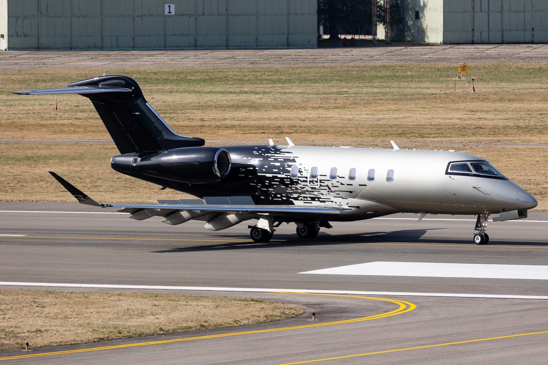 Sat, Nov 7in 4 daysSanta Cruz De TenerifeGCTS · Tenerife South AirportPoznanEPPO · Poznan-Lawica AirportChallenger 35009—On request7NovSanta Cruz De Tenerife → PoznanGCTS → EPPO · in 4 daysChallenger 3500 · 9 seatsOn request
 Wed, Nov 11in 8 daysSanta Cruz De TenerifeGCTS · Tenerife South AirportLondonEGGW · London Luton AirportLegacy 65013—On request11NovSanta Cruz De Tenerife → LondonGCTS → EGGW · in 8 daysLegacy 650 · 13 seatsOn request
 Fri, Nov 13in 10 daysTenerife South/Reina SofiaGCTSMalaga/Costa del SolLEMGCessna Citation Latitude92h 20mOn request13NovTenerife South/Reina Sofia → Malaga/Costa del SolGCTS → LEMG · in 10 daysCessna Citation Latitude · 9 seats · 2h 20mOn request
 Mon, Jan 18in 76 daysTenerife South/Reina SofiaGCTSLondon LutonEGGWEmbraer Legacy 650134h 15mOn request18JanTenerife South/Reina Sofia → London LutonGCTS → EGGW · in 76 daysEmbraer Legacy 650 · 13 seats · 4h 15mOn request
 GCTS · Reina Sofia
 LOWK · Klagenfurt Airport
 LPFR · Faro Airport
 EPPO · Poznan-Lawica Airport
 EGGW · London Luton Airport
* Total price incl. 10% service fee, converted to your selected currency. Price subject to operator confirmation.
Empty legs to GCTS
7 arrivals available
 Fri, Nov 6in 3 daysMalagaLEMG · Malaga AirportSanta Cruz De TenerifeGCTS · Tenerife South AirportPilatus PC-248—On request6NovMalaga → Santa Cruz De TenerifeLEMG → GCTS · in 3 daysPilatus PC-24 · 8 seatsOn request
 Sun, Nov 8in 5 daysNurembergEDDN · Nuremberg AirportSanta Cruz De TenerifeGCTS · Tenerife South AirportCitation Longitude9—On request8NovNuremberg → Santa Cruz De TenerifeEDDN → GCTS · in 5 daysCitation Longitude · 9 seatsOn request
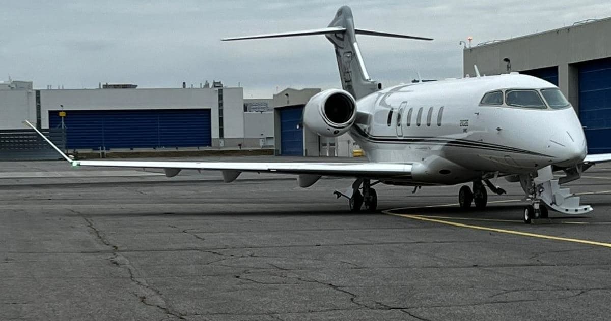 Sun, Nov 15in 12 daysKlagenfurt Am WortherseeLOWK · Klagenfurt AirportSanta Cruz De TenerifeGCTS · Tenerife South AirportChallenger 35008—$49,51115NovKlagenfurt Am Worthersee → Santa Cruz De TenerifeLOWK → GCTS · in 12 daysChallenger 3500 · 8 seats$49,511
 Tue, Nov 17in 14 daysLondonEGGW · London Luton AirportSanta Cruz De TenerifeGCTS · Tenerife South AirportCitation Latitude8—On request17NovLondon → Santa Cruz De TenerifeEGGW → GCTS · in 14 daysCitation Latitude · 8 seatsOn request
- Thu, Nov 19in 16 daysLondon LutonEGGWTenerife South/Reina SofiaGCTSCessna Citation Latitude94h 15mOn request19NovLondon Luton → Tenerife South/Reina SofiaEGGW → GCTS · in 16 daysCessna Citation Latitude · 9 seats · 4h 15mOn request
- Thu, Nov 19in 16 daysLutonEGGW · London Luton AirportTenerifeGCTS · Tenerife Sur AirportCitation C68A Latitude8—On request19NovLuton → TenerifeEGGW → GCTS · in 16 daysCitation C68A Latitude · 8 seatsOn request
- Sat, Jan 23in 81 daysLondon LutonEGGWTenerife South/Reina SofiaGCTSEmbraer Legacy 650134h 25mOn request23JanLondon Luton → Tenerife South/Reina SofiaEGGW → GCTS · in 81 daysEmbraer Legacy 650 · 13 seats · 4h 25mOn request
 EDDN · Nuremberg Airport
* Total price incl. 10% service fee, converted to your selected currency. Price subject to operator confirmation.
Map: Tenerife Island Airport
View the location of Tenerife Island – TFS/GCTS. Zoom in to explore the area around the airport.
About the airport
Tenerife South Airport (TFS/GCTS) is the key private jet gateway for Tenerife Island. PrivJet gives you instant access to charter flights and empty legs: fast, discreet and globally connected.
GCTS airport FAQ
Are there any restrictions at Tenerife Island airport (GCTS) today?
There are currently 11 valid NOTAMs for Tenerife Island (GCTS). 1 more NOTAM starts in the coming days. For information only, not for flight planning or operational use. Always rely on an official pre-flight briefing. This list may be incomplete or out of date.
What is the weather at Tenerife Island airport (GCTS)?
According to the latest weather report for GCTS (METAR, 03 Nov, 06:30 UTC): Good visual conditions (VFR). Wind 10 kt (19 km/h) from east (80°), visibility 10 km or more, temperature 23 °C (dew point 14 °C). For information only, not for flight planning. Weather can change quickly; always rely on official reports.
How long are the runways at Tenerife Island airport (GCTS)?
Tenerife Island (GCTS) has one runway: runway 07/25 with 3,200 m (10,499 ft), asphalt.
What are the radio frequencies at Tenerife Island airport (GCTS)?
Frequencies at GCTS: Tower 119 MHz, Ground 121.9 MHz and ATIS 118.675 MHz. For information only. Always rely on the published AIP.
What are the airport codes of Tenerife South Airport?
The ICAO code is GCTS and the IATA code is TFS. ICAO codes are used by air traffic control and pilots, e.g. in flight plans; IATA codes appear on tickets and baggage tags.
What is the elevation of GCTS airport?
Tenerife South Airport sits at 209 ft (64 m) above sea level. Local time zone: Atlantic/Canary.
Can I fly to GCTS by private jet?
Whether a private jet can operate into Tenerife South Airport depends on runway length, opening hours, customs and immigration rules as well as slot and handling availability, among other things. PrivJet checks this with the operating carrier for every request.
Are there empty legs from or to GCTS?
There are currently 7 empty legs departing from and 7 arriving at Tenerife South Airport. Empty legs are repositioning flights at heavily reduced prices; the list is updated several times a day.