Allentown Lehigh Valley Airport (KABE / ABE)
Empty legs and charters from Allentown
KABE airport at a glance
- ICAO code
- KABE
- IATA code
- ABE
- City
- Allentown
- Region
- Pennsylvania
- Country
- United States
- Elevation
- 393 ft (120 m)
- Time zone
- America/New York (UTC-5)
- Coordinates
- 40.6521° N, 75.4408° W
- Empty legs from
- 14
- Empty legs to
- 11
Weather & airport info KABE
Current weather
Good visual conditions (VFR)observed 03 Nov, 07:51 UTC- Wind
- Calm
- Visibility
- 10 km or more
- Clouds
- no significant clouds
- Temperature
- 6 °C (dew point 4 °C)
- Pressure (QNH)
- 1,026 hPa
Original weather report (METAR)
METAR KABE 030751Z 00000KT 10SM CLR 06/04 A3030 RMK AO2 SLP260 T00560044 $
Forecast (TAF)
- 03 Nov, 06:00–09:00 UTC4 kt (7 km/h) from variable directions · visibility 10 km or more · no significant clouds
- 03 Nov, 09:00–13:00 UTCfrom2 kt (4 km/h) from variable directions · visibility 8 km · Mist · scattered clouds at 500 ft
- 03 Nov, 13:00–00:00 UTCfrom5 kt (9 km/h) from southwest (220°) · visibility 10 km or more · scattered clouds at 25,000 ft
- 04 Nov, 00:00–06:00 UTCfrom2 kt (4 km/h) from variable directions · visibility 10 km or more · scattered clouds at 25,000 ft
Original forecast (TAF)
TAF KABE 030539Z 0306/0406 VRB04KT P6SM SKC FM030900 VRB02KT 5SM BR SCT005 FM031300 22005KT P6SM SCT250 FM040000 VRB02KT P6SM SCT250
Airport
- Elevation
- 393 ft (120 m)
- Sunrise / Sunset
- 06:34 / 16:56 local time
Runways
| Runway | Length | Surface | Lighted |
|---|---|---|---|
| 06/24 | 2,316 m (7,599 ft) | asphalt | yes |
| 13/31 | 1,768 m (5,800 ft) | asphalt | yes |
Radio frequencies
- ATIS: 126.975
- Clearance: 124.05
- Ground: 121.9
- Tower: 120.5
- UNICOM: 122.95
For information only, not for flight planning. Weather can change quickly; always rely on official reports. Sources: aviationweather.gov (NOAA), OurAirports.
Airport map KABE
Full screen →Runways white, taxiways yellow with designators, closed taxiways and runways per NOTAM in red.
Official charts (FAA)
Cycle 2611, valid until 0901Z 11/26/26
Airport diagram (FAA)
Airport diagram (1)
Instrument approaches (9)
Minimums (2)
For information only, not for navigation. Always use current official charts and NOTAMs.
Current NOTAMs for KABE(13)
NOTAMs (Notices to Air Missions) announce short-term changes at an airport: closed runways or taxiways, unserviceable approach aids, obstacles, airspace restrictions.
- NoticeObstacle: erectedA4381/26· from 03 Nov, 12:00 UTC · until 03 Nov, 20:00 UTC
A crane is located 2.69 nautical miles west-southwest of the approach end of runway 06. Its top is 575 feet above sea level, 150 feet above ground, and it is flagged.
Show original text
OBST CRANE (ASN UNKNOWN) 403826N0753030W (2.69NM WSW APCH END RWY 06) 575FT (150FT AGL) FLAGGED
A4381/26 NOTAMN
Q) KZNY/QOBCE/IV/M/AE/000/999/4039N07526W005
A) KABE
B) 2611031200
C) 2611032000
E) OBST CRANE (ASN UNKNOWN) 403826N0753030W (2.69NM WSW APCH END RWY 06)
 575FT (150FT AGL) FLAGGED
- NoticeObstacle: erected10/178· until 04 Nov, 21:00 UTC
An obstacle, a crane, with its top at 607 feet above sea level and 150 feet above ground, is located 3.05 nautical miles west of the approach end of runway 06 and is flagged.
Show original text
OBST CRANE (ASN UNKNOWN) 403825N0753028W (3.05NM W APCH END RWY 06) 607FT (150FT AGL) FLAGGED
A4364/26 NOTAMN
Q) KZNY/QOBCE/IV/M/AE/000/999/4039N07526W005
A) KABE
B) 2611021200
C) 2611042100
D) MON-WED 1200-2100
E) OBST CRANE (ASN UNKNOWN) 403825N0753028W (3.05NM W APCH END RWY 06)
 607FT (150FT AGL) FLAGGED
Hours: MON-WED 1200-2100
- NoticeObstacle: erectedA4364/26· until 04 Nov, 21:00 UTC
An obstacle, a crane, with its top at 607 feet above sea level and 150 feet above ground, is located 3.05 nautical miles west of the approach end of runway 06 and is flagged.
Show original text
OBST CRANE (ASN UNKNOWN) 403825N0753028W (3.05NM W APCH END RWY 06) 607FT (150FT AGL) FLAGGED
A4364/26 NOTAMN Q) KZNY/QOBCE/IV/M/AE/000/999/4039N07526W005 A) KABE B) 2611021200 C) 2611042100 D) MON-WED 1200-2100 E) OBST CRANE (ASN UNKNOWN) 403825N0753028W (3.05NM W APCH END RWY 06) 607FT (150FT AGL) FLAGGED
Hours: MON-WED 1200-2100
- NoticeObstacle: erectedA4380/26· until 03 Nov, 21:00 UTC
An obstacle, a crane, is located 1.09 nautical miles north-northwest of the approach end of runway 13. Its top is 511 feet above sea level, 125 feet above ground, and it is flagged.
Show original text
OBST CRANE (ASN UNKNOWN) 404018N0752737W (1.09NM NNW APCH END RWY 13) 511FT (125FT AGL) FLAGGED
A4380/26 NOTAMN
Q) KZNY/QOBCE/IV/M/AE/000/999/4039N07526W005
A) KABE
B) 2611021200
C) 2611032100
E) OBST CRANE (ASN UNKNOWN) 404018N0752737W (1.09NM NNW APCH END RWY 13)
 511FT (125FT AGL) FLAGGED
- NoticeRunway10/196· until 15 Nov, 20:00 UTC
The lead-off centerline markings for runway 24 at taxiway B on the south side are not standard.
Show original text
RWY 24 LEAD OFF CL MARKINGS AT TWY B S SIDE NOT STD
- NoticeRunway10/195· until 15 Nov, 21:00 UTC
The lead-off centerline markings for runway 06 at taxiway B on the south side are not marked.
Show original text
RWY 06 LEAD OFF CL MARKINGS AT TWY B S SIDE NOT MARKED
- NoticeTaxiway10/161· until 15 Nov, 19:00 UTC
The elevated runway guard lighting on taxiway E is not standard.
Show original text
TWY E ELEVATED RWY GUARD LGT NOT STD
A4333/26 NOTAMN Q) KZNY/QMXXX////000/999/4039N07526W005 A) KABE B) 2610241020 C) 2611151900 E) TWY E ELEVATED RWY GUARD LGT NOT STD
- NoticeTaxiway10/162· until 15 Nov, 21:00 UTC
Taxiway A4 ELEVATED runway GUARD light not STD
Show original text
TWY A4 ELEVATED RWY GUARD LGT NOT STD
A4331/26 NOTAMN
Q) KZNY/QMXXX////000/999/4039N07526W005
A) KABE
B) 2610241020
C) 2611152100
E) TWY A4 ELEVATED RWY GUARD LGT NOT STD
5 more NOTAMs
- NoticeTaxiwayA4331/26· until 15 Nov, 21:00 UTC
The elevated runway guard lighting on taxiway A4 is not standard.
Show original text
TWY A4 ELEVATED RWY GUARD LGT NOT STD
A4331/26 NOTAMN Q) KZNY/QMXXX////000/999/4039N07526W005 A) KABE B) 2610241020 C) 2611152100 E) TWY A4 ELEVATED RWY GUARD LGT NOT STD
- NoticeTaxiwayA4333/26· until 15 Nov, 19:00 UTC
The elevated runway guard lighting on taxiway E is not standard.
Show original text
TWY E ELEVATED RWY GUARD LGT NOT STD
A4333/26 NOTAMN
Q) KZNY/QMXXX////000/999/4039N07526W005
A) KABE
B) 2610241020
C) 2611151900
E) TWY E ELEVATED RWY GUARD LGT NOT STD
- NoticeTaxiway10/159· until 08 Nov, 22:00 UTC
The edge markings on taxiway A7 are not standard.
Show original text
TWY A7 EDGE MARKINGS NOT STD
- NoticeTaxiway10/160· until 15 Nov, 19:00 UTC
The elevated runway guard lighting on taxiway A3 is not standard.
Show original text
TWY A3 ELEVATED RWY GUARD LGT NOT STD
A4330/26 NOTAMN
Q) KZNY/QMXXX////000/999/4039N07526W005
A) KABE
B) 2610241019
C) 2611151900
E) TWY A3 ELEVATED RWY GUARD LGT NOT STD
- NoticeTaxiwayA4330/26· until 15 Nov, 19:00 UTC
Taxiway A3 ELEVATED runway GUARD light not STD
Show original text
TWY A3 ELEVATED RWY GUARD LGT NOT STD
A4330/26 NOTAMN Q) KZNY/QMXXX////000/999/4039N07526W005 A) KABE B) 2610241019 C) 2611151900 E) TWY A3 ELEVATED RWY GUARD LGT NOT STD
For information only, not for flight planning or operational use. Always rely on an official pre-flight briefing. This list may be incomplete or out of date. Explanations and expanded abbreviations are generated automatically. The original text is authoritative. Source: FAA NOTAM Management Service (SWIM).
Private jet traffic in Lehigh Valley International Airport (last 30 days)
- Arrivals
- 393
- Departures
- 386
- Different jets
- 246
Most frequent origins: Teterboro Airport (21), Burlington Alamance Regional Airport (19), Washington Dulles International Airport (12), Westchester County Airport (11), Morristown Municipal Airport (10).
Most frequent destinations: Burlington Alamance Regional Airport (22), Teterboro Airport (19), Morristown Municipal Airport (10), Wayne County Airport (8), Laurence G Hanscom Field (8).
Most common aircraft types: Pilatus PC-12 (82), Hawker 800/900 (75), Embraer Phenom 300 (56), Cessna Citation Excel/XLS (52), Cessna Citation CJ3 (36).
Sunday is the busiest day.
Our own analysis of public ADS-B signals from business jets. Not every flight is received, and jets with a removal request are excluded.
Charter operators based here
Operators with a base at this airport.
- East Coast JetsLight jet, Midsize jet
- Jet-AMidsize jet, Super midsize jet
- Scott Richard Aviation ServicesLight jet, Midsize jet
- ContrailTurboprop, Piston aircraft
- Skystream JetSuper midsize jet, Heavy jet
- New World AviationSuper midsize jet
Empty legs from KABE
14 departures available
- Sun, Nov 812:06AllentownKABE · Lehigh Valley International AirportSouth BendKSBN · South Bend Regional AirportCessna Citation Bravo7—$7,5908NovAllentown → South BendKABE → KSBN · 12:06Cessna Citation Bravo · 7 seats$7,590
- Sun, Nov 8in 5 daysAllentownKABE · Lehigh Valley International AirportSouth BendKSBN · South Bend Regional AirportEmbraer Phenom 300E7—$7,8108NovAllentown → South BendKABE → KSBN · in 5 daysEmbraer Phenom 300E · 7 seats$7,810
 Sun, Nov 8in 5 daysAllentownKABE · Lehigh Valley International AirportSouth BendKSBN · South Bend Regional AirportCitation Bravo7—On request8NovAllentown → South BendKABE → KSBN · in 5 daysCitation Bravo · 7 seatsOn request
- Sun, Nov 15in 12 daysAllentownKABE · Lehigh Valley IntlTorontoCYYZ · Lester B.Pearson IntlFalcon 2000——On request15NovAllentown → TorontoKABE → CYYZ · in 12 daysFalcon 2000On request
- Sun, Nov 15in 12 daysAllentownKABE · Lehigh Valley International AirportTorontoCYYZ · Lester B. Pearson International AirportDA200012—On request15NovAllentown → TorontoKABE → CYYZ · in 12 daysDA2000 · 12 seatsOn request
- Sun, Nov 1514:00AllentownKABE · Lehigh Valley International AirportTorontoCYYZ · Toronto Lester B. Pearson International AirportDassault Falcon 200010—$8,03015NovAllentown → TorontoKABE → CYYZ · 14:00Dassault Falcon 2000 · 10 seats$8,030
- Sun, Nov 15in 12 daysAllentownKABE · Lehigh Valley International AirportTorontoCYYZ · Lester B. Pearson International AirportDA2000 (HEAVY JET)12—On request15NovAllentown → TorontoKABE → CYYZ · in 12 daysDA2000 (HEAVY JET) · 12 seatsOn request
- Mon, Nov 1605:00AllentownKABE · Lehigh Valley IntlNew OrleansKNEW · LakefrontDassault Falcon 200012—$31,76316NovAllentown → New OrleansKABE → KNEW · 05:00Dassault Falcon 2000 · 12 seats$31,763
 Wed, Nov 1811:00AllentownKABE · Lehigh Valley International AirportTorontoCYYZ · Toronto Lester B. Pearson International AirportDassault Falcon 200012—$10,19318NovAllentown → TorontoKABE → CYYZ · 11:00Dassault Falcon 2000 · 12 seats$10,193
 KABE · Lehigh Valley International Airport
 CYYZ · Lester B.Pearson Intl
* Total price incl. 10% service fee, converted to your selected currency. Price subject to operator confirmation.
Empty legs to KABE
11 arrivals available
- Wed, Nov 4TomorrowChicagoKMDW · Chicago Midway International AirportAllentownKABE · Lehigh Valley International AirportBombardier Challenger 604121h 36mOn request4NovChicago → AllentownKMDW → KABE · TomorrowBombardier Challenger 604 · 12 seats · 1h 36mOn request
 Thu, Nov 5in 2 daysChicagoKMDW · Chicago Midway International AirportAllentownKABE · Lehigh Valley International AirportChallenger 60412—On request5NovChicago → AllentownKMDW → KABE · in 2 daysChallenger 604 · 12 seatsOn request
- Sun, Nov 805:00MontereyKMRY · Monterey RegionalAllentownKABE · Lehigh Valley IntlGulfstream G V16—On request8NovMonterey → AllentownKMRY → KABE · 05:00Gulfstream G V · 16 seatsOn request
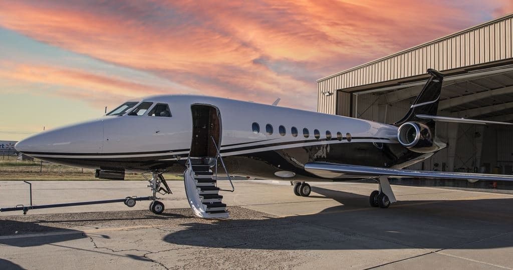 Mon, Nov 9in 6 daysNew OrleansKNEW · Lakefront AirportAllentownKABE · Lehigh Valley International AirportFalcon 200012—$20,9009NovNew Orleans → AllentownKNEW → KABE · in 6 daysFalcon 2000 · 12 seats$20,900
- Tue, Nov 10in 7 daysNew OrleansKNEW · LakefrontAllentownKABE · Lehigh Valley IntlFalcon 2000——On request10NovNew Orleans → AllentownKNEW → KABE · in 7 daysFalcon 2000On request
- Tue, Nov 10in 7 daysNew OrleansKNEW · Lakefront AirportAllentownKABE · Lehigh Valley International AirportDA200012—On request10NovNew Orleans → AllentownKNEW → KABE · in 7 daysDA2000 · 12 seatsOn request
 Tue, Nov 10in 7 daysNew OrleansKNEW · Lakefront AirportAllentownKABE · Lehigh Valley International AirportDassault Falcon 200012h 30m$29,26010NovNew Orleans → AllentownKNEW → KABE · in 7 daysDassault Falcon 2000 · 1 seat · 2h 30m$29,260
- Tue, Nov 10in 7 daysNew OrleansKNEW · Lakefront AirportAllentownKABE · Lehigh Valley International AirportDA2000 (HEAVY JET)12—On request10NovNew Orleans → AllentownKNEW → KABE · in 7 daysDA2000 (HEAVY JET) · 12 seatsOn request
- Tue, Nov 24in 21 daysStuartKSUA · Witham FieldAllentownKABE · Lehigh Valley International AirportGulfstream G450142h 24mOn request24NovStuart → AllentownKSUA → KABE · in 21 daysGulfstream G450 · 14 seats · 2h 24mOn request
* Total price incl. 10% service fee, converted to your selected currency. Price subject to operator confirmation.
Map: Allentown Airport
View the location of Allentown – ABE/KABE. Zoom in to explore the area around the airport.
About the airport
Lehigh Valley International Airport (ABE/KABE) is the key private jet gateway for Allentown. PrivJet gives you instant access to charter flights and empty legs: fast, discreet and globally connected.
KABE airport FAQ
Are there any restrictions at Allentown airport (KABE) today?
There are currently 12 valid NOTAMs for Allentown (KABE). 1 more NOTAM starts in the coming days. For information only, not for flight planning or operational use. Always rely on an official pre-flight briefing. This list may be incomplete or out of date.
What is the weather at Allentown airport (KABE)?
According to the latest weather report for KABE (METAR, 03 Nov, 07:51 UTC): Good visual conditions (VFR). Wind Calm, visibility 10 km or more, temperature 6 °C (dew point 4 °C). For information only, not for flight planning. Weather can change quickly; always rely on official reports.
How long are the runways at Allentown airport (KABE)?
Allentown (KABE) has 2 runways: runway 06/24 with 2,316 m (7,599 ft), asphalt and runway 13/31 with 1,768 m (5,800 ft), asphalt. The longest is 2,316 m.
What are the radio frequencies at Allentown airport (KABE)?
Frequencies at KABE: Tower 120.5 MHz, Ground 121.9 MHz and ATIS 126.975 MHz. For information only. Always rely on the published AIP.
What are the airport codes of Lehigh Valley International Airport?
The ICAO code is KABE and the IATA code is ABE. ICAO codes are used by air traffic control and pilots, e.g. in flight plans; IATA codes appear on tickets and baggage tags.
What is the elevation of KABE airport?
Lehigh Valley International Airport sits at 393 ft (120 m) above sea level. Local time zone: America/New York.
Can I fly to KABE by private jet?
Whether a private jet can operate into Lehigh Valley International Airport depends on runway length, opening hours, customs and immigration rules as well as slot and handling availability, among other things. PrivJet checks this with the operating carrier for every request.
Are there empty legs from or to KABE?
There are currently 14 empty legs departing from and 11 arriving at Lehigh Valley International Airport. Empty legs are repositioning flights at heavily reduced prices; the list is updated several times a day.