Albuquerque International Sunport Airport (KABQ / ABQ)
Empty legs and charters from Albuquerque
KABQ airport at a glance
- ICAO code
- KABQ
- IATA code
- ABQ
- City
- Albuquerque
- Region
- New Mexico
- Country
- United States
- Elevation
- 5,355 ft (1,632 m)
- Time zone
- America/Denver (UTC-7)
- Coordinates
- 35.0402° N, 106.6090° W
- Empty legs from
- 74
- Empty legs to
- 56
Weather & airport info KABQ
Current weather
No current weather report is available for this airport.
Airport
- Elevation
- 5,355 ft (1,632 m)
- Sunrise / Sunset
- 06:29 / 17:10 local time
Runways
| Runway | Length | Surface | Lighted |
|---|---|---|---|
| 08/26 | 4,204 m (13,793 ft) | concrete | no |
| 03/21 | 3,048 m (10,000 ft) | concrete | no |
| 12/30 | 1,829 m (6,000 ft) | concrete | no |
Radio frequencies
- Approach: 123.9
- ATIS: 118
- Clearance: 119.2
- Ground: 121.9
- Tower: 120.3
- Tower: 123.775
For information only, not for flight planning. Weather can change quickly; always rely on official reports. Sources: aviationweather.gov (NOAA), OurAirports.
Airport map KABQ
Full screen →Runways white, taxiways yellow with designators, closed taxiways and runways per NOTAM in red.
Closed per NOTAM: RWY 8/26, TWY M7
Official charts (FAA)
Cycle 2611, valid until 0901Z 11/26/26
Airport diagram (FAA)
Airport diagram (1)
Instrument approaches (13)
Departure procedures (12)
Hot spots (1)
For information only, not for navigation. Always use current official charts and NOTAMs.
Current NOTAMs for KABQ(30)
NOTAMs (Notices to Air Missions) announce short-term changes at an airport: closed runways or taxiways, unserviceable approach aids, obstacles, airspace restrictions.
- ClosedRunway: closedA1084/26· until 04 Nov, 03:00 UTC
Runway 08/26 is closed. This means that this runway cannot be used at the moment.
Show original text
RWY 08/26 CLSD
A1084/26 NOTAMN
Q) KZAB/QMRLC////000/999/3502N10636W005
A) KABQ
B) 2611031500
C) 2611040300
E) RWY 08/26 CLSD
- Out of serviceServices11/001· from 08 Nov, 05:00 UTC · until 08 Nov, 15:00 UTC
The automatic terminal information service (ATIS) on frequency 118.0 is out of service. This means you cannot receive important airport information via this frequency.
Show original text
SVC ATIS 118.0 U/S
- Out of serviceServices11/002· from 08 Nov, 05:00 UTC · until 08 Nov, 15:00 UTC
The remote communication outlet on frequency 122.3 for communicating with the airport is out of service.
Show original text
COM REMOTE COM OUTLET 122.3 U/S
- Out of serviceServices11/004· from 08 Nov, 05:00 UTC · until 08 Nov, 15:00 UTC
Several radio frequencies for communication (COM REMOTE TRANS/REC) at Albuquerque International Sunport are out of service (U/S).
Show original text
COM REMOTE TRANS/REC 243.000, 253.500, 257.700, 259.300, 263.150, 317.600, 348.600, 351.900, 354.100, 360.850, 372.000 U/S
- Out of serviceServices11/005· from 08 Nov, 05:00 UTC · until 08 Nov, 15:00 UTC
Several radio frequencies for communication (COM REMOTE TRANS/REC) at Albuquerque International Sunport are out of service (U/S).
Show original text
COM REMOTE TRANS/REC 119.200, 120.300, 121.500, 121.900, 123.775, 123.900, 124.400, 125.450, 126.300, 127.400, 134.800 U/S
- Out of serviceTerminal area surveillance radar: unserviceableA1086/26· from 08 Nov, 05:00 UTC · until 08 Nov, 15:00 UTC
The air traffic control service for the Terminal Area Radar (TAR) and Secondary Surveillance Radar (SSR) is out of service. These radar systems help air traffic control locate and identify aircraft.
Show original text
SVC TAR/SSR U/S
A1086/26 NOTAMN
Q) KZAB/QCTAS////000/999/3502N10636W005
A) KABQ
B) 2611080500
C) 2611081500
E) SVC TAR/SSR U/S
- ClosedTaxiway: closedA1094/26· from 04 Nov, 16:00 UTC · until 04 Nov, 20:00 UTC
Taxiway A11 closed
Show original text
TWY A11 CLSD
A1094/26 NOTAMN
Q) KZAB/QMXLC////000/999/3502N10636W005
A) KABQ
B) 2611041600
C) 2611042000
E) TWY A11 CLSD
- ClosedTaxiway: closedM0325/26· from 04 Nov, 16:00 UTC · until 04 Nov, 22:00 UTC
Taxiway M7 is closed for C130 training operations.
Show original text
TWY M7 CLOSED FOR C130 TRAINING OPERATIONS
M0325/26 NOTAMN
Q) ZAB/QMXLC/IV/NBO/A/000/999/3502N10636W005
A) KABQ
B) 2611041600
C) 2611042200
E) TWY M7 CLOSED FOR C130 TRAINING OPERATIONS
22 more NOTAMs
- Out of serviceILS: unserviceableA1087/26· until 04 Nov, 03:00 UTC
The instrument landing system (ILS) for runway 08 is out of service. The ILS guides aircraft to the runway in poor visibility.
Show original text
ABQ NAV ILS RWY 08 U/S
A1087/26 NOTAMN
Q) KZAB/QICAS////000/999/3502N10636W005
A) KABQ
B) 2611031500
C) 2611040300
E) ABQ NAV ILS RWY 08 U/S
- ClosedTaxiway: closedM0326/26· until 03 Nov, 21:00 UTC
Taxiway M7 is closed for C130 training operations. This may lead to diversions or delays in taxiing at the airport.
Show original text
TWY M7 CLOSED FOR C130 TRAINING OPERATIONS
M0326/26 NOTAMN
Q) ZAB/QMXLC/IV/NBO/A/000/999/3502N10636W005
A) KABQ
B) 2611031300
C) 2611032100
E) TWY M7 CLOSED FOR C130 TRAINING OPERATIONS
- Out of serviceObstacle11/012· until 02 Mar, 02:30 UTC
A tower 13.0 nautical miles northeast of the airport is out of service. Its top is 10897.0 feet above sea level, 285.1 feet above ground.
Show original text
OBST TOWER LGT (ASR 1225205) 351249.80N1062703.30W (13.0NM NE ABQ) 10897.0FT (285.1FT AGL) U/S
- Out of serviceObstacle lights: unserviceableA1090/26· until 17 Dec, 00:51 UTC
A tower light (ASR 1006948) 2.7 nautical miles west of the airport is out of service. Its top is 5338 feet above sea level, 407 feet above ground.
Show original text
TOWER LGT (ASR 1006948) 350159.00N1063946.00W (2.7NM W ABQ) 5338FT (407FT AGL) U/S
A1090/26 NOTAMN
Q) KZAB/QOLAS/IV/M/AE/000/999/3501N10639W001
A) KABQ
B) 2611020051
C) 2612170051
E) TOWER LGT (ASR 1006948) 350159.00N1063946.00W (2.7NM W ABQ) 5338FT (407FT AGL) U/S
- Out of serviceVASISA1075/26· until 11 Nov, 23:00 UTC
The VASI (Visual Approach Slope Indicator) for Runway 08 at Albuquerque International Sunport is out of service, except for high intensity on request.
Show original text
RWY 08 VASI U/S EXC HIGH INTST ON CONS
A1075/26 NOTAMN
Q) KZAB/QLVXX////000/999/3502N10636W005
A) KABQ
B) 2610291152
C) 2611112300
E) RWY 08 VASI U/S EXC HIGH INTST ON CONS
- Out of serviceObstacle10/184· until 14 Jan, 23:59 UTC
A tower 8.0 nautical miles north of the airport is an obstacle to air traffic. Its top is 5293.0 ft above sea level, 306.1 ft above ground, and its lighting is out of service.
Show original text
OBST TOWER LGT (ASR 1046175) 351014.00N1063753.00W (8.0NM N ABQ) 5293.0FT (306.1FT AGL) U/S
- Out of serviceAir/ground facility: unserviceable10/097· permanent
The remote communication outlet (RCO) 122.5 at Albuquerque International Sunport airport is out of service. This means radio communication on this frequency is not possible.
Show original text
COM REMOTE COM OUTLET 122.5 U/S
10/097 NOTAMN
Q) KZAB/QCAAS/IV/B/AE/000/999/3502N10636W025
A) KABQ
B) 2610081725
C) PERM

E) REMOTE COM OUTLET 122.5 U/S
- Out of serviceObstacle10/025· until 31 Dec, 05:55 UTC
A tower obstacle light 22.1 nautical miles north-northeast of the airport is out of service. Its top is 5508.2 ft above sea level, 303.1 ft above ground.
Show original text
OBST TOWER LGT (ASR 1007702) 352304.10N1062658.10W (22.1NM NNE ABQ) 5508.2FT (303.1FT AGL) U/S
- NoticeAirspace11/047· from 06 Nov, 02:30 UTC · until 06 Nov, 07:00 UTC
Airspace military AIRDROP within an area defined as 5 NM radius of a defined point (7.4 NM southeast of ABQ) surface- 6500 ft above ground.
Show original text
AIRSPACE MIL AIRDROP WI AN AREA DEFINED AS 5NM RADIUS OF 345721N1063046W (7.4NM SE ABQ) SFC-6500FT AGL.
- NoticeAirspace11/048· from 05 Nov, 17:00 UTC · until 05 Nov, 22:00 UTC
Airspace military AIRDROP within an area defined as 5 NM radius of a defined point (7.4 NM southeast of ABQ) surface- 6500 ft above ground.
Show original text
AIRSPACE MIL AIRDROP WI AN AREA DEFINED AS 5NM RADIUS OF 345721N1063046W (7.4NM SE ABQ) SFC-6500FT AGL.
- NoticeAirspace11/042· from 05 Nov, 02:30 UTC · until 05 Nov, 07:00 UTC
In the airspace within a 5 nautical mile radius, 7.4 nautical miles southeast of Albuquerque International Sunport airport, up to 6500 feet above ground, military airdrop operations are taking place.
Show original text
AIRSPACE MIL AIRDROP WI AN AREA DEFINED AS 5NM RADIUS OF 345721N1063046W (7.4NM SE ABQ) SFC-6500FT AGL.
- NoticeAirspace11/043· from 04 Nov, 18:00 UTC · until 04 Nov, 22:00 UTC
Airspace military AIRDROP within an area defined as 5 NM radius of a defined point (7.4 NM southeast of ABQ) surface- 6500 ft above ground.
Show original text
AIRSPACE MIL AIRDROP WI AN AREA DEFINED AS 5NM RADIUS OF 345721N1063046W (7.4NM SE ABQ) SFC-6500FT AGL.
- NoticeAirspace11/019· from 04 Nov, 03:00 UTC · until 04 Nov, 07:00 UTC
Military airdrops are taking place in an area with a 5 nautical mile radius, 7.4 nautical miles southeast of the airport. This area is affected from the surface up to 6500 feet above ground.
Show original text
AIRSPACE MIL AIRDROP WI AN AREA DEFINED AS 5NM RADIUS OF 345721N1063046W (7.4NM SE ABQ) SFC-6500FT AGL.
- NoticeTaxiway11/050· until 04 Nov, 20:00 UTC
Taxiway A11 surface PAINTED holding position SIGNS for runway 08/26 not STD
Show original text
TWY A11 SFC PAINTED HLDG PSN SIGNS FOR RWY 08/26 NOT STD
- NoticeAirspace11/020· until 03 Nov, 22:00 UTC
Military air dropping is taking place within an area of 5 nautical miles radius, 7.4 nautical miles southeast of the airport. This area extends from the surface to 6500 feet above ground.
Show original text
AIRSPACE MIL AIRDROP WI AN AREA DEFINED AS 5NM RADIUS OF 345721N1063046W (7.4NM SE ABQ) SFC-6500FT AGL
- NoticeFire and rescue: downgradedM0322/26· until 05 Nov, 23:59 UTC
Aircraft Rescue and Fire Fighting (ARFF) capabilities are reduced for military aircraft. ARFF category 1-7 is released, 8-10 is closed. 12 personnel and 6000 gallons are available.
Show original text
MILITARY ONLY: AIRCRAFT RESCUE AND FIRE FIGHTING (ARFF) CAPABILITIES REDUCED. ARFF CAT IS: CAT 1-7 RLS, CAT 8-10 CLS. 12 PERSONNEL AND 6000 GALS AVAILABLE. CONTACT AM OPS DSN 246-8335 FOR MORE INFORMATION
M0322/26 NOTAMN
Q) ZAB/QFFCG/IV/NBO/A/000/999/3502N10636W005
A) KABQ
B) 2610291457
C) 2611052359
E) MILITARY ONLY: AIRCRAFT RESCUE AND FIRE FIGHTING (ARFF) CAPABILITIES REDUCED. ARFF CAT IS: CAT 1-7 RLS, CAT 8-10 CLS. 12 PERSONNEL AND 6000 GALS AVAILABLE. CONTACT AM OPS DSN 246-8335 FOR MORE INFORMATION
- NoticeRunway10/374· until 30 Nov, 23:00 UTC
The runway centerline lighting for runway 08/26 is not standard. This may affect orientation on the runway in darkness or poor weather.
Show original text
RWY 08/26 RCLL NOT STD
- NoticeRunway10/373· until 31 Dec, 23:59 UTC
Runway 26 LEAD OFF light at taxiway E1 not STD
Show original text
RWY 26 LEAD OFF LGT AT TWY E1 NOT STD
A1048/26 NOTAMN
Q) KZAB/QMRXX////000/999/3502N10636W005
A) KABQ
B) 2610270326
C) 2612312359
E) RWY 26 LEAD OFF LGT AT TWY E1 NOT STD
- NoticeRunwayA1048/26· until 31 Dec, 23:59 UTC
The lead-off lights for runway 26 at taxiway E1 are not standard.
Show original text
RWY 26 LEAD OFF LGT AT TWY E1 NOT STD
A1048/26 NOTAMN Q) KZAB/QMRXX////000/999/3502N10636W005 A) KABQ B) 2610270326 C) 2612312359 E) RWY 26 LEAD OFF LGT AT TWY E1 NOT STD
- NoticeRunway10/372· until 31 Dec, 23:59 UTC
The lead-on lights for runway 08 at taxiway E1 are not standard.
Show original text
RWY 08 LEAD ON LGT AT TWY E1 NOT STD
A1047/26 NOTAMN
Q) KZAB/QMRXX////000/999/3502N10636W005
A) KABQ
B) 2610270325
C) 2612312359
E) RWY 08 LEAD ON LGT AT TWY E1 NOT STD
- NoticeRunwayA1047/26· until 31 Dec, 23:59 UTC
The lead-on lights for runway 08 at taxiway E1 are not standard.
Show original text
RWY 08 LEAD ON LGT AT TWY E1 NOT STD
A1047/26 NOTAMN Q) KZAB/QMRXX////000/999/3502N10636W005 A) KABQ B) 2610270325 C) 2612312359 E) RWY 08 LEAD ON LGT AT TWY E1 NOT STD
- NoticeOtherM0320/26· until 22 Jan, 23:59 UTC
Equipment is located adjacent to the hot refueling pad north of Kirtland AFB helipads. Taxi-through is restricted to aircraft hot refueling only.
Show original text
EQUIPMENT LOCATED ADJACENT TO HOT REFUELING PAD NORTH OF KIRTLAND AFB HELIPADS. TAXITHROUGH RESTRICTED TO AIRCRAFT HOT REFUELING ONLY. CONTACT AIRFIELD MANAGEMENT AT DSN 846-8335 FOR PRIOR COORDINATION AS NEEDED.
M0320/26 NOTAMN
Q) ZAB/QTTTT/IV/NBO/A/000/999/3502N10636W005
A) KABQ
B) 2610262305
C) 2701222359
E) EQUIPMENT LOCATED ADJACENT TO HOT REFUELING PAD NORTH OF KIRTLAND AFB HELIPADS. TAXITHROUGH RESTRICTED TO AIRCRAFT HOT REFUELING ONLY. CONTACT AIRFIELD MANAGEMENT AT DSN 846-8335 FOR PRIOR COORDINATION AS NEEDED.
For information only, not for flight planning or operational use. Always rely on an official pre-flight briefing. This list may be incomplete or out of date. Explanations and expanded abbreviations are generated automatically. The original text is authoritative. Source: FAA NOTAM Management Service (SWIM).
Private jet traffic in Albuquerque International Sunport Airport (last 30 days)
- Arrivals
- 1,038
- Departures
- 1,011
- Different jets
- 369
Most frequent origins: Las Cruces International Airport (42), Phoenix Sky Harbor International Airport (42), Centennial Airport (25), Scottsdale Airport (14), City of Colorado Springs Municipal Airport (13).
Most frequent destinations: Las Cruces International Airport (43), Grant County Airport (38), Phoenix Sky Harbor International Airport (36), Centennial Airport (29), El Paso International Airport (28).
Most common aircraft types: Beechcraft King Air 200/250 (344), Pilatus PC-12 (222), Beechcraft King Air 90 (218), Beechcraft King Air 300 (172), Beechcraft King Air 350 (102).
Our own analysis of public ADS-B signals from business jets. Not every flight is received, and jets with a removal request are excluded.
Charter operators based here
Operators with a base at this airport.
- CSI AviationTurboprop
- Cutter AviationPhoenix (Sky Harbor International) (KPHX) · Turboprop, Light jet, Midsize jet
- South AeroTurboprop, Piston aircraft
- Bode AviationTurboprop, Light jet
- AeroLynxTurboprop
- Biotech AviationPiston aircraft
- Vertical Limit AviationHelicopter
- Med Flight Air AmbulanceLight jet
Empty legs from KABQ
74 departures available
- Wed, Nov 4TomorrowAlbuquerqueKABQ · Albuquerque International SunportCarlsbadKCRQ · McClellan-Palomar AirportCessna CitationJet5—$8,1404NovAlbuquerque → CarlsbadKABQ → KCRQ · TomorrowCessna CitationJet · 5 seats$8,140
- Wed, Nov 4TomorrowAlbuquerqueKABQ · Albuquerque IntlCarlsbadKCNM · Cavern City Air TrmlCommercial/VIP Airliner30—On request4NovAlbuquerque → CarlsbadKABQ → KCNM · TomorrowCommercial/VIP Airliner · 30 seatsOn request
- Thu, Nov 5in 2 daysAlbuquerqueKABQ · Albuquerque International SunportTitusvilleKTIX · Space Coast Regional AirportBombardier Learjet 607—$23,3205NovAlbuquerque → TitusvilleKABQ → KTIX · in 2 daysBombardier Learjet 60 · 7 seats$23,320
- Thu, Nov 5in 2 daysAlbuquerqueKABQ · Albuquerque International SunportTitusvilleKTIX · Space Coast Regional AirportEmbraer Legacy 650E13—$23,3205NovAlbuquerque → TitusvilleKABQ → KTIX · in 2 daysEmbraer Legacy 650E · 13 seats$23,320
- Thu, Nov 5in 2 daysAlbuquerqueKABQ · Albuquerque International SunportCarlsbadKCRQ · McClellan-Palomar AirportCessna CitationJet5—$8,1405NovAlbuquerque → CarlsbadKABQ → KCRQ · in 2 daysCessna CitationJet · 5 seats$8,140
- Thu, Nov 504:24AlbuquerqueKABQ · Albuquerque IntlScottsdaleKSDLCessna Citation Excel8—$7,7145NovAlbuquerque → ScottsdaleKABQ → KSDL · 04:24Cessna Citation Excel · 8 seats$7,714
- Thu, Nov 5in 2 daysAlbuquerqueKABQ · Albuquerque IntlCarlsbadKCNM · Cavern City Air TrmlCommercial/VIP Airliner30—On request5NovAlbuquerque → CarlsbadKABQ → KCNM · in 2 daysCommercial/VIP Airliner · 30 seatsOn request
- Thu, Nov 5in 2 daysAlbuquerqueKABQ · Albuquerque IntlTitusvilleKTIX · Space Coast RegionalMidsize Jet6—On request5NovAlbuquerque → TitusvilleKABQ → KTIX · in 2 daysMidsize Jet · 6 seatsOn request
- Thu, Nov 5in 2 daysAlbuquerqueKABQ · Albuquerque IntlEl PasoKBIF · BIGGS AAFMidsize Jet6—On request5NovAlbuquerque → El PasoKABQ → KBIF · in 2 daysMidsize Jet · 6 seatsOn request
 KABQ · Albuquerque International Sunport
* Total price incl. 10% service fee, converted to your selected currency. Price subject to operator confirmation.
Empty legs to KABQ
56 arrivals available
- Wed, Nov 4TomorrowCarlsbadKCRQ · McClellan-Palomar AirportAlbuquerqueKABQ · Albuquerque International SunportCessna CitationJet5—$8,1404NovCarlsbad → AlbuquerqueKCRQ → KABQ · TomorrowCessna CitationJet · 5 seats$8,140
- Wed, Nov 4TomorrowCarlsbadKCNM · Cavern City Air TrmlAlbuquerqueKABQ · Albuquerque IntlCommercial/VIP Airliner30—On request4NovCarlsbad → AlbuquerqueKCNM → KABQ · TomorrowCommercial/VIP Airliner · 30 seatsOn request
- Thu, Nov 5in 2 daysCarlsbadKCRQ · McClellan-Palomar AirportAlbuquerqueKABQ · Albuquerque International SunportCessna CitationJet5—$8,1405NovCarlsbad → AlbuquerqueKCRQ → KABQ · in 2 daysCessna CitationJet · 5 seats$8,140
- Thu, Nov 5in 2 daysCarlsbadKCNM · Cavern City Air TrmlAlbuquerqueKABQ · Albuquerque IntlCommercial/VIP Airliner30—On request5NovCarlsbad → AlbuquerqueKCNM → KABQ · in 2 daysCommercial/VIP Airliner · 30 seatsOn request
- Fri, Nov 6in 3 daysCarlsbadKCRQ · McClellan-Palomar AirportAlbuquerqueKABQ · Albuquerque International SunportCessna CitationJet5—$8,1406NovCarlsbad → AlbuquerqueKCRQ → KABQ · in 3 daysCessna CitationJet · 5 seats$8,140
- Fri, Nov 611:06Las VegasKLAS · Harry Reid IntlAlbuquerqueKABQ · Albuquerque IntlBombardier Challenger 85015—On request6NovLas Vegas → AlbuquerqueKLAS → KABQ · 11:06Bombardier Challenger 850 · 15 seatsOn request
- Fri, Nov 6in 3 daysCarlsbadKCNM · Cavern City Air TrmlAlbuquerqueKABQ · Albuquerque IntlCommercial/VIP Airliner30—On request6NovCarlsbad → AlbuquerqueKCNM → KABQ · in 3 daysCommercial/VIP Airliner · 30 seatsOn request
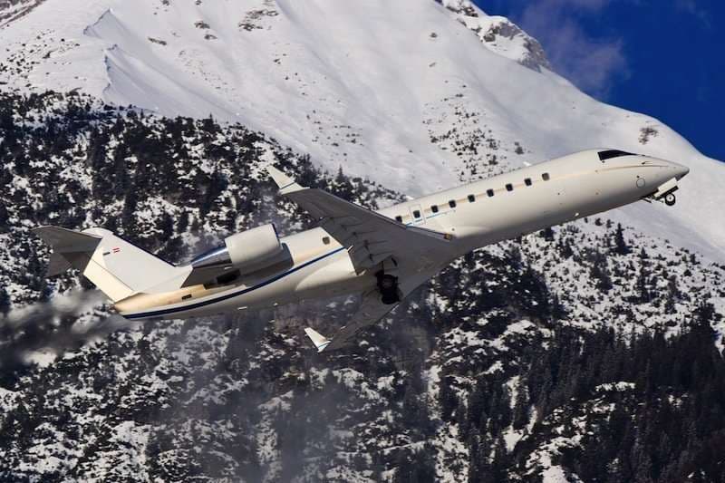 Fri, Nov 6in 3 daysLas VegasKLAS · Harry Reid International AirportAlbuquerqueKABQ · Albuquerque International Sunport AirportChallenger 85015—On request6NovLas Vegas → AlbuquerqueKLAS → KABQ · in 3 daysChallenger 850 · 15 seatsOn request
- Fri, Nov 6in 3 daysPhoenixKPHX · Phoenix Sky Harbor International AirportAlbuquerqueKABQ · Albuquerque International Sunport AirportBombardier Inc Challenger 85015—$10,4506NovPhoenix → AlbuquerqueKPHX → KABQ · in 3 daysBombardier Inc Challenger 850 · 15 seats$10,450
* Total price incl. 10% service fee, converted to your selected currency. Price subject to operator confirmation.
Map: Albuquerque Airport
View the location of Albuquerque – ABQ/KABQ. Zoom in to explore the area around the airport.
About the airport
Albuquerque International Sunport Airport (ABQ/KABQ) is the key private jet gateway for Albuquerque. PrivJet gives you instant access to charter flights and empty legs: fast, discreet and globally connected.
KABQ airport FAQ
Are there any restrictions at Albuquerque airport (KABQ) today?
There are currently 18 valid NOTAMs for Albuquerque (KABQ). According to NOTAM, at least one runway or the aerodrome itself is closed. Affected: Runway: closed; Taxiway: closed; ILS: unserviceable; Obstacle: out of service and 3 more. 12 more NOTAMs start in the coming days. For information only, not for flight planning or operational use. Always rely on an official pre-flight briefing. This list may be incomplete or out of date.
How long are the runways at Albuquerque airport (KABQ)?
Albuquerque (KABQ) has 3 runways: runway 08/26 with 4,204 m (13,793 ft), concrete, runway 03/21 with 3,048 m (10,000 ft), concrete and runway 12/30 with 1,829 m (6,000 ft), concrete. The longest is 4,204 m.
What are the radio frequencies at Albuquerque airport (KABQ)?
Frequencies at KABQ: Tower 120.3 / 123.775 MHz, Ground 121.9 MHz and ATIS 118 MHz. For information only. Always rely on the published AIP.
What are the airport codes of Albuquerque International Sunport Airport?
The ICAO code is KABQ and the IATA code is ABQ. ICAO codes are used by air traffic control and pilots, e.g. in flight plans; IATA codes appear on tickets and baggage tags.
What is the elevation of KABQ airport?
Albuquerque International Sunport Airport sits at 5,355 ft (1,632 m) above sea level. Local time zone: America/Denver.
Can I fly to KABQ by private jet?
Whether a private jet can operate into Albuquerque International Sunport Airport depends on runway length, opening hours, customs and immigration rules as well as slot and handling availability, among other things. PrivJet checks this with the operating carrier for every request.
Are there empty legs from or to KABQ?
There are currently 74 empty legs departing from and 56 arriving at Albuquerque International Sunport Airport. Empty legs are repositioning flights at heavily reduced prices; the list is updated several times a day.