Atlantic City Airport (KACY / ACY)
Empty legs and charters from Atlantic City
KACY airport at a glance
- ICAO code
- KACY
- IATA code
- ACY
- City
- Atlantic City
- Region
- New Jersey
- Country
- United States
- Elevation
- 75 ft (23 m)
- Time zone
- America/New York (UTC-5)
- Coordinates
- 39.4576° N, 74.5772° W
- Empty legs from
- 19
- Empty legs to
- 9
Weather & airport info KACY
Current weather
Poor visibility, instrument conditions (IFR)observed 03 Nov, 10:02 UTC- Wind
- Calm
- Visibility
- 3 km
- Weather
- Mist
- Clouds
- scattered clouds at 100 ft
- Temperature
- 4 °C (dew point 4 °C)
- Pressure (QNH)
- 1,027 hPa
Original weather report (METAR)
SPECI KACY 031002Z 00000KT 1 3/4SM BR SCT001 04/04 A3033 RMK AO2 T00440039 $
Forecast (TAF)
- 03 Nov, 10:00–14:00 UTCfromCalm · visibility 1.2 km · Mist · sky obscured, vertical visibility 40000 ft
- 03 Nov, 14:00–00:00 UTCfrom5 kt (9 km/h) from southwest (220°) · visibility 10 km or more · scattered clouds at 25,000 ft
- 04 Nov, 00:00–06:00 UTCfrom2 kt (4 km/h) from variable directions · visibility 10 km or more · scattered clouds at 25,000 ft
Original forecast (TAF)
TAF KACY 030714Z 0307/0406 00000KT 2SM BR SCT004 TEMPO 0307/0310 1SM BR VV004 FM031000 00000KT 3/4SM BR VV004 FM031400 22005KT P6SM SCT250 FM040000 VRB02KT P6SM SCT250
Airport
- Elevation
- 75 ft (23 m)
- Sunrise / Sunset
- 06:28 / 16:55 local time
Runways
| Runway | Length | Surface | Lighted |
|---|---|---|---|
| 13/31 | 3,048 m (10,001 ft) | asphalt | yes |
| 04/22 | 1,873 m (6,145 ft) | asphalt/concrete | yes |
Radio frequencies
- ATIS: 108.6
- Clearance: 127.85
- Ground: 121.9
- Tower: 120.3
For information only, not for flight planning. Weather can change quickly; always rely on official reports. Sources: aviationweather.gov (NOAA), OurAirports.
Airport map KACY
Full screen →Runways white, taxiways yellow with designators, closed taxiways and runways per NOTAM in red.
Official charts (FAA)
Cycle 2611, valid until 0901Z 11/26/26
Airport diagram (FAA)
Airport diagram (1)
Instrument approaches (13)
Departure procedures (1)
Minimums (2)
Hot spots (1)
LAHSO (1)
For information only, not for navigation. Always use current official charts and NOTAMs.
Current NOTAMs for KACY(23)
NOTAMs (Notices to Air Missions) announce short-term changes at an airport: closed runways or taxiways, unserviceable approach aids, obstacles, airspace restrictions.
- ClosedRunway: closedA2133/26· from 06 Nov, 13:30 UTC · until 06 Nov, 21:30 UTC
Runway 04/22 is closed. This means aircraft cannot use this runway at the moment.
Show original text
RWY 04/22 CLSD
A2133/26 NOTAMN
Q) KZDC/QMRLC////000/999/3927N07434W005
A) KACY
B) 2611061330
C) 2611062130
E) RWY 04/22 CLSD
- ClosedRunway: closedA2126/26· from 05 Nov, 13:30 UTC · until 05 Nov, 21:30 UTC
Runway 04/22 is closed. This means aircraft cannot use this runway at the moment.
Show original text
RWY 04/22 CLSD
A2126/26 NOTAMN
Q) KZDC/QMRLC////000/999/3927N07434W005
A) KACY
B) 2611051330
C) 2611052130
E) RWY 04/22 CLSD
- ClosedRunway: closedA2127/26· from 04 Nov, 13:30 UTC · until 04 Nov, 21:30 UTC
Runway 04/22 is closed. This means the runway cannot be used for take-offs and landings at this time.
Show original text
RWY 04/22 CLSD
A2127/26 NOTAMN
Q) KZDC/QMRLC////000/999/3927N07434W005
A) KACY
B) 2611041330
C) 2611042130
E) RWY 04/22 CLSD
- ClosedRunway: closedA2130/26· from 03 Nov, 13:30 UTC · until 03 Nov, 21:30 UTC
Runway 04/22 is closed. This means the runway cannot be used for takeoffs and landings at this time.
Show original text
RWY 04/22 CLSD
A2130/26 NOTAMN
Q) KZDC/QMRLC////000/999/3927N07434W005
A) KACY
B) 2611031330
C) 2611032130
E) RWY 04/22 CLSD
- ClosedTaxiway: closedA2138/26· from 06 Nov, 13:30 UTC · until 06 Nov, 21:30 UTC
Taxiway A is closed between the approach end of runway 22 and runway 13/31.
Show original text
TWY A BTN APCH END RWY 22 AND RWY 13/31 CLSD
A2138/26 NOTAMN
Q) KZDC/QMXLC////000/999/3927N07434W005
A) KACY
B) 2611061330
C) 2611062130
E) TWY A BTN APCH END RWY 22 AND RWY 13/31 CLSD
- ClosedTaxiway: closedA2137/26· from 05 Nov, 13:30 UTC · until 05 Nov, 21:30 UTC
Taxiway A between approach END runway 22 and runway 13/31 closed
Show original text
TWY A BTN APCH END RWY 22 AND RWY 13/31 CLSD
A2137/26 NOTAMN
Q) KZDC/QMXLC////000/999/3927N07434W005
A) KACY
B) 2611051330
C) 2611052130
E) TWY A BTN APCH END RWY 22 AND RWY 13/31 CLSD
- ClosedTaxiway: closedA2134/26· from 04 Nov, 13:30 UTC · until 04 Nov, 21:30 UTC
Taxiway A is closed between the approach end of runway 22 and runway 13/31. This means this part of the taxiway cannot be used.
Show original text
TWY A BTN APCH END RWY 22 AND RWY 13/31 CLSD
A2134/26 NOTAMN
Q) KZDC/QMXLC////000/999/3927N07434W005
A) KACY
B) 2611041330
C) 2611042130
E) TWY A BTN APCH END RWY 22 AND RWY 13/31 CLSD
- ClosedTaxiway: closedA2135/26· from 03 Nov, 13:30 UTC · until 03 Nov, 21:30 UTC
Taxiway A is closed between the approach end of runway 22 and runway 13/31. This means this part of the taxiway cannot be used.
Show original text
TWY A BTN APCH END RWY 22 AND RWY 13/31 CLSD
A2135/26 NOTAMN
Q) KZDC/QMXLC////000/999/3927N07434W005
A) KACY
B) 2611031330
C) 2611032130
E) TWY A BTN APCH END RWY 22 AND RWY 13/31 CLSD
15 more NOTAMs
- ClosedApron: work in progressA2142/26· from 03 Nov, 13:00 UTC · until 03 Nov, 22:00 UTC
The helipad H1 on the apron is closed.
Show original text
APRON HELIPAD H1 CLSD
A2142/26 NOTAMN
Q) KZDC/QMNHW////000/999/3927N07434W005
A) KACY
B) 2611031300
C) 2611032200
E) APRON HELIPAD H1 CLSD
- Out of servicePAPI: unserviceableA2121/26· until 31 Dec, 23:55 UTC
The PAPI (Precision Approach Path Indicator) for runway 13 is out of service. The PAPI helps pilots maintain the correct glide path to the runway.
Show original text
RWY 13 PAPI U/S
A2121/26 NOTAMN
Q) KZDC/QLPAS////000/999/3927N07434W005
A) KACY
B) 2611021422
C) 2612312355
E) RWY 13 PAPI U/S
- Out of serviceObstacle11/001· until 01 Mar, 14:24 UTC
The lighting of a tower 4.9 nautical miles south of Atlantic City International airport is out of service. Its top is 370.7 feet above sea level, 352.7 feet above ground.
Show original text
OBST TOWER LGT (ASR 1053552) 392235.80N0743342.20W (4.9NM S ACY) 370.7FT (352.7FT AGL) U/S
- Out of serviceTerminal area surveillance radar: unserviceableA2109/26· until 13 Nov, 23:59 UTC
The Terminal Area Radar (TAR) and Secondary Surveillance Radar (SSR) are out of service. These radar systems are used to monitor air traffic near the airport.
Show original text
SVC TAR/SSR U/S
A2109/26 NOTAMN
Q) KZDC/QCTAS////000/999/3927N07434W005
A) KACY
B) 2610301729
C) 2611132359
E) SVC TAR/SSR U/S
- Out of serviceILS: unserviceable10/091· until 30 Nov, 02:30 UTC
The Instrument Landing System (ILS) for runway 31 at Atlantic City is out of service. The ILS guides aircraft precisely to the runway in poor visibility.
Show original text
ACY NAV ILS RWY 31 U/S
A2091/26 NOTAMN
Q) KZDC/QICAS////000/999/3927N07434W005
A) KACY
B) 2610250032
C) 2611300230
E) ACY NAV ILS RWY 31 U/S
- Out of serviceILS: unserviceableA2091/26· until 30 Nov, 02:30 UTC
ACY navigation: ILS (instrument landing system) runway 31 out of service
Show original text
ACY NAV ILS RWY 31 U/S
A2091/26 NOTAMN Q) KZDC/QICAS////000/999/3927N07434W005 A) KACY B) 2610250032 C) 2611300230 E) ACY NAV ILS RWY 31 U/S
- Out of serviceObstacle lights: unserviceableA2031/26· until 27 Nov, 02:17 UTC
The lighting on a tower 3.7 nautical miles east of the airport is out of service. Its top is 283 feet above sea level, 223 feet above ground.
Show original text
TOWER LGT (ASR 1264968) 392752.70N0742956.20W (3.7NM E ACY) 283FT (223FT AGL) U/S
A2031/26 NOTAMN
Q) KZDC/QOLAS/IV/M/AE/000/999/3927N07429W001
A) KACY
B) 2610130217
C) 2611270217
E) TOWER LGT (ASR 1264968) 392752.70N0742956.20W (3.7NM E ACY) 283FT (223FT AGL) U/S
- Out of serviceObstacle10/006· until 31 Dec, 23:59 UTC
An obstacle, a building, near the airport has a light that is out of service. Its top is 82 ft above sea level, 10 ft above ground.
Show original text
OBST BLDG LGT (ASN UNKNOWN) 392747N0743536W (0.86NM WNW ACY) 82FT (10FT AGL) U/S
- Out of serviceFuel: not availableA1932/26· until 31 Dec, 20:00 UTC
At Atlantic City International Airport, fuel is not available at the FAA ramp.
Show original text
AD AP FAA RAMP FUEL NOT AVBL
A1932/26 NOTAMN
Q) KZDC/QFUAU////000/999/3927N07434W005
A) KACY
B) 2609241750
C) 2612312000
E) AD AP FAA RAMP FUEL NOT AVBL
- NoticeAirspace10/103· from 03 Nov, 14:00 UTC · until 03 Nov, 22:00 UTC (estimated)
Flight check aircraft (FLTCK ACFT OPS) with callsign FLC70 are operating within an area defined as a 5 nautical mile radius of Atlantic City International airport, from the surface up to 3500 feet above ground.
Show original text
AIRSPACE FLTCK ACFT OPS WI AN AREA DEFINED AS 5NM RADIUS OF ACY SFC-3500FT AGL ACFT CS FLC70
- NoticeRunwayA2120/26· until 31 Dec, 17:00 UTC
Runway 13/31 safety area is not standard. There is an irregular surface on the north side, 1 foot wide by 1 foot long by 18 inches deep.
Show original text
RWY 13/31 SAFETY AREA NOT STD N SIDE IRREGULAR SFC 1FT WID X 1FT LEN X 18IN DPT
A2120/26 NOTAMN
Q) KZDC/QMRXX////000/999/3927N07434W005
A) KACY
B) 2610312124
C) 2612311700
E) RWY 13/31 SAFETY AREA NOT STD N SIDE IRREGULAR SFC 1FT WID X 1FT LEN X 18IN DPT
- NoticeVORTAC10/096· until 05 Nov, 23:59 UTC
The Atlantic City NAV VORTAC navigation aid is not monitored.
Show original text
ACY NAV VORTAC NOT MNT
A2099/26 NOTAMN Q) KZDC/QNTXX////000/999/3927N07434W005 A) KACY B) 2610280018 C) 2611052359 E) ACY NAV VORTAC NOT MNT
- NoticeTaxiwayA2052/26· until 31 Jan, 23:59 UTC
Taxiway A has an irregular surface between the approach end of runway 04 and the north edge of taxiway G. This may affect the use of this area.
Show original text
TWY A BTN APCH END RWY 04 AND TWY G NORTH EDGE IRREGULAR SFC
A2052/26 NOTAMN
Q) KZDC/QMXXX////000/999/3927N07434W005
A) KACY
B) 2610161312
C) 2701312359
E) TWY A BTN APCH END RWY 04 AND TWY G NORTH EDGE IRREGULAR SFC
- NoticeObstacle10/059· until 15 Jan, 23:59 UTC
A rig 0.64 nautical miles south-southeast of the airport is an obstacle. Its top is 140 feet above sea level, 77 feet above ground, and it is flagged and lighted.
Show original text
OBST RIG (ASN UNKNOWN) 392649N0743439W (0.64NM SSE ACY) 140FT (77FT AGL) FLAGGED AND LGTD
- NoticeObstacle10/010· until 31 Dec, 23:59 UTC
Near the airport, 0.4 nautical miles southeast, there is an unlit pole. Its top is 160 ft above sea level, 100 ft above ground.
Show original text
OBST POLE (ASN UNKNOWN) 392705N0743416W (0.4NM SE ACY) 160FT (100FT AGL) NOT LGTD
For information only, not for flight planning or operational use. Always rely on an official pre-flight briefing. This list may be incomplete or out of date. Explanations and expanded abbreviations are generated automatically. The original text is authoritative. Source: FAA NOTAM Management Service (SWIM).
Private jet traffic in Atlantic City International Airport (last 30 days)
- Arrivals
- 210
- Departures
- 102
- Different jets
- 171
Most frequent origins: Washington Dulles International Airport (9), Teterboro Airport (9), Laurence G Hanscom Field (6), Pittsburgh International Airport (5), Cincinnati Municipal Airport Lunken Field (4).
Most frequent destinations: Boca Raton Airport (4), Teterboro Airport (4), Palm Beach International Airport (3), Tweed New Haven Airport (3), Morristown Municipal Airport (3).
Most common aircraft types: Embraer Phenom 300 (30), Cessna Citation X (20), Cessna Citation Longitude (20), Cessna Citation Excel/XLS (17), Cessna Citation CJ3 (17).
Sunday is the busiest day.
Our own analysis of public ADS-B signals from business jets. Not every flight is received, and jets with a removal request are excluded.
Empty legs from KACY
19 departures available
- Fri, Nov 6in 3 daysAtlantic CityKACY · Atlantic City International AirportDetroitKDTW · Detroit Metropolitan Wayne County AirportCessna Citation X8—$15,4006NovAtlantic City → DetroitKACY → KDTW · in 3 daysCessna Citation X · 8 seats$15,400
- Sun, Nov 817:00Atlantic CityKACY · Atlantic City International AirportLawrenceKLWM · Lawrence Municipal AirportEmbraer Phenom 3007—$5,3908NovAtlantic City → LawrenceKACY → KLWM · 17:00Embraer Phenom 300 · 7 seats$5,390
- Sun, Nov 8in 5 daysAtlantic CityKACY · Atlantic City IntlLawrenceKLWC · Lawrence MuniLight Jet6—On request8NovAtlantic City → LawrenceKACY → KLWC · in 5 daysLight Jet · 6 seatsOn request
 Mon, Nov 9in 6 daysAtlantic CityKACY · Atlantic City International AirportLawrenceKLWM · Lawrence Municipal AirportPhenom 3008—On request9NovAtlantic City → LawrenceKACY → KLWM · in 6 daysPhenom 300 · 8 seatsOn request
- Sat, Nov 21in 18 daysAtlantic CityKACY · Atlantic City International AirportFort LauderdaleKFLL · Fort Lauderdale Hollywood International AirportBeechcraft Hawker 900XP8—$14,08021NovAtlantic City → Fort LauderdaleKACY → KFLL · in 18 daysBeechcraft Hawker 900XP · 8 seats$14,080
- Sat, Nov 2123:18Atlantic CityKACY · Atlantic City IntlEl PasoKELP · El Paso IntlBombardier Learjet 607—$47,19021NovAtlantic City → El PasoKACY → KELP · 23:18Bombardier Learjet 60 · 7 seats$47,190
- Sat, Nov 2123:18Atlantic CityKACY · Atlantic City IntlFort LauderdaleKFLL · Hollywood IntlBombardier Learjet 607—$24,65421NovAtlantic City → Fort LauderdaleKACY → KFLL · 23:18Bombardier Learjet 60 · 7 seats$24,654
 Sun, Nov 22in 19 daysAtlantic CityKACY · Atlantic City International AirportFort LauderdaleKFLL · Fort Lauderdale Hollywood International AirportLear 607—$21,06822NovAtlantic City → Fort LauderdaleKACY → KFLL · in 19 daysLear 60 · 7 seats$21,068
- Mon, Nov 23in 20 daysAtlantic CityKACY · Atlantic City International AirportFort LauderdaleKFLL · Fort Lauderdale Hollywood International AirportBeechcraft Hawker 900XP8—$14,08023NovAtlantic City → Fort LauderdaleKACY → KFLL · in 20 daysBeechcraft Hawker 900XP · 8 seats$14,080
 KACY · Atlantic City International Airport
* Total price incl. 10% service fee, converted to your selected currency. Price subject to operator confirmation.
Empty legs to KACY
9 arrivals available
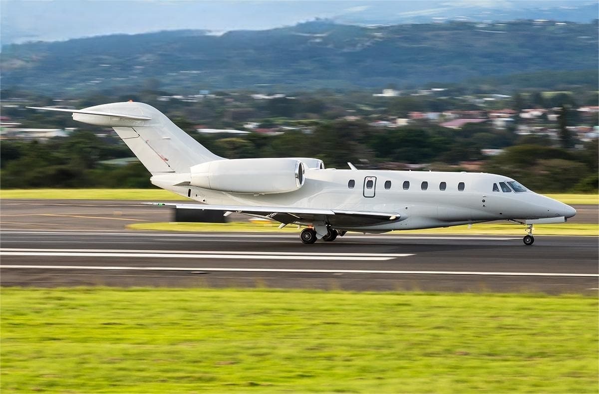 Tue, Nov 3TodayScottsdaleKSDL · Scottsdale AirportAtlantic CityKACY · Atlantic City International AirportCitation X8—On request3NovScottsdale → Atlantic CityKSDL → KACY · TodayCitation X · 8 seatsOn request
- Mon, Nov 909:32Belmar/FarmingdaleKBLM · Monmouth Executive AirportAtlantic CityKACY · Atlantic City International AirportGulfstream GIV14—$8,1409NovBelmar/Farmingdale → Atlantic CityKBLM → KACY · 09:32Gulfstream GIV · 14 seats$8,140
- Sat, Nov 28in 25 daysFarmingdaleKFRG · Republic AirportAtlantic CityKACY · Atlantic City International AirportCessna CitationJet5—$4,95028NovFarmingdale → Atlantic CityKFRG → KACY · in 25 daysCessna CitationJet · 5 seats$4,950
- Sat, Nov 2814:00KenoshaKENW · Kenosha RegionalAtlantic CityKACY · Atlantic City IntlBombardier Learjet 458—On request28NovKenosha → Atlantic CityKENW → KACY · 14:00Bombardier Learjet 45 · 8 seatsOn request
 Sat, Nov 28in 25 daysKenoshaKENW · Kenosha Regional AirportAtlantic CityKACY · Atlantic City International AirportLear 458—On request28NovKenosha → Atlantic CityKENW → KACY · in 25 daysLear 45 · 8 seatsOn request
- Sat, Nov 28in 25 daysKenoshaKENW · Kenosha Regional AirportAtlantic CityKACY · Atlantic City International AirportLearjet Lear 458—On request28NovKenosha → Atlantic CityKENW → KACY · in 25 daysLearjet Lear 45 · 8 seatsOn request
- Sun, Nov 29in 26 daysPhiladelphiaKMPE · Philadelphia Municipal AirportAtlantic CityKACY · Atlantic City International AirportCessna Citation XLS8—$13,97029NovPhiladelphia → Atlantic CityKMPE → KACY · in 26 daysCessna Citation XLS · 8 seats$13,970
- Sun, Nov 29in 26 daysPhiladelphiaKPHL · Philadelphia International AirportAtlantic CityKACY · Atlantic City International AirportCessna Citation XLS8—$13,97029NovPhiladelphia → Atlantic CityKPHL → KACY · in 26 daysCessna Citation XLS · 8 seats$13,970
 Sat, Dec 2622:20TeterboroKTEB · Teterboro AirportAtlantic CityKACY · Atlantic City International AirportGulfstream IV15—$10,36626DecTeterboro → Atlantic CityKTEB → KACY · 22:20Gulfstream IV · 15 seats$10,366
* Total price incl. 10% service fee, converted to your selected currency. Price subject to operator confirmation.
Map: Atlantic City Airport
View the location of Atlantic City – ACY/KACY. Zoom in to explore the area around the airport.
About the airport
Atlantic City International Airport (ACY/KACY) is the key private jet gateway for Atlantic City. PrivJet gives you instant access to charter flights and empty legs: fast, discreet and globally connected.
KACY airport FAQ
Are there any restrictions at Atlantic City airport (KACY) today?
There are currently 13 valid NOTAMs for Atlantic City (KACY). Affected: PAPI: unserviceable; Obstacle: out of service; Terminal area surveillance radar: unserviceable; ILS: unserviceable and 2 more. 10 more NOTAMs start in the coming days. For information only, not for flight planning or operational use. Always rely on an official pre-flight briefing. This list may be incomplete or out of date.
What is the weather at Atlantic City airport (KACY)?
According to the latest weather report for KACY (METAR, 03 Nov, 10:02 UTC): Poor visibility, instrument conditions (IFR). Wind Calm, visibility 3 km, temperature 4 °C (dew point 4 °C). Mist. For information only, not for flight planning. Weather can change quickly; always rely on official reports.
How long are the runways at Atlantic City airport (KACY)?
Atlantic City (KACY) has 2 runways: runway 13/31 with 3,048 m (10,001 ft), asphalt and runway 04/22 with 1,873 m (6,145 ft), asphalt/concrete. The longest is 3,048 m.
What are the radio frequencies at Atlantic City airport (KACY)?
Frequencies at KACY: Tower 120.3 MHz, Ground 121.9 MHz and ATIS 108.6 MHz. For information only. Always rely on the published AIP.
What are the airport codes of Atlantic City International Airport?
The ICAO code is KACY and the IATA code is ACY. ICAO codes are used by air traffic control and pilots, e.g. in flight plans; IATA codes appear on tickets and baggage tags.
What is the elevation of KACY airport?
Atlantic City International Airport sits at 75 ft (23 m) above sea level. Local time zone: America/New York.
Can I fly to KACY by private jet?
Whether a private jet can operate into Atlantic City International Airport depends on runway length, opening hours, customs and immigration rules as well as slot and handling availability, among other things. PrivJet checks this with the operating carrier for every request.
Are there empty legs from or to KACY?
There are currently 19 empty legs departing from and 9 arriving at Atlantic City International Airport. Empty legs are repositioning flights at heavily reduced prices; the list is updated several times a day.