Fort Worth Alliance Airport (KAFW / AFW)
Empty legs and charters from Fort Worth
KAFW airport at a glance
- ICAO code
- KAFW
- IATA code
- AFW
- City
- Fort Worth
- Region
- Texas
- Country
- United States
- Elevation
- 722 ft (220 m)
- Time zone
- America/Chicago (UTC-6)
- Coordinates
- 32.9876° N, 97.3188° W
- Empty legs from
- 14
- Empty legs to
- 13
Weather & airport info KAFW
Current weather
No current weather report is available for this airport.
Airport
- Elevation
- 722 ft (220 m)
- Sunrise / Sunset
- 06:48 / 17:36 local time
Runways
| Runway | Length | Surface | Lighted |
|---|---|---|---|
| 16R/34L | 3,391 m (11,125 ft) | concrete | yes |
| 16L/34R | 3,353 m (11,000 ft) | concrete | yes |
Radio frequencies
- ATIS: 126.925
- Clearance: 128.725
- Ground: 132.65
- Tower: 120.825
For information only, not for flight planning. Weather can change quickly; always rely on official reports. Sources: aviationweather.gov (NOAA), OurAirports.
Airport map KAFW
Full screen →Runways white, taxiways yellow with designators, closed taxiways and runways per NOTAM in red.
Official charts (FAA)
Cycle 2611, valid until 0901Z 11/26/26
Airport diagram (FAA)
Airport diagram (1)
Instrument approaches (6)
Departure procedures (18)
- BOTCH TWO (RNAV)
- BOTCH TWO (RNAV), CONT.1
- DALLAS FOUR
- DALLAS FOUR, CONT.1
- GARLAND SIX
- GARLAND SIX, CONT.1
- JOE POOL EIGHT
- JOE POOL EIGHT, CONT.1
- KINGDOM FIVE
- KINGDOM FIVE, CONT.1
- KUSSO THREE (RNAV)
- KUSSO THREE (RNAV), CONT.1
- NANDR FOUR (RNAV)
- NANDR FOUR (RNAV), CONT.1
- TEXOMA FIVE
- TEXOMA FIVE, CONT.1
- WORTH ONE
- WORTH ONE, CONT.1
Minimums (2)
For information only, not for navigation. Always use current official charts and NOTAMs.
Current NOTAMs for KAFW(10)
NOTAMs (Notices to Air Missions) announce short-term changes at an airport: closed runways or taxiways, unserviceable approach aids, obstacles, airspace restrictions.
- Out of serviceStandard instrument departure: changed4974/26· from 04 Nov, 13:00 UTC · until 04 Nov, 18:30 UTC
Standard departure (SID) PEROT FLD/FORT WORTH ALLIANCE, FORT WORTH, TX. TEXOMA FIVE DEPARTURE... OKMULGEE TRANSITION not available except for aircraft equipped with SUITABLE RNAV (area navigation) SYSTEM with GPS, OKM VOR/DME out of service. 4 Nov 13:00 UTC -2611041830EST
Show original text
SID PEROT FLD/FORT WORTH ALLIANCE, FORT WORTH, TX. TEXOMA FIVE DEPARTURE... OKMULGEE TRANSITION NA EXCEPT FOR ACFT EQUIPPED WITH SUITABLE RNAV SYSTEM WITH GPS, OKM VOR/DME OUT OF SERVICE. 2611041300-2611041830EST
Q) KZFW/QPDCH/I/NBO/A/000/999/3259N09719W005
A) KAFW
B) 2402071701
C) 2409181701EST
E) AFW PEROT FLD/FORT WORTH ALLIANCE, FORT WORTH, TX.
TEXOMA FIVE DEPARTURE...
OKMULGEE TRANSITION NA EXCEPT FOR ACFT EQUIPPED WITH SUITABLE RNAV SYSTEM WITH GPS,
OKM VOR/DME U/S.
- Out of serviceStandard instrument departure: changedA1460/26· from 04 Nov, 13:00 UTC · until 04 Nov, 18:30 UTC
Standard departure (SID) PEROT FLD/FORT WORTH ALLIANCE, FORT WORTH, TX. TEXOMA FIVE DEPARTURE... OKMULGEE TRANSITION not available except for aircraft equipped with SUITABLE RNAV (area navigation) SYSTEM with GPS, OKM VOR/DME out of service.
Show original text
SID PEROT FLD/FORT WORTH ALLIANCE, FORT WORTH, TX. TEXOMA FIVE DEPARTURE... OKMULGEE TRANSITION NA EXCEPT FOR ACFT EQUIPPED WITH SUITABLE RNAV SYSTEM WITH GPS, OKM VOR/DME OUT OF SERVICE.
A1460/26 NOTAMN
Q) KZFW/QPDCH/I/NBO/A/000/999/3259N09719W005
A) KAFW
B) 2611041300
C) 2611041830
E) SID PEROT FLD/FORT WORTH ALLIANCE, FORT WORTH, TX. TEXOMA FIVE DEPARTURE... OKMULGEE TRANSITION NA EXCEPT FOR ACFT EQUIPPED WITH SUITABLE RNAV SYSTEM WITH GPS, OKM VOR/DME OUT OF SERVICE.
- Out of serviceILS: unserviceableA1458/26· until 03 Nov, 20:00 UTC
The Instrument Landing System (ILS) for runway 16L is out of service. The ILS guides aircraft to the runway in poor visibility.
Show original text
AFW NAV ILS RWY 16L U/S
A1458/26 NOTAMN
Q) KZFW/QICAS////000/999/3259N09719W005
A) KAFW
B) 2611031500
C) 2611032000
E) AFW NAV ILS RWY 16L U/S
- Out of serviceILS: unserviceableA1459/26· until 03 Nov, 20:00 UTC
The Instrument Landing System (ILS) for runway 34R is out of service. The ILS guides aircraft to the runway in poor visibility.
Show original text
AFW NAV ILS RWY 34R U/S
A1459/26 NOTAMN
Q) KZFW/QICAS////000/999/3259N09719W005
A) KAFW
B) 2611031500
C) 2611032000
E) AFW NAV ILS RWY 34R U/S
- NoticeAirspace10/035· from 05 Nov, 19:00 UTC · until 05 Nov, 23:00 UTC (estimated)
Flight check aircraft operations are taking place within an area defined as a 5 nautical mile radius of the airport. The height ranges from the surface to 3500 ft above ground.
Show original text
AIRSPACE FLTCK ACFT OPS WI AN AREA DEFINED AS 5NM RADIUS OF AFW SFC-3500FT AGL ACFT CS FLC78
- NoticeInstrument approach procedure306/26· until 15 May, 15:21 UTC (estimated)
For the instrument approach procedure (IAP) RNAV (GPS) runway 16L, amendment 2, there are temporary cranes up to 934 feet above mean sea level, beginning 4549 feet east of runway 16L. If the approach lighting system (ALS) is inoperative, visibility requirements increase.
Show original text
IAP PEROT FLD/FORT WORTH ALLIANCE, FORT WORTH, TX. RNAV (GPS) RWY 16L, AMDT 2... LNAV/VNAV DA 1145/HAT 422 ALL CATS. VIS RVR 4000 ALL CATS. FOR INOP ALS, INCREASE LPV CAT E VISIBILITY TO RVR 4000, LNAV/VNAV ALL CATS VISIBILITY TO 1 1/4 SM AND LNAV CAT E VISIBILITY TO RVR 6000. TEMPORARY CRANES, UP TO 934 MSL, BEGINNING 4549FT EAST OF RWY 16L (2026-ASW-10349/10402/10403/10434/10435-OE). 2610200400-2705151521EST
Q) KZFW/QPIXX/I/NBO/A/000/999/3259N09719W005
A) KAFW
B) 2610161723
C) 2705281719EST
E) AFW PEROT FLD/FORT WORTH ALLIANCE, FORT WORTH, TX.
RNAV (GPS) RWY 16L, AMDT 2...
LNAV/VNAV DA 1145/HAT 422 ALL CATS. VIS RVR 4000 ALL CATS.
FOR INOP ALS, INCREASE LPV CAT E VISIBILITY TO RVR 4000, LNAV/VNAV ALL CATS VISIBILITY TO 1 1/4 SM AND LNAV CAT E VISIBILITY TO RVR 6000.
TEMPORARY CRANES, UP TO 934 MSL, BEGINNING 4549FT EAST OF RWY 16L (2026-ASW-10349/10402/10403/10434/10435-OE).
- NoticeInstrument approach procedure307/26· until 15 May, 15:21 UTC (estimated)
For the instrument approach procedure (IAP) RNAV (GPS) runway 16R, amendment 1B, there are temporary cranes up to 934 feet above mean sea level, beginning 5110 feet east of runway 16R.
Show original text
IAP PEROT FLD/FORT WORTH ALLIANCE, FORT WORTH, TX. RNAV (GPS) RWY 16R, AMDT 1B... LNAV/VNAV DA 1145/HAT 424 ALL CATS. VIS 1 1/4 ALL CATS. TEMPORARY CRANES, UP TO 934 MSL, BEGINNING 5110FT EAST OF RWY 16R (2026-ASW-10349/10402/10403/10434/10435-OE). 2610200400-2705151521EST
Q) KZFW/QPIXX/I/NBO/A/000/999/3259N09719W005
A) KAFW
B) 2610161725
C) 2705281723EST
E) AFW PEROT FLD/FORT WORTH ALLIANCE, FORT WORTH, TX.
RNAV (GPS) RWY 16R, AMDT 1B...
LNAV/VNAV DA 1145/HAT 424 ALL CATS. VIS 1 1/4 ALL CATS.
TEMPORARY CRANES, UP TO 934 MSL, BEGINNING 5110FT EAST OF RWY 16R (2026-ASW-10349/10402/10403/10434/10435-OE).
- NoticeInstrument approach procedure: changedA1392/26· until 15 May, 15:21 UTC
For the instrument approach procedure (IAP) RNAV (GPS) runway 16L, amendment 2, there are temporary cranes up to 934 feet above mean sea level, beginning 4549 feet east of runway 16L. If the approach lighting system (ALS) is inoperative, visibility requirements increase.
Show original text
IAP PEROT FLD/FORT WORTH ALLIANCE, FORT WORTH, TX. RNAV (GPS) RWY 16L, AMDT 2... LNAV/VNAV DA 1145/HAT 422 ALL CATS. VIS RVR 4000 ALL CATS. FOR INOP ALS, INCREASE LPV CAT E VISIBILITY TO RVR 4000, LNAV/VNAV ALL CATS VISIBILITY TO 1 1/4 SM AND LNAV CAT E VISIBILITY TO RVR 6000. TEMPORARY CRANES, UP TO 934 MSL, BEGINNING 4549FT EAST OF RWY 16L (2026-ASW-10349/10402/10403/10434/10435-OE).
A1392/26 NOTAMN
Q) KZFW/QPICH/I/NBO/A/000/999/3259N09719W005
A) KAFW
B) 2610200400
C) 2705151521
E) IAP PEROT FLD/FORT WORTH ALLIANCE, FORT WORTH, TX. RNAV (GPS) RWY 16L, AMDT 2... LNAV/VNAV DA 1145/HAT 422 ALL CATS. VIS RVR 4000 ALL CATS. FOR INOP ALS, INCREASE LPV CAT E VISIBILITY TO RVR 4000, LNAV/VNAV ALL CATS VISIBILITY TO 1 1/4 SM AND LNAV CAT E VISIBILITY TO RVR 6000. TEMPORARY CRANES, UP TO 934 MSL, BEGINNING 4549FT EAST OF RWY 16L (2026-ASW-10349/10402/10403/10434/10435-OE).
2 more NOTAMs
- NoticeInstrument approach procedure: changedA1393/26· until 15 May, 15:21 UTC
For the instrument approach procedure (IAP) RNAV (GPS) runway 16R, amendment 1B, there are temporary cranes up to 934 feet above mean sea level, beginning 5110 feet east of runway 16R.
Show original text
IAP PEROT FLD/FORT WORTH ALLIANCE, FORT WORTH, TX. RNAV (GPS) RWY 16R, AMDT 1B... LNAV/VNAV DA 1145/HAT 424 ALL CATS. VIS 1 1/4 ALL CATS. TEMPORARY CRANES, UP TO 934 MSL, BEGINNING 5110FT EAST OF RWY 16R (2026-ASW-10349/10402/10403/10434/10435-OE).
A1393/26 NOTAMN
Q) KZFW/QPICH/I/NBO/A/000/999/3259N09719W005
A) KAFW
B) 2610200400
C) 2705151521
E) IAP PEROT FLD/FORT WORTH ALLIANCE, FORT WORTH, TX. RNAV (GPS) RWY 16R, AMDT 1B... LNAV/VNAV DA 1145/HAT 424 ALL CATS. VIS 1 1/4 ALL CATS. TEMPORARY CRANES, UP TO 934 MSL, BEGINNING 5110FT EAST OF RWY 16R (2026-ASW-10349/10402/10403/10434/10435-OE).
- NoticeTaxiwayA1341/26· until 31 Dec, 23:00 UTC
Taxiway H between taxiway H1 and taxiway H2 is a non-movement area, meaning aircraft are not permitted to taxi there without clearance.
Show original text
TWY H BTN TWY H1 AND TWY H2 NONMOVEMENT AREA
A1341/26 NOTAMN
Q) KZFW/QMXXX////000/999/3259N09719W005
A) KAFW
B) 2609261920
C) 2612312300
E) TWY H BTN TWY H1 AND TWY H2 NONMOVEMENT AREA
For information only, not for flight planning or operational use. Always rely on an official pre-flight briefing. This list may be incomplete or out of date. Explanations and expanded abbreviations are generated automatically. The original text is authoritative. Source: FAA NOTAM Management Service (SWIM).
Private jet traffic in Fort Worth Alliance Airport (last 30 days)
- Arrivals
- 465
- Departures
- 344
- Different jets
- 276
Most frequent origins: Dallas Love Field (14), Austin Bergstrom International Airport (13), Addison Airport (12), Will Rogers World Airport (9), William P Hobby Airport (8).
Most frequent destinations: Dallas Love Field (10), Will Rogers World Airport (10), Addison Airport (8), Austin Bergstrom International Airport (7), Phoenix Sky Harbor International Airport (6).
Most common aircraft types: Beechcraft King Air 90 (82), Embraer Phenom 300 (70), Bombardier Challenger 300 (40), Gulfstream G550/GV (38), Gulfstream G500 (37).
Thursday is the busiest day.
Our own analysis of public ADS-B signals from business jets. Not every flight is received, and jets with a removal request are excluded.
Charter operators based here
Operators with a base at this airport.
- Solairus AviationVan Nuys (KVNY) · Turboprop, Light jet, Midsize jet
- Executive Jet ManagementWhite Plains (Westchester County) (KHPN) · Light jet, Midsize jet, Super midsize jet
Empty legs from KAFW
14 departures available
- Wed, Nov 1113:45Fort WorthKAFW · Perot Field/Fort Worth Alliance AirportLas VegasKLAS · Harry Reid International AirportBombardier Learjet 607—$18,04011NovFort Worth → Las VegasKAFW → KLAS · 13:45Bombardier Learjet 60 · 7 seats$18,040
 Wed, Nov 11in 8 daysFort WorthKAFW · Fort Worth Alliance AirportLas VegasKLAS · Harry Reid International AirportLear 607—On request11NovFort Worth → Las VegasKAFW → KLAS · in 8 daysLear 60 · 7 seatsOn request
- Wed, Nov 11in 8 daysFort WorthKAFW · Fort Worth Alliance AirportLas VegasKLAS · Harry Reid International AirportLearjet Lear 607—$14,42411NovFort Worth → Las VegasKAFW → KLAS · in 8 daysLearjet Lear 60 · 7 seats$14,424
 Sat, Nov 14in 11 daysFort WorthKAFW · Fort Worth Alliance AirportSan AntonioKSAT · San Antonio International AirportCitation VI9—On request14NovFort Worth → San AntonioKAFW → KSAT · in 11 daysCitation VI · 9 seatsOn request
 Sat, Nov 1403:45Fort WorthKAFW · Perot Field/Fort Worth Alliance AirportLas VegasKLAS · Harry Reid International AirportBombardier Learjet 607—$19,96414NovFort Worth → Las VegasKAFW → KLAS · 03:45Bombardier Learjet 60 · 7 seats$19,964
- Sat, Nov 14in 11 daysFort WorthKAFW · Fort Worth Alliance AirportSan AntonioKSAT · San Antonio International AirportCessna Citation VII8—On request14NovFort Worth → San AntonioKAFW → KSAT · in 11 daysCessna Citation VII · 8 seatsOn request
- Sun, Nov 1514:45Fort WorthKAFW · Perot Field/Fort Worth Alliance AirportSan AntonioKSAT · San Antonio International AirportCessna Citation VI7—$9,46015NovFort Worth → San AntonioKAFW → KSAT · 14:45Cessna Citation VI · 7 seats$9,460
 Sun, Nov 15in 12 daysFort WorthKAFW · Fort Worth Alliance AirportSan AntonioKSAT · San Antonio International AirportCitation VI8—On request15NovFort Worth → San AntonioKAFW → KSAT · in 12 daysCitation VI · 8 seatsOn request
- Mon, Nov 16in 13 daysFort WorthKAFW · Fort Worth AllianceVan NuysKVNYMidsize Jet6—On request16NovFort Worth → Van NuysKAFW → KVNY · in 13 daysMidsize Jet · 6 seatsOn request
 KAFW · Perot Field/Fort Worth Alliance Airport
* Total price incl. 10% service fee, converted to your selected currency. Price subject to operator confirmation.
Empty legs to KAFW
13 arrivals available
- Thu, Nov 5in 2 daysPittsburghKPIT · Pittsburgh International AirportFort WorthKAFW · Fort Worth Alliance AirportBeechcraft Hawker 900XP73hOn request5NovPittsburgh → Fort WorthKPIT → KAFW · in 2 daysBeechcraft Hawker 900XP · 7 seats · 3hOn request
- Wed, Nov 11in 8 daysSan AntonioKSAT · San Antonio International AirportFort WorthKAFW · Fort Worth Alliance AirportCitation VI9—On request11NovSan Antonio → Fort WorthKSAT → KAFW · in 8 daysCitation VI · 9 seatsOn request
- Wed, Nov 11in 8 daysSan AntonioKSAT · San Antonio International AirportFort WorthKAFW · Fort Worth Alliance AirportCessna Citation VII8—On request11NovSan Antonio → Fort WorthKSAT → KAFW · in 8 daysCessna Citation VII · 8 seatsOn request
- Thu, Nov 1214:00San AntonioKSAT · San Antonio International AirportFort WorthKAFW · Perot Field/Fort Worth Alliance AirportCessna Citation VI7—$11,66012NovSan Antonio → Fort WorthKSAT → KAFW · 14:00Cessna Citation VI · 7 seats$11,660
- Thu, Nov 12in 9 daysChicagoKIGQ · Lansing MuniFort WorthKAFW · Fort Worth AllianceMidsize Jet6—On request12NovChicago → Fort WorthKIGQ → KAFW · in 9 daysMidsize Jet · 6 seatsOn request
- Thu, Nov 12in 9 daysEl PasoKBIF · BIGGS AAFFort WorthKAFW · Fort Worth AllianceMidsize Jet6—On request12NovEl Paso → Fort WorthKBIF → KAFW · in 9 daysMidsize Jet · 6 seatsOn request
- Thu, Nov 12in 9 daysSan AntonioKSAT · San Antonio International AirportFort WorthKAFW · Fort Worth Alliance AirportCitation VI8—On request12NovSan Antonio → Fort WorthKSAT → KAFW · in 9 daysCitation VI · 8 seatsOn request
 Sat, Nov 1417:00San AntonioKSAT · San Antonio International AirportFort WorthKAFW · Perot Field/Fort Worth Alliance AirportCessna Citation VI8—$6,07114NovSan Antonio → Fort WorthKSAT → KAFW · 17:00Cessna Citation VI · 8 seats$6,071
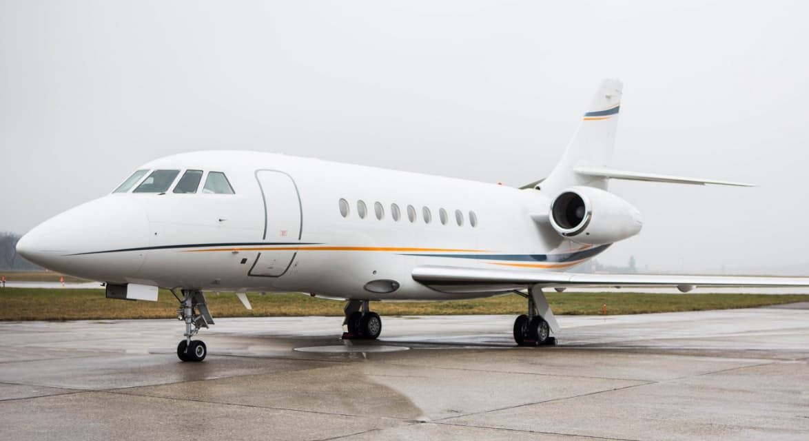 Sun, Nov 15in 12 daysAguascalientesMMAS · Jesus Teran International AirportFort WorthKAFW · Fort Worth Alliance AirportFalcon 2000EX EASy8—On request15NovAguascalientes → Fort WorthMMAS → KAFW · in 12 daysFalcon 2000EX EASy · 8 seatsOn request
 MMAS · Jesus Teran International Airport
* Total price incl. 10% service fee, converted to your selected currency. Price subject to operator confirmation.
Map: Fort Worth Airport
View the location of Fort Worth – AFW/KAFW. Zoom in to explore the area around the airport.
About the airport
Fort Worth Alliance Airport (AFW/KAFW) is the key private jet gateway for Fort Worth. PrivJet gives you instant access to charter flights and empty legs: fast, discreet and globally connected.
KAFW airport FAQ
Are there any restrictions at Fort Worth airport (KAFW) today?
There are currently 7 valid NOTAMs for Fort Worth (KAFW). Affected: ILS: unserviceable. 3 more NOTAMs start in the coming days. For information only, not for flight planning or operational use. Always rely on an official pre-flight briefing. This list may be incomplete or out of date.
How long are the runways at Fort Worth airport (KAFW)?
Fort Worth (KAFW) has 2 runways: runway 16R/34L with 3,391 m (11,125 ft), concrete and runway 16L/34R with 3,353 m (11,000 ft), concrete. The longest is 3,391 m.
What are the radio frequencies at Fort Worth airport (KAFW)?
Frequencies at KAFW: Tower 120.825 MHz, Ground 132.65 MHz and ATIS 126.925 MHz. For information only. Always rely on the published AIP.
What are the airport codes of Fort Worth Alliance Airport?
The ICAO code is KAFW and the IATA code is AFW. ICAO codes are used by air traffic control and pilots, e.g. in flight plans; IATA codes appear on tickets and baggage tags.
What is the elevation of KAFW airport?
Fort Worth Alliance Airport sits at 722 ft (220 m) above sea level. Local time zone: America/Chicago.
Can I fly to KAFW by private jet?
Whether a private jet can operate into Fort Worth Alliance Airport depends on runway length, opening hours, customs and immigration rules as well as slot and handling availability, among other things. PrivJet checks this with the operating carrier for every request.
Are there empty legs from or to KAFW?
There are currently 14 empty legs departing from and 13 arriving at Fort Worth Alliance Airport. Empty legs are repositioning flights at heavily reduced prices; the list is updated several times a day.