Pittsburgh Allegheny County Airport (KAGC / AGC)
Empty legs and charters from Pittsburgh
KAGC airport at a glance
- ICAO code
- KAGC
- IATA code
- AGC
- City
- Pittsburgh
- Region
- Pennsylvania
- Country
- United States
- Elevation
- 1,252 ft (382 m)
- Time zone
- America/New York (UTC-5)
- Coordinates
- 40.3544° N, 79.9302° W
- Empty legs from
- 13
- Empty legs to
- 11
Weather & airport info KAGC
Current weather
Good visual conditions (VFR)observed 03 Nov, 20:53 UTC- Wind
- 6 kt (11 km/h) from south (170°)
- Visibility
- 10 km or more
- Clouds
- no significant clouds
- Temperature
- 23 °C (dew point 11 °C)
- Pressure (QNH)
- 1,020 hPa
Original weather report (METAR)
METAR KAGC 032053Z 17006KT 10SM CLR 23/11 A3012 RMK AO2 SLP201 T02330111 56018
Forecast (TAF)
- 03 Nov, 18:00–16:00 UTC7 kt (13 km/h) from south-southwest (200°) · visibility 10 km or more · scattered clouds at 25,000 ft
- 04 Nov, 16:00–18:00 UTCfrom9 kt (17 km/h) from south (180°) · visibility 10 km or more · broken clouds at 15,000 ft
Original forecast (TAF)
TAF KAGC 031720Z 0318/0418 20007KT P6SM SCT250 FM041600 18009KT P6SM BKN150
Airport
- Elevation
- 1,252 ft (382 m)
- Sunrise / Sunset
- 06:51 / 17:14 local time
Runways
| Runway | Length | Surface | Lighted |
|---|---|---|---|
| 10/28 | 1,982 m (6,501 ft) | concrete | yes |
| 13/31 | 1,166 m (3,825 ft) | concrete | yes |
| H1/H1 | 14 m (47 ft) | concrete | no |
Radio frequencies
- ATIS: 120.55
- Ground: 121.7
- Tower: 121.1
- UNICOM: 122.95
For information only, not for flight planning. Weather can change quickly; always rely on official reports. Sources: aviationweather.gov (NOAA), OurAirports.
Airport map KAGC
Full screen →Runways white, taxiways yellow with designators, closed taxiways and runways per NOTAM in red.
Official charts (FAA)
Cycle 2611, valid until 0901Z 11/26/26
Airport diagram (FAA)
Airport diagram (1)
Instrument approaches (4)
Departure procedures (1)
Minimums (2)
Hot spots (1)
LAHSO (1)
For information only, not for navigation. Always use current official charts and NOTAMs.
Current NOTAMs for KAGC(17)
NOTAMs (Notices to Air Missions) announce short-term changes at an airport: closed runways or taxiways, unserviceable approach aids, obstacles, airspace restrictions.
- ClosedRunway: closedA2403/26· from 08 Nov, 01:00 UTC · until 08 Nov, 13:00 UTC
Runway 10/28 closed
Show original text
RWY 10/28 CLSD
A2403/26 NOTAMN
Q) KZOB/QMRLC////000/999/4021N07955W005
A) KAGC
B) 2611080100
C) 2611081300
E) RWY 10/28 CLSD
- ClosedRunway: closedA2404/26· from 08 Nov, 01:00 UTC · until 08 Nov, 13:00 UTC
Runway 13/31 closed
Show original text
RWY 13/31 CLSD
A2404/26 NOTAMN
Q) KZOB/QMRLC////000/999/4021N07955W005
A) KAGC
B) 2611080100
C) 2611081300
E) RWY 13/31 CLSD
- Out of serviceLanding direction indicator: unserviceableA2390/26· from 04 Nov, 13:00 UTC · until 04 Nov, 17:00 UTC
All Runway Visual Range (RVR) measurements at the airport are out of service. RVR measures the visibility on the runway.
Show original text
AD AP RVR ALL U/S
A2390/26 NOTAMN
Q) KZOB/QFTAS////000/999/4021N07955W005
A) KAGC
B) 2611041300
C) 2611041700
E) AD AP RVR ALL U/S
- Out of serviceObstacle10/110· until 27 Feb, 15:03 UTC
The lighting of a tower 7.4 nautical miles north-northwest of Allegheny County airport is out of service. The tower's top is 2046.9 feet above sea level, 846.8 feet above ground.
Show original text
OBST TOWER LGT (ASR 1032235) 402748.00N0800015.00W (7.4NM NNW AGC) 2046.9FT (846.8FT AGL) U/S
- Out of serviceInstrument approach procedure: operational3901/26· until 10 Jun, 23:55 UTC (estimated)
The Instrument Landing System (ILS) or Localizer (LOC) for runway 10 is out of service. The AGC VOR (VHF Omnidirectional Range) radio beacon is out of service, meaning radar or a suitable RNAV system with GPS is required for the approach.
Show original text
IAP ALLEGHENY COUNTY, PITTSBURGH, PA. ILS OR LOC RWY 10, AMDT 7A... MISSED APPROACH: CLIMB TO 2000 THEN CLIMBING RIGHT TURN TO 3000 ON HEADING 279 AND EWC VOR/DME R-187 TO HYETO INT AND HOLD. RADAR REQUIRED FOR PROCEDURE ENTRY EXCEPT FOR ACFT EQUIPPED WITH SUITABLE RNAV SYSTEM WITH GPS, AGC VOR OUT OF SERVICE. 2610292052-2706102355EST
Q) KZOB/QPIAO/I/NBO/A/000/999/4021N07955W005
A) KAGC
B) 2606291634
C) 2702081633EST
E) AGC ALLEGHENY COUNTY, PITTSBURGH, PA.
ILS OR LOC RWY 10, AMDT 7A...
MISSED APPROACH: CLIMB TO 2000 THEN CLIMBING RIGHT TURN TO 3000 ON HEADING 279 AND EWC VOR/DME R-187 TO HYETO INT AND HOLD.
RADAR REQUIRED FOR PROCEDURE ENTRY EXCEPT FOR ACFT EQUIPPED WITH SUITABLE RNAV SYSTEM WITH GPS,
AGC VOR U/S.
- Out of serviceInstrument approach procedure3906/26· until 10 Jun, 23:55 UTC (estimated)
For the instrument approach procedure (IAP) ILS OR LOC RWY 28, S-LOC 28 is not available unless the aircraft is equipped with a suitable RNAV system with GPS. Radar is required for the missed approach, as the AGC VOR is out of service.
Show original text
IAP ALLEGHENY COUNTY, PITTSBURGH, PA. ILS OR LOC RWY 28, AMDT 29E... S-LOC 28: NA EXCEPT FOR ACFT EQUIPPED WITH SUITABLE RNAV SYSTEM WITH GPS. MISSED APPROACH: CLIMB TO 3000 ON HEADING 280.90 FOR RADAR VECTORS (RADAR REQUIRED), AGC VOR OUT OF SERVICE. 2610292052-2706102355EST
Q) KZOB/QPIXX/I/NBO/A/000/999/4021N07955W005
A) KAGC
B) 2606291632
C) 2702081631EST
E) AGC ALLEGHENY COUNTY, PITTSBURGH, PA.
ILS OR LOC RWY 28, AMDT 29E...
S-LOC 28: NA EXCEPT FOR ACFT EQUIPPED WITH SUITABLE RNAV SYSTEM WITH GPS.
MISSED APPROACH: CLIMB TO 3000 ON HEADING 280.90 FOR RADAR VECTORS (RADAR REQUIRED),
AGC VOR U/S.
- Out of serviceInstrument approach procedure: changedA2397/26· until 10 Jun, 23:55 UTC
For the instrument approach procedure (IAP) ILS OR LOC RWY 28, S-LOC 28 is not available unless the aircraft is equipped with a suitable RNAV system with GPS. Radar is required for the missed approach, as the AGC VOR is out of service.
Show original text
IAP ALLEGHENY COUNTY, PITTSBURGH, PA. ILS OR LOC RWY 28, AMDT 29E... S-LOC 28: NA EXCEPT FOR ACFT EQUIPPED WITH SUITABLE RNAV SYSTEM WITH GPS. MISSED APPROACH: CLIMB TO 3000 ON HEADING 280.90 FOR RADAR VECTORS (RADAR REQUIRED), AGC VOR OUT OF SERVICE.
A2397/26 NOTAMN
Q) KZOB/QPICH/I/NBO/A/000/999/4021N07955W005
A) KAGC
B) 2610292052
C) 2706102355
E) IAP ALLEGHENY COUNTY, PITTSBURGH, PA. ILS OR LOC RWY 28, AMDT 29E... S-LOC 28: NA EXCEPT FOR ACFT EQUIPPED WITH SUITABLE RNAV SYSTEM WITH GPS. MISSED APPROACH: CLIMB TO 3000 ON HEADING 280.90 FOR RADAR VECTORS (RADAR REQUIRED), AGC VOR OUT OF SERVICE.
- Out of serviceInstrument approach procedure: changedA2398/26· until 10 Jun, 23:55 UTC
For the instrument approach procedure (IAP) ILS OR LOC RWY 10, radar is required for procedure entry, unless the aircraft is equipped with a suitable RNAV system with GPS, as the AGC VOR is out of service.
Show original text
IAP ALLEGHENY COUNTY, PITTSBURGH, PA. ILS OR LOC RWY 10, AMDT 7A... MISSED APPROACH: CLIMB TO 2000 THEN CLIMBING RIGHT TURN TO 3000 ON HEADING 279 AND EWC VOR/DME R-187 TO HYETO INT AND HOLD. RADAR REQUIRED FOR PROCEDURE ENTRY EXCEPT FOR ACFT EQUIPPED WITH SUITABLE RNAV SYSTEM WITH GPS, AGC VOR OUT OF SERVICE.
A2398/26 NOTAMN
Q) KZOB/QPICH/I/NBO/A/000/999/4021N07955W005
A) KAGC
B) 2610292052
C) 2706102355
E) IAP ALLEGHENY COUNTY, PITTSBURGH, PA. ILS OR LOC RWY 10, AMDT 7A... MISSED APPROACH: CLIMB TO 2000 THEN CLIMBING RIGHT TURN TO 3000 ON HEADING 279 AND EWC VOR/DME R-187 TO HYETO INT AND HOLD. RADAR REQUIRED FOR PROCEDURE ENTRY EXCEPT FOR ACFT EQUIPPED WITH SUITABLE RNAV SYSTEM WITH GPS, AGC VOR OUT OF SERVICE.
9 more NOTAMs
- Out of serviceVOR: unserviceableA2393/26· permanent
The VOR navigation system at Allegheny County Airport is out of service. VOR is a radio navigation system that helps aircraft determine their location.
Show original text
AGC NAV VOR U/S
A2393/26 NOTAMN
Q) KZOB/QNVAS////000/999/4021N07955W005
A) KAGC
B) 2610291857
C) PERM
E) AGC NAV VOR U/S
- Out of serviceObstacle lights: unserviceableA2379/26· until 11 Dec, 11:24 UTC
The lighting on a tower 3.5 nautical miles south of the airport is out of service. Its top is 1330 feet above sea level, 220 feet above ground.
Show original text
TOWER LGT (ASR 1026344) 401748.60N0795552.50W (3.5NM S AGC) 1330FT (220FT AGL) U/S
A2379/26 NOTAMN
Q) KZOB/QOLAS/IV/M/AE/000/999/4017N07955W001
A) KAGC
B) 2610270524
C) 2612111124
E) TOWER LGT (ASR 1026344) 401748.60N0795552.50W (3.5NM S AGC) 1330FT (220FT AGL) U/S
- Out of serviceObstacle lights: unserviceableA2378/26· until 11 Dec, 11:18 UTC
A tower light 9.9 nautical miles north of the airport is out of service. Its top is 1425 ft above sea level, 250 ft above ground.
Show original text
TOWER LGT (ASR 1034045) 403033.00N0800022.00W (9.9NM N AGC) 1425FT (250FT AGL) U/S
A2378/26 NOTAMN
Q) KZOB/QOLAS/IV/M/E/000/999/4030N08000W001
A) KAGC
B) 2610270518
C) 2612111118
E) TOWER LGT (ASR 1034045) 403033.00N0800022.00W (9.9NM N AGC) 1425FT (250FT AGL) U/S
- Out of serviceObstacle lights: unserviceableA2375/26· until 11 Dec, 00:06 UTC
The tower light (ASR 1049265) 4.2 nautical miles west of the airport is out of service. Its top is 1407 feet above sea level, 252 feet above ground.
Show original text
TOWER LGT (ASR 1049265) 402102.00N0800116.30W (4.2NM W AGC) 1407FT (252FT AGL) U/S
A2375/26 NOTAMN
Q) KZOB/QOLAS/IV/M/AE/000/999/4021N08001W001
A) KAGC
B) 2610261806
C) 2612110006
E) TOWER LGT (ASR 1049265) 402102.00N0800116.30W (4.2NM W AGC) 1407FT (252FT AGL) U/S
- Out of serviceObstacle10/030· until 10 Jan, 15:18 UTC
A tower obstacle light is out of service. The tower is located 9.4 nautical miles north-northwest of the airport. Its top is 1647.0 feet above sea level, 315.9 feet above ground.
Show original text
OBST TOWER LGT (ASR 1027464) 402939.20N0800112.30W (9.4NM NNW AGC) 1647.0FT (315.9FT AGL) U/S
- Out of serviceObstacle10/008· until 05 Nov, 23:00 UTC
An obstacle, the tower (ASR 1026131) 9.1 nautical miles north-northwest of the airport, is out of service; its top is 2048.9 ft above sea level, 730.0 ft above ground.
Show original text
OBST TOWER LGT (ASR 1026131) 402943.00N0800016.00W (9.1NM NNW AGC) 2048.9FT (730.0FT AGL) U/S
- Out of serviceObstacle09/131· until 26 Dec, 23:59 UTC
A tower obstacle light 5.4 nautical miles northeast of the airport is out of service; its top is 1439.69 feet above sea level, 162.69 feet above ground.
Show original text
OBST TOWER LGT (ASR UNKNOWN) 401222.55N0801254.84W (5.4NM NE AFJ) 1439.69FT (162.69FT AGL) U/S
- NoticeObstacle: erectedA2402/26· until 03 Nov, 22:00 UTC
Obstacle: crane (ASN unknown) (. 1386 NM southeast of approach END runway 10) 1316 ft above sea level (100 ft above ground) flagged
Show original text
OBST CRANE (ASN UNKNOWN) 402107N0795625W (.1386NM SE APCH END RWY 10) 1316FT (100FT AGL) FLAGGED
A2402/26 NOTAMN
Q) KZOB/QOBCE/IV/M/AE/000/999/4021N07955W005
A) KAGC
B) 2611031639
C) 2611032200
E) OBST CRANE (ASN UNKNOWN) 402107N0795625W (.1386NM SE APCH END RWY 10)
 1316FT (100FT AGL) FLAGGED
- NoticeObstacle10/116· until 31 Dec, 23:59 UTC
A watertower near the airport, 0.8 nautical miles north-northwest of the approach end of runway 28, is an obstacle. Its top is 1405 feet above sea level, 153 feet above ground, and it is not lighted.
Show original text
OBST WATERTOWER (ASN UNKNOWN) 402240N0795534W (0.8NM NNW APCH END RWY 28) 1405FT (153FT AGL) NOT LGTD
For information only, not for flight planning or operational use. Always rely on an official pre-flight briefing. This list may be incomplete or out of date. Explanations and expanded abbreviations are generated automatically. The original text is authoritative. Source: FAA NOTAM Management Service (SWIM).
Private jet traffic in Allegheny County Airport (last 30 days)
- Arrivals
- 481
- Departures
- 440
- Different jets
- 275
Most frequent origins: Teterboro Airport (34), Cincinnati Municipal Airport Lunken Field (32), Manassas Regional Harry P. Davis field (20), Greater Rochester International Airport (14), Washington Dulles International Airport (12).
Most frequent destinations: Teterboro Airport (34), Manassas Regional Harry P. Davis field (32), Reading Regional Carl A Spaatz Field (22), Piedmont Triad International Airport (17), Westchester County Airport (10).
Most common aircraft types: Pilatus PC-12 (207), Bombardier Challenger 350/3500 (90), Embraer Phenom 300 (60), Cessna Citation Excel/XLS (51), Cessna Citation Latitude (36).
Our own analysis of public ADS-B signals from business jets. Not every flight is received, and jets with a removal request are excluded.
Charter operators based here
Operators with a base at this airport.
- Executive Jet ManagementWhite Plains (Westchester County) (KHPN) · Light jet, Midsize jet, Super midsize jet
- Liberty Jet ManagementWhite Plains (Westchester County) (KHPN) · Super midsize jet, Heavy jet
- STAT MedEvacHelicopter
Empty legs from KAGC
13 departures available
 Wed, Nov 413:24PittsburghKAGC · Allegheny County AirportTeterboroKTEB · Teterboro AirportBombardier Challenger 605154m$6,6174NovPittsburgh → TeterboroKAGC → KTEB · 13:24Bombardier Challenger 605 · 1 seat · 54m$6,617
- Wed, Nov 415:01PittsburghKAGC · Allegheny County AirportWest Palm BeachKDJT · President Donald J. Trump International AirportBombardier Challenger 6059—$28,9884NovPittsburgh → West Palm BeachKAGC → KDJT · 15:01Bombardier Challenger 605 · 9 seats$28,988
 Wed, Nov 4TomorrowPittsburghKAGC · Allegheny County AirportWest Palm BeachKDJT · President Donald J. Trump International AirportChallenger 60510—$24,7724NovPittsburgh → West Palm BeachKAGC → KDJT · TomorrowChallenger 605 · 10 seats$24,772
- Wed, Nov 4TomorrowPittsburghKAGC · Allegheny County AirportTeterboroKTEB · Teterboro AirportChallenger 60510—$6,5664NovPittsburgh → TeterboroKAGC → KTEB · TomorrowChallenger 605 · 10 seats$6,566
- Thu, Nov 513:42PittsburghKAGC · Allegheny County AirportValparaisoKVPZ · Porter County RegionalBombardier Challenger 6059—$7,4175NovPittsburgh → ValparaisoKAGC → KVPZ · 13:42Bombardier Challenger 605 · 9 seats$7,417
- Tue, Nov 1718:27PittsburghKAGC · Allegheny County AirportHilton Head IslandKHXD · Hilton Head AirportCessna Citation CJ3+7—$15,07017NovPittsburgh → Hilton Head IslandKAGC → KHXD · 18:27Cessna Citation CJ3+ · 7 seats$15,070
- Tue, Nov 17in 14 daysPittsburghKAGC · Allegheny County AirportFort Collins/LovelandKFNL · Northern Colorado Regional AirportEpic E1000 AX54h 30mOn request17NovPittsburgh → Fort Collins/LovelandKAGC → KFNL · in 14 daysEpic E1000 AX · 5 seats · 4h 30mOn request
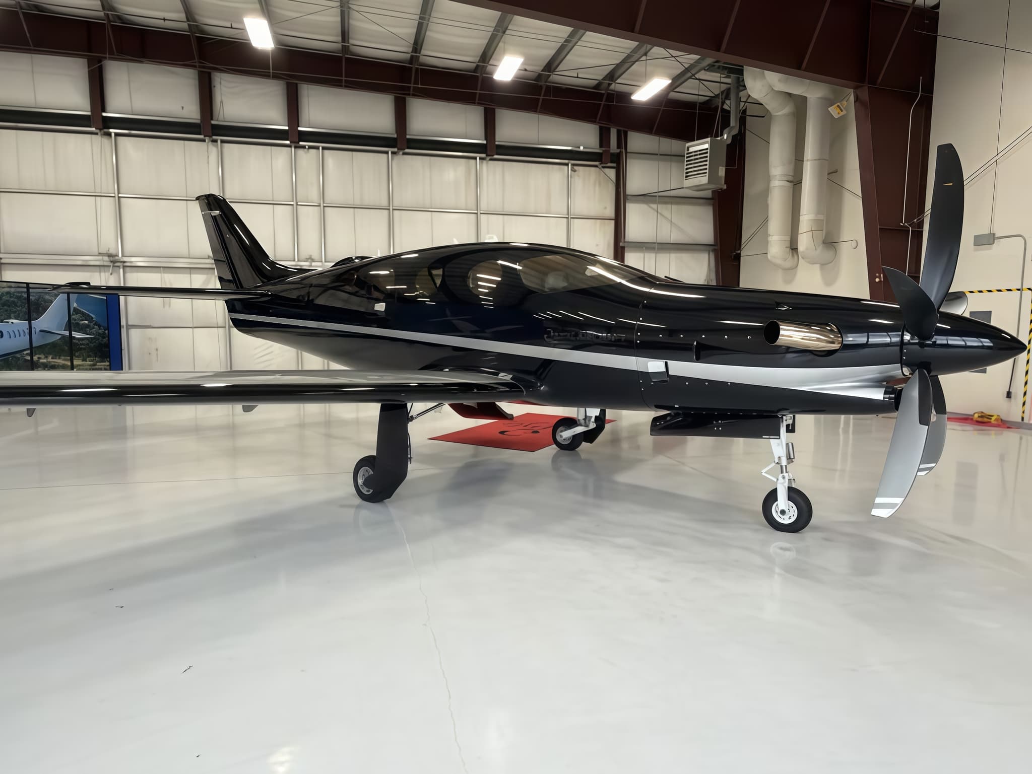 Wed, Nov 18in 15 daysPittsburghKAGC · Allegheny County AirportFort CollinsKFNL · Northern Colorado Regional AirportEpic E10005—$13,03518NovPittsburgh → Fort CollinsKAGC → KFNL · in 15 daysEpic E1000 · 5 seats$13,035
 Wed, Nov 25in 22 daysPittsburghKAGC · Allegheny County AirportNew YorkKTEB · Teterboro AirportGulfstream G2009—On request25NovPittsburgh → New YorkKAGC → KTEB · in 22 daysGulfstream G200 · 9 seatsOn request
 KAGC · Allegheny County Airport
* Total price incl. 10% service fee, converted to your selected currency. Price subject to operator confirmation.
Empty legs to KAGC
11 arrivals available
- Tue, Nov 3TodayVan NuysKVNY · Van Nuys AirportPittsburghKAGC · Allegheny County AirportBombardier Global Express124h 12mOn request3NovVan Nuys → PittsburghKVNY → KAGC · TodayBombardier Global Express · 12 seats · 4h 12mOn request
- Tue, Nov 3TodayAtlantaKPDK · DeKalb Peachtree AirportPittsburghKAGC · Allegheny County AirportCessna Citation Excel 560XLS9—On request3NovAtlanta → PittsburghKPDK → KAGC · TodayCessna Citation Excel 560XLS · 9 seatsOn request
 Thu, Nov 5in 2 daysAtlantaKPDK · DeKalb Peachtree AirportPittsburghKAGC · Allegheny County AirportCessna Citation XLS11h 24m$12,7055NovAtlanta → PittsburghKPDK → KAGC · in 2 daysCessna Citation XLS · 1 seat · 1h 24m$12,705
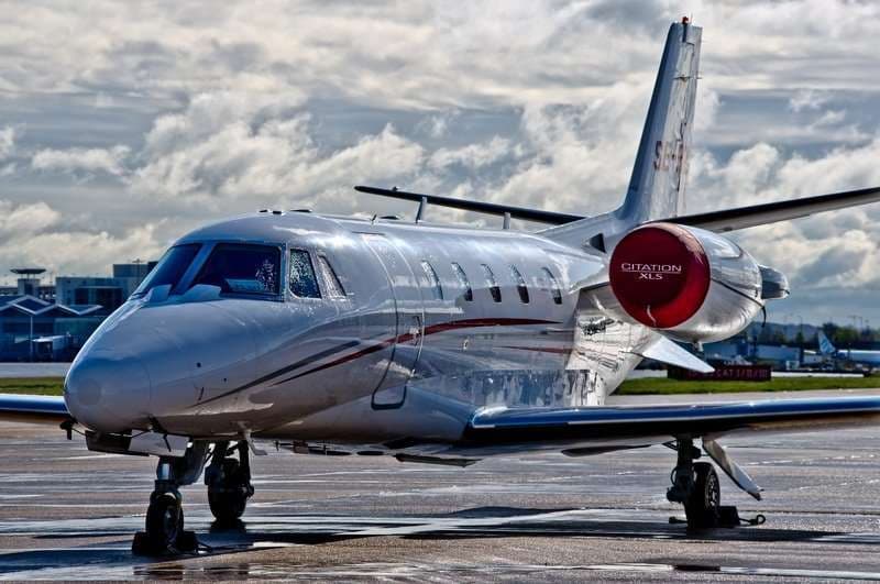 Thu, Nov 5in 2 daysAtlantaKPDK · DeKalb Peachtree AirportPittsburghKAGC · Allegheny County AirportCitation XLS8—$11,2415NovAtlanta → PittsburghKPDK → KAGC · in 2 daysCitation XLS · 8 seats$11,241
- Fri, Nov 13in 10 daysRifleKRIL · Garfield County Regional AirportPittsburghKAGC · Allegheny County AirportEpic E1000 AX53h 48mOn request13NovRifle → PittsburghKRIL → KAGC · in 10 daysEpic E1000 AX · 5 seats · 3h 48mOn request
- Mon, Nov 16in 13 daysRifleKRIL · Garfield County Regional AirportPittsburghKAGC · Allegheny County AirportEpic E10005—$10,83516NovRifle → PittsburghKRIL → KAGC · in 13 daysEpic E1000 · 5 seats$10,835
- Sat, Nov 21in 18 daysPunta GordaKPGD · Punta Gorda AirportPittsburghKAGC · Allegheny County AirportCessna Citation V82h 36mOn request21NovPunta Gorda → PittsburghKPGD → KAGC · in 18 daysCessna Citation V · 8 seats · 2h 36mOn request
- Tue, Nov 24in 21 daysSarasotaKSRQ · Sarasota Bradenton International AirportPittsburghKAGC · Allegheny County AirportGulfstream G2009—On request24NovSarasota → PittsburghKSRQ → KAGC · in 21 daysGulfstream G200 · 9 seatsOn request
 Tue, Nov 2400:54Punta GordaKPGD · Punta Gorda AirportPittsburghKAGC · Allegheny County AirportCessna Citation V7—$15,66124NovPunta Gorda → PittsburghKPGD → KAGC · 00:54Cessna Citation V · 7 seats$15,661
* Total price incl. 10% service fee, converted to your selected currency. Price subject to operator confirmation.
Map: Pittsburgh Airport
View the location of Pittsburgh – AGC/KAGC. Zoom in to explore the area around the airport.
About the airport
Allegheny County Airport (AGC/KAGC) is the key private jet gateway for Pittsburgh. PrivJet gives you instant access to charter flights and empty legs: fast, discreet and globally connected.
KAGC airport FAQ
Are there any restrictions at Pittsburgh airport (KAGC) today?
There are currently 14 valid NOTAMs for Pittsburgh (KAGC). Affected: Obstacle: out of service; Instrument approach procedure: operational; Instrument approach procedure; Instrument approach procedure: changed and 2 more. 3 more NOTAMs start in the coming days. For information only, not for flight planning or operational use. Always rely on an official pre-flight briefing. This list may be incomplete or out of date.
What is the weather at Pittsburgh airport (KAGC)?
According to the latest weather report for KAGC (METAR, 03 Nov, 20:53 UTC): Good visual conditions (VFR). Wind 6 kt (11 km/h) from south (170°), visibility 10 km or more, temperature 23 °C (dew point 11 °C). For information only, not for flight planning. Weather can change quickly; always rely on official reports.
How long are the runways at Pittsburgh airport (KAGC)?
Pittsburgh (KAGC) has 3 runways: runway 10/28 with 1,982 m (6,501 ft), concrete, runway 13/31 with 1,166 m (3,825 ft), concrete and runway H1/H1 with 14 m (47 ft), concrete. The longest is 1,982 m.
What are the radio frequencies at Pittsburgh airport (KAGC)?
Frequencies at KAGC: Tower 121.1 MHz, Ground 121.7 MHz and ATIS 120.55 MHz. For information only. Always rely on the published AIP.
What are the airport codes of Allegheny County Airport?
The ICAO code is KAGC and the IATA code is AGC. ICAO codes are used by air traffic control and pilots, e.g. in flight plans; IATA codes appear on tickets and baggage tags.
What is the elevation of KAGC airport?
Allegheny County Airport sits at 1,252 ft (382 m) above sea level. Local time zone: America/New York.
Can I fly to KAGC by private jet?
Whether a private jet can operate into Allegheny County Airport depends on runway length, opening hours, customs and immigration rules as well as slot and handling availability, among other things. PrivJet checks this with the operating carrier for every request.
Are there empty legs from or to KAGC?
There are currently 13 empty legs departing from and 11 arriving at Allegheny County Airport. Empty legs are repositioning flights at heavily reduced prices; the list is updated several times a day.