Albany Airport (KALB / ALB)
Empty legs and charters from Albany
KALB airport at a glance
- ICAO code
- KALB
- IATA code
- ALB
- City
- Albany
- Region
- New York
- Country
- United States
- Elevation
- 285 ft (87 m)
- Time zone
- America/New York (UTC-5)
- Coordinates
- 42.7483° N, 73.8017° W
- Empty legs from
- 8
- Empty legs to
- 11
Weather & airport info KALB
Current weather
Good visual conditions (VFR)observed 03 Nov, 06:51 UTC- Wind
- 9 kt (17 km/h) from south-southeast (160°)
- Visibility
- 10 km or more
- Clouds
- overcast at 13,000 ft
- Temperature
- 14 °C (dew point 4 °C)
- Pressure (QNH)
- 1,024 hPa
Original weather report (METAR)
METAR KALB 030651Z 16009KT 10SM OVC130 14/04 A3024 RMK AO2 SLP240 T01440044 $
Forecast (TAF)
- 03 Nov, 18:00–00:00 UTC9 kt (17 km/h) from south (170°) · visibility 10 km or more · broken clouds at 4,500 ft, overcast at 10,000 ft
- 04 Nov, 00:00–07:00 UTCfrom4 kt (7 km/h) from south (170°) · visibility 10 km or more · broken clouds at 10,000 ft
- 04 Nov, 07:00–14:00 UTCfrom3 kt (6 km/h) from south-southeast (160°) · visibility 10 km or more · few clouds at 10,000 ft, broken clouds at 20,000 ft
- 04 Nov, 14:00–18:00 UTCfrom9 kt (17 km/h) from south (170°) · visibility 10 km or more · scattered clouds at 25,000 ft
Original forecast (TAF)
TAF KALB 031720Z 0318/0418 17009KT P6SM BKN045 OVC100 FM040000 17004KT P6SM BKN100 FM040700 16003KT P6SM FEW100 BKN200 FM041400 17009KT P6SM SCT250
Airport
- Elevation
- 285 ft (87 m)
- Sunrise / Sunset
- 06:31 / 16:45 local time
Runways
| Runway | Length | Surface | Lighted |
|---|---|---|---|
| 01/19 | 2,591 m (8,500 ft) | asphalt | yes |
| 10/28 | 2,195 m (7,200 ft) | asphalt | yes |
Radio frequencies
- ATIS: 120.45
- Clearance: 127.5
- Ground: 121.7
- Tower: 119.5
- UNICOM: 122.95
For information only, not for flight planning. Weather can change quickly; always rely on official reports. Sources: aviationweather.gov (NOAA), OurAirports.
Airport map KALB
Full screen →Runways white, taxiways yellow with designators, closed taxiways and runways per NOTAM in red.
Official charts (FAA)
Cycle 2611, valid until 0901Z 11/26/26
Airport diagram (FAA)
Airport diagram (1)
Instrument approaches (9)
Departure procedures (2)
Minimums (2)
LAHSO (1)
For information only, not for navigation. Always use current official charts and NOTAMs.
Current NOTAMs for KALB(21)
NOTAMs (Notices to Air Missions) announce short-term changes at an airport: closed runways or taxiways, unserviceable approach aids, obstacles, airspace restrictions.
- Out of serviceLanding direction indicator: unserviceableA2934/26· from 05 Nov, 05:00 UTC · until 05 Nov, 11:00 UTC
All runway visual range (RVR) measurements at Albany International airport are out of service.
Show original text
AD AP RVR ALL U/S
A2934/26 NOTAMN
Q) KZBW/QFTAS////000/999/4244N07348W005
A) KALB
B) 2611050500
C) 2611051100
E) AD AP RVR ALL U/S
- Out of serviceILS: unserviceableA2956/26· until 03 Nov, 21:00 UTC
ALB navigation: ILS (instrument landing system) runway 01 out of service
Show original text
ALB NAV ILS RWY 01 U/S
A2956/26 NOTAMN
Q) KZBW/QICAS////000/999/4244N07348W005
A) KALB
B) 2611031819
C) 2611032100
E) ALB NAV ILS RWY 01 U/S
- Out of serviceILS: unserviceableA2955/26· until 03 Nov, 21:00 UTC
ALB navigation: ILS (instrument landing system) runway 19 out of service
Show original text
ALB NAV ILS RWY 19 U/S
A2955/26 NOTAMN
Q) KZBW/QICAS////000/999/4244N07348W005
A) KALB
B) 2611031818
C) 2611032100
E) ALB NAV ILS RWY 19 U/S
- Out of serviceTACANA2943/26· until 20 Nov, 23:59 UTC
The TACAN (Tactical Air Navigation) azimuth system at Albany airport is out of service. It helps aircraft determine their position and direction.
Show original text
ALB NAV TACAN AZM U/S
A2943/26 NOTAMN
Q) KZBW/QNNXX////000/999/4244N07348W005
A) KALB
B) 2611021126
C) 2611202359
E) ALB NAV TACAN AZM U/S
- Out of serviceAerodrome beacon: unserviceable10/047· until 07 Nov, 10:13 UTC
The airport beacon is out of service. This means the lights that mark the airport at night or in poor visibility are not working.
Show original text
AD AP ABN U/S
A2922/26 NOTAMN Q) KZBW/QLBAS////000/999/4244N07348W005 A) KALB B) 2610231013 C) 2611071013 E) AD AP ABN U/S
- Out of serviceObstacle10/033· until 26 Dec, 23:59 UTC
The lighting of a power line 6.2 nautical miles southeast of the airport is out of service. Its top is 441 ft above sea level, 207 ft above ground.
Show original text
OBST POWER LINE LGT (ASR UNKNOWN) 424052N0734309W (6.2NM SE ALB) 441FT (207FT AGL) U/S
- Out of serviceObstacle09/109· until 25 Dec, 11:57 UTC
An obstacle, a tower with its top at 633.9 ft above sea level (187.0 ft above ground), is out of service 1.9 nautical miles west-northwest of the airport.
Show original text
OBST TOWER LGT (ASR 1009600) 424529.60N0735038.10W (1.9NM WNW ALB) 633.9FT (187.0FT AGL) U/S
- NoticeILS glide pathA2932/26· from 05 Nov, 05:00 UTC · until 05 Nov, 11:00 UTC
The glide path of the Instrument Landing System (ILS) for runway 01 at Albany airport is not monitored. The ILS guides aircraft to the runway in poor visibility.
Show original text
ALB NAV ILS RWY 01 GP NOT MNT
A2932/26 NOTAMN
Q) KZBW/QIGXX////000/999/4244N07348W005
A) KALB
B) 2611050500
C) 2611051100
E) ALB NAV ILS RWY 01 GP NOT MNT
13 more NOTAMs
- NoticeVORA2933/26· from 05 Nov, 05:00 UTC · until 05 Nov, 11:00 UTC
The VOR (VHF Omnidirectional Range) navigation beacon at Albany airport is not monitored. VOR beacons are navigation aids for aircraft.
Show original text
ALB NAV VOR NOT MNT
A2933/26 NOTAMN
Q) KZBW/QNVXX////000/999/4244N07348W005
A) KALB
B) 2611050500
C) 2611051100
E) ALB NAV VOR NOT MNT
- NoticeInstrument approach procedure3763/26· until 01 May, 18:17 UTC (estimated)
The instrument approach procedures (IAP) for runways 1 and 19 (ILS or LOC) and for runways 1, 10, 19 and 28 (RNAV GPS) at Albany International Airport have been amended. The circling minimum descent altitude (MDA) for Category C is 920 feet above sea level, 635 feet above airport elevation.
Show original text
IAP ALBANY INTL, ALBANY, NY. ILS OR LOC RWY 1, AMDT 11D... ILS OR LOC RWY 19, AMDT 24A... RNAV (GPS) RWY 10, ORIG-D... RNAV (GPS) RWY 28, AMDT 1... RNAV (GPS) Y RWY 1, AMDT 1D... RNAV (GPS) Y RWY 19, AMDT 2B... CIRCLING CAT C MDA 920/HAA 635. 2610291817-2805011817EST
Q) KZBW/QPIXX/I/NBO/A/000/999/4244N07348W005
A) KALB
B) 2610291817
C) 2805011817EST
E) ALB ALBANY INTL, ALBANY, NY.
ILS OR LOC RWY 1, AMDT 11D...
ILS OR LOC RWY 19, AMDT 24A...
RNAV (GPS) RWY 10, ORIG-D...
RNAV (GPS) RWY 28, AMDT 1...
RNAV (GPS) Y RWY 1, AMDT 1D...
RNAV (GPS) Y RWY 19, AMDT 2B...
CIRCLING CAT C MDA 920/HAA 635.
- NoticeInstrument approach procedure: changedA2937/26· until 01 May, 18:17 UTC
Instrument approach procedure ALBANY INTL, ALBANY, NY. ILS (instrument landing system) or localizer runway 1, amendment 11D... ILS (instrument landing system) or localizer runway 19, amendment 24A... RNAV (area navigation) (GPS) runway 10, ORIG-D... RNAV (area navigation) (GPS) runway 28, amendment 1... RNAV (area navigation) (GPS) Y runway 1, amendment 1D... RNAV (area navigation) (GPS) Y runway 19, amendment 2B... CIRCLING category C minimum descent altitude 920/HAA 635.
Show original text
IAP ALBANY INTL, ALBANY, NY. ILS OR LOC RWY 1, AMDT 11D... ILS OR LOC RWY 19, AMDT 24A... RNAV (GPS) RWY 10, ORIG-D... RNAV (GPS) RWY 28, AMDT 1... RNAV (GPS) Y RWY 1, AMDT 1D... RNAV (GPS) Y RWY 19, AMDT 2B... CIRCLING CAT C MDA 920/HAA 635.
A2937/26 NOTAMN
Q) KZBW/QPICH/I/NBO/A/000/999/4244N07348W005
A) KALB
B) 2610291817
C) 2805011817
E) IAP ALBANY INTL, ALBANY, NY. ILS OR LOC RWY 1, AMDT 11D... ILS OR LOC RWY 19, AMDT 24A... RNAV (GPS) RWY 10, ORIG-D... RNAV (GPS) RWY 28, AMDT 1... RNAV (GPS) Y RWY 1, AMDT 1D... RNAV (GPS) Y RWY 19, AMDT 2B... CIRCLING CAT C MDA 920/HAA 635.
- NoticeObstacle: erected10/048· until 17 Nov, 12:19 UTC
A crane near Albany airport, 0.4 nautical miles north-northeast, is an obstacle. Its top is 411 feet above sea level, 150 feet above ground, and it is flagged and lighted.
Show original text
OBST CRANE (ASN 2025-AEA-982-OE) 424519N0734754W (0.4NM NNE ALB) 411FT (150FT AGL) FLAGGED AND LGTD
A2926/26 NOTAMN
Q) KZBW/QOBCE/IV/M/AE/000/999/4244N07348W005
A) KALB
B) 2610271219
C) 2611171219
E) OBST CRANE (ASN 2025-AEA-982-OE) 424519N0734754W (0.4NM NNE ALB) 411FT (150FT AGL) FLAGGED AND LGTD
- NoticeObstacle: erectedA2926/26· until 17 Nov, 12:19 UTC
A crane near Albany airport, 0.4 nautical miles north-northeast, is an obstacle. Its top is 411 feet above sea level, 150 feet above ground, and it is flagged and lighted.
Show original text
OBST CRANE (ASN 2025-AEA-982-OE) 424519N0734754W (0.4NM NNE ALB) 411FT (150FT AGL) FLAGGED AND LGTD
A2926/26 NOTAMN Q) KZBW/QOBCE/IV/M/AE/000/999/4244N07348W005 A) KALB B) 2610271219 C) 2611171219 E) OBST CRANE (ASN 2025-AEA-982-OE) 424519N0734754W (0.4NM NNE ALB) 411FT (150FT AGL) FLAGGED AND LGTD
- NoticeInstrument approach procedure2643/26· until 16 Mar, 11:12 UTC (estimated)
Two temporary cranes are obstacles for the RNAV (GPS) Y approach to runway 1 at Albany airport. One crane is 469 feet above sea level and 3400 feet northwest of runway 1, the other is 416 feet above sea level and 1.0 nautical mile south of runway 1.
Show original text
IAP ALBANY INTL, ALBANY, NY. RNAV (GPS) Y RWY 1, AMDT 1D... LPV DA 534/HAT 250 ALL CATS. LNAV/VNAV DA 720/HAT 436 ALL CATS. TEMPORARY CRANE 469FT MSL 3400FT NORTHWEST OF RWY 1 (2026-AEA-3431 THRU 3443-NRA). TEMPORARY CRANE 416 MSL 1.0NM S OF RWY 1 (2026-AEA-9359-OE). 2610271112-2703161112EST
Q) KZBW/QPIXX/I/NBO/A/000/999/4244N07348W005
A) KALB
B) 2610231506
C) 2706041505EST
E) ALB ALBANY INTL, ALBANY, NY.
RNAV (GPS) Y RWY 1, AMDT 1D...
LPV DA 534/HAT 250 ALL CATS.  LNAV/VNAV DA 720/HAT 436 ALL CATS. TEMPORARY CRANE 469FT MSL 3400FT NORTHWEST OF RWY 1 (2026-AEA-3431 THRU 3443-NRA).   TEMPORARY CRANE 416 MSL 1.0NM S OF RWY 1 (2026-AEA-9359-OE).
- NoticeInstrument approach procedure2644/26· until 14 Nov, 11:12 UTC (estimated)
A temporary crane is an obstacle for the RNAV (RNP) Z approach to runway 1 at Albany airport. Its top is 416 feet above sea level and it is located 1.0 nautical mile south of runway 1.
Show original text
IAP ALBANY INTL, ALBANY, NY. RNAV (RNP) Z RWY 1, ORIG-A... RNP 0.15 DA 730/HAT 446 ALL CATS, VIS ALL CATS RVR 4500. RNP 0.30 DA 768/HAT 484 ALL CATS, VIS ALL CATS RVR 5000. TEMPORARY CRANE 416 MSL 1.0NM S OF RWY 1 (2026-AEA-9359-OE). 2610271112-2611141112EST
Q) KZBW/QPIXX/I/NBO/A/000/999/4244N07348W005
A) KALB
B) 2610231507
C) 2706041507EST
E) ALB ALBANY INTL, ALBANY, NY.
RNAV (RNP) Z RWY 1, ORIG-A...
RNP 0.15 DA 730/HAT 446 ALL CATS, VIS ALL CATS RVR 4500.  RNP 0.30 DA 768/HAT 484 ALL CATS, VIS ALL CATS RVR 5000.  TEMPORARY CRANE 416 MSL 1.0NM S OF RWY 1 (2026-AEA-9359-OE).
- NoticeInstrument approach procedure: changedA2923/26· until 16 Mar, 11:12 UTC
Two temporary cranes are obstacles for the RNAV (GPS) Y approach to runway 1 at Albany airport. One crane is 469 feet above sea level and 3400 feet northwest of runway 1, the other is 416 feet above sea level and 1.0 nautical mile south of runway 1.
Show original text
IAP ALBANY INTL, ALBANY, NY. RNAV (GPS) Y RWY 1, AMDT 1D... LPV DA 534/HAT 250 ALL CATS. LNAV/VNAV DA 720/HAT 436 ALL CATS. TEMPORARY CRANE 469FT MSL 3400FT NORTHWEST OF RWY 1 (2026-AEA-3431 THRU 3443-NRA). TEMPORARY CRANE 416 MSL 1.0NM S OF RWY 1 (2026-AEA-9359-OE).
A2923/26 NOTAMN
Q) KZBW/QPICH/I/NBO/A/000/999/4244N07348W005
A) KALB
B) 2610271112
C) 2703161112
E) IAP ALBANY INTL, ALBANY, NY. RNAV (GPS) Y RWY 1, AMDT 1D... LPV DA 534/HAT 250 ALL CATS. LNAV/VNAV DA 720/HAT 436 ALL CATS. TEMPORARY CRANE 469FT MSL 3400FT NORTHWEST OF RWY 1 (2026-AEA-3431 THRU 3443-NRA). TEMPORARY CRANE 416 MSL 1.0NM S OF RWY 1 (2026-AEA-9359-OE).
- NoticeInstrument approach procedure: changedA2924/26· until 14 Nov, 11:12 UTC
A temporary crane is an obstacle for the RNAV (RNP) Z approach to runway 1 at Albany airport. Its top is 416 feet above sea level and it is located 1.0 nautical mile south of runway 1.
Show original text
IAP ALBANY INTL, ALBANY, NY. RNAV (RNP) Z RWY 1, ORIG-A... RNP 0.15 DA 730/HAT 446 ALL CATS, VIS ALL CATS RVR 4500. RNP 0.30 DA 768/HAT 484 ALL CATS, VIS ALL CATS RVR 5000. TEMPORARY CRANE 416 MSL 1.0NM S OF RWY 1 (2026-AEA-9359-OE).
A2924/26 NOTAMN
Q) KZBW/QPICH/I/NBO/A/000/999/4244N07348W005
A) KALB
B) 2610271112
C) 2611141112
E) IAP ALBANY INTL, ALBANY, NY. RNAV (RNP) Z RWY 1, ORIG-A... RNP 0.15 DA 730/HAT 446 ALL CATS, VIS ALL CATS RVR 4500. RNP 0.30 DA 768/HAT 484 ALL CATS, VIS ALL CATS RVR 5000. TEMPORARY CRANE 416 MSL 1.0NM S OF RWY 1 (2026-AEA-9359-OE).
- NoticeInstrument approach procedure6081/26· until 16 Mar, 14:16 UTC (estimated)
At Albany International Airport, there is a temporary crane with its top at 469 feet above mean sea level, 3400 feet northwest of runway 1. The ILS decision altitude for runway 1 is 534 feet above mean sea level, which is 250 feet above touchdown zone elevation.
Show original text
IAP ALBANY INTL, ALBANY, NY. ILS OR LOC RWY 1, AMDT 11D... ILS DA 534/HAT 250 ALL CATS. TEMPORARY CRANE 469FT MSL 3400FT NORTHWEST OF RWY 1 (2026-AEA-3431 THRU 3443-NRA). 2609291416-2703161416EST
Q) KZBW/QPIXX/I/NBO/A/000/999/4244N07348W005
A) KALB
B) 2609291416
C) 2703161416EST
E) ALB ALBANY INTL, ALBANY, NY.
ILS OR LOC RWY 1, AMDT 11D...
ILS DA 534/HAT 250 ALL CATS. TEMPORARY CRANE 469FT MSL 3400FT NORTHWEST OF RWY 1 (2026-AEA-3431 THRU 3443-NRA).
- NoticeInstrument approach procedure: changedA2818/26· until 16 Mar, 14:16 UTC
At Albany International Airport, there is a temporary crane with its top at 469 feet above mean sea level, 3400 feet northwest of runway 1. The ILS decision altitude for runway 1 is 534 feet above mean sea level, which is 250 feet above touchdown zone elevation.
Show original text
IAP ALBANY INTL, ALBANY, NY. ILS OR LOC RWY 1, AMDT 11D... ILS DA 534/HAT 250 ALL CATS. TEMPORARY CRANE 469FT MSL 3400FT NORTHWEST OF RWY 1 (2026-AEA-3431 THRU 3443-NRA).
A2818/26 NOTAMN
Q) KZBW/QPICH/I/NBO/A/000/999/4244N07348W005
A) KALB
B) 2609291416
C) 2703161416
E) IAP ALBANY INTL, ALBANY, NY. ILS OR LOC RWY 1, AMDT 11D... ILS DA 534/HAT 250 ALL CATS. TEMPORARY CRANE 469FT MSL 3400FT NORTHWEST OF RWY 1 (2026-AEA-3431 THRU 3443-NRA).
- Out of serviceOther6080/26· until 16 Mar, 14:15 UTC (estimated)
The Instrument Landing System (ILS) for runway 1 (SA CAT II) is not available. A temporary crane, with its top at 469 feet above mean sea level, is located 3400 feet northwest of runway 1, affecting the system that guides aircraft to the runway in poor visibility.
Show original text
IAP ALBANY INTL, ALBANY, NY. ILS RWY 1 (SA CAT II) AMDT 11D ... PROCEDURE NA. TEMPORARY CRANE 469FT MSL 3400FT NORTHWEST OF RWY 1 (2026-AEA-3431 THRU 3443-NRA) 2609291415-2703161415EST
Q) KZBW/QXXXX/I/NBO/A/000/999/4244N07348W025
A) KALB
B) 2609291415
C) 2703161415EST
E) IAP ALBANY INTL, ALBANY, NY.
ILS RWY 1 (SA CAT II) AMDT 11D ...
PROCEDURE NA. TEMPORARY CRANE 469FT MSL 3400FT NORTHWEST OF RWY 1 (2026-AEA-3431 THRU 3443-NRA)
- Out of serviceInstrument approach procedure: changedA2817/26· until 16 Mar, 14:15 UTC
The Instrument Landing System (ILS) for runway 1 (SA CAT II) is not available. A temporary crane, with its top at 469 feet above mean sea level, is located 3400 feet northwest of runway 1, affecting the system that guides aircraft to the runway in poor visibility.
Show original text
IAP ALBANY INTL, ALBANY, NY. ILS RWY 1 (SA CAT II) AMDT 11D ... PROCEDURE NA. TEMPORARY CRANE 469FT MSL 3400FT NORTHWEST OF RWY 1 (2026-AEA-3431 THRU 3443-NRA)
A2817/26 NOTAMN
Q) KZBW/QPICH/I/NBO/A/000/999/4244N07348W005
A) KALB
B) 2609291415
C) 2703161415
E) IAP ALBANY INTL, ALBANY, NY. ILS RWY 1 (SA CAT II) AMDT 11D ... PROCEDURE NA. TEMPORARY CRANE 469FT MSL 3400FT NORTHWEST OF RWY 1 (2026-AEA-3431 THRU 3443-NRA)
For information only, not for flight planning or operational use. Always rely on an official pre-flight briefing. This list may be incomplete or out of date. Explanations and expanded abbreviations are generated automatically. The original text is authoritative. Source: FAA NOTAM Management Service (SWIM).
Private jet traffic in Albany International Airport (last 30 days)
- Arrivals
- 237
- Departures
- 181
- Different jets
- 184
Most frequent origins: Teterboro Airport (14), Westchester County Airport (10), Buffalo Niagara International Airport (7), Greater Rochester International Airport (5), Patrick Leahy Burlington International Airport (5).
Most frequent destinations: Teterboro Airport (9), Westchester County Airport (7), Laurence G Hanscom Field (5), Patrick Leahy Burlington International Airport (5), Waterbury Oxford Airport (5).
Most common aircraft types: Pilatus PC-12 (48), Embraer Phenom 300 (38), Beechcraft King Air 200/250 (25), Cessna Citation Latitude (25), Bombardier Challenger 350/3500 (23).
Thursday is the busiest day.
Our own analysis of public ADS-B signals from business jets. Not every flight is received, and jets with a removal request are excluded.
Empty legs from KALB
8 departures available
- Wed, Nov 419:12AlbanyKALB · Albany International AirportLouisvilleKSDF · Louisville Muhammad Ali International AirportBombardier Learjet 607—$16,6104NovAlbany → LouisvilleKALB → KSDF · 19:12Bombardier Learjet 60 · 7 seats$16,610
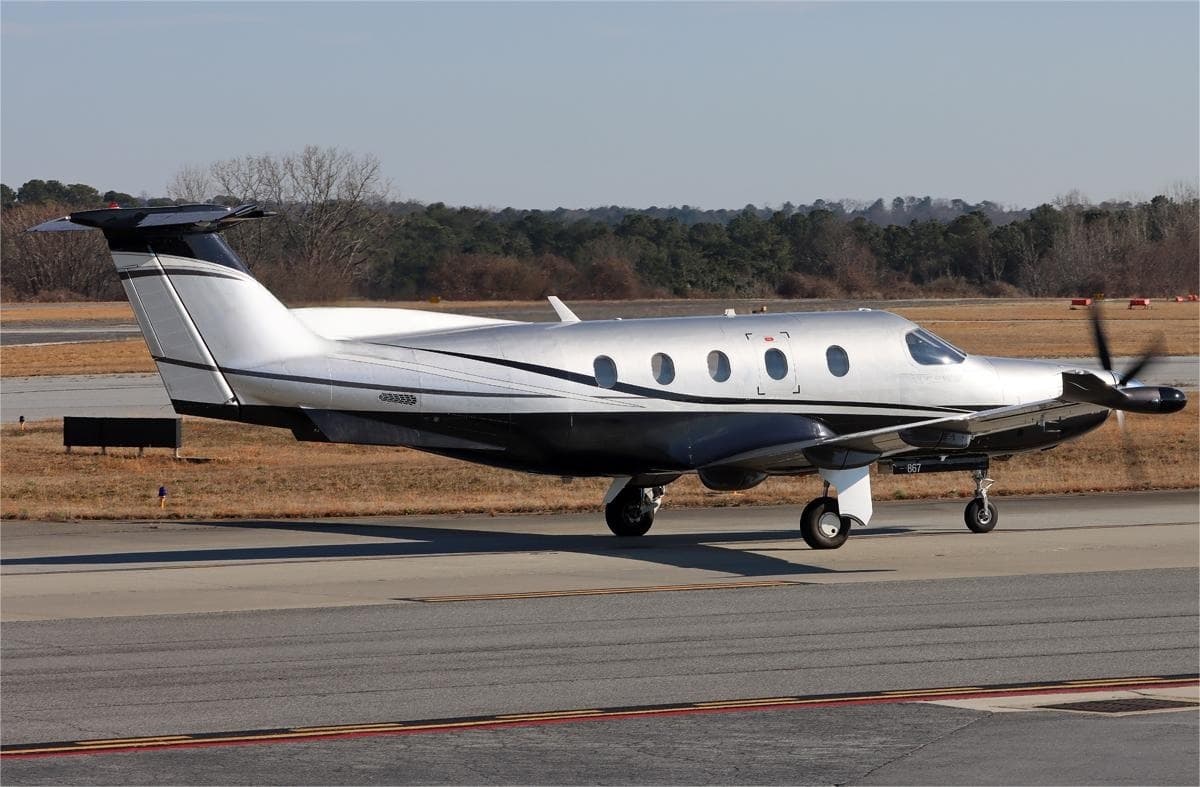 Thu, Nov 5in 2 daysAlbanyKALB · Albany International AirportCharlotteKCLT · Charlotte Douglas International AirportPilatus PC-128—On request5NovAlbany → CharlotteKALB → KCLT · in 2 daysPilatus PC-12 · 8 seatsOn request
- Thu, Nov 506:12AlbanyKALB · Albany International AirportTeterboroKTEB · Teterboro AirportBombardier Learjet 607—$10,7805NovAlbany → TeterboroKALB → KTEB · 06:12Bombardier Learjet 60 · 7 seats$10,780
- Sun, Nov 8in 5 daysAlbanyKALB · Albany International AirportTorontoCYYZ · Toronto Lester B. Pearson International AirportHawker 7508—$7,8108NovAlbany → TorontoKALB → CYYZ · in 5 daysHawker 750 · 8 seats$7,810
 Mon, Nov 910:00AlbanyKALB · Albany International AirportTorontoCYYZ · Toronto Lester B. Pearson International AirportBeechcraft Hawker 7506—$8,9859NovAlbany → TorontoKALB → CYYZ · 10:00Beechcraft Hawker 750 · 6 seats$8,985
- Thu, Nov 1209:33AlbanyKALB · Albany International AirportGlens FallsKGFL · Floyd Bennett Memorial AirportCessna Citation CJ3+7—$14,08012NovAlbany → Glens FallsKALB → KGFL · 09:33Cessna Citation CJ3+ · 7 seats$14,080
 Mon, Nov 1610:06AlbanyKALB · Albany International AirportFrederickKFDK · Frederick Municipal AirportBeechcraft Hawker 900XP8—On request16NovAlbany → FrederickKALB → KFDK · 10:06Beechcraft Hawker 900XP · 8 seatsOn request
- Sat, Nov 28in 25 daysAlbanyKALB · Albany International AirportWhite PlainsKHPN · Westchester County AirportEmbraer Phenom 300844mOn request28NovAlbany → White PlainsKALB → KHPN · in 25 daysEmbraer Phenom 300 · 8 seats · 44mOn request
 KALB · Albany International Airport
 CYYZ · Toronto Lester B. Pearson International Airport
* Total price incl. 10% service fee, converted to your selected currency. Price subject to operator confirmation.
Empty legs to KALB
11 arrivals available
- Tue, Nov 3TodayWilmingtonKILG · New Castle AirportAlbanyKALB · Albany International AirportCirrus SR22——On request3NovWilmington → AlbanyKILG → KALB · TodayCirrus SR22On request
- Wed, Nov 410:21Chicago/Prospect Heights/WheelingKPWK · Chicago Executive AirportAlbanyKALB · Albany International AirportCessna Citation CJ3+7—$16,9404NovChicago/Prospect Heights/Wheeling → AlbanyKPWK → KALB · 10:21Cessna Citation CJ3+ · 7 seats$16,940
- Wed, Nov 410:09NaplesKAPF · Naples Municipal AirportAlbanyKALB · Albany International AirportCessna Citation CJ3+7—$19,4704NovNaples → AlbanyKAPF → KALB · 10:09Cessna Citation CJ3+ · 7 seats$19,470
- Wed, Nov 421:00TorontoCYYZ · Toronto Lester B. Pearson International AirportAlbanyKALB · Albany International AirportBeechcraft Hawker 7506—$7,3794NovToronto → AlbanyCYYZ → KALB · 21:00Beechcraft Hawker 750 · 6 seats$7,379
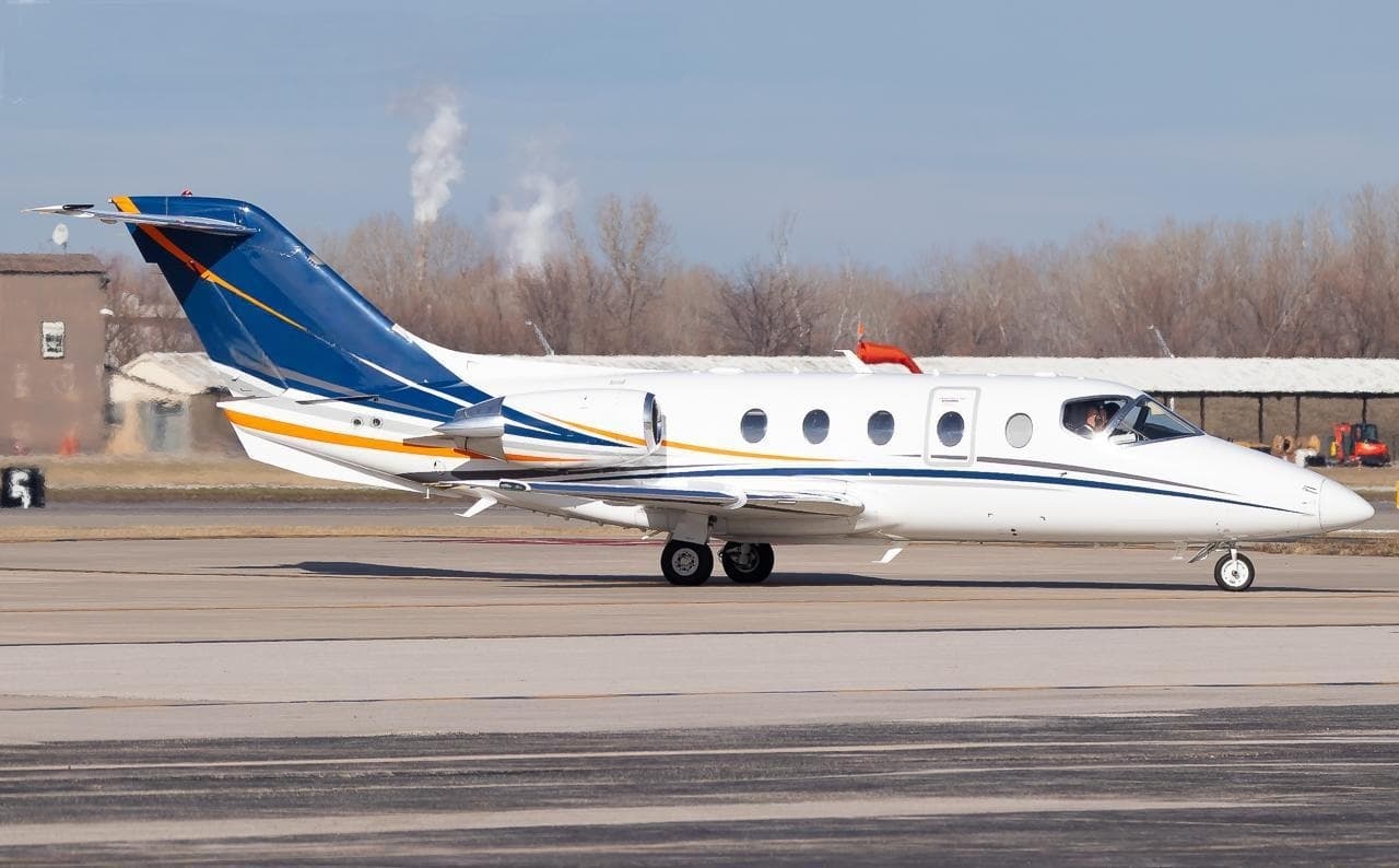 Thu, Nov 5in 2 daysMyrtle BeachKCRE · Grand Strand AirportAlbanyKALB · Albany International AirportHawker 400XP8—$9,2295NovMyrtle Beach → AlbanyKCRE → KALB · in 2 daysHawker 400XP · 8 seats$9,229
- Thu, Nov 518:00TorontoCYYZ · Toronto Lester B. Pearson International AirportAlbanyKALB · Albany International AirportBeechcraft Hawker 7506—$7,6055NovToronto → AlbanyCYYZ → KALB · 18:00Beechcraft Hawker 750 · 6 seats$7,605
- Fri, Nov 612:00TorontoCYYZ · Toronto Lester B. Pearson International AirportAlbanyKALB · Albany International AirportBeechcraft Hawker 7506—$6,6586NovToronto → AlbanyCYYZ → KALB · 12:00Beechcraft Hawker 750 · 6 seats$6,658
 Mon, Nov 16in 13 daysIndianapolisKTYQ · Indianapolis Executive AirportAlbanyKALB · Albany International AirportLearjet 607—On request16NovIndianapolis → AlbanyKTYQ → KALB · in 13 daysLearjet 60 · 7 seatsOn request
- Mon, Nov 1608:18SherbrookeCYSC · Sherbrooke AirportAlbanyKALB · Albany International AirportBeechcraft Hawker 900XP8—On request16NovSherbrooke → AlbanyCYSC → KALB · 08:18Beechcraft Hawker 900XP · 8 seatsOn request
* Total price incl. 10% service fee, converted to your selected currency. Price subject to operator confirmation.
Map: Albany Airport
View the location of Albany – ALB/KALB. Zoom in to explore the area around the airport.
About the airport
Albany International Airport (ALB/KALB) is the key private jet gateway for Albany. PrivJet gives you instant access to charter flights and empty legs: fast, discreet and globally connected.
KALB airport FAQ
Are there any restrictions at Albany airport (KALB) today?
There are currently 18 valid NOTAMs for Albany (KALB). Affected: ILS: unserviceable; TACAN; Aerodrome beacon: unserviceable; Obstacle: out of service and 2 more. 3 more NOTAMs start in the coming days. For information only, not for flight planning or operational use. Always rely on an official pre-flight briefing. This list may be incomplete or out of date.
What is the weather at Albany airport (KALB)?
According to the latest weather report for KALB (METAR, 03 Nov, 12:51 UTC): Good visual conditions (VFR). Wind 6 kt (11 km/h) from south-southeast (160°), visibility 10 km or more, temperature 13 °C (dew point 6 °C). For information only, not for flight planning. Weather can change quickly; always rely on official reports.
How long are the runways at Albany airport (KALB)?
Albany (KALB) has 2 runways: runway 01/19 with 2,591 m (8,500 ft), asphalt and runway 10/28 with 2,195 m (7,200 ft), asphalt. The longest is 2,591 m.
What are the radio frequencies at Albany airport (KALB)?
Frequencies at KALB: Tower 119.5 MHz, Ground 121.7 MHz and ATIS 120.45 MHz. For information only. Always rely on the published AIP.
What are the airport codes of Albany International Airport?
The ICAO code is KALB and the IATA code is ALB. ICAO codes are used by air traffic control and pilots, e.g. in flight plans; IATA codes appear on tickets and baggage tags.
What is the elevation of KALB airport?
Albany International Airport sits at 285 ft (87 m) above sea level. Local time zone: America/New York.
Can I fly to KALB by private jet?
Whether a private jet can operate into Albany International Airport depends on runway length, opening hours, customs and immigration rules as well as slot and handling availability, among other things. PrivJet checks this with the operating carrier for every request.
Are there empty legs from or to KALB?
There are currently 8 empty legs departing from and 11 arriving at Albany International Airport. Empty legs are repositioning flights at heavily reduced prices; the list is updated several times a day.