Benton Harbor Southwest Michigan Airport (KBEH / BEH)
Empty legs and charters from Benton Harbor
KBEH airport at a glance
- ICAO code
- KBEH
- IATA code
- BEH
- City
- Benton Harbor
- Region
- Michigan
- Country
- United States
- Elevation
- 643 ft (196 m)
- Time zone
- America/Detroit (UTC-5)
- Coordinates
- 42.1286° N, 86.4285° W
- Empty legs from
- 1
- Empty legs to
- 4
Weather & airport info KBEH
Current weather
No current weather report is available for this airport.
Airport
- Elevation
- 643 ft (196 m)
- Sunrise / Sunset
- 07:20 / 17:37 local time
Runways
| Runway | Length | Surface | Lighted |
|---|---|---|---|
| 10/28 | 1,831 m (6,006 ft) | asphalt | yes |
| 14/32 | 977 m (3,205 ft) | asphalt | yes |
Radio frequencies
- Clearance: 119.7
- UNICOM: 123
For information only, not for flight planning. Weather can change quickly; always rely on official reports. Sources: aviationweather.gov (NOAA), OurAirports.
Airport map KBEH
Full screen →Runways white, taxiways yellow with designators, closed taxiways and runways per NOTAM in red.
Official charts (FAA)
Cycle 2611, valid until 0901Z 11/26/26
Instrument approaches (3)
Minimums (2)
For information only, not for navigation. Always use current official charts and NOTAMs.
Current NOTAMs for KBEH(3)
NOTAMs (Notices to Air Missions) announce short-term changes at an airport: closed runways or taxiways, unserviceable approach aids, obstacles, airspace restrictions.
- Out of serviceObstacle lights: unserviceable10/021· until 13 Nov, 09:48 UTC
Obstacle light on tower (ASR 1061877) (4.0 NM north-northeast of BEH) 860.2 ft above sea level (220.1 ft above ground) out of service
Show original text
OBST TOWER LGT (ASR 1061877) 421106.00N0862242.00W (4.0NM NNE BEH) 860.2FT (220.1FT AGL) U/S
10/021 NOTAMN<br/>
<b>Q) </b>KZAU/QOLAS/IV/M/AE/000/009/4207N08625W005<br/>
<b>A) </b>KBEH<br/>
<b>B) </b>2610291048<br/>
<b>C) </b>2611130948<br/>
<b>E) </b> TOWER LGT (ASR 1061877) 421106.00N0862242.00W (4.0NM NNE BEH) 860.2FT (220.1FT AGL) U/S<br/>
- Out of serviceObstacle10/019· until 10 Dec, 19:09 UTC
A tower 5.3 nautical miles southeast of the airport is out of service. Its top is 963 feet above sea level, 280 feet above ground.
Show original text
OBST TOWER LGT (ASR 1255165) 420259.70N0862207.40W (5.3NM SE BEH) 963FT (280FT AGL) U/S
- NoticeRunway11/001· until 04 Nov, 21:00 UTC
Runway 10 has work in progress for crack sealing daily from 12:05 to 21:00.
Show original text
RWY 10 WIP MAINT CRACK SEALING DLY 1205-2100
Hours: DLY 1205-2100
For information only, not for flight planning or operational use. Always rely on an official pre-flight briefing. This list may be incomplete or out of date. Explanations and expanded abbreviations are generated automatically. The original text is authoritative. Source: FAA NOTAM Management Service (SWIM).
Private jet traffic in Southwest Michigan Regional Airport (last 30 days)
- Arrivals
- 53
- Departures
- 15
- Different jets
- 35
Most frequent origins: Chicago Midway International Airport (4).
Most common aircraft types: Piper M500/M600 (10), Daher TBM 700 (7), Cessna Citation Latitude (6), Embraer Phenom 300 (6), Gulfstream G600 (6).
Monday is the busiest day.
Our own analysis of public ADS-B signals from business jets. Not every flight is received, and jets with a removal request are excluded.
Empty legs from KBEH
1 departures available
 KBEH · Southwest Michigan Regional Airport
* Total price incl. 10% service fee, converted to your selected currency. Price subject to operator confirmation.
Empty legs to KBEH
4 arrivals available
- Thu, Nov 5in 2 daysTeterboroKTEB · Teterboro AirportBenton HarborKBEH · Southwest Michigan Regional AirportCessna Citation X8—On request5NovTeterboro → Benton HarborKTEB → KBEH · in 2 daysCessna Citation X · 8 seatsOn request
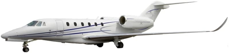 Sun, Nov 8in 5 daysNew YorkKTEB · Teterboro AirportBenton HarborKBEH · Southwest Michigan Regional AirportCitation X8—On request8NovNew York → Benton HarborKTEB → KBEH · in 5 daysCitation X · 8 seatsOn request
- Fri, Nov 13in 10 daysTraverse CityKTVC · Cherry Capital AirportBenton HarborKBEH · Southwest Michigan Regional AirportSocata TBM 900554mOn request13NovTraverse City → Benton HarborKTVC → KBEH · in 10 daysSocata TBM 900 · 5 seats · 54mOn request
- Sun, Nov 29in 26 daysKalamazooKAZO · Kalamazoo Battle Creek International AirportBenton HarborKBEH · Southwest Michigan Regional AirportEmbraer Phenom 300E7—$4,07029NovKalamazoo → Benton HarborKAZO → KBEH · in 26 daysEmbraer Phenom 300E · 7 seats$4,070
* Total price incl. 10% service fee, converted to your selected currency. Price subject to operator confirmation.
Map: Benton Harbor Airport
View the location of Benton Harbor – BEH/KBEH. Zoom in to explore the area around the airport.
About the airport
Southwest Michigan Regional Airport (BEH/KBEH) is the key private jet gateway for Benton Harbor. PrivJet gives you instant access to charter flights and empty legs: fast, discreet and globally connected.
KBEH airport FAQ
Are there any restrictions at Benton Harbor airport (KBEH) today?
There are currently 3 valid NOTAMs for Benton Harbor (KBEH). Affected: Obstacle lights: unserviceable; Obstacle: out of service. For information only, not for flight planning or operational use. Always rely on an official pre-flight briefing. This list may be incomplete or out of date.
How long are the runways at Benton Harbor airport (KBEH)?
Benton Harbor (KBEH) has 2 runways: runway 10/28 with 1,831 m (6,006 ft), asphalt and runway 14/32 with 977 m (3,205 ft), asphalt. The longest is 1,831 m.
What are the airport codes of Southwest Michigan Regional Airport?
The ICAO code is KBEH and the IATA code is BEH. ICAO codes are used by air traffic control and pilots, e.g. in flight plans; IATA codes appear on tickets and baggage tags.
What is the elevation of KBEH airport?
Southwest Michigan Regional Airport sits at 643 ft (196 m) above sea level. Local time zone: America/Detroit.
Can I fly to KBEH by private jet?
Whether a private jet can operate into Southwest Michigan Regional Airport depends on runway length, opening hours, customs and immigration rules as well as slot and handling availability, among other things. PrivJet checks this with the operating carrier for every request.
Are there empty legs from or to KBEH?
There are currently 1 empty legs departing from and 4 arriving at Southwest Michigan Regional Airport. Empty legs are repositioning flights at heavily reduced prices; the list is updated several times a day.