Birmingham-Shuttlesworth Airport (KBHM / BHM)
Empty legs and charters from Birmingham
KBHM airport at a glance
- ICAO code
- KBHM
- IATA code
- BHM
- City
- Birmingham
- Region
- Alabama
- Country
- United States
- Elevation
- 650 ft (198 m)
- Time zone
- America/Chicago (UTC-6)
- Coordinates
- 33.5629° N, 86.7535° W
- Empty legs from
- 57
- Empty legs to
- 48
Private jet terminal & FBOs at Birmingham-Shuttlesworth
- Million Air Birmingham4725 65th Place North, Birmingham, AL 35206
Weather & airport info KBHM
Current weather
No current weather report is available for this airport.
Airport
- Elevation
- 650 ft (198 m)
- Sunrise / Sunset
- 06:07 / 16:53 local time
Runways
| Runway | Length | Surface | Lighted |
|---|---|---|---|
| 06/24 | 3,660 m (12,007 ft) | asphalt | yes |
| 18/36 | 2,164 m (7,099 ft) | asphalt | yes |
Radio frequencies
- ATIS: 119.4
- Clearance: 125.675
- Ground: 121.7
- Tower: 119.9
- UNICOM: 122.95
For information only, not for flight planning. Weather can change quickly; always rely on official reports. Sources: aviationweather.gov (NOAA), OurAirports.
Airport map KBHM
Full screen →Runways white, taxiways yellow with designators, closed taxiways and runways per NOTAM in red.
Closed per NOTAM: RWY 6/24, TWY H4, TWY A7*, TWY A4*, TWY A1*, TWY A3*, TWY A2*, TWY M*, TWY H2*, TWY H3*, TWY A*, TWY B* (* partly closed)
Official charts (FAA)
Cycle 2611, valid until 0901Z 11/26/26
Airport diagram (FAA)
Airport diagram (1)
Instrument approaches (11)
Departure procedures (2)
Minimums (2)
Hot spots (1)
LAHSO (1)
For information only, not for navigation. Always use current official charts and NOTAMs.
Current NOTAMs for KBHM(60)
NOTAMs (Notices to Air Missions) announce short-term changes at an airport: closed runways or taxiways, unserviceable approach aids, obstacles, airspace restrictions.
- ClosedRunway: closedA2184/26· until 06 Nov, 10:00 UTC
Runway 06/24 is closed.
Show original text
RWY 06/24 CLSD
A2184/26 NOTAMN
Q) KZTL/QMRLC////000/999/3333N08645W005
A) KBHM
B) 2611030600
C) 2611061000
D) DLY 0600-1000
E) RWY 06/24 CLSD
Hours: DLY 0600-1000
- Out of serviceApproach lighting: unserviceableA2191/26· from 05 Nov, 14:00 UTC · until 05 Nov, 21:30 UTC
Runway 06 approach lighting out of service
Show original text
RWY 06 ALS U/S
A2191/26 NOTAMN
Q) KZTL/QLAAS////000/999/3333N08645W005
A) KBHM
B) 2611051400
C) 2611052130
E) RWY 06 ALS U/S
- Out of serviceObstacle11/030· until 03 Dec, 23:59 UTC
Obstacle light on tower (ASR 1036003) (5.0 NM south-southwest of BHM) 2048.9 ft above sea level (1075.1 ft above ground) out of service
Show original text
OBST TOWER LGT (ASR 1036003) 332926.00N0864748.00W (5.0NM SSW BHM) 2048.9FT (1075.1FT AGL) U/S
- ClosedTaxiway: closedA2155/26· until 04 Nov, 22:00 UTC
Taxiway H4 is closed. This means this specific taxiway at the airport cannot be used.
Show original text
TWY H4 CLSD
A2155/26 NOTAMN
Q) KZTL/QMXLC////000/999/3333N08645W005
A) KBHM
B) 2611031400
C) 2611042200
D) DLY 1400-2200
E) TWY H4 CLSD
Hours: DLY 1400-2200
- ClosedTaxiway: closedA2183/26· until 06 Nov, 10:00 UTC
Several taxiways are closed: taxiway A7, A4, A1, A3, A2, M, H2, H3. Also, taxiway A between the approach end of runway 24 and Hangar 25B apron is closed, as well as taxiway A between the approach end of runway 06 and the cargo ramp. Taxiway H is closed between the approach end of runway 06 and the southwest access to the west Fixed Base Operator apron.
Show original text
TWY A7, A4, A1, A3, A2, M, H2, H3, TWY A BTN APCH END RWY 24 AND HANGAR 25B APN, TWY A BTN APCH END RWY 06 AND CARGO RAMP, TWY H BTN APCH END RWY 06 AND WEST FIXED BASE OPR APN SOUTHWEST ACCESS CLSD
A2183/26 NOTAMN
Q) KZTL/QMXLC////000/999/3333N08645W005
A) KBHM
B) 2611030600
C) 2611061000
D) DLY 0600-1000
E) TWY A7, A4, A1, A3, A2, M, H2, H3, TWY A BTN APCH END RWY 24 AND HANGAR 25B APN, TWY A BTN APCH END RWY 06 AND CARGO RAMP, TWY H BTN APCH END RWY 06 AND WEST FIXED BASE OPR APN SOUTHWEST ACCESS CLSD
Hours: DLY 0600-1000
- Out of serviceObstacle11/028· until 03 Mar, 01:13 UTC
A tower light near Birmingham-Shuttlesworth International Airport is out of service. The top of the tower is 916.0 feet above sea level, 285.1 feet above ground.
Show original text
OBST TOWER LGT (ASR 1055793) 334245.70N0864925.00W (9.5NM NNW BHM) 916.0FT (285.1FT AGL) U/S
- ClosedTaxiway: closedA2178/26· until 05 Nov, 05:45 UTC
Taxiway B between runway 06/24 and taxiway F at Birmingham-Shuttlesworth International Airport is closed.
Show original text
TWY B BTN RWY 06/24 AND TWY F CLSD
A2178/26 NOTAMN
Q) KZTL/QMXLC////000/999/3333N08645W005
A) KBHM
B) 2611030001
C) 2611050545
D) DLY 0001-0545
E) TWY B BTN RWY 06/24 AND TWY F CLSD
Hours: DLY 0001-0545
- ClosedTaxiway: closedA2179/26· until 05 Nov, 05:45 UTC
Taxiway A between taxiway F and runway 18/36 at Birmingham-Shuttlesworth International Airport is closed daily from 00:01 to 05:45.
Show original text
TWY A BTN TWY F AND RWY 18/36 CLSD DLY 0001-0545
A2179/26 NOTAMN
Q) KZTL/QMXLC////000/999/3333N08645W005
A) KBHM
B) 2611030001
C) 2611050545
E) TWY A BTN TWY F AND RWY 18/36 CLSD DLY 0001-0545
52 more NOTAMs
- Out of serviceObstacle lights: unserviceable10/250· until 28 Jan, 00:12 UTC
An obstacle, a tower light (ASR 1035615) 5.8 nautical miles east of the airport, is out of service. Its top is 1130.9 feet above sea level, 290.0 feet above ground.
Show original text
OBST TOWER LGT (ASR 1035615) 333305.60N0863811.00W (5.8NM E BHM) 1130.9FT (290.0FT AGL) U/S
10/250 NOTAMN<br/>
<b>Q) </b>KZTL/QOLAS/IV/M/E/000/012/3333N08645W005<br/>
<b>A) </b>KBHM<br/>
<b>B) </b>2610292312<br/>
<b>C) </b>2701280012<br/>
<b>E) </b> TOWER LGT (ASR 1035615) 333305.60N0863811.00W (5.8NM E BHM) 1130.9FT (290.0FT AGL) U/S<br/>
- Out of serviceObstacle10/247· until 29 Nov, 23:00 UTC
The lighting of a tower obstacle (ASR 1294524) 2.6 nautical miles northeast of the airport is out of service. Its top is 944.6 ft above sea level, 199.1 ft above ground.
Show original text
OBST TOWER LGT (ASR 1294524) 333600.50N0864322.00W (2.6NM NE BHM) 944.6FT (199.1FT AGL) U/S
10/247 NOTAMN<BR>
<B>Q) </B>KZTL/QOLAS/IV/M/AE/000/010/3333N08645W005<BR>
<B>A) </B>KBHM<BR>
<B>B) </B>2610291744<BR>
<B>C) </B>2611292300<BR>
<B>E) </B> TOWER LGT (ASR 1294524) 333600.50N0864322.00W (2.6NM NE BHM) 944.6FT (199.1FT AGL) U/S<BR>
- Out of serviceILS glide path: unserviceable10/231· until 25 Nov, 23:59 UTC
The instrument landing system (ILS) for runway 06 glide path (GP) is out of service. The ILS guides aircraft to the runway in poor visibility.
Show original text
BHM NAV ILS RWY 06 GP U/S
A2127/26 NOTAMN
Q) KZTL/QIGAS////000/999/3333N08645W005
A) KBHM
B) 2610271135
C) 2611252359
E) BHM NAV ILS RWY 06 GP U/S
- Out of serviceILS glide path: unserviceableA2127/26· until 25 Nov, 23:59 UTC
The instrument landing system (ILS) for runway 06, which guides aircraft to the runway in poor visibility, has an out of service glideslope.
Show original text
BHM NAV ILS RWY 06 GP U/S
A2127/26 NOTAMN Q) KZTL/QIGAS////000/999/3333N08645W005 A) KBHM B) 2610271135 C) 2611252359 E) BHM NAV ILS RWY 06 GP U/S
- Out of serviceObstacle10/214· until 08 Nov, 03:32 UTC
The lighting of an obstacle tower (ASR 1040161) 8.1 nautical miles north-northwest of the airport is out of service. Its top is 1081.7 feet above sea level, 447.8 feet above ground.
Show original text
OBST TOWER LGT (ASR 1040161) 334114.00N0864922.30W (8.1NM NNW BHM) 1081.7FT (447.8FT AGL) U/S
- Out of serviceObstacle lights: unserviceableA2101/26· until 07 Dec, 10:54 UTC
A tower 7.8 nautical miles southwest of the airport is out of service. Its top is 1659 ft above sea level, 714 ft above ground.
Show original text
TOWER LGT (ASR 1017640) 332745.00N0865059.00W (7.8NM SW BHM) 1659FT (714FT AGL) U/S
A2101/26 NOTAMN
Q) KZTL/QOLAS/IV/M/E/000/999/3327N08650W001
A) KBHM
B) 2610230955
C) 2612071054
E) TOWER LGT (ASR 1017640) 332745.00N0865059.00W (7.8NM SW BHM) 1659FT (714FT AGL) U/S
- Out of serviceRunway end identifier lights: unserviceable10/201· until 25 Nov, 23:59 UTC
Runway 36 runway END ID light out of service
Show original text
RWY 36 RWY END ID LGT U/S
A2084/26 NOTAMN Q) KZTL/QLIAS////000/999/3333N08645W005 A) KBHM B) 2610221126 C) 2611252359 E) RWY 36 RWY END ID LGT U/S
- Out of servicePAPI: unserviceableA1995/26· until 17 Nov, 23:59 UTC
The precision approach path indicator (PAPI) for runway 18 is out of service. The PAPI helps pilots maintain the correct approach angle to the runway.
Show original text
RWY 18 PAPI U/S
A1995/26 NOTAMN
Q) KZTL/QLPAS////000/999/3333N08645W005
A) KBHM
B) 2610131138
C) 2611172359
E) RWY 18 PAPI U/S
- Out of serviceObstacle10/052· until 06 Feb, 14:28 UTC
A tower light 17.8 nautical miles northeast of the airport is out of service. The tower's top is 914.0 ft above sea level, 310.0 ft above ground.
Show original text
OBST TOWER LGT (ASR 1284122) 335137.30N0864501.30W (17.8NM NE BHM) 914.0FT (310.0FT AGL) U/S
- Out of serviceObstacle lights: unserviceableA1961/26· until 21 Nov, 23:58 UTC
The lighting on a tower 8 nautical miles west of the airport is out of service. The tower's top is 945 ft above sea level, 205 ft above ground.
Show original text
TOWER LGT (ASR 1036583) 333308.60N0865438.70W (8NM W BHM) 945FT (205FT AGL) U/S
A1961/26 NOTAMN
Q) KZTL/QOLAS/IV/M/E/000/999/3333N08654W001
A) KBHM
B) 2610072358
C) 2611212358
E) TOWER LGT (ASR 1036583) 333308.60N0865438.70W (8NM W BHM) 945FT (205FT AGL) U/S
- Out of serviceInstrument approach procedure6864/26· until 06 Jan, 16:09 UTC
The instrument approach procedures ILS or LOC for runway 24 and ILS runway 24 (SA CAT II) at Birmingham-Shuttlesworth International airport are not available, except for aircraft equipped with a suitable RNAV system with GPS, because the VUZ VOR is out of service.
Show original text
IAP BIRMINGHAM-SHUTTLESWORTH INTL, BIRMINGHAM, AL. ILS OR LOC RWY 24, AMDT 5... ILS RWY 24 (SA CAT II), AMDT 5... PROCEDURE NA EXCEPT FOR ACFT EQUIPPED WITH SUITABLE RNAV SYSTEM WITH GPS, VUZ VOR OUT OF SERVICE. 2610021609-2701061609EST
Q) KZTL/QPIXX/I/NBO/A/000/999/3333N08645W005
A) KBHM
B) 2407170417
C) 2502260417EST
E) BHM BIRMINGHAM-SHUTTLESWORTH INTL, BIRMINGHAM, AL.
ILS OR LOC RWY 24, AMDT 5...
ILS RWY 24 (SA CAT II), AMDT 5...
PROCEDURE NA EXCEPT FOR ACFT EQUIPPED WITH SUITABLE RNAV SYSTEM WITH GPS,
VUZ VOR U/S.
- Out of serviceInstrument approach procedure6868/26· until 06 Jan, 16:09 UTC (estimated)
For the Instrument Approach Procedure (IAP) LOC runway 18 at Birmingham-Shuttlesworth International airport, the VUZ VOR is out of service. For the missed approach, a DME system is required.
Show original text
IAP BIRMINGHAM-SHUTTLESWORTH INTL, BIRMINGHAM, AL. LOC RWY 18, AMDT 2C... MISSED APPROACH: CLIMB TO 1800 THEN CLIMBING LEFT TURN TO 3600 ON HEADING 025 AND ON GAD VOR/DME R-231 TO SPATT/GAD 28.80 DME AND HOLD (DME REQUIRED), VUZ VOR OUT OF SERVICE. 2610021609-2701061609EST
Q) KZTL/QPIXX/I/NBO/A/000/999/3333N08645W005
A) KBHM
B) 2606221353
C) 2702011351EST
E) BHM BIRMINGHAM-SHUTTLESWORTH INTL, BIRMINGHAM, AL.
LOC RWY 18, AMDT 2C...
MISSED APPROACH: CLIMB TO 1800 THEN CLIMBING LEFT TURN TO 3600 ON HEADING 025 AND ON GAD VOR/DME R-231 TO SPATT/GAD 28.80 DME AND HOLD (DME REQUIRED),
VUZ VOR U/S.
- Out of serviceInstrument approach procedure6870/26· until 06 Jan, 16:09 UTC (estimated)
For the Instrument Approach Procedure (IAP) ILS or LOC runway 6 at Birmingham-Shuttlesworth International airport, the VUZ VOR is out of service. For the missed approach, a DME system is required.
Show original text
IAP BIRMINGHAM-SHUTTLESWORTH INTL, BIRMINGHAM, AL. ILS OR LOC RWY 6, AMDT 43B... MISSED APPROACH: CLIMB TO 3300 ON HEADING 058 AND GAD R-231 TO SPATT/GAD 28.80 DME AND HOLD. (DME REQUIRED), VUZ VOR OUT OF SERVICE. 2610021609-2701061609EST
Q) KZTL/QPIXX/I/NBO/A/000/999/3333N08645W005
A) KBHM
B) 2606221400
C) 2610071400EST
E) BHM BIRMINGHAM-SHUTTLESWORTH INTL, BIRMINGHAM, AL.
ILS OR LOC RWY 6, AMDT 43B...
MISSED APPROACH: CLIMB TO 3300 ON HEADING 058 AND GAD R-231 TO SPATT/GAD 28.80 DME AND HOLD. (DME REQUIRED),
VUZ VOR U/S.
- Out of serviceOther6871/26· until 06 Jan, 16:09 UTC (estimated)
For the Instrument Approach Procedure (IAP) ILS runway 6 (CAT II) at Birmingham-Shuttlesworth International airport, the VUZ VOR is out of service, making the procedure not available.
Show original text
IAP BIRMINGHAM-SHUTTLESWORTH INTL, BIRMINGHAM, AL. ILS RWY 6 (CAT II), AMDT 43B ... PROCEDURE NA. VUZ VOR OUT OF SERVICE. 2610021609-2701061609EST
Q) KZTL/QXXXX/I/NBO/A/000/999/3333N08645W025
A) KBHM
B) 2606221403
C) 2610071402EST
E) IAP BIRMINGHAM-SHUTTLESWORTH INTL, BIRMINGHAM, AL.
ILS RWY 6 (CAT II), AMDT 43B ...
PROCEDURE NA. VUZ VOR OUT OF SERVICE.
- Out of serviceInstrument approach procedure: changedA1908/26· until 06 Jan, 16:09 UTC
The instrument approach procedures ILS or LOC for runway 24 and ILS runway 24 (SA CAT II) at Birmingham-Shuttlesworth International airport are not available, except for aircraft equipped with a suitable RNAV system with GPS, because the VUZ VOR is out of service.
Show original text
IAP BIRMINGHAM-SHUTTLESWORTH INTL, BIRMINGHAM, AL. ILS OR LOC RWY 24, AMDT 5... ILS RWY 24 (SA CAT II), AMDT 5... PROCEDURE NA EXCEPT FOR ACFT EQUIPPED WITH SUITABLE RNAV SYSTEM WITH GPS, VUZ VOR OUT OF SERVICE.
A1908/26 NOTAMN
Q) KZTL/QPICH/I/NBO/A/000/999/3333N08645W005
A) KBHM
B) 2610021609
C) 2701061609
E) IAP BIRMINGHAM-SHUTTLESWORTH INTL, BIRMINGHAM, AL. ILS OR LOC RWY 24, AMDT 5... ILS RWY 24 (SA CAT II), AMDT 5... PROCEDURE NA EXCEPT FOR ACFT EQUIPPED WITH SUITABLE RNAV SYSTEM WITH GPS, VUZ VOR OUT OF SERVICE.
- Out of serviceInstrument approach procedure: changedA1909/26· until 06 Jan, 16:09 UTC
For the Instrument Approach Procedure (IAP) ILS or LOC runway 6 at Birmingham-Shuttlesworth International airport, the VUZ VOR is out of service. For the missed approach, a DME system is required.
Show original text
IAP BIRMINGHAM-SHUTTLESWORTH INTL, BIRMINGHAM, AL. ILS OR LOC RWY 6, AMDT 43B... MISSED APPROACH: CLIMB TO 3300 ON HEADING 058 AND GAD R-231 TO SPATT/GAD 28.80 DME AND HOLD. (DME REQUIRED), VUZ VOR OUT OF SERVICE.
A1909/26 NOTAMN
Q) KZTL/QPICH/I/NBO/A/000/999/3333N08645W005
A) KBHM
B) 2610021609
C) 2701061609
E) IAP BIRMINGHAM-SHUTTLESWORTH INTL, BIRMINGHAM, AL. ILS OR LOC RWY 6, AMDT 43B... MISSED APPROACH: CLIMB TO 3300 ON HEADING 058 AND GAD R-231 TO SPATT/GAD 28.80 DME AND HOLD. (DME REQUIRED), VUZ VOR OUT OF SERVICE.
- Out of serviceInstrument approach procedure: changedA1910/26· until 06 Jan, 16:09 UTC
For the Instrument Approach Procedure (IAP) LOC runway 18 at Birmingham-Shuttlesworth International airport, the VUZ VOR is out of service. For the missed approach, a DME system is required.
Show original text
IAP BIRMINGHAM-SHUTTLESWORTH INTL, BIRMINGHAM, AL. LOC RWY 18, AMDT 2C... MISSED APPROACH: CLIMB TO 1800 THEN CLIMBING LEFT TURN TO 3600 ON HEADING 025 AND ON GAD VOR/DME R-231 TO SPATT/GAD 28.80 DME AND HOLD (DME REQUIRED), VUZ VOR OUT OF SERVICE.
A1910/26 NOTAMN
Q) KZTL/QPICH/I/NBO/A/000/999/3333N08645W005
A) KBHM
B) 2610021609
C) 2701061609
E) IAP BIRMINGHAM-SHUTTLESWORTH INTL, BIRMINGHAM, AL. LOC RWY 18, AMDT 2C... MISSED APPROACH: CLIMB TO 1800 THEN CLIMBING LEFT TURN TO 3600 ON HEADING 025 AND ON GAD VOR/DME R-231 TO SPATT/GAD 28.80 DME AND HOLD (DME REQUIRED), VUZ VOR OUT OF SERVICE.
- Out of serviceInstrument approach procedure: changedA1911/26· until 06 Jan, 16:09 UTC
For the Instrument Approach Procedure (IAP) ILS runway 6 (CAT II) at Birmingham-Shuttlesworth International airport, the VUZ VOR is out of service, making the procedure not available.
Show original text
IAP BIRMINGHAM-SHUTTLESWORTH INTL, BIRMINGHAM, AL. ILS RWY 6 (CAT II), AMDT 43B ... PROCEDURE NA. VUZ VOR OUT OF SERVICE.
A1911/26 NOTAMN
Q) KZTL/QPICH/I/NBO/A/000/999/3333N08645W005
A) KBHM
B) 2610021609
C) 2701061609
E) IAP BIRMINGHAM-SHUTTLESWORTH INTL, BIRMINGHAM, AL. ILS RWY 6 (CAT II), AMDT 43B ... PROCEDURE NA. VUZ VOR OUT OF SERVICE.
- Out of serviceObstacle10/008· until 31 Dec, 10:24 UTC
A tower obstacle light 9.3 nautical miles east of Birmingham-Shuttlesworth International airport is out of service. Its top is 1056.1 ft above sea level, 265.1 ft above ground.
Show original text
OBST TOWER LGT (ASR 1000486) 333320.00N0863402.50W (9.3NM E BHM) 1056.1FT (265.1FT AGL) U/S
- Out of serviceILS category II: not availableA2192/26· from 05 Nov, 14:00 UTC · until 05 Nov, 21:30 UTC
BHM navigation: ILS (instrument landing system) runway 06 category II not available
Show original text
BHM NAV ILS RWY 06 CAT II NA
A2192/26 NOTAMN
Q) KZTL/QITAU////000/999/3333N08645W005
A) KBHM
B) 2611051400
C) 2611052130
E) BHM NAV ILS RWY 06 CAT II NA
- NoticeTaxiway11/012· until 14 Nov, 23:00 UTC
The surface painted holding position signs on taxiway A between runway 18/36 and taxiway G are not standard.
Show original text
TWY A SFC PAINTED HLDG PSN SIGNS BTN RWY 18/36 AND TWY G NOT STD
- NoticeTaxiway11/011· until 14 Nov, 23:00 UTC
The surface painted holding position signs on taxiway A are not standard.
Show original text
TWY A SFC PAINTED HLDG PSN SIGNS NOT STD
- NoticeTaxiway11/010· until 14 Nov, 23:00 UTC
Taxiway B centerline markings between taxiway A and the terminal ramp northeast access are obscured.
Show original text
TWY B CL MARKINGS BTN TWY A AND TERMINAL RAMP NORTHEAST ACCESS OBSC
- NoticeTaxiway11/007· until 14 Nov, 23:00 UTC
The center line markings on taxiway H between the Air National Guard apron and taxiway H4 have been removed. This may make orientation on this section of the taxiway more difficult.
Show original text
TWY H CL MARKINGS BTN AIR NTL GUARD APN AND TWY H4 REMOVED
- NoticeDaylight markings11/008· until 14 Nov, 23:00 UTC
The center line markings on taxiway B for the approach end of runway 36 are obscured. This may affect orientation when taxiing in this area.
Show original text
TWY B CL MARKINGS FOR APCH END RWY 36 OBSC
11/008 NOTAMR
Q) KZTL/QMMXX/V/M/A/000/999/3333N08645W005
A) KBHM
B) 2611011256
C) 2611142300

E) TWY B CL MARKINGS FOR APCH END RWY 36 OBSC
- NoticeDaylight markings11/009· until 14 Nov, 23:00 UTC
The taxiway centerline markings on taxiway B are obscured between taxiway F and the terminal ramp northeast access. This might make it harder to navigate the taxiway.
Show original text
TWY B CL MARKINGS BTN TWY F AND TERMINAL RAMP NORTHEAST ACCESS OBSC
11/009 NOTAMR
Q) KZTL/QMMXX/V/M/A/000/999/3333N08645W005
A) KBHM
B) 2611011256
C) 2611142300

E) TWY B CL MARKINGS BTN TWY F AND TERMINAL RAMP NORTHEAST ACCESS OBSC
- NoticeDaylight markings11/006· until 14 Nov, 23:00 UTC
The taxiway H centerline markings between taxiway H2 and taxiway H3 are obscured or difficult to see.
Show original text
TWY H CL MARKINGS BTN TWY H2 AND TWY H3 OBSC
11/006 NOTAMR
Q) KZTL/QMMXX/V/M/A/000/999/3333N08645W005
A) KBHM
B) 2611011252
C) 2611142300

E) TWY H CL MARKINGS BTN TWY H2 AND TWY H3 OBSC
- NoticeTaxiway11/005· until 14 Nov, 23:00 UTC
The taxiway H edge markings between taxiway H2 and taxiway H3 are not standard.
Show original text
TWY H EDGE MARKINGS BTN TWY H2 AND TWY H3 NOT STD
- NoticeTaxiway10/219· until 07 Nov, 04:45 UTC
The edge markings of taxiway F between taxiway A and taxiway B on the northeast side have been removed.
Show original text
TWY F EDGE MARKINGS BTN TWY A AND TWY B NORTHEAST SIDE REMOVED
- NoticeTaxiway10/218· until 07 Nov, 04:45 UTC
The edge markings of taxiway B between taxiway A and taxiway F on the west side have been removed.
Show original text
TWY B EDGE MARKINGS BTN TWY A AND TWY F WEST SIDE REMOVED
- NoticeTaxiway10/217· until 07 Nov, 04:45 UTC
The edge markings of taxiway A between taxiway F and taxiway B on the south side have been removed.
Show original text
TWY A EDGE MARKINGS BTN TWY F AND TWY B SOUTH SIDE REMOVED
- NoticeTaxiway10/216· until 07 Nov, 04:45 UTC
The centerline markings of taxiway B between the terminal ramp northeast access and taxiway A are obscured.
Show original text
TWY B CL MARKINGS BTN TERMINAL RAMP NORTHEAST ACCESS AND TWY A OBSC
- NoticeObstacle10/188· until 25 Nov, 23:00 UTC
An obstacle, a rig, is located 1.4 nautical miles west-southwest of the airport. Its top is 627 feet above sea level, 25 feet above ground, and it is flagged and lighted.
Show original text
OBST RIG (ASN 2025-ASO-4060-NRA) 333319N0864642W (1.4NM WSW BHM) 627FT (25FT AGL) FLAGGED AND LGTD
- NoticeObstacle10/189· until 25 Nov, 23:00 UTC
An obstacle, a rig, is located 1.4 nautical miles west-southwest of the airport. Its top is 625 feet above sea level, 25 feet above ground, and it is flagged and lighted.
Show original text
OBST RIG (ASN 2025-ASO-4061-NRA) 333318N0864642W (1.4NM WSW BHM) 625FT (25FT AGL) FLAGGED AND LGTD
- NoticeObstacle10/186· until 25 Nov, 23:00 UTC
An obstacle, a rig, is located 1.4 nautical miles west-southwest of the airport. Its top is 626 feet above sea level, 25 feet above ground, and it is flagged and lighted.
Show original text
OBST RIG (ASN 2025-ASO-4058-NRA) 333317N0864642W (1.4NM WSW BHM) 626FT (25FT AGL) FLAGGED AND LGTD
- NoticeObstacle10/187· until 25 Nov, 23:00 UTC
Obstacle RIG (ASN 2025-ASO-4059-NRA) (1.4 NM west-southwest of BHM) 629 ft above sea level (25 ft above ground) flagged and lighted
Show original text
OBST RIG (ASN 2025-ASO-4059-NRA) 333318N0864641W (1.4NM WSW BHM) 629FT (25FT AGL) FLAGGED AND LGTD
- NoticeObstacle10/183· until 25 Nov, 23:00 UTC
An obstacle, a rig, is located 1.2 nautical miles west-southwest of the airport. Its top is 633 feet above sea level, 25 feet above ground, and it is flagged and lighted.
Show original text
OBST RIG (ASN 2025-ASO-4055-NRA) 333325N0864626W (1.2NM WSW BHM) 633FT (25FT AGL) FLAGGED AND LGTD
- NoticeObstacle10/184· until 25 Nov, 23:00 UTC
An obstacle, a rig, is located 1.2 nautical miles west-southwest of the airport. Its top is 630 feet above sea level, 25 feet above ground, and it is flagged and lighted.
Show original text
OBST RIG (ASN 2025-ASO-4056-NRA) 333324N0864625W (1.2NM WSW BHM) 630FT (25FT AGL) FLAGGED AND LGTD
- NoticeObstacle10/185· until 25 Nov, 23:00 UTC
An obstacle, a rig, is located 1.2 nautical miles west-southwest of the airport. Its top is 633 feet above sea level, 25 feet above ground, and it is flagged and lighted.
Show original text
OBST RIG (ASN 2025-ASO-4057-NRA) 333324N0864628W (1.2NM WSW BHM) 633FT (25FT AGL) FLAGGED AND LGTD
- NoticeObstacle10/182· until 25 Nov, 23:00 UTC
An obstacle, a rig, is located 1.2 nautical miles west-southwest of the airport. Its top is 629 feet above sea level, 25 feet above ground, and it is flagged and lighted.
Show original text
OBST RIG (ASN 2025-ASO-4054-NRA) 333323N0864627W (1.2NM WSW BHM) 629FT (25FT AGL) FLAGGED AND LGTD
- NoticeObstacle10/179· until 25 Nov, 23:00 UTC
An obstacle, a rig, is located 1.1 nautical miles west-southwest of the airport. Its top is 618 feet above sea level, 15 feet above ground, and it is flagged and lighted.
Show original text
OBST RIG (ASN 2025-ASO-4051-NRA) 333325N0864619W (1.1NM WSW BHM) 618FT (15FT AGL) FLAGGED AND LGTD
- NoticeObstacle10/180· until 25 Nov, 23:00 UTC
An obstacle, a rig, is located 1.1 nautical miles west-southwest of the airport. Its top is 618 feet above sea level, 15 feet above ground, and it is flagged and lighted.
Show original text
OBST RIG (ASN 2025-ASO-4052-NRA) 333325N0864620W (1.1NM WSW BHM) 618FT (15FT AGL) FLAGGED AND LGTD
- NoticeObstacle10/181· until 25 Nov, 23:00 UTC
An obstacle, a rig, is located 1.1 nautical miles west-southwest of the airport. Its top is 618 feet above sea level, 15 feet above ground, and it is flagged and lighted.
Show original text
OBST RIG (ASN 2025-ASO-4053-NRA) 333325N0864620W (1.1NM WSW BHM) 618FT (15FT AGL) FLAGGED AND LGTD
- NoticeObstacle10/176· until 25 Nov, 23:00 UTC
A rig (obstacle) is located 1.0 nautical miles west-southwest of the airport. Its top is 618 feet above sea level, 15 feet above ground, flagged and lighted.
Show original text
OBST RIG (ASN 2025-ASO-4048-NRA) 333327N0864616W (1.0NM WSW BHM) 618FT (15FT AGL) FLAGGED AND LGTD
- NoticeObstacle10/177· until 25 Nov, 23:00 UTC
An obstacle, a rig, is located 1.0 nautical miles west-southwest of the airport. Its top is 617 feet above sea level, 15 feet above ground, and it is flagged and lighted.
Show original text
OBST RIG (ASN 2025-ASO-4049-NRA) 333327N0864616W (1.0NM WSW BHM) 617FT (15FT AGL) FLAGGED AND LGTD
- NoticeObstacle10/178· until 25 Nov, 23:00 UTC
An obstacle, a rig, is located 1.0 nautical miles west-southwest of the airport. Its top is 618 feet above sea level, 15 feet above ground, and it is flagged and lighted.
Show original text
OBST RIG (ASN 2025-ASO-4050-NRA) 333328N0864614W (1.0NM WSW BHM) 618FT (15FT AGL) FLAGGED AND LGTD
- NoticeObstacle10/175· until 25 Nov, 23:00 UTC
A rig (obstacle) is located 1.0 nautical miles west-southwest of the airport. Its top is 618 feet above sea level, 15 feet above ground, flagged and lighted.
Show original text
OBST RIG (ASN 2025-ASO-4047-NRA) 333327N0864617W (1.0NM WSW BHM) 618FT (15FT AGL) FLAGGED AND LGTD
- NoticeObstacle10/174· until 25 Nov, 23:00 UTC
A rig (obstacle) is located 1.1 nautical miles west-southwest of the airport. Its top is 618 feet above sea level, 15 feet above ground, flagged and lighted.
Show original text
OBST RIG (ASN 2025-ASO-4046-NRA) 333325N0864619W (1.1NM WSW BHM) 618FT (15FT AGL) FLAGGED AND LGTD
- NoticeObstacle10/172· until 25 Nov, 23:00 UTC
A rig (obstacle) is located 1.1 nautical miles west-southwest of the airport. Its top is 620 feet above sea level, 15 feet above ground, flagged and lighted.
Show original text
OBST RIG (ASN 2025-ASO-4044-NRA) 333327N0864619W (1.1NM WSW BHM) 620FT (15FT AGL) FLAGGED AND LGTD
- NoticeObstacle10/173· until 25 Nov, 23:00 UTC
A rig (obstacle) is located 1.0 nautical miles west-southwest of the airport. Its top is 618 feet above sea level, 15 feet above ground, flagged and lighted.
Show original text
OBST RIG (ASN 2025-ASO-4045-NRA) 333329N0864615W (1.0NM WSW BHM) 618FT (15FT AGL) FLAGGED AND LGTD
- NoticeObstacle10/170· until 25 Nov, 23:00 UTC
A rig (obstacle) is located 1.0 nautical miles west-southwest of the airport. Its top is 621 feet above sea level, 15 feet above ground, flagged and lighted.
Show original text
OBST RIG (ASN 2025-ASO-4042-NRA) 333329N0864618W (1.0NM WSW BHM) 621FT (15FT AGL) FLAGGED AND LGTD
- NoticeObstacle10/171· until 25 Nov, 23:00 UTC
A rig (obstacle) is located 1.1 nautical miles west-southwest of the airport. Its top is 620 feet above sea level, 15 feet above ground, flagged and lighted.
Show original text
OBST RIG (ASN 2025-ASO-4043-NRA) 333328N0864620W (1.1NM WSW BHM) 620FT (15FT AGL) FLAGGED AND LGTD
For information only, not for flight planning or operational use. Always rely on an official pre-flight briefing. This list may be incomplete or out of date. Explanations and expanded abbreviations are generated automatically. The original text is authoritative. Source: FAA NOTAM Management Service (SWIM).
Private jet traffic in Birmingham-Shuttlesworth International Airport (last 30 days)
- Arrivals
- 1,459
- Departures
- 842
- Different jets
- 696
Most frequent origins: DeKalb Peachtree Airport (88), Baton Rouge Metropolitan Ryan Field (34), McGhee Tyson Airport (32), Auburn Opelika Robert G. Pitts Airport (27), Nashville International Airport (23).
Most frequent destinations: DeKalb Peachtree Airport (64), Nashville International Airport (18), Northwest Florida Beaches International Airport (17), Baton Rouge Metropolitan Ryan Field (15), Auburn Opelika Robert G. Pitts Airport (15).
Most common aircraft types: Pilatus PC-12 (289), Embraer Phenom 300 (229), Cessna Citation Excel/XLS (196), Cessna Citation CJ2 (157), Cessna Citation CJ3 (103).
Tuesday is the busiest day.
Our own analysis of public ADS-B signals from business jets. Not every flight is received, and jets with a removal request are excluded.
Charter operators based here
Operators with a base at this airport.
- AirMed InternationalTurboprop, Light jet, Midsize jet
Empty legs from KBHM
57 departures available
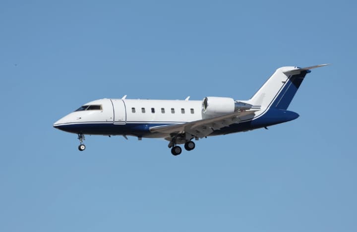 Tue, Nov 3TodayBirminghamKBHM · Birmingham-Shuttlesworth International AirportHoustonKHOU · William P Hobby AirportChallenger 60410—$12,8703NovBirmingham → HoustonKBHM → KHOU · TodayChallenger 604 · 10 seats$12,870
- Tue, Nov 3TodayBirminghamKBHM · Birmingham-Shuttlesworth IntlHoustonKHOU · William P HobbyChallenger 604—1h 43m$12,8703NovBirmingham → HoustonKBHM → KHOU · TodayChallenger 604 · 1h 43m$12,870
 Tue, Nov 322:22BirminghamKBHM · Birmingham-Shuttlesworth International AirportClemsonKCEU · Oconee County Regional AirportCessna Citation Ultra148m$2,8343NovBirmingham → ClemsonKBHM → KCEU · 22:22Cessna Citation Ultra · 1 seat · 48m$2,834
- Tue, Nov 3TodayBirminghamKBHM · Birmingham-Shuttlesworth International AirportWinston SalemKINT · Smith Reynolds AirportCessna Citation V81h 12mOn request3NovBirmingham → Winston SalemKBHM → KINT · TodayCessna Citation V · 8 seats · 1h 12mOn request
- Tue, Nov 3TodayBirminghamKBHM · Birmingham-Shuttlesworth International AirportClemsonKCEU · Oconee County Regional AirportCessna Citation V7—$2,7323NovBirmingham → ClemsonKBHM → KCEU · TodayCessna Citation V · 7 seats$2,732
 Wed, Nov 413:48BirminghamKBHM · Birmingham-Shuttlesworth International AirportWinston SalemKINT · Smith Reynolds AirportCessna Citation V11h 18mOn request4NovBirmingham → Winston SalemKBHM → KINT · 13:48Cessna Citation V · 1 seat · 1h 18mOn request
- Wed, Nov 4TomorrowBirminghamKBHM · Birmingham - ShuttlesworthWinston SalemKINT · Smith ReynoldsLight Jet6—On request4NovBirmingham → Winston SalemKBHM → KINT · TomorrowLight Jet · 6 seatsOn request
- Wed, Nov 403:22BirminghamKBHM · Birmingham - ShuttlesworthClemsonKCEU · Oconee County RegionalCessna Citation Ultra7—$3,4794NovBirmingham → ClemsonKBHM → KCEU · 03:22Cessna Citation Ultra · 7 seats$3,479
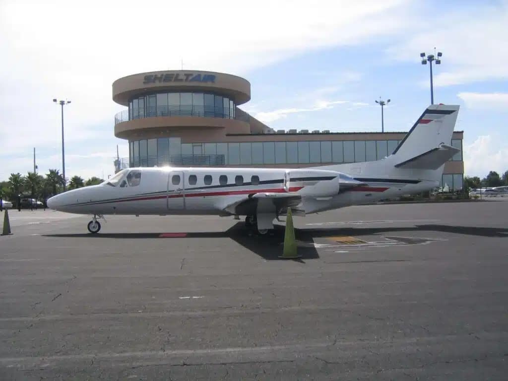 Wed, Nov 4TomorrowBirminghamKBHM · Birmingham-Shuttlesworth International AirportWinston SalemKINT · Smith Reynolds AirportCitation V7—On request4NovBirmingham → Winston SalemKBHM → KINT · TomorrowCitation V · 7 seatsOn request
 KBHM · Birmingham-Shuttlesworth International Airport
* Total price incl. 10% service fee, converted to your selected currency. Price subject to operator confirmation.
Empty legs to KBHM
48 arrivals available
 Tue, Nov 3TodayMiamiKOPF · Miami-Opa Locka Executive AirportBirminghamKBHM · Birmingham-Shuttlesworth International AirportGulfstream GIV-SP12—$19,7773NovMiami → BirminghamKOPF → KBHM · TodayGulfstream GIV-SP · 12 seats$19,777
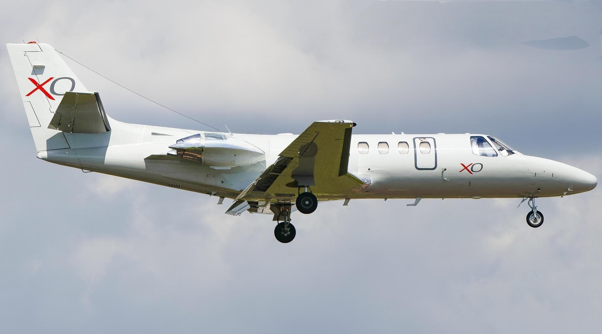 Tue, Nov 3TodayClemsonKCEU · Oconee County Regional AirportBirminghamKBHM · Birmingham-Shuttlesworth International AirportCitation Ultra7—$3,5203NovClemson → BirminghamKCEU → KBHM · TodayCitation Ultra · 7 seats$3,520
- Wed, Nov 418:30TupeloKTUP · Tupelo Regional AirportBirminghamKBHM · Birmingham-Shuttlesworth International AirportCessna Citation V136mOn request4NovTupelo → BirminghamKTUP → KBHM · 18:30Cessna Citation V · 1 seat · 36mOn request
- Wed, Nov 4TomorrowTupeloKTUP · Tupelo Regional AirportBirminghamKBHM · Birmingham - ShuttlesworthLight Jet6—On request4NovTupelo → BirminghamKTUP → KBHM · TomorrowLight Jet · 6 seatsOn request
- Thu, Nov 5in 2 daysAtlantaKATL · Hartsfield Jackson Atlanta International AirportBirminghamKBHM · Birmingham-Shuttlesworth International AirportEmbraer Phenom 300E7—$7,2605NovAtlanta → BirminghamKATL → KBHM · in 2 daysEmbraer Phenom 300E · 7 seats$7,260
- Thu, Nov 5in 2 daysAtlantaKY93 · Atlanta Municipal AirportBirminghamKBHM · Birmingham-Shuttlesworth International AirportHawker 9008—$13,3105NovAtlanta → BirminghamKY93 → KBHM · in 2 daysHawker 900 · 8 seats$13,310
- Thu, Nov 5in 2 daysAtlantaKFTY · Fulton County Airport Brown FieldBirminghamKBHM · Birmingham-Shuttlesworth International AirportCessna CitationJet5—$4,4005NovAtlanta → BirminghamKFTY → KBHM · in 2 daysCessna CitationJet · 5 seats$4,400
- Thu, Nov 5in 2 daysAtlantaKPDK · DeKalb Peachtree AirportBirminghamKBHM · Birmingham-Shuttlesworth International AirportCessna CitationJet5—$4,1805NovAtlanta → BirminghamKPDK → KBHM · in 2 daysCessna CitationJet · 5 seats$4,180
- Thu, Nov 5in 2 daysAtlantaKATL · Hartsfield Jackson Atlanta International AirportBirminghamKBHM · Birmingham-Shuttlesworth International AirportCessna CitationJet5—$4,4005NovAtlanta → BirminghamKATL → KBHM · in 2 daysCessna CitationJet · 5 seats$4,400
* Total price incl. 10% service fee, converted to your selected currency. Price subject to operator confirmation.
Map: Birmingham Airport
View the location of Birmingham – BHM/KBHM. Zoom in to explore the area around the airport.
About the airport
Birmingham-Shuttlesworth International Airport (BHM/KBHM) is the key private jet gateway for Birmingham. PrivJet gives you instant access to charter flights and empty legs: fast, discreet and globally connected.
KBHM airport FAQ
Are there any restrictions at Birmingham airport (KBHM) today?
There are currently 98 valid NOTAMs for Birmingham (KBHM). According to NOTAM, at least one runway or the aerodrome itself is closed. Affected: Runway: closed; Taxiway: closed; Obstacle: out of service; Obstacle lights: unserviceable and 6 more. 2 more NOTAMs start in the coming days. For information only, not for flight planning or operational use. Always rely on an official pre-flight briefing. This list may be incomplete or out of date.
How long are the runways at Birmingham airport (KBHM)?
Birmingham (KBHM) has 2 runways: runway 06/24 with 3,660 m (12,007 ft), asphalt and runway 18/36 with 2,164 m (7,099 ft), asphalt. The longest is 3,660 m.
What are the radio frequencies at Birmingham airport (KBHM)?
Frequencies at KBHM: Tower 119.9 MHz, Ground 121.7 MHz and ATIS 119.4 MHz. For information only. Always rely on the published AIP.
What are the airport codes of Birmingham-Shuttlesworth International Airport?
The ICAO code is KBHM and the IATA code is BHM. ICAO codes are used by air traffic control and pilots, e.g. in flight plans; IATA codes appear on tickets and baggage tags.
What is the elevation of KBHM airport?
Birmingham-Shuttlesworth International Airport sits at 650 ft (198 m) above sea level. Local time zone: America/Chicago.
Where do private jets land at Birmingham-Shuttlesworth?
Private jet passengers at KBHM are handled through Million Air Birmingham (4725 65th Place North, Birmingham, AL 35206). The operator confirms the exact meeting point with your flight confirmation.
Can I fly to KBHM by private jet?
Whether a private jet can operate into Birmingham-Shuttlesworth International Airport depends on runway length, opening hours, customs and immigration rules as well as slot and handling availability, among other things. PrivJet checks this with the operating carrier for every request.
Are there empty legs from or to KBHM?
There are currently 57 empty legs departing from and 48 arriving at Birmingham-Shuttlesworth International Airport. Empty legs are repositioning flights at heavily reduced prices; the list is updated several times a day.