Boise Air Terminal/Gowen field Airport (KBOI / BOI)
Empty legs and charters from Boise
KBOI airport at a glance
- ICAO code
- KBOI
- IATA code
- BOI
- City
- Boise
- Region
- Idaho
- Country
- United States
- Elevation
- 2,871 ft (875 m)
- Time zone
- America/Boise (UTC-7)
- Coordinates
- 43.5644° N, 116.2230° W
- Empty legs from
- 100
- Empty legs to
- 100
Weather & airport info KBOI
Current weather
No current weather report is available for this airport.
Airport
- Elevation
- 2,871 ft (875 m)
- Sunrise / Sunset
- 07:23 / 17:33 local time
Runways
| Runway | Length | Surface | Lighted |
|---|---|---|---|
| 10L/28R | 3,048 m (10,000 ft) | asphalt | yes |
| 10R/28L | 2,976 m (9,763 ft) | asphalt | yes |
Radio frequencies
- ATIS: 123.9
- Clearance: 125.9
- Ground: 121.7
- Tower: 118.1
- UNICOM: 122.95
For information only, not for flight planning. Weather can change quickly; always rely on official reports. Sources: aviationweather.gov (NOAA), OurAirports.
Airport map KBOI
Full screen →Runways white, taxiways yellow with designators, closed taxiways and runways per NOTAM in red.
Closed per NOTAM: RWY 10L/28R, TWY P, TWY C*, TWY A* (* partly closed)
Official charts (FAA)
Cycle 2611, valid until 0901Z 11/26/26
Airport diagram (FAA)
Airport diagram (1)
Instrument approaches (16)
- ILS OR LOC RWY 28R
- ILS Y OR LOC Y RWY 10R
- ILS Y RWY 10R (SA CAT I)
- ILS Y RWY 10R (CAT II - III)
- RNAV (RNP) X RWY 28L
- RNAV (RNP) X RWY 28R
- RNAV (RNP) Z RWY 10L
- RNAV (RNP) Z RWY 10R
- RNAV (RNP) Z RWY 28L
- RNAV (RNP) Z RWY 28R
- RNAV (GPS) Y RWY 10L
- RNAV (GPS) Y RWY 10R
- RNAV (GPS) Y RWY 28L
- RNAV (GPS) Y RWY 28R
- VOR OR TACAN RWY 10L
- VOR Y OR TACAN Y RWY 28L
Departure procedures (1)
Obstacle departure procedures (1)
Hot spots (1)
For information only, not for navigation. Always use current official charts and NOTAMs.
Current NOTAMs for KBOI(42)
NOTAMs (Notices to Air Missions) announce short-term changes at an airport: closed runways or taxiways, unserviceable approach aids, obstacles, airspace restrictions.
- ClosedRunway: closedA2745/26· until 20 Nov, 23:59 UTC
Runway 10L/28R is closed except for crossing. This means the runway cannot be used for takeoffs or landings, but aircraft may cross it.
Show original text
RWY 10L/28R CLSD EXC XNG
A2745/26 NOTAMN
Q) KZLC/QMRLC////000/999/4333N11613W005
A) KBOI
B) 2611012032
C) 2611202359
E) RWY 10L/28R CLSD EXC XNG
- Out of serviceILS: unserviceableA2725/26· from 05 Nov, 15:00 UTC · until 05 Nov, 22:00 UTC
The instrument landing system (ILS) for runway 10R is out of service. The ILS guides aircraft to the runway in poor visibility.
Show original text
BOI NAV ILS RWY 10R U/S
A2725/26 NOTAMN
Q) KZLC/QICAS////000/999/4333N11613W005
A) KBOI
B) 2611051500
C) 2611052200
E) BOI NAV ILS RWY 10R U/S
- Out of serviceServices11/036· from 05 Nov, 07:15 UTC · until 05 Nov, 12:30 UTC
Several radio frequencies (118.1, 121.5, 121.7, 125.5, 125.9, 243.0, 257.8, 269.4, 282.2, 285.525) for communication are out of service. This affects the reception and transmission of radio signals.
Show original text
COM REMOTE TRANS/REC 118.1, 121.5, 121.7, 125.5, 125.9, 243.0, 257.8, 269.4, 282.2, 285.525 U/S
- Out of serviceServices11/037· from 05 Nov, 07:15 UTC · until 05 Nov, 12:30 UTC
The remote transmit and receive frequencies 323.2, 348.6, and 351.85 are out of service.
Show original text
COM REMOTE TRANS/REC 323.2, 348.6, 351.85 U/S
- Out of serviceServices11/042· from 04 Nov, 07:15 UTC · until 04 Nov, 12:30 UTC
Communications REMOTE TRANS/REC 121.5, 121.7, 125.5, 125.9, 243.0, 257.8, 269.4, 282.4, 285.525, 323.2 out of service
Show original text
COM REMOTE TRANS/REC 121.5, 121.7, 125.5, 125.9, 243.0, 257.8, 269.4, 282.4, 285.525, 323.2 U/S
- Out of serviceServices11/043· from 04 Nov, 07:15 UTC · until 04 Nov, 12:30 UTC
Communications REMOTE TRANS/REC 348.6, 351.85 out of service
Show original text
COM REMOTE TRANS/REC 348.6, 351.85 U/S
- ClosedApron: closedA2750/26· until 16 Nov, 19:00 UTC
Apron taxilane T2 closed
Show original text
APRON TXL T2 CLSD
A2750/26 NOTAMN
Q) KZLC/QMNLC////000/999/4333N11613W005
A) KBOI
B) 2611021829
C) 2611161900
E) APRON TXL T2 CLSD
- Out of serviceTaxiway11/025· until 20 Nov, 23:59 UTC
The lighting for the taxiway M location sign between taxiway A and the approach end of runway 28L at Boise Air Terminal/Gowen Field is out of service.
Show original text
TWY M LOCATION SIGN BTN TWY A AND APCH END RWY 28L LGT U/S
34 more NOTAMs
- Out of serviceTaxiway11/026· until 20 Nov, 23:59 UTC
The lighting for the taxiway D location sign between taxiway A and runway 10R/28L at Boise Air Terminal/Gowen Field is out of service.
Show original text
TWY D LOCATION SIGN BTN TWY A AND RWY 10R/28L LGT U/S
- Out of serviceTaxiway11/024· until 20 Nov, 23:59 UTC
The lighting for the taxiway M runway approach boundary sign between taxiway A and runway 10L/28R at Boise Air Terminal/Gowen Field is out of service.
Show original text
TWY M RWY APCH BDRY SIGN BTN TWY A AND RWY 10L/28R LGT U/S
- ClosedTaxiway: closedA2747/26· until 20 Nov, 23:59 UTC
Taxiway P at Boise Air Terminal/Gowen Field is closed. This may cause diversions at the airport.
Show original text
TWY P CLSD
A2747/26 NOTAMN
Q) KZLC/QMXLC////000/999/4333N11613W005
A) KBOI
B) 2611012049
C) 2611202359
E) TWY P CLSD
- Out of serviceTaxiway11/022· until 20 Nov, 23:59 UTC
The taxiway runway approach boundary sign light between taxiway W and approach end runway 10R is out of service.
Show original text
TWY J RWY APCH BDRY SIGN BTN TWY W AND APCH END RWY 10R LGT U/S
- Out of serviceTaxiway11/020· until 20 Nov, 23:59 UTC
The location sign light for taxiway G between taxiway A and runway 10R/28L is out of service.
Show original text
TWY G LOCATION SIGN BTN TWY A AND RWY 10R/28L LGT U/S
- Out of serviceTaxiway11/021· until 20 Nov, 23:59 UTC
The taxiway J approach area holding position sign light is out of service.
Show original text
TWY J APCH AREA HLDG PSN SIGN LGT U/S
- Out of serviceTaxiway11/019· until 20 Nov, 23:59 UTC
The location sign light for taxiway E between taxiway A and runway 10R/28L is out of service.
Show original text
TWY E LOCATION SIGN BTN TWY A AND RWY 10R/28L LGT U/S
- ClosedTaxiway: closedA2746/26· until 20 Nov, 23:59 UTC
Taxiway E between runway 10R/28L and taxiway A is closed.
Show original text
TWY E BTN RWY 10R/28L AND TWY A CLSD
A2746/26 NOTAMN
Q) KZLC/QMXLC////000/999/4333N11613W005
A) KBOI
B) 2611012039
C) 2611202359
E) TWY E BTN RWY 10R/28L AND TWY A CLSD
- Out of serviceServices10/240· until 30 Nov, 20:00 UTC (estimated)
The remote communication outlet 122.6 is out of service. This may affect communication with air traffic control.
Show original text
COM REMOTE COM OUTLET 122.6 U/S
- ClosedApron: closedA2613/26· until 20 Nov, 23:59 UTC
Apron taxiway S between the Southeast Cargo Ramp and the Skywest Maintenance Ramp is closed to aircraft with a wingspan of more than 94 feet.
Show original text
APRON TXL S BTN SOUTHEAST CARGO RAMP AND SKYWEST MAINT RAMP CLSD TO ACFT WINGSPAN MORE THAN 94FT
A2613/26 NOTAMN
Q) KZLC/QMNLC////000/999/4333N11613W005
A) KBOI
B) 2610152043
C) 2611202359
E) APRON TXL S BTN SOUTHEAST CARGO RAMP AND SKYWEST MAINT RAMP CLSD TO ACFT WINGSPAN MORE THAN 94FT
- ClosedApron: closedA2612/26· until 20 Nov, 23:59 UTC
Apron taxiway S between the Skywest Maintenance Ramp and the Idaho Transportation Department Ramp is closed to aircraft with a wingspan of more than 58 feet.
Show original text
APRON TXL S BTN SKYWEST MAINT RAMP AND IDAHO TRANSPORTATION DEPARTMENT RAMP CLSD TO ACFT WINGSPAN MORE THAN 58FT
A2612/26 NOTAMN
Q) KZLC/QMNLC////000/999/4333N11613W005
A) KBOI
B) 2610152041
C) 2611202359
E) APRON TXL S BTN SKYWEST MAINT RAMP AND IDAHO TRANSPORTATION DEPARTMENT RAMP CLSD TO ACFT WINGSPAN MORE THAN 58FT
- ClosedTaxiway: closedA2553/26· permanent
Taxiway C between runway 10L/28R and taxiway A closed
Show original text
TWY C BTN RWY 10L/28R AND TWY A CLSD
A2553/26 NOTAMN
Q) KZLC/QMXLC////000/999/4333N11613W005
A) KBOI
B) 2610071225
C) PERM
E) TWY C BTN RWY 10L/28R AND TWY A CLSD
- ClosedTaxiway: closedA2547/26· until 06 Nov, 23:59 UTC
Taxiway A between taxiway link A2 and taxiway M is closed.
Show original text
TWY A BTN TXL A2 AND TWY M CLSD
A2547/26 NOTAMN
Q) KZLC/QMXLC////000/999/4333N11613W005
A) KBOI
B) 2610061743
C) 2611062359
E) TWY A BTN TXL A2 AND TWY M CLSD
- ClosedApron: closedA2546/26· until 06 Nov, 23:00 UTC
Apron taxiway link A2 is closed.
Show original text
APRON TXL A2 CLSD
A2546/26 NOTAMN
Q) KZLC/QMNLC////000/999/4333N11613W005
A) KBOI
B) 2610061706
C) 2611062300
E) APRON TXL A2 CLSD
- ClosedApron: closedA2543/26· until 06 Nov, 23:59 UTC
Apron taxilane N1 closed
Show original text
APRON TXL N1 CLSD
A2543/26 NOTAMN
Q) KZLC/QMNLC////000/999/4333N11613W005
A) KBOI
B) 2610061500
C) 2611062359
E) APRON TXL N1 CLSD
- ClosedApron: closedA2542/26· until 06 Nov, 23:59 UTC
Apron taxiway A1 at Boise Air Terminal/Gowen Field Airport is closed.
Show original text
APRON TXL A1 CLSD
A2542/26 NOTAMN
Q) KZLC/QMNLC////000/999/4333N11613W005
A) KBOI
B) 2610061459
C) 2611062359
E) APRON TXL A1 CLSD
- Out of serviceObstacle09/235· until 24 Dec, 23:59 UTC
An obstacle tower light, with its top 2793 feet above sea level (155 feet above ground), is out of service 5.1 nautical miles north-northwest of the airport.
Show original text
OBST TOWER LGT (ASN 2025-ANM-3740-OE) 433836N1161550W (5.1NM NNW BOI) 2793FT (155FT AGL) U/S
- NoticeAirspace11/047· from 04 Nov, 14:00 UTC · until 05 Nov, 02:00 UTC
Numerous unmanned aircraft systems (UAS) are active within an area defined as a 6.5 nautical mile radius, 1.5 nautical miles northeast of MAN, from the surface to 400 feet above ground.
Show original text
AIRSPACE NUMEROUS UAS WI AN AREA DEFINED AS 6.5NM RADIUS OF 433613N1163008W (1.5NM NE MAN) SFC-400FT AGL
- NoticeAirspace11/034· until 04 Nov, 02:00 UTC
In the airspace, there are numerous unmanned aircraft systems (UAS) within an area of 6.5 nautical miles radius, 1.5 nautical miles northeast of MAN, from the surface to 400 feet above ground.
Show original text
AIRSPACE NUMEROUS UAS WI AN AREA DEFINED AS 6.5NM RADIUS OF 433613N1163008W (1.5NM NE MAN) SFC-400FT AGL
- NoticeAerodrome: work in progressA2752/26· until 03 Nov, 23:59 UTC
Airport: all surface works HEAVY equipment
Show original text
AD AP ALL SFC WIP HEAVY EQUIPMENT
A2752/26 NOTAMN
Q) KZLC/QFAHW////000/999/4333N11613W005
A) KBOI
B) 2611031345
C) 2611032359
E) AD AP ALL SFC WIP HEAVY EQUIPMENT
- NoticeRunway11/029· until 01 Dec, 19:00 UTC
The center line markings on runway 10R/28L are obscured. This might make it harder to navigate on the runway.
Show original text
RWY 10R/28L CL MARKINGS OBSC
- NoticeAirspace11/011· until 15 Nov, 06:59 UTC
The airspace is restricted for unmanned aircraft systems (UAS) within an area defined as a 3 nautical mile radius (7.8 nautical miles east of BOI) from the surface to 400 feet above ground level.
Show original text
AIRSPACE UAS WI AN AREA DEFINED AS 3NM RADIUS OF 433231.60N1160244.80W (7.8NM E BOI) SFC-400FT AGL
- NoticeAirspace11/027· until 29 Nov, 01:00 UTC
Airspace for unmanned aircraft systems (UAS) is restricted within a 2.5 nautical mile radius south of the airport from the surface to 400 feet above ground daily from 14:00 to 01:00.
Show original text
AIRSPACE UAS WI AN AREA DEFINED AS 2.5NM RADIUS OF 432537N1161207W (8.8NM S BOI) SFC-400FT AGL DLY 1400-0100
- NoticeTaxiway10/247· until 01 Dec, 06:59 UTC
The surface painted holding position signs on taxiway W for the approach end of runway 10L are not standard.
Show original text
TWY W SFC PAINTED HLDG PSN SIGNS FOR APCH END RWY 10L NOT STD
- NoticeAerodromeM0031/26· until 25 Jan, 12:00 UTC
Military aircraft arriving at Boise Airport require prior permission (PPR), regardless of where they park. Exceptions are aircraft conducting low approaches, pattern work, or touch-and-go maneuvers.
Show original text
AERODROME OFFICIAL BUSINESS ONLY OFFICIAL BUSINESS ONLY MANDATORY PPR REQUIRED FOR ALL MILITARY AIRCRAFT ARRIVING AT KBOI IN BOISE, IDAHO REGARDLESS OF WHERE THE A/C IS PARKING AT: HTTP://WWW.124THFIGHTERWING.ANG.AF.MIL. IF PARKING ON THE ANG RAMP SUBMIT NLT 72 HOURS IN ADVANCE; ALL OTHER AREAS, TO INCLUDE FBO PARKING, SUBMIT PRIOR TO ARRIVAL. PPR TIME IS VALID +/- 30 MIN. PPR NOT REQUIRED FOR AIRCRAFT CONDUCTING LOW APPROACHES, PATTERN WORK, & TOUCH AND GO.
M0031/26 NOTAMN
Q) ZLC/QFAGD/IV/NBO/A/000/999/4333N11613W005
A) KBOI
B) 2610292017
C) 2701251200
E) AERODROME OFFICIAL BUSINESS ONLY OFFICIAL BUSINESS ONLY MANDATORY PPR REQUIRED FOR ALL MILITARY AIRCRAFT ARRIVING AT KBOI IN BOISE, IDAHO REGARDLESS OF WHERE THE A/C IS PARKING AT: HTTP://WWW.124THFIGHTERWING.ANG.AF.MIL. IF PARKING ON THE ANG RAMP SUBMIT NLT 72 HOURS IN ADVANCE; ALL OTHER AREAS, TO INCLUDE FBO PARKING, SUBMIT PRIOR TO ARRIVAL. PPR TIME IS VALID +/- 30 MIN. PPR NOT REQUIRED FOR AIRCRAFT CONDUCTING LOW APPROACHES, PATTERN WORK, & TOUCH AND GO.
- NoticeAerodrome: military operations onlyM0029/26· until 25 Jan, 12:00 UTC
Noise abatement procedures are in effect for all military arrivals and departures at Boise Airport. Military aircraft are prohibited from performing carrier breaks and using afterburners on takeoff or missed approaches, unless operationally required.
Show original text
AERODROME AERODROME NOISE ABATEMENT PROCEDURES IN EFFECT FOR ALL MILITARY ARRIVALS AND DEPARTURES. TRANSIENT MILITARY AIRCRAFT RESTRICTED TO STRAIGHT-IN FULL STOP ONLY. STRICTLY ENFORCED. CARRIER BREAKS ARE PROHIBITED AT ALL TIMES. FIGHTER AIRCRAFT WILL NOT PERFORM AFTERBURNER TAKEOFFS, GO-AROUNDS, OR MISSED APPROACHES EXCEPT WHEN OPERATIONALLY REQUIRED. IF SO, FIGHTERS WILL TERMINATE AFTERBURNERS ON TAKEOFF NO LATER THAN DEPARTURE END OF RUNWAY, OR 300 KIAS, WHICHEVER OCCURS FIRST. AFTER TAKEOFF, GO AROUND OR MISSED APPROACH FIGHTER AIRCRAFT WILL RAPIDLY CLIMB TO 5,000’ MSL UNLESS DIRECTED OTHERWISE BY ATC. QUIET HOURS ARE 1900-0700 LOCAL. DURING THESE HOURS, PRACTICE APPROACHES ARE PROHIBITED.
M0029/26 NOTAMN Q) ZLC/QFAAM/IV/NBO/A/000/999/4333N11613W005 A) KBOI B) 2610292013 C) 2701251200 E) AERODROME AERODROME NOISE ABATEMENT PROCEDURES IN EFFECT FOR ALL MILITARY ARRIVALS AND DEPARTURES. TRANSIENT MILITARY AIRCRAFT RESTRICTED TO STRAIGHT-IN FULL STOP ONLY. STRICTLY ENFORCED. CARRIER BREAKS ARE PROHIBITED AT ALL TIMES. FIGHTER AIRCRAFT WILL NOT PERFORM AFTERBURNER TAKEOFFS, GO-AROUNDS, OR MISSED APPROACHES EXCEPT WHEN OPERATIONALLY REQUIRED. IF SO, FIGHTERS WILL TERMINATE AFTERBURNERS ON TAKEOFF NO LATER THAN DEPARTURE END OF RUNWAY, OR 300 KIAS, WHICHEVER OCCURS FIRST. AFTER TAKEOFF, GO AROUND OR MISSED APPROACH FIGHTER AIRCRAFT WILL RAPIDLY CLIMB TO 5,000 MSL UNLESS DIRECTED OTHERWISE BY ATC. QUIET HOURS ARE 1900-0700 LOCAL. DURING THESE HOURS, PRACTICE APPROACHES ARE PROHIBITED.
- NoticeInstrument approach procedure658/26· until 01 Jun, 13:52 UTC (estimated)
For the RNAV (RNP) X approach to runway 28L at Boise Air Terminal/Gowen Field, amendment 1, the decision altitude (DA) is 3232 feet above mean sea level and the height above touchdown (HAT) is 374 feet for all categories at RNP 0.15. The profile note stating that the visual glide slope indicator (VGSI) and RNAV glidepath are not coincident should be disregarded.
Show original text
IAP BOISE AIR TRML/GOWEN FLD, BOISE, ID. RNAV (RNP) X RWY 28L, AMDT 1... RNP 0.15 DA 3232/HAT 374 ALL CATS. DISREGARD PROFILE NOTE: VGSI AND RNAV GLIDEPATH NOT COINCIDENT (VGSI ANGLE 3.00/TCH 50). 2610201352-2806011352EST
Q) KZLC/QPIXX/I/NBO/A/000/999/4333N11613W005
A) KBOI
B) 2610201352
C) 2806011352EST
E) BOI BOISE AIR TRML/GOWEN FLD, BOISE, ID.
RNAV (RNP) X RWY 28L, AMDT 1...
RNP 0.15 DA 3232/HAT 374 ALL CATS.
DISREGARD PROFILE NOTE: VGSI AND RNAV GLIDEPATH NOT COINCIDENT (VGSI ANGLE 3.00/TCH 50).
- NoticeInstrument approach procedure: changedA2647/26· until 01 Jun, 13:52 UTC
For the RNAV (RNP) X approach to runway 28L at Boise Air Terminal/Gowen Field, amendment 1, the decision altitude (DA) is 3232 feet above mean sea level and the height above touchdown (HAT) is 374 feet for all categories at RNP 0.15. The profile note stating that the visual glide slope indicator (VGSI) and RNAV glidepath are not coincident should be disregarded.
Show original text
IAP BOISE AIR TRML/GOWEN FLD, BOISE, ID. RNAV (RNP) X RWY 28L, AMDT 1... RNP 0.15 DA 3232/HAT 374 ALL CATS. DISREGARD PROFILE NOTE: VGSI AND RNAV GLIDEPATH NOT COINCIDENT (VGSI ANGLE 3.00/TCH 50).
A2647/26 NOTAMN
Q) KZLC/QPICH/I/NBO/A/000/999/4333N11613W005
A) KBOI
B) 2610201352
C) 2806011352
E) IAP BOISE AIR TRML/GOWEN FLD, BOISE, ID. RNAV (RNP) X RWY 28L, AMDT 1... RNP 0.15 DA 3232/HAT 374 ALL CATS. DISREGARD PROFILE NOTE: VGSI AND RNAV GLIDEPATH NOT COINCIDENT (VGSI ANGLE 3.00/TCH 50).
- Out of serviceInstrument approach procedure657/26· until 01 Jun, 13:51 UTC (estimated)
Instrument approach procedure BOISE AIR TRML/GOWEN FLD, BOISE, ID. RNAV (area navigation) (RNP) Z runway 28L, amendment 3... PROCEDURE not available. TEMPORARY cranes UP to 3506 MSL BEGINNING 4.21 NM SE of BOI AIRPORT (2023-ANM-6825/6827/6828/6829/6830-OE, 2024-ANM-2415-OE). TEMPORARY cranes, UP to 3480 MSL, BEGNNING 3.2 NM SE of runway 28L (2025-ANM-5697 through 5702-OE). TEMPORARY crane, 2964 MSL, 1.0 NM SE of runway 28L (2025-ANM-3304-NRA). 20 Oct 13:51 UTC -2706011351EST
Show original text
IAP BOISE AIR TRML/GOWEN FLD, BOISE, ID. RNAV (RNP) Z RWY 28L, AMDT 3... PROCEDURE NA. TEMPORARY CRANES UP TO 3506 MSL BEGINNING 4.21NM SE OF BOI AIRPORT (2023-ANM-6825/6827/6828/6829/6830-OE, 2024-ANM-2415-OE). TEMPORARY CRANES, UP TO 3480 MSL, BEGNNING 3.2NM SE OF RWY 28L (2025-ANM-5697 THRU 5702-OE). TEMPORARY CRANE, 2964 MSL, 1.0 NM SE OF RWY 28L (2025-ANM-3304-NRA). 2610201351-2706011351EST
Q) KZLC/QPIXX/I/NBO/A/000/999/4333N11613W005
A) KBOI
B) 2610201351
C) 2706011351EST
E) BOI BOISE AIR TRML/GOWEN FLD, BOISE, ID.
RNAV (RNP) Z RWY 28L, AMDT 3...
PROCEDURE NA. TEMPORARY CRANES UP TO 3506 MSL BEGINNING 4.21NM SE OF BOI AIRPORT (2023-ANM-6825/6827/6828/6829/6830-OE, 2024-ANM-2415-OE).
TEMPORARY CRANES, UP TO 3480 MSL, BEGNNING 3.2NM SE OF RWY 28L (2025-ANM-5697 THRU 5702-OE). TEMPORARY CRANE, 2964 MSL, 1.0 NM SE OF RWY 28L (2025-ANM-3304-NRA).
- Out of serviceInstrument approach procedure: changedA2645/26· until 01 Jun, 13:51 UTC
Instrument approach procedure BOISE AIR TRML/GOWEN FLD, BOISE, ID. RNAV (area navigation) (RNP) Z runway 28L, amendment 3... PROCEDURE not available. TEMPORARY cranes UP to 3506 MSL BEGINNING 4.21 NM SE of BOI AIRPORT (2023-ANM-6825/6827/6828/6829/6830-OE, 2024-ANM-2415-OE). TEMPORARY cranes, UP to 3480 MSL, BEGNNING 3.2 NM SE of runway 28L (2025-ANM-5697 through 5702-OE). TEMPORARY crane, 2964 MSL, 1.0 NM SE of runway 28L (2025-ANM-3304-NRA).
Show original text
IAP BOISE AIR TRML/GOWEN FLD, BOISE, ID. RNAV (RNP) Z RWY 28L, AMDT 3... PROCEDURE NA. TEMPORARY CRANES UP TO 3506 MSL BEGINNING 4.21NM SE OF BOI AIRPORT (2023-ANM-6825/6827/6828/6829/6830-OE, 2024-ANM-2415-OE). TEMPORARY CRANES, UP TO 3480 MSL, BEGNNING 3.2NM SE OF RWY 28L (2025-ANM-5697 THRU 5702-OE). TEMPORARY CRANE, 2964 MSL, 1.0 NM SE OF RWY 28L (2025-ANM-3304-NRA).
A2645/26 NOTAMN
Q) KZLC/QPICH/I/NBO/A/000/999/4333N11613W005
A) KBOI
B) 2610201351
C) 2706011351
E) IAP BOISE AIR TRML/GOWEN FLD, BOISE, ID. RNAV (RNP) Z RWY 28L, AMDT 3... PROCEDURE NA. TEMPORARY CRANES UP TO 3506 MSL BEGINNING 4.21NM SE OF BOI AIRPORT (2023-ANM-6825/6827/6828/6829/6830-OE, 2024-ANM-2415-OE). TEMPORARY CRANES, UP TO 3480 MSL, BEGNNING 3.2NM SE OF RWY 28L (2025-ANM-5697 THRU 5702-OE). TEMPORARY CRANE, 2964 MSL, 1.0 NM SE OF RWY 28L (2025-ANM-3304-NRA).
- NoticeInstrument approach procedure656/26· until 01 Jun, 13:50 UTC (estimated)
Instrument approach procedure BOISE AIR TRML/GOWEN FLD, BOISE, ID. RNAV (area navigation) (RNP) Z runway 28R, amendment 2... RNP 0.15 decision altitude 3209/HAT 337 all categories. RNP 0.30 decision altitude 3357/HAT 485, VIS all categories 1 3/8. TERMINAL ROUTE JUBEN to SAKVY MINIMUM ALTITUDE 4700. 20 Oct 13:50 UTC -2706011350EST
Show original text
IAP BOISE AIR TRML/GOWEN FLD, BOISE, ID. RNAV (RNP) Z RWY 28R, AMDT 2... RNP 0.15 DA 3209/HAT 337 ALL CATS. RNP 0.30 DA 3357/HAT 485, VIS ALL CATS 1 3/8. TERMINAL ROUTE JUBEN TO SAKVY MINIMUM ALTITUDE 4700. 2610201350-2706011350EST
Q) KZLC/QPIXX/I/NBO/A/000/999/4333N11613W005
A) KBOI
B) 2610201350
C) 2706011350EST
E) BOI BOISE AIR TRML/GOWEN FLD, BOISE, ID.
RNAV (RNP) Z RWY 28R, AMDT 2...
RNP 0.15 DA 3209/HAT 337 ALL CATS.
RNP 0.30 DA 3357/HAT 485, VIS ALL CATS 1 3/8.
TERMINAL ROUTE JUBEN TO SAKVY MINIMUM ALTITUDE 4700.
- NoticeInstrument approach procedure: changedA2643/26· until 01 Jun, 13:50 UTC
Instrument approach procedure BOISE AIR TRML/GOWEN FLD, BOISE, ID. RNAV (area navigation) (RNP) Z runway 28R, amendment 2... RNP 0.15 decision altitude 3209/HAT 337 all categories. RNP 0.30 decision altitude 3357/HAT 485, VIS all categories 1 3/8. TERMINAL ROUTE JUBEN to SAKVY MINIMUM ALTITUDE 4700.
Show original text
IAP BOISE AIR TRML/GOWEN FLD, BOISE, ID. RNAV (RNP) Z RWY 28R, AMDT 2... RNP 0.15 DA 3209/HAT 337 ALL CATS. RNP 0.30 DA 3357/HAT 485, VIS ALL CATS 1 3/8. TERMINAL ROUTE JUBEN TO SAKVY MINIMUM ALTITUDE 4700.
A2643/26 NOTAMN
Q) KZLC/QPICH/I/NBO/A/000/999/4333N11613W005
A) KBOI
B) 2610201350
C) 2706011350
E) IAP BOISE AIR TRML/GOWEN FLD, BOISE, ID. RNAV (RNP) Z RWY 28R, AMDT 2... RNP 0.15 DA 3209/HAT 337 ALL CATS. RNP 0.30 DA 3357/HAT 485, VIS ALL CATS 1 3/8. TERMINAL ROUTE JUBEN TO SAKVY MINIMUM ALTITUDE 4700.
- NoticeInstrument approach procedure652/26· until 01 Jun, 13:46 UTC (estimated)
For the RNAV (GPS) Y instrument approach to runway 28R, the LNAV/VNAV decision altitude has been changed to 3231 feet above sea level (359 feet above ground) for all aircraft categories.
Show original text
IAP BOISE AIR TRML/GOWEN FLD, BOISE, ID. RNAV (GPS) Y RWY 28R, AMDT 6A... LNAV/VNAV DA 3231/HAT 359 ALL CATS. 2610201346-2806011346EST
Q) KZLC/QPIXX/I/NBO/A/000/999/4333N11613W005
A) KBOI
B) 2610201346
C) 2806011346EST
E) BOI BOISE AIR TRML/GOWEN FLD, BOISE, ID.
RNAV (GPS) Y RWY 28R, AMDT 6A...
LNAV/VNAV DA 3231/HAT 359 ALL CATS.
- NoticeInstrument approach procedure: changedA2640/26· until 01 Jun, 13:46 UTC
For the RNAV (GPS) Y approach to runway 28R at Boise Air Terminal/Gowen Field, amendment 6A, the LNAV/VNAV decision altitude (DA) is 3231 feet above mean sea level and the height above touchdown (HAT) is 359 feet for all categories.
Show original text
IAP BOISE AIR TRML/GOWEN FLD, BOISE, ID. RNAV (GPS) Y RWY 28R, AMDT 6A... LNAV/VNAV DA 3231/HAT 359 ALL CATS.
A2640/26 NOTAMN
Q) KZLC/QPICH/I/NBO/A/000/999/4333N11613W005
A) KBOI
B) 2610201346
C) 2806011346
E) IAP BOISE AIR TRML/GOWEN FLD, BOISE, ID. RNAV (GPS) Y RWY 28R, AMDT 6A... LNAV/VNAV DA 3231/HAT 359 ALL CATS.
For information only, not for flight planning or operational use. Always rely on an official pre-flight briefing. This list may be incomplete or out of date. Explanations and expanded abbreviations are generated automatically. The original text is authoritative. Source: FAA NOTAM Management Service (SWIM).
Private jet traffic in Boise Air Terminal/Gowen field (last 30 days)
- Arrivals
- 951
- Departures
- 756
- Different jets
- 504
Most frequent origins: Salt Lake City International Airport (45), Norman Y. Mineta San Jose International Airport (32), Felts Field (25), Boeing Field King County International Airport (23), Provo Municipal Airport (14).
Most frequent destinations: Salt Lake City International Airport (37), Felts Field (32), Norman Y. Mineta San Jose International Airport (30), Provo Municipal Airport (15), Boeing Field King County International Airport (15).
Most common aircraft types: Pilatus PC-12 (366), Beechcraft King Air 200/250 (135), Cessna Citation CJ3 (107), Embraer Phenom 300 (84), Pilatus PC-24 (66).
Our own analysis of public ADS-B signals from business jets. Not every flight is received, and jets with a removal request are excluded.
Charter operators based here
Operators with a base at this airport.
- Executive Jet ManagementWhite Plains (Westchester County) (KHPN) · Light jet, Midsize jet, Super midsize jet
- Gem AirSalmon (Lemhi County) (KSMN) · Turboprop, Piston aircraft
- Jackson Jet CenterTurboprop, Light jet, Midsize jet
- Turbo AirTurboprop, Light jet
- Idaho HelicoptersHelicopter
- Western AircraftTurboprop, Light jet
- Gen4 JetsLight jet
- Air CarriageTurboprop
- Aviation Specialties UnlimitedHelicopter
- Jetstream AviationLight jet
- Western Air ExpressTurboprop, Piston aircraft
Empty legs from KBOI
100 departures available
 Tue, Nov 3TodayBoiseKBOI · Boise Air Terminal/Gowen fieldOlatheKOJC · Johnson County Executive AirportPilatus PC-248—$13,4203NovBoise → OlatheKBOI → KOJC · TodayPilatus PC-24 · 8 seats$13,420
 Tue, Nov 318:54BoiseKBOI · Boise Air Terminal/Gowen fieldPhoenixKPHX · Phoenix Sky Harbor International AirportCessna Citation Latitude11h 30mOn request3NovBoise → PhoenixKBOI → KPHX · 18:54Cessna Citation Latitude · 1 seat · 1h 30mOn request
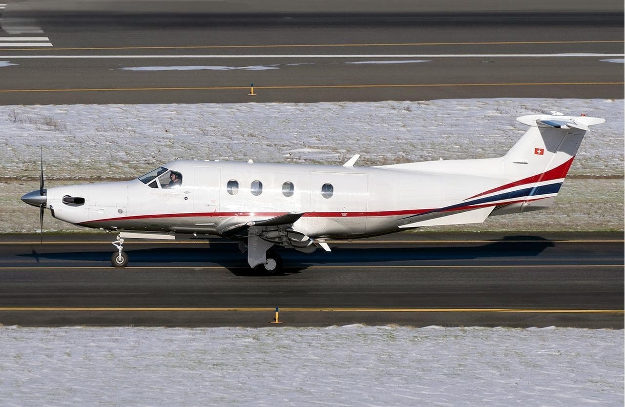 Wed, Nov 4TomorrowBoiseKBOI · Boise Air Terminal/Gowen fieldSalemKSLE · McNary FieldPilatus PC-129—$5,7354NovBoise → SalemKBOI → KSLE · TomorrowPilatus PC-12 · 9 seats$5,735
- Wed, Nov 4TomorrowBoiseKBOI · Boise Air Terminal/Gowen FieldPhoenixKPHX · Phoenix Sky Harbor International AirportCessna Citation Latitude9—$38,1704NovBoise → PhoenixKBOI → KPHX · TomorrowCessna Citation Latitude · 9 seats$38,170
- Wed, Nov 407:40BoiseKBOI · Boise Air Terminal/Gowen FieldSpokaneKSFF · Felts FieldPilatus PC-128—$2,3104NovBoise → SpokaneKBOI → KSFF · 07:40Pilatus PC-12 · 8 seats$2,310
- Wed, Nov 4TomorrowBoiseKBOI · Boise Air Terminal/Gowen FieldSalemKSLE · Salem-Willamette Valley Airport/McNary FieldPilatus PC-12/47 NG8—$6,9304NovBoise → SalemKBOI → KSLE · TomorrowPilatus PC-12/47 NG · 8 seats$6,930
- Wed, Nov 418:42BoiseKBOI · Boise Air Terminal/Gowen FieldCaldwellKEUL · Caldwell Executive AirportPilatus PC-12 NG8—$1,8704NovBoise → CaldwellKBOI → KEUL · 18:42Pilatus PC-12 NG · 8 seats$1,870
- Wed, Nov 4TomorrowBoiseKBOI · Boise Air Terminal/Gowen FieldCoeur d'AleneKCOE · Coeur D'Alene Airport - Pappy Boyington FieldCessna Citation Mustang4—$4,6204NovBoise → Coeur d'AleneKBOI → KCOE · TomorrowCessna Citation Mustang · 4 seats$4,620
- Wed, Nov 4TomorrowBoiseKBOI · Boise Air Terminal/Gowen fieldHaileyKSUN · Friedman Memorial AirportCessna Citation Mustang436mOn request4NovBoise → HaileyKBOI → KSUN · TomorrowCessna Citation Mustang · 4 seats · 36mOn request
 KBOI · Boise Air Terminal/Gowen field
* Total price incl. 10% service fee, converted to your selected currency. Price subject to operator confirmation.
Empty legs to KBOI
100 arrivals available
 Tue, Nov 3TodayPhoenixKDVT · Phoenix Deer Valley AirportBoiseKBOI · Boise Air Terminal/Gowen fieldLearjet 458—On request3NovPhoenix → BoiseKDVT → KBOI · TodayLearjet 45 · 8 seatsOn request
- Tue, Nov 3TodayDenverKDEN · Denver IntlBoiseKBOI · Boise Air Terminal GowenCessna Citation Mustang—2h 21mOn request3NovDenver → BoiseKDEN → KBOI · TodayCessna Citation Mustang · 2h 21mOn request
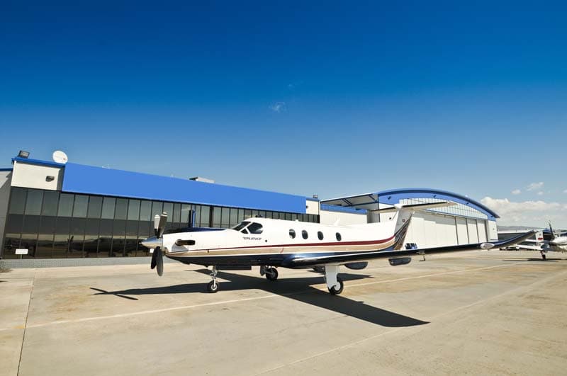 Tue, Nov 320:24DenverKAPA · Centennial AirportBoiseKBOI · Boise Air Terminal/Gowen fieldPilatus PC 1212h 36mOn request3NovDenver → BoiseKAPA → KBOI · 20:24Pilatus PC 12 · 1 seat · 2h 36mOn request
- Wed, Nov 4TomorrowDenverKAPA · Centennial AirportBoiseKBOI · Boise Air Terminal/Gowen fieldPilatus PC 12——On request4NovDenver → BoiseKAPA → KBOI · TomorrowPilatus PC 12On request
 Wed, Nov 4TomorrowSacramentoKMHR · Sacramento Mather AirportBoiseKBOI · Boise Air Terminal/Gowen fieldCitation Mustang4—On request4NovSacramento → BoiseKMHR → KBOI · TomorrowCitation Mustang · 4 seatsOn request
- Wed, Nov 4TomorrowSacramentoKSAC · Sacramento ExecutiveBoiseKBOI · Boise Air Terminal GowenCessna Citation Mustang—1h 47mOn request4NovSacramento → BoiseKSAC → KBOI · TomorrowCessna Citation Mustang · 1h 47mOn request
- Wed, Nov 4TomorrowSacramentoKSMF · Sacramento IntlBoiseKBOI · Boise Air Terminal GowenCessna Citation Mustang—1h 45mOn request4NovSacramento → BoiseKSMF → KBOI · TomorrowCessna Citation Mustang · 1h 45mOn request
- Wed, Nov 411:54McCallKMYL · McCall Municipal AirportBoiseKBOI · Boise Air Terminal/Gowen FieldCessna Citation Mustang4—$3,7404NovMcCall → BoiseKMYL → KBOI · 11:54Cessna Citation Mustang · 4 seats$3,740
- Wed, Nov 407:45PortlandKPDX · Portland IntlBoiseKBOI · Gowen FieldPilatus PC 127—On request4NovPortland → BoiseKPDX → KBOI · 07:45Pilatus PC 12 · 7 seatsOn request
* Total price incl. 10% service fee, converted to your selected currency. Price subject to operator confirmation.
Map: Boise Airport
View the location of Boise – BOI/KBOI. Zoom in to explore the area around the airport.
About the airport
Boise Air Terminal/Gowen field (BOI/KBOI) is the key private jet gateway for Boise. PrivJet gives you instant access to charter flights and empty legs: fast, discreet and globally connected.
KBOI airport FAQ
Are there any restrictions at Boise airport (KBOI) today?
There are currently 36 valid NOTAMs for Boise (KBOI). According to NOTAM, at least one runway or the aerodrome itself is closed. Affected: Runway: closed; Apron: closed; Taxiway: closed; Taxiway: out of service and 4 more. 6 more NOTAMs start in the coming days. For information only, not for flight planning or operational use. Always rely on an official pre-flight briefing. This list may be incomplete or out of date.
How long are the runways at Boise airport (KBOI)?
Boise (KBOI) has 2 runways: runway 10L/28R with 3,048 m (10,000 ft), asphalt and runway 10R/28L with 2,976 m (9,763 ft), asphalt. The longest is 3,048 m.
What are the radio frequencies at Boise airport (KBOI)?
Frequencies at KBOI: Tower 118.1 MHz, Ground 121.7 MHz and ATIS 123.9 MHz. For information only. Always rely on the published AIP.
What are the airport codes of Boise Air Terminal/Gowen field?
The ICAO code is KBOI and the IATA code is BOI. ICAO codes are used by air traffic control and pilots, e.g. in flight plans; IATA codes appear on tickets and baggage tags.
What is the elevation of KBOI airport?
Boise Air Terminal/Gowen field sits at 2,871 ft (875 m) above sea level. Local time zone: America/Boise.
Can I fly to KBOI by private jet?
Whether a private jet can operate into Boise Air Terminal/Gowen field depends on runway length, opening hours, customs and immigration rules as well as slot and handling availability, among other things. PrivJet checks this with the operating carrier for every request.
Are there empty legs from or to KBOI?
There are currently 100 empty legs departing from and 100 arriving at Boise Air Terminal/Gowen field. Empty legs are repositioning flights at heavily reduced prices; the list is updated several times a day.