Boston General Edward Lawrence Logan Airport (KBOS / BOS)
Empty legs and charters from Boston
KBOS airport at a glance
- ICAO code
- KBOS
- IATA code
- BOS
- City
- Boston
- Region
- Massachusetts
- Country
- United States
- Elevation
- 20 ft (6 m)
- Time zone
- America/New York (UTC-5)
- Coordinates
- 42.3643° N, 71.0052° W
- Empty legs from
- 40
- Empty legs to
- 27
Private jet terminal & FBOs at Boston General Edward Lawrence Logan
- Signature Aviation BOS240 Prescott Street (60 Logan South-Harborside), East Boston, MA 02128
Weather & airport info KBOS
Current weather
Good visual conditions (VFR)observed 03 Nov, 13:54 UTC- Wind
- 6 kt (11 km/h) from southwest (230°)
- Visibility
- 10 km or more
- Clouds
- few clouds at 16,000 ft, broken clouds at 25,000 ft
- Temperature
- 17 °C (dew point 7 °C)
- Pressure (QNH)
- 1,025 hPa
Original weather report (METAR)
METAR KBOS 031354Z 23006KT 10SM FEW160 BKN250 17/07 A3026 RMK AO2 SLP245 T01720072
Forecast (TAF)
- 03 Nov, 12:00–19:00 UTC10 kt (19 km/h) from southwest (230°) · visibility 10 km or more · few clouds at 15,000 ft
- 03 Nov, 19:00–04:00 UTCfrom8 kt (15 km/h) from south (190°) · visibility 10 km or more · scattered clouds at 10,000 ft
- 04 Nov, 04:00–18:00 UTCfrom5 kt (9 km/h) from southwest (230°) · visibility 10 km or more · overcast at 10,000 ft
Original forecast (TAF)
TAF KBOS 031120Z 0312/0418 23010KT P6SM FEW150 FM031900 19008KT P6SM SCT100 FM040400 23005KT P6SM OVC100
Airport
- Elevation
- 20 ft (6 m)
- Sunrise / Sunset
- 06:19 / 16:35 local time
Runways
| Runway | Length | Surface | Lighted |
|---|---|---|---|
| 15R/33L | 3,073 m (10,083 ft) | asphalt | yes |
| 04R/22L | 3,050 m (10,006 ft) | asphalt | yes |
| 04L/22R | 2,397 m (7,864 ft) | asphalt | yes |
| 09/27 | 2,134 m (7,001 ft) | asphalt | yes |
| 14/32 | 1,524 m (5,000 ft) | asphalt | no |
| 15L/33R | 779 m (2,557 ft) | asphalt | yes |
Radio frequencies
- Approach: 118.25
- Approach: 120.6
- Approach: 127.2
- ATIS: 135
- Clearance: 121.65
- Ground: 121.75
- Ground: 121.9
- Tower: 128.8
For information only, not for flight planning. Weather can change quickly; always rely on official reports. Sources: aviationweather.gov (NOAA), OurAirports.
Airport map KBOS
Full screen →Runways white, taxiways yellow with designators, closed taxiways and runways per NOTAM in red.
Closed per NOTAM: RWY 15R/33L*, RWY 14/32, RWY 9/27*, RWY 15L/33R, TWY D* (* partly closed)
Official charts (FAA)
Cycle 2611, valid until 0901Z 11/26/26
Airport diagram (FAA)
Airport diagram (1)
Instrument approaches (19)
- ILS OR LOC RWY 04R
- ILS OR LOC RWY 15R
- ILS OR LOC RWY 22L
- ILS OR LOC RWY 27
- ILS OR LOC RWY 33L
- ILS RWY 04R (SA CAT I)
- ILS RWY 33L (SA CAT I)
- ILS RWY 04R (CAT II - III)
- ILS RWY 33L (CAT II - III)
- RNAV (RNP) X RWY 33L
- RNAV (GPS) RWY 04L
- RNAV (GPS) RWY 04R
- RNAV (GPS) RWY 15R
- RNAV (GPS) RWY 27
- RNAV (GPS) RWY 32
- RNAV (GPS) X RWY 22L
- RNAV (GPS) Y RWY 22L
- RNAV (GPS) Z RWY 33L
- LIGHT VISUAL RWY 33L
Departure procedures (19)
- BLZZR SIX (RNAV)
- BLZZR SIX (RNAV), CONT.1
- BRUWN SEVEN (RNAV)
- BRUWN SEVEN (RNAV), CONT.1
- CELTK SEVEN (RNAV)
- CELTK SEVEN (RNAV), CONT.1
- HYLND SEVEN (RNAV)
- HYLND SEVEN (RNAV), CONT.1
- LBSTA EIGHT (RNAV)
- LBSTA EIGHT (RNAV), CONT.1
- LOGAN FOUR
- LOGAN FOUR, CONT.1
- PATSS SEVEN (RNAV)
- PATSS SEVEN (RNAV), CONT.1
- REVSS SIX (RNAV)
- REVSS SIX (RNAV), CONT.1
- SSOXS SEVEN (RNAV)
- SSOXS SEVEN (RNAV), CONT.1
- WYLYY FIVE (RNAV)
Hot spots (1)
LAHSO (1)
For information only, not for navigation. Always use current official charts and NOTAMs.
Current NOTAMs for KBOS(34)
NOTAMs (Notices to Air Missions) announce short-term changes at an airport: closed runways or taxiways, unserviceable approach aids, obstacles, airspace restrictions.
- ClosedRunway: closedA4021/26· until 03 Nov, 17:00 UTC
Runway 15R/33L at General Edward Lawrence Logan International Airport is closed, except for taxiing between taxiway L and runway 22L. This requires 30 minutes prior permission on frequency 131.1.
Show original text
RWY 15R/33L CLSD EXC TAX BTN TWY L AND RWY 22L 30MIN PPR 131.1
A4021/26 NOTAMN
Q) KZBW/QMRLC////000/999/4221N07100W005
A) KBOS
B) 2611031150
C) 2611031700
E) RWY 15R/33L CLSD EXC TAX BTN TWY L AND RWY 22L 30MIN PPR 131.1
- ClosedRunway: closedA3979/26· until 30 Nov, 12:00 UTC
Runway 14/32 is closed, except for taxiing with 30 minutes prior permission required by calling 617-561-1919.
Show original text
RWY 14/32 CLSD EXC TAX 30MIN PPR 617-561-1919
A3979/26 NOTAMN
Q) KZBW/QMRLC////000/999/4221N07100W005
A) KBOS
B) 2611011909
C) 2611301200
E) RWY 14/32 CLSD EXC TAX 30MIN PPR 617-561-1919
- ClosedRunway: closedA3978/26· until 08 Nov, 23:59 UTC
Runway 09/27 is closed, except for taxiing between taxiway D2 and taxiway M.
Show original text
RWY 09/27 CLSD EXC TAX BTN TWY D2 AND TWY M
A3978/26 NOTAMN
Q) KZBW/QMRLC////000/999/4221N07100W005
A) KBOS
B) 2611011035
C) 2611082359
E) RWY 09/27 CLSD EXC TAX BTN TWY D2 AND TWY M
- ClosedAerodrome: closed10/567· until 14 Nov, 05:59 UTC
The airport is closed to non-scheduled transient general aviation aircraft, except with 24-hour prior permission required.
Show original text
AD AP CLSD TO NON-SKED TRANSIENT GA ACFT EXC 24HR PPR
A3653/26 NOTAMN
Q) KZBW/QFALC////000/999/4221N07100W005
A) KBOS
B) 2610222001
C) 2611140559
E) AD AP CLSD TO NON-SKED TRANSIENT GA ACFT EXC 24HR
PPR
- ClosedAerodrome: closedA3653/26· until 14 Nov, 05:59 UTC
The airport is closed to non-scheduled transient general aviation aircraft, except with 24-hour prior permission required.
Show original text
AD AP CLSD TO NON-SKED TRANSIENT GA ACFT EXC 24HR PPR
A3653/26 NOTAMN Q) KZBW/QFALC////000/999/4221N07100W005 A) KBOS B) 2610222001 C) 2611140559 E) AD AP CLSD TO NON-SKED TRANSIENT GA ACFT EXC 24HR PPR
- ClosedRunway: closedA2820/26· until 15 Nov, 06:00 UTC
Runway 15L/33R is closed, except for taxiing.
Show original text
RWY 15L/33R CLSD EXC TAX
A2820/26 NOTAMN
Q) KZBW/QMRLC////000/999/4221N07100W005
A) KBOS
B) 2610030159
C) 2611150600
E) RWY 15L/33R CLSD EXC TAX
- Out of serviceInstrument approach procedure4885/26· from 05 Nov, 12:00 UTC · until 05 Nov, 19:00 UTC (estimated)
Instrument approach procedure GENERAL EDWARD LAWRENCE LOGAN INTL, BOSTON, MA. ILS (instrument landing system) or localizer runway 4R, amendment 11C... ILS (instrument landing system) runway 4R (SA category I), amendment 11C... ILS (instrument landing system) runway 4R (category II-III), amendment 11C... RADAR REQUIRED except for aircraft equipped with SUITABLE RNAV (area navigation) SYSTEM with GPS. visual descent point not available. I-BOS DME (distance measuring) out of service. 5 Nov 12:00 UTC -2611051900EST
Show original text
IAP GENERAL EDWARD LAWRENCE LOGAN INTL, BOSTON, MA. ILS OR LOC RWY 4R, AMDT 11C... ILS RWY 4R (SA CAT I), AMDT 11C... ILS RWY 4R (CAT II-III), AMDT 11C... RADAR REQUIRED EXCEPT FOR ACFT EQUIPPED WITH SUITABLE RNAV SYSTEM WITH GPS. VDP NA. I-BOS DME OUT OF SERVICE. 2611051200-2611051900EST
Q) KZBW/QPIXX/I/NBO/A/000/999/4221N07100W005
A) KBOS
B) 2611031403
C) 2706151403EST
E) BOS GENERAL EDWARD LAWRENCE LOGAN INTL, BOSTON, MA.
ILS OR LOC RWY 4R, AMDT 11C...
ILS RWY 4R (SA CAT I), AMDT 11C...
ILS RWY 4R (CAT II-III), AMDT 11C...
RADAR REQUIRED EXCEPT FOR ACFT EQUIPPED WITH SUITABLE RNAV SYSTEM WITH GPS.
VDP NA.
I-BOS DME OUT OF SERVICE.
- Out of serviceDME associated with ILS: unserviceableA3999/26· from 05 Nov, 12:00 UTC · until 05 Nov, 19:00 UTC
The instrument landing system (ILS) for runway 04R is out of service. The ILS guides aircraft to the runway in poor visibility.
Show original text
BOS NAV ILS RWY 04R DME U/S
A3999/26 NOTAMN
Q) KZBW/QIDAS////000/999/4221N07100W005
A) KBOS
B) 2611051200
C) 2611051900
E) BOS NAV ILS RWY 04R DME U/S
26 more NOTAMs
- Out of serviceInstrument approach procedure: changedA4032/26· from 05 Nov, 12:00 UTC · until 05 Nov, 19:00 UTC
Instrument approach procedure GENERAL EDWARD LAWRENCE LOGAN INTL, BOSTON, MA. ILS (instrument landing system) or localizer runway 4R, amendment 11C... ILS (instrument landing system) runway 4R (SA category I), amendment 11C... ILS (instrument landing system) runway 4R (category II-III), amendment 11C... RADAR REQUIRED except for aircraft equipped with SUITABLE RNAV (area navigation) SYSTEM with GPS. visual descent point not available. I-BOS DME (distance measuring) out of service.
Show original text
IAP GENERAL EDWARD LAWRENCE LOGAN INTL, BOSTON, MA. ILS OR LOC RWY 4R, AMDT 11C... ILS RWY 4R (SA CAT I), AMDT 11C... ILS RWY 4R (CAT II-III), AMDT 11C... RADAR REQUIRED EXCEPT FOR ACFT EQUIPPED WITH SUITABLE RNAV SYSTEM WITH GPS. VDP NA. I-BOS DME OUT OF SERVICE.
A4032/26 NOTAMN
Q) KZBW/QPICH/I/NBO/A/000/999/4221N07100W005
A) KBOS
B) 2611051200
C) 2611051900
E) IAP GENERAL EDWARD LAWRENCE LOGAN INTL, BOSTON, MA. ILS OR LOC RWY 4R, AMDT 11C... ILS RWY 4R (SA CAT I), AMDT 11C... ILS RWY 4R (CAT II-III), AMDT 11C... RADAR REQUIRED EXCEPT FOR ACFT EQUIPPED WITH SUITABLE RNAV SYSTEM WITH GPS. VDP NA. I-BOS DME OUT OF SERVICE.
- Out of serviceILS: unserviceableA3995/26· from 04 Nov, 12:00 UTC · until 04 Nov, 19:00 UTC
The instrument landing system (ILS) for runway 04R is out of service. The ILS guides aircraft precisely to the runway in poor visibility.
Show original text
BOS NAV ILS RWY 04R U/S
A3995/26 NOTAMN
Q) KZBW/QICAS////000/999/4221N07100W005
A) KBOS
B) 2611041200
C) 2611041900
E) BOS NAV ILS RWY 04R U/S
- Out of serviceILS: unserviceableA3996/26· from 04 Nov, 12:00 UTC · until 04 Nov, 19:00 UTC
The instrument landing system (ILS) for runway 22L is out of service. The ILS guides aircraft to the runway in poor visibility.
Show original text
BOS NAV ILS RWY 22L U/S
A3996/26 NOTAMN
Q) KZBW/QICAS////000/999/4221N07100W005
A) KBOS
B) 2611041200
C) 2611041900
E) BOS NAV ILS RWY 22L U/S
- Out of serviceRunwayA4029/26· from 04 Nov, 12:00 UTC · until 14 Nov, 18:00 UTC
Runway 09 TKOF HOLD light out of service
Show original text
RWY 09 TKOF HOLD LGT U/S
A4029/26 NOTAMN
Q) KZBW/QMRXX////000/999/4221N07100W005
A) KBOS
B) 2611041200
C) 2611141800
E) RWY 09 TKOF HOLD LGT U/S
- Out of serviceRunwayA4030/26· from 04 Nov, 12:00 UTC · until 14 Nov, 18:00 UTC
Runway 27 TKOF HOLD light out of service
Show original text
RWY 27 TKOF HOLD LGT U/S
A4030/26 NOTAMN
Q) KZBW/QMRXX////000/999/4221N07100W005
A) KBOS
B) 2611041200
C) 2611141800
E) RWY 27 TKOF HOLD LGT U/S
- Out of serviceApproach lighting: unserviceableA4024/26· until 03 Nov, 17:00 UTC
The approach lighting system (ALS) for runway 04R is out of service. Approach lighting helps pilots locate the runway in poor visibility.
Show original text
RWY 04R ALS U/S
A4024/26 NOTAMN
Q) KZBW/QLAAS////000/999/4221N07100W005
A) KBOS
B) 2611031230
C) 2611031700
E) RWY 04R ALS U/S
- Out of serviceObstacle10/705· until 13 Nov, 09:51 UTC
Obstacle light on tower (ASR 1017974) (5.4 NM northwest of BOS) 428.8 ft above sea level (252.6 ft above ground) out of service
Show original text
OBST TOWER LGT (ASR 1017974) 422550.00N0710520.00W (5.4NM NW BOS) 428.8FT (252.6FT AGL) U/S
- Out of serviceObstacle lights: unserviceableA3862/26· until 11 Nov, 21:55 UTC
A tower light (ASR 1031648) 2.4 nautical miles west of the airport, with its top at 691 feet above sea level and 629 feet above ground, is out of service.
Show original text
TOWER LGT (ASR 1031648) 422131.00N0710339.00W (2.4NM W BOS) 691FT (629FT AGL) U/S
A3862/26 NOTAMN
Q) KZBW/QOLAS/IV/M/AE/000/999/4221N07103W001
A) KBOS
B) 2610282155
C) 2611112155
E) TOWER LGT (ASR 1031648) 422131.00N0710339.00W (2.4NM W BOS) 691FT (629FT AGL) U/S
- Out of serviceSequenced flashing lights: unserviceableA3438/26· until 19 Feb, 19:00 UTC
The sequenced flashing lights for runway 22L are out of service.
Show original text
RWY 22L SEQUENCED FLG LGT U/S
A3438/26 NOTAMN
Q) KZBW/QLFAS////000/999/4221N07100W005
A) KBOS
B) 2610162128
C) 2702191900
E) RWY 22L SEQUENCED FLG LGT U/S
- ClosedTaxiway: closedA2846/26· until 16 Nov, 18:00 UTC
Taxiway D is closed between taxiway D2 and the approach end of runway 27.
Show original text
TWY D BTN TWY D2 AND APCH END RWY 27 CLSD
A2846/26 NOTAMN
Q) KZBW/QMXLC////000/999/4221N07100W005
A) KBOS
B) 2610051136
C) 2611161800
E) TWY D BTN TWY D2 AND APCH END RWY 27 CLSD
- NoticeAerodrome: concentration of birdsA4027/26· until 03 Nov, 15:00 UTC
At the airport, there is increased bird activity. This may lead to bird strikes.
Show original text
AD AP BIRD ACT INCREASED
A4027/26 NOTAMN
Q) KZBW/QFAHX////000/999/4221N07100W005
A) KBOS
B) 2611031242
C) 2611031500
E) AD AP BIRD ACT INCREASED
- Out of serviceILS category I: not availableA4026/26· until 03 Nov, 17:00 UTC
BOS navigation: ILS (instrument landing system) runway 04R SPECIAL AUTH category I not available
Show original text
BOS NAV ILS RWY 04R SPECIAL AUTH CAT I NA
A4026/26 NOTAMN
Q) KZBW/QISAU////000/999/4221N07100W005
A) KBOS
B) 2611031234
C) 2611031700
E) BOS NAV ILS RWY 04R SPECIAL AUTH CAT I NA
- Out of serviceILS category II: not availableA4025/26· until 03 Nov, 17:00 UTC
The Instrument Landing System (ILS) for runway 04R is not available for Category II approaches. The ILS guides aircraft to the runway in poor visibility.
Show original text
BOS NAV ILS RWY 04R CAT II NA
A4025/26 NOTAMN
Q) KZBW/QITAU////000/999/4221N07100W005
A) KBOS
B) 2611031230
C) 2611031700
E) BOS NAV ILS RWY 04R CAT II NA
- NoticeObstacle: erectedA4023/26· until 03 Nov, 23:00 UTC
A crane is an obstacle. It is located 1.1 nautical miles northwest of the airport, its top is 162 feet above sea level and 150 feet above ground. It is flagged and lighted.
Show original text
OBST CRANE (ASN 2026-ANE-564-NRA) 422240N0710116W (1.1NM NW BOS) 162FT (150FT AGL) FLAGGED AND LGTD
A4023/26 NOTAMN
Q) KZBW/QOBCE/IV/M/AE/000/999/4221N07100W005
A) KBOS
B) 2611031215
C) 2611032300
E) OBST CRANE (ASN 2026-ANE-564-NRA) 422240N0710116W (1.1NM NW BOS) 162FT (150FT AGL) FLAGGED AND LGTD
- NoticeObstacle: erectedA4022/26· until 03 Nov, 23:00 UTC
A crane is an obstacle. It is located 1.1 nautical miles northwest of the airport, its top is 162 feet above sea level and 150 feet above ground. It is flagged and lighted.
Show original text
OBST CRANE (ASN 2026-ANE-563-NRA) 422242N0710113W (1.1NM NW BOS) 162FT (150FT AGL) FLAGGED AND LGTD
A4022/26 NOTAMN
Q) KZBW/QOBCE/IV/M/AE/000/999/4221N07100W005
A) KBOS
B) 2611031214
C) 2611032300
E) OBST CRANE (ASN 2026-ANE-563-NRA) 422242N0710113W (1.1NM NW BOS) 162FT (150FT AGL) FLAGGED AND LGTD
- NoticeTaxiway: work in progressA4020/26· until 03 Nov, 19:00 UTC
Work is in progress on taxiways A, B, E, and K.
Show original text
TWY A, B, E, K WIP
A4020/26 NOTAMN
Q) KZBW/QMXHW////000/999/4221N07100W005
A) KBOS
B) 2611031120
C) 2611031900
E) TWY A, B, E, K WIP
- NoticeAirspace10/683· until 04 Nov, 20:00 UTC
Airspace within a 1 nautical mile radius east-northeast of the airport, up to 150 feet above ground, is designated for Unmanned Aircraft Systems (UAS).
Show original text
AIRSPACE UAS WI AN AREA DEFINED AS 1NM RADIUS OF 422258.70N0705822W (1.9NM ENE BOS) SFC-150FT AGL
- NoticeDaylight markings10/689· until 27 Jan, 05:00 UTC
The runway 09/27 centerline markings are obscured.
Show original text
RWY 09/27 CL MARKINGS OBSC
10/689 NOTAMN
Q) KZBW/QMMXX/V/M/A/000/999/4221N07100W005
A) KBOS
B) 2610281806
C) 2701270500

E) RWY 09/27 CL MARKINGS OBSC
- NoticeDaylight markings10/688· until 27 Jan, 05:00 UTC
The runway 15R/33L centerline markings are obscured.
Show original text
RWY 15R/33L CL MARKINGS OBSC
10/688 NOTAMN
Q) KZBW/QMMXX/V/M/A/000/999/4221N07100W005
A) KBOS
B) 2610281805
C) 2701270500

E) RWY 15R/33L CL MARKINGS OBSC
- NoticeRunway10/687· until 15 Jan, 05:00 UTC
The runway 04L/22R centerline marking between taxiway E and runway 15R/33L is obscured.
Show original text
RWY 04L/22R CL MARKING BTN TWY E AND RWY 15R/33L OBSC
- NoticeDaylight markings10/686· until 15 Jan, 05:00 UTC
The holding position markings for runway 22L at runway 09/27 are obscured. This might make it harder to see where to hold short of the runway.
Show original text
RWY 22L HLDG PSN MARKINGS AT RWY 09/27 OBSC
10/686 NOTAMR
Q) KZBW/QMMXX/V/M/A/000/999/4221N07100W005
A) KBOS
B) 2610281737
C) 2701150500

E) RWY 22L HLDG PSN MARKINGS AT RWY 9/27 OBSC
- NoticeAirspace10/610· until 05 Nov, 20:00 UTC
The airspace within a 4 nautical mile radius, 4.1 nautical miles west of Boston airport, is restricted for unmanned aircraft systems (UAS) up to 200 feet above ground.
Show original text
AIRSPACE UAS WI AN AREA DEFINED AS 4NM RADIUS OF 422003N0710527W (4.1NM W BOS) SFC-200FT AGL
- NoticeObstacle: erected10/571· until 31 Dec, 23:59 UTC
A crane is an obstacle 0.7 nautical miles west-northwest of the airport. Its top is 183 ft above sea level, 170 ft above ground. It is flagged and lighted.
Show original text
OBST CRANE (ASN 2025-ANE-1558-NRA) 422208N0710112W (0.7NM WNW BOS) 183FT (170FT AGL) FLAGGED AND LGTD
A3661/26 NOTAMN
Q) KZBW/QOBCE/IV/M/AE/000/999/4221N07100W005
A) KBOS
B) 2610230323
C) 2612312359
E) OBST CRANE (ASN 2025-ANE-1558-NRA) 422208N0710112W (0.7NM WNW BOS) 183FT (170FT AGL) FLAGGED AND LGTD
- NoticeObstacle: erectedA3661/26· until 31 Dec, 23:59 UTC
A crane is an obstacle 0.7 nautical miles west-northwest of the airport. Its top is 183 ft above sea level, 170 ft above ground. It is flagged and lighted.
Show original text
OBST CRANE (ASN 2025-ANE-1558-NRA) 422208N0710112W (0.7NM WNW BOS) 183FT (170FT AGL) FLAGGED AND LGTD
A3661/26 NOTAMN Q) KZBW/QOBCE/IV/M/AE/000/999/4221N07100W005 A) KBOS B) 2610230323 C) 2612312359 E) OBST CRANE (ASN 2025-ANE-1558-NRA) 422208N0710112W (0.7NM WNW BOS) 183FT (170FT AGL) FLAGGED AND LGTD
- NoticeRunwayA2816/26· until 15 Nov, 12:00 UTC
A 25 feet wide by 550 feet long section of runway 04R/22L between taxiway C and taxiway F is not grooved.
Show original text
RWY 04R/22L CL 25FT WID X 550FT LEN BTN TWY C AND TWY F NOT GROOVED
A2816/26 NOTAMN
Q) KZBW/QMRXX////000/999/4221N07100W005
A) KBOS
B) 2610030109
C) 2611151200
E) RWY 04R/22L CL 25FT WID X 550FT LEN BTN TWY C AND TWY F NOT GROOVED
- NoticeRunwayA2572/26· until 30 Nov, 23:59 UTC
A 25 ft wide and 1150 ft long section of runway 04R/22L between taxiway C and runway 09/27 is not grooved. This may affect the surface grip.
Show original text
RWY 04R/22L CL 25FT WID X 1150FT LEN BTN TWY C AND RWY 09/27 NOT GROOVED
A2572/26 NOTAMN
Q) KZBW/QMRXX////000/999/4221N07100W005
A) KBOS
B) 2609272227
C) 2611302359
E) RWY 04R/22L CL 25FT WID X 1150FT LEN BTN TWY C AND RWY 09/27 NOT GROOVED
For information only, not for flight planning or operational use. Always rely on an official pre-flight briefing. This list may be incomplete or out of date. Explanations and expanded abbreviations are generated automatically. The original text is authoritative. Source: FAA NOTAM Management Service (SWIM).
Private jet traffic in General Edward Lawrence Logan International Airport (last 30 days)
- Arrivals
- 1,196
- Departures
- 1,131
- Different jets
- 826
Most frequent origins: Teterboro Airport (143), Westchester County Airport (50), Laurence G Hanscom Field (40), Washington Dulles International Airport (29), Philadelphia International Airport (18).
Most frequent destinations: Teterboro Airport (152), Massena International Richards Field (83), Westchester County Airport (64), Laurence G Hanscom Field (53), Nantucket Memorial Airport (27).
Most common aircraft types: Pilatus PC-12 (369), Embraer Phenom 300 (290), Cessna Citation Latitude (188), Bombardier Challenger 350/3500 (159), Cessna Citation Longitude (145).
Our own analysis of public ADS-B signals from business jets. Not every flight is received, and jets with a removal request are excluded.
Charter operators based here
Operators with a base at this airport.
- Fly AllianceOrlando Executive (KORL) · Light jet, Midsize jet, Super midsize jet
- Boutique AirLos Angeles International (KLAX) · Turboprop
Empty legs from KBOS
40 departures available
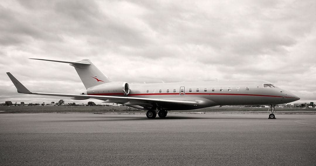 Tue, Nov 3TodayBostonKBOS · General Edward Lawrence Logan International AirportNew YorkKEWR · Newark Liberty International AirportGlobal 500012—On request3NovBoston → New YorkKBOS → KEWR · TodayGlobal 5000 · 12 seatsOn request
 Tue, Nov 3TodayBostonKBOS · General Edward Lawrence Logan International AirportNantucketKACK · Nantucket Memorial AirportPhenom 3007—On request3NovBoston → NantucketKBOS → KACK · TodayPhenom 300 · 7 seatsOn request
- Wed, Nov 4TomorrowBostonKBOS · Logan International AirportTitusvilleKTIX · Space Coast Regional AirportBombardier Learjet 607—$20,6804NovBoston → TitusvilleKBOS → KTIX · TomorrowBombardier Learjet 60 · 7 seats$20,680
- Wed, Nov 4TomorrowBostonKBOS · Logan International AirportTitusvilleKTIX · Space Coast Regional AirportEmbraer Phenom 300E7—$6,9304NovBoston → TitusvilleKBOS → KTIX · TomorrowEmbraer Phenom 300E · 7 seats$6,930
- Wed, Nov 4TomorrowBostonKBOS · Logan IntlTitusvilleKTIX · Space Coast RegionalMidsize Jet6—On request4NovBoston → TitusvilleKBOS → KTIX · TomorrowMidsize Jet · 6 seatsOn request
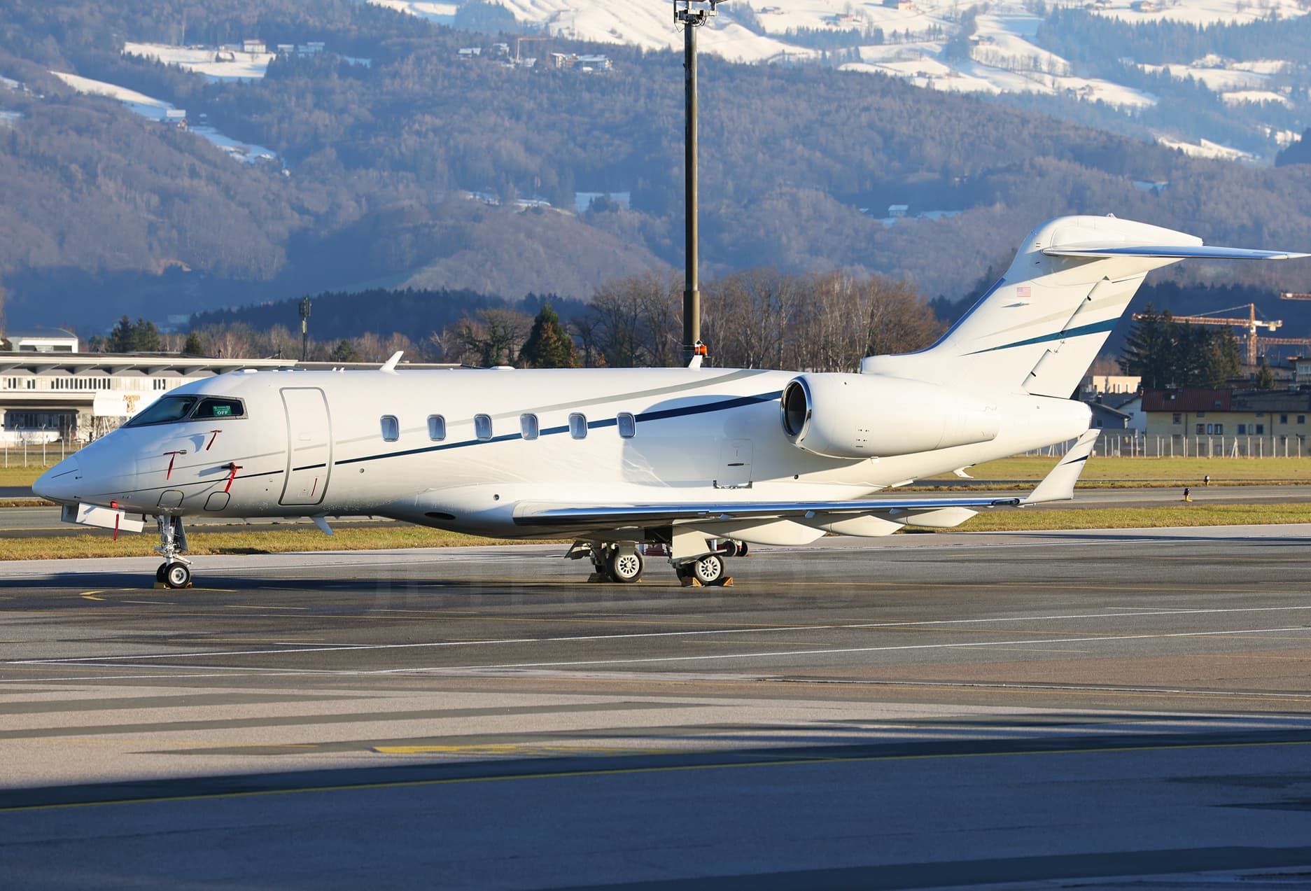 Thu, Nov 5in 2 daysBostonKBOS · General Edward Lawrence Logan International AirportWestchesterKHPN · Westchester County AirportChallenger 3008—On request5NovBoston → WestchesterKBOS → KHPN · in 2 daysChallenger 300 · 8 seatsOn request
 Thu, Nov 5in 2 daysBostonKBOS · General Edward Lawrence Logan International AirportSpringfieldKBAF · Westfield-Barnes Regional AirportLearjet 607—On request5NovBoston → SpringfieldKBOS → KBAF · in 2 daysLearjet 60 · 7 seatsOn request
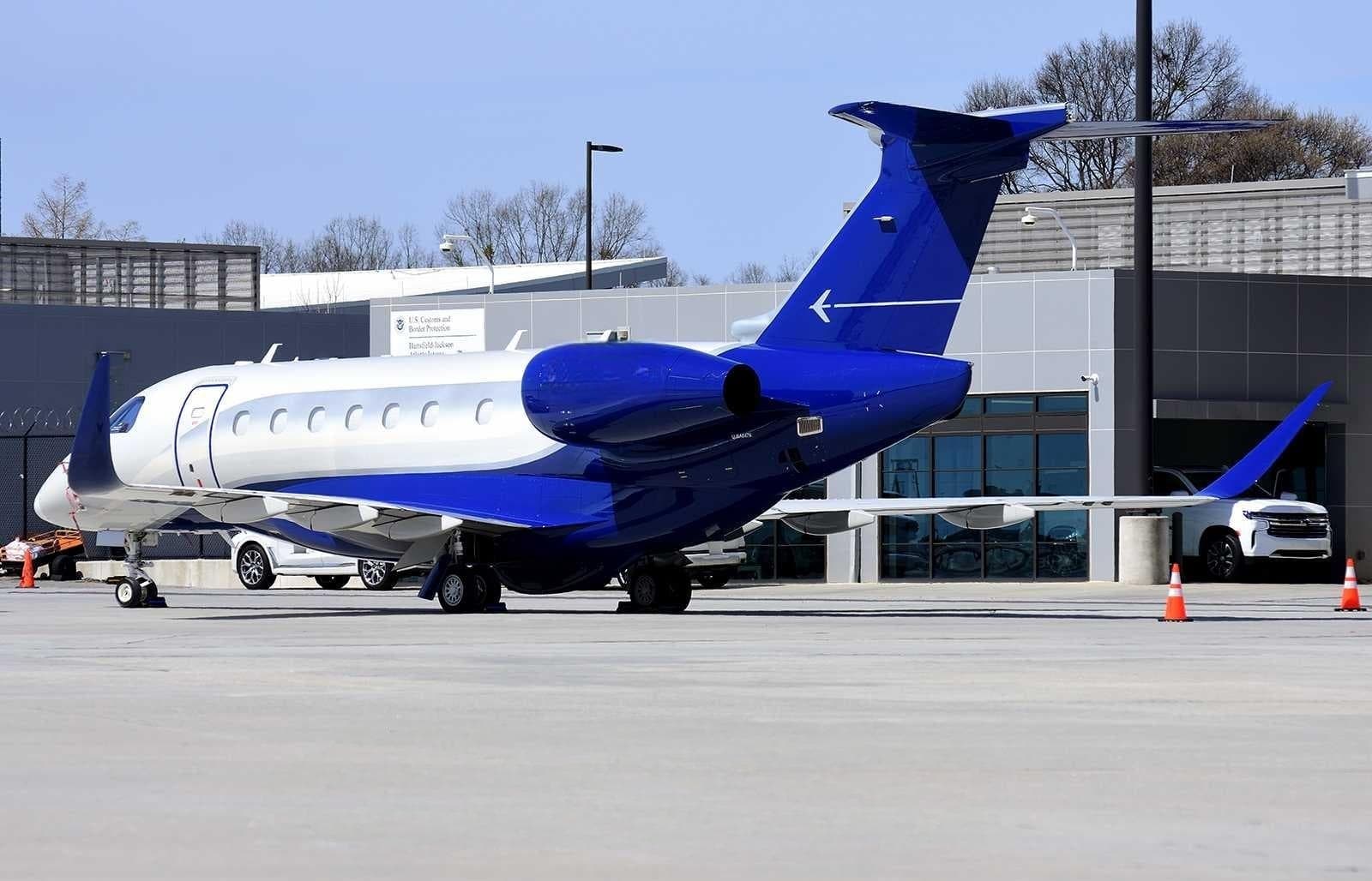 Thu, Nov 5in 2 daysBostonKBOS · General Edward Lawrence Logan International AirportNaplesKAPF · Naples Municipal AirportPraetor 6009—$16,4805NovBoston → NaplesKBOS → KAPF · in 2 daysPraetor 600 · 9 seats$16,480
- Thu, Nov 5in 2 daysBostonKBOS · General Edward Lawrence Logan International AirportTeterboroKTEB · Teterboro AirportBombardier Learjet 60XR7—On request5NovBoston → TeterboroKBOS → KTEB · in 2 daysBombardier Learjet 60XR · 7 seatsOn request
 KBOS · General Edward Lawrence Logan International Airport
* Total price incl. 10% service fee, converted to your selected currency. Price subject to operator confirmation.
Empty legs to KBOS
27 arrivals available
 Tue, Nov 3TodayDallasKADS · Addison AirportBostonKBOS · General Edward Lawrence Logan International AirportChallenger 3508—On request3NovDallas → BostonKADS → KBOS · TodayChallenger 350 · 8 seatsOn request
 Tue, Nov 3TodaySan JoseKSJC · Norman Y. Mineta San Jose International AirportBostonKBOS · General Edward Lawrence Logan International AirportCitation X8—$36,8503NovSan Jose → BostonKSJC → KBOS · TodayCitation X · 8 seats$36,850
- Tue, Nov 323:06TorontoCYYZ · Lester B. Pearson IntlBostonKBOS · Logan IntlCessna Citation Ultra7—CA$9,0753NovToronto → BostonCYYZ → KBOS · 23:06Cessna Citation Ultra · 7 seatsCA$9,075
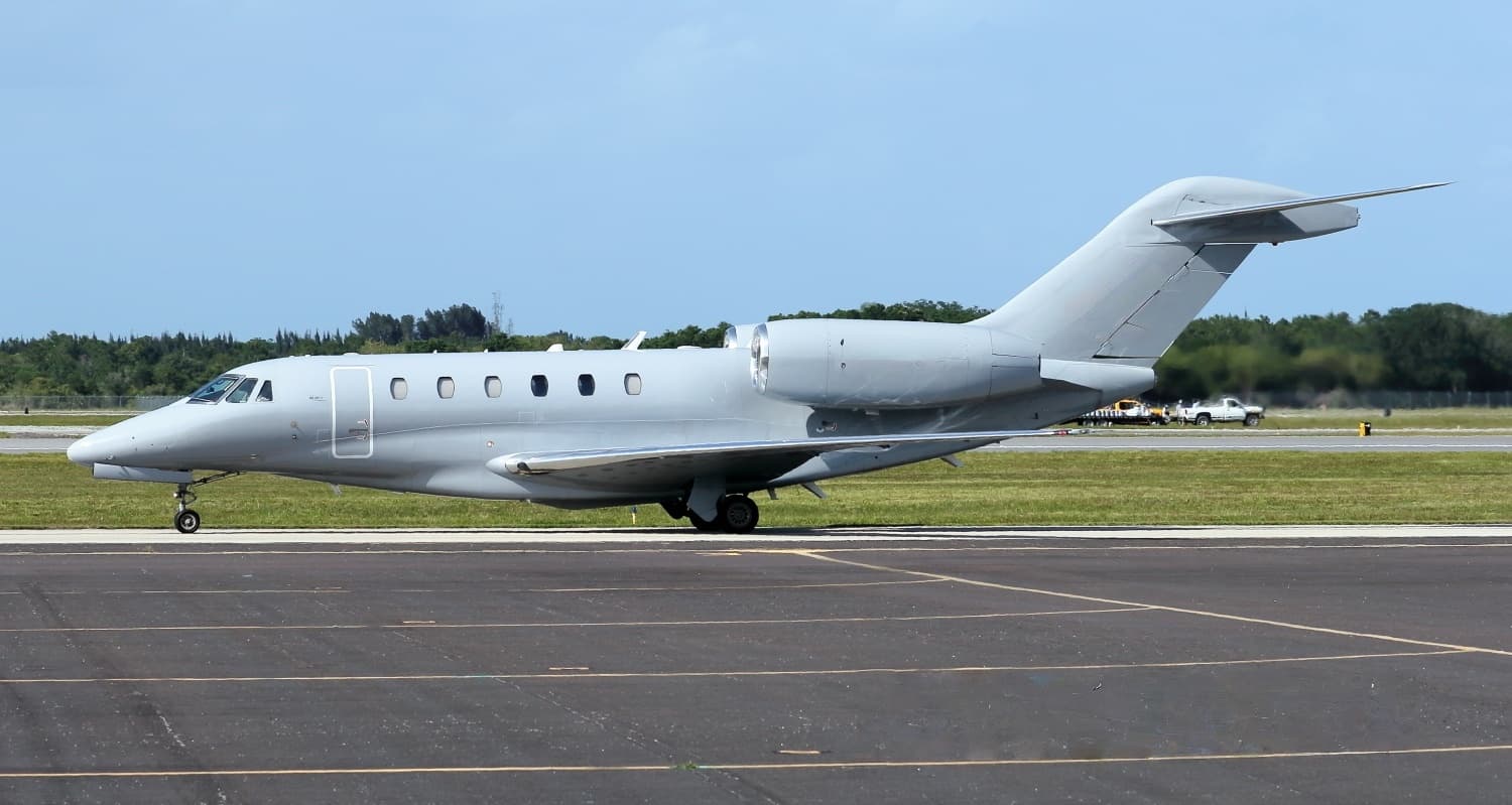 Wed, Nov 4TomorrowSanta FeKSAF · Santa Fe Municipal AirportBostonKBOS · General Edward Lawrence Logan International AirportCitation X8—On request4NovSanta Fe → BostonKSAF → KBOS · TomorrowCitation X · 8 seatsOn request
- Wed, Nov 4TomorrowTorontoCYYZ · Lester B. Pearson International AirportBostonKBOS · General Edward Lawrence Logan International AirportGulfstream G450161h 15m€6,1454NovToronto → BostonCYYZ → KBOS · TomorrowGulfstream G450 · 16 seats · 1h 15m€6,145
- Wed, Nov 4TomorrowDallasKDAL · Dallas Love FieldBostonKBOS · General Edward Lawrence Logan International AirportBombardier Challenger 35083h 30m€13,7634NovDallas → BostonKDAL → KBOS · TomorrowBombardier Challenger 350 · 8 seats · 3h 30m€13,763
 Thu, Nov 5in 2 daysMontrealCYUL · Montreal / Pierre Elliott Trudeau International AirportBostonKBOS · General Edward Lawrence Logan International AirportGlobal 600014—On request5NovMontreal → BostonCYUL → KBOS · in 2 daysGlobal 6000 · 14 seatsOn request
- Thu, Nov 5in 2 daysSmyrnaKMQY · Smyrna AirportBostonKBOS · General Edward Lawrence Logan International AirportBombardier Challenger 30092h 19m€9,1735NovSmyrna → BostonKMQY → KBOS · in 2 daysBombardier Challenger 300 · 9 seats · 2h 19m€9,173
 Thu, Nov 12in 9 daysNew YorkKTEB · Teterboro AirportBostonKBOS · General Edward Lawrence Logan International AirportChallenger 3009—On request12NovNew York → BostonKTEB → KBOS · in 9 daysChallenger 300 · 9 seatsOn request
 CYYZ · Lester B. Pearson Intl
* Total price incl. 10% service fee, converted to your selected currency. Price subject to operator confirmation.
Map: Boston Airport
View the location of Boston – BOS/KBOS. Zoom in to explore the area around the airport.
About the airport
General Edward Lawrence Logan International Airport (BOS/KBOS) is the key private jet gateway for Boston. PrivJet gives you instant access to charter flights and empty legs: fast, discreet and globally connected.
KBOS airport FAQ
Are there any restrictions at Boston airport (KBOS) today?
There are currently 27 valid NOTAMs for Boston (KBOS). According to NOTAM, at least one runway or the aerodrome itself is closed. Affected: Runway: closed; Aerodrome: closed; Taxiway: closed; Approach lighting: unserviceable and 5 more. 7 more NOTAMs start in the coming days. For information only, not for flight planning or operational use. Always rely on an official pre-flight briefing. This list may be incomplete or out of date.
What is the weather at Boston airport (KBOS)?
According to the latest weather report for KBOS (METAR, 03 Nov, 13:54 UTC): Good visual conditions (VFR). Wind 6 kt (11 km/h) from southwest (230°), visibility 10 km or more, temperature 17 °C (dew point 7 °C). For information only, not for flight planning. Weather can change quickly; always rely on official reports.
How long are the runways at Boston airport (KBOS)?
Boston (KBOS) has 6 runways: runway 15R/33L with 3,073 m (10,083 ft), asphalt, runway 04R/22L with 3,050 m (10,006 ft), asphalt, runway 04L/22R with 2,397 m (7,864 ft), asphalt, runway 09/27 with 2,134 m (7,001 ft), asphalt, runway 14/32 with 1,524 m (5,000 ft), asphalt and runway 15L/33R with 779 m (2,557 ft), asphalt. The longest is 3,073 m.
What are the radio frequencies at Boston airport (KBOS)?
Frequencies at KBOS: Tower 128.8 / 132.225 MHz, Ground 121.75 / 121.9 MHz and ATIS 135 MHz. For information only. Always rely on the published AIP.
What are the airport codes of General Edward Lawrence Logan International Airport?
The ICAO code is KBOS and the IATA code is BOS. ICAO codes are used by air traffic control and pilots, e.g. in flight plans; IATA codes appear on tickets and baggage tags.
What is the elevation of KBOS airport?
General Edward Lawrence Logan International Airport sits at 20 ft (6 m) above sea level. Local time zone: America/New York.
Where do private jets land at Boston General Edward Lawrence Logan?
Private jet passengers at KBOS are handled through Signature Aviation BOS (240 Prescott Street (60 Logan South-Harborside), East Boston, MA 02128). The operator confirms the exact meeting point with your flight confirmation.
Can I fly to KBOS by private jet?
Whether a private jet can operate into General Edward Lawrence Logan International Airport depends on runway length, opening hours, customs and immigration rules as well as slot and handling availability, among other things. PrivJet checks this with the operating carrier for every request.
Are there empty legs from or to KBOS?
There are currently 40 empty legs departing from and 27 arriving at General Edward Lawrence Logan International Airport. Empty legs are repositioning flights at heavily reduced prices; the list is updated several times a day.