Burbank Bob Hope Airport (KBUR / BUR)
Empty legs and charters from Burbank
KBUR airport at a glance
- ICAO code
- KBUR
- IATA code
- BUR
- City
- Burbank
- Region
- California
- Country
- United States
- Elevation
- 778 ft (237 m)
- Time zone
- America/Los Angeles (UTC-8)
- Coordinates
- 34.2007° N, 118.3590° W
- Empty legs from
- 32
- Empty legs to
- 19
Weather & airport info KBUR
Current weather
Good visual conditions (VFR)observed 03 Nov, 13:53 UTC- Wind
- Calm
- Visibility
- 10 km or more
- Clouds
- no significant clouds
- Temperature
- 11 °C (dew point 6 °C)
- Pressure (QNH)
- 1,019 hPa
Original weather report (METAR)
METAR KBUR 031353Z 00000KT 10SM CLR 11/06 A3008 RMK AO2 SLP178 T01110061
Forecast (TAF)
- 03 Nov, 12:00–21:00 UTC3 kt (6 km/h) from variable directions · visibility 10 km or more · scattered clouds at 25,000 ft
- 03 Nov, 21:00–04:00 UTCfrom8 kt (15 km/h) from south (190°) · visibility 10 km or more · broken clouds at 25,000 ft
- 04 Nov, 04:00–12:00 UTCfrom3 kt (6 km/h) from variable directions · visibility 10 km or more · scattered clouds at 25,000 ft
Original forecast (TAF)
TAF KBUR 031120Z 0312/0412 VRB03KT P6SM SCT250 FM032100 19008KT P6SM BKN250 FM040400 VRB03KT P6SM SCT250
Airport
- Elevation
- 778 ft (237 m)
- Sunrise / Sunset
- 06:15 / 16:58 local time
Runways
| Runway | Length | Surface | Lighted |
|---|---|---|---|
| 15/33 | 2,099 m (6,886 ft) | asphalt | yes |
| 08/26 | 1,768 m (5,802 ft) | asphalt | yes |
Radio frequencies
- ATIS: 134.5
- Clearance: 118
- Ground: 123.9
- Tower: 118.7
- UNICOM: 122.95
For information only, not for flight planning. Weather can change quickly; always rely on official reports. Sources: aviationweather.gov (NOAA), OurAirports.
Airport map KBUR
Full screen →Runways white, taxiways yellow with designators, closed taxiways and runways per NOTAM in red.
Closed per NOTAM: TWY A* (* partly closed)
Official charts (FAA)
Cycle 2611, valid until 0901Z 11/26/26
Airport diagram (FAA)
Airport diagram (1)
Instrument approaches (6)
Departure procedures (7)
LAHSO (1)
For information only, not for navigation. Always use current official charts and NOTAMs.
Current NOTAMs for KBUR(11)
NOTAMs (Notices to Air Missions) announce short-term changes at an airport: closed runways or taxiways, unserviceable approach aids, obstacles, airspace restrictions.
- Out of serviceStandard instrument departure: not available4698/26· from 03 Nov, 15:00 UTC · until 03 Nov, 23:00 UTC (estimated)
The ELMOO NINE and VAN NUYS THREE standard departure routes (SID) are only available for aircraft equipped with a suitable RNAV system with GPS, because the VOR/DME system in Van Nuys is out of service.
Show original text
SID BOB HOPE, BURBANK, CA. ELMOO NINE DEPARTURE... VAN NUYS THREE DEPARTURE... DEPARTURE NA EXCEPT FOR ACFT EQUIPPED WITH SUITABLE RNAV SYSTEM WITH GPS, VNY VOR/DME OUT OF SERVICE. 2611031500-2611032300EST
Q) KZLA/QPDAU/I/NBO/A/000/999/3412N11821W005
A) KBUR
B) 2606291727
C) 2702081724EST
E) BUR BOB HOPE, BURBANK, CA.
ELMOO NINE DEPARTURE...
VAN NUYS THREE DEPARTURE...
DEPARTURE NA EXCEPT FOR ACFT EQUIPPED WITH SUITABLE RNAV SYSTEM WITH GPS,
VNY VOR/DME U/S.
- Out of serviceStandard instrument departure: not available4699/26· from 03 Nov, 15:00 UTC · until 03 Nov, 23:00 UTC (estimated)
The Obstacle Departure Procedures (ODP) at Hollywood Burbank airport are not available, unless the aircraft is equipped with a suitable RNAV system with GPS, because the VNY VOR/DME is out of service.
Show original text
ODP BOB HOPE, BURBANK, CA. TAKEOFF MINIMUMS AND (OBSTACLE) DEPARTURE PROCEDURES AMDT 5... DEPARTURE PROCEDURE NA EXCEPT FOR ACFT EQUIPPED WITH SUITABLE RNAV SYSTEM WITH GPS, VNY VOR/DME OUT OF SERVICE. 2611031500-2611032300EST
Q) KZLA/QPDAU/I/NBO/A/000/999/3412N11821W005
A) KBUR
B) 2606291723
C) 2702081723EST
E) BUR BOB HOPE, BURBANK, CA.
TAKEOFF MINIMUMS AND (OBSTACLE) DEPARTURE PROCEDURES AMDT 5...
DEPARTURE PROCEDURE NA EXCEPT FOR ACFT EQUIPPED WITH SUITABLE RNAV SYSTEM WITH GPS,
VNY VOR/DME U/S.
- Out of serviceObstacle clearance altitude: changedA1083/26· from 03 Nov, 15:00 UTC · until 03 Nov, 23:00 UTC
The Obstacle Departure Procedures (ODP) at Hollywood Burbank airport are not available, unless the aircraft is equipped with a suitable RNAV system with GPS, because the VNY VOR/DME is out of service.
Show original text
ODP BOB HOPE, BURBANK, CA. TAKEOFF MINIMUMS AND (OBSTACLE) DEPARTURE PROCEDURES AMDT 5... DEPARTURE PROCEDURE NA EXCEPT FOR ACFT EQUIPPED WITH SUITABLE RNAV SYSTEM WITH GPS, VNY VOR/DME OUT OF SERVICE.
A1083/26 NOTAMN
Q) KZLA/QPOCH/I/NBO/A/000/999/3412N11821W005
A) KBUR
B) 2611031500
C) 2611032300
E) ODP BOB HOPE, BURBANK, CA. TAKEOFF MINIMUMS AND (OBSTACLE) DEPARTURE PROCEDURES AMDT 5... DEPARTURE PROCEDURE NA EXCEPT FOR ACFT EQUIPPED WITH SUITABLE RNAV SYSTEM WITH GPS, VNY VOR/DME OUT OF SERVICE.
- Out of serviceStandard instrument departure: changedA1084/26· from 03 Nov, 15:00 UTC · until 03 Nov, 23:00 UTC
The ELMOO NINE and VAN NUYS THREE standard departure routes from Hollywood Burbank airport are not available, unless the aircraft is equipped with a suitable RNAV system with GPS, because the VNY VOR/DME is out of service.
Show original text
SID BOB HOPE, BURBANK, CA. ELMOO NINE DEPARTURE... VAN NUYS THREE DEPARTURE... DEPARTURE NA EXCEPT FOR ACFT EQUIPPED WITH SUITABLE RNAV SYSTEM WITH GPS, VNY VOR/DME OUT OF SERVICE.
A1084/26 NOTAMN
Q) KZLA/QPDCH/I/NBO/A/000/999/3412N11821W005
A) KBUR
B) 2611031500
C) 2611032300
E) SID BOB HOPE, BURBANK, CA. ELMOO NINE DEPARTURE... VAN NUYS THREE DEPARTURE... DEPARTURE NA EXCEPT FOR ACFT EQUIPPED WITH SUITABLE RNAV SYSTEM WITH GPS, VNY VOR/DME OUT OF SERVICE.
- ClosedTaxiway: closedA1067/26· until 04 Nov, 14:45 UTC
Taxiway A between taxiway A2 and taxiway D is closed.
Show original text
TWY A BTN TWY A2 AND TWY D CLSD
A1067/26 NOTAMN
Q) KZLA/QMXLC////000/999/3412N11821W005
A) KBUR
B) 2611031330
C) 2611041445
D) DLY 1330-1445
E) TWY A BTN TWY A2 AND TWY D CLSD
Hours: DLY 1330-1445
- Out of serviceServices10/092· until 11 Nov, 23:59 UTC (estimated)
The automatic terminal information service (ATIS) on frequency 135.125 at Hollywood Burbank Airport is not available.
Show original text
SVC ATIS 135.125 NOT AVBL
- Out of serviceILS outer marker: unserviceableA0967/26· until 17 Dec, 23:59 UTC
The instrument landing system (ILS) for runway 08 is out of service. The ILS helps aircraft land safely in poor visibility.
Show original text
NAV ILS RWY 08 OM U/S
A0967/26 NOTAMN
Q) KZLA/QIOAS////000/999/3412N11821W005
A) KBUR
B) 2610120340
C) 2612172359
E) NAV ILS RWY 08 OM U/S
- NoticeRunway10/078· until 04 Nov, 15:00 UTC
The runway 08/26 centerline markings on the west side are obscured.
Show original text
RWY 08/26 CL MARKINGS W SIDE OBSC
3 more NOTAMs
- NoticeApronA0970/26· permanent
The radio frequency 130.875 for terminal ramp control has been commissioned. This means communication on this frequency is now available.
Show original text
APRON TERMINAL RAMP CTL FREQ 130.875 COMMISSIONED
A0970/26 NOTAMN
Q) KZLA/QMNXX////000/999/3412N11821W005
A) KBUR
B) 2610131300
C) PERM
E) APRON TERMINAL RAMP CTL FREQ 130.875 COMMISSIONED
- NoticeStandard instrument departure: operational5252/26· until 06 May, 14:43 UTC (estimated)
For runway 8, new takeoff obstacle notes have been added: lighting starts 272 feet from the departure end of the runway, 97 feet right of the centerline, up to 30 feet above ground (its top is 728 feet above sea level). Additional lighting starts 272 feet from the departure end of the runway, 92 feet left of the centerline, up to 30 feet above ground (its top is 728 feet above sea level).
Show original text
ODP HOLLYWOOD BURBANK, BURBANK, CA. TAKEOFF MINIMUMS AND (OBSTACLE) DEPARTURE PROCEDURES AMDT 5... ADD TAKEOFF OBSTACLE NOTES: RWY 8, LIGHTING STARTING 272FT FROM DER, 97FT RIGHT OF CENTERLINE, UP TO 30 AGL/728 MSL. LIGHTING STARTING 272FT FROM DER, 92FT LEFT OF CENTERLINE, UP TO 30 AGL/728 MSL.. ALL OTHER DATA REMAINS AS PUBLISHED. 2609241450-2705061443EST
Q) KZLA/QPDAO/I/NBO/A/000/999/3412N11821W005
A) KBUR
B) 2609241450
C) 2705061443EST
E) BUR HOLLYWOOD BURBANK, BURBANK, CA.
TAKEOFF MINIMUMS AND (OBSTACLE) DEPARTURE PROCEDURES AMDT 5...
ADD TAKEOFF OBSTACLE NOTES: RWY 8, LIGHTING STARTING 272FT FROM DER, 97FT RIGHT OF CENTERLINE, UP TO 30 AGL/728 MSL. LIGHTING STARTING 272FT FROM DER, 92FT LEFT OF CENTERLINE, UP TO 30 AGL/728 MSL..
ALL OTHER DATA REMAINS AS PUBLISHED.
- NoticeObstacle clearance altitude: changedA0897/26· until 06 May, 14:43 UTC
For runway 8, new takeoff obstacle notes have been added: lighting starts 272 feet from the departure end of the runway, 97 feet right of the centerline, up to 30 feet above ground (its top is 728 feet above sea level). Additional lighting starts 272 feet from the departure end of the runway, 92 feet left of the centerline, up to 30 feet above ground (its top is 728 feet above sea level).
Show original text
ODP HOLLYWOOD BURBANK, BURBANK, CA. TAKEOFF MINIMUMS AND (OBSTACLE) DEPARTURE PROCEDURES AMDT 5... ADD TAKEOFF OBSTACLE NOTES: RWY 8, LIGHTING STARTING 272FT FROM DER, 97FT RIGHT OF CENTERLINE, UP TO 30 AGL/728 MSL. LIGHTING STARTING 272FT FROM DER, 92FT LEFT OF CENTERLINE, UP TO 30 AGL/728 MSL.. ALL OTHER DATA REMAINS AS PUBLISHED.
A0897/26 NOTAMN
Q) KZLA/QPOCH/I/NBO/A/000/999/3412N11821W005
A) KBUR
B) 2609241450
C) 2705061443
E) ODP HOLLYWOOD BURBANK, BURBANK, CA. TAKEOFF MINIMUMS AND (OBSTACLE) DEPARTURE PROCEDURES AMDT 5... ADD TAKEOFF OBSTACLE NOTES: RWY 8, LIGHTING STARTING 272FT FROM DER, 97FT RIGHT OF CENTERLINE, UP TO 30 AGL/728 MSL. LIGHTING STARTING 272FT FROM DER, 92FT LEFT OF CENTERLINE, UP TO 30 AGL/728 MSL.. ALL OTHER DATA REMAINS AS PUBLISHED.
For information only, not for flight planning or operational use. Always rely on an official pre-flight briefing. This list may be incomplete or out of date. Explanations and expanded abbreviations are generated automatically. The original text is authoritative. Source: FAA NOTAM Management Service (SWIM).
Private jet traffic in Bob Hope Airport (last 30 days)
- Arrivals
- 837
- Departures
- 828
- Different jets
- 599
Most frequent origins: Norman Y. Mineta San Jose International Airport (73), Harry Reid International Airport (54), San Francisco International Airport (33), John Wayne Airport-Orange County Airport (28), Phoenix Sky Harbor International Airport (25).
Most frequent destinations: Norman Y. Mineta San Jose International Airport (78), Harry Reid International Airport (49), Van Nuys Airport (35), John Wayne Airport-Orange County Airport (29), Metropolitan Oakland International Airport (28).
Most common aircraft types: Beechcraft King Air 350 (125), Cessna Citation CJ3 (113), Bombardier Challenger 350/3500 (92), Cessna Citation Latitude (87), Embraer Phenom 300 (82).
Sunday is the busiest day.
Our own analysis of public ADS-B signals from business jets. Not every flight is received, and jets with a removal request are excluded.
Charter operators based here
Operators with a base at this airport.
- Executive Jet ManagementWhite Plains (Westchester County) (KHPN) · Light jet, Midsize jet, Super midsize jet
- Jet Aviation Flight ServicesTeterboro (KTEB) · Light jet, Super midsize jet, Heavy jet
- Planet Nine Private AirVan Nuys (KVNY) · Turboprop, Heavy jet
- Mira Vista AviationVan Nuys (KVNY) · Light jet, Heavy jet
- Schubach AviationCarlsbad (McClellan-Palomar) (KCRQ) · Light jet, Midsize jet, Super midsize jet
- JSXDallas (Love Field) (KDAL) · Turboprop, Super midsize jet
- Western AircraftBoise (Gowen Field) (KBOI) · Turboprop, Light jet
- Lite Flight HelicoptersHelicopter
Empty legs from KBUR
32 departures available
- Fri, Nov 6in 3 daysBurbankKBUR · Bob Hope AirportSouth BendKSBN · South Bend Regional AirportChallenger 3008—€36,9726NovBurbank → South BendKBUR → KSBN · in 3 daysChallenger 300 · 8 seats€36,972
- Sat, Nov 7in 4 daysBurbankKBUR · Hollywood Burbank AirportVan NuysKVNY · Van Nuys AirportCessna CitationJet5—$3,6307NovBurbank → Van NuysKBUR → KVNY · in 4 daysCessna CitationJet · 5 seats$3,630
- Sat, Nov 701:01BurbankKBUR · Hollywood Burbank / Bob HopeTeterboroKTEBBombardier Challenger 3008—On request7NovBurbank → TeterboroKBUR → KTEB · 01:01Bombardier Challenger 300 · 8 seatsOn request
- Sat, Nov 7in 4 daysBurbankKBUR · Hollywood Burbank / Bob HopeVan NuysKVNYSuper Midsize Jet6—On request7NovBurbank → Van NuysKBUR → KVNY · in 4 daysSuper Midsize Jet · 6 seatsOn request
 Sat, Nov 7in 4 daysBurbankKBUR · Bob Hope AirportTeterboroKTEB · Teterboro AirportChallenger 3009—On request7NovBurbank → TeterboroKBUR → KTEB · in 4 daysChallenger 300 · 9 seatsOn request
- Sun, Nov 801:01BurbankKBUR · Hollywood Burbank / Bob HopeSouth BendKSBN · South Bend Regional AirportBombardier Challenger 3008—On request8NovBurbank → South BendKBUR → KSBN · 01:01Bombardier Challenger 300 · 8 seatsOn request
 Sun, Nov 812:00BurbankKBUR · Hollywood Burbank AirportVan NuysKVNY · Van Nuys AirportBombardier Challenger 3009—$6,5748NovBurbank → Van NuysKBUR → KVNY · 12:00Bombardier Challenger 300 · 9 seats$6,574
- Sun, Nov 8in 5 daysBurbankKBUR · Bob Hope AirportSouth BendKSBN · South Bend Regional AirportChallenger 3009—On request8NovBurbank → South BendKBUR → KSBN · in 5 daysChallenger 300 · 9 seatsOn request
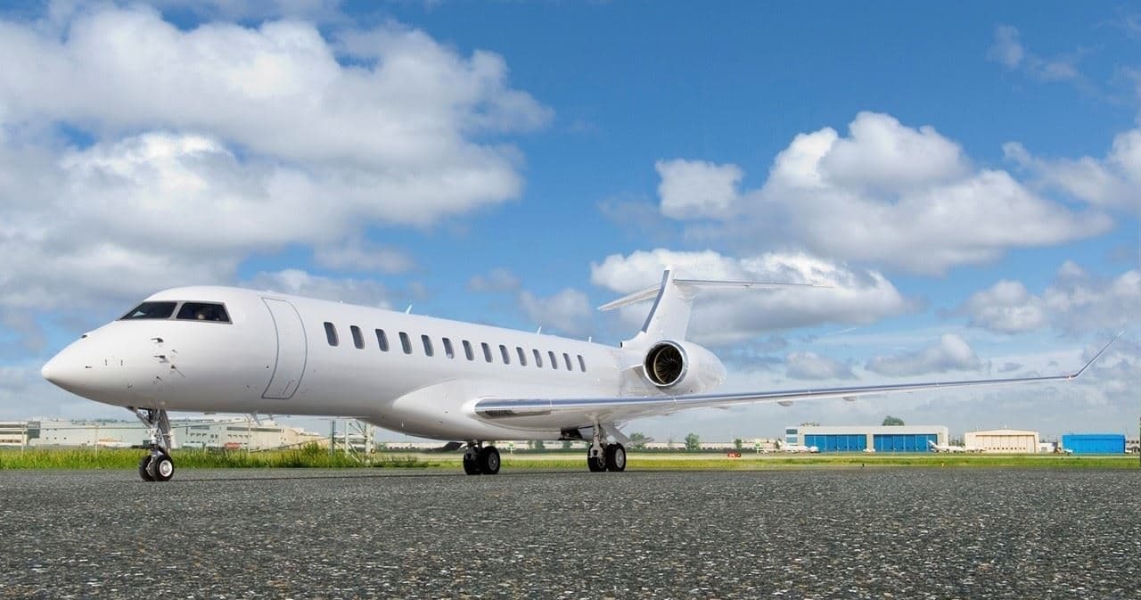 Wed, Nov 11in 8 daysBurbankKBUR · Bob Hope AirportNew YorkKTEB · Teterboro AirportGlobal 800016—On request11NovBurbank → New YorkKBUR → KTEB · in 8 daysGlobal 8000 · 16 seatsOn request
 KBUR · Bob Hope Airport
* Total price incl. 10% service fee, converted to your selected currency. Price subject to operator confirmation.
Empty legs to KBUR
19 arrivals available
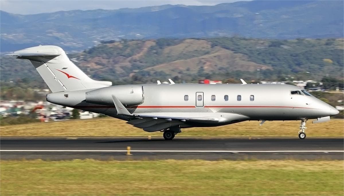 Thu, Nov 5in 2 daysSan DiegoKCRQ · Mc Clellan-Palomar AirportBurbankKBUR · Bob Hope AirportChallenger 3008—On request5NovSan Diego → BurbankKCRQ → KBUR · in 2 daysChallenger 300 · 8 seatsOn request
- Thu, Nov 5in 2 daysPalm SpringsKPSP · Palm Springs International AirportBurbankKBUR · Bob Hope AirportBombardier Challenger 300949m€3,9335NovPalm Springs → BurbankKPSP → KBUR · in 2 daysBombardier Challenger 300 · 9 seats · 49m€3,933
- Sun, Nov 808:20ScottsdaleKSDL · Scottsdale AirportBurbankKBUR · Bob Hope AirportCitation CJ48—On request8NovScottsdale → BurbankKSDL → KBUR · 08:20Citation CJ4 · 8 seatsOn request
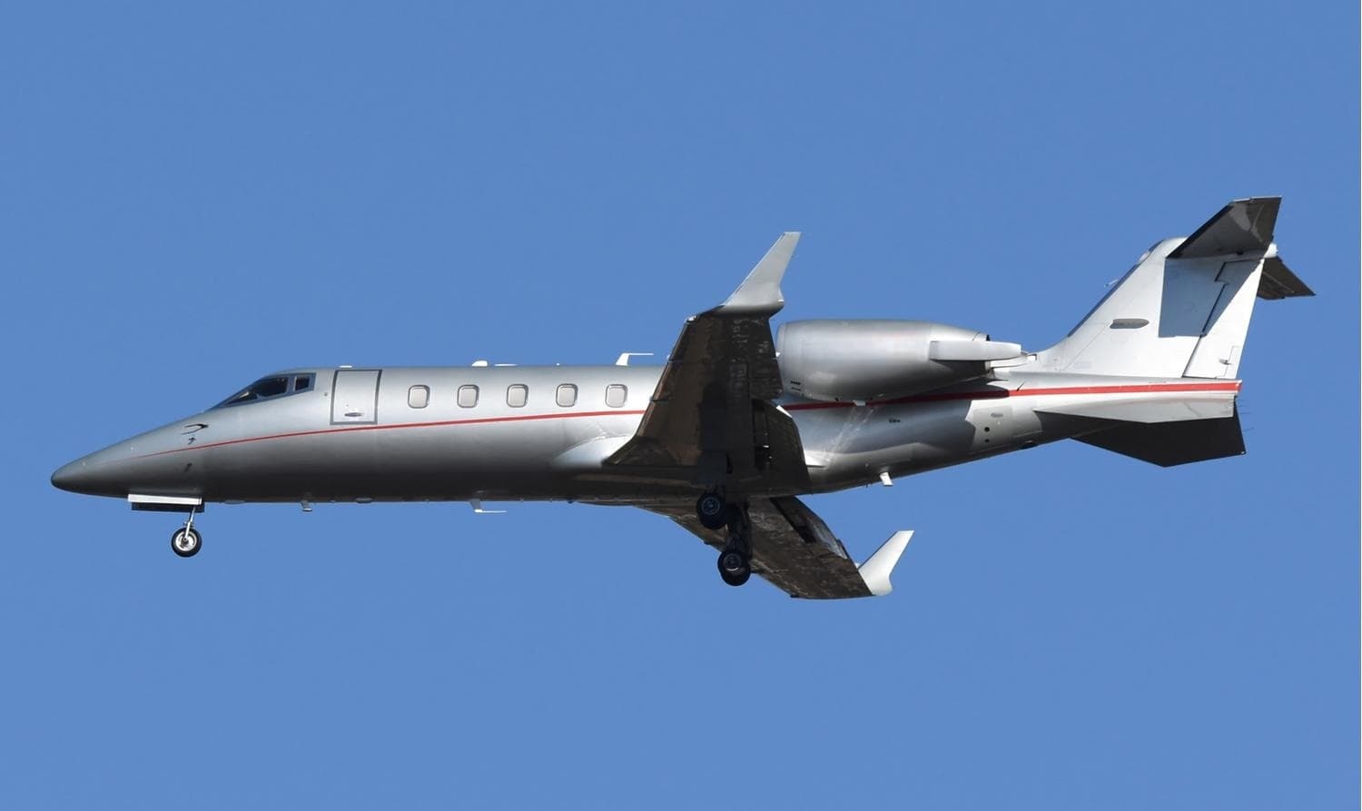 Mon, Nov 9in 6 daysEl PasoKELP · El Paso International AirportBurbankKBUR · Bob Hope AirportLearjet 60XR8—$15,6209NovEl Paso → BurbankKELP → KBUR · in 6 daysLearjet 60XR · 8 seats$15,620
- Tue, Nov 10in 7 daysRenoKRNO · Reno Tahoe International AirportBurbankKBUR · Hollywood Burbank AirportCessna CitationJet5—$6,60010NovReno → BurbankKRNO → KBUR · in 7 daysCessna CitationJet · 5 seats$6,600
- Tue, Nov 10in 7 daysMolineKMLI · Quad City International AirportBurbankKBUR · Hollywood Burbank AirportHawker 9008—$17,05010NovMoline → BurbankKMLI → KBUR · in 7 daysHawker 900 · 8 seats$17,050
- Tue, Nov 10in 7 daysNew OrleansKMSY · Louis Armstrong New Orleans International AirportBurbankKBUR · Hollywood Burbank AirportGulfstream GIV14—$28,05010NovNew Orleans → BurbankKMSY → KBUR · in 7 daysGulfstream GIV · 14 seats$28,050
- Tue, Nov 1015:52WashingtonKIAD · Dulles IntlBurbankKBUR · Hollywood Burbank / Bob HopeBombardier Learjet 607—$54,14810NovWashington → BurbankKIAD → KBUR · 15:52Bombardier Learjet 60 · 7 seats$54,148
- Tue, Nov 1017:54MolineKMLI · Quad City International AirportBurbankKBUR · Hollywood Burbank / Bob HopeBombardier Learjet 607—$38,41810NovMoline → BurbankKMLI → KBUR · 17:54Bombardier Learjet 60 · 7 seats$38,418
* Total price incl. 10% service fee, converted to your selected currency. Price subject to operator confirmation.
Map: Burbank Airport
View the location of Burbank – BUR/KBUR. Zoom in to explore the area around the airport.
About the airport
Bob Hope Airport (BUR/KBUR) is the key private jet gateway for Burbank. PrivJet gives you instant access to charter flights and empty legs: fast, discreet and globally connected.
KBUR airport FAQ
Are there any restrictions at Burbank airport (KBUR) today?
There are currently 7 valid NOTAMs for Burbank (KBUR). Affected: Taxiway: closed; Services: out of service; ILS outer marker: unserviceable. 4 more NOTAMs start in the coming days. For information only, not for flight planning or operational use. Always rely on an official pre-flight briefing. This list may be incomplete or out of date.
What is the weather at Burbank airport (KBUR)?
According to the latest weather report for KBUR (METAR, 03 Nov, 13:53 UTC): Good visual conditions (VFR). Wind Calm, visibility 10 km or more, temperature 11 °C (dew point 6 °C). For information only, not for flight planning. Weather can change quickly; always rely on official reports.
How long are the runways at Burbank airport (KBUR)?
Burbank (KBUR) has 2 runways: runway 15/33 with 2,099 m (6,886 ft), asphalt and runway 08/26 with 1,768 m (5,802 ft), asphalt. The longest is 2,099 m.
What are the radio frequencies at Burbank airport (KBUR)?
Frequencies at KBUR: Tower 118.7 MHz, Ground 123.9 MHz and ATIS 134.5 MHz. For information only. Always rely on the published AIP.
What are the airport codes of Bob Hope Airport?
The ICAO code is KBUR and the IATA code is BUR. ICAO codes are used by air traffic control and pilots, e.g. in flight plans; IATA codes appear on tickets and baggage tags.
What is the elevation of KBUR airport?
Bob Hope Airport sits at 778 ft (237 m) above sea level. Local time zone: America/Los Angeles.
Can I fly to KBUR by private jet?
Whether a private jet can operate into Bob Hope Airport depends on runway length, opening hours, customs and immigration rules as well as slot and handling availability, among other things. PrivJet checks this with the operating carrier for every request.
Are there empty legs from or to KBUR?
There are currently 32 empty legs departing from and 19 arriving at Bob Hope Airport. Empty legs are repositioning flights at heavily reduced prices; the list is updated several times a day.