Concord Buchanan Field Airport (KCCR / CCR)
Empty legs and charters from Concord
KCCR airport at a glance
- ICAO code
- KCCR
- IATA code
- CCR
- City
- Concord
- Region
- California
- Country
- United States
- Elevation
- 26 ft (8 m)
- Time zone
- America/Los Angeles (UTC-8)
- Coordinates
- 37.9897° N, 122.0570° W
- Empty legs from
- 25
- Empty legs to
- 25
Weather & airport info KCCR
Current weather
Good visual conditions (VFR)observed 04 Nov, 11:53 UTC- Wind
- 5 kt (9 km/h) from east (80°)
- Visibility
- 10 km or more
- Clouds
- overcast at 3,300 ft
- Temperature
- 13 °C (dew point 9 °C)
- Pressure (QNH)
- 1,018 hPa
Original weather report (METAR)
METAR KCCR 041153Z AUTO 08005KT 10SM OVC033 13/09 A3005 RMK AO2 SLP162 70009 T01280089 10128 20122 58006
Airport
- Elevation
- 26 ft (8 m)
- Sunrise / Sunset
- 06:37 / 17:06 local time
Runways
| Runway | Length | Surface | Lighted |
|---|---|---|---|
| 01L/19R | 1,524 m (5,001 ft) | asphalt/concrete | yes |
| 14L/32R | 1,403 m (4,602 ft) | asphalt/concrete | yes |
| 14R/32L | 853 m (2,798 ft) | asphalt | no |
| 01R/19L | 844 m (2,770 ft) | asphalt | yes |
Radio frequencies
- ATIS: 124.7
- Clearance: 118.75
- CTAF: 119.7
- Ground: 121.9
- Tower: 119.7
- UNICOM: 122.95
For information only, not for flight planning. Weather can change quickly; always rely on official reports. Sources: aviationweather.gov (NOAA), OurAirports.
Airport map KCCR
Full screen →Runways white, taxiways yellow with designators, closed taxiways and runways per NOTAM in red.
Official charts (FAA)
Cycle 2611, valid until 0901Z 11/26/26
Airport diagram (FAA)
Airport diagram (1)
Instrument approaches (3)
Departure procedures (1)
Minimums (2)
Hot spots (1)
For information only, not for navigation. Always use current official charts and NOTAMs.
Current NOTAMs for KCCR(18)
NOTAMs (Notices to Air Missions) announce short-term changes at an airport: closed runways or taxiways, unserviceable approach aids, obstacles, airspace restrictions.
- Out of serviceInstrument approach procedure5103/26· from 04 Nov, 17:00 UTC · until 04 Nov, 20:00 UTC
The LDA runway 19R instrument approach procedure, amendment 9B, is not available except for aircraft equipped with a suitable RNAV system with GPS, because the I-CCR DME is out of service.
Show original text
IAP BUCHANAN FLD, CONCORD, CA. LDA RWY 19R, AMDT 9B... PROCEDURE NA EXCEPT FOR ACFT EQUIPPED WITH SUITABLE RNAV SYSTEM WITH GPS, I-CCR DME OUT OF SERVICE. 2611041700-2611042000EST
Q) KZOA/QPIXX/I/NBO/A/000/999/3759N12203W005
A) KCCR
B) 2501162146
C) 2508282145EST
E) CCR BUCHANAN FLD, CONCORD, CA.
LDA RWY 19R, AMDT 9B...
PROCEDURE NA EXCEPT FOR ACFT EQUIPPED WITH SUITABLE RNAV SYSTEM WITH GPS, I-CCR DME OUT OF SERVICE.
- Out of serviceObstacle10/039· until 12 Nov, 21:35 UTC
A tower light 9.2 nautical miles southeast of the airport is out of service. Its top is 3901 feet above sea level, 300 feet above ground.
Show original text
OBST TOWER LGT (ASR 1014626) 375254.20N1215508.80W (9.2NM SE CCR) 3901FT (300FT AGL) U/S
- Out of serviceObstacle10/037· until 07 Dec, 23:59 UTC
The light on a wind turbine, 9.3 nautical miles east-northeast of the airport, is out of service. Its top is 420 feet above sea level, 400 feet above ground.
Show original text
OBST WIND TURBINE LGT (ASN UNKNOWN) 381400N1220531W (9.3NM ENE APC) 420FT (400FT AGL) U/S
- Out of serviceObstacle10/036· until 07 Dec, 23:59 UTC
Obstacle WIND TURBINE light (ASN unknown) (9.3 NM east-northeast of APC) 361 ft above sea level (341 ft above ground) out of service
Show original text
OBST WIND TURBINE LGT (ASN UNKNOWN) 381356N1220521W (9.3NM ENE APC) 361FT (341FT AGL) U/S
- Out of serviceObstacle10/035· until 11 Dec, 07:15 UTC
A tower light 9.2 nautical miles southeast of the airport is out of service. Its top is 3901 ft above sea level, 300 ft above ground.
Show original text
OBST TOWER LGT (ASR 1014626) 375254.20N1215508.80W (9.2NM SE CCR) 3901FT (300FT AGL) U/S
- Out of serviceObstacle10/027· until 29 Jan, 23:59 UTC
The lighting of a tower 1.6 nautical miles west-southwest of the airport is out of service. Its top is 307 feet above sea level, 142 feet above ground.
Show original text
OBST TOWER LGT (ASN 2022-AWP-9642-OE) 375902N1220525W (1.6NM WSW CCR) 307FT (142FT AGL) U/S
10/027 NOTAMN<BR>
<B>Q) </B>KZOA/QOLAS/IV/M/AE/000/004/3759N12203W005<BR>
<B>A) </B>KCCR<BR>
<B>B) </B>2610201938<BR>
<B>C) </B>2701292359<BR>
<B>E) </B> TOWER LGT (ASN 2022-AWP-9642-OE) 375902N1220525W (1.6NM WSW CCR) 307FT (142FT AGL) U/S<BR>
- Out of serviceObstacle10/028· until 29 Jan, 23:59 UTC
The lighting of a tower 1.9 nautical miles west-southwest of the airport is out of service. Its top is 396 feet above sea level, 161 feet above ground.
Show original text
OBST TOWER LGT (ASN 2022-AWP-9644-OE) 375846N1220544W (1.9NM WSW CCR) 396FT (161FT AGL) U/S
10/028 NOTAMN<BR>
<B>Q) </B>KZOA/QOLAS/IV/M/AE/000/004/3759N12203W005<BR>
<B>A) </B>KCCR<BR>
<B>B) </B>2610201938<BR>
<B>C) </B>2701292359<BR>
<B>E) </B> TOWER LGT (ASN 2022-AWP-9644-OE) 375846N1220544W (1.9NM WSW CCR) 396FT (161FT AGL) U/S<BR>
- Out of serviceObstacle10/025· until 29 Jan, 23:59 UTC
Obstacle light on tower (ASN 2022-AWP-9641-OE) (1.6 NM west of CCR) 305 ft above sea level (141 ft above ground) out of service
Show original text
OBST TOWER LGT (ASN 2022-AWP-9641-OE) 375909N1220525W (1.6NM W CCR) 305FT (141FT AGL) U/S
10/025 NOTAMN<BR>
<B>Q) </B>KZOA/QOLAS/IV/M/AE/000/004/3759N12203W005<BR>
<B>A) </B>KCCR<BR>
<B>B) </B>2610201937<BR>
<B>C) </B>2701292359<BR>
<B>E) </B> TOWER LGT (ASN 2022-AWP-9641-OE) 375909N1220525W (1.6NM W CCR) 305FT (141FT AGL) U/S<BR>
10 more NOTAMs
- Out of serviceObstacle10/026· until 29 Jan, 23:59 UTC
The lighting of a tower 1.7 nautical miles west-southwest of the airport is out of service. Its top is 345 feet above sea level, 153 feet above ground.
Show original text
OBST TOWER LGT (ASN 2022-AWP-9643-OE) 375855N1220531W (1.7NM WSW CCR) 345FT (153FT AGL) U/S
10/026 NOTAMN<BR>
<B>Q) </B>KZOA/QOLAS/IV/M/AE/000/004/3759N12203W005<BR>
<B>A) </B>KCCR<BR>
<B>B) </B>2610201937<BR>
<B>C) </B>2701292359<BR>
<B>E) </B> TOWER LGT (ASN 2022-AWP-9643-OE) 375855N1220531W (1.7NM WSW CCR) 345FT (153FT AGL) U/S<BR>
- Out of serviceObstacle10/023· until 29 Jan, 23:59 UTC
The lighting of a tower 1.6 nautical miles west of the airport is out of service. Its top is 316 feet above sea level, 146 feet above ground.
Show original text
OBST TOWER LGT (ASN 2022-AWP-9640-OE) 375919N1220525W (1.6NM W CCR) 316FT (146FT AGL) U/S
10/023 NOTAMN<BR>
<B>Q) </B>KZOA/QOLAS/IV/M/AE/000/004/3759N12203W005<BR>
<B>A) </B>KCCR<BR>
<B>B) </B>2610201936<BR>
<B>C) </B>2701292359<BR>
<B>E) </B> TOWER LGT (ASN 2022-AWP-9640-OE) 375919N1220525W (1.6NM W CCR) 316FT (146FT AGL) U/S<BR>
- Out of serviceObstacle10/024· until 29 Jan, 23:59 UTC
The lighting of a tower 1.6 nautical miles west of the airport is out of service. Its top is 314 feet above sea level, 161 feet above ground.
Show original text
OBST TOWER LGT (ASN 2022-AWP-9639-OE) 375925N1220525W (1.6NM W CCR) 314FT (161FT AGL) U/S
10/024 NOTAMN<BR>
<B>Q) </B>KZOA/QOLAS/IV/M/AE/000/004/3759N12203W005<BR>
<B>A) </B>KCCR<BR>
<B>B) </B>2610201936<BR>
<B>C) </B>2701292359<BR>
<B>E) </B> TOWER LGT (ASN 2022-AWP-9639-OE) 375925N1220525W (1.6NM W CCR) 314FT (161FT AGL) U/S<BR>
- Out of serviceObstacle10/022· until 29 Jan, 23:59 UTC
The lighting of a tower 2.1 nautical miles west-southwest of the airport is out of service. Its top is 550 feet above sea level, 161 feet above ground.
Show original text
OBST TOWER LGT (ASN 2022-AWP-9645-OE) 375836N1220557W (2.1NM WSW CCR) 550FT (161FT AGL) U/S
10/022 NOTAMN<BR>
<B>Q) </B>KZOA/QOLAS/IV/M/AE/000/006/3759N12203W005<BR>
<B>A) </B>KCCR<BR>
<B>B) </B>2610201935<BR>
<B>C) </B>2701292359<BR>
<B>E) </B> TOWER LGT (ASN 2022-AWP-9645-OE) 375836N1220557W (2.1NM WSW CCR) 550FT (161FT AGL) U/S<BR>
- NoticeApron: work in progress11/002· until 08 Nov, 01:00 UTC
Work in progress on the apron Conco Ramp.
Show original text
APRON CONCO RAMP WIP GALA
11/002 NOTAMN
Q) KZOA/QMNHW/IV/BO/A/000/999/3759N12203W005
A) KCCR
B) 2611021902
C) 2611080100

E) CONCO RAMP WIP GALA
- NoticeNavigation11/001· permanent
The VOR/DME navigation system at Buchanan Field airport has been decommissioned. This system helps aircraft with navigation.
Show original text
NAV VOR/DME DECOMMISSIONED
- NoticeNavigation10/040· until 09 Nov, 23:59 UTC (estimated)
The localizer (LOC) for runway 19R is not monitored. The localizer is part of the Instrument Landing System.
Show original text
NAV LOC RWY 19R NOT MNT
10/040 NOTAMR
Q) KZOA//IV/NBO/A/000/999/3759N12203W025
A) KCCR
B) 2610301532
C) 2611092359EST

E) LOC RWY 19R NOT MNT
- NoticeApron: work in progress10/021· until 30 Nov, 01:00 UTC
Work in progress on the Sterling Aviation ramp. The area is lit and barricaded.
Show original text
APRON STERLING AVIATION RAMP WIP CONST LGTD AND BARRICADED
10/021 NOTAMR
Q) KZOA/QMNHW/IV/BO/A/000/999/3759N12203W005
A) KCCR
B) 2610192001
C) 2611300100

E) STERLING AVIATION RAMP WIP CONST LGTD AND BARRICADED
- NoticeAirspace10/014· until 14 Jan, 22:00 UTC
Airspace for unmanned aircraft systems (UAS) is closed within a 5 nautical mile radius of 1.6 nautical miles south of VCB, from the surface up to 400 feet above ground.
Show original text
AIRSPACE UAS WI AN AREA DEFINED AS 5NM RADIUS OF 382129N1215810W (1.6NM S VCB) SFC-400FT AGL
- NoticeAirspace09/030· until 31 Dec, 05:00 UTC
The airspace for unmanned aircraft systems (UAS) is restricted within an area with a 1 nautical mile radius, 5.6 nautical miles northeast of the airport, from the surface up to 400 feet above ground.
Show original text
AIRSPACE UAS WI AN AREA DEFINED AS 1NM RADIUS OF 380212N1215729W (5.6NM NE CCR) SFC-400FT AGL DLY 1300-0500
For information only, not for flight planning or operational use. Always rely on an official pre-flight briefing. This list may be incomplete or out of date. Explanations and expanded abbreviations are generated automatically. The original text is authoritative. Source: FAA NOTAM Management Service (SWIM).
Private jet traffic in Buchanan Field (last 30 days)
- Arrivals
- 280
- Departures
- 280
- Different jets
- 175
Most frequent origins: Norman Y. Mineta San Jose International Airport (14), John Wayne Airport-Orange County Airport (10), Van Nuys Airport (10), Harry Reid International Airport (8), Reno Tahoe International Airport (8).
Most frequent destinations: Van Nuys Airport (10), Reno Tahoe International Airport (9), Gnoss Field (9), Norman Y. Mineta San Jose International Airport (8), Henderson Executive Airport (8).
Most common aircraft types: Pilatus PC-12 (99), Cirrus Vision Jet (40), Cessna Citation Excel/XLS (36), Epic E1000 (35), Embraer Phenom 300 (34).
Monday is the busiest day.
Our own analysis of public ADS-B signals from business jets. Not every flight is received, and jets with a removal request are excluded.
Charter operators based here
Operators with a base at this airport.
- Executive Jet ManagementWhite Plains (Westchester County) (KHPN) · Light jet, Midsize jet, Super midsize jet
- Air SF Flight ServicesNapa (Napa County) (KAPC) · Turboprop
- Executive Flight ManagementPiston aircraft
Empty legs from KCCR
25 departures available
- Fri, Nov 6in 2 daysConcordKCCR · Buchanan FieldManisteeKMBL · Manistee Co. - BlackerMidsize Jet6—On request6NovConcord → ManisteeKCCR → KMBL · in 2 daysMidsize Jet · 6 seatsOn request
- Sat, Nov 7in 3 daysConcordKCCR · Buchanan FieldFresnoKFAT · Fresno Yosemite International AirportEpic E1000 GX448mOn request7NovConcord → FresnoKCCR → KFAT · in 3 daysEpic E1000 GX · 4 seats · 48mOn request
- Mon, Nov 908:02ConcordKCCR · Buchanan FieldFresnoKFAT · Fresno Yosemite International AirportCessna CitationJet5—$2,3109NovConcord → FresnoKCCR → KFAT · 08:02Cessna CitationJet · 5 seats$2,310
 Mon, Nov 916:02ConcordKCCR · Buchanan FieldFresnoKFAT · Fresno Yosemite International AirportEpic E1000142mOn request9NovConcord → FresnoKCCR → KFAT · 16:02Epic E1000 · 1 seat · 42mOn request
 Mon, Nov 921:49ConcordKCCR · Buchanan FieldSan Diego/El CajonKSEE · Gillespie FieldBombardier Challenger 350011hOn request9NovConcord → San Diego/El CajonKCCR → KSEE · 21:49Bombardier Challenger 3500 · 1 seat · 1hOn request
- Mon, Nov 921:02ConcordKCCR · Buchanan FieldFresnoKFAT · Fresno Yosemite IntlEpic E10004—On request9NovConcord → FresnoKCCR → KFAT · 21:02Epic E1000 · 4 seatsOn request
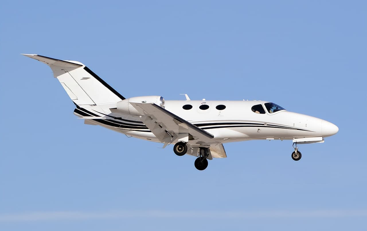 Tue, Nov 10in 6 daysConcordKCCR · Buchanan FieldLas VegasKHND · Henderson Executive AirportCitation M26—On request10NovConcord → Las VegasKCCR → KHND · in 6 daysCitation M2 · 6 seatsOn request
- Tue, Nov 1002:49ConcordKCCR · Buchanan FieldSan DiegoKSEE · Gillespie FieldBombardier Challenger 35009—On request10NovConcord → San DiegoKCCR → KSEE · 02:49Bombardier Challenger 3500 · 9 seatsOn request
- Tue, Nov 10in 6 daysConcordKCCR · Buchanan FieldPageKPGA · Page Municipal AirportEpic E1000 GX42hOn request10NovConcord → PageKCCR → KPGA · in 6 daysEpic E1000 GX · 4 seats · 2hOn request
 KCCR · Buchanan Field
* Total price incl. 10% service fee, converted to your selected currency. Price subject to operator confirmation.
Empty legs to KCCR
25 arrivals available
- Fri, Nov 6in 2 daysLas VegasKHND · Henderson Executive AirportConcordKCCR · Buchanan FieldCessna Citation M27—On request6NovLas Vegas → ConcordKHND → KCCR · in 2 daysCessna Citation M2 · 7 seatsOn request
- Sat, Nov 7in 3 daysLas VegasKHND · Henderson Executive AirportConcordKCCR · Buchanan FieldCitation M26—$10,4167NovLas Vegas → ConcordKHND → KCCR · in 3 daysCitation M2 · 6 seats$10,416
- Sat, Nov 7in 3 daysLas VegasKHND · Henderson Executive AirportConcordKCCR · Buchanan FieldM27—On request7NovLas Vegas → ConcordKHND → KCCR · in 3 daysM2 · 7 seatsOn request
- Sun, Nov 8in 4 daysSan Diego/El CajonKSEE · Gillespie FieldConcordKCCR · Buchanan FieldBombardier Challenger 35009—$10,0108NovSan Diego/El Cajon → ConcordKSEE → KCCR · in 4 daysBombardier Challenger 3500 · 9 seats$10,010
- Sun, Nov 8in 4 daysNovatoKDVO · Gnoss FieldConcordKCCR · Buchanan FieldEpic E1000 GX524mOn request8NovNovato → ConcordKDVO → KCCR · in 4 daysEpic E1000 GX · 5 seats · 24mOn request
- Tue, Nov 1017:42Van NuysKVNY · Van Nuys AirportConcordKCCR · Buchanan FieldCessna CitationJet5—$5,50010NovVan Nuys → ConcordKVNY → KCCR · 17:42Cessna CitationJet · 5 seats$5,500
- Tue, Nov 1020:42Van NuysKVNY · Van Nuys AirportConcordKCCR · Buchanan FieldEpic E100011h 12mOn request10NovVan Nuys → ConcordKVNY → KCCR · 20:42Epic E1000 · 1 seat · 1h 12mOn request
- Tue, Nov 10in 6 daysVan NuysKVNY · Van Nuys AirportConcordKCCR · Buchanan FieldEpic E1000 GX41h 24mOn request10NovVan Nuys → ConcordKVNY → KCCR · in 6 daysEpic E1000 GX · 4 seats · 1h 24mOn request
- Wed, Nov 1101:42Van NuysKVNYConcordKCCR · Buchanan FieldEpic E10004—On request11NovVan Nuys → ConcordKVNY → KCCR · 01:42Epic E1000 · 4 seatsOn request
* Total price incl. 10% service fee, converted to your selected currency. Price subject to operator confirmation.
Map: Concord Airport
View the location of Concord – CCR/KCCR. Zoom in to explore the area around the airport.
About the airport
Buchanan Field (CCR/KCCR) is the key private jet gateway for Concord. PrivJet gives you instant access to charter flights and empty legs: fast, discreet and globally connected.
KCCR airport FAQ
Are there any restrictions at Concord airport (KCCR) today?
There are currently 17 valid NOTAMs for Concord (KCCR). Affected: Obstacle: out of service. 1 more NOTAM starts in the coming days. For information only, not for flight planning or operational use. Always rely on an official pre-flight briefing. This list may be incomplete or out of date.
What is the weather at Concord airport (KCCR)?
According to the latest weather report for KCCR (METAR, 04 Nov, 11:53 UTC): Good visual conditions (VFR). Wind 5 kt (9 km/h) from east (80°), visibility 10 km or more, temperature 13 °C (dew point 9 °C). For information only, not for flight planning. Weather can change quickly; always rely on official reports.
How long are the runways at Concord airport (KCCR)?
Concord (KCCR) has 4 runways: runway 01L/19R with 1,524 m (5,001 ft), asphalt/concrete, runway 14L/32R with 1,403 m (4,602 ft), asphalt/concrete, runway 14R/32L with 853 m (2,798 ft), asphalt and runway 01R/19L with 844 m (2,770 ft), asphalt. The longest is 1,524 m.
What are the radio frequencies at Concord airport (KCCR)?
Frequencies at KCCR: Tower 119.7 MHz, Ground 121.9 MHz and ATIS 124.7 MHz. For information only. Always rely on the published AIP.
What are the airport codes of Buchanan Field?
The ICAO code is KCCR and the IATA code is CCR. ICAO codes are used by air traffic control and pilots, e.g. in flight plans; IATA codes appear on tickets and baggage tags.
What is the elevation of KCCR airport?
Buchanan Field sits at 26 ft (8 m) above sea level. Local time zone: America/Los Angeles.
Can I fly to KCCR by private jet?
Whether a private jet can operate into Buchanan Field depends on runway length, opening hours, customs and immigration rules as well as slot and handling availability, among other things. PrivJet checks this with the operating carrier for every request.
Are there empty legs from or to KCCR?
There are currently 25 empty legs departing from and 25 arriving at Buchanan Field. Empty legs are repositioning flights at heavily reduced prices; the list is updated several times a day.