Springfield Westover ARB/Metropolitan Airport (KCEF / CEF)
Empty legs and charters from Springfield/Chicopee
KCEF airport at a glance
- ICAO code
- KCEF
- IATA code
- CEF
- City
- Springfield
- Region
- Massachusetts
- Country
- United States
- Elevation
- 241 ft (73 m)
- Time zone
- America/New York (UTC-5)
- Coordinates
- 42.1940° N, 72.5348° W
- Empty legs from
- 2
- Empty legs to
- 0
Weather & airport info KCEF
Current weather
No current weather report is available for this airport.
Forecast (TAF)
- 03 Nov, 14:00–12:00 UTCbecoming9 kt (17 km/h) from south (190°) · visibility 10 km or more · broken clouds at 10,000 ft, broken clouds at 20,000 ft
- 03 Nov, 16:00–22:00 UTCtemporarily10 kt (19 km/h) from south-southwest (210°), gusts up to 15 kt
- 04 Nov, 12:00–19:00 UTCbecoming9 kt (17 km/h) from south-southwest (210°) · visibility 10 km or more · scattered clouds at 5,000 ft, scattered clouds at 10,000 ft, broken clouds at 25,000 ft
- 04 Nov, 17:00–19:00 UTCtemporarily10 kt (19 km/h) from west-southwest (240°), gusts up to 20 kt
Original forecast (TAF)
TAF KCEF 031310Z 0313/0419 VRB06KT 9999 SCT100 BKN200 QNH3025INS BECMG 0314/0315 19009KT 9999 BKN100 BKN200 QNH3012INS WND VRB06KT AFT 0323 TEMPO 0316/0322 21010G15KT BECMG 0412/0413 21009KT 9999 SCT050 SCT100 BKN250 510105 QNH3004INS TEMPO 0417/0419 24010G20KT 510006 TX23/0321Z TN09/0411Z
Airport
- Elevation
- 241 ft (73 m)
- Sunrise / Sunset
- 06:25 / 16:41 local time
Runways
| Runway | Length | Surface | Lighted |
|---|---|---|---|
| 05/23 | 3,535 m (11,597 ft) | asphalt | yes |
| 15/33 | 2,160 m (7,085 ft) | asphalt | yes |
Radio frequencies
- ATIS: 114
- Ground: 118.35
- Tower: 134.85
- UNICOM: 123
For information only, not for flight planning. Weather can change quickly; always rely on official reports. Sources: aviationweather.gov (NOAA), OurAirports.
Airport map KCEF
Full screen →Runways white, taxiways yellow with designators, closed taxiways and runways per NOTAM in red.
Official charts (FAA)
Cycle 2611, valid until 0901Z 11/26/26
Airport diagram (FAA)
Airport diagram (1)
Instrument approaches (6)
Departure procedures (1)
Minimums (1)
Other (2)
For information only, not for navigation. Always use current official charts and NOTAMs.
Current NOTAMs for KCEF(23)
NOTAMs (Notices to Air Missions) announce short-term changes at an airport: closed runways or taxiways, unserviceable approach aids, obstacles, airspace restrictions.
- ClosedAerodrome11/002· from 07 Nov, 22:00 UTC · until 14 Mar, 18:00 UTC
The airport is closed, except with a three-hour prior permission required by calling 413-593-5543 on Saturday from 22:00 to 23:59 and on Sunday from 00:00 to 18:00.
Show original text
AD AP CLSD EXC 3HR PPR 413-593-5543 SAT 2200-2359, SUN 0000-1800
- ClosedAerodrome: closed11/001· from 07 Nov, 04:00 UTC · until 13 Mar, 14:00 UTC
The airport is closed, except for 3 hours on Saturday from 04:00 to 14:00 with prior permission, which can be requested at 413-593-5543.
Show original text
AD AP CLSD EXC 3HR PPR 413-593-5543 SAT 0400-1400
11/001 NOTAMN
Q) KZBW/QFALC/IV/NBO/A/000/999/4211N07232W005
A) KCEF
B) 2611070400
C) 2703131400
 D) SAT 0400-1400

E) AP CLSD EXC 3HR
PPR 413-593-5543
Hours: SAT 0400-1400
- ClosedAerodrome: closed10/025· until 12 Mar, 13:00 UTC
The airport is closed, except with a 3-hour prior permission required (PPR) by calling 413-593-5543, Tuesday to Friday from 04:00 to 13:00.
Show original text
AD AP CLSD EXC 3HR PPR 413-593-5543 TUE-FRI 0400-1300
10/025 NOTAMN
Q) KZBW/QFALC/IV/NBO/A/000/999/4211N07232W005
A) KCEF
B) 2611030400
C) 2703121300
 D) TUE-FRI 0400-1300

E) AP CLSD EXC 3HR
PPR 413-593-5543
Hours: TUE WED THU FRI
- ClosedAerodrome: closed10/024· until 08 Mar, 13:00 UTC
The airport is closed, except with 3 hours prior permission required, which can be requested at 413-593-5543 on Mondays from 02:00 to 13:00.
Show original text
AD AP CLSD EXC 3HR PPR 413-593-5543 MON 0200-1300
10/024 NOTAMN
Q) KZBW/QFALC/IV/NBO/A/000/999/4211N07232W005
A) KCEF
B) 2611020200
C) 2703081300
 D) MON 0200-1300

E) AP CLSD EXC 3HR
PPR 413-593-5543
Hours: MON 0200-1300
- ClosedOtherM1404/26· until 03 Nov, 18:00 UTC
Aerodrome BASE hangar apron and ERCC are closed for SPALL REPAIRS.
Show original text
AERODROME BASE HANGAR APRON AND ERCC ARE CLOSED FOR SPALL REPAIRS.
M1404/26 NOTAMN
Q) ZBW/QXXXX/IV/NBO/A/000/999/4211N07232W005
A) KCEF
B) 2611031335
C) 2611031800
E) AERODROME BASE HANGAR APRON AND ERCC ARE CLOSED FOR SPALL REPAIRS.
- Out of serviceObstacle10/034· until 13 Nov, 21:22 UTC
A tower light 1.8 nautical miles east of the airport is out of service. The obstacle's top is 429 feet above sea level, 73 feet above ground.
Show original text
OBST TOWER LGT (ASN 2012-ANE-68-OE) 421120N0722940W (1.8NM E CEF) 429FT (73FT AGL) U/S
- Out of serviceObstacle10/032· until 13 Nov, 21:21 UTC
A tower light 1.7 nautical miles east of the airport is out of service. The obstacle's top is 428 feet above sea level, 127 feet above ground.
Show original text
OBST TOWER LGT (ASN 2011-ANE-215-OE) 421119N0722950W (1.7NM E CEF) 428FT (127FT AGL) U/S
- Out of serviceObstacle10/033· until 13 Nov, 21:21 UTC
The lighting on a tower obstacle 1.9 nautical miles east of the airport is out of service. Its top is 487 feet above sea level, 117 feet above ground.
Show original text
OBST TOWER LGT (ASN 2011-ANE-217-OE) 421121N0722937W (1.9NM E CEF) 487FT (117FT AGL) U/S
15 more NOTAMs
- Out of serviceObstacle10/029· until 13 Nov, 21:20 UTC
A tower light 1.6 nautical miles east of the airport is out of service; its top is 390 ft above sea level, 142 ft above ground.
Show original text
OBST TOWER LGT (ASN 2011-ANE-214-OE) 421118N0722957W (1.6NM E CEF) 390FT (142FT AGL) U/S
- Out of serviceObstacle10/030· until 13 Nov, 21:20 UTC
The lighting on a tower obstacle 1.9 nautical miles east of the airport is out of service. Its top is 488 feet above sea level, 127 feet above ground.
Show original text
OBST TOWER LGT (ASN 2011-ANE-218-OE) 421121N0722931W (1.9NM E CEF) 488FT (127FT AGL) U/S
- Out of serviceObstacle10/031· until 13 Nov, 21:20 UTC
The lighting on a tower obstacle 2 nautical miles east of the airport is out of service. Its top is 460 feet above sea level, 132 feet above ground.
Show original text
OBST TOWER LGT (ASN 2011-ANE-219-OE) 421123N0722923W (2NM E CEF) 460FT (132FT AGL) U/S
- Out of serviceObstacle10/028· until 13 Nov, 21:18 UTC
A tower light 1.9 nautical miles south of the airport is out of service. Its top is 390 feet above sea level, 168 feet above ground.
Show original text
OBST TOWER LGT (ASN 2011-ANE-1637-OE) 420944N0723225W (1.9NM S CEF) 390FT (168FT AGL) U/S
- Out of serviceObstacle10/027· until 13 Nov, 21:16 UTC
The lighting on an obstacle tower 1.8 nautical miles east of the airport is out of service. Its top is 461 feet above sea level, 127 feet above ground.
Show original text
OBST TOWER LGT (ASN 2012-ANE-173-OE) 421120N0722943W (1.8NM E CEF) 461FT (127FT AGL) U/S
- Out of serviceObstacle10/022· until 10 Jan, 23:59 UTC
Obstacle light on tower (ASR 1007724) (8.8 NM east-southeast of CEF) 1207.0 ft above sea level (249.3 ft above ground) out of service
Show original text
OBST TOWER LGT (ASR 1007724) 420831.00N0722052.00W (8.8NM ESE CEF) 1207.0FT (249.3FT AGL) U/S
10/022 NOTAMN<BR>
<B>Q) </B>KZBW/QOLAS/IV/M/E/000/013/4211N07232W005<BR>
<B>A) </B>KCEF<BR>
<B>B) </B>2610222225<BR>
<B>C) </B>2701102359<BR>
<B>E) </B> TOWER LGT (ASR 1007724) 420831.00N0722052.00W (8.8NM ESE CEF) 1207.0FT (249.3FT AGL) U/S<BR>
- ClosedOtherM1252/26· until 24 Dec, 23:59 UTC
This NOTAM corrects the aerodrome chart supplement for KCEF airport: Class E airspace is active after the tower is closed.
Show original text
AERODROME N.E. US AFLD CHART SUPPLEMENT CORRECTION: KCEF CLASS E AIRSPACE AFTER TOWER IS CLOSED
M1252/26 NOTAMN
Q) ZBW/QXXXX/IV/NBO/A/000/999/4211N07232W005
A) KCEF
B) 2609261828
C) 2612242359
E) AERODROME N.E. US AFLD CHART SUPPLEMENT CORRECTION: KCEF CLASS E AIRSPACE AFTER TOWER IS CLOSED
- Out of serviceOtherM1248/26· until 24 Dec, 23:59 UTC
The sequenced flashing lights (SFL) for runway 05 are out of service.
Show original text
RWY 05 RWY 5 SFL OTS
M1248/26 NOTAMN
Q) ZBW/QXXXX/IV/NBO/A/000/999/4211N07232W005
A) KCEF
B) 2609261802
C) 2612242359
E) RWY 05 RWY 5 SFL OTS
- Out of serviceOtherM1246/26· until 24 Dec, 23:59 UTC
The instrument landing system (ILS) for runway 23 is out of service. The ILS guides aircraft to the runway in poor visibility.
Show original text
RWY 23 RWY 23 ILS OTS.
M1246/26 NOTAMN Q) ZBW/QXXXX/IV/NBO/A/000/999/4211N07232W005 A) KCEF B) 2609261800 C) 2612242359 E) RWY 23 RWY 23 ILS OTS.
- NoticeOtherM1403/26· until 03 Nov, 22:00 UTC
Aerodrome PAEW runway 33 CLEAR zone EQUIP LOCATED 1455 ft east of runway 33 & 850 ft east of TACAN. maximum HEIGHT 35' AGL.
Show original text
AERODROME PAEW RWY 33 CLEAR ZONE EQUIP LOCATED 1455 FT EAST OF RWY 33 & 850 FT EAST OF TACAN. MAX HEIGHT 35' AGL.
M1403/26 NOTAMN
Q) ZBW/QXXXX/IV/NBO/A/000/999/4211N07232W005
A) KCEF
B) 2611031305
C) 2611032200
E) AERODROME PAEW RWY 33 CLEAR ZONE EQUIP LOCATED 1455 FT EAST OF RWY 33 & 850 FT EAST OF TACAN. MAX HEIGHT 35' AGL.
- NoticeAirspace10/023· until 30 Nov, 21:00 UTC
Airspace for Unmanned Aircraft Systems (UAS) is defined within an area of 0.5 nautical miles radius around a position 3.5 nautical miles west-northwest of the airport, from the surface up to 99 ft above ground.
Show original text
AIRSPACE UAS WI AN AREA DEFINED AS 0.5NM RADIUS OF 421203.80N0723647.20W (3.5NM WNW CEF) SFC-99FT AGL
- NoticeAerodromeM1295/26· until 04 Dec, 23:59 UTC
The Instrument Landing System (ILS) or Localizer (LOC) for runway 5 is for military use only and not available for civil flights. The ILS guides aircraft to the runway in poor visibility.
Show original text
ILS OR LOC RWY 5 MILITARY USE ONLY (NOT FOR CIVIL USE)
M1295/26 NOTAMN
Q) ZBW/QFAXX/IV/NBO/A/000/999/4211N07232W005
A) KCEF
B) 2610071415
C) 2612042359
E) ILS OR LOC RWY 5 MILITARY USE ONLY (NOT FOR CIVIL USE)
- NoticeOtherM1254/26· until 24 Dec, 23:59 UTC
The instrument landing system (ILS) critical area at the airport is unprotected during uncontrolled hours. The ILS guides aircraft to the runway in poor visibility.
Show original text
AERODROME ILS CRITICAL AREA UNPROTECTED DURING UNCONTROLLED HRS
M1254/26 NOTAMN Q) ZBW/QXXXX/IV/NBO/A/000/999/4211N07232W005 A) KCEF B) 2609261830 C) 2612242359 E) AERODROME ILS CRITICAL AREA UNPROTECTED DURING UNCONTROLLED HRS
- NoticeOtherM1250/26· until 24 Dec, 23:59 UTC
Parking for hazardous cargo at the airport requires 48 hours prior notice. The primary spot on pad 19 is unusable due to current work in progress; temporary spots are available on taxiway Y, the North Ramp, and taxiway R North.
Show original text
AERODROME HAZ CARGO PARKING REQ 48HRS PN. PRIMARY SPOT ON PAD19 UNUSEABLE DUE TO CURRENT WBC ON PAD. TEMP SPOTS AVAILABLE ON TWY Y, NORTH RAMP AND TWY R NORTH.
M1250/26 NOTAMN
Q) ZBW/QXXXX/IV/NBO/A/000/999/4211N07232W005
A) KCEF
B) 2609261824
C) 2612242359
E) AERODROME HAZ CARGO PARKING REQ 48HRS PN. PRIMARY SPOT ON PAD19 UNUSEABLE DUE TO CURRENT WBC ON PAD. TEMP SPOTS AVAILABLE ON TWY Y, NORTH RAMP AND TWY R NORTH.
- NoticeOtherM1242/26· until 24 Dec, 03:00 UTC
The aerodrome weather station is operating on Sundays from 11:00 UTC to 02:00 UTC.
Show original text
AERODROME WX STATION OPERATING HOURS SUN 1100-0200Z
M1242/26 NOTAMN
Q) ZBW/QXXXX/IV/NBO/A/000/999/4211N07232W005
A) KCEF
B) 2609251352
C) 2612240300
E) AERODROME WX STATION OPERATING HOURS SUN 1100-0200Z
For information only, not for flight planning or operational use. Always rely on an official pre-flight briefing. This list may be incomplete or out of date. Explanations and expanded abbreviations are generated automatically. The original text is authoritative. Source: FAA NOTAM Management Service (SWIM).
Private jet traffic in Westover ARB/Metropolitan Airport (last 30 days)
- Arrivals
- 58
- Departures
- 51
- Different jets
- 51
Most frequent origins: Teterboro Airport (4), Laurence G Hanscom Field (3).
Most frequent destinations: Teterboro Airport (5), Philadelphia International Airport (3), Westchester County Airport (3), Laconia Municipal Airport (3).
Most common aircraft types: Piper M500/M600 (14), Bombardier Challenger 350/3500 (9), Cessna Citation Latitude (8), Cessna Citation Longitude (7), Cessna Citation Excel/XLS (7).
Sunday is the busiest day.
Our own analysis of public ADS-B signals from business jets. Not every flight is received, and jets with a removal request are excluded.
Empty legs from KCEF
2 departures available
- Sat, Nov 7in 4 daysSpringfield/ChicopeeKCEF · Westover ARB/Metropolitan AirportTacomaKTIW · Tacoma Narrows AirportDassault Falcon 900B146h 18mOn request7NovSpringfield/Chicopee → TacomaKCEF → KTIW · in 4 daysDassault Falcon 900B · 14 seats · 6h 18mOn request
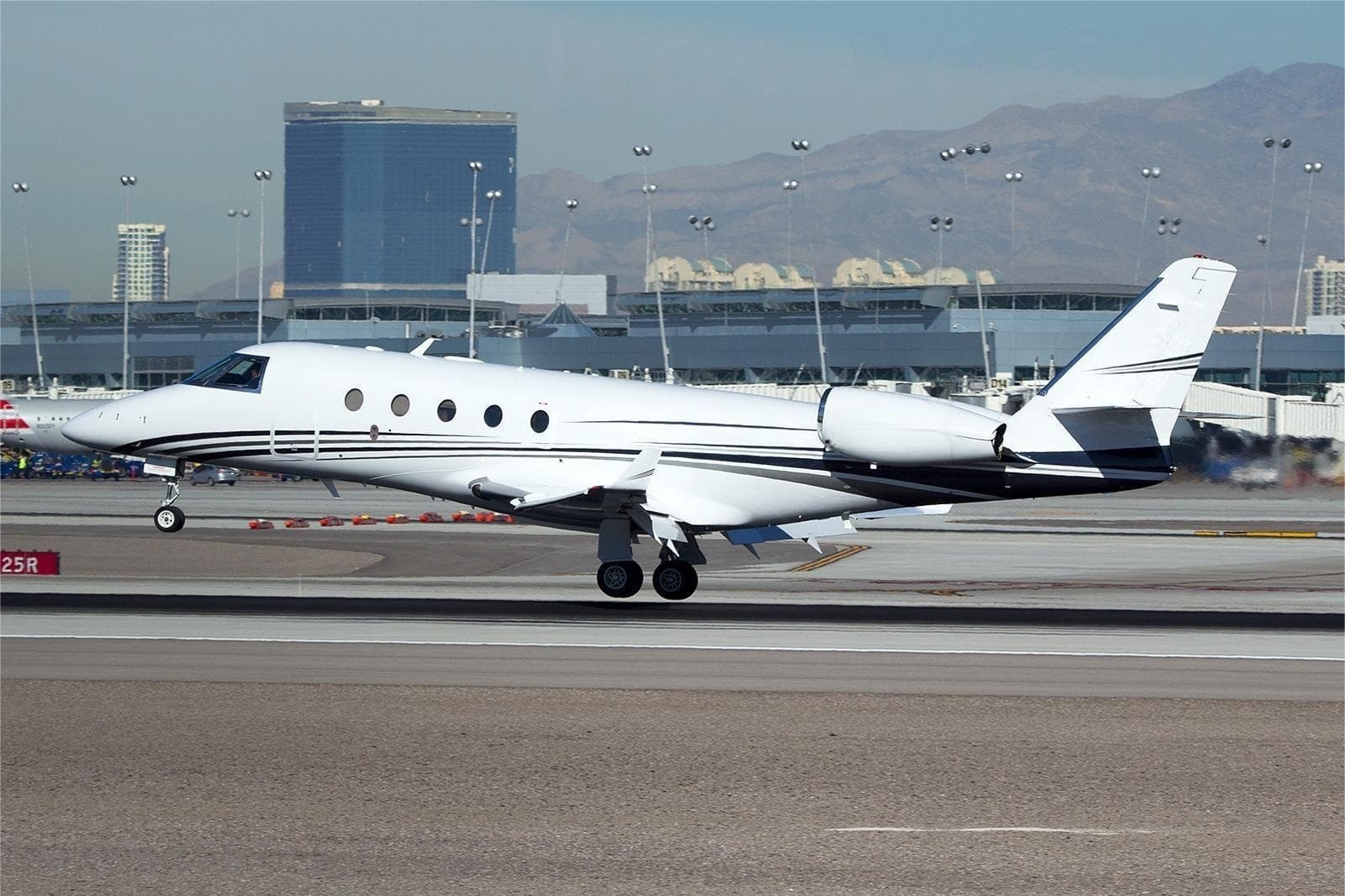 Thu, Nov 12in 9 daysSpringfieldKCEF · Westover ARB/Metropolitan AirportTacomaKTIW · Tacoma Narrows AirportFalcon 900B14—$65,00112NovSpringfield → TacomaKCEF → KTIW · in 9 daysFalcon 900B · 14 seats$65,001
 KCEF · Westover ARB/Metropolitan Airport
* Total price incl. 10% service fee, converted to your selected currency. Price subject to operator confirmation.
Empty legs to KCEF
0 arrivals available
No empty legs are currently available arriving at this airport.
Request tailored flightMap: Springfield/Chicopee Airport
View the location of Springfield/Chicopee – CEF/KCEF. Zoom in to explore the area around the airport.
About the airport
Westover ARB/Metropolitan Airport (CEF/KCEF) is the key private jet gateway for Springfield/Chicopee. PrivJet gives you instant access to charter flights and empty legs: fast, discreet and globally connected.
KCEF airport FAQ
Are there any restrictions at Springfield airport (KCEF) today?
There are currently 21 valid NOTAMs for Springfield (KCEF). According to NOTAM, at least one runway or the aerodrome itself is closed. Affected: Aerodrome: closed; Other: closed; Obstacle: out of service; Other: out of service. 2 more NOTAMs start in the coming days. For information only, not for flight planning or operational use. Always rely on an official pre-flight briefing. This list may be incomplete or out of date.
How long are the runways at Springfield airport (KCEF)?
Springfield (KCEF) has 2 runways: runway 05/23 with 3,535 m (11,597 ft), asphalt and runway 15/33 with 2,160 m (7,085 ft), asphalt. The longest is 3,535 m.
What are the radio frequencies at Springfield airport (KCEF)?
Frequencies at KCEF: Tower 134.85 MHz, Ground 118.35 MHz and ATIS 114 MHz. For information only. Always rely on the published AIP.
What are the airport codes of Westover ARB/Metropolitan Airport?
The ICAO code is KCEF and the IATA code is CEF. ICAO codes are used by air traffic control and pilots, e.g. in flight plans; IATA codes appear on tickets and baggage tags.
What is the elevation of KCEF airport?
Westover ARB/Metropolitan Airport sits at 241 ft (73 m) above sea level. Local time zone: America/New York.
Can I fly to KCEF by private jet?
Whether a private jet can operate into Westover ARB/Metropolitan Airport depends on runway length, opening hours, customs and immigration rules as well as slot and handling availability, among other things. PrivJet checks this with the operating carrier for every request.
Are there empty legs from or to KCEF?
There are currently 2 empty legs departing from and 0 arriving at Westover ARB/Metropolitan Airport. Empty legs are repositioning flights at heavily reduced prices; the list is updated several times a day.