Cleveland Hopkins Airport (KCLE / CLE)
Empty legs and charters from Cleveland
KCLE airport at a glance
- ICAO code
- KCLE
- IATA code
- CLE
- City
- Cleveland
- Region
- Ohio
- Country
- United States
- Elevation
- 791 ft (241 m)
- Time zone
- America/New York (UTC-5)
- Coordinates
- 41.4117° N, 81.8498° W
- Empty legs from
- 31
- Empty legs to
- 49
Weather & airport info KCLE
Current weather
No current weather report is available for this airport.
Airport
- Elevation
- 791 ft (241 m)
- Sunrise / Sunset
- 07:01 / 17:20 local time
Runways
| Runway | Length | Surface | Lighted |
|---|---|---|---|
| 6R/24L | 3,034 m (9,953 ft) | concrete | yes |
| 6L/24R | 2,743 m (9,000 ft) | concrete | yes |
| 10/28 | 1,834 m (6,018 ft) | concrete | yes |
Radio frequencies
- Approach: 119.625
- ATIS: 127.85
- Clearance: 125.05
- Ground: 121.7
- Tower: 120.9
- UNICOM: 122.95
For information only, not for flight planning. Weather can change quickly; always rely on official reports. Sources: aviationweather.gov (NOAA), OurAirports.
Airport map KCLE
Full screen →Runways white, taxiways yellow with designators, closed taxiways and runways per NOTAM in red.
Closed per NOTAM: RWY 6R/24L, TWY L3, TWY L5, TWY L4, TWY L7, TWY A
Official charts (FAA)
Cycle 2611, valid until 0901Z 11/26/26
Airport diagram (FAA)
Airport diagram (1)
Instrument approaches (20)
- ILS OR LOC RWY 06L
- ILS OR LOC RWY 06R
- ILS OR LOC RWY 24L
- ILS OR LOC RWY 24R
- ILS OR LOC RWY 28
- ILS RWY 24R (SA CAT I)
- ILS RWY 06L (CAT II - III)
- ILS RWY 24R (CAT II - III)
- ILS RWY 06R (SA CAT II)
- ILS RWY 24L (SA CAT II)
- RNAV (RNP) Z RWY 06L
- RNAV (RNP) Z RWY 06R
- RNAV (RNP) Z RWY 24L
- RNAV (RNP) Z RWY 24R
- RNAV (GPS) RWY 10
- RNAV (GPS) RWY 28
- RNAV (GPS) Y RWY 06L
- RNAV (GPS) Y RWY 06R
- RNAV (GPS) Y RWY 24L
- RNAV (GPS) Y RWY 24R
Departure procedures (8)
Minimums (1)
For information only, not for navigation. Always use current official charts and NOTAMs.
Current NOTAMs for KCLE(22)
NOTAMs (Notices to Air Missions) announce short-term changes at an airport: closed runways or taxiways, unserviceable approach aids, obstacles, airspace restrictions.
- ClosedRunway: closedA8880/26· until 06 Nov, 23:00 UTC
Runway 06R/24L at Cleveland-Hopkins International airport is closed.
Show original text
RWY 06R/24L CLSD
A8880/26 NOTAMN
Q) KZOB/QMRLC////000/999/4124N08151W005
A) KCLE
B) 2611021557
C) 2611062300
E) RWY 06R/24L CLSD
- Out of serviceApproach lighting: unserviceableA8886/26· from 03 Nov, 12:00 UTC · until 03 Nov, 19:00 UTC
The approach lighting system (ALS) for Runway 24L is out of service. Approach lighting helps pilots find the runway in poor visibility.
Show original text
RWY 24L ALS U/S
A8886/26 NOTAMN
Q) KZOB/QLAAS////000/999/4124N08151W005
A) KCLE
B) 2611031200
C) 2611031900
E) RWY 24L ALS U/S
- Out of serviceILS glide path: unserviceableA8846/26· from 03 Nov, 11:30 UTC · until 03 Nov, 23:00 UTC
The glide path (GP) of the instrument landing system (ILS) for runway 06L is out of service. The ILS guides aircraft to the runway in poor visibility.
Show original text
CLE NAV ILS RWY 06L GP U/S
A8846/26 NOTAMN
Q) KZOB/QIGAS////000/999/4124N08151W005
A) KCLE
B) 2611031130
C) 2611032300
E) CLE NAV ILS RWY 06L GP U/S
- Out of serviceILS glide path: unserviceable10/692· until 03 Nov, 22:00 UTC
The Instrument Landing System (ILS) glideslope for runway 06L is out of service. The ILS guides aircraft to the runway in poor visibility.
Show original text
CLE NAV ILS RWY 06L GP U/S
A8792/26 NOTAMN Q) KZOB/QIGAS////000/999/4124N08151W005 A) KCLE B) 2611031030 C) 2611032200 E) CLE NAV ILS RWY 06L GP U/S
- ClosedTaxiway: closedA8876/26· until 06 Nov, 23:00 UTC
Taxiway L3 is closed. Aircraft cannot use this taxiway to get to the runways or terminals.
Show original text
TWY L3 CLSD
A8876/26 NOTAMN
Q) KZOB/QMXLC////000/999/4124N08151W005
A) KCLE
B) 2611021548
C) 2611062300
E) TWY L3 CLSD
- ClosedTaxiway: closedA8875/26· until 06 Nov, 23:00 UTC
Taxiway L5 is closed. Aircraft cannot use this taxiway to get to the runways or terminals.
Show original text
TWY L5 CLSD
A8875/26 NOTAMN
Q) KZOB/QMXLC////000/999/4124N08151W005
A) KCLE
B) 2611021547
C) 2611062300
E) TWY L5 CLSD
- ClosedTaxiway: closedA8879/26· until 06 Nov, 23:00 UTC
Taxiway L4 is closed.
Show original text
TWY L4 CLSD
A8879/26 NOTAMN
Q) KZOB/QMXLC////000/999/4124N08151W005
A) KCLE
B) 2611021547
C) 2611062300
E) TWY L4 CLSD
- ClosedTaxiway: closedA8881/26· until 06 Nov, 23:00 UTC
Taxiway L7 is closed. This means that this part of the taxiway system at Cleveland-Hopkins International Airport cannot be used.
Show original text
TWY L7 CLSD
A8881/26 NOTAMN
Q) KZOB/QMXLC////000/999/4124N08151W005
A) KCLE
B) 2611021547
C) 2611062300
E) TWY L7 CLSD
14 more NOTAMs
- ClosedTaxiway: closedA8877/26· until 06 Nov, 23:00 UTC
Taxiway N between taxiway G and taxiway L is closed. This section of the taxiway cannot be used.
Show original text
TWY N BTN TWY G AND TWY L CLSD
A8877/26 NOTAMN
Q) KZOB/QMXLC////000/999/4124N08151W005
A) KCLE
B) 2611021546
C) 2611062300
E) TWY N BTN TWY G AND TWY L CLSD
- ClosedTaxiway: closedA8874/26· until 06 Nov, 23:00 UTC
Taxiway A is closed. Aircraft cannot use this taxiway to get to the runways or terminals.
Show original text
TWY A CLSD
A8874/26 NOTAMN
Q) KZOB/QMXLC////000/999/4124N08151W005
A) KCLE
B) 2611021543
C) 2611062300
E) TWY A CLSD
- Out of serviceILS inner marker: unserviceableA8841/26· until 30 Jun, 20:00 UTC
The inner marker (IM) of the instrument landing system (ILS) for runway 24R is out of service. The ILS guides aircraft to the runway in poor visibility.
Show original text
CLE NAV ILS RWY 24R IM U/S
A8841/26 NOTAMN
Q) KZOB/QIIAS////000/999/4124N08151W005
A) KCLE
B) 2610301345
C) 2706302000
E) CLE NAV ILS RWY 24R IM U/S
- Out of serviceTerminal area surveillance radar: unserviceableA8559/26· until 06 Nov, 23:59 UTC
The Transponder and Secondary Surveillance Radar (TAR/SSR) service is out of service. This service helps air traffic control identify and track aircraft.
Show original text
SVC TAR/SSR U/S
A8559/26 NOTAMN
Q) KZOB/QCTAS////000/999/4124N08151W005
A) KCLE
B) 2610151409
C) 2611062359
E) SVC TAR/SSR U/S
- Out of serviceObstacle lights: unserviceableA8483/26· until 24 Nov, 00:23 UTC
The tower light (ASR 1012028) 7.4 nautical miles east of the airport is out of service; its top is 2049 ft above sea level, 1131 ft above ground.
Show original text
TOWER LGT (ASR 1012028) 412302.00N0814143.00W (7.4NM E CL 2049FT (1131FT AGL) U/S
A8483/26 NOTAMN
Q) KZOB/QOLAS/IV/M/E/000/999/4123N08141W001
A) KCLE
B) 2610100023
C) 2611240023
E) TOWER LGT (ASR 1012028) 412302.00N0814143.00W (7.4NM E CLE) 2049FT (1131FT AGL) U/S
- Out of serviceInstrument approach procedure6389/26· until 12 May, 16:02 UTC (estimated)
Instrument approach procedure CLEVELAND-HOPKINS INTL, CLEVELAND, OH. ILS (instrument landing system) or localizer runway 6L, ILS (instrument landing system) runway 6L category II - III, amendment 3... S-ILS (instrument landing system) 6L category II not available except for aircraft equipped with RADAR ALTIMETER. I-LIZ INNER MARKER out of service.. 30 Sep 16:03 UTC -2705121602EST
Show original text
IAP CLEVELAND-HOPKINS INTL, CLEVELAND, OH. ILS OR LOC RWY 6L, ILS RWY 6L CAT II - III, AMDT 3... S-ILS 6L CAT II NA EXCEPT FOR AIRCRAFT EQUIPPED WITH RADAR ALTIMETER. I-LIZ INNER MARKER OUT OF SERVICE.. 2609301603-2705121602EST
Q) KZOB/QPIXX/I/NBO/A/000/999/4124N08151W005
A) KCLE
B) 2609301603
C) 2705121602EST
E) CLE CLEVELAND-HOPKINS INTL, CLEVELAND, OH.
ILS OR LOC RWY 6L, ILS RWY 6L CAT II - III, AMDT 3...
S-ILS 6L CAT II NA EXCEPT FOR AIRCRAFT EQUIPPED WITH RADAR ALTIMETER.  I-LIZ INNER MARKER OUT OF SERVICE..
- Out of serviceInstrument approach procedure: changedA8343/26· until 12 May, 16:02 UTC
At Cleveland-Hopkins International Airport, S-ILS 6L CAT II is not available for the ILS or LOC runway 6L and ILS runway 6L CAT II - III approach procedures, except for aircraft equipped with a radar altimeter. The I-LIZ inner marker is out of service.
Show original text
IAP CLEVELAND-HOPKINS INTL, CLEVELAND, OH. ILS OR LOC RWY 6L, ILS RWY 6L CAT II - III, AMDT 3... S-ILS 6L CAT II NA EXCEPT FOR AIRCRAFT EQUIPPED WITH RADAR ALTIMETER. I-LIZ INNER MARKER OUT OF SERVICE..
A8343/26 NOTAMN
Q) KZOB/QPICH/I/NBO/A/000/999/4124N08151W005
A) KCLE
B) 2609301603
C) 2705121602
E) IAP CLEVELAND-HOPKINS INTL, CLEVELAND, OH. ILS OR LOC RWY 6L, ILS RWY 6L CAT II - III, AMDT 3... S-ILS 6L CAT II NA EXCEPT FOR AIRCRAFT EQUIPPED WITH RADAR ALTIMETER. I-LIZ INNER MARKER OUT OF SERVICE..
- Out of serviceObstacle09/808· until 13 Nov, 23:59 UTC
An obstacle, a tower with the identifier ASR 1014000, is out of service. Its top is 1670.9 ft above sea level, 449.8 ft above ground, located approximately 11.1 nautical miles southeast of the airport.
Show original text
OBST TOWER LGT (ASR 1014000) 411748.00N0813926.00W (11.1NM SE CLE) 1670.9FT (449.8FT AGL) U/S
- Out of serviceILS category II: not availableA8887/26· from 03 Nov, 12:00 UTC · until 03 Nov, 19:00 UTC
The Instrument Landing System (ILS) for Runway 24L is not available for special authorization Category II approaches. The ILS guides aircraft to the runway in poor visibility.
Show original text
CLE NAV ILS RWY 24L SPECIAL AUTH CAT II NA
A8887/26 NOTAMN
Q) KZOB/QITAU////000/999/4124N08151W005
A) KCLE
B) 2611031200
C) 2611031900
E) CLE NAV ILS RWY 24L SPECIAL AUTH CAT II NA
- NoticeOtherA8852/26· until 24 Jun, 22:00 UTC
The general aviation ramp markings in the southeast apron area are not standard.
Show original text
APRON SOUTHEAST GA RAMP CL MARKINGS NOT STD
A8852/26 NOTAMN
Q) KZOB/QXXXX////000/999/4124N08151W005
A) KCLE
B) 2610301919
C) 2706242200
E) APRON SOUTHEAST GA RAMP CL MARKINGS NOT STD
- NoticeApron10/541· until 30 Jun, 23:59 UTC
The apron Hangar 1 ramp centerline markings are not standard.
Show original text
APRON HANGAR 1 RAMP CL MARKINGS NOT STD
- NoticeObstacle09/829· until 24 Dec, 23:59 UTC
A tower, an obstacle, is located about 7.8 nautical miles southeast of Cleveland-Hopkins International Airport; its top is 1348 ft above sea level, 128 ft above ground, and it is not lighted.
Show original text
OBST TOWER (ASN 2021-AGL-7866-OE ) 411953N0814250W (7.8NM SE CLE) 1348FT (128FT AGL) NOT LGTD
- NoticeRunway09/779· until 15 Nov, 21:00 UTC
The centerline markings for runway 06R/24L are not standard.
Show original text
RWY 06R/24L CL MARKINGS NOT STD
- NoticeRunway09/778· until 15 Nov, 21:00 UTC
The touchdown zone markings for runway 24L are not standard.
Show original text
RWY 24L TDZ MARKINGS NOT STD
For information only, not for flight planning or operational use. Always rely on an official pre-flight briefing. This list may be incomplete or out of date. Explanations and expanded abbreviations are generated automatically. The original text is authoritative. Source: FAA NOTAM Management Service (SWIM).
Private jet traffic in Cleveland Hopkins International Airport (last 30 days)
- Arrivals
- 711
- Departures
- 638
- Different jets
- 420
Most frequent origins: Teterboro Airport (46), Washington Dulles International Airport (18), Philadelphia International Airport (11), Naples Municipal Airport (10), Lester B. Pearson International Airport (10).
Most frequent destinations: Teterboro Airport (40), Washington Dulles International Airport (19), Naples Municipal Airport (18), Cuyahoga County Airport (14), John Glenn Columbus International Airport (13).
Most common aircraft types: Embraer Phenom 300 (145), Hawker 800/900 (139), Bombardier Challenger 350/3500 (130), Learjet 45 (87), Dassault Falcon 2000 (80).
Sunday is the busiest day.
Our own analysis of public ADS-B signals from business jets. Not every flight is received, and jets with a removal request are excluded.
Charter operators based here
Operators with a base at this airport.
- Sky QuestLight jet, Midsize jet, Super midsize jet
Empty legs from KCLE
31 departures available
- Tue, Nov 3TodayClevelandKCLE · Cleveland Hopkins International AirportLouisvilleKSDF · Louisville Muhammad Ali International AirportCessna Citation X——On request3NovCleveland → LouisvilleKCLE → KSDF · TodayCessna Citation XOn request
- Tue, Nov 318:54ClevelandKCLE · Hopkins IntlPlacidaFA54 · Coral Creek AirportBombardier Learjet 45XR9—$24,1703NovCleveland → PlacidaKCLE → FA54 · 18:54Bombardier Learjet 45XR · 9 seats$24,170
 Wed, Nov 412:11ClevelandKCLE · Cleveland Hopkins International AirportBaltimoreKBWI · Baltimore/Washington International Thurgood Marshal AirportBeechcraft Hawker 900XP154mOn request4NovCleveland → BaltimoreKCLE → KBWI · 12:11Beechcraft Hawker 900XP · 1 seat · 54mOn request
 Fri, Nov 6in 3 daysClevelandKCLE · Cleveland Hopkins International AirportSarasotaKSRQ · Sarasota Bradenton International AirportHawker 800XP8—$20,8786NovCleveland → SarasotaKCLE → KSRQ · in 3 daysHawker 800XP · 8 seats$20,878
- Fri, Nov 6in 3 daysClevelandKCLE · Cleveland Hopkins International AirportTorontoCYYZ · Toronto Lester B. Pearson International AirportHawker 800XP8—$7,1506NovCleveland → TorontoKCLE → CYYZ · in 3 daysHawker 800XP · 8 seats$7,150
 Fri, Nov 615:17ClevelandKCLE · Cleveland Hopkins International AirportTorontoCYYZ · Lester B. Pearson International AirportBeechcraft Hawker 800XPi142mOn request6NovCleveland → TorontoKCLE → CYYZ · 15:17Beechcraft Hawker 800XPi · 1 seat · 42mOn request
- Fri, Nov 6in 3 daysClevelandKCLE · Cleveland Hopkins International AirportSarasota/BradentonKSRQ · Sarasota Bradenton International AirportBeechcraft Hawker 800XPi12h 24m$23,3846NovCleveland → Sarasota/BradentonKCLE → KSRQ · in 3 daysBeechcraft Hawker 800XPi · 1 seat · 2h 24m$23,384
 Sat, Nov 716:00ClevelandKCLE · Cleveland Hopkins International AirportRoad TownTUPJ · Terrance B. Lettsome International AirportBeechcraft Hawker 850XP14h 12m$38,9147NovCleveland → Road TownKCLE → TUPJ · 16:00Beechcraft Hawker 850XP · 1 seat · 4h 12m$38,914
- Sat, Nov 721:00ClevelandKCLE · Hopkins IntlBeef IslandTUPJ · Terrance B Lettsome IntlBeechcraft Hawker 800XP9—On request7NovCleveland → Beef IslandKCLE → TUPJ · 21:00Beechcraft Hawker 800XP · 9 seatsOn request
 KCLE · Cleveland Hopkins International Airport
 CYYZ · Toronto Lester B. Pearson International Airport
 TUPJ · Terrance B. Lettsome International Airport
* Total price incl. 10% service fee, converted to your selected currency. Price subject to operator confirmation.
Empty legs to KCLE
49 arrivals available
- Wed, Nov 406:54HarrisburgKCXY · Capital City AirportClevelandKCLE · Cleveland Hopkins International AirportCessna Citation CJ26—$4,9504NovHarrisburg → ClevelandKCXY → KCLE · 06:54Cessna Citation CJ2 · 6 seats$4,950
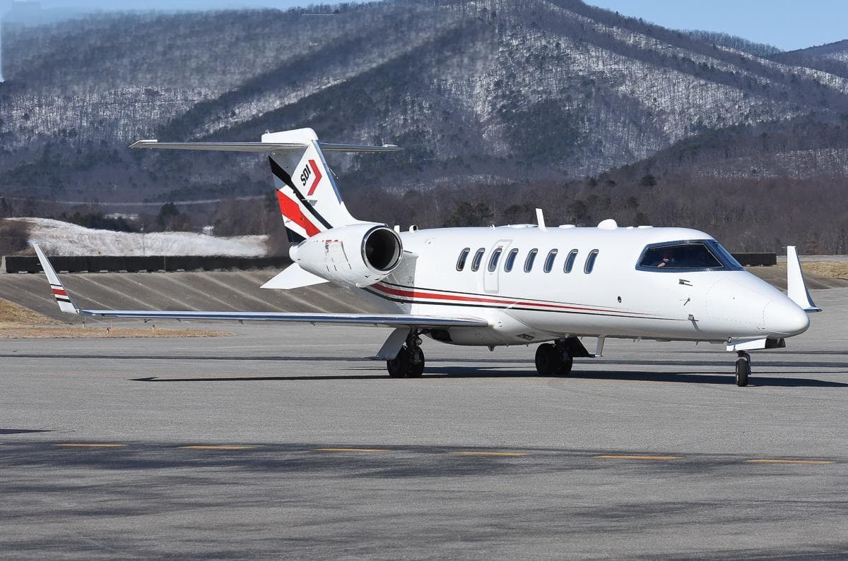 Fri, Nov 6in 3 daysNantucketKACK · Nantucket Memorial AirportClevelandKCLE · Cleveland Hopkins International AirportLearjet 459—$13,1786NovNantucket → ClevelandKACK → KCLE · in 3 daysLearjet 45 · 9 seats$13,178
- Fri, Nov 6in 3 daysOklahoma CityKOKC · Will Rogers WorldClevelandKCLE · Cleveland-Hopkins IntlLearjet 40XR——On request6NovOklahoma City → ClevelandKOKC → KCLE · in 3 daysLearjet 40XROn request
- Fri, Nov 6in 3 daysSouth BendKSBN · South Bend Regional AirportClevelandKCLE · Cleveland Hopkins International AirportBeechcraft Hawker 900XP8—$13,7506NovSouth Bend → ClevelandKSBN → KCLE · in 3 daysBeechcraft Hawker 900XP · 8 seats$13,750
- Fri, Nov 621:00South BendKSBN · South Bend Regional AirportClevelandKCLE · Cleveland Hopkins International AirportCessna Citation Bravo7—$4,7306NovSouth Bend → ClevelandKSBN → KCLE · 21:00Cessna Citation Bravo · 7 seats$4,730
 Fri, Nov 621:05NantucketKACK · Nantucket Memorial AirportClevelandKCLE · Cleveland Hopkins International AirportBombardier Learjet 45XR11h 36m$18,4496NovNantucket → ClevelandKACK → KCLE · 21:05Bombardier Learjet 45XR · 1 seat · 1h 36m$18,449
- Fri, Nov 6in 3 daysNantucketKACK · Nantucket Memorial AirportClevelandKCLE · Cleveland Hopkins International AirportLearjet Lear 459—On request6NovNantucket → ClevelandKACK → KCLE · in 3 daysLearjet Lear 45 · 9 seatsOn request
- Sat, Nov 7in 4 daysSouth BendKSBN · South Bend Regional AirportClevelandKCLE · Cleveland Hopkins International AirportBeechcraft Hawker 900XP8—$13,7507NovSouth Bend → ClevelandKSBN → KCLE · in 4 daysBeechcraft Hawker 900XP · 8 seats$13,750
- Sat, Nov 7in 4 daysNantucketKACK · Nantucket Memorial AirportClevelandKCLE · Cleveland Hopkins International AirportBombardier Learjet 45XR8—$16,1707NovNantucket → ClevelandKACK → KCLE · in 4 daysBombardier Learjet 45XR · 8 seats$16,170
* Total price incl. 10% service fee, converted to your selected currency. Price subject to operator confirmation.
Map: Cleveland Airport
View the location of Cleveland – CLE/KCLE. Zoom in to explore the area around the airport.
About the airport
Cleveland Hopkins International Airport (CLE/KCLE) is the key private jet gateway for Cleveland. PrivJet gives you instant access to charter flights and empty legs: fast, discreet and globally connected.
KCLE airport FAQ
Are there any restrictions at Cleveland airport (KCLE) today?
There are currently 19 valid NOTAMs for Cleveland (KCLE). According to NOTAM, at least one runway or the aerodrome itself is closed. Affected: Runway: closed; Taxiway: closed; ILS glide path: unserviceable; ILS inner marker: unserviceable and 5 more. 3 more NOTAMs start in the coming days. For information only, not for flight planning or operational use. Always rely on an official pre-flight briefing. This list may be incomplete or out of date.
How long are the runways at Cleveland airport (KCLE)?
Cleveland (KCLE) has 3 runways: runway 6R/24L with 3,034 m (9,953 ft), concrete, runway 6L/24R with 2,743 m (9,000 ft), concrete and runway 10/28 with 1,834 m (6,018 ft), concrete. The longest is 3,034 m.
What are the radio frequencies at Cleveland airport (KCLE)?
Frequencies at KCLE: Tower 120.9 MHz, Ground 121.7 MHz and ATIS 127.85 MHz. For information only. Always rely on the published AIP.
What are the airport codes of Cleveland Hopkins International Airport?
The ICAO code is KCLE and the IATA code is CLE. ICAO codes are used by air traffic control and pilots, e.g. in flight plans; IATA codes appear on tickets and baggage tags.
What is the elevation of KCLE airport?
Cleveland Hopkins International Airport sits at 791 ft (241 m) above sea level. Local time zone: America/New York.
Can I fly to KCLE by private jet?
Whether a private jet can operate into Cleveland Hopkins International Airport depends on runway length, opening hours, customs and immigration rules as well as slot and handling availability, among other things. PrivJet checks this with the operating carrier for every request.
Are there empty legs from or to KCLE?
There are currently 31 empty legs departing from and 49 arriving at Cleveland Hopkins International Airport. Empty legs are repositioning flights at heavily reduced prices; the list is updated several times a day.