College Station Easterwood Field Airport (KCLL / CLL)
Empty legs and charters from College Station
KCLL airport at a glance
- ICAO code
- KCLL
- IATA code
- CLL
- City
- College Station
- Region
- Texas
- Country
- United States
- Elevation
- 320 ft (98 m)
- Time zone
- America/Chicago (UTC-6)
- Coordinates
- 30.5886° N, 96.3638° W
- Empty legs from
- 11
- Empty legs to
- 18
Weather & airport info KCLL
Current weather
Marginal visual conditions (MVFR)observed 03 Nov, 11:27 UTC- Wind
- 9 kt (17 km/h) from south (170°)
- Visibility
- 10 km or more
- Clouds
- broken clouds at 1,500 ft, overcast at 2,100 ft
- Temperature
- 23 °C (dew point 22 °C)
- Pressure (QNH)
- 1,012 hPa
Original weather report (METAR)
SPECI KCLL 031127Z AUTO 17009KT 10SM BKN015 OVC021 23/22 A2988 RMK AO2 LTG DSNT N T02330217
Forecast (TAF)
- 03 Nov, 12:00–15:00 UTC10 kt (19 km/h) from south (190°) · visibility 10 km or more · Light rain showers, thunderstorm in the vicinity · overcast at 1,200 ft
- 03 Nov, 12:00–15:00 UTCtemporarily8 kt (15 km/h) from variable directions · visibility 6 km · Thunderstorm with rain · broken clouds at 3,000 ft
- 03 Nov, 15:00–18:00 UTCfrom9 kt (17 km/h) from northwest (310°) · visibility 10 km or more · Showers in the vicinity · scattered clouds at 2,500 ft, broken clouds at 3,500 ft
- 03 Nov, 18:00–00:00 UTCfrom9 kt (17 km/h) from northwest (320°) · visibility 10 km or more · broken clouds at 3,500 ft
- 04 Nov, 00:00–12:00 UTCfrom5 kt (9 km/h) from north-northwest (340°) · visibility 10 km or more · scattered clouds at 25,000 ft
Original forecast (TAF)
TAF KCLL 031120Z 0312/0412 19010KT 6SM -SHRA VCTS OVC012CB TEMPO 0312/0315 VRB08KT 4SM TSRA BKN030CB FM031500 31009KT P6SM VCSH SCT025 BKN035 FM031800 32009KT P6SM BKN035 FM040000 34005KT P6SM SCT250
Airport
- Elevation
- 320 ft (98 m)
- Sunrise / Sunset
- 06:41 / 17:36 local time
Runways
| Runway | Length | Surface | Lighted |
|---|---|---|---|
| 17/35 | 2,134 m (7,000 ft) | asphalt/concrete | yes |
| 11/29 | 1,572 m (5,158 ft) | asphalt | yes |
Radio frequencies
- ATIS: 126.85
- CTAF: 118.5
- Ground: 128.7
- Tower: 118.5
- UNICOM: 122.95
For information only, not for flight planning. Weather can change quickly; always rely on official reports. Sources: aviationweather.gov (NOAA), OurAirports.
Airport map KCLL
Full screen →Runways white, taxiways yellow with designators, closed taxiways and runways per NOTAM in red.
Official charts (FAA)
Cycle 2611, valid until 0901Z 11/26/26
Airport diagram (FAA)
Airport diagram (1)
Instrument approaches (8)
Minimums (2)
Hot spots (1)
For information only, not for navigation. Always use current official charts and NOTAMs.
Current NOTAMs for KCLL(7)
NOTAMs (Notices to Air Missions) announce short-term changes at an airport: closed runways or taxiways, unserviceable approach aids, obstacles, airspace restrictions.
- Out of serviceServices11/003· from 03 Nov, 15:00 UTC · until 03 Nov, 19:00 UTC
Service: ATIS (airport information) 126.85 out of service
Show original text
SVC ATIS 126.85 U/S
- Out of serviceTaxiway11/002· until 06 Nov, 23:00 UTC
The light for the taxiway A holding position sign on the southwest side for runway 11/29 is out of service. The sign is not illuminated.
Show original text
TWY A HLDG PSN SIGN SOUTHWEST SIDE FOR RWY 11/29 LGT U/S
- Out of serviceTaxiway11/001· until 06 Nov, 23:00 UTC
The illuminated taxiway holding position sign on the northeast side of taxiway A for runway 11/29 is out of service. This may make orientation on the taxiway more difficult.
Show original text
TWY A HLDG PSN SIGN NORTHEAST SIDE FOR RWY 11/29 LGT U/S
- Out of serviceTaxiway10/033· until 06 Nov, 23:00 UTC
The taxiway H holding position sign light on the southeast side for runway 11/29 is out of service.
Show original text
TWY H HLDG PSN SIGN SOUTHEAST SIDE FOR RWY 11/29 LGT U/S
- NoticeInstrument approach procedure305/26· until 01 Dec, 15:06 UTC (estimated)
There are several temporary cranes near the airport. One crane is up to 742 feet above mean sea level, beginning 1.91 nautical miles northeast of the airport. Other temporary cranes are up to 645 feet above mean sea level, beginning 1.5 nautical miles northeast of the airport. A temporary crane is 526 feet above mean sea level, 1.63 nautical miles north of the airport.
Show original text
IAP EASTERWOOD FLD, COLLEGE STATION, TX. ILS OR LOC RWY 35, AMDT 15... LOC BC RWY 17, AMDT 8A... RNAV (GPS) RWY 11, AMDT 1D... RNAV (GPS) RWY 17, AMDT 1C... RNAV (GPS) RWY 29, AMDT 1B... RNAV (GPS) RWY 35, AMDT 1D... VOR OR TACAN RWY 11, AMDT 19F... VOR RWY 29, AMDT 14A... CIRCLING CAT A MDA 1000/HAA 679, CATS B/C MDA 1060/HAA 739. TEMPORARY CRANES, UP TO 742 MSL, BEGINNING 1.91 NM NE OF KCLL AIRPORT (2025-ASW-28 THRU 32-OE), TEMPORARY CRANES, UP TO 645 MSL BEGINNING 1.5 NM NE OF KCLL AIRPORT (2025-ASW-12862-OE), TEMPORARY CRANE, 526 MSL, 1.63 NM NORTH OF KCLL AIRPORT (2025-ASW-5924-NRA). 2610191506-2712011506EST
Q) KZHU/QPIXX/I/NBO/A/000/999/3035N09621W005
A) KCLL
B) 2610191506
C) 2705311505EST
E) CLL EASTERWOOD FLD, COLLEGE STATION, TX.
ILS OR LOC RWY 35, AMDT 15...
LOC BC RWY 17, AMDT 8A...
RNAV (GPS) RWY 11, AMDT 1D...
RNAV (GPS) RWY 17, AMDT 1C...
RNAV (GPS) RWY 29, AMDT 1B...
RNAV (GPS) RWY 35, AMDT 1D...
VOR OR TACAN RWY 11, AMDT 19F...
VOR RWY 29, AMDT 14A...
CIRCLING CAT A MDA 1000/HAA 679, CATS B/C MDA 1060/HAA 739.
TEMPORARY CRANES, UP TO 742 MSL, BEGINNING 1.91 NM NE OF KCLL AIRPORT (2025-ASW-28 THRU 32-OE), TEMPORARY CRANES, UP TO 645 MSL BEGINNING 1.5 NM NE OF KCLL AIRPORT (2025-ASW-12862-OE), TEMPORARY CRANE, 526 MSL, 1.63 NM NORTH OF KCLL AIRPORT (2025-ASW-5924-NRA).
- NoticeInstrument approach procedure: changedA0440/26· until 01 Dec, 15:06 UTC
There are several temporary cranes near the airport. One crane is up to 742 feet above mean sea level, beginning 1.91 nautical miles northeast of the airport. Other temporary cranes are up to 645 feet above mean sea level, beginning 1.5 nautical miles northeast of the airport. A temporary crane is 526 feet above mean sea level, 1.63 nautical miles north of the airport.
Show original text
IAP EASTERWOOD FLD, COLLEGE STATION, TX. ILS OR LOC RWY 35, AMDT 15... LOC BC RWY 17, AMDT 8A... RNAV (GPS) RWY 11, AMDT 1D... RNAV (GPS) RWY 17, AMDT 1C... RNAV (GPS) RWY 29, AMDT 1B... RNAV (GPS) RWY 35, AMDT 1D... VOR OR TACAN RWY 11, AMDT 19F... VOR RWY 29, AMDT 14A... CIRCLING CAT A MDA 1000/HAA 679, CATS B/C MDA 1060/HAA 739. TEMPORARY CRANES, UP TO 742 MSL, BEGINNING 1.91 NM NE OF KCLL AIRPORT (2025-ASW-28 THRU 32-OE), TEMPORARY CRANES, UP TO 645 MSL BEGINNING 1.5 NM NE OF KCLL AIRPORT (2025-ASW-12862-OE), TEMPORARY CRANE, 526 MSL, 1.63 NM NORTH OF KCLL AIRPORT (2025-ASW-5924-NRA).
A0440/26 NOTAMN
Q) KZHU/QPICH/I/NBO/A/000/999/3035N09621W005
A) KCLL
B) 2610191506
C) 2712011506
E) IAP EASTERWOOD FLD, COLLEGE STATION, TX. ILS OR LOC RWY 35, AMDT 15... LOC BC RWY 17, AMDT 8A... RNAV (GPS) RWY 11, AMDT 1D... RNAV (GPS) RWY 17, AMDT 1C... RNAV (GPS) RWY 29, AMDT 1B... RNAV (GPS) RWY 35, AMDT 1D... VOR OR TACAN RWY 11, AMDT 19F... VOR RWY 29, AMDT 14A... CIRCLING CAT A MDA 1000/HAA 679, CATS B/C MDA 1060/HAA 739. TEMPORARY CRANES, UP TO 742 MSL, BEGINNING 1.91 NM NE OF KCLL AIRPORT (2025-ASW-28 THRU 32-OE), TEMPORARY CRANES, UP TO 645 MSL BEGINNING 1.5 NM NE OF KCLL AIRPORT (2025-ASW-12862-OE), TEMPORARY CRANE, 526 MSL, 1.63 NM NORTH OF KCLL AIRPORT (2025-ASW-5924-NRA).
- NoticeTaxiway10/013· until 11 Dec, 23:00 UTC
The holding position markings (HLDG PSN MARKINGS) for runway 11/29 (RWY 11/29) on the west side of taxiway G (TWY G) are not standard (NOT STD).
Show original text
TWY G HLDG PSN MARKINGS FOR RWY 11/29 WEST SIDE NOT STD
For information only, not for flight planning or operational use. Always rely on an official pre-flight briefing. This list may be incomplete or out of date. Explanations and expanded abbreviations are generated automatically. The original text is authoritative. Source: FAA NOTAM Management Service (SWIM).
Private jet traffic in Easterwood Field (last 30 days)
- Arrivals
- 457
- Departures
- 461
- Different jets
- 285
Most frequent origins: Dallas Love Field (23), Fort Worth Meacham International Airport (15), Corpus Christi Naval Air Station/Truax Field (14), Austin Bergstrom International Airport (14), San Antonio International Airport (10).
Most frequent destinations: Corpus Christi Naval Air Station/Truax Field (33), Dallas Love Field (27), San Antonio International Airport (17), Victoria Regional Airport (15), Fort Worth Meacham International Airport (13).
Most common aircraft types: Beechcraft King Air 200/250 (178), Beechcraft King Air 90 (72), Embraer Phenom 300 (56), Cessna Citation Excel/XLS (51), Pilatus PC-12 (43).
Sunday is the busiest day.
Our own analysis of public ADS-B signals from business jets. Not every flight is received, and jets with a removal request are excluded.
Charter operators based here
Operators with a base at this airport.
- Executive Jet ManagementWhite Plains (Westchester County) (KHPN) · Light jet, Midsize jet, Super midsize jet
Empty legs from KCLL
11 departures available
- Sun, Nov 8in 5 daysCollege StationKCLL · Easterwood FieldAustinKAUS · Austin Bergstrom International AirportCessna CitationJet5—$4,0708NovCollege Station → AustinKCLL → KAUS · in 5 daysCessna CitationJet · 5 seats$4,070
- Sun, Nov 8in 5 daysCollege StationKCLL · Easterwood FieldAustinKAUMMidsize Jet6—On request8NovCollege Station → AustinKCLL → KAUM · in 5 daysMidsize Jet · 6 seatsOn request
- Fri, Nov 13in 10 daysCollege StationKCLL · Easterwood FieldDallasKDAL · Dallas Love FieldCessna Citation Excel——On request13NovCollege Station → DallasKCLL → KDAL · in 10 daysCessna Citation ExcelOn request
- Fri, Nov 1305:40College StationKCLL · Easterwood FieldMidlandKMDD · Midland AirparkBombardier Learjet 758—$5,17013NovCollege Station → MidlandKCLL → KMDD · 05:40Bombardier Learjet 75 · 8 seats$5,170
- Fri, Nov 1316:40College StationKCLL · Easterwood FieldMidlandKMAF · Midland IntlBombardier Learjet 759—On request13NovCollege Station → MidlandKCLL → KMAF · 16:40Bombardier Learjet 75 · 9 seatsOn request
 Fri, Nov 13in 10 daysCollege StationKCLL · Easterwood FieldMidlandKMDD · Midland AirparkLear 758—On request13NovCollege Station → MidlandKCLL → KMDD · in 10 daysLear 75 · 8 seatsOn request
 Sat, Nov 1415:57College StationKCLL · Easterwood FieldDallasKADS · Addison AirportGulfstream GIV-SP142m$7,92014NovCollege Station → DallasKCLL → KADS · 15:57Gulfstream GIV-SP · 1 seat · 42m$7,920
 Sun, Nov 1523:40College StationKCLL · Easterwood FieldMidlandKMDD · Midland AirparkBombardier Learjet 759—$5,16515NovCollege Station → MidlandKCLL → KMDD · 23:40Bombardier Learjet 75 · 9 seats$5,165
- Sun, Nov 22in 19 daysCollege StationKCLL · Easterwood FieldFort WorthKFTW · Fort Worth Meacham International AirportCessna Citation CJ48—On request22NovCollege Station → Fort WorthKCLL → KFTW · in 19 daysCessna Citation CJ4 · 8 seatsOn request
 KCLL · Easterwood Field
* Total price incl. 10% service fee, converted to your selected currency. Price subject to operator confirmation.
Empty legs to KCLL
18 arrivals available
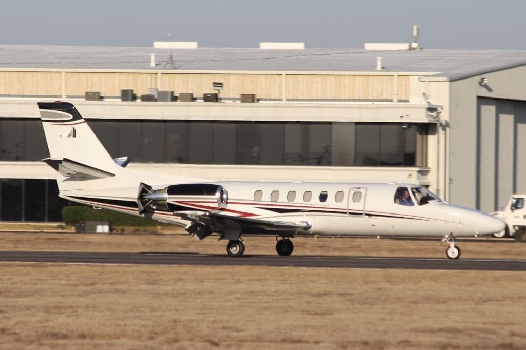 Tue, Nov 3TodayDallasKDAL · Dallas Love FieldCollege StationKCLL · Easterwood FieldCitation XLS8—On request3NovDallas → College StationKDAL → KCLL · TodayCitation XLS · 8 seatsOn request
- Wed, Nov 4TomorrowFort WorthKFTW · Fort Worth Meacham International AirportCollege StationKCLL · Easterwood FieldCessna Citation CJ48—On request4NovFort Worth → College StationKFTW → KCLL · TomorrowCessna Citation CJ4 · 8 seatsOn request
- Sat, Nov 706:26DallasKADS · Addison AirportCollege StationKCLL · Easterwood FieldGulfstream GIV-SP136m$7,0407NovDallas → College StationKADS → KCLL · 06:26Gulfstream GIV-SP · 1 seat · 36m$7,040
 Sun, Nov 8in 5 daysPunta GordaKPGD · Punta Gorda AirportCollege StationKCLL · Easterwood FieldLearjet 607—$16,5008NovPunta Gorda → College StationKPGD → KCLL · in 5 daysLearjet 60 · 7 seats$16,500
- Sun, Nov 8in 5 daysFort LauderdaleKFXE · Fort Lauderdale Executive AirportCollege StationKCLL · Easterwood FieldBombardier Learjet 60XR7—On request8NovFort Lauderdale → College StationKFXE → KCLL · in 5 daysBombardier Learjet 60XR · 7 seatsOn request
- Sun, Nov 815:42Sarasota/BradentonKSRQ · Sarasota Bradenton International AirportCollege StationKCLL · Easterwood FieldBombardier Learjet 607—$24,0908NovSarasota/Bradenton → College StationKSRQ → KCLL · 15:42Bombardier Learjet 60 · 7 seats$24,090
- Sun, Nov 8in 5 daysPunta GordaKPGD · Punta Gorda AirportCollege StationKCLL · Easterwood FieldCessna Citation XLS8—$13,9708NovPunta Gorda → College StationKPGD → KCLL · in 5 daysCessna Citation XLS · 8 seats$13,970
 Sun, Nov 820:18Fort LauderdaleKFXE · Fort Lauderdale Executive AirportCollege StationKCLL · Easterwood FieldBombardier Learjet 6012h 30m$17,9308NovFort Lauderdale → College StationKFXE → KCLL · 20:18Bombardier Learjet 60 · 1 seat · 2h 30m$17,930
- Sun, Nov 8in 5 daysPunta GordaKPGDCollege StationKCLL · Easterwood FieldMidsize Jet6—On request8NovPunta Gorda → College StationKPGD → KCLL · in 5 daysMidsize Jet · 6 seatsOn request
* Total price incl. 10% service fee, converted to your selected currency. Price subject to operator confirmation.
Map: College Station Airport
View the location of College Station – CLL/KCLL. Zoom in to explore the area around the airport.
About the airport
Easterwood Field (CLL/KCLL) is the key private jet gateway for College Station. PrivJet gives you instant access to charter flights and empty legs: fast, discreet and globally connected.
KCLL airport FAQ
Are there any restrictions at College Station airport (KCLL) today?
There are currently 6 valid NOTAMs for College Station (KCLL). Affected: Taxiway: out of service. 1 more NOTAM starts in the coming days. For information only, not for flight planning or operational use. Always rely on an official pre-flight briefing. This list may be incomplete or out of date.
What is the weather at College Station airport (KCLL)?
According to the latest weather report for KCLL (METAR, 03 Nov, 11:27 UTC): Marginal visual conditions (MVFR). Wind 9 kt (17 km/h) from south (170°), visibility 10 km or more, temperature 23 °C (dew point 22 °C). For information only, not for flight planning. Weather can change quickly; always rely on official reports.
How long are the runways at College Station airport (KCLL)?
College Station (KCLL) has 2 runways: runway 17/35 with 2,134 m (7,000 ft), asphalt/concrete and runway 11/29 with 1,572 m (5,158 ft), asphalt. The longest is 2,134 m.
What are the radio frequencies at College Station airport (KCLL)?
Frequencies at KCLL: Tower 118.5 MHz, Ground 128.7 MHz and ATIS 126.85 MHz. For information only. Always rely on the published AIP.
What are the airport codes of Easterwood Field?
The ICAO code is KCLL and the IATA code is CLL. ICAO codes are used by air traffic control and pilots, e.g. in flight plans; IATA codes appear on tickets and baggage tags.
What is the elevation of KCLL airport?
Easterwood Field sits at 320 ft (98 m) above sea level. Local time zone: America/Chicago.
Can I fly to KCLL by private jet?
Whether a private jet can operate into Easterwood Field depends on runway length, opening hours, customs and immigration rules as well as slot and handling availability, among other things. PrivJet checks this with the operating carrier for every request.
Are there empty legs from or to KCLL?
There are currently 11 empty legs departing from and 18 arriving at Easterwood Field. Empty legs are repositioning flights at heavily reduced prices; the list is updated several times a day.