Camarillo Airport (KCMA)
Empty legs and charters from Camarillo
KCMA airport at a glance
- ICAO code
- KCMA
- IATA code
- —
- City
- Camarillo
- Region
- California
- Country
- United States
- Elevation
- 77 ft (23 m)
- Time zone
- America/Los Angeles (UTC-8)
- Coordinates
- 34.2137° N, 119.0940° W
- Empty legs from
- 28
- Empty legs to
- 34
Weather & airport info KCMA
Current weather
Good visual conditions (VFR)observed 03 Nov, 09:55 UTC- Wind
- 4 kt (7 km/h) from east-northeast (70°)
- Visibility
- 10 km or more
- Clouds
- no significant clouds
- Temperature
- 11 °C (dew point 9 °C)
- Pressure (QNH)
- 1,018 hPa
Original weather report (METAR)
METAR KCMA 030955Z AUTO 07004KT 10SM CLR 11/09 A3005 RMK AO2 SLP184 T01110089
Forecast (TAF)
- 03 Nov, 06:00–18:00 UTC3 kt (6 km/h) from variable directions · visibility 10 km or more · scattered clouds at 25,000 ft
- 03 Nov, 18:00–20:00 UTCfrom5 kt (9 km/h) from west-southwest (250°) · visibility 10 km or more · broken clouds at 25,000 ft
- 03 Nov, 20:00–02:00 UTCfrom10 kt (19 km/h) from west-southwest (250°) · visibility 10 km or more · broken clouds at 25,000 ft
- 04 Nov, 02:00–06:00 UTCfrom5 kt (9 km/h) from west-southwest (250°) · visibility 10 km or more · broken clouds at 25,000 ft
Original forecast (TAF)
TAF KCMA 030526Z 0306/0406 VRB03KT P6SM SCT250 FM031800 25005KT P6SM BKN250 FM032000 25010KT P6SM BKN250 FM040200 25005KT P6SM BKN250
Airport
- Elevation
- 77 ft (23 m)
- Sunrise / Sunset
- 06:17 / 17:01 local time
Runways
| Runway | Length | Surface | Lighted |
|---|---|---|---|
| 08/26 | 1,833 m (6,013 ft) | asphalt/concrete | yes |
| 07/25 | 518 m (1,700 ft) | asphalt | no |
Radio frequencies
- ATIS: 126.025
- Clearance: 121.8
- CTAF: 128.2
- Ground: 121.8
- Tower: 128.2
For information only, not for flight planning. Weather can change quickly; always rely on official reports. Sources: aviationweather.gov (NOAA), OurAirports.
Airport map KCMA
Full screen →Runways white, taxiways yellow with designators, closed taxiways and runways per NOTAM in red.
Official charts (FAA)
Cycle 2611, valid until 0901Z 11/26/26
Airport diagram (FAA)
Airport diagram (1)
Instrument approaches (4)
Minimums (2)
For information only, not for navigation. Always use current official charts and NOTAMs.
Current NOTAMs for KCMA(10)
NOTAMs (Notices to Air Missions) announce short-term changes at an airport: closed runways or taxiways, unserviceable approach aids, obstacles, airspace restrictions.
- NoticeAirspace11/003· from 04 Nov, 16:00 UTC · until 05 Nov, 01:00 UTC
The airspace in an area from the surface up to 200 feet above ground near Camarillo airport is closed for unmanned aircraft systems (UAS).
Show original text
AIRSPACE UAS WI AN AREA DEFINED AS 341458.70N1190721.60W (2.6NM NW CMA) TO 341314.80N1190721.80W (1.5NM W CMA) TO 341315.10N1190348.90W (1.6NM ENE CMA) TO 341229.20N1190350.70W (1.5NM E CMA) TO 341228.70N1190724.70W (1.5NM WSW CMA) TO 341102.70N1190725.60W (2.3NM SSW CMA) TO 341103.80N1185951.60W (5.1NM E CMA) TO 341459.10N1185953.50W (5.2NM NE CMA) TO POINT OF ORIGIN SFC-200FT AGL
- NoticeObstacle10/063· from 04 Nov, 15:00 UTC · until 04 Nov, 20:30 UTC
A crane is an obstacle near the airport, approximately 1 nautical mile southeast of Camarillo. Its top is 162 feet above sea level, 95 feet above ground, flagged but not lighted.
Show original text
OBST CRANE (ASN UNKNOWN) 341234N1190508W (1NM SE CMA) 162FT (95FT AGL) FLAGGED, NOT LGTD
- NoticeObstacle11/004· from 03 Nov, 17:00 UTC · until 03 Nov, 19:00 UTC
A crane, whose owner is unknown, is located 3 nautical miles east of the airport. Its top is 85 feet above ground, it is flagged but not lit.
Show original text
OBST CRANE (ASN UNKNOWN) 341342N1190230W (3NM E CMA) UNKNOWN (85FT AGL) FLAGGED, NOT LGTD
- NoticeAirspace11/002· from 03 Nov, 16:00 UTC · until 04 Nov, 01:00 UTC
The airspace in an area west, southwest, and east of Camarillo airport is closed for unmanned aircraft systems (drones) up to 125 feet above ground.
Show original text
AIRSPACE UAS WI AN AREA DEFINED AS 341313.80N1190723W (1.5NM W CMA) TO 341228.60N1190723.10W (1.5NM WSW CMA) TO 341228.70N1190651.20W (1.0NM WSW CMA) TO 341304.70N1190651.50W (1.0NM W CMA) TO 341304.10N1190411.40W (1.2NM ENE CMA) TO 341229N1190410.60W (1.3NM E CMA) TO 341228.20N1190350.50W (1.5NM E CMA) TO 341315.10N1190349.10W (1.6NM ENE CMA) TO POINT OF ORIGIN SFC-125FT AGL
- NoticeAirspace11/001· from 03 Nov, 15:00 UTC · until 07 Nov, 04:00 UTC
The airspace is restricted for unmanned aircraft systems (drones) within a 5.5 nautical mile radius of Camarillo Airport up to 1500 feet above ground.
Show original text
AIRSPACE UAS WI AN AREA DEFINED AS 5.5NM RADIUS OF 341344N1191755W (3.9NM WNW OXR) SFC-1500FT AGL DLY 1500-0400
- Out of serviceInstrument approach procedure4112/26· until 06 Nov, 23:59 UTC
Alternate minimums for the VOR approach to runway 26 are not available, unless the aircraft is equipped with a suitable RNAV system with GPS. The VOR/DME system is unmonitored.
Show original text
IAP CAMARILLO, CAMARILLO, CA. VOR RWY 26, AMDT 5B... ALTERNATE MINIMUMS NA EXCEPT FOR ACFT EQUIPPED WITH SUITABLE RNAV SYSTEM WITH GPS, CMA VOR/DME UNMONITORED. 2610302128-2611062359EST
Q) KZLA/QPIXX/I/NBO/A/000/999/3412N11905W005
A) KCMA
B) 2211051749
C) 2306171749EST
E) CMA CAMARILLO, CAMARILLO, CA.
VOR RWY 26, AMDT 5B...
ALTERNATE MNM NA EXCEPT FOR ACFT EQUIPPED WITH SUITABLE RNAV SYSTEM WITH GPS,
CMA VOR/DME NOT MNT.
- Out of serviceInstrument approach procedure472/26· until 16 Nov, 23:59 UTC (estimated)
For the Instrument Approach Procedure (IAP) VOR runway 26 at Camarillo airport, alternate minimums are not available unless the aircraft is equipped with a suitable RNAV system with GPS, as the FIM VORTAC is unmonitored.
Show original text
IAP CAMARILLO, CAMARILLO, CA. VOR RWY 26, AMDT 5B... ALTERNATE MINIMUMS NA EXCEPT FOR ACFT EQUIPPED WITH SUITABLE RNAV SYSTEM WITH GPS, FIM VORTAC UNMONITORED. 2610191909-2611162359EST
Q) KZLA/QPIXX/I/NBO/A/000/999/3412N11905W005
A) KCMA
B) 2605161842
C) 2612261842EST
E) CMA CAMARILLO, CAMARILLO, CA.
VOR RWY 26, AMDT 5B...
ALTERNATE MNM NA EXCEPT FOR ACFT EQUIPPED WITH SUITABLE RNAV SYSTEM WITH GPS,
FIM VORTAC NOT MNT.
- NoticeAirspace10/002· until 02 Apr, 23:59 UTC
There are unmanned aircraft systems (UAS) in the airspace within a 3 nautical mile radius southeast of the airport, up to 400 feet above ground.
Show original text
AIRSPACE UAS WI AN AREA DEFINED AS 3NM RADIUS OF 341023N1191038W (3NM SE OXR) SFC-400FT AGL
2 more NOTAMs
- NoticeAirspace10/001· until 02 Apr, 23:59 UTC
Airspace for unmanned aircraft systems (drones) is restricted within a 3-nautical-mile radius of a point 2.2 nautical miles east-northeast of Oxnard airport, from the surface up to 400 feet above ground.
Show original text
AIRSPACE UAS WI AN AREA DEFINED AS 3NM RADIUS OF 341333N1191046W (2.2NM ENE OXR) SFC-400FT AGL
- NoticeAerodrome09/031· until 24 Dec, 20:00 UTC
The airport beacon is now 4070 ft northwest of its previous location.
Show original text
AD AP ABN NOW 4070FT NW OF PREVIOUS LOCATION
For information only, not for flight planning or operational use. Always rely on an official pre-flight briefing. This list may be incomplete or out of date. Explanations and expanded abbreviations are generated automatically. The original text is authoritative. Source: FAA NOTAM Management Service (SWIM).
Private jet traffic in Camarillo Airport (last 30 days)
- Arrivals
- 557
- Departures
- 406
- Different jets
- 329
Most frequent origins: Van Nuys Airport (29), Harry Reid International Airport (19), Norman Y. Mineta San Jose International Airport (16), John Wayne Airport-Orange County Airport (14), Mc Clellan-Palomar Airport (13).
Most frequent destinations: Van Nuys Airport (18), Norman Y. Mineta San Jose International Airport (14), Santa Barbara Municipal Airport (13), Harry Reid International Airport (11), Mc Clellan-Palomar Airport (10).
Most common aircraft types: Pilatus PC-12 (112), Daher TBM 700 (102), Daher TBM 900–960 (63), Cessna Citation CJ3 (48), Beechcraft King Air 200/250 (39).
Monday is the busiest day.
Our own analysis of public ADS-B signals from business jets. Not every flight is received, and jets with a removal request are excluded.
Charter operators based here
Operators with a base at this airport.
- Solairus AviationVan Nuys (KVNY) · Turboprop, Light jet, Midsize jet
- Air 7Turboprop, Light jet, Midsize jet
- Sun Air JetsVan Nuys (KVNY) · Turboprop, Super midsize jet, Heavy jet
- Orbic Helicopters Sales & Service at CamarilloHelicopter
Empty legs from KCMA
28 departures available
- Wed, Nov 408:14CamarilloKCMA · Camarillo International AirportSan DiegoKSAN · San Diego International AirportCessna Citation X8—$6,7104NovCamarillo → San DiegoKCMA → KSAN · 08:14Cessna Citation X · 8 seats$6,710
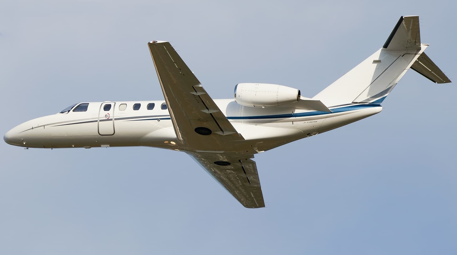 Thu, Nov 5in 2 daysCamarilloKCMA · Camarillo AirportPhoenixKPHX · Phoenix Sky Harbor International AirportCitation CJ37—$13,9105NovCamarillo → PhoenixKCMA → KPHX · in 2 daysCitation CJ3 · 7 seats$13,910
- Thu, Nov 5in 2 daysCamarilloKCMA · Camarillo AirportMc CallKMYL · Mc Call Municipal AirportCitation CJ37—$14,8985NovCamarillo → Mc CallKCMA → KMYL · in 2 daysCitation CJ3 · 7 seats$14,898
- Thu, Nov 505:00CamarilloKCMA · Camarillo International AirportLancasterKWJF · General William J Fox AirfieldPilatus PC-12 NG8—$1,8705NovCamarillo → LancasterKCMA → KWJF · 05:00Pilatus PC-12 NG · 8 seats$1,870
- Thu, Nov 5in 2 daysCamarilloKCMA · Camarillo AirportMcCallKMYL · McCall Municipal AirportCJ38—On request5NovCamarillo → McCallKCMA → KMYL · in 2 daysCJ3 · 8 seatsOn request
- Fri, Nov 6in 3 daysCamarilloKCMA · Camarillo International AirportPhoenixKPHX · Phoenix Sky Harbor International AirportCessna Citation CJ3+7—$16,1706NovCamarillo → PhoenixKCMA → KPHX · in 3 daysCessna Citation CJ3+ · 7 seats$16,170
- Fri, Nov 611:59CamarilloKCMA · Camarillo International AirportPalm SpringsKTRM · Jacqueline Cochran Regional AirportPilatus PC-12 NG8—$1,9806NovCamarillo → Palm SpringsKCMA → KTRM · 11:59Pilatus PC-12 NG · 8 seats$1,980
- Sat, Nov 712:59CamarilloKCMA · Camarillo International AirportPalm SpringsKTRM · Jacqueline Cochran Regional AirportPilatus PC-12 NG8—$2,7507NovCamarillo → Palm SpringsKCMA → KTRM · 12:59Pilatus PC-12 NG · 8 seats$2,750
- Sun, Nov 811:00CamarilloKCMA · Camarillo International AirportSanta AnaKSNA · John Wayne Orange County International AirportPilatus PC-12 NG8—$1,7608NovCamarillo → Santa AnaKCMA → KSNA · 11:00Pilatus PC-12 NG · 8 seats$1,760
 KCMA · Camarillo International Airport
* Total price incl. 10% service fee, converted to your selected currency. Price subject to operator confirmation.
Empty legs to KCMA
34 arrivals available
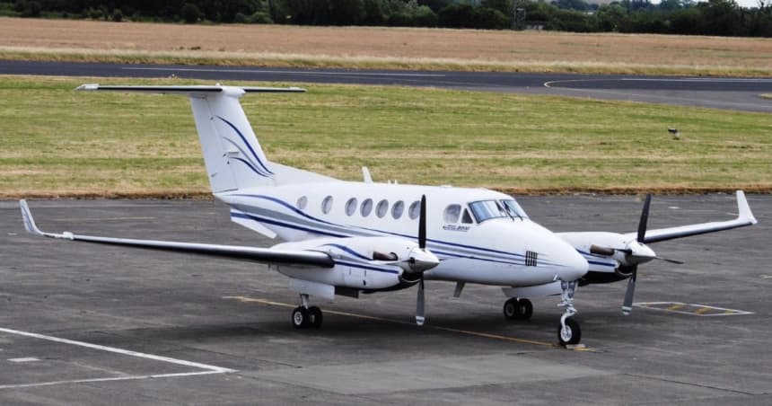 Tue, Nov 3TodayYumaKNYL · Yuma MCAS/Yuma International AirportCamarilloKCMA · Camarillo AirportKing Air 2008—On request3NovYuma → CamarilloKNYL → KCMA · TodayKing Air 200 · 8 seatsOn request
- Tue, Nov 317:00San DiegoKSDM · Brown Field Municipal AirportCamarilloKCMA · Camarillo International AirportPilatus PC-12 NG8—$2,7503NovSan Diego → CamarilloKSDM → KCMA · 17:00Pilatus PC-12 NG · 8 seats$2,750
- Tue, Nov 314:30Santa AnaKSNA · John Wayne/Orange CountyCamarilloKCMAChallenger 85015—€5,1403NovSanta Ana → CamarilloKSNA → KCMA · 14:30Challenger 850 · 15 seats€5,140
- Wed, Nov 4TomorrowSanta AnaKSNA · John Wayne Airport-Orange County AirportCamarilloKCMA · Camarillo AirportBombardier Learjet 40XR6—On request4NovSanta Ana → CamarilloKSNA → KCMA · TomorrowBombardier Learjet 40XR · 6 seatsOn request
- Wed, Nov 413:57Van NuysKVNY · Van Nuys AirportCamarilloKCMA · Camarillo International AirportBombardier Challenger 85015—$3,0804NovVan Nuys → CamarilloKVNY → KCMA · 13:57Bombardier Challenger 850 · 15 seats$3,080
- Wed, Nov 4TomorrowSanta AnaKSNA · John Wayne Airport-Orange County AirportCamarilloKCMA · Camarillo AirportBombardier Lear 40XR630mOn request4NovSanta Ana → CamarilloKSNA → KCMA · TomorrowBombardier Lear 40XR · 6 seats · 30mOn request
- Thu, Nov 510:30MesaKIWA · Mesa Gateway AirportCamarilloKCMA · Camarillo International AirportPilatus PC-12 NG8—$2,9705NovMesa → CamarilloKIWA → KCMA · 10:30Pilatus PC-12 NG · 8 seats$2,970
- Fri, Nov 6in 3 daysVan NuysKVNY · Van Nuys AirportCamarilloKCMA · Camarillo AirportBombardier Learjet 40XR6—On request6NovVan Nuys → CamarilloKVNY → KCMA · in 3 daysBombardier Learjet 40XR · 6 seatsOn request
- Fri, Nov 622:05CarlsbadKCRQ · McClellan-Palomar AirportCamarilloKCMA · Camarillo International AirportEmbraer Phenom 3007—$3,9606NovCarlsbad → CamarilloKCRQ → KCMA · 22:05Embraer Phenom 300 · 7 seats$3,960
* Total price incl. 10% service fee, converted to your selected currency. Price subject to operator confirmation.
Map: Camarillo Airport
View the location of Camarillo – KCMA/KCMA. Zoom in to explore the area around the airport.
About the airport
Camarillo Airport (KCMA/KCMA) is the key private jet gateway for Camarillo. PrivJet gives you instant access to charter flights and empty legs: fast, discreet and globally connected.
KCMA airport FAQ
Are there any restrictions at Camarillo airport (KCMA) today?
There are currently 5 valid NOTAMs for Camarillo (KCMA). Affected: Instrument approach procedure. 5 more NOTAMs start in the coming days. For information only, not for flight planning or operational use. Always rely on an official pre-flight briefing. This list may be incomplete or out of date.
What is the weather at Camarillo airport (KCMA)?
According to the latest weather report for KCMA (METAR, 03 Nov, 09:55 UTC): Good visual conditions (VFR). Wind 4 kt (7 km/h) from east-northeast (70°), visibility 10 km or more, temperature 11 °C (dew point 9 °C). For information only, not for flight planning. Weather can change quickly; always rely on official reports.
How long are the runways at Camarillo airport (KCMA)?
Camarillo (KCMA) has 2 runways: runway 08/26 with 1,833 m (6,013 ft), asphalt/concrete and runway 07/25 with 518 m (1,700 ft), asphalt. The longest is 1,833 m.
What are the radio frequencies at Camarillo airport (KCMA)?
Frequencies at KCMA: Tower 128.2 MHz, Ground 121.8 MHz and ATIS 126.025 MHz. For information only. Always rely on the published AIP.
What are the airport codes of Camarillo Airport?
The ICAO code is KCMA; no IATA code is listed in our data. ICAO codes are used by air traffic control and pilots, e.g. in flight plans.
What is the elevation of KCMA airport?
Camarillo Airport sits at 77 ft (23 m) above sea level. Local time zone: America/Los Angeles.
Can I fly to KCMA by private jet?
Whether a private jet can operate into Camarillo Airport depends on runway length, opening hours, customs and immigration rules as well as slot and handling availability, among other things. PrivJet checks this with the operating carrier for every request.
Are there empty legs from or to KCMA?
There are currently 28 empty legs departing from and 34 arriving at Camarillo Airport. Empty legs are repositioning flights at heavily reduced prices; the list is updated several times a day.