Ronald Reagan Washington National Airport (KDCA / DCA)
Empty legs and charters from Washington
KDCA airport at a glance
- ICAO code
- KDCA
- IATA code
- DCA
- City
- Washington
- Region
- Virginia
- Country
- United States
- Elevation
- 15 ft (5 m)
- Time zone
- America/New York (UTC-5)
- Coordinates
- 38.8521° N, 77.0377° W
- Empty legs from
- 3
- Empty legs to
- 2
Weather & airport info KDCA
Current weather
Good visual conditions (VFR)observed 03 Nov, 16:52 UTC- Wind
- 9 kt (17 km/h) from south (180°)
- Visibility
- 10 km or more
- Clouds
- scattered clouds at 25,000 ft
- Temperature
- 21 °C (dew point 12 °C)
- Pressure (QNH)
- 1,026 hPa
Original weather report (METAR)
METAR KDCA 031652Z 18009KT 10SM SCT250 21/12 A3028 RMK AO2 SLP252 T02060122 $
Forecast (TAF)
- 03 Nov, 15:00–21:00 UTC7 kt (13 km/h) from south (170°) · visibility 10 km or more · few clouds at 10,000 ft, few clouds at 25,000 ft
- 03 Nov, 21:00–04:00 UTCfrom7 kt (13 km/h) from south (180°) · visibility 10 km or more · scattered clouds at 25,000 ft
- 04 Nov, 04:00–10:00 UTCfrom5 kt (9 km/h) from south (170°) · visibility 10 km or more · no significant clouds
- 04 Nov, 10:00–15:00 UTCfrom3 kt (6 km/h) from south-southeast (150°) · visibility 6 km · Mist · few clouds at 10,000 ft, broken clouds at 25,000 ft
- 04 Nov, 15:00–18:00 UTCfrom5 kt (9 km/h) from south (170°) · visibility 10 km or more · scattered clouds at 5,000 ft, broken clouds at 25,000 ft
Original forecast (TAF)
TAF KDCA 031445Z 0315/0418 17007KT P6SM FEW100 FEW250 FM032100 18007KT P6SM SCT250 FM040400 17005KT P6SM SKC FM041000 15003KT 4SM BR FEW100 BKN250 FM041500 17005KT P6SM SCT050 BKN250
Airport
- Elevation
- 15 ft (5 m)
- Sunrise / Sunset
- 06:37 / 17:06 local time
Runways
| Runway | Length | Surface | Lighted |
|---|---|---|---|
| 01/19 | 2,185 m (7,169 ft) | asphalt | yes |
| 15/33 | 1,586 m (5,204 ft) | asphalt | yes |
| 04/22 | 1,524 m (5,000 ft) | asphalt | yes |
Radio frequencies
- Approach: 119.85
- Approach: 124.2
- Ground: 121.7
- Ground: 257.6
- Tower: 119.1
- Tower: 134.35
- Tower: 257.6
- UNICOM: 122.95
For information only, not for flight planning. Weather can change quickly; always rely on official reports. Sources: aviationweather.gov (NOAA), OurAirports.
Airport map KDCA
Full screen →Runways white, taxiways yellow with designators, closed taxiways and runways per NOTAM in red.
Closed per NOTAM: RWY 1/19
Official charts (FAA)
Cycle 2611, valid until 0901Z 11/26/26
Airport diagram (FAA)
Airport diagram (1)
Instrument approaches (11)
Departure procedures (20)
- AMEEE ONE (RNAV)
- AMEEE ONE (RNAV), CONT.1
- CLTCH THREE (RNAV)
- CLTCH THREE (RNAV), CONT.1
- DOCTR FIVE (RNAV)
- DOCTR FIVE (RNAV), CONT.1
- HORTO FOUR (RNAV)
- HORTO FOUR (RNAV), CONT.1
- JDUBB FOUR (RNAV)
- JDUBB FOUR (RNAV), CONT.1
- NATIONAL EIGHT
- NATIONAL EIGHT, CONT.1
- REBLL FIVE (RNAV)
- REBLL FIVE (RNAV), CONT.1
- SCRAM SIX (RNAV)
- SCRAM SIX (RNAV), CONT.1
- SOOKI SIX (RNAV)
- SOOKI SIX (RNAV), CONT.1
- WYNGS FIVE (RNAV)
- WYNGS FIVE (RNAV), CONT.1
Minimums (2)
Hot spots (1)
For information only, not for navigation. Always use current official charts and NOTAMs.
Current NOTAMs for KDCA(41)
NOTAMs (Notices to Air Missions) announce short-term changes at an airport: closed runways or taxiways, unserviceable approach aids, obstacles, airspace restrictions.
- ClosedRunway: closedA4076/26· from 04 Nov, 05:00 UTC · until 07 Nov, 10:00 UTC
Runway 01/19 is closed except for crossing and taxiing. This means the runway cannot be used for takeoffs and landings.
Show original text
RWY 01/19 CLSD EXC XNG AND TAX
A4076/26 NOTAMN
Q) KZDC/QMRLC////000/999/3851N07702W005
A) KDCA
B) 2611040500
C) 2611071000
D) DLY 0500-1000
E) RWY 01/19 CLSD EXC XNG AND TAX
Hours: DLY 0500-1000
- ClosedRunway: closed10/597· until 06 Nov, 10:00 UTC
Runway 01/19 is closed, except for crossings and taxiing.
Show original text
RWY 01/19 CLSD EXC XNG AND TAX
A4045/26 NOTAMN Q) KZDC/QMRLC////000/999/3851N07702W005 A) KDCA B) 2611020500 C) 2611061000 D) DLY 0500-1000 E) RWY 01/19 CLSD EXC XNG AND TAX
Hours: DLY 0500-1000
- Out of serviceILS: unserviceableA4072/26· from 04 Nov, 14:00 UTC · until 04 Nov, 19:00 UTC
The Instrument Landing System (ILS) for runway 01 is out of service. The ILS guides aircraft to the runway in poor visibility.
Show original text
DCA NAV ILS RWY 01 U/S
A4072/26 NOTAMN
Q) KZDC/QICAS////000/999/3851N07702W005
A) KDCA
B) 2611041400
C) 2611041900
E) DCA NAV ILS RWY 01 U/S
- Out of serviceDMEA4073/26· from 04 Nov, 14:00 UTC · until 04 Nov, 19:00 UTC
The DME (distance measuring equipment) of the Instrument Landing System (ILS) for runway 19 at Ronald Reagan Washington National airport is out of service. The ILS guides aircraft to the runway in poor visibility.
Show original text
DCA NAV ASO LOC TYPE DIRECTIONAL AID RWY 19 DME U/S
A4073/26 NOTAMN
Q) KZDC/QNDXX////000/999/3851N07702W005
A) KDCA
B) 2611041400
C) 2611041900
E) DCA NAV ASO LOC TYPE DIRECTIONAL AID RWY 19 DME U/S
- Out of serviceAerodrome: not availableA4074/26· from 04 Nov, 14:00 UTC · until 04 Nov, 21:00 UTC
The microburst and wind shear detection system is out of service. This system warns of dangerous wind phenomena.
Show original text
SVC MBST/WS DETECTION SYSTEM NOT AVBL
A4074/26 NOTAMN
Q) KZDC/QFMAU////000/999/3851N07702W005
A) KDCA
B) 2611041400
C) 2611042100
E) SVC MBST/WS DETECTION SYSTEM NOT AVBL
- Out of servicePAPI: unserviceableA4077/26· from 04 Nov, 12:00 UTC · until 04 Nov, 14:00 UTC
The Precision Approach Path Indicator (PAPI) for runway 15 is out of service. The PAPI is a visual aid that helps pilots maintain the correct altitude during approach.
Show original text
RWY 15 PAPI U/S
A4077/26 NOTAMN
Q) KZDC/QLPAS////000/999/3851N07702W005
A) KDCA
B) 2611041200
C) 2611041400
E) RWY 15 PAPI U/S
- Out of serviceServices10/636· until 11 Nov, 20:00 UTC (estimated)
Ground communication outlet 122.200 at Ronald Reagan Washington National Airport is out of service.
Show original text
COM GND COM OUTLET 122.200 U/S
- Out of serviceObstacle10/490· until 05 Dec, 10:23 UTC
A tower light, 9.5 nautical miles southwest of the airport, is out of service. Its top is 265 feet above sea level, 125 feet above ground.
Show original text
OBST TOWER LGT (ASN 2008-AEA-2022-OE) 384442N0771102W (9.5NM SW DCA) 265FT (125FT AGL) U/S
33 more NOTAMs
- Out of servicePAPI: unserviceableA3560/26· until 31 Dec, 03:00 UTC
The Precision Approach Path Indicator (PAPI) for runway 22 is out of service. The PAPI helps pilots maintain the correct approach angle to the runway.
Show original text
RWY 22 PAPI U/S
A3560/26 NOTAMN
Q) KZDC/QLPAS////000/999/3851N07702W005
A) KDCA
B) 2609261720
C) 2612310300
E) RWY 22 PAPI U/S
- Out of servicePAPI: unserviceableA3558/26· until 31 Dec, 03:00 UTC
The PAPI (Precision Approach Path Indicator) for runway 04 is out of service. This system helps pilots maintain the correct glide path to the runway.
Show original text
RWY 04 PAPI U/S
A3558/26 NOTAMN
Q) KZDC/QLPAS////000/999/3851N07702W005
A) KDCA
B) 2609261719
C) 2612310300
E) RWY 04 PAPI U/S
- NoticeAirspace11/017· until 03 Nov, 21:30 UTC
The airspace for unmanned aircraft systems (UAS) is restricted within a 0.5 nautical mile radius, 9 nautical miles northwest of 2W5, from the surface to 400 feet above ground.
Show original text
AIRSPACE UAS WI AN AREA DEFINED AS .5NM RADIUS OF 384108N0771440W (9NM NW 2W5) SFC-400FT AGL
- Out of serviceInstrument approach procedure3362/26· until 31 Dec, 23:59 UTC (estimated)
The RNAV (RNP) Z approach procedure for runway 19, amendment 3A, is not available unless the airport ATIS advises that a temporary crane 3885 feet north of runway 19, with its top at 157 feet above mean sea level, has been lowered.
Show original text
IAP RONALD REAGAN WASHINGTON NTL, WASHINGTON, DC. RNAV (RNP) Z RWY 19, AMDT 3A... PROCEDURE NA UNLESS ADVISED BY THE AIRPORT ATIS (CONSULT ATIS) THAT THIS CRANE HAS BEEN LOWERED AT OR BELOW THE NO EFFECT HEIGHT. TEMPORARY CRANE, 157FT MSL, 3885FT NORTH OF RWY 19 (2025-AEA-11017-OE). 2610282120-2612312359EST
Q) KZDC/QPIXX/I/NBO/A/000/999/3851N07702W005
A) KDCA
B) 2610282120
C) 2612312359EST
E) DCA RONALD REAGAN WASHINGTON NTL, WASHINGTON, DC.
RNAV (RNP) Z RWY 19, AMDT 3A...
PROCEDURE NA UNLESS ADVISED BY THE AIRPORT ATIS (CONSULT ATIS) THAT THIS CRANE HAS BEEN LOWERED AT OR BELOW THE NO EFFECT HEIGHT. TEMPORARY CRANE, 157FT MSL, 3885FT NORTH OF RWY 19 (2025-AEA-11017-OE).
- Out of serviceInstrument approach procedure: changedA4057/26· until 31 Dec, 23:59 UTC
The RNAV (RNP) Z approach procedure for runway 19, amendment 3A, is not available unless the airport ATIS advises that a temporary crane 3885 feet north of runway 19, with its top at 157 feet above mean sea level, has been lowered.
Show original text
IAP RONALD REAGAN WASHINGTON NTL, WASHINGTON, DC. RNAV (RNP) Z RWY 19, AMDT 3A... PROCEDURE NA UNLESS ADVISED BY THE AIRPORT ATIS (CONSULT ATIS) THAT THIS CRANE HAS BEEN LOWERED AT OR BELOW THE NO EFFECT HEIGHT. TEMPORARY CRANE, 157FT MSL, 3885FT NORTH OF RWY 19 (2025-AEA-11017-OE).
A4057/26 NOTAMN
Q) KZDC/QPICH/I/NBO/A/000/999/3851N07702W005
A) KDCA
B) 2610282120
C) 2612312359
E) IAP RONALD REAGAN WASHINGTON NTL, WASHINGTON, DC. RNAV (RNP) Z RWY 19, AMDT 3A... PROCEDURE NA UNLESS ADVISED BY THE AIRPORT ATIS (CONSULT ATIS) THAT THIS CRANE HAS BEEN LOWERED AT OR BELOW THE NO EFFECT HEIGHT. TEMPORARY CRANE, 157FT MSL, 3885FT NORTH OF RWY 19 (2025-AEA-11017-OE).
- Out of serviceInstrument approach procedure3180/26· until 11 Nov, 20:00 UTC (estimated)
Certain instrument approach procedures at Ronald Reagan Washington National Airport are not available except for aircraft equipped with a suitable RNAV system with GPS, as the DCA VOR/DME is unmonitored.
Show original text
IAP RONALD REAGAN WASHINGTON NTL, WASHINGTON, DC. ILS OR LOC RWY 1, AMDT 41E... LDA RWY 19, AMDT 4A... ILS RWY 1 (SA CAT I), AMDT 41E... ILS RWY 1 (CAT II), AMDT 41E... ALTERNATE MINIMUMS NA EXCEPT FOR ACFT EQUIPPED WITH SUITABLE RNAV SYSTEM WITH GPS, DCA VOR/DME UNMONITORED. 2610281448-2611112000EST
Q) KZDC/QPIXX/I/NBO/A/000/999/3851N07702W005
A) KDCA
B) 2610141442
C) 2705261441EST
E) DCA RONALD REAGAN WASHINGTON NTL, WASHINGTON, DC.
ILS OR LOC RWY 1, AMDT 41E...
LDA RWY 19, AMDT 4A...
ILS RWY 1 (SA CAT I), AMDT 41E...
ILS RWY 1 (CAT II), AMDT 41E...
ALTERNATE MNM NA EXCEPT FOR ACFT EQUIPPED WITH SUITABLE RNAV SYSTEM WITH GPS,
DCA VOR/DME NOT MNT.
- Out of serviceInstrument approach procedure: changedA4056/26· until 11 Nov, 20:00 UTC
Instrument approach procedure RONALD REAGAN WASHINGTON NTL, WASHINGTON, DC. ILS (instrument landing system) or localizer runway 1, amendment 41E... LDA runway 19, amendment 4A... ILS (instrument landing system) runway 1 (SA category I), amendment 41E... ILS (instrument landing system) runway 1 (category II), amendment 41E... ALTERNATE MINIMUMS not available except for aircraft equipped with SUITABLE RNAV (area navigation) SYSTEM with GPS, DCA VOR/DME UNMONITORED.
Show original text
IAP RONALD REAGAN WASHINGTON NTL, WASHINGTON, DC. ILS OR LOC RWY 1, AMDT 41E... LDA RWY 19, AMDT 4A... ILS RWY 1 (SA CAT I), AMDT 41E... ILS RWY 1 (CAT II), AMDT 41E... ALTERNATE MINIMUMS NA EXCEPT FOR ACFT EQUIPPED WITH SUITABLE RNAV SYSTEM WITH GPS, DCA VOR/DME UNMONITORED.
A4056/26 NOTAMN
Q) KZDC/QPICH/I/NBO/A/000/999/3851N07702W005
A) KDCA
B) 2610281448
C) 2611112000
E) IAP RONALD REAGAN WASHINGTON NTL, WASHINGTON, DC. ILS OR LOC RWY 1, AMDT 41E... LDA RWY 19, AMDT 4A... ILS RWY 1 (SA CAT I), AMDT 41E... ILS RWY 1 (CAT II), AMDT 41E... ALTERNATE MINIMUMS NA EXCEPT FOR ACFT EQUIPPED WITH SUITABLE RNAV SYSTEM WITH GPS, DCA VOR/DME UNMONITORED.
- NoticeVOR/DMEA4055/26· until 11 Nov, 20:00 UTC
DCA navigation: VOR/DME not MNT
Show original text
DCA NAV VOR/DME NOT MNT
A4055/26 NOTAMN
Q) KZDC/QNMXX////000/999/3851N07702W005
A) KDCA
B) 2610281443
C) 2611112000
E) DCA NAV VOR/DME NOT MNT
- NoticeRunway10/600· until 08 Nov, 05:00 UTC
The runway 01/19 centerline markings are obscured.
Show original text
RWY 01/19 CL MARKINGS OBSC
- NoticeObstacle: erected10/589· until 05 Nov, 22:00 UTC
A crane near the airport, 0.1 nautical miles southwest, is an obstacle. Its top is 111 feet above sea level, 95 feet above ground, and it is flagged and lighted.
Show original text
OBST CRANE (ASN 2025-AEA-4344-NRA) 385059N0770224W (0.1NM SW DCA) 111FT (95FT AGL) FLAGGED AND LGTD
A4041/26 NOTAMN
Q) KZDC/QOBCE/IV/M/AE/000/999/3851N07702W005
A) KDCA
B) 2610261450
C) 2611052200
E) OBST CRANE (ASN 2025-AEA-4344-NRA) 385059N0770224W (0.1NM SW DCA) 111FT (95FT AGL) FLAGGED AND LGTD
- NoticeObstacle: erectedA4041/26· until 05 Nov, 22:00 UTC
A crane near the airport, 0.1 nautical miles southwest, is an obstacle. Its top is 111 feet above sea level, 95 feet above ground, and it is flagged and lighted.
Show original text
OBST CRANE (ASN 2025-AEA-4344-NRA) 385059N0770224W (0.1NM SW DCA) 111FT (95FT AGL) FLAGGED AND LGTD
A4041/26 NOTAMN Q) KZDC/QOBCE/IV/M/AE/000/999/3851N07702W005 A) KDCA B) 2610261450 C) 2611052200 E) OBST CRANE (ASN 2025-AEA-4344-NRA) 385059N0770224W (0.1NM SW DCA) 111FT (95FT AGL) FLAGGED AND LGTD
- NoticeInstrument approach procedure1990/26· until 04 Jun, 19:47 UTC (estimated)
For the RNAV (GPS) Y instrument approach to runway 19 at Ronald Reagan Washington National Airport, an operational visual glide slope indicator (VGSI) is required. Remain on or above the VGSI glideslope until the threshold.
Show original text
IAP RONALD REAGAN WASHINGTON NTL, WASHINGTON, DC. RNAV (GPS) Y RWY 19, ORIG... OPERATIONAL VGSI REQUIRED, REMAIN ON OR ABOVE VGSI GLIDEPATH UNTIL THRESHOLD. 2610231949-2706041947EST
Q) KZDC/QPIXX/I/NBO/A/000/999/3851N07702W005
A) KDCA
B) 2610231949
C) 2706041947EST
E) DCA RONALD REAGAN WASHINGTON NTL, WASHINGTON, DC.
RNAV (GPS) Y RWY 19, ORIG...
OPERATIONAL VGSI REQUIRED, REMAIN ON OR ABOVE VGSI GLIDEPATH UNTIL THRESHOLD.
- NoticeInstrument approach procedure: changedA4023/26· until 04 Jun, 19:47 UTC
For the RNAV (GPS) Y instrument approach to runway 19 at Ronald Reagan Washington National Airport, an operational visual glide slope indicator (VGSI) is required. Remain on or above the VGSI glideslope until the threshold.
Show original text
IAP RONALD REAGAN WASHINGTON NTL, WASHINGTON, DC. RNAV (GPS) Y RWY 19, ORIG... OPERATIONAL VGSI REQUIRED, REMAIN ON OR ABOVE VGSI GLIDEPATH UNTIL THRESHOLD.
A4023/26 NOTAMN
Q) KZDC/QPICH/I/NBO/A/000/999/3851N07702W005
A) KDCA
B) 2610231949
C) 2706041947
E) IAP RONALD REAGAN WASHINGTON NTL, WASHINGTON, DC. RNAV (GPS) Y RWY 19, ORIG... OPERATIONAL VGSI REQUIRED, REMAIN ON OR ABOVE VGSI GLIDEPATH UNTIL THRESHOLD.
- NoticeObstacle: erected10/526· until 31 Dec, 04:59 UTC
A crane is an obstacle near the airport. Its top is 155 feet above sea level, 150 feet above ground, and it is flagged and lighted.
Show original text
OBST CRANE (ASN 2025-AEA-11020-OE) 385234N0770213W (1.5NM N DCA) 155FT (150FT AGL) FLAGGED AND LGTD
A4002/26 NOTAMN
Q) KZDC/QOBCE/IV/M/AE/000/999/3851N07702W005
A) KDCA
B) 2610221913
C) 2612310459
E) OBST CRANE (ASN 2025-AEA-11020-OE) 385234N0770213W (1.5NM N DCA) 155FT (150FT AGL) FLAGGED AND LGTD
- NoticeObstacle: erected10/527· until 31 Dec, 04:59 UTC
A crane is an obstacle near the airport. Its top is 155 feet above sea level, 150 feet above ground, and it is flagged and lighted.
Show original text
OBST CRANE (ASN 2025-AEA-11018-OE) 385236N0770212W (1.5NM N DCA) 155FT (150FT AGL) FLAGGED AND LGTD
A4004/26 NOTAMN
Q) KZDC/QOBCE/IV/M/AE/000/999/3851N07702W005
A) KDCA
B) 2610221913
C) 2612310459
E) OBST CRANE (ASN 2025-AEA-11018-OE) 385236N0770212W (1.5NM N DCA) 155FT (150FT AGL) FLAGGED AND LGTD
- NoticeObstacle: erectedA4002/26· until 31 Dec, 04:59 UTC
A crane is an obstacle near the airport. Its top is 155 feet above sea level, 150 feet above ground, and it is flagged and lighted.
Show original text
OBST CRANE (ASN 2025-AEA-11020-OE) 385234N0770213W (1.5NM N DCA) 155FT (150FT AGL) FLAGGED AND LGTD
A4002/26 NOTAMN Q) KZDC/QOBCE/IV/M/AE/000/999/3851N07702W005 A) KDCA B) 2610221913 C) 2612310459 E) OBST CRANE (ASN 2025-AEA-11020-OE) 385234N0770213W (1.5NM N DCA) 155FT (150FT AGL) FLAGGED AND LGTD
- NoticeObstacle: erectedA4004/26· until 31 Dec, 04:59 UTC
A crane is an obstacle near the airport. Its top is 155 feet above sea level, 150 feet above ground, and it is flagged and lighted.
Show original text
OBST CRANE (ASN 2025-AEA-11018-OE) 385236N0770212W (1.5NM N DCA) 155FT (150FT AGL) FLAGGED AND LGTD
A4004/26 NOTAMN Q) KZDC/QOBCE/IV/M/AE/000/999/3851N07702W005 A) KDCA B) 2610221913 C) 2612310459 E) OBST CRANE (ASN 2025-AEA-11018-OE) 385236N0770212W (1.5NM N DCA) 155FT (150FT AGL) FLAGGED AND LGTD
- NoticeObstacle: erected10/524· until 31 Dec, 04:59 UTC
A crane is an obstacle near the airport. Its top is 155 feet above sea level, 150 feet above ground, and it is flagged and lighted.
Show original text
OBST CRANE (ASN 2025-AEA-11019-OE) 385234N0770213W (1.5NM N DCA) 155FT (150FT AGL) FLAGGED AND LGTD
A4001/26 NOTAMN
Q) KZDC/QOBCE/IV/M/AE/000/999/3851N07702W005
A) KDCA
B) 2610221903
C) 2612310459
E) OBST CRANE (ASN 2025-AEA-11019-OE) 385234N0770213W (1.5NM N DCA) 155FT (150FT AGL) FLAGGED AND LGTD
- NoticeObstacle: erectedA4001/26· until 31 Dec, 04:59 UTC
A crane is an obstacle near the airport. Its top is 155 feet above sea level, 150 feet above ground, and it is flagged and lighted.
Show original text
OBST CRANE (ASN 2025-AEA-11019-OE) 385234N0770213W (1.5NM N DCA) 155FT (150FT AGL) FLAGGED AND LGTD
A4001/26 NOTAMN Q) KZDC/QOBCE/IV/M/AE/000/999/3851N07702W005 A) KDCA B) 2610221903 C) 2612310459 E) OBST CRANE (ASN 2025-AEA-11019-OE) 385234N0770213W (1.5NM N DCA) 155FT (150FT AGL) FLAGGED AND LGTD
- NoticeObstacle: erectedA3897/26· until 17 Oct, 23:59 UTC
A crane 3.5 nautical miles west southwest of the airport is an obstacle. Its top is 380 ft above sea level, 191 ft above ground, flagged and lighted.
Show original text
OBST CRANE (ASN 2026-AEA-7078-OE) 385016N0770639W (3.5NM WSW DCA) 380FT (191FT AGL) FLAGGED AND LGTD
A3897/26 NOTAMN
Q) KZDC/QOBCE/IV/M/AE/000/999/3851N07702W005
A) KDCA
B) 2610170000
C) 2710172359
E) OBST CRANE (ASN 2026-AEA-7078-OE) 385016N0770639W (3.5NM WSW DCA) 380FT (191FT AGL) FLAGGED AND LGTD
- NoticeObstacle: erectedA3831/26· until 31 Dec, 04:59 UTC
A crane near Ronald Reagan Washington National Airport is an obstacle to air traffic. Its top is 157 ft above sea level, 150 ft above ground, and it is flagged and lighted.
Show original text
OBST CRANE (ASN 2025-AEA-11009-OE) 385218N0770230W (1.2NM N DCA) 157FT (150FT AGL) FLAGGED AND LGTD
A3831/26 NOTAMN
Q) KZDC/QOBCE/IV/M/AE/000/999/3851N07702W005
A) KDCA
B) 2610141000
C) 2612310459
E) OBST CRANE (ASN 2025-AEA-11009-OE) 385218N0770230W (1.2NM N DCA) 157FT (150FT AGL) FLAGGED AND LGTD
- NoticeObstacle: erectedA3833/26· until 31 Dec, 04:59 UTC
A crane near the airport (1.3 nautical miles north of DCA) is an obstacle. Its top is 155 ft above sea level, 150 ft above ground, and it is flagged and lighted.
Show original text
OBST CRANE (ASN 2025-AEA-11025-OE) 385223N0770225W (1.3NM N DCA) 155FT (150FT AGL) FLAGGED AND LGTD
A3833/26 NOTAMN
Q) KZDC/QOBCE/IV/M/AE/000/999/3851N07702W005
A) KDCA
B) 2610141000
C) 2612310459
E) OBST CRANE (ASN 2025-AEA-11025-OE) 385223N0770225W (1.3NM N DCA) 155FT (150FT AGL) FLAGGED AND LGTD
- NoticeObstacle: erectedA3834/26· until 31 Dec, 04:59 UTC
A crane near the airport is an obstacle. Its top is 155 ft above sea level, 150 ft above ground, and it is flagged and lit.
Show original text
OBST CRANE (ASN 2025-AEA-11026-OE) 385221N0770226W (1.3NM N DCA) 155FT (150FT AGL) FLAGGED AND LGTD
A3834/26 NOTAMN
Q) KZDC/QOBCE/IV/M/AE/000/999/3851N07702W005
A) KDCA
B) 2610141000
C) 2612310459
E) OBST CRANE (ASN 2025-AEA-11026-OE) 385221N0770226W (1.3NM N DCA) 155FT (150FT AGL) FLAGGED AND LGTD
- NoticeObstacle: erectedA3835/26· until 31 Dec, 04:59 UTC
A crane near the airport (1.3 nautical miles north of DCA) is an obstacle. Its top is 155 ft above sea level, 150 ft above ground, marked with flags and lit.
Show original text
OBST CRANE (ASN 2025-AEA-11024-OE) 385225N0770223W (1.3NM N DCA) 155FT (150FT AGL) FLAGGED AND LGTD
A3835/26 NOTAMN
Q) KZDC/QOBCE/IV/M/AE/000/999/3851N07702W005
A) KDCA
B) 2610141000
C) 2612310459
E) OBST CRANE (ASN 2025-AEA-11024-OE) 385225N0770223W (1.3NM N DCA) 155FT (150FT AGL) FLAGGED AND LGTD
- NoticeObstacle: erectedA3836/26· until 31 Dec, 04:59 UTC
A crane near the airport (1.4 nautical miles north of DCA) is an obstacle. Its top is 155 ft above sea level, 150 ft above ground, marked with flags and lit.
Show original text
OBST CRANE (ASN 2025-AEA-11023-OE) 385227N0770221W (1.4NM N DCA) 155FT (150FT AGL) FLAGGED AND LGTD
A3836/26 NOTAMN
Q) KZDC/QOBCE/IV/M/AE/000/999/3851N07702W005
A) KDCA
B) 2610141000
C) 2612310459
E) OBST CRANE (ASN 2025-AEA-11023-OE) 385227N0770221W (1.4NM N DCA) 155FT (150FT AGL) FLAGGED AND LGTD
- NoticeObstacle: erectedA3837/26· until 31 Dec, 04:59 UTC
A crane near the airport (1.4 nautical miles north of DCA) is an obstacle. Its top is 155 ft above sea level, 150 ft above ground, marked with flags and lit.
Show original text
OBST CRANE (ASN 2025-AEA-11022-OE) 385229N0770219W (1.4NM N DCA) 155FT (150FT AGL) FLAGGED AND LGTD
A3837/26 NOTAMN
Q) KZDC/QOBCE/IV/M/AE/000/999/3851N07702W005
A) KDCA
B) 2610141000
C) 2612310459
E) OBST CRANE (ASN 2025-AEA-11022-OE) 385229N0770219W (1.4NM N DCA) 155FT (150FT AGL) FLAGGED AND LGTD
- NoticeObstacle: erectedA3838/26· until 31 Dec, 04:59 UTC
A crane near the airport (1.4 nautical miles north of DCA) is an obstacle. Its top is 155 ft above sea level, 150 ft above ground, marked with flags and lit.
Show original text
OBST CRANE (ASN 2025-AEA-11021-OE) 385231N0770217W (1.4NM N DCA) 155FT (150FT AGL) FLAGGED AND LGTD
A3838/26 NOTAMN
Q) KZDC/QOBCE/IV/M/AE/000/999/3851N07702W005
A) KDCA
B) 2610141000
C) 2612310459
E) OBST CRANE (ASN 2025-AEA-11021-OE) 385231N0770217W (1.4NM N DCA) 155FT (150FT AGL) FLAGGED AND LGTD
- NoticeObstacle: erectedA3832/26· until 31 Dec, 04:59 UTC
A crane near the airport (1.2 nautical miles north of DCA) is an obstacle. Its top is 157 ft above sea level, 150 ft above ground, and it is flagged and lighted.
Show original text
OBST CRANE (ASN 2025-AEA-11017-OE) 385218N0770228W (1.2NM N DCA) 157FT (150FT AGL) FLAGGED AND LGTD
A3832/26 NOTAMN
Q) KZDC/QOBCE/IV/M/AE/000/999/3851N07702W005
A) KDCA
B) 2610140600
C) 2612310459
E) OBST CRANE (ASN 2025-AEA-11017-OE) 385218N0770228W (1.2NM N DCA) 157FT (150FT AGL) FLAGGED AND LGTD
- NoticePAPIA3731/26· until 24 Dec, 23:59 UTC
The PAPI (Precision Approach Path Indicator) glide path for runway 19 has been changed to 3.16 degrees. The PAPI helps pilots maintain the correct approach angle to the runway.
Show original text
RWY 19 PAPI GPA NOW 3.16DEG
A3731/26 NOTAMN
Q) KZDC/QLPXX////000/999/3851N07702W005
A) KDCA
B) 2610052123
C) 2612242359
E) RWY 19 PAPI GPA NOW 3.16DEG
- NoticePAPIA3730/26· until 24 Dec, 23:59 UTC
The glide path angle for the PAPI (Precision Approach Path Indicator) on runway 19 has been changed to 3.16 degrees. The PAPI is a visual aid that helps pilots maintain the correct approach angle.
Show original text
RWY 19 OFFSET PAPI GPA NOW 3.16DEG
A3730/26 NOTAMN
Q) KZDC/QLPXX////000/999/3851N07702W005
A) KDCA
B) 2610052122
C) 2612242359
E) RWY 19 OFFSET PAPI GPA NOW 3.16DEG
- NoticeStandard instrument departure: changed6828/26· until 17 Mar, 13:06 UTC (estimated)
On runway 1, there are several temporary cranes near the departure end of the runway, up to 130 feet above ground and 140 feet above mean sea level. On runway 33, there is a temporary crane that is 25 feet above ground and 35 feet above mean sea level.
Show original text
ODP RONALD REAGAN WASHINGTON NTL, WASHINGTON, DC. TAKEOFF MINIMUMS AND (OBSTACLE) DEPARTURE PROCEDURES AMDT 8B... TAKEOFF OBSTACLE NOTE: RWY 1, TEMPORARY CRANE 3595FT FROM DER, 695FT LEFT OF CENTERLINE, 130FT AGL/140FT MSL (2026-AEA-12601-OE). TEMPORARY CRANE 3848FT FROM DER, 537FT LEFT OF CENTERLINE, 130FT AGL/137FT MSL (2025-AEA-12599-OE). TEMPORARY CRANE 4100FT FROM DER, 221FT LEFT OF CENTERLINE, 130FT AGL/135FT MSL (2025-AEA-12676-OE). TEMPORARY BARGE CRANE 4124FT FROM DER, 302FT LEFT OF CENTERLINE, 135FT AGL/135FT MSL (2025-AEA-1490-OE). TEMPORARY CRANE 3605FT FROM DER, 603FT LEFT OF CENTERLINE, 110FT AGL/ 116FT MSL (2026-AEA-8104-OE). TEMPORARY CRANE 3028FT FROM DER, 80FT RIGHT OF CENTERLINE, 83FT AGL/ 90FT MSL (2025-AEA-11236-OE). RWY 33, TEMPORARY CRANE 304FT FROM DER, 406FT LEFT OF CENTERLINE, 25FT AGL/35FT MSL (2023-AEA-2183-NRA). ALL OTHER DATA REMAINS AS PUBLISHED. 2610021306-2703171306EST
Q) KZDC/QPDCH/I/NBO/A/000/999/3851N07702W005
A) KDCA
B) 2610021306
C) 2703171306EST
E) DCA RONALD REAGAN WASHINGTON NTL, WASHINGTON, DC.
TAKEOFF MINIMUMS AND (OBSTACLE) DEPARTURE PROCEDURES AMDT 8B...
TAKEOFF OBSTACLE NOTE: RWY 1, TEMPORARY CRANE 3595FT FROM DER, 695FT LEFT OF CENTERLINE, 130FT AGL/140FT MSL (2026-AEA-12601-OE). TEMPORARY CRANE 3848FT FROM DER, 537FT LEFT OF CENTERLINE, 130FT AGL/137FT MSL (2025-AEA-12599-OE). TEMPORARY CRANE 4100FT FROM DER, 221FT LEFT OF CENTERLINE, 130FT AGL/135FT MSL (2025-AEA-12676-OE). TEMPORARY BARGE CRANE 4124FT FROM DER, 302FT LEFT OF CENTERLINE, 135FT AGL/135FT MSL (2025-AEA-1490-OE). TEMPORARY CRANE 3605FT FROM DER, 603FT LEFT OF CENTERLINE, 110FT AGL/ 116FT MSL (2026-AEA-8104-OE). TEMPORARY CRANE 3028FT FROM DER, 80FT RIGHT OF CENTERLINE, 83FT AGL/ 90FT MSL (2025-AEA-11236-OE). RWY 33, TEMPORARY CRANE 304FT FROM DER, 406FT LEFT OF CENTERLINE, 25FT AGL/35FT MSL (2023-AEA-2183-NRA).
ALL OTHER DATA REMAINS AS PUBLISHED.
- NoticeObstacle clearance altitude: changedA3682/26· until 17 Mar, 13:06 UTC
For runway 1 and 33 at Ronald Reagan Washington NTL airport, there are new or amended departure procedures due to temporary cranes near the runway. These cranes are obstacles for departing aircraft.
Show original text
ODP RONALD REAGAN WASHINGTON NTL, WASHINGTON, DC. TAKEOFF MINIMUMS AND (OBSTACLE) DEPARTURE PROCEDURES AMDT 8B... TAKEOFF OBSTACLE NOTE: RWY 1, TEMPORARY CRANE 3595FT FROM DER, 695FT LEFT OF CENTERLINE, 130FT AGL/140FT MSL (2026-AEA-12601-OE). TEMPORARY CRANE 3848FT FROM DER, 537FT LEFT OF CENTERLINE, 130FT AGL/137FT MSL (2025-AEA-12599-OE). TEMPORARY CRANE 4100FT FROM DER, 221FT LEFT OF CENTERLINE, 130FT AGL/135FT MSL (2025-AEA-12676-OE). TEMPORARY BARGE CRANE 4124FT FROM DER, 302FT LEFT OF CENTERLINE, 135FT AGL/135FT MSL (2025-AEA-1490-OE). TEMPORARY CRANE 3605FT FROM DER, 603FT LEFT OF CENTERLINE, 110FT AGL/ 116FT MSL (2026-AEA-8104-OE). TEMPORARY CRANE 3028FT FROM DER, 80FT RIGHT OF CENTERLINE, 83FT AGL/ 90FT MSL (2025-AEA-11236-OE). RWY 33, TEMPORARY CRANE 304FT FROM DER, 406FT LEFT OF CENTERLINE, 25FT AGL/35FT MSL (2023-AEA-2183-NRA). ALL OTHER DATA REMAINS AS PUBLISHED.
A3682/26 NOTAMN
Q) KZDC/QPOCH/I/NBO/A/000/999/3851N07702W005
A) KDCA
B) 2610021306
C) 2703171306
E) ODP RONALD REAGAN WASHINGTON NTL, WASHINGTON, DC. TAKEOFF MINIMUMS AND (OBSTACLE) DEPARTURE PROCEDURES AMDT 8B... TAKEOFF OBSTACLE NOTE: RWY 1, TEMPORARY CRANE 3595FT FROM DER, 695FT LEFT OF CENTERLINE, 130FT AGL/140FT MSL (2026-AEA-12601-OE). TEMPORARY CRANE 3848FT FROM DER, 537FT LEFT OF CENTERLINE, 130FT AGL/137FT MSL (2025-AEA-12599-OE). TEMPORARY CRANE 4100FT FROM DER, 221FT LEFT OF CENTERLINE, 130FT AGL/135FT MSL (2025-AEA-12676-OE). TEMPORARY BARGE CRANE 4124FT FROM DER, 302FT LEFT OF CENTERLINE, 135FT AGL/135FT MSL (2025-AEA-1490-OE). TEMPORARY CRANE 3605FT FROM DER, 603FT LEFT OF CENTERLINE, 110FT AGL/ 116FT MSL (2026-AEA-8104-OE). TEMPORARY CRANE 3028FT FROM DER, 80FT RIGHT OF CENTERLINE, 83FT AGL/ 90FT MSL (2025-AEA-11236-OE). RWY 33, TEMPORARY CRANE 304FT FROM DER, 406FT LEFT OF CENTERLINE, 25FT AGL/35FT MSL (2023-AEA-2183-NRA). ALL OTHER DATA REMAINS AS PUBLISHED.
- NoticeObstacle: erectedA3599/26· until 31 Dec, 23:59 UTC
A crane 1.4 nautical miles (approx. 2.6 km) northeast of the airport is an obstacle. Its top is 120 feet above sea level, 115 feet above ground, and it is flagged.
Show original text
OBST CRANE (ASN 2026-AEA-9613-OE) 385226N0770216W (1.4NM NE DCA) 120FT (115FT AGL) FLAGGED
A3599/26 NOTAMN
Q) KZDC/QOBCE/IV/M/AE/000/999/3851N07702W005
A) KDCA
B) 2609281640
C) 2612312359
E) OBST CRANE (ASN 2026-AEA-9613-OE) 385226N0770216W (1.4NM NE DCA) 120FT (115FT AGL) FLAGGED
For information only, not for flight planning or operational use. Always rely on an official pre-flight briefing. This list may be incomplete or out of date. Explanations and expanded abbreviations are generated automatically. The original text is authoritative. Source: FAA NOTAM Management Service (SWIM).
Private jet traffic in Ronald Reagan Washington National Airport (last 30 days)
- Arrivals
- 149
- Departures
- 144
- Different jets
- 86
Most frequent origins: Teterboro Airport (17), Morristown Municipal Airport (8), Washington Dulles International Airport (7), Lehigh Valley International Airport (5), Austin Bergstrom International Airport (4).
Most frequent destinations: Teterboro Airport (10), Morristown Municipal Airport (8), Washington Dulles International Airport (5), Bradley International Airport (4), Lehigh Valley International Airport (4).
Most common aircraft types: Gulfstream G550/GV (55), Gulfstream G650 (34), Cessna Citation Latitude (32), Dassault Falcon 2000 (17), Gulfstream G700 (17).
Tuesday is the busiest day.
Our own analysis of public ADS-B signals from business jets. Not every flight is received, and jets with a removal request are excluded.
Empty legs from KDCA
3 departures available
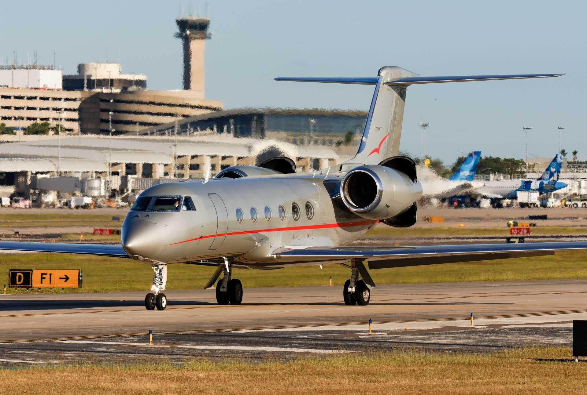 Wed, Nov 4TomorrowWashingtonKDCA · Ronald Reagan Washington National AirportHyannisKHYA · Cape Cod Gateway AirportGulfstream GIV14—On request4NovWashington → HyannisKDCA → KHYA · TomorrowGulfstream GIV · 14 seatsOn request
- Wed, Nov 412:12WashingtonKDCA · Ronald Reagan Washington National AirportIslipKISP · Long Island Mac Arthur AirportGulfstream G55014—$14,6304NovWashington → IslipKDCA → KISP · 12:12Gulfstream G550 · 14 seats$14,630
- Sun, Nov 15in 12 daysWashingtonKDCA · Ronald Reagan Washington National AirportHoustonKDWH · David Wayne Hooks Memorial AirportGulfstream G550153hOn request15NovWashington → HoustonKDCA → KDWH · in 12 daysGulfstream G550 · 15 seats · 3hOn request
 KDCA · Ronald Reagan Washington National Airport
* Total price incl. 10% service fee, converted to your selected currency. Price subject to operator confirmation.
Empty legs to KDCA
2 arrivals available
- Thu, Nov 5in 2 daysHoustonKDWH · David Wayne Hooks MemorialWashingtonKDCA · Ronald Reagan Washington NatlGulfstream G550—2h 54mOn request5NovHouston → WashingtonKDWH → KDCA · in 2 daysGulfstream G550 · 2h 54mOn request
- Sat, Nov 7in 4 daysHoustonKDWH · David Wayne Hooks Memorial AirportWashingtonKDCA · Ronald Reagan Washington National AirportGulfstream G550152h 30mOn request7NovHouston → WashingtonKDWH → KDCA · in 4 daysGulfstream G550 · 15 seats · 2h 30mOn request
* Total price incl. 10% service fee, converted to your selected currency. Price subject to operator confirmation.
Map: Washington Airport
View the location of Washington – DCA/KDCA. Zoom in to explore the area around the airport.
About the airport
Ronald Reagan Washington National Airport (DCA/KDCA) is the key private jet gateway for Washington. PrivJet gives you instant access to charter flights and empty legs: fast, discreet and globally connected.
KDCA airport FAQ
Are there any restrictions at Washington airport (KDCA) today?
There are currently 36 valid NOTAMs for Washington (KDCA). According to NOTAM, at least one runway or the aerodrome itself is closed. Affected: Runway: closed; Services: out of service; Obstacle: out of service; PAPI: unserviceable and 2 more. 5 more NOTAMs start in the coming days. For information only, not for flight planning or operational use. Always rely on an official pre-flight briefing. This list may be incomplete or out of date.
What is the weather at Washington airport (KDCA)?
According to the latest weather report for KDCA (METAR, 03 Nov, 16:52 UTC): Good visual conditions (VFR). Wind 9 kt (17 km/h) from south (180°), visibility 10 km or more, temperature 21 °C (dew point 12 °C). For information only, not for flight planning. Weather can change quickly; always rely on official reports.
How long are the runways at Washington airport (KDCA)?
Washington (KDCA) has 3 runways: runway 01/19 with 2,185 m (7,169 ft), asphalt, runway 15/33 with 1,586 m (5,204 ft), asphalt and runway 04/22 with 1,524 m (5,000 ft), asphalt. The longest is 2,185 m.
What are the radio frequencies at Washington airport (KDCA)?
Frequencies at KDCA: Tower 119.1 / 134.35 MHz and Ground 121.7 / 257.6 MHz. For information only. Always rely on the published AIP.
What are the airport codes of Ronald Reagan Washington National Airport?
The ICAO code is KDCA and the IATA code is DCA. ICAO codes are used by air traffic control and pilots, e.g. in flight plans; IATA codes appear on tickets and baggage tags.
What is the elevation of KDCA airport?
Ronald Reagan Washington National Airport sits at 15 ft (5 m) above sea level. Local time zone: America/New York.
Can I fly to KDCA by private jet?
Whether a private jet can operate into Ronald Reagan Washington National Airport depends on runway length, opening hours, customs and immigration rules as well as slot and handling availability, among other things. PrivJet checks this with the operating carrier for every request.
Are there empty legs from or to KDCA?
There are currently 3 empty legs departing from and 2 arriving at Ronald Reagan Washington National Airport. Empty legs are repositioning flights at heavily reduced prices; the list is updated several times a day.