Des Moines Airport (KDSM / DSM)
Empty legs and charters from Des Moines
KDSM airport at a glance
- ICAO code
- KDSM
- IATA code
- DSM
- City
- Des Moines
- Region
- Iowa
- Country
- United States
- Elevation
- 958 ft (292 m)
- Time zone
- America/Chicago (UTC-6)
- Coordinates
- 41.5340° N, 93.6631° W
- Empty legs from
- 22
- Empty legs to
- 24
Weather & airport info KDSM
Current weather
Marginal visual conditions (MVFR)observed 03 Nov, 01:54 UTC- Wind
- 16 kt (30 km/h) from south-southeast (160°), gusts up to 23 kt
- Visibility
- 5 km
- Weather
- Thunderstorm with rain, mist
- Clouds
- few clouds at 500 ft, broken clouds at 1,100 ft, overcast at 2,000 ft
- Temperature
- 18 °C (dew point 17 °C)
- Pressure (QNH)
- 1,007 hPa
Original weather report (METAR)
METAR KDSM 030154Z 16016G23KT 3SM TSRA BR FEW005 BKN011 OVC020CB 18/17 A2974 RMK AO2 TWR VIS 4 TSE32B53 SLP068 OCNL LTGICCCCG SE-SW TS SE-SW MOV NE P0030 T01830172
Forecast (TAF)
- 03 Nov, 01:00–03:00 UTC13 kt (24 km/h) from south-southeast (160°) · visibility 10 km or more · Light rain showers · scattered clouds at 800 ft, broken clouds at 2,000 ft
- 03 Nov, 01:00–03:00 UTCtemporarilyvisibility 5 km · Light thunderstorm with rain · overcast at 800 ft
- 03 Nov, 03:00–10:00 UTCfrom12 kt (22 km/h) from south-southeast (160°) · visibility 10 km or more · Light rain showers · overcast at 800 ft
- 03 Nov, 03:00–07:00 UTCpossible, 30 % probabilityvisibility 3 km · Light thunderstorm with rain · overcast at 400 ft
- 03 Nov, 10:00–18:00 UTCfrom9 kt (17 km/h) from south-southeast (160°) · visibility 5 km · Light rain showers · overcast at 700 ft
Original forecast (TAF)
TAF KDSM 030041Z 0301/0324 16013KT 6SM -SHRA SCT008 BKN020 TEMPO 0301/0303 3SM -TSRA OVC008CB FM030300 16012KT 6SM -SHRA OVC008 PROB30 0303/0307 2SM -TSRA OVC004CB FM031000 16009KT 3SM -SHRA OVC007 PROB30 0310/0315 2SM -TSRA OVC004CB FM031800 20010KT P6SM BKN008 PROB30 0318/0324 3SM -SHRA OVC005
Airport
- Elevation
- 958 ft (292 m)
- Sunrise / Sunset
- 06:48 / 17:07 local time
Runways
| Runway | Length | Surface | Lighted |
|---|---|---|---|
| 5/23 | 2,744 m (9,004 ft) | concrete | yes |
| 13/31 | 2,744 m (9,001 ft) | asphalt | yes |
Radio frequencies
- ATIS: 119.55
- Clearance: 134.15
- Ground: 121.9
- Tower: 118.3
- UNICOM: 122.95
For information only, not for flight planning. Weather can change quickly; always rely on official reports. Sources: aviationweather.gov (NOAA), OurAirports.
Airport map KDSM
Full screen →Runways white, taxiways yellow with designators, closed taxiways and runways per NOTAM in red.
Closed per NOTAM: TWY H
Official charts (FAA)
Cycle 2611, valid until 0901Z 11/26/26
Airport diagram (FAA)
Airport diagram (1)
Instrument approaches (10)
Departure procedures (1)
Minimums (2)
Hot spots (1)
For information only, not for navigation. Always use current official charts and NOTAMs.
Current NOTAMs for KDSM(24)
NOTAMs (Notices to Air Missions) announce short-term changes at an airport: closed runways or taxiways, unserviceable approach aids, obstacles, airspace restrictions.
- Out of serviceApproach lighting: unserviceableA3438/26· from 03 Nov, 14:00 UTC · until 03 Nov, 20:00 UTC
The approach lighting system (ALS) for runway 05 is out of service. The approach lighting helps pilots find the runway in poor visibility.
Show original text
RWY 05 ALS U/S
A3438/26 NOTAMN
Q) KZMP/QLAAS////000/999/4132N09339W005
A) KDSM
B) 2611031400
C) 2611032000
E) RWY 05 ALS U/S
- Out of serviceILS: unserviceableA3481/26· from 03 Nov, 14:00 UTC · until 03 Nov, 22:00 UTC
The instrument landing system (ILS) for runway 13 is out of service. The ILS guides aircraft precisely to the runway in poor visibility.
Show original text
DSM NAV ILS RWY 13 U/S
A3481/26 NOTAMN
Q) KZMP/QICAS////000/999/4132N09339W005
A) KDSM
B) 2611031400
C) 2611032200
E) DSM NAV ILS RWY 13 U/S
- Out of serviceServices10/147· from 03 Nov, 13:00 UTC · until 03 Nov, 20:30 UTC
The remote communication outlet 122.5 is out of service.
Show original text
COM REMOTE COM OUTLET 122.5 U/S
- Out of servicePAPI: unserviceableA3485/26· from 03 Nov, 11:00 UTC · until 03 Nov, 12:00 UTC
The PAPI (Precision Approach Path Indicator) for runway 31 is out of service. The PAPI is a visual aid system that helps pilots maintain the correct altitude during approach.
Show original text
RWY 31 PAPI U/S
A3485/26 NOTAMN
Q) KZMP/QLPAS////000/999/4132N09339W005
A) KDSM
B) 2611031100
C) 2611031200
E) RWY 31 PAPI U/S
- Out of serviceServices11/005· until 13 Nov, 14:00 UTC (estimated)
A remote communication outlet with frequency 122.5 is out of service. This may affect communication with air traffic control.
Show original text
COM REMOTE COM OUTLET 122.5 U/S
- Out of serviceObstacle10/166· until 30 Nov, 23:59 UTC
An obstacle, a tower with its top at 1416.0 ft above sea level (536.7 ft above ground), is out of service. It is located 3.8 nautical miles north-northeast of Des Moines International Airport.
Show original text
OBST TOWER LGT (ASR 1016800) 413535.00N0933749.00W (3.8NM NNE DSM) 1416.0FT (536.7FT AGL) U/S
- ClosedTaxiway: closedA3432/26· until 13 Jan, 23:00 UTC
Taxiway H is closed.
Show original text
TWY H CLSD
A3432/26 NOTAMN
Q) KZMP/QMXLC////000/999/4132N09339W005
A) KDSM
B) 2610290500
C) 2701132300
E) TWY H CLSD
- ClosedApron: closedA3433/26· until 13 Jan, 22:00 UTC
The East Terminal apron is closed.
Show original text
APRON EAST TERMINAL APN CLSD
A3433/26 NOTAMN
Q) KZMP/QMNLC////000/999/4132N09339W005
A) KDSM
B) 2610290500
C) 2701132200
E) APRON EAST TERMINAL APN CLSD
16 more NOTAMs
- Out of serviceWind indicator10/129· until 31 Dec, 23:59 UTC
The windcone lighting for runway 23 at the airport is out of service.
Show original text
AD AP WINDCONE FOR RWY 23 LGT U/S
A3408/26 NOTAMN
Q) KZMP/QFWXX////000/999/4132N09339W005
A) KDSM
B) 2610271213
C) 2612312359
E) AD AP WINDCONE FOR RWY 23 LGT U/S
- Out of serviceWind indicatorA3408/26· until 31 Dec, 23:59 UTC
The windcone lighting for runway 23 at the airport is out of service.
Show original text
AD AP WINDCONE FOR RWY 23 LGT U/S
A3408/26 NOTAMN Q) KZMP/QFWXX////000/999/4132N09339W005 A) KDSM B) 2610271213 C) 2612312359 E) AD AP WINDCONE FOR RWY 23 LGT U/S
- Out of serviceDME associated with ILS: unserviceableA3308/26· until 25 Nov, 21:00 UTC
The Distance Measuring Equipment (DME) for the instrument landing system (ILS) for runway 05 is out of service. The DME is a navigation system that measures distance to a point.
Show original text
NAV ILS RWY 05 DME U/S
A3308/26 NOTAMN
Q) KZMP/QIDAS////000/999/4132N09339W005
A) KDSM
B) 2610191200
C) 2611252100
E) NAV ILS RWY 05 DME U/S
- NoticeAirspace11/009· from 07 Nov, 14:00 UTC · until 08 Nov, 22:00 UTC
The airspace within a 1.35 nautical mile radius, 8.3 nautical miles northwest of IKV, is closed for unmanned aircraft systems (drones) up to 400 feet above ground.
Show original text
AIRSPACE UAS WI AN AREA DEFINED AS 1.35NM RADIUS OF 414349N0934448W (8.3NM NW IKV) SFC-400FT AGL
- Out of serviceILS: not availableA3482/26· from 03 Nov, 14:00 UTC · until 03 Nov, 22:00 UTC
The Instrument Landing System (ILS) for runway 31 at Des Moines International Airport is unusable from the decision altitude to the touchdown zone. The ILS guides aircraft to the runway in poor visibility.
Show original text
DSM NAV ILS RWY 31 UNUSABLE DA TO TDZ
A3482/26 NOTAMN
Q) KZMP/QICAU////000/999/4132N09339W005
A) KDSM
B) 2611031400
C) 2611032200
E) DSM NAV ILS RWY 31 UNUSABLE DA TO TDZ
- NoticeRunwayA3488/26· until 03 Nov, 22:54 UTC
Runway 13 surface condition 5/5/5 100 percent wet observed at 2 Nov 22:53 UTC.
Show original text
RWY 13 FICON 5/5/5 100 PCT WET OBS AT 2611022253.
A3488/26 NOTAMN
Q) KZMP/QMRXX////000/999/4132N09339W005
A) KDSM
B) 2611022254
C) 2611032254
E) RWY 13 FICON 5/5/5 100 PCT WET OBS AT 2611022253.
- NoticeRunwayA3489/26· until 03 Nov, 22:54 UTC
Runway 23 surface condition 5/5/5 100 percent wet observed at 2 Nov 22:53 UTC.
Show original text
RWY 23 FICON 5/5/5 100 PCT WET OBS AT 2611022253.
A3489/26 NOTAMN
Q) KZMP/QMRXX////000/999/4132N09339W005
A) KDSM
B) 2611022254
C) 2611032254
E) RWY 23 FICON 5/5/5 100 PCT WET OBS AT 2611022253.
- NoticeObstacle: erectedA3447/26· until 07 Nov, 05:59 UTC
A crane is an obstacle 1.1 nautical miles east-northeast of Des Moines Airport. Its top is 1009 feet above sea level, 70 feet above ground, and it is flagged.
Show original text
OBST CRANE (ASN 2026-ACE-4376-OE) 413235N0933831W (1.1NM ENE DSM) 1009FT (70FT AGL) FLAGGED
A3447/26 NOTAMN
Q) KZMP/QOBCE/IV/M/AE/000/999/4132N09339W005
A) KDSM
B) 2611020600
C) 2611070559
E) OBST CRANE (ASN 2026-ACE-4376-OE) 413235N0933831W (1.1NM ENE DSM) 1009FT (70FT AGL) FLAGGED
- NoticeObstacle: erectedA3446/26· until 23 Nov, 23:00 UTC
A crane 1.97 nautical miles northwest of the approach end of runway 13 is an obstacle. Its height above ground is 140 feet, and it is flagged and lighted.
Show original text
OBST CRANE (ASN UNKNOWN) 413322N0934129W (1.97NM NW APCH END RWY 13) UNKNOWN (140FT AGL) FLAGGED AND LGTD
A3446/26 NOTAMN
Q) KZMP/QOBCE/IV/M/AE/000/999/4132N09339W005
A) KDSM
B) 2610301901
C) 2611232300
E) OBST CRANE (ASN UNKNOWN) 413322N0934129W (1.97NM NW APCH END RWY 13) UNKNOWN (140FT AGL) FLAGGED AND LGTD
- NoticeObstacle: erectedA3098/26· until 30 Apr, 23:59 UTC
A crane obstacle (ASN UNKNOWN) 0.21 nautical miles southeast of the approach end of runway 23 is flagged and lighted. Its height above ground is 170 feet.
Show original text
OBST CRANE (ASN UNKNOWN) 413254N0933744W (0.21NM SE APCH END RWY 23) UNKNOWN (170FT AGL) FLAGGED AND LGTD
A3098/26 NOTAMN
Q) KZMP/QOBCE/IV/M/AE/000/999/4132N09339W005
A) KDSM
B) 2609241222
C) 2704302359
E) OBST CRANE (ASN UNKNOWN) 413254N0933744W (0.21NM SE APCH END RWY 23)
UNKNOWN (170FT AGL) FLAGGED AND LGTD
- NoticeInstrument approach procedure5172/26· until 16 May, 20:00 UTC (estimated)
A temporary crane with its top at 1124 ft above mean sea level is located 4496 ft east of Des Moines Airport. This may affect the approach procedures for runways 31 and 5.
Show original text
IAP DES MOINES INTL, DES MOINES, IA. ILS OR LOC RWY 31, AMDT 24B... ILS OR LOC RWY 5, AMDT 1B... RNAV (GPS) RWY 31, AMDT 2A... RNAV (GPS) RWY 5, AMDT 4B... CIRCLING CATS A/B MDA 1440/HAA 482. TEMPORARY CRANE 1124 MSL 4496FT E OF KDSM AIRPORT (2025-ACE-3463-NRA). 2609232304-2805162000EST
Q) KZMP/QPIXX/I/NBO/A/000/999/4132N09339W005
A) KDSM
B) 2609232303
C) 2705052303EST
E) DSM DES MOINES INTL, DES MOINES, IA.
ILS OR LOC RWY 31, AMDT 24B...
ILS OR LOC RWY 5, AMDT 1B...
RNAV (GPS) RWY 31, AMDT 2A...
RNAV (GPS) RWY 5, AMDT 4B...
CIRCLING CATS A/B MDA 1440/HAA 482. TEMPORARY CRANE 1124 MSL 4496FT E OF KDSM AIRPORT (2025-ACE-3463-NRA).
- NoticeInstrument approach procedure: changedA3092/26· until 16 May, 20:00 UTC
A temporary crane, with its top at 1124 ft above mean sea level, is located 4496 ft east of Des Moines International Airport and may affect approach procedures for runways 31 and 5.
Show original text
IAP DES MOINES INTL, DES MOINES, IA. ILS OR LOC RWY 31, AMDT 24B... ILS OR LOC RWY 5, AMDT 1B... RNAV (GPS) RWY 31, AMDT 2A... RNAV (GPS) RWY 5, AMDT 4B... CIRCLING CATS A/B MDA 1440/HAA 482. TEMPORARY CRANE 1124 MSL 4496FT E OF KDSM AIRPORT (2025-ACE-3463-NRA).
A3092/26 NOTAMN
Q) KZMP/QPICH/I/NBO/A/000/999/4132N09339W005
A) KDSM
B) 2609232304
C) 2805162000
E) IAP DES MOINES INTL, DES MOINES, IA. ILS OR LOC RWY 31, AMDT 24B... ILS OR LOC RWY 5, AMDT 1B... RNAV (GPS) RWY 31, AMDT 2A... RNAV (GPS) RWY 5, AMDT 4B... CIRCLING CATS A/B MDA 1440/HAA 482. TEMPORARY CRANE 1124 MSL 4496FT E OF KDSM AIRPORT (2025-ACE-3463-NRA).
- Out of serviceInstrument approach procedure5170/26· until 16 May, 20:00 UTC (estimated)
A temporary crane with its top at 1124 ft above mean sea level is located 4496 ft east of Des Moines Airport. Another temporary crane with its top at 991 ft above mean sea level is located 5268 ft northwest of runway 13. This may affect the approach procedures for runway 13.
Show original text
IAP DES MOINES INTL, DES MOINES, IA. ILS OR LOC RWY 13, AMDT 10A... S-LOC 13 ALL CATS MDA 1300/HAT 376, VISIBILITY CATS C/D RVR 5000. VDP NA. CIRCLING CATS A/B MDA 1440/HAA 482. TEMPORARY CRANE 1124 MSL 4496FT E OF KDSM AIRPORT (2025-ACE-3463-NRA).TEMPORARY CRANE 991 MSL, 5268FT NW OF RWY 13 (2026-ACE-1770-OE). 2609232302-2805162000EST
Q) KZMP/QPIXX/I/NBO/A/000/999/4132N09339W005
A) KDSM
B) 2609210343
C) 2705030343EST
E) DSM DES MOINES INTL, DES MOINES, IA.
ILS OR LOC RWY 13, AMDT 10A...
S-LOC 13 ALL CATS MDA 1300/HAT 376, VISIBILITY CATS C/D RVR 5000. VDP NA. CIRCLING CATS A/B MDA 1440/HAA 482. TEMPORARY CRANE 1124 MSL 4496FT E OF KDSM AIRPORT (2025-ACE-3463-NRA).TEMPORARY CRANE 991 MSL, 5268FT NW OF RWY 13 (2026-ACE-1770-OE).
- NoticeInstrument approach procedure5171/26· until 16 May, 20:00 UTC (estimated)
A temporary crane with its top at 1124 ft above mean sea level is located 4496 ft east of Des Moines Airport. Another temporary crane with its top at 991 ft above mean sea level is located 5268 ft northwest of runway 13. This may affect the approach procedures for runway 13.
Show original text
IAP DES MOINES INTL, DES MOINES, IA. RNAV (GPS) RWY 13, AMDT 2A... LNAV ALL CATS MDA 1300/HAT 376, VISIBILITY CATS C/D RVR 5000. VDP: 1.05 NM TO RW13. CIRCLING CATS A/B MDA 1440/HAA 482. TEMPORARY CRANE 1124 MSL 4496FT E OF KDSM AIRPORT (2025-ACE-3463-NRA). TEMPORARY CRANE 991 MSL, 5268FT NW OF RWY 13 (2026-ACE-1770-OE). 2609232302-2805162000EST
Q) KZMP/QPIXX/I/NBO/A/000/999/4132N09339W005
A) KDSM
B) 2609210340
C) 2705030339EST
E) DSM DES MOINES INTL, DES MOINES, IA.
RNAV (GPS) RWY 13, AMDT 2A...
LNAV ALL CATS MDA 1300/HAT 376, VISIBILITY CATS C/D RVR 5000. VDP: 1.05 NM TO RW13. CIRCLING CATS A/B MDA 1440/HAA 482. TEMPORARY CRANE 1124 MSL 4496FT E OF KDSM AIRPORT (2025-ACE-3463-NRA). TEMPORARY CRANE 991 MSL, 5268FT NW OF RWY 13 (2026-ACE-1770-OE).
- NoticeInstrument approach procedure: changedA3090/26· until 16 May, 20:00 UTC
A temporary crane, with its top at 1124 ft above mean sea level, is located 4496 ft east of Des Moines International Airport. Another temporary crane, with its top at 991 ft above mean sea level, is located 5268 ft northwest of runway 13.
Show original text
IAP DES MOINES INTL, DES MOINES, IA. RNAV (GPS) RWY 13, AMDT 2A... LNAV ALL CATS MDA 1300/HAT 376, VISIBILITY CATS C/D RVR 5000. VDP: 1.05 NM TO RW13. CIRCLING CATS A/B MDA 1440/HAA 482. TEMPORARY CRANE 1124 MSL 4496FT E OF KDSM AIRPORT (2025-ACE-3463-NRA). TEMPORARY CRANE 991 MSL, 5268FT NW OF RWY 13 (2026-ACE-1770-OE).
A3090/26 NOTAMN
Q) KZMP/QPICH/I/NBO/A/000/999/4132N09339W005
A) KDSM
B) 2609232302
C) 2805162000
E) IAP DES MOINES INTL, DES MOINES, IA. RNAV (GPS) RWY 13, AMDT 2A... LNAV ALL CATS MDA 1300/HAT 376, VISIBILITY CATS C/D RVR 5000. VDP: 1.05 NM TO RW13. CIRCLING CATS A/B MDA 1440/HAA 482. TEMPORARY CRANE 1124 MSL 4496FT E OF KDSM AIRPORT (2025-ACE-3463-NRA). TEMPORARY CRANE 991 MSL, 5268FT NW OF RWY 13 (2026-ACE-1770-OE).
- Out of serviceInstrument approach procedure: changedA3091/26· until 16 May, 20:00 UTC
A temporary crane, with its top at 1124 ft above mean sea level, is located 4496 ft east of Des Moines International Airport. Another temporary crane, with its top at 991 ft above mean sea level, is located 5268 ft northwest of runway 13.
Show original text
IAP DES MOINES INTL, DES MOINES, IA. ILS OR LOC RWY 13, AMDT 10A... S-LOC 13 ALL CATS MDA 1300/HAT 376, VISIBILITY CATS C/D RVR 5000. VDP NA. CIRCLING CATS A/B MDA 1440/HAA 482. TEMPORARY CRANE 1124 MSL 4496FT E OF KDSM AIRPORT (2025-ACE-3463-NRA).TEMPORARY CRANE 991 MSL, 5268FT NW OF RWY 13 (2026-ACE-1770-OE).
A3091/26 NOTAMN
Q) KZMP/QPICH/I/NBO/A/000/999/4132N09339W005
A) KDSM
B) 2609232302
C) 2805162000
E) IAP DES MOINES INTL, DES MOINES, IA. ILS OR LOC RWY 13, AMDT 10A... S-LOC 13 ALL CATS MDA 1300/HAT 376, VISIBILITY CATS C/D RVR 5000. VDP NA. CIRCLING CATS A/B MDA 1440/HAA 482. TEMPORARY CRANE 1124 MSL 4496FT E OF KDSM AIRPORT (2025-ACE-3463-NRA).TEMPORARY CRANE 991 MSL, 5268FT NW OF RWY 13 (2026-ACE-1770-OE).
For information only, not for flight planning or operational use. Always rely on an official pre-flight briefing. This list may be incomplete or out of date. Explanations and expanded abbreviations are generated automatically. The original text is authoritative. Source: FAA NOTAM Management Service (SWIM).
Private jet traffic in Des Moines International Airport (last 30 days)
- Arrivals
- 710
- Departures
- 632
- Different jets
- 421
Most frequent origins: Chicago Midway International Airport (21), Joe Foss Field Airport (17), Newton Municipal Airport (9), Lincoln Airport (9), Spirit of St Louis Airport (8).
Most frequent destinations: Chicago Midway International Airport (18), Joe Foss Field Airport (14), Marshalltown Municipal Airport (14), Eppley Airfield (13), Newton Municipal Airport (10).
Most common aircraft types: Pilatus PC-12 (126), Embraer Phenom 300 (99), Cessna Citation CJ3 (89), Cessna Citation Excel/XLS (82), Cessna Citation Latitude (79).
Our own analysis of public ADS-B signals from business jets. Not every flight is received, and jets with a removal request are excluded.
Charter operators based here
Operators with a base at this airport.
- Exec 1 AviationAnkeny Regional (KIKV) · Light jet
- AirflairSioux Falls (Joe Foss Field) (KFSD) · Turboprop, Light jet, Midsize jet
Empty legs from KDSM
22 departures available
- Tue, Nov 3TodayDes MoinesKDSM · Des Moines International AirportPellstonKPLN · Pellston Regional Airport of Emmet County AirportBeechcraft Hawker 400XP71h 24mOn request3NovDes Moines → PellstonKDSM → KPLN · TodayBeechcraft Hawker 400XP · 7 seats · 1h 24mOn request
- Thu, Nov 5in 2 daysDes MoinesKDSM · Des Moines International AirportTeterboroKTEB · Teterboro AirportBombardier Challenger 65012—$19,8005NovDes Moines → TeterboroKDSM → KTEB · in 2 daysBombardier Challenger 650 · 12 seats$19,800
- Fri, Nov 6in 3 daysDes MoinesKDSM · Des Moines International AirportTeterboroKTEB · Teterboro AirportBombardier Challenger 65012—$17,6006NovDes Moines → TeterboroKDSM → KTEB · in 3 daysBombardier Challenger 650 · 12 seats$17,600
- Sat, Nov 7in 4 daysDes MoinesKDSM · Des Moines International AirportChicago/West ChicagoKDPA · Dupage AirportGulfstream G50016—On request7NovDes Moines → Chicago/West ChicagoKDSM → KDPA · in 4 daysGulfstream G500 · 16 seatsOn request
- Sun, Nov 820:30Des MoinesKDSM · Des Moines IntlClevelandKRZR · Cleveland Rgnl JetportDassault Falcon 900B12—On request8NovDes Moines → ClevelandKDSM → KRZR · 20:30Dassault Falcon 900B · 12 seatsOn request
- Mon, Nov 9in 6 daysDes MoinesKDSM · Des Moines IntlLincolnKLNKCessna Citation Ultra—58m$1,6509NovDes Moines → LincolnKDSM → KLNK · in 6 daysCessna Citation Ultra · 58m$1,650
- Tue, Nov 1023:39Des MoinesKDSM · Des Moines International AirportLincolnKLNK · Lincoln AirportCessna Citation Ultra8—$1,65010NovDes Moines → LincolnKDSM → KLNK · 23:39Cessna Citation Ultra · 8 seats$1,650
- Wed, Nov 18in 15 daysDes MoinesKDSM · Des Moines IntlBlairKBTA · Blair MunCessna Citation Ultra—51m$1,65018NovDes Moines → BlairKDSM → KBTA · in 15 daysCessna Citation Ultra · 51m$1,650
- Wed, Nov 18in 15 daysDes MoinesKDSM · Des Moines IntlLincolnKLNKCessna Citation Excel—55m$2,75018NovDes Moines → LincolnKDSM → KLNK · in 15 daysCessna Citation Excel · 55m$2,750
 KDSM · Des Moines International Airport
* Total price incl. 10% service fee, converted to your selected currency. Price subject to operator confirmation.
Empty legs to KDSM
24 arrivals available
 Tue, Nov 3TodaySarasota/bradentonKSRQ · Sarasota Bradenton International AirportDes MoinesKDSM · Des Moines International AirportChallenger 65010—On request3NovSarasota/bradenton → Des MoinesKSRQ → KDSM · TodayChallenger 650 · 10 seatsOn request
- Tue, Nov 3TodayAustinKAUS · Austin Bergstrom International AirportDes MoinesKDSM · Des Moines International AirportBombardier Challenger 35082h 4m€8,2093NovAustin → Des MoinesKAUS → KDSM · TodayBombardier Challenger 350 · 8 seats · 2h 4m€8,209
- Thu, Nov 511:48ClevelandKRZR · Cleveland Rgnl JetportDes MoinesKDSM · Des Moines IntlDassault Falcon 900B12—On request5NovCleveland → Des MoinesKRZR → KDSM · 11:48Dassault Falcon 900B · 12 seatsOn request
- Fri, Nov 6in 3 daysChicago/West ChicagoKDPA · Dupage AirportDes MoinesKDSM · Des Moines International AirportGulfstream G50016—On request6NovChicago/West Chicago → Des MoinesKDPA → KDSM · in 3 daysGulfstream G500 · 16 seatsOn request
- Sat, Nov 7in 4 daysSarasota/BradentonKSRQ · Sarasota Bradenton International AirportDes MoinesKDSM · Des Moines International AirportBombardier Learjet 458—$22,0007NovSarasota/Bradenton → Des MoinesKSRQ → KDSM · in 4 daysBombardier Learjet 45 · 8 seats$22,000
- Sun, Nov 8in 5 daysNaplesKAPF · Naples Municipal AirportDes MoinesKDSM · Des Moines International AirportHawker 400XP7—$20,6808NovNaples → Des MoinesKAPF → KDSM · in 5 daysHawker 400XP · 7 seats$20,680
- Sun, Nov 8in 5 daysMarco IslandKMKY · Marco Island Executive AirportDes MoinesKDSM · Des Moines International AirportBombardier Learjet 458—$23,3208NovMarco Island → Des MoinesKMKY → KDSM · in 5 daysBombardier Learjet 45 · 8 seats$23,320
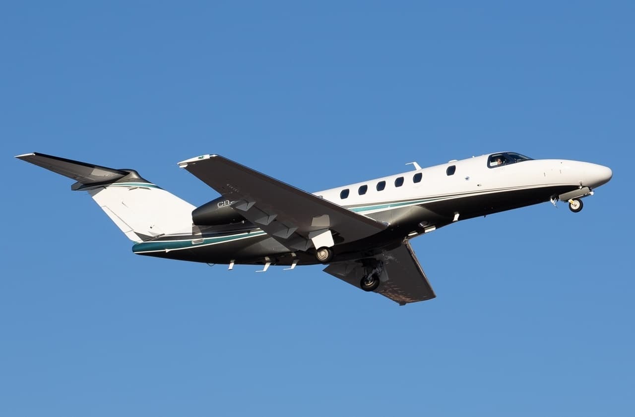 Mon, Nov 9in 6 daysScottsdaleKSDL · Scottsdale AirportWest Des MoinesKDSM · Des Moines International AirportCitation CJ49—$19,1189NovScottsdale → West Des MoinesKSDL → KDSM · in 6 daysCitation CJ4 · 9 seats$19,118
- Mon, Nov 912:12LincolnKLNK · Lincoln AirportDes MoinesKDSM · Des Moines International AirportCessna Citation Ultra8—$1,6509NovLincoln → Des MoinesKLNK → KDSM · 12:12Cessna Citation Ultra · 8 seats$1,650
* Total price incl. 10% service fee, converted to your selected currency. Price subject to operator confirmation.
Map: Des Moines Airport
View the location of Des Moines – DSM/KDSM. Zoom in to explore the area around the airport.
About the airport
Des Moines International Airport (DSM/KDSM) is the key private jet gateway for Des Moines. PrivJet gives you instant access to charter flights and empty legs: fast, discreet and globally connected.
KDSM airport FAQ
Are there any restrictions at Des Moines airport (KDSM) today?
There are currently 18 valid NOTAMs for Des Moines (KDSM). Affected: Taxiway: closed; Apron: closed; Services: out of service; Obstacle: out of service and 4 more. 6 more NOTAMs start in the coming days. For information only, not for flight planning or operational use. Always rely on an official pre-flight briefing. This list may be incomplete or out of date.
What is the weather at Des Moines airport (KDSM)?
According to the latest weather report for KDSM (METAR, 03 Nov, 01:54 UTC): Marginal visual conditions (MVFR). Wind 16 kt (30 km/h) from south-southeast (160°), gusts up to 23 kt, visibility 5 km, temperature 18 °C (dew point 17 °C). Thunderstorm with rain, mist. For information only, not for flight planning. Weather can change quickly; always rely on official reports.
How long are the runways at Des Moines airport (KDSM)?
Des Moines (KDSM) has 2 runways: runway 5/23 with 2,744 m (9,004 ft), concrete and runway 13/31 with 2,744 m (9,001 ft), asphalt. The longest is 2,744 m.
What are the radio frequencies at Des Moines airport (KDSM)?
Frequencies at KDSM: Tower 118.3 MHz, Ground 121.9 MHz and ATIS 119.55 MHz. For information only. Always rely on the published AIP.
What are the airport codes of Des Moines International Airport?
The ICAO code is KDSM and the IATA code is DSM. ICAO codes are used by air traffic control and pilots, e.g. in flight plans; IATA codes appear on tickets and baggage tags.
What is the elevation of KDSM airport?
Des Moines International Airport sits at 958 ft (292 m) above sea level. Local time zone: America/Chicago.
Can I fly to KDSM by private jet?
Whether a private jet can operate into Des Moines International Airport depends on runway length, opening hours, customs and immigration rules as well as slot and handling availability, among other things. PrivJet checks this with the operating carrier for every request.
Are there empty legs from or to KDSM?
There are currently 22 empty legs departing from and 24 arriving at Des Moines International Airport. Empty legs are repositioning flights at heavily reduced prices; the list is updated several times a day.