Fresno Yosemite Airport (KFAT / FAT)
Empty legs and charters from Fresno
KFAT airport at a glance
- ICAO code
- KFAT
- IATA code
- FAT
- City
- Fresno
- Region
- California
- Country
- United States
- Elevation
- 336 ft (102 m)
- Time zone
- America/Los Angeles (UTC-8)
- Coordinates
- 36.7762° N, 119.7180° W
- Empty legs from
- 11
- Empty legs to
- 12
Weather & airport info KFAT
Current weather
Good visual conditions (VFR)observed 03 Nov, 20:53 UTC- Wind
- 8 kt (15 km/h) from south (180°)
- Visibility
- 10 km or more
- Clouds
- few clouds at 11,000 ft, scattered clouds at 18,000 ft, scattered clouds at 22,000 ft
- Temperature
- 22 °C (dew point 7 °C)
- Pressure (QNH)
- 1,017 hPa
Original weather report (METAR)
METAR KFAT 032053Z 18008KT 10SM FEW110 SCT180 SCT220 22/07 A3002 RMK AO2 SLP164 T02170072 58018
Forecast (TAF)
- 03 Nov, 18:00–18:00 UTC5 kt (9 km/h) from variable directions · visibility 10 km or more · scattered clouds at 20,000 ft
Original forecast (TAF)
TAF KFAT 031729Z 0318/0418 VRB05KT P6SM SCT200
Airport
- Elevation
- 336 ft (102 m)
- Sunrise / Sunset
- 06:24 / 17:00 local time
Runways
| Runway | Length | Surface | Lighted |
|---|---|---|---|
| 11L/29R | 2,907 m (9,539 ft) | asphalt | yes |
| 11R/29L | 2,441 m (8,008 ft) | asphalt | yes |
Radio frequencies
- ATIS: 121.35
- Clearance: 124.35
- Ground: 121.7
- Tower: 118.2
- UNICOM: 122.95
For information only, not for flight planning. Weather can change quickly; always rely on official reports. Sources: aviationweather.gov (NOAA), OurAirports.
Airport map KFAT
Full screen →Runways white, taxiways yellow with designators, closed taxiways and runways per NOTAM in red.
Closed per NOTAM: RWY 11R/29L, TWY B2*, TWY B3*, TWY B8*, TWY B11*, TWY B6*, TWY B4*, TWY B10* (* partly closed)
Official charts (FAA)
Cycle 2611, valid until 0901Z 11/26/26
Airport diagram (FAA)
Airport diagram (1)
Instrument approaches (14)
Departure procedures (3)
Minimums (2)
Other (1)
For information only, not for navigation. Always use current official charts and NOTAMs.
Current NOTAMs for KFAT(24)
NOTAMs (Notices to Air Missions) announce short-term changes at an airport: closed runways or taxiways, unserviceable approach aids, obstacles, airspace restrictions.
- ClosedRunway: closedA1024/26· until 25 Nov, 23:00 UTC
Runway 11R/29L is closed. This means aircraft cannot use this runway at the moment.
Show original text
RWY 11R/29L CLSD
A1024/26 NOTAMN
Q) KZOA/QMRLC////000/999/3646N11943W005
A) KFAT
B) 2609281400
C) 2611252300
E) RWY 11R/29L CLSD
- Out of serviceStandard instrument departure: not available5054/26· from 04 Nov, 17:00 UTC · until 04 Nov, 23:00 UTC
Standard departure (SID) FRESNO YOSEMITE INTL, FRESNO, CA. COALDALE FOUR DEPARTURE... DEPARTURE PROCEDURE not available except for aircraft equipped with SUITABLE RNAV (area navigation) SYSTEM with GPS, OAL VOR beacon out of service. 4 Nov 17:00 UTC -2611042300EST
Show original text
SID FRESNO YOSEMITE INTL, FRESNO, CA. COALDALE FOUR DEPARTURE... DEPARTURE PROCEDURE NA EXCEPT FOR AIRCRAFT EQUIPPED WITH SUITABLE RNAV SYSTEM WITH GPS, OAL VOR OUT OF SERVICE. 2611041700-2611042300EST
Q) KZOA/QPDAU/I/NBO/A/000/999/3646N11943W005
A) KFAT
B) 2407291558
C) 2503101558EST
E) FAT FRESNO YOSEMITE INTL, FRESNO, CA.
COALDALE FOUR DEPARTURE...
DEPARTURE PROCEDURE NA EXCEPT FOR AIRCRAFT EQUIPPED WITH SUITABLE RNAV SYSTEM WITH GPS,
OAL VOR U/S.
- Out of serviceStandard instrument departure: changedA1147/26· from 04 Nov, 17:00 UTC · until 04 Nov, 23:00 UTC
Standard departure (SID) FRESNO YOSEMITE INTL, FRESNO, CA. COALDALE FOUR DEPARTURE... DEPARTURE PROCEDURE not available except for aircraft equipped with SUITABLE RNAV (area navigation) SYSTEM with GPS, OAL VOR beacon out of service.
Show original text
SID FRESNO YOSEMITE INTL, FRESNO, CA. COALDALE FOUR DEPARTURE... DEPARTURE PROCEDURE NA EXCEPT FOR AIRCRAFT EQUIPPED WITH SUITABLE RNAV SYSTEM WITH GPS, OAL VOR OUT OF SERVICE.
A1147/26 NOTAMN
Q) KZOA/QPDCH/I/NBO/A/000/999/3646N11943W005
A) KFAT
B) 2611041700
C) 2611042300
E) SID FRESNO YOSEMITE INTL, FRESNO, CA. COALDALE FOUR DEPARTURE... DEPARTURE PROCEDURE NA EXCEPT FOR AIRCRAFT EQUIPPED WITH SUITABLE RNAV SYSTEM WITH GPS, OAL VOR OUT OF SERVICE.
- Out of serviceInstrument approach procedure5118/26· from 04 Nov, 16:00 UTC · until 05 Nov, 03:00 UTC
Instrument approach procedure FRESNO YOSEMITE INTL, FRESNO, CA. ILS (instrument landing system) Y or localizer Y runway 29R, amendment 39A... ILS (instrument landing system) Y runway 29R (SA category I), amendment 39A... ILS (instrument landing system) Y runway 29R (category II - III), amendment 39A... DME (distance measuring) REQUIRED except for aircraft equipped with SUITABLE RNAV (area navigation) SYSTEM with GPS, HYP VOR/DME out of service. 4 Nov 16:00 UTC -2611050300EST
Show original text
IAP FRESNO YOSEMITE INTL, FRESNO, CA. ILS Y OR LOC Y RWY 29R, AMDT 39A... ILS Y RWY 29R (SA CAT I), AMDT 39A... ILS Y RWY 29R (CAT II - III), AMDT 39A... DME REQUIRED EXCEPT FOR ACFT EQUIPPED WITH SUITABLE RNAV SYSTEM WITH GPS, HYP VOR/DME OUT OF SERVICE. 2611041600-2611050300EST
Q) KZOA/QPIXX/I/NBO/A/000/999/3646N11943W005
A) KFAT
B) 2304071520
C) 2311171519EST
E) FAT FRESNO YOSEMITE INTL, FRESNO, CA.
ILS Y OR LOC Y RWY 29R, AMDT 39A...
ILS Y RWY 29R (SA CAT I), AMDT 39A...
ILS Y RWY 29R (CAT II - III), AMDT 39A...
DME REQUIRED EXCEPT FOR ACFT EQUIPPED WITH SUITABLE RNAV SYSTEM WITH GPS,
HYP VOR/DME U/S.
- Out of serviceInstrument approach procedure: changedA1148/26· from 04 Nov, 16:00 UTC · until 05 Nov, 03:00 UTC
Instrument approach procedure FRESNO YOSEMITE INTL, FRESNO, CA. ILS (instrument landing system) Y or localizer Y runway 29R, amendment 39A... ILS (instrument landing system) Y runway 29R (SA category I), amendment 39A... ILS (instrument landing system) Y runway 29R (category II - III), amendment 39A... DME (distance measuring) REQUIRED except for aircraft equipped with SUITABLE RNAV (area navigation) SYSTEM with GPS, HYP VOR/DME out of service.
Show original text
IAP FRESNO YOSEMITE INTL, FRESNO, CA. ILS Y OR LOC Y RWY 29R, AMDT 39A... ILS Y RWY 29R (SA CAT I), AMDT 39A... ILS Y RWY 29R (CAT II - III), AMDT 39A... DME REQUIRED EXCEPT FOR ACFT EQUIPPED WITH SUITABLE RNAV SYSTEM WITH GPS, HYP VOR/DME OUT OF SERVICE.
A1148/26 NOTAMN
Q) KZOA/QPICH/I/NBO/A/000/999/3646N11943W005
A) KFAT
B) 2611041600
C) 2611050300
E) IAP FRESNO YOSEMITE INTL, FRESNO, CA. ILS Y OR LOC Y RWY 29R, AMDT 39A... ILS Y RWY 29R (SA CAT I), AMDT 39A... ILS Y RWY 29R (CAT II - III), AMDT 39A... DME REQUIRED EXCEPT FOR ACFT EQUIPPED WITH SUITABLE RNAV SYSTEM WITH GPS, HYP VOR/DME OUT OF SERVICE.
- Out of serviceStandard instrument departure: changed4577/26· until 03 Nov, 23:00 UTC (estimated)
The Standard Departure Route (SID) COALDALE FOUR DEPARTURE at Fresno Yosemite airport is not available, unless the aircraft is equipped with a suitable RNAV system with GPS, because the OAL VOR is out of service.
Show original text
FRESNO YOSEMITE INTL, FRESNO, CA. COALDALE FOUR DEPARTURE... DEPARTURE PROCEDURE NA EXCEPT FOR AIRCRAFT EQUIPPED WITH SUITABLE RNAV SYSTEM WITH GPS, OAL VOR OUT OF SERVICE.
A1144/26 NOTAMN
Q) KZOA/QPDCH/I/NBO/A/000/999/3646N11943W005
A) KFAT
B) 2611031700
C) 2611032300
E) SID FRESNO YOSEMITE INTL, FRESNO, CA. COALDALE FOUR DEPARTURE... DEPARTURE PROCEDURE NA EXCEPT FOR AIRCRAFT EQUIPPED WITH SUITABLE RNAV SYSTEM WITH GPS, OAL VOR OUT OF SERVICE.
- Out of serviceStandard instrument departure: changedA1144/26· until 03 Nov, 23:00 UTC
The Standard Departure Route (SID) COALDALE FOUR DEPARTURE at Fresno Yosemite airport is not available, unless the aircraft is equipped with a suitable RNAV system with GPS, because the OAL VOR is out of service.
Show original text
SID FRESNO YOSEMITE INTL, FRESNO, CA. COALDALE FOUR DEPARTURE... DEPARTURE PROCEDURE NA EXCEPT FOR AIRCRAFT EQUIPPED WITH SUITABLE RNAV SYSTEM WITH GPS, OAL VOR OUT OF SERVICE.
A1144/26 NOTAMN Q) KZOA/QPDCH/I/NBO/A/000/999/3646N11943W005 A) KFAT B) 2611031700 C) 2611032300 E) SID FRESNO YOSEMITE INTL, FRESNO, CA. COALDALE FOUR DEPARTURE... DEPARTURE PROCEDURE NA EXCEPT FOR AIRCRAFT EQUIPPED WITH SUITABLE RNAV SYSTEM WITH GPS, OAL VOR OUT OF SERVICE.
- Out of serviceWind indicatorA1143/26· until 29 Jan, 12:34 UTC
The lighted wind cone for runway 11L at Fresno Yosemite International Airport is out of service.
Show original text
AD AP WINDCONE FOR RWY 11L LGT U/S
A1143/26 NOTAMN
Q) KZOA/QFWXX////000/999/3646N11943W005
A) KFAT
B) 2611021321
C) 2701291234
E) AD AP WINDCONE FOR RWY 11L LGT U/S
16 more NOTAMs
- Out of serviceDaylight markings10/042· until 30 Nov, 05:00 UTC
Runway 29R 9000 ft DIST REMAINING SIGN light out of service
Show original text
RWY 29R 9000FT DIST REMAINING SIGN LGT U/S
10/042 NOTAMN
Q) KZOA/QMMXX/V/M/A/000/999/3646N11943W005
A) KFAT
B) 2610301025
C) 2611300500

E) RWY 29R 9000FT DIST REMAINING SIGN LGT U/S
- Out of serviceObstacle10/017· until 05 Nov, 05:07 UTC
A tower near the airport, 22.3 nautical miles northeast of Fresno Yosemite Intl, with its top at 4747.0 feet above sea level and 254.9 feet above ground, has its lighting out of service.
Show original text
OBST TOWER LGT (ASR 1047401) 370422.00N1192553.00W (22.3NM NE FAT) 4747.0FT (254.9FT AGL) U/S
- ClosedTaxiway: closedA1025/26· until 25 Nov, 23:00 UTC
Taxiway B2 between approach END runway 29L and taxiway B closed
Show original text
TWY B2 BTN APCH END RWY 29L AND TWY B CLSD
A1025/26 NOTAMN
Q) KZOA/QMXLC////000/999/3646N11943W005
A) KFAT
B) 2609281400
C) 2611252300
E) TWY B2 BTN APCH END RWY 29L AND TWY B CLSD
- ClosedTaxiway: closedA1026/26· until 25 Nov, 23:00 UTC
Taxiway B3 between runway 11R/29L and taxiway B is closed. This may lead to longer taxiing times at the airport.
Show original text
TWY B3 BTN RWY 11R/29L AND TWY B CLSD
A1026/26 NOTAMN
Q) KZOA/QMXLC////000/999/3646N11943W005
A) KFAT
B) 2609281400
C) 2611252300
E) TWY B3 BTN RWY 11R/29L AND TWY B CLSD
- ClosedTaxiway: closedA1029/26· until 25 Nov, 23:00 UTC
Taxiway B8 between runway 11R/29L and taxiway B is closed. This means this section of the taxiway cannot be used.
Show original text
TWY B8 BTN RWY 11R/29L AND TWY B CLSD
A1029/26 NOTAMN
Q) KZOA/QMXLC////000/999/3646N11943W005
A) KFAT
B) 2609281400
C) 2611252300
E) TWY B8 BTN RWY 11R/29L AND TWY B CLSD
- Out of servicePAPI: unserviceableA1030/26· until 25 Nov, 23:00 UTC
The PAPI (Precision Approach Path Indicator) for runway 29L is out of service. The PAPI is a visual aid system that helps pilots maintain the correct altitude during approach.
Show original text
RWY 29L PAPI U/S
A1030/26 NOTAMN
Q) KZOA/QLPAS////000/999/3646N11943W005
A) KFAT
B) 2609281400
C) 2611252300
E) RWY 29L PAPI U/S
- ClosedTaxiway: closedA1031/26· until 25 Nov, 23:00 UTC
Taxiway B11 between runway 11R/29L and taxiway B is closed.
Show original text
TWY B11 BTN RWY 11R/29L AND TWY B CLSD
A1031/26 NOTAMN
Q) KZOA/QMXLC////000/999/3646N11943W005
A) KFAT
B) 2609281400
C) 2611252300
E) TWY B11 BTN RWY 11R/29L AND TWY B CLSD
- ClosedTaxiway: closedA1032/26· until 25 Nov, 23:00 UTC
Taxiway B6 between runway 11R/29L and taxiway B is closed. Aircraft cannot use this section.
Show original text
TWY B6 BTN RWY 11R/29L AND TWY B CLSD
A1032/26 NOTAMN
Q) KZOA/QMXLC////000/999/3646N11943W005
A) KFAT
B) 2609281400
C) 2611252300
E) TWY B6 BTN RWY 11R/29L AND TWY B CLSD
- Out of serviceRunway end identifier lights: unserviceableA1033/26· until 25 Nov, 23:00 UTC
The runway end identification lights for runway 11R are out of service. These lights mark the end of the runway.
Show original text
RWY 11R RWY END ID LGT U/S
A1033/26 NOTAMN
Q) KZOA/QLIAS////000/999/3646N11943W005
A) KFAT
B) 2609281400
C) 2611252300
E) RWY 11R RWY END ID LGT U/S
- Out of serviceOtherM0016/26· until 22 Nov, 23:59 UTC
The BAK-14 arresting gear at the approach end of runway 29R is out of service. Arresting gear is used to stop aircraft on the runway in an emergency.
Show original text
RWY 29R APPROACH END BAK-14 AAS OTS
M0016/26 NOTAMN Q) ZOA/QXXXX/IV/NBO/A/000/999/3646N11943W005 A) KFAT B) 2609252044 C) 2611222359 E) RWY 29R APPROACH END BAK-14 AAS OTS
- ClosedTaxiway: closedA1005/26· until 25 Nov, 23:00 UTC
Taxiway B4 between runway 11L/29R and runway 11R/29L at Fresno Yosemite International Airport is closed.
Show original text
TWY B4 BTN RWY 11L/29R AND RWY 11R/29L CLSD
A1005/26 NOTAMN
Q) KZOA/QMXLC////000/999/3646N11943W005
A) KFAT
B) 2609251600
C) 2611252300
E) TWY B4 BTN RWY 11L/29R AND RWY 11R/29L CLSD
- ClosedTaxiway: closedA1006/26· until 25 Nov, 23:00 UTC
Taxiway B6 between runway 11L/29R and runway 11R/29L is closed. This means this section of the taxiway cannot be used.
Show original text
TWY B6 BTN RWY 11L/29R AND RWY 11R/29L CLSD
A1006/26 NOTAMN
Q) KZOA/QMXLC////000/999/3646N11943W005
A) KFAT
B) 2609251600
C) 2611252300
E) TWY B6 BTN RWY 11L/29R AND RWY 11R/29L CLSD
- ClosedTaxiway: closedA1008/26· until 25 Nov, 23:00 UTC
Taxiway B10 between runway 11L/29R and runway 11R/29L is closed. Aircraft cannot use this section of the taxiway.
Show original text
TWY B10 BTN RWY 11L/29R AND RWY 11R/29L CLSD
A1008/26 NOTAMN
Q) KZOA/QMXLC////000/999/3646N11943W005
A) KFAT
B) 2609251600
C) 2611252300
E) TWY B10 BTN RWY 11L/29R AND RWY 11R/29L CLSD
- ClosedTaxiway: closedA1013/26· until 25 Nov, 23:00 UTC
Taxiway B2 between approach end runway 29L and runway 11L/29R is closed.
Show original text
TWY B2 BTN APCH END RWY 29L AND RWY 11L/29R CLSD
A1013/26 NOTAMN
Q) KZOA/QMXLC////000/999/3646N11943W005
A) KFAT
B) 2609251600
C) 2611252300
E) TWY B2 BTN APCH END RWY 29L AND RWY 11L/29R CLSD
- NoticeObstacle11/003· until 06 Nov, 23:00 UTC
An obstacle, a rig, is located 0.7 nautical miles southeast of the airport. Its top is 346 feet above sea level, 20 feet above ground, flagged and lighted.
Show original text
OBST RIG (ASN 2026-AWP-2126-NRA) 364603N1194231W (0.7NM SE FAT) 346FT (20FT AGL) FLAGGED AND LGTD
- NoticeRunway: work in progressA1027/26· until 25 Nov, 23:00 UTC
Runway 11R/29L has work in progress due to construction. This may lead to restrictions in the use of the runway.
Show original text
RWY 11R/29L WIP CONSTRUCTION
A1027/26 NOTAMN
Q) KZOA/QMRHW////000/999/3646N11943W005
A) KFAT
B) 2609281400
C) 2611252300
E) RWY 11R/29L WIP CONSTRUCTION
For information only, not for flight planning or operational use. Always rely on an official pre-flight briefing. This list may be incomplete or out of date. Explanations and expanded abbreviations are generated automatically. The original text is authoritative. Source: FAA NOTAM Management Service (SWIM).
Private jet traffic in Fresno Yosemite International Airport (last 30 days)
- Arrivals
- 480
- Departures
- 129
- Different jets
- 205
Most frequent origins: John Wayne Airport-Orange County Airport (49), Santa Monica Municipal Airport (21), Norman Y. Mineta San Jose International Airport (19), Van Nuys Airport (18), Bob Hope Airport (15).
Most frequent destinations: John Wayne Airport-Orange County Airport (12), Santa Monica Municipal Airport (9), Jack Northrop Field Hawthorne Municipal Airport (6), Metropolitan Oakland International Airport (4), Santa Barbara Municipal Airport (4).
Most common aircraft types: Beechcraft King Air 200/250 (113), Pilatus PC-12 (87), Beechcraft King Air 350 (43), Cirrus Vision Jet (29), Piper M500/M600 (28).
Monday is the busiest day.
Our own analysis of public ADS-B signals from business jets. Not every flight is received, and jets with a removal request are excluded.
Charter operators based here
Operators with a base at this airport.
- CSM AviationTurboprop, Light jet, Midsize jet
- Rogers HelicoptersHelicopter
- JetsPlusLight jet, Super midsize jet, Heavy jet
Empty legs from KFAT
11 departures available
- Tue, Nov 3TodayFresnoKFAT · Fresno Yosemite International AirportSanta AnaKSNA · John Wayne Airport-Orange County AirportBeech King Air B2007—$8,6133NovFresno → Santa AnaKFAT → KSNA · TodayBeech King Air B200 · 7 seats$8,613
- Fri, Nov 618:42FresnoKFAT · Fresno Yosemite International AirportRenoKRNO · Reno Tahoe International AirportPilatus PC-12 NG8—$2,3106NovFresno → RenoKFAT → KRNO · 18:42Pilatus PC-12 NG · 8 seats$2,310
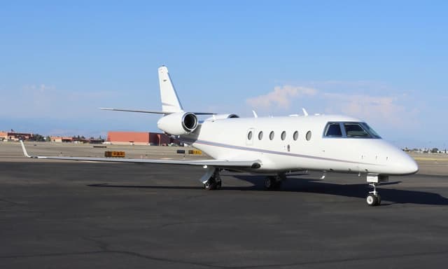 Sat, Nov 7in 4 daysFresnoKFAT · Fresno Yosemite International AirportSacramentoKMCC · Mc Clellan AirfieldGulfstream G1507—On request7NovFresno → SacramentoKFAT → KMCC · in 4 daysGulfstream G150 · 7 seatsOn request
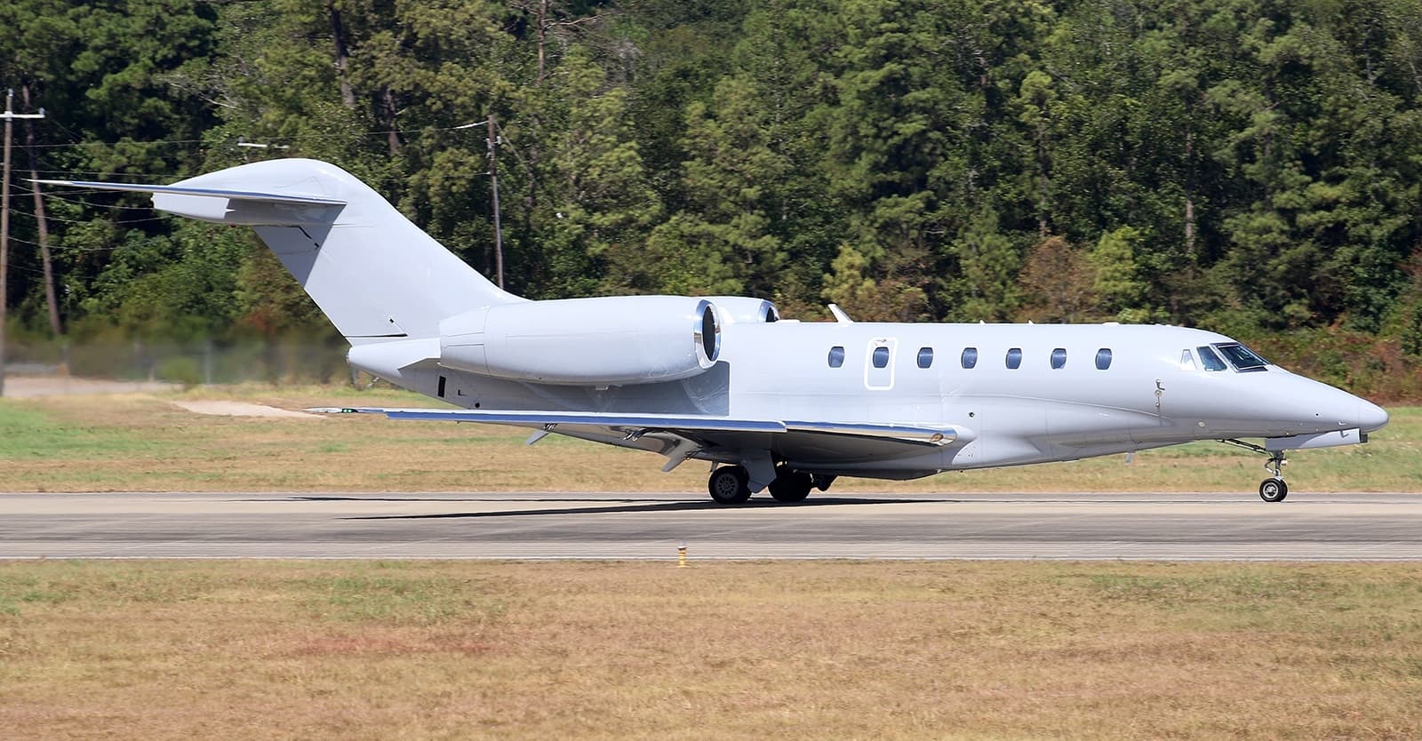 Sun, Nov 8in 5 daysFresnoKFAT · Fresno Yosemite International AirportSanfordKTTA · Raleigh Executive Jetport at Sanford-Lee County AirportCitation X8—On request8NovFresno → SanfordKFAT → KTTA · in 5 daysCitation X · 8 seatsOn request
- Sun, Nov 819:10FresnoKFAT · Fresno Yosemite International AirportHawthorneKHHR · Jack Northrop Field Hawthorne Municipal AirportBeechcraft King Air 200GT8—$6,7108NovFresno → HawthorneKFAT → KHHR · 19:10Beechcraft King Air 200GT · 8 seats$6,710
- Sun, Nov 813:48FresnoKFAT · Fresno Yosemite International AirportSacramentoKMCC · McClellan AirfieldGulfstream G1507—$14,1908NovFresno → SacramentoKFAT → KMCC · 13:48Gulfstream G150 · 7 seats$14,190
- Thu, Nov 12in 9 daysFresnoKFAT · Fresno Yosemite International AirportSacramentoKMCC · Mc Clellan AirfieldGulfstream G1507—On request12NovFresno → SacramentoKFAT → KMCC · in 9 daysGulfstream G150 · 7 seatsOn request
- Fri, Nov 1311:33FresnoKFAT · Fresno Yosemite International AirportSacramentoKMCC · McClellan AirfieldGulfstream G1507—$11,44013NovFresno → SacramentoKFAT → KMCC · 11:33Gulfstream G150 · 7 seats$11,440
- Tue, Nov 1709:00FresnoKFAT · Fresno Yosemite International AirportMercedKMCE · Merced Regional Macready FieldBeechcraft King Air B2008—$6,93017NovFresno → MercedKFAT → KMCE · 09:00Beechcraft King Air B200 · 8 seats$6,930
 KFAT · Fresno Yosemite International Airport
* Total price incl. 10% service fee, converted to your selected currency. Price subject to operator confirmation.
Empty legs to KFAT
12 arrivals available
- Fri, Nov 616:27Yucca ValleyKL22 · Yucca Valley AirportFresnoKFAT · Fresno Yosemite International AirportPilatus PC-12 NG8—$2,5306NovYucca Valley → FresnoKL22 → KFAT · 16:27Pilatus PC-12 NG · 8 seats$2,530
- Fri, Nov 6in 3 daysVan NuysKVNY · Van Nuys AirportFresnoKFAT · Fresno Yosemite International AirportEmbraer Phenom 10051h 2mOn request6NovVan Nuys → FresnoKVNY → KFAT · in 3 daysEmbraer Phenom 100 · 5 seats · 1h 2mOn request
- Mon, Nov 900:48VisaliaKVIS · Visalia Municipal AirportFresnoKFAT · Fresno Yosemite International AirportGulfstream G1507—$14,1909NovVisalia → FresnoKVIS → KFAT · 00:48Gulfstream G150 · 7 seats$14,190
- Tue, Nov 10in 7 daysNashvilleKBNA · Nashville International AirportFresnoKFAT · Fresno Yosemite International AirportGulfstream G1507—On request10NovNashville → FresnoKBNA → KFAT · in 7 daysGulfstream G150 · 7 seatsOn request
- Wed, Nov 1121:24NashvilleKBNA · Nashville International AirportFresnoKFAT · Fresno Yosemite International AirportGulfstream G1507—$41,47011NovNashville → FresnoKBNA → KFAT · 21:24Gulfstream G150 · 7 seats$41,470
- Wed, Nov 1107:58Van NuysKVNY · Van Nuys AirportFresnoKFAT · Fresno Yosemite International AirportEmbraer Phenom 1004—$2,20011NovVan Nuys → FresnoKVNY → KFAT · 07:58Embraer Phenom 100 · 4 seats$2,200
- Sun, Nov 15in 12 daysSacramentoKMCC · Mc Clellan AirfieldFresnoKFAT · Fresno Yosemite International AirportGulfstream G1507—On request15NovSacramento → FresnoKMCC → KFAT · in 12 daysGulfstream G150 · 7 seatsOn request
- Thu, Nov 1918:36Las VegasKVGT · North Las Vegas Metropolitan International AirportFresnoKFAT · Fresno Yosemite International AirportBeechcraft King Air 200GT8—$4,95019NovLas Vegas → FresnoKVGT → KFAT · 18:36Beechcraft King Air 200GT · 8 seats$4,950
 Sat, Nov 2122:36Las VegasKVGT · North Las Vegas Metropolitan International AirportFresnoKFAT · Fresno Yosemite International AirportBeech King Air B200GT7—$5,77421NovLas Vegas → FresnoKVGT → KFAT · 22:36Beech King Air B200GT · 7 seats$5,774
* Total price incl. 10% service fee, converted to your selected currency. Price subject to operator confirmation.
Map: Fresno Airport
View the location of Fresno – FAT/KFAT. Zoom in to explore the area around the airport.
About the airport
Fresno Yosemite International Airport (FAT/KFAT) is the key private jet gateway for Fresno. PrivJet gives you instant access to charter flights and empty legs: fast, discreet and globally connected.
KFAT airport FAQ
Are there any restrictions at Fresno airport (KFAT) today?
There are currently 20 valid NOTAMs for Fresno (KFAT). According to NOTAM, at least one runway or the aerodrome itself is closed. Affected: Runway: closed; Taxiway: closed; Standard instrument departure: changed; Wind indicator and 5 more. 4 more NOTAMs start in the coming days. For information only, not for flight planning or operational use. Always rely on an official pre-flight briefing. This list may be incomplete or out of date.
What is the weather at Fresno airport (KFAT)?
According to the latest weather report for KFAT (METAR, 03 Nov, 20:53 UTC): Good visual conditions (VFR). Wind 8 kt (15 km/h) from south (180°), visibility 10 km or more, temperature 22 °C (dew point 7 °C). For information only, not for flight planning. Weather can change quickly; always rely on official reports.
How long are the runways at Fresno airport (KFAT)?
Fresno (KFAT) has 2 runways: runway 11L/29R with 2,907 m (9,539 ft), asphalt and runway 11R/29L with 2,441 m (8,008 ft), asphalt. The longest is 2,907 m.
What are the radio frequencies at Fresno airport (KFAT)?
Frequencies at KFAT: Tower 118.2 MHz, Ground 121.7 MHz and ATIS 121.35 MHz. For information only. Always rely on the published AIP.
What are the airport codes of Fresno Yosemite International Airport?
The ICAO code is KFAT and the IATA code is FAT. ICAO codes are used by air traffic control and pilots, e.g. in flight plans; IATA codes appear on tickets and baggage tags.
What is the elevation of KFAT airport?
Fresno Yosemite International Airport sits at 336 ft (102 m) above sea level. Local time zone: America/Los Angeles.
Can I fly to KFAT by private jet?
Whether a private jet can operate into Fresno Yosemite International Airport depends on runway length, opening hours, customs and immigration rules as well as slot and handling availability, among other things. PrivJet checks this with the operating carrier for every request.
Are there empty legs from or to KFAT?
There are currently 11 empty legs departing from and 12 arriving at Fresno Yosemite International Airport. Empty legs are repositioning flights at heavily reduced prices; the list is updated several times a day.