Frederick Airport (KFDK / FDK)
Empty legs and charters from Frederick
KFDK airport at a glance
- ICAO code
- KFDK
- IATA code
- FDK
- City
- Frederick
- Region
- Maryland
- Country
- United States
- Elevation
- 303 ft (92 m)
- Time zone
- America/New York (UTC-5)
- Coordinates
- 39.4176° N, 77.3743° W
- Empty legs from
- 7
- Empty legs to
- 10
Weather & airport info KFDK
Current weather
Good visual conditions (VFR)observed 03 Nov, 22:52 UTC- Wind
- Calm
- Visibility
- 10 km or more
- Clouds
- no significant clouds
- Temperature
- 18 °C (dew point 12 °C)
- Pressure (QNH)
- 1,024 hPa
Original weather report (METAR)
METAR KFDK 032252Z 00000KT 10SM CLR 18/12 A3022
Airport
- Elevation
- 303 ft (92 m)
- Sunrise / Sunset
- 06:39 / 17:06 local time
Runways
| Runway | Length | Surface | Lighted |
|---|---|---|---|
| 05/23 | 1,774 m (5,819 ft) | asphalt | yes |
| 12/30 | 1,097 m (3,599 ft) | asphalt | yes |
Radio frequencies
- Clearance: 126.9
- CTAF: 132.4
- Tower: 132.4
- UNICOM: 122.95
For information only, not for flight planning. Weather can change quickly; always rely on official reports. Sources: aviationweather.gov (NOAA), OurAirports.
Airport map KFDK
Full screen →Runways white, taxiways yellow with designators, closed taxiways and runways per NOTAM in red.
Closed per NOTAM: TWY A* (* partly closed)
Official charts (FAA)
Cycle 2611, valid until 0901Z 11/26/26
Airport diagram (FAA)
Airport diagram (1)
Instrument approaches (4)
Departure procedures (5)
Minimums (2)
Hot spots (1)
For information only, not for navigation. Always use current official charts and NOTAMs.
Current NOTAMs for KFDK(9)
NOTAMs (Notices to Air Missions) announce short-term changes at an airport: closed runways or taxiways, unserviceable approach aids, obstacles, airspace restrictions.
- ClosedTaxiway: closed10/034· until 06 Nov, 23:59 UTC
Taxiway A between taxiway A2 and the taxiway runup pad for runway 05 is closed.
Show original text
TWY A BTN TWY A2 AND TWY A RUNUP PAD FOR RWY 05 CLSD
10/034 NOTAMN
Q) KZDC/QMXLC/IV/M/A/000/999/3925N07722W005
A) KFDK
B) 2611021200
C) 2611062359

E) TWY A BTN TWY A2 AND TWY A RUNUP PAD FOR RWY 05 CLSDTWY A RUNUP PAD FOR RWY 05RSTRCTN>0? TO|
- Out of serviceObstacle lights: unserviceable11/002· until 30 Jan, 12:09 UTC
An obstacle, a tower, approximately 7.7 nautical miles east-southeast of Frederick Muni airport, is out of service. Its top is 873.0 feet above sea level, 253.0 feet above ground.
Show original text
OBST TOWER LGT (ASR 1023488) 392221.40N0771258.00W (7.7NM ESE FDK) 873.0FT (253.0FT AGL) U/S
11/002 NOTAMN<br/>
<b>Q) </b>KZDC/QOLAS/IV/M/E/000/009/3925N07722W005<br/>
<b>A) </b>KFDK<br/>
<b>B) </b>2611011209<br/>
<b>C) </b>2701301209<br/>
<b>E) </b> TOWER LGT (ASR 1023488) 392221.40N0771258.00W (7.7NM ESE FDK) 873.0FT (253.0FT AGL) U/S<br/>
- Out of serviceAerodrome10/036· until 06 Nov, 20:00 UTC
Self-service 100LL aviation fuel is not available at Frederick Municipal Airport.
Show original text
AD AP SELF SERVE 100LL FUEL NOT AVBL
- NoticeNavigation11/008· until 19 Nov, 20:00 UTC
Navigation: VOR beacon not MNT
Show original text
NAV VOR NOT MNT
- NoticeILS11/007· until 10 Nov, 23:59 UTC
Navigation: ILS (instrument landing system) runway 23 not MNT
Show original text
NAV ILS RWY 23 NOT MNT
11/007 NOTAMN
Q) KZDC/QICXX/IV/NBO/A/000/999/3925N07722W025
A) KFDK
B) 2611032127
C) 2611102359

E) ILS RWY 23 NOT MNT
- NoticeAirspace11/005· until 14 Nov, 21:55 UTC
The airspace in a defined area near the airport is closed for unmanned aircraft systems (UAS) between 10,000 feet and 12,000 feet above ground.
Show original text
AIRSPACE UAS WI AN AREA DEFINED AS 394143N0772247W (4.5NM S W73) TO 392347N0773100W (7NM WSW FDK) TO 392744N0774021W (13.7NM W FDK)TO 394331N0773126W (8NM WSW W73) TO POINT OF ORIGIN 10000FT-12000FT AGL DLY SR-SS
- NoticeAirspace11/006· until 14 Nov, 21:55 UTC
The airspace is restricted for unmanned aircraft systems (drones) within an area 1 nautical mile either side of a line from Frederick Municipal Airport to 6 nautical miles northwest of the airport. This applies from the surface up to 10,000 feet.
Show original text
AIRSPACE UAS WI AN AREA DEFINED AS 1NM EITHER SIDE OF A LINE FM FDK TO 392715N0772103W (2.3NM NE FDK) 392954N0772812W (6NM NW FDK) SFC-10000FT DLY SR-SS
- Out of serviceInstrument approach procedure4350/26· until 19 Nov, 23:59 UTC
For the instrument approach to runway 23, the Instrument Landing System (ILS) or Localizer (LOC) requires an aircraft equipped with a suitable RNAV system with GPS, as the FDK VOR is unmonitored.
Show original text
IAP FREDERICK MUNI, FREDERICK, MD. ILS OR LOC RWY 23, AMDT 6A... ALTERNATE MINIMUMS NA EXCEPT FOR ACFT EQUIPPED WITH SUITABLE RNAV SYSTEM WITH GPS, FDK VOR UNMONITORED. 2611021319-2611192359EST
Q) KZDC/QPIXX/I/NBO/A/000/999/3925N07722W005
A) KFDK
B) 2512192149
C) 2607312149EST
E) FDK FREDERICK MUNI, FREDERICK, MD.
ILS OR LOC RWY 23, AMDT 6A...
ALTERNATE MNM NA EXCEPT FOR ACFT EQUIPPED WITH SUITABLE RNAV SYSTEM WITH GPS,
FDK VOR NOT MNT.
1 more NOTAMs
- NoticeObstacle10/035· until 20 Nov, 23:00 UTC
A crane 1.8 nautical miles north of the approach end of runway 30 is an obstacle. Its height is unknown, but it is 160 feet above ground and flagged.
Show original text
OBST CRANE (ASN UNKNOWN) 392625N0772259W (1.8NM N APCH END RWY 30) UNKNOWN (160FT AGL) FLAGGED
10/035 NOTAMN
Q) KZDC//IV/M//000//3925N07722W005
A) KFDK
B) 2610301501
C) 2611202300
E) CRANE LGT (ASN UNKNOWN) 392625N0772259W ( 1.8NM N ( APCH END RWY 30))( UNKNOWN) ( 160FT AGL) FLAGGED
For information only, not for flight planning or operational use. Always rely on an official pre-flight briefing. This list may be incomplete or out of date. Explanations and expanded abbreviations are generated automatically. The original text is authoritative. Source: FAA NOTAM Management Service (SWIM).
Private jet traffic in Frederick Municipal Airport (last 30 days)
- Arrivals
- 129
- Departures
- 94
- Different jets
- 94
Most frequent origins: Teterboro Airport (6), Charleston Air Force Base-International Airport (4), Raleigh Durham International Airport (4), Greenville Spartanburg International Airport (3), Nashville International Airport (3).
Most frequent destinations: Westchester County Airport (4), McGhee Tyson Airport (4), Charleston Air Force Base-International Airport (3), Chesterfield County Airport (3).
Most common aircraft types: Cirrus Vision Jet (30), Embraer Phenom 300 (23), Cessna Citation Excel/XLS (15), Dassault Falcon 50 (13), Piper M500/M600 (13).
Thursday is the busiest day.
Our own analysis of public ADS-B signals from business jets. Not every flight is received, and jets with a removal request are excluded.
Charter operators based here
Operators with a base at this airport.
- AirshareKansas City (Downtown-Charles B Wheeler) (KMKC) · Light jet, Midsize jet, Super midsize jet
- Whirlwind AviationHelicopter
Empty legs from KFDK
7 departures available
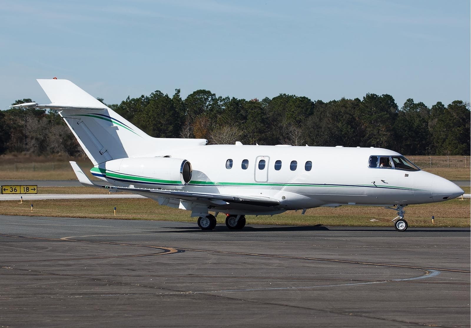 Tue, Nov 3TodayFrederickKFDK · Frederick Municipal AirportRichmondKFCI · Chesterfield County AirportHawker 900XP9—On request3NovFrederick → RichmondKFDK → KFCI · TodayHawker 900XP · 9 seatsOn request
 Thu, Nov 1201:36FrederickKFDK · Frederick Municipal AirportSherbrookeCYSC · Sherbrooke AirportBeechcraft Hawker 900XP8—On request12NovFrederick → SherbrookeKFDK → CYSC · 01:36Beechcraft Hawker 900XP · 8 seatsOn request
- Fri, Nov 2004:42FrederickKFDK · Frederick Municipal AirportSeviervilleKGKT · Gatlinburg-Pigeon Forge AirportBeechcraft Hawker 900XP8—On request20NovFrederick → SeviervilleKFDK → KGKT · 04:42Beechcraft Hawker 900XP · 8 seatsOn request
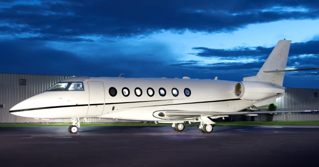 Mon, Nov 23in 20 daysFrederickKFDK · Frederick Municipal AirportWest Palm BeachKDJT · President Donald J. Trump International AirportGulfstream G2009—On request23NovFrederick → West Palm BeachKFDK → KDJT · in 20 daysGulfstream G200 · 9 seatsOn request
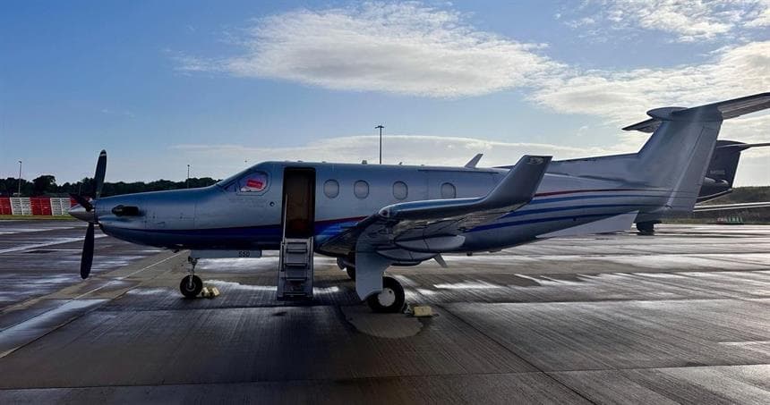 Sun, Nov 29in 26 daysFrederickKFDK · Frederick Municipal AirportWestchesterKHPN · Westchester County AirportPilatus PC-128—$2,63729NovFrederick → WestchesterKFDK → KHPN · in 26 daysPilatus PC-12 · 8 seats$2,637
- Mon, Nov 30in 27 daysFrederickKFDK · Frederick Municipal AirportWhite PlainsKHPN · Westchester County AirportPilatus PC-12/458—$3,19030NovFrederick → White PlainsKFDK → KHPN · in 27 daysPilatus PC-12/45 · 8 seats$3,190
- Sun, Dec 1303:30FrederickKFDK · Frederick Municipal AirportBuffaloKBUF · Buffalo Niagara International AirportBeechcraft Hawker 900XP8—On request13DecFrederick → BuffaloKFDK → KBUF · 03:30Beechcraft Hawker 900XP · 8 seatsOn request
 KFDK · Frederick Municipal Airport
 CYSC · Sherbrooke Airport
* Total price incl. 10% service fee, converted to your selected currency. Price subject to operator confirmation.
Empty legs to KFDK
10 arrivals available
- Wed, Nov 418:12RichmondKFCI · Chesterfield County AirportFrederickKFDK · Frederick Municipal AirportBeechcraft Hawker 900XP8—On request4NovRichmond → FrederickKFCI → KFDK · 18:12Beechcraft Hawker 900XP · 8 seatsOn request
- Thu, Nov 506:00Fort WorthKFTW · Fort Worth Meacham International AirportFrederickKFDK · Frederick Municipal AirportCessna Citation CJ48—$20,1305NovFort Worth → FrederickKFTW → KFDK · 06:00Cessna Citation CJ4 · 8 seats$20,130
- Sun, Nov 8in 5 daysBelmar/FarmingdaleKBLM · Monmouth Executive AirportFrederickKFDK · Frederick Municipal AirportHawker 900XP8—$7,0408NovBelmar/Farmingdale → FrederickKBLM → KFDK · in 5 daysHawker 900XP · 8 seats$7,040
- Mon, Nov 1610:06AlbanyKALB · Albany International AirportFrederickKFDK · Frederick Municipal AirportBeechcraft Hawker 900XP8—On request16NovAlbany → FrederickKALB → KFDK · 10:06Beechcraft Hawker 900XP · 8 seatsOn request
 Thu, Nov 19in 16 daysWest Palm BeachKDJT · President Donald J. Trump International AirportFrederickKFDK · Frederick Municipal AirportGulfstream G2009—On request19NovWest Palm Beach → FrederickKDJT → KFDK · in 16 daysGulfstream G200 · 9 seatsOn request
- Fri, Nov 2010:00LebanonKLEB · Lebanon Municipal AirportFrederickKFDK · Frederick Municipal AirportBeechcraft Hawker 900XP8—On request20NovLebanon → FrederickKLEB → KFDK · 10:00Beechcraft Hawker 900XP · 8 seatsOn request
- Sun, Nov 22in 19 daysFort LauderdaleKFXE · Fort Lauderdale Executive AirportFrederickKFDK · Frederick Municipal AirportGulfstream G2009—On request22NovFort Lauderdale → FrederickKFXE → KFDK · in 19 daysGulfstream G200 · 9 seatsOn request
- Wed, Nov 25in 22 daysWestchesterKHPN · Westchester County AirportFrederickKFDK · Frederick Municipal AirportPilatus PC-128—$3,29625NovWestchester → FrederickKHPN → KFDK · in 22 daysPilatus PC-12 · 8 seats$3,296
- Wed, Nov 25in 22 daysWhite PlainsKHPN · Westchester County AirportFrederickKFDK · Frederick Municipal AirportPilatus PC-12/458—$3,85025NovWhite Plains → FrederickKHPN → KFDK · in 22 daysPilatus PC-12/45 · 8 seats$3,850
* Total price incl. 10% service fee, converted to your selected currency. Price subject to operator confirmation.
Map: Frederick Airport
View the location of Frederick – FDK/KFDK. Zoom in to explore the area around the airport.
About the airport
Frederick Municipal Airport (FDK/KFDK) is the key private jet gateway for Frederick. PrivJet gives you instant access to charter flights and empty legs: fast, discreet and globally connected.
KFDK airport FAQ
Are there any restrictions at Frederick airport (KFDK) today?
There are currently 9 valid NOTAMs for Frederick (KFDK). Affected: Taxiway: closed; Obstacle lights: unserviceable; Aerodrome: out of service; Instrument approach procedure. For information only, not for flight planning or operational use. Always rely on an official pre-flight briefing. This list may be incomplete or out of date.
What is the weather at Frederick airport (KFDK)?
According to the latest weather report for KFDK (METAR, 03 Nov, 22:52 UTC): Good visual conditions (VFR). Wind Calm, visibility 10 km or more, temperature 18 °C (dew point 12 °C). For information only, not for flight planning. Weather can change quickly; always rely on official reports.
How long are the runways at Frederick airport (KFDK)?
Frederick (KFDK) has 2 runways: runway 05/23 with 1,774 m (5,819 ft), asphalt and runway 12/30 with 1,097 m (3,599 ft), asphalt. The longest is 1,774 m.
What are the radio frequencies at Frederick airport (KFDK)?
Frequencies at KFDK: Tower 132.4 MHz. For information only. Always rely on the published AIP.
What are the airport codes of Frederick Municipal Airport?
The ICAO code is KFDK and the IATA code is FDK. ICAO codes are used by air traffic control and pilots, e.g. in flight plans; IATA codes appear on tickets and baggage tags.
What is the elevation of KFDK airport?
Frederick Municipal Airport sits at 303 ft (92 m) above sea level. Local time zone: America/New York.
Can I fly to KFDK by private jet?
Whether a private jet can operate into Frederick Municipal Airport depends on runway length, opening hours, customs and immigration rules as well as slot and handling availability, among other things. PrivJet checks this with the operating carrier for every request.
Are there empty legs from or to KFDK?
There are currently 7 empty legs departing from and 10 arriving at Frederick Municipal Airport. Empty legs are repositioning flights at heavily reduced prices; the list is updated several times a day.