Fort Lauderdale Hollywood Airport (KFLL / FLL)
Empty legs and charters from Fort Lauderdale
KFLL airport at a glance
- ICAO code
- KFLL
- IATA code
- FLL
- City
- Fort Lauderdale
- Region
- Florida
- Country
- United States
- Elevation
- 9 ft (3 m)
- Time zone
- America/New York (UTC-5)
- Coordinates
- 26.0726° N, 80.1527° W
- Empty legs from
- 100
- Empty legs to
- 100
Private jet terminal & FBOs at Fort Lauderdale Hollywood
- Signature Aviation FLL4050 SW 11th Terrace, Fort Lauderdale, FL 33315
- Sheltair FLL1100 Lee Wagener Blvd., Fort Lauderdale, FL 33315
- Fontainebleau Aviation Fort Lauderdale1451 Lee Wagener Blvd, Fort Lauderdale, FL 33315
- National Jets3495 SW 9th Avenue, Fort Lauderdale, FL 33315
Weather & airport info KFLL
Current weather
Marginal visual conditions (MVFR)observed 02 Nov, 22:24 UTC- Wind
- 11 kt (20 km/h) from west-northwest (300°)
- Visibility
- 5 km
- Weather
- Thunderstorm with rain, mist
- Clouds
- broken clouds at 1,600 ft, broken clouds at 2,300 ft, broken clouds at 5,000 ft
- Temperature
- 22 °C (dew point 21 °C)
- Pressure (QNH)
- 1,015 hPa
Original weather report (METAR)
SPECI KFLL 022224Z 30011KT 3SM R10L/5500VP6000FT TSRA BR BKN016CB BKN023 BKN050 22/21 A2997 RMK AO2 TSE13B14 OCNL LTGICCG SW-W TS SW-W MOV NW CB DSNT NE SW NW MOV NW P0037 T02220206
Forecast (TAF)
- 02 Nov, 22:00–01:00 UTC12 kt (22 km/h) from east (100°) · visibility 10 km or more · Thunderstorm in the vicinity · scattered clouds at 2,000 ft, broken clouds at 4,000 ft
- 03 Nov, 01:00–14:00 UTCfrom10 kt (19 km/h) from east (100°) · visibility 10 km or more · scattered clouds at 2,500 ft, broken clouds at 5,000 ft, overcast at 15,000 ft
- 03 Nov, 14:00–00:00 UTCfrom12 kt (22 km/h) from east (100°), gusts up to 22 kt · visibility 10 km or more · scattered clouds at 2,500 ft, broken clouds at 5,000 ft
Original forecast (TAF)
TAF KFLL 022149Z 0222/0324 10012KT P6SM VCTS SCT020CB BKN040 TEMPO 0222/0223 08015G30KT 3SM TSRA BKN015CB FM030100 10010KT P6SM SCT025 BKN050 OVC150 FM031400 10012G22KT P6SM SCT025 BKN050
Airport
- Elevation
- 9 ft (3 m)
- Sunrise / Sunset
- 06:30 / 17:37 local time
Runways
| Runway | Length | Surface | Lighted |
|---|---|---|---|
| 10L/28R | 2,743 m (9,000 ft) | asphalt | yes |
| 10R/28L | 2,438 m (8,000 ft) | asphalt | yes |
Radio frequencies
- Approach: 118.1
- ATIS: 135
- Clearance: 128.4
- Ground: 121.4
- Tower: 119.3
- UNICOM: 122.95
For information only, not for flight planning. Weather can change quickly; always rely on official reports. Sources: aviationweather.gov (NOAA), OurAirports.
Airport map KFLL
Full screen →Runways white, taxiways yellow with designators, closed taxiways and runways per NOTAM in red.
Official charts (FAA)
Cycle 2611, valid until 0901Z 11/26/26
Airport diagram (FAA)
Airport diagram (1)
Instrument approaches (10)
Departure procedures (23)
- AGERS ONE (RNAV)
- AGERS ONE (RNAV), CONT.1
- BNICE TWO (RNAV)
- BNICE TWO (RNAV), CONT.1
- DORRL TWO (RNAV)
- FEALX TWO (RNAV)
- FEALX TWO (RNAV), CONT.1
- FEALX TWO (RNAV), CONT.2
- FORT LAUDERDALE TWO
- FORT LAUDERDALE TWO, CONT.1
- FRSBE TWO (RNAV)
- GLADZ FOUR (RNAV)
- GLADZ FOUR (RNAV), CONT.1
- GLADZ FOUR (RNAV), CONT.2
- HROCK TWO (RNAV)
- HROCK TWO (RNAV), CONT.1
- LIFRR TWO (RNAV)
- LIFRR TWO (RNAV), CONT.1
- MAYNR THREE (RNAV)
- MAYNR THREE (RNAV), CONT.1
- REGAE TWO (RNAV)
- SNAPR TWO (RNAV)
- SNAPR TWO (RNAV), CONT.1
Minimums (2)
Hot spots (1)
Other (19)
- BHHIA THREE (RNAV)
- BHHIA THREE (RNAV), CONT.1
- BHHIA THREE (RNAV), CONT.2
- CUUDA THREE (RNAV)
- CUUDA THREE (RNAV), CONT.1
- DEKAL NINE
- DVALL FOUR
- FORTL NINE
- KYAKS THREE (RNAV)
- KYAKS THREE (RNAV), CONT.1
- OLAHS THREE (RNAV)
- OLAHS THREE (RNAV), CONT.1
- OLAHS THREE (RNAV), CONT.2
- TARPN THREE (RNAV)
- TEEKY FOUR (RNAV)
- TEEKY FOUR (RNAV), CONT.1
- TOREZ ONE (RNAV)
- RNAV DP AAUP
- RNAV DP AAUP, CONT.1
For information only, not for navigation. Always use current official charts and NOTAMs.
Current NOTAMs for KFLL(33)
NOTAMs (Notices to Air Missions) announce short-term changes at an airport: closed runways or taxiways, unserviceable approach aids, obstacles, airspace restrictions.
- Out of serviceSurface movement radar: unserviceableA3119/26· from 04 Nov, 03:00 UTC · until 04 Nov, 11:00 UTC
The surface movement radar (SMR) is out of service. This system helps track aircraft and vehicles on the ground.
Show original text
SVC SMR U/S
A3119/26 NOTAMN
Q) KZMA/QCMAS////000/999/2604N08008W005
A) KFLL
B) 2611040300
C) 2611041100
E) SVC SMR U/S
- Out of serviceAerodromeA3120/26· from 04 Nov, 03:00 UTC · until 04 Nov, 11:00 UTC
The airport's runway status light system is out of service. This system indicates the status of the runways.
Show original text
AD AP RWY STATUS LGT SYSTEM U/S
A3120/26 NOTAMN
Q) KZMA/QFAXX////000/999/2604N08008W005
A) KFLL
B) 2611040300
C) 2611041100
E) AD AP RWY STATUS LGT SYSTEM U/S
- Out of serviceTaxiway centre line lightsA3118/26· until 03 Nov, 18:00 UTC
The edge lighting for taxiway T between taxiway B and taxiway T1 on the apron is out of service.
Show original text
APRON TXL T BTN TWY B AND TWY T1 EDGE LGT U/S
A3118/26 NOTAMN
Q) KZMA/QLXXX////000/999/2604N08008W005
A) KFLL
B) 2611021909
C) 2611031800
E) APRON TXL T BTN TWY B AND TWY T1 EDGE LGT U/S
- Out of serviceILS: unserviceableA3115/26· until 02 Dec, 20:00 UTC
The Instrument Landing System (ILS) for runway 28R is out of service. The ILS guides aircraft to the runway in poor visibility.
Show original text
FLL NAV ILS RWY 28R U/S
A3115/26 NOTAMN
Q) KZMA/QICAS////000/999/2604N08008W005
A) KFLL
B) 2611021312
C) 2612022000
E) FLL NAV ILS RWY 28R U/S
- Out of serviceThreshold lights: unserviceableA3112/26· until 13 Nov, 20:00 UTC
The runway threshold (start of the runway) for runway 28R is out of service. This may affect the usable length of the runway.
Show original text
RWY 28R RTHL U/S
A3112/26 NOTAMN
Q) KZMA/QLTAS////000/999/2604N08008W005
A) KFLL
B) 2611021014
C) 2611132000
E) RWY 28R RTHL U/S
- Out of serviceObstacle10/202· until 30 Nov, 23:59 UTC
A stack light 1.6 nautical miles east-northeast of the airport is out of service. Its top is 165 feet above sea level, 149 feet above ground.
Show original text
OBST STACK LGT (ASN 2013-ASO-9866-OE) 260509N0800732W (1.6NM ENE FLL) 165FT (149FT AGL) U/S
- Out of serviceTaxiwayA2863/26· until 06 Nov, 20:00 UTC
Taxiway A7, A8, B11, B12, Q north, Q south runway ENTRANCE light for runway 10L out of service
Show original text
TWY A7, A8, B11, B12, Q NORTH, Q SOUTH RWY ENTRANCE LGT FOR RWY 10L U/S
A2863/26 NOTAMN
Q) KZMA/QMXXX////000/999/2604N08008W005
A) KFLL
B) 2610161412
C) 2611062000
E) TWY A7, A8, B11, B12, Q NORTH, Q SOUTH RWY ENTRANCE LGT FOR RWY 10L U/S
- NoticeRunwayA3127/26· until 03 Nov, 04:00 UTC
Runway 28L surface condition 5/5/5 100 percent wet observed at 2 Nov 23:19 UTC.
Show original text
RWY 28L FICON 5/5/5 100 PCT WET OBS AT 2611022319.
A3127/26 NOTAMN
Q) KZMA/QMRXX////000/999/2604N08008W005
A) KFLL
B) 2611022319
C) 2611030400
E) RWY 28L FICON 5/5/5 100 PCT WET OBS AT 2611022319.
25 more NOTAMs
- NoticeRunwayA3126/26· until 03 Nov, 04:00 UTC
Runway 28R surface condition 5/5/5 100 percent wet observed at 2 Nov 23:17 UTC.
Show original text
RWY 28R FICON 5/5/5 100 PCT WET OBS AT 2611022317.
A3126/26 NOTAMN
Q) KZMA/QMRXX////000/999/2604N08008W005
A) KFLL
B) 2611022317
C) 2611030400
E) RWY 28R FICON 5/5/5 100 PCT WET OBS AT 2611022317.
- NoticeAerodromeA3121/26· until 03 Nov, 05:00 UTC
The airport is experiencing terminal processing delays for diverted aircraft due to capacity issues. Air carriers may experience significant delays. Please contact airport management at 954-336-2734.
Show original text
AD AP TERMINAL PROCESSING DLA FOR DIVERSION ACFT DUE TO CAPACITY, AIR CARRIERS MAY EXPERIENCE SIGNIFICANT DLA, CTC AP MANAGEMENT AT 954-336-2734
A3121/26 NOTAMN
Q) KZMA/QFAXX////000/999/2604N08008W005
A) KFLL
B) 2611022143
C) 2611030500
E) AD AP TERMINAL PROCESSING DLA FOR DIVERSION ACFT DUE TO CAPACITY, AIR CARRIERS MAY EXPERIENCE SIGNIFICANT DLA, CTC AP MANAGEMENT AT 954-336-2734
- NoticeVOR/DMEA3116/26· until 05 Nov, 21:00 UTC
The VOR/DME navigation system at Fort Lauderdale/Hollywood International Airport is not monitored. This system helps aircraft with navigation.
Show original text
FLL NAV VOR/DME NOT MNT
A3116/26 NOTAMN
Q) KZMA/QNMXX////000/999/2604N08008W005
A) KFLL
B) 2611021514
C) 2611052100
E) FLL NAV VOR/DME NOT MNT
- NoticeRunway11/007· until 01 Dec, 23:30 UTC (estimated)
The chevron surface marking at the end of runway 28L is obscured. This marking indicates an area unsuitable for aircraft.
Show original text
RWY 28L CHEVRON SFC MARKING OBSC
- NoticeRunway11/008· until 01 Dec, 23:00 UTC (estimated)
All lead-off lines for runway 10R/28L are obscured. This means the markings guiding aircraft from the runway to the taxiways are not visible.
Show original text
RWY 10R/28L ALL LEAD OFF LINES OBSC
- NoticeRunway11/006· until 01 Dec, 23:00 UTC (estimated)
The center line markings for runway 10R/28L are obscured or difficult to see.
Show original text
RWY 10R/28L CL MARKINGS OBSC
- NoticeRunway11/005· until 01 Dec, 23:00 UTC (estimated)
The center line markings for runway 10L/28R are obscured or difficult to see.
Show original text
RWY 10L/28R CL MARKINGS OBSC
- NoticeRunway11/003· until 01 Dec, 12:00 UTC (estimated)
The chevron surface markings for runway 10R are obscured or difficult to see.
Show original text
RWY 10R CHEVRON SFC MARKINGS OBSC
- NoticeRunway11/004· until 01 Dec, 23:00 UTC (estimated)
All lead-off lines for runway 10L/28R are obscured or difficult to see.
Show original text
RWY 10L/28R ALL LEAD OFF LINES OBSC
- NoticeTaxiway10/209· until 30 Nov, 23:59 UTC (estimated)
The center line markings on taxiway J1 are obscured or unclear.
Show original text
TWY J1 CL MARKINGS OBSC
- NoticeObstacle10/208· until 30 Nov, 23:59 UTC
An unlighted pole, with its top 50 feet above ground, is an obstacle near the airport, 0.18 nautical miles north-northeast of the approach end of runway 28L.
Show original text
OBST POLE (ASN UNKNOWN) 260406N0800757W (0.18NM NNE APCH END RWY 28L) UNKNOWN (50FT AGL) NOT LGTD
- NoticeDME associated with ILSA3057/26· until 13 Nov, 20:00 UTC
The DME (distance measuring equipment) for the Instrument Landing System (ILS) for runway 28L at Fort Lauderdale/Hollywood International Airport is not monitored.
Show original text
FLL NAV ILS RWY 28L DME NOT MNT
A3057/26 NOTAMN
Q) KZMA/QIDXX////000/999/2604N08008W005
A) KFLL
B) 2610301320
C) 2611132000
E) FLL NAV ILS RWY 28L DME NOT MNT
- NoticeRunway10/173· until 04 Nov, 18:13 UTC
The safety area for runway 10R/28L on the south side is not standard due to aircraft tire ruts.
Show original text
RWY 10R/28L SAFETY AREA NOT STD S SIDE ACFT TIRE RUTS
A3018/26 NOTAMN Q) KZMA/QMRXX////000/999/2604N08008W005 A) KFLL B) 2610271816 C) 2611041813 E) RWY 10R/28L SAFETY AREA NOT STD S SIDE ACFT TIRE RUTS
- NoticeRunway10/129· until 30 Nov, 22:00 UTC
The safety area at the east end of runway 10L/28R is not standard.
Show original text
RWY 10L/28R SAFETY AREA NOT STD E END
A2947/26 NOTAMN
Q) KZMA/QMRXX////000/999/2604N08008W005
A) KFLL
B) 2610231612
C) 2611302200
E) RWY 10L/28R SAFETY AREA NOT STD E END
- NoticeRunwayA2947/26· until 30 Nov, 22:00 UTC
The safety area at the east end of runway 10L/28R is not standard.
Show original text
RWY 10L/28R SAFETY AREA NOT STD E END
A2947/26 NOTAMN Q) KZMA/QMRXX////000/999/2604N08008W005 A) KFLL B) 2610231612 C) 2611302200 E) RWY 10L/28R SAFETY AREA NOT STD E END
- NoticeTaxiway10/124· until 30 Nov, 23:59 UTC (estimated)
The centerline markings for taxiway B between taxiway C4 and taxiway E are not standard.
Show original text
TWY B CL MARKINGS BTN TWY C4 AND TWY E NOT STD
- NoticeObstacle10/097· until 31 Dec, 23:59 UTC
An unlit pole, 100 feet above ground, is located 0.22 nautical miles northwest of the approach end of runway 28L. Its height above sea level is unknown.
Show original text
OBST POLE (ASN UNKNOWN) 260407N0800811W (.22NM NW APCH END RWY 28L) UNKNOWN (100FT AGL) NOT LGTD
- NoticeObstacle10/077· until 31 Dec, 23:59 UTC
An unlighted pole near the approach end of runway 28L is an obstacle. Its height above ground is 100 ft.
Show original text
OBST POLE (ASN UNKNOWN) 260410N0800757W (.25NM NNE APCH END RWY 28L) UNKNOWN (100FT AGL) NOT LGTD
- NoticeObstacle10/054· until 31 Dec, 23:59 UTC
An unknown pole, 35 feet above ground, is out of service and not lit. It is located 0.57 nautical miles northwest of the approach end of runway 28R.
Show original text
OBST POLE (ASN UNKNOWN) 260443N0800905W (.57NM NW APCH END RWY 28R) UNKNOWN (35FT AGL) NOT LGTD
- NoticeTaxiway10/020· until 31 Dec, 23:59 UTC (estimated)
The centerline markings on taxiway Q, southeast of taxiway H, are not standard. This might affect guidance on the taxiway.
Show original text
TWY Q CL MARKINGS FOR TWY H SOUTHEAST SIDE NOT STD
- Out of serviceInstrument approach procedure6849/26· until 14 May, 15:20 UTC (estimated)
For the instrument approach procedure ILS or LOC runway 10L, an autopilot coupled approach is not authorized below 203 feet.
Show original text
IAP FORT LAUDERDALE/HOLLYWOOD INTL, FORT LAUDERDALE, FL. ILS OR LOC RWY 10L, AMDT 25... NOTE: AUTOPILOT COUPLED APPROACH NA BELOW 203. 2610021520-2705141520EST
Q) KZMA/QPIXX/I/NBO/A/000/999/2604N08008W005
A) KFLL
B) 2610021519
C) 2705141519EST
E) FLL FORT LAUDERDALE/HOLLYWOOD INTL, FORT LAUDERDALE, FL.
ILS OR LOC RWY 10L, AMDT 25...
NOTE: AUTOPILOT COUPLED APPROACH NA BELOW 203.
- Out of serviceInstrument approach procedure: changedA2785/26· until 14 May, 15:20 UTC
For the instrument approach procedure ILS or LOC runway 10L, an autopilot coupled approach is not authorized below 203 feet.
Show original text
IAP FORT LAUDERDALE/HOLLYWOOD INTL, FORT LAUDERDALE, FL. ILS OR LOC RWY 10L, AMDT 25... NOTE: AUTOPILOT COUPLED APPROACH NA BELOW 203.
A2785/26 NOTAMN
Q) KZMA/QPICH/I/NBO/A/000/999/2604N08008W005
A) KFLL
B) 2610021520
C) 2705141520
E) IAP FORT LAUDERDALE/HOLLYWOOD INTL, FORT LAUDERDALE, FL. ILS OR LOC RWY 10L, AMDT 25... NOTE: AUTOPILOT COUPLED APPROACH NA BELOW 203.
- NoticeApron09/231· until 31 Dec, 23:59 UTC
The taxiway edge markings on apron taxiway T between Gate G3 and Gate G12 are not standard and have been removed.
Show original text
APRON TXL T BTN GATE G3 AND GATE G12 EDGE MARKINGS NOT STD REMOVED
- NoticeTaxiway09/230· until 31 Dec, 12:00 UTC (estimated)
The surface-painted holding position signs on taxiway J1, located at the approach end of runway 10R, are not standard.
Show original text
TWY J1 SFC PAINTED HLDG PSN SIGNS FOR APCH END RWY 10R NOT STD
- NoticeTaxiway09/210· until 04 Dec, 10:30 UTC
The centerline markings on taxiway A between the FedEx ramp and the Aeroterm ramp East have been removed.
Show original text
TWY A CL MARKINGS BTN FEDEX RAMP AND AEROTERM RAMP EAST REMOVED
For information only, not for flight planning or operational use. Always rely on an official pre-flight briefing. This list may be incomplete or out of date. Explanations and expanded abbreviations are generated automatically. The original text is authoritative. Source: FAA NOTAM Management Service (SWIM).
Private jet traffic in Fort Lauderdale Hollywood International Airport (last 30 days)
- Arrivals
- 1,790
- Departures
- 1,568
- Different jets
- 1,183
Most frequent origins: Tampa International Airport (62), Witham Field (60), Palm Beach International Airport (54), Teterboro Airport (44), Miami-Opa Locka Executive Airport (31).
Most frequent destinations: Tampa International Airport (66), Witham Field (60), Teterboro Airport (51), Miami-Opa Locka Executive Airport (42), Palm Beach International Airport (40).
Most common aircraft types: Embraer Phenom 300 (352), Pilatus PC-12 (280), Cessna Citation Latitude (158), Gulfstream G450/GIV (151), Cessna Citation Excel/XLS (130).
Sunday is the busiest day.
Our own analysis of public ADS-B signals from business jets. Not every flight is received, and jets with a removal request are excluded.
Charter operators based here
Operators with a base at this airport.
- Jet Edge InternationalVan Nuys (KVNY) · Midsize jet, Super midsize jet, Heavy jet
- Wheels UpDenver (Rocky Mountain Metropolitan) (KBJC) · Turboprop, Light jet, Midsize jet
- Jet Aviation Flight ServicesTeterboro (KTEB) · Light jet, Super midsize jet, Heavy jet
- Jet OutFort Worth (Meacham International) (KFTW) · Light jet
- Gold Aviation ServicesLight jet, Super midsize jet
- Aztec Worldwide AirlinesTurboprop, Piston aircraft
- Aitheras Aviation GroupCleveland (Burke Lakefront) (KBKL) · Light jet, Midsize jet, Super midsize jet
- Tropic Ocean AirwaysTurboprop
- Executive Aviation CorporationMiami (Executive) (KTMB) · Midsize jet, Super midsize jet
- Aery AviationAtlanta (Hartsfield - Jackson International) (KATL) · Light jet
- DM AirSuper midsize jet, Heavy jet
- Island Air ChartersPiston aircraft
- Air FlightFort Lauderdale Executive (KFXE) · Piston aircraft
- BONDLight jet, Heavy jet
- Capital JetsMidsize jet
- Skyjet EliteMidsize jet
- A-1 Air CarriersPiston aircraft
- Florida Air CargoTurboprop
Empty legs from KFLL
100 departures available
- Tue, Nov 3TodayFort LauderdaleKFLL · Fort Lauderdale Hollywood International AirportPlacidaFA54 · Coral Creek AirportHawker 800XP——On request3NovFort Lauderdale → PlacidaKFLL → FA54 · TodayHawker 800XPOn request
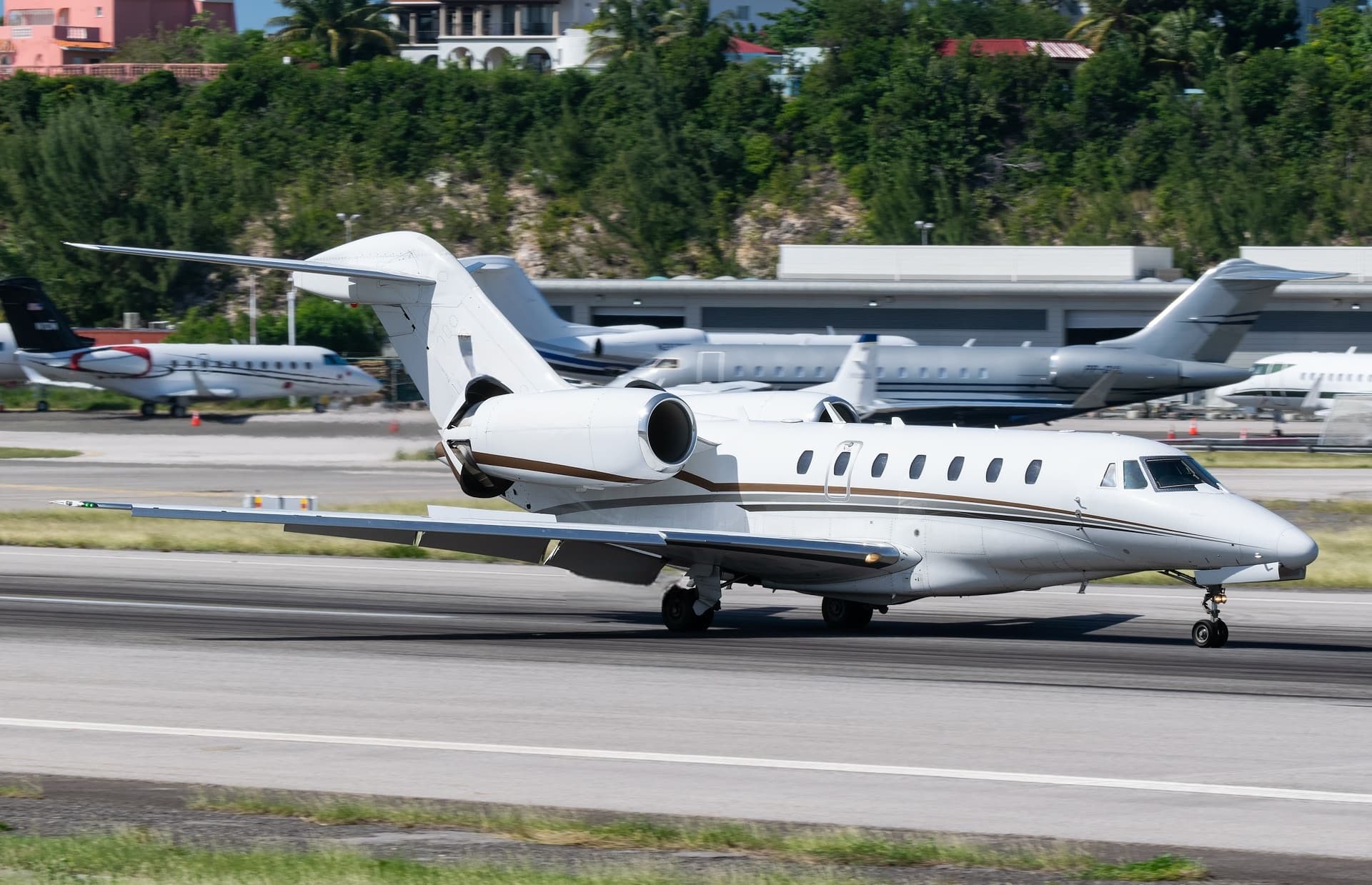 Tue, Nov 3TodayFort LauderdaleKFLL · Fort Lauderdale Hollywood International AirportSan JuanTJIG · Fernando Luis Ribas Dominicci AirportCitation X8—On request3NovFort Lauderdale → San JuanKFLL → TJIG · TodayCitation X · 8 seatsOn request
- Tue, Nov 3TodayFort LauderdaleKFLL · Ft Lauderdale Hollywood IntlOmahaKOMA · Eppley AirfieldCessna Citation XLS—3h 36m$8,2503NovFort Lauderdale → OmahaKFLL → KOMA · TodayCessna Citation XLS · 3h 36m$8,250
- Tue, Nov 322:54Fort LauderdaleKFLL · Fort Lauderdale Hollywood International AirportJacksonvilleKCRG · Jacksonville Executive at Craig AirportPilatus PC-128—$4,1803NovFort Lauderdale → JacksonvilleKFLL → KCRG · 22:54Pilatus PC-12 · 8 seats$4,180
- Tue, Nov 315:45Fort LauderdaleKFLL · Hollywood IntlBedfordKBED · Laurence G. Hanscom FieldEmbraer Praetor 6009—$29,9483NovFort Lauderdale → BedfordKFLL → KBED · 15:45Embraer Praetor 600 · 9 seats$29,948
 Tue, Nov 3TodayFort LauderdaleKFLL · Fort Lauderdale Hollywood International AirportOrlandoKMCO · Orlando International AirportPhenom 3008—$12,0103NovFort Lauderdale → OrlandoKFLL → KMCO · TodayPhenom 300 · 8 seats$12,010
- Wed, Nov 4TomorrowFort LauderdaleKFLL · Fort Lauderdale Hollywood International AirportTampaKX39 · Tampa North Aero Park AirportCessna CitationJet5—$4,8404NovFort Lauderdale → TampaKFLL → KX39 · TomorrowCessna CitationJet · 5 seats$4,840
- Wed, Nov 4TomorrowFort LauderdaleKFLL · Fort Lauderdale Hollywood International AirportTampaKMCF · MacDill Air Force BaseCessna CitationJet5—$4,7304NovFort Lauderdale → TampaKFLL → KMCF · TomorrowCessna CitationJet · 5 seats$4,730
- Wed, Nov 405:18Fort LauderdaleKFLL · Fort Lauderdale Hollywood International AirportMontrealCYMX · Montreal International (Mirabel) AirportDassault Falcon 90012—$29,5904NovFort Lauderdale → MontrealKFLL → CYMX · 05:18Dassault Falcon 900 · 12 seats$29,590
 KFLL · Fort Lauderdale Hollywood International Airport
 TJIG · Fernando Luis Ribas Dominicci Airport
 CYMX · Montreal International (Mirabel) Airport
* Total price incl. 10% service fee, converted to your selected currency. Price subject to operator confirmation.
Empty legs to KFLL
100 arrivals available
- Tue, Nov 3TodayKnoxvilleKTYS · Mc Ghee TysonFort LauderdaleKFLL · Ft Lauderdale Hollywood IntlEmbraer Legacy 500—2h 9m$20,0863NovKnoxville → Fort LauderdaleKTYS → KFLL · TodayEmbraer Legacy 500 · 2h 9m$20,086
- Tue, Nov 317:33NaplesKAPF · Naples Municipal AirportFort LauderdaleKFLL · Fort Lauderdale Hollywood International AirportEmbraer Phenom 3007—$11,8803NovNaples → Fort LauderdaleKAPF → KFLL · 17:33Embraer Phenom 300 · 7 seats$11,880
- Tue, Nov 322:45KnoxvilleKTYS · McGhee TysonFort LauderdaleKFLL · Hollywood IntlEmbraer Praetor 6009—$25,1083NovKnoxville → Fort LauderdaleKTYS → KFLL · 22:45Embraer Praetor 600 · 9 seats$25,108
- Tue, Nov 3TodayVan NuysKVNY · Van Nuys AirportFort LauderdaleKFLL · Fort Lauderdale Hollywood International AirportGulfstream G-65011—On request3NovVan Nuys → Fort LauderdaleKVNY → KFLL · TodayGulfstream G-650 · 11 seatsOn request
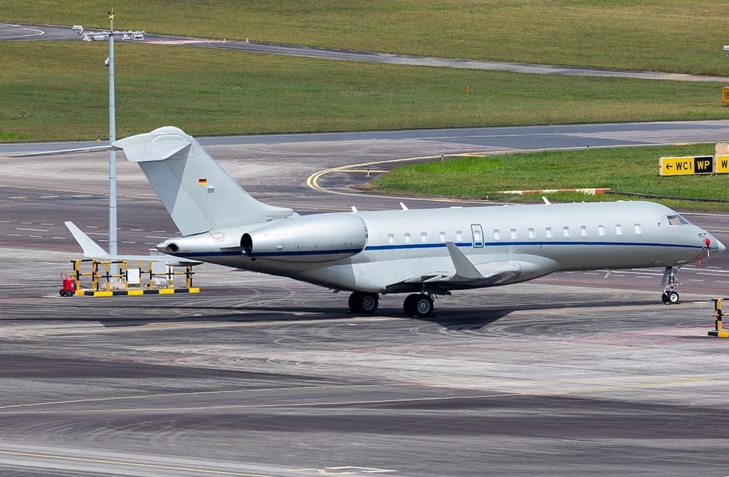 Wed, Nov 4TomorrowMunichEDDM · Munich International AirportFort LauderdaleKFLL · Fort Lauderdale Hollywood International AirportGlobal 600014—On request4NovMunich → Fort LauderdaleEDDM → KFLL · TomorrowGlobal 6000 · 14 seatsOn request
- Wed, Nov 4TomorrowNorth EleutheraMYEH · North Eleuthera AirportFort LauderdaleKFLL · Fort Lauderdale Hollywood International AirportGlobal 600014—On request4NovNorth Eleuthera → Fort LauderdaleMYEH → KFLL · TomorrowGlobal 6000 · 14 seatsOn request
- Wed, Nov 4TomorrowVan NuysKVNYFort LauderdaleKFLL · Ft Lauderdale Hollywood IntlGulfstream IV-SP—5h 25mOn request4NovVan Nuys → Fort LauderdaleKVNY → KFLL · TomorrowGulfstream IV-SP · 5h 25mOn request
- Wed, Nov 4TomorrowWest Palm BeachKDJT · President Donald J. Trump International AirportFort LauderdaleKFLL · Hollywood IntlMidsize Jet6—On request4NovWest Palm Beach → Fort LauderdaleKDJT → KFLL · TomorrowMidsize Jet · 6 seatsOn request
- Thu, Nov 516:46ProvidencialesMBPV · Providenciales International AirportFort LauderdaleKFLL · Fort Lauderdale Hollywood International AirportEmbraer Legacy 60013—$31,7905NovProvidenciales → Fort LauderdaleMBPV → KFLL · 16:46Embraer Legacy 600 · 13 seats$31,790
 EDDM · Munich International Airport
 MYEH · North Eleuthera Airport
 MBPV · Providenciales International Airport
* Total price incl. 10% service fee, converted to your selected currency. Price subject to operator confirmation.
Map: Fort Lauderdale Airport
View the location of Fort Lauderdale – FLL/KFLL. Zoom in to explore the area around the airport.
About the airport
Fort Lauderdale Hollywood International Airport (FLL/KFLL) is the key private jet gateway for Fort Lauderdale. PrivJet gives you instant access to charter flights and empty legs: fast, discreet and globally connected.
KFLL airport FAQ
Are there any restrictions at Fort Lauderdale airport (KFLL) today?
There are currently 31 valid NOTAMs for Fort Lauderdale (KFLL). Affected: Taxiway centre line lights; ILS: unserviceable; Threshold lights: unserviceable; Obstacle: out of service and 3 more. 2 more NOTAMs start in the coming days. For information only, not for flight planning or operational use. Always rely on an official pre-flight briefing. This list may be incomplete or out of date.
What is the weather at Fort Lauderdale airport (KFLL)?
According to the latest weather report for KFLL (METAR, 02 Nov, 22:24 UTC): Marginal visual conditions (MVFR). Wind 11 kt (20 km/h) from west-northwest (300°), visibility 5 km, temperature 22 °C (dew point 21 °C). Thunderstorm with rain, mist. For information only, not for flight planning. Weather can change quickly; always rely on official reports.
How long are the runways at Fort Lauderdale airport (KFLL)?
Fort Lauderdale (KFLL) has 2 runways: runway 10L/28R with 2,743 m (9,000 ft), asphalt and runway 10R/28L with 2,438 m (8,000 ft), asphalt. The longest is 2,743 m.
What are the radio frequencies at Fort Lauderdale airport (KFLL)?
Frequencies at KFLL: Tower 119.3 MHz, Ground 121.4 MHz and ATIS 135 MHz. For information only. Always rely on the published AIP.
What are the airport codes of Fort Lauderdale Hollywood International Airport?
The ICAO code is KFLL and the IATA code is FLL. ICAO codes are used by air traffic control and pilots, e.g. in flight plans; IATA codes appear on tickets and baggage tags.
What is the elevation of KFLL airport?
Fort Lauderdale Hollywood International Airport sits at 9 ft (3 m) above sea level. Local time zone: America/New York.
Where do private jets land at Fort Lauderdale Hollywood?
KFLL has 4 private jet terminals or FBOs: Signature Aviation FLL, Sheltair FLL, Fontainebleau Aviation Fort Lauderdale and National Jets. Your flight confirmation says which one your operator uses.
Can I fly to KFLL by private jet?
Whether a private jet can operate into Fort Lauderdale Hollywood International Airport depends on runway length, opening hours, customs and immigration rules as well as slot and handling availability, among other things. PrivJet checks this with the operating carrier for every request.
Are there empty legs from or to KFLL?
There are currently 100 empty legs departing from and 100 arriving at Fort Lauderdale Hollywood International Airport. Empty legs are repositioning flights at heavily reduced prices; the list is updated several times a day.