Fort Myers Page Field Airport (KFMY / FMY)
Empty legs and charters from Fort Myers
KFMY airport at a glance
- ICAO code
- KFMY
- IATA code
- FMY
- City
- Fort Myers
- Region
- Florida
- Country
- United States
- Elevation
- 17 ft (5 m)
- Time zone
- America/New York (UTC-5)
- Coordinates
- 26.5866° N, 81.8633° W
- Empty legs from
- 29
- Empty legs to
- 15
Weather & airport info KFMY
Current weather
Good visual conditions (VFR)observed 03 Nov, 14:53 UTC- Wind
- 9 kt (17 km/h) from east (100°)
- Visibility
- 10 km or more
- Clouds
- few clouds at 2,900 ft, few clouds at 3,700 ft
- Temperature
- 27 °C (dew point 23 °C)
- Pressure (QNH)
- 1,016 hPa
Original weather report (METAR)
METAR KFMY 031453Z 10009KT 10SM FEW029 FEW037 27/23 A3000 RMK AO2 SLP159 60002 T02670228 50009
Forecast (TAF)
- 03 Nov, 14:00–02:00 UTCfrom8 kt (15 km/h) from east-southeast (110°) · visibility 10 km or more · Showers in the vicinity · scattered clouds at 2,000 ft, broken clouds at 12,000 ft
- 03 Nov, 20:00–00:00 UTCtemporarilyvisibility 5 km · Rain showers · broken clouds at 3,000 ft
- 04 Nov, 02:00–12:00 UTCfrom5 kt (9 km/h) from east (90°) · visibility 10 km or more · few clouds at 1,000 ft, broken clouds at 4,000 ft
Original forecast (TAF)
TAF KFMY 031134Z 0312/0412 07007KT P6SM VCSH SCT015 BKN100 TEMPO 0312/0314 5SM -SHRA BKN025 FM031400 11008KT P6SM VCSH SCT020 BKN120 TEMPO 0320/0324 3SM SHRA BKN030 FM040200 09005KT P6SM FEW010 BKN040
Airport
- Elevation
- 17 ft (5 m)
- Sunrise / Sunset
- 06:38 / 17:43 local time
Runways
| Runway | Length | Surface | Lighted |
|---|---|---|---|
| 05/23 | 1,953 m (6,406 ft) | asphalt | yes |
| 13/31 | 1,497 m (4,910 ft) | asphalt | yes |
Radio frequencies
- ATIS: 123.725
- Clearance: 121.7
- CTAF: 119
- Ground: 121.7
- Tower: 119
- UNICOM: 130.55
For information only, not for flight planning. Weather can change quickly; always rely on official reports. Sources: aviationweather.gov (NOAA), OurAirports.
Airport map KFMY
Full screen →Runways white, taxiways yellow with designators, closed taxiways and runways per NOTAM in red.
Official charts (FAA)
Cycle 2611, valid until 0901Z 11/26/26
Airport diagram (FAA)
Airport diagram (1)
Instrument approaches (5)
Departure procedures (1)
Minimums (2)
Hot spots (1)
For information only, not for navigation. Always use current official charts and NOTAMs.
Current NOTAMs for KFMY(8)
NOTAMs (Notices to Air Missions) announce short-term changes at an airport: closed runways or taxiways, unserviceable approach aids, obstacles, airspace restrictions.
- Out of serviceObstacle10/025· until 26 Nov, 23:59 UTC
A tower light 3.8 nautical miles east-northeast of the airport is out of service. Its top is 209 feet above sea level, 190 feet above ground.
Show original text
OBST TOWER LGT (ASR UNKNOWN) 263740.25N0814835.50W (3.8NM ENE FMY) 209FT (190FT AGL) U/S
- NoticeProcedure921/26· until 26 Sept, 17:43 UTC (estimated)
ODP PAGE FLD, FORT MYERS, FL. TAKEOFF MINIMUMS and (obstacle) DEPARTURE PROCEDURES amendment 5A... TAKEOFF MINIMUMS: runway 5, STANDARD with MINIMUM CLIMB of 251 ft PER NM to 500 (2026-ASO-3452-OE). TEMPORARY crane 353 MSL 1.9 NM NE of runway 23 (2026-ASO-3452-OE). all OTHER DATA REMAINS as PUBLISHED. 20 Oct 17:43 UTC -2709261743EST
Show original text
ODP PAGE FLD, FORT MYERS, FL. TAKEOFF MINIMUMS AND (OBSTACLE) DEPARTURE PROCEDURES AMDT 5A... TAKEOFF MINIMUMS: RWY 5, STANDARD WITH MINIMUM CLIMB OF 251 FT PER NM TO 500 (2026-ASO-3452-OE). TEMPORARY CRANE 353 MSL 1.9NM NE OF RWY 23 (2026-ASO-3452-OE). ALL OTHER DATA REMAINS AS PUBLISHED. 2610201743-2709261743EST
Q) KZMA/undefined/NBO/A/000/999/2635N08151W005
A) KFMY
B) 2610191344
C) 2705311344EST
E) FMY PAGE FLD, FORT MYERS, FL.
TAKEOFF MINIMUMS AND (OBSTACLE) DEPARTURE PROCEDURES AMDT 5A...
TAKEOFF MINIMUMS: RWY 5, STANDARD WITH MINIMUM CLIMB OF 251 FT PER NM TO 500 (2026-ASO-3452-OE).  TEMPORARY CRANE 353 MSL 1.9NM NE OF RWY 23 (2026-ASO-3452-OE).   ALL OTHER DATA REMAINS AS PUBLISHED.
- NoticeInstrument approach procedure922/26· until 26 Sept, 17:43 UTC (estimated)
A temporary crane 2.3 nautical miles northeast of the airport is an obstacle. Its top is 353 ft above sea level.
Show original text
IAP PAGE FLD, FORT MYERS, FL. ILS OR LOC RWY 5, AMDT 7F... RNAV (GPS) RWY 13, AMDT 1F... RNAV (GPS) RWY 31, AMDT 1... RNAV (GPS) RWY 5, AMDT 1... CIRCLING CAT A/B MDA 660/HAA 643, CAT C/D MDA 720/HAA 703, VIS CAT C 2, CAT D 2 1/4. TEMPORARY CRANE 353 MSL 2.3NM NE OF FMY AIRPORT (2026-ASO-3452-OE). 2610201743-2709261743EST
Q) KZMA/QPIXX/I/NBO/A/000/999/2635N08151W005
A) KFMY
B) 2610191328
C) 2705311327EST
E) FMY PAGE FLD, FORT MYERS, FL.
ILS OR LOC RWY 5, AMDT 7F...
RNAV (GPS) RWY 13, AMDT 1F...
RNAV (GPS) RWY 31, AMDT 1...
RNAV (GPS) RWY 5, AMDT 1...
CIRCLING CAT A/B MDA 660/HAA 643, CAT C/D MDA 720/HAA 703, VIS CAT C 2, CAT D 2 1/4.  TEMPORARY CRANE 353 MSL 2.3NM NE OF FMY AIRPORT (2026-ASO-3452-OE).
- NoticeInstrument approach procedure923/26· until 26 Sept, 17:43 UTC (estimated)
A temporary crane 1.9 nautical miles northeast of runway 23 is an obstacle. Its top is 353 ft above sea level.
Show original text
IAP PAGE FLD, FORT MYERS, FL. RNAV (GPS) RWY 23, AMDT 2... LNAV MDA 660/HAT 644 ALL CATS, VIS CATS C/D 1 7/8. CIRCLING CAT A/B MDA 660/HAA 643, CAT C/D MDA 720/HAA 703, VIS CAT C 2, CAT D 2 1/4. TEMPORARY CRANE 353 MSL 1.9NM NE OF RWY 23 (2026-ASO-3452-OE). 2610201743-2709261743EST
Q) KZMA/QPIXX/I/NBO/A/000/999/2635N08151W005
A) KFMY
B) 2610191344
C) 2705311343EST
E) FMY PAGE FLD, FORT MYERS, FL.
RNAV (GPS) RWY 23, AMDT 2...
LNAV MDA 660/HAT 644 ALL CATS, VIS CATS C/D 1 7/8.  CIRCLING CAT A/B MDA 660/HAA 643, CAT C/D MDA 720/HAA 703, VIS CAT C 2, CAT D 2 1/4.  TEMPORARY CRANE 353 MSL 1.9NM NE OF RWY 23 (2026-ASO-3452-OE).
- NoticeObstacle clearance altitude: changedA0539/26· until 26 Sept, 17:43 UTC
A temporary crane 1.9 nautical miles northeast of runway 23 is an obstacle. Its top is 353 ft above sea level.
Show original text
ODP PAGE FLD, FORT MYERS, FL. TAKEOFF MINIMUMS AND (OBSTACLE) DEPARTURE PROCEDURES AMDT 5A... TAKEOFF MINIMUMS: RWY 5, STANDARD WITH MINIMUM CLIMB OF 251 FT PER NM TO 500 (2026-ASO-3452-OE). TEMPORARY CRANE 353 MSL 1.9NM NE OF RWY 23 (2026-ASO-3452-OE). ALL OTHER DATA REMAINS AS PUBLISHED.
A0539/26 NOTAMN
Q) KZMA/QPOCH/I/NBO/A/000/999/2635N08151W005
A) KFMY
B) 2610201743
C) 2709261743
E) ODP PAGE FLD, FORT MYERS, FL. TAKEOFF MINIMUMS AND (OBSTACLE) DEPARTURE PROCEDURES AMDT 5A... TAKEOFF MINIMUMS: RWY 5, STANDARD WITH MINIMUM CLIMB OF 251 FT PER NM TO 500 (2026-ASO-3452-OE). TEMPORARY CRANE 353 MSL 1.9NM NE OF RWY 23 (2026-ASO-3452-OE). ALL OTHER DATA REMAINS AS PUBLISHED.
- NoticeInstrument approach procedure: changedA0540/26· until 26 Sept, 17:43 UTC
A temporary crane 1.9 nautical miles northeast of runway 23 is an obstacle. Its top is 353 ft above sea level.
Show original text
IAP PAGE FLD, FORT MYERS, FL. RNAV (GPS) RWY 23, AMDT 2... LNAV MDA 660/HAT 644 ALL CATS, VIS CATS C/D 1 7/8. CIRCLING CAT A/B MDA 660/HAA 643, CAT C/D MDA 720/HAA 703, VIS CAT C 2, CAT D 2 1/4. TEMPORARY CRANE 353 MSL 1.9NM NE OF RWY 23 (2026-ASO-3452-OE).
A0540/26 NOTAMN
Q) KZMA/QPICH/I/NBO/A/000/999/2635N08151W005
A) KFMY
B) 2610201743
C) 2709261743
E) IAP PAGE FLD, FORT MYERS, FL. RNAV (GPS) RWY 23, AMDT 2... LNAV MDA 660/HAT 644 ALL CATS, VIS CATS C/D 1 7/8. CIRCLING CAT A/B MDA 660/HAA 643, CAT C/D MDA 720/HAA 703, VIS CAT C 2, CAT D 2 1/4. TEMPORARY CRANE 353 MSL 1.9NM NE OF RWY 23 (2026-ASO-3452-OE).
- NoticeInstrument approach procedure: changedA0541/26· until 26 Sept, 17:43 UTC
Instrument approach procedure PAGE FLD, FORT MYERS, FL. ILS (instrument landing system) or localizer runway 5, amendment 7F... RNAV (area navigation) (GPS) runway 13, amendment 1F... RNAV (area navigation) (GPS) runway 31, amendment 1... RNAV (area navigation) (GPS) runway 5, amendment 1... CIRCLING category A/B minimum descent altitude 660/HAA 643, category C/D minimum descent altitude 720/HAA 703, VIS category C 2, category D 2 1/4. TEMPORARY crane 353 MSL 2.3 NM NE of FMY AIRPORT (2026-ASO-3452-OE).
Show original text
IAP PAGE FLD, FORT MYERS, FL. ILS OR LOC RWY 5, AMDT 7F... RNAV (GPS) RWY 13, AMDT 1F... RNAV (GPS) RWY 31, AMDT 1... RNAV (GPS) RWY 5, AMDT 1... CIRCLING CAT A/B MDA 660/HAA 643, CAT C/D MDA 720/HAA 703, VIS CAT C 2, CAT D 2 1/4. TEMPORARY CRANE 353 MSL 2.3NM NE OF FMY AIRPORT (2026-ASO-3452-OE).
A0541/26 NOTAMN
Q) KZMA/QPICH/I/NBO/A/000/999/2635N08151W005
A) KFMY
B) 2610201743
C) 2709261743
E) IAP PAGE FLD, FORT MYERS, FL. ILS OR LOC RWY 5, AMDT 7F... RNAV (GPS) RWY 13, AMDT 1F... RNAV (GPS) RWY 31, AMDT 1... RNAV (GPS) RWY 5, AMDT 1... CIRCLING CAT A/B MDA 660/HAA 643, CAT C/D MDA 720/HAA 703, VIS CAT C 2, CAT D 2 1/4. TEMPORARY CRANE 353 MSL 2.3NM NE OF FMY AIRPORT (2026-ASO-3452-OE).
- NoticeObstacle: erectedA0535/26· until 31 Jan, 23:00 UTC
A crane 0.62 nautical miles north of the approach end of runway 23 is an obstacle. The top of the obstacle is 180 ft above sea level, 165 ft above ground and is flagged.
Show original text
OBST CRANE (ASN UNKNOWN) 263609N0815128W (0.62NM N APCH END RWY 23) 180FT (165FT AGL) FLAGGED
A0535/26 NOTAMN
Q) KZMA/QOBCE/IV/M/AE/000/999/2635N08151W005
A) KFMY
B) 2610162036
C) 2701312300
E) OBST CRANE (ASN UNKNOWN) 263609N0815128W (0.62NM N APCH END RWY 23)
 180FT (165FT AGL) FLAGGED
For information only, not for flight planning or operational use. Always rely on an official pre-flight briefing. This list may be incomplete or out of date. Explanations and expanded abbreviations are generated automatically. The original text is authoritative. Source: FAA NOTAM Management Service (SWIM).
Private jet traffic in Page Field (last 30 days)
- Arrivals
- 429
- Departures
- 274
- Different jets
- 339
Most frequent origins: Palm Beach International Airport (11), Sarasota Bradenton International Airport (9), Naples Municipal Airport (7), Fort Lauderdale Hollywood International Airport (6), Flying Cloud Airport (6).
Most frequent destinations: Palm Beach International Airport (8), Naples Municipal Airport (8), Orlando Executive Airport (8), Key West International Airport (6), DeKalb Peachtree Airport (6).
Most common aircraft types: Pilatus PC-12 (58), Cessna Citation Excel/XLS (55), Embraer Phenom 300 (50), Cessna Citation Latitude (42), Cessna Citation CJ2 (42).
Monday is the busiest day.
Our own analysis of public ADS-B signals from business jets. Not every flight is received, and jets with a removal request are excluded.
Charter operators based here
Operators with a base at this airport.
- RAI JetsKalamazoo/Battle Creek (KAZO) · Turboprop, Midsize jet, Super midsize jet
- O'Brien HelicoptersHelicopter
Empty legs from KFMY
29 departures available
- Wed, Nov 413:12Fort MyersKFMY · Page FieldTulsaKRVS · Tulsa Riverside AirportPiaggio Avanti II6—$10,5604NovFort Myers → TulsaKFMY → KRVS · 13:12Piaggio Avanti II · 6 seats$10,560
- Wed, Nov 4TomorrowFort MyersKFMY · Page FieldMiamiKOPF · Miami-Opa Locka Executive AirportChallenger 30010—$9,4604NovFort Myers → MiamiKFMY → KOPF · TomorrowChallenger 300 · 10 seats$9,460
- Fri, Nov 6in 3 daysFort MyersKFMY · Page FieldCharlestonKCHS · Charleston Air Force Base-International AirportBeechcraft Beechjet 400A71h 12mOn request6NovFort Myers → CharlestonKFMY → KCHS · in 3 daysBeechcraft Beechjet 400A · 7 seats · 1h 12mOn request
 Fri, Nov 606:24Fort MyersKFMY · Page FieldWest Palm BeachKDJT · President Donald J. Trump International AirportCessna Citation III9—$5,0606NovFort Myers → West Palm BeachKFMY → KDJT · 06:24Cessna Citation III · 9 seats$5,060
 Sat, Nov 7in 4 daysFort MyersKFMY · Page FieldLubbockKLBB · Lubbock Preston Smith International AirportPhenom 1005—$8,9107NovFort Myers → LubbockKFMY → KLBB · in 4 daysPhenom 100 · 5 seats$8,910
- Mon, Nov 9in 6 daysFort MyersKFMY · Page FieldWest Palm BeachKLNA · Palm Beach County Park AirportEpic E1000 GX442mOn request9NovFort Myers → West Palm BeachKFMY → KLNA · in 6 daysEpic E1000 GX · 4 seats · 42mOn request
 Tue, Nov 10in 7 daysFort MyersKFMY · Page FieldAshevilleKAVL · Asheville Regional AirportLearjet 607—$11,44010NovFort Myers → AshevilleKFMY → KAVL · in 7 daysLearjet 60 · 7 seats$11,440
- Tue, Nov 1012:54Fort MyersKFMY · Page FieldPunta GordaKPGD · Punta Gorda AirportCessna Citation Excel8—$5,50010NovFort Myers → Punta GordaKFMY → KPGD · 12:54Cessna Citation Excel · 8 seats$5,500
- Tue, Nov 10in 7 daysFort MyersKFMY · Page FieldBoca RatonKBCTMidsize Jet6—On request10NovFort Myers → Boca RatonKFMY → KBCT · in 7 daysMidsize Jet · 6 seatsOn request
 KFMY · Page Field
* Total price incl. 10% service fee, converted to your selected currency. Price subject to operator confirmation.
Empty legs to KFMY
15 arrivals available
- Tue, Nov 3TodayMadisonKMSN · Dane County Regional Truax FieldFort MyersKFMY · Page FieldPhenom 1005—$8,4153NovMadison → Fort MyersKMSN → KFMY · TodayPhenom 100 · 5 seats$8,415
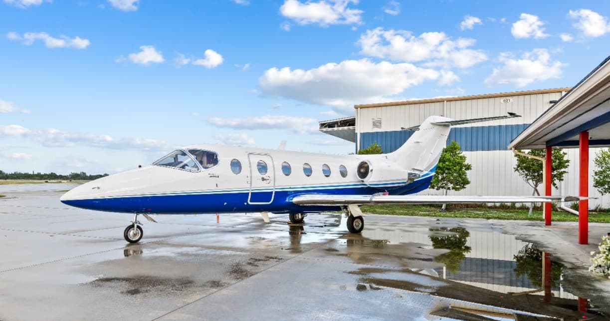 Wed, Nov 4TomorrowGeorge TownMYEF · Exuma International AirportFort MyersKFMY · Page FieldHawker 400XP7—$5,7754NovGeorge Town → Fort MyersMYEF → KFMY · TomorrowHawker 400XP · 7 seats$5,775
- Wed, Nov 4TomorrowMadisonKMSN · Dane County Regional Truax FieldFort MyersKFMY · Page FieldEmbraer Phenom 1004—$11,2204NovMadison → Fort MyersKMSN → KFMY · TomorrowEmbraer Phenom 100 · 4 seats$11,220
- Wed, Nov 4TomorrowGeorge TownMYEF · Exuma International AirportFort MyersKFMY · Page FieldBeechcraft Beechjet 400A71h 12mOn request4NovGeorge Town → Fort MyersMYEF → KFMY · TomorrowBeechcraft Beechjet 400A · 7 seats · 1h 12mOn request
- Thu, Nov 519:21NaplesKAPF · Naples Municipal AirportFort MyersKFMY · Page FieldCessna Citation III7—$7,0405NovNaples → Fort MyersKAPF → KFMY · 19:21Cessna Citation III · 7 seats$7,040
- Fri, Nov 6in 3 daysNorfolkKORF · Norfolk International AirportFort MyersKFMY · Page FieldCitation III——On request6NovNorfolk → Fort MyersKORF → KFMY · in 3 daysCitation IIIOn request
- Sun, Nov 813:06Punta GordaKPGD · Punta Gorda AirportFort MyersKFMY · Page FieldCessna Citation Excel8—$4,9508NovPunta Gorda → Fort MyersKPGD → KFMY · 13:06Cessna Citation Excel · 8 seats$4,950
 Sun, Nov 822:06Punta GordaKPGD · Punta Gorda AirportFort MyersKFMY · Page FieldCessna 414A5—$3,4238NovPunta Gorda → Fort MyersKPGD → KFMY · 22:06Cessna 414A · 5 seats$3,423
- Sat, Nov 14in 11 daysWest Palm BeachKLNA · Palm Beach County Park AirportFort MyersKFMY · Page FieldEpic E1000 GX442mOn request14NovWest Palm Beach → Fort MyersKLNA → KFMY · in 11 daysEpic E1000 GX · 4 seats · 42mOn request
 MYEF · Exuma International Airport
* Total price incl. 10% service fee, converted to your selected currency. Price subject to operator confirmation.
Map: Fort Myers Airport
View the location of Fort Myers – FMY/KFMY. Zoom in to explore the area around the airport.
About the airport
Page Field (FMY/KFMY) is the key private jet gateway for Fort Myers. PrivJet gives you instant access to charter flights and empty legs: fast, discreet and globally connected.
KFMY airport FAQ
Are there any restrictions at Fort Myers airport (KFMY) today?
There are currently 8 valid NOTAMs for Fort Myers (KFMY). Affected: Obstacle: out of service. For information only, not for flight planning or operational use. Always rely on an official pre-flight briefing. This list may be incomplete or out of date.
What is the weather at Fort Myers airport (KFMY)?
According to the latest weather report for KFMY (METAR, 03 Nov, 14:53 UTC): Good visual conditions (VFR). Wind 9 kt (17 km/h) from east (100°), visibility 10 km or more, temperature 27 °C (dew point 23 °C). For information only, not for flight planning. Weather can change quickly; always rely on official reports.
How long are the runways at Fort Myers airport (KFMY)?
Fort Myers (KFMY) has 2 runways: runway 05/23 with 1,953 m (6,406 ft), asphalt and runway 13/31 with 1,497 m (4,910 ft), asphalt. The longest is 1,953 m.
What are the radio frequencies at Fort Myers airport (KFMY)?
Frequencies at KFMY: Tower 119 MHz, Ground 121.7 MHz and ATIS 123.725 MHz. For information only. Always rely on the published AIP.
What are the airport codes of Page Field?
The ICAO code is KFMY and the IATA code is FMY. ICAO codes are used by air traffic control and pilots, e.g. in flight plans; IATA codes appear on tickets and baggage tags.
What is the elevation of KFMY airport?
Page Field sits at 17 ft (5 m) above sea level. Local time zone: America/New York.
Can I fly to KFMY by private jet?
Whether a private jet can operate into Page Field depends on runway length, opening hours, customs and immigration rules as well as slot and handling availability, among other things. PrivJet checks this with the operating carrier for every request.
Are there empty legs from or to KFMY?
There are currently 29 empty legs departing from and 15 arriving at Page Field. Empty legs are repositioning flights at heavily reduced prices; the list is updated several times a day.