Fort Worth Meacham Airport (KFTW / FTW)
Empty legs and charters from Fort Worth
KFTW airport at a glance
- ICAO code
- KFTW
- IATA code
- FTW
- City
- Fort Worth
- Region
- Texas
- Country
- United States
- Elevation
- 710 ft (216 m)
- Time zone
- America/Chicago (UTC-6)
- Coordinates
- 32.8198° N, 97.3624° W
- Empty legs from
- 66
- Empty legs to
- 54
Private jet terminal & FBOs at Fort Worth Meacham
- Modern Aviation Fort Worth (FTW)251 American Concourse, Fort Worth, TX 76106
- Texas Jet200 Texas Way, Fort Worth, TX 76106
Weather & airport info KFTW
Current weather
Good visual conditions (VFR)observed 03 Nov, 01:53 UTC- Wind
- 11 kt (20 km/h) from south (170°), gusts up to 20 kt
- Visibility
- 10 km or more
- Clouds
- scattered clouds at 4,100 ft, overcast at 5,500 ft
- Temperature
- 26 °C (dew point 19 °C)
- Pressure (QNH)
- 1,009 hPa
Original weather report (METAR)
METAR KFTW 030153Z 17011G20KT 10SM SCT041 OVC055 26/19 A2978 RMK AO2 SLP078 T02560189
Forecast (TAF)
- 03 Nov, 02:00–04:00 UTC12 kt (22 km/h) from south (170°), gusts up to 22 kt · visibility 10 km or more · scattered clouds at 4,000 ft, broken clouds at 6,000 ft
- 03 Nov, 04:00–08:00 UTCfrom15 kt (28 km/h) from south (180°), gusts up to 25 kt · visibility 10 km or more · Thunderstorm in the vicinity · scattered clouds at 3,500 ft, broken clouds at 5,000 ft
- 03 Nov, 05:00–07:00 UTCtemporarily25 kt (46 km/h) from west (260°), gusts up to 40 kt · visibility 3 km · Heavy thunderstorm with rain · broken clouds at 2,500 ft
- 03 Nov, 08:00–11:00 UTCfrom11 kt (20 km/h) from south-southwest (200°) · visibility 10 km or more · few clouds at 2,500 ft, scattered clouds at 12,000 ft
- 03 Nov, 11:00–00:00 UTCfrom15 kt (28 km/h) from west-northwest (300°), gusts up to 25 kt · visibility 10 km or more · scattered clouds at 5,000 ft
Original forecast (TAF)
TAF KFTW 030201Z 0302/0324 17012G22KT P6SM SCT040 BKN060 FM030400 18015G25KT P6SM VCTS SCT035CB BKN050 TEMPO 0305/0307 26025G40KT 2SM +TSRA BKN025CB FM030800 20011KT P6SM FEW025 SCT120 FM031100 30015G25KT P6SM SCT050
Airport
- Elevation
- 710 ft (216 m)
- Sunrise / Sunset
- 06:48 / 17:37 local time
Runways
| Runway | Length | Surface | Lighted |
|---|---|---|---|
| 16/34 | 2,287 m (7,502 ft) | concrete | yes |
| 17/35 | 1,221 m (4,005 ft) | asphalt | yes |
Radio frequencies
- ATIS: 120.7
- Clearance: 124.65
- Ground: 121.9
- Tower: 118.3
- UNICOM: 122.95
For information only, not for flight planning. Weather can change quickly; always rely on official reports. Sources: aviationweather.gov (NOAA), OurAirports.
Airport map KFTW
Full screen →Runways white, taxiways yellow with designators, closed taxiways and runways per NOTAM in red.
Official charts (FAA)
Cycle 2611, valid until 0901Z 11/26/26
Airport diagram (FAA)
Airport diagram (1)
Instrument approaches (4)
Departure procedures (18)
- BOTCH TWO (RNAV)
- BOTCH TWO (RNAV), CONT.1
- DALLAS FOUR
- DALLAS FOUR, CONT.1
- GARLAND SIX
- GARLAND SIX, CONT.1
- JOE POOL EIGHT
- JOE POOL EIGHT, CONT.1
- KINGDOM FIVE
- KINGDOM FIVE, CONT.1
- KUSSO THREE (RNAV)
- KUSSO THREE (RNAV), CONT.1
- NANDR FOUR (RNAV)
- NANDR FOUR (RNAV), CONT.1
- TEXOMA FIVE
- TEXOMA FIVE, CONT.1
- WORTH ONE
- WORTH ONE, CONT.1
Minimums (2)
For information only, not for navigation. Always use current official charts and NOTAMs.
Current NOTAMs for KFTW(14)
NOTAMs (Notices to Air Missions) announce short-term changes at an airport: closed runways or taxiways, unserviceable approach aids, obstacles, airspace restrictions.
- Out of serviceObstacle11/045· until 31 Jan, 23:59 UTC
A tower near the airport, with its top at 3423.17 feet above sea level (141.17 feet above ground), has its lighting out of service and is an obstacle.
Show original text
OBST TOWER LGT (ASR UNKNOWN) 340744.79N1012628.29W (9.43NM NW 41F) 3423.17FT (141.17FT AGL) U/S
- Out of serviceRunway10/001· until 07 Nov, 18:00 UTC
The Precision Approach Path Indicator (PAPI) for runway 17 is out of service. This system helps pilots maintain the correct glide path to the runway.
Show original text
RWY 17 PAPI U/S
- Out of serviceILS outer marker: unserviceableA1346/26· until 01 Jan, 23:59 UTC
The Instrument Landing System (ILS) for runway 16, specifically the outer marker, is out of service. The ILS guides aircraft to the runway in poor visibility.
Show original text
FTW NAV ILS RWY 16 OM U/S
A1346/26 NOTAMN
Q) KZFW/QIOAS////000/999/3249N09721W005
A) KFTW
B) 2610290042
C) 2701012359
E) FTW NAV ILS RWY 16 OM U/S
- Out of serviceObstacle10/151· until 31 Dec, 10:35 UTC
A tower light (ASR 1213187) 0.8 nautical miles southeast of the airport is out of service; its top is 797.2 feet above sea level, 160.1 feet above ground.
Show original text
OBST TOWER LGT (ASR 1213187) 324836.10N0972103.00W (0.8NM SE FTW) 797.2FT (160.1FT AGL) U/S
- NoticeAirspace11/041· from 03 Nov, 13:00 UTC · until 04 Nov, 01:00 UTC
The airspace is restricted for numerous Unmanned Aircraft Systems (UAS) within an area defined as a 6.48 nautical mile radius of 324510N0965416W (4.2 nautical miles north-northwest of RBD) from the surface to 400 feet above ground.
Show original text
AIRSPACE NUMEROUS UAS WI AN AREA DEFINED AS 6.48NM RADIUS OF 324510N0965416W (4.2NM NNW RBD) SFC-400FT AGL
- NoticeAirspace11/040· from 03 Nov, 12:00 UTC · until 03 Nov, 23:59 UTC
The airspace is restricted for numerous Unmanned Aircraft Systems (UAS) within an area defined as a 6.47 nautical mile radius of 325924N0963944W (9.6 nautical miles east of ADS) from the surface to 400 feet above ground.
Show original text
AIRSPACE NUMEROUS UAS WI AN AREA DEFINED AS 6.47NM RADIUS OF 325924N0963944W (9.6NM E ADS) SFC-400FT AGL
- NoticeTaxiway: work in progressA1365/26· until 02 Feb, 23:00 UTC
Apron taxilane J construction work nearby SW SIDE lighted and BARRICADED
Show original text
APRON TXL J WIP CONST ADJ SW SIDE LGTD AND BARRICADED
A1365/26 NOTAMN
Q) KZFW/QMXHW////000/999/3249N09721W005
A) KFTW
B) 2611022033
C) 2702022300
E) APRON TXL J WIP CONST ADJ SW SIDE LGTD AND BARRICADED
- NoticeObstacle: erectedA1360/26· permanent
A crane is an obstacle. Its top is 785 feet above sea level, 75 feet above ground, and it is flagged. It is located 0.71 nautical miles west of the approach end of runway 16.
Show original text
OBST CRANE (ASN UNKNOWN) 324846N0972212W (.71NM W APCH END RWY 16) 785FT (75FT AGL) FLAGGED
A1360/26 NOTAMN
Q) KZFW/QOBCE/IV/M/AE/000/999/3249N09721W005
A) KFTW
B) 2611012207
C) PERM
E) OBST CRANE (ASN UNKNOWN) 324846N0972212W (.71NM W APCH END RWY 16)
 785FT (75FT AGL) FLAGGED
6 more NOTAMs
- NoticeAirspace10/936· until 14 Mar, 03:00 UTC
Unmanned Aircraft Systems (UAS) are operating within a defined area near COWBOY airport, from the surface up to 400 feet above ground.
Show original text
AIRSPACE UAS WI AN AREA DEFINED AS 323127.90N0970102.40W (4.6NM W T56) TO 323027.50N0964652.10W (5.2NM WNW T13) TO 323253.60N0964400.30W (1.9NM SSW LNC) TO 323513.40N0964316.90W (0.6NM NNW LNC) TO 323745.10N0964355.10W (3.2NM NNW LNC) TO 323956.10N0964630.50W (4.8NM E RBD) TO 323726.10N0964841.20W (4.5NM SE RBD) TO 323612.20N0965137.80W (4.7NM S RBD) TO 323631N0965417.20W (4.7NM SSW RBD) TO 324100.10N0965410.50W (1.7NM W RBD) TO 324219.70N0965552W (3.5NM WNW RBD) TO 324214.60N0965652.40W (4.2NM WNW RBD) TO 324159N0965705.30W (4.3NM W RBD) TO 324211.70N0965721.50W (4.6NM W RBD) TO 324156N0965735.10W (4.4NM E GPM) TO 324208.70N0965750.70W (4.2NM E GPM) TO 323924.10N0965928.10W (3.8NM SE GPM) TO POINT OF ORIGIN SFC-400FT AGL
- NoticeAirspace10/942· until 13 Mar, 22:30 UTC
Unmanned Aircraft Systems (UAS) are active within a defined area around KFTW airport, from the surface up to 400 feet above ground. These are drones or other uncrewed aerial vehicles.
Show original text
AIRSPACE UAS WI AN AREA DEFINED AS 331334.10N0965151.60W (6.3NM W T31) TO 331339.10N0964551W (1.6NM NW T31) TO 331143N0964030.80W (3.5NM E T31) TO 330836.20N0963948W (4.3NM WSW TKI) TO 330306.30N0964141.60W (7.4NM ENE F69) TO 330141.80N0964633.20W (3.1NM E F69) TO 330235.60N0964947.20W (1.2NM NNE F69) TO 330209.10N0965227.70W (2.0NM WNW F69) TO 330339.60N0965458.40W (4.6NM WNW F69) TO 330916.20N0965720.60W (3.3NM ENE 30F) TO 331232.50N0965311W (7.3NM W T31) TO 331230.20N0965300.80W (7.1NM W T31) TO 331237N0965301.60W (7.1NM W T31) TO 331236.30N0965253.10W (7.0NM W T31) TO 331243.50N0965256.80W (7.1NM W T31) TO POINT OF ORIGIN SFC-400FT AGL
- NoticeAirspace10/947· until 13 Mar, 22:30 UTC
Unmanned Aircraft Systems (UAS) are active within a defined area around KFTW airport, from the surface up to 400 feet above ground. These are drones or other uncrewed aerial vehicles.
Show original text
AIRSPACE UAS WI AN AREA DEFINED AS 324238N0963629.50W (4.5NM WSW HQZ) TO 323905.30N0963832.20W (5.8NM NE LNC) TO 323539.70N0963355.50W (7.8NM ENE LNC) TO 324014.10N0963031.80W (4.7NM SSE HQZ) TO 324048.20N0963415.10W (4.5NM SSW HQZ) TO 324204.80N0963553.10W (4.4NM SW HQZ) TO 324200.50N0963608.40W (4.6NM SW HQZ) TO 324217.70N0963611.80W (4.5NM SW HQZ) TO 324214.30N0963627.70W (4.7NM SW HQZ) TO POINT OF ORIGIN SFC-400FT AGL
- NoticeAirspace10/943· until 14 Mar, 04:00 UTC
Unmanned Aircraft Systems (UAS) are active within a defined area around KFTW airport, from the surface up to 400 feet above ground. These are drones or other uncrewed aerial vehicles.
Show original text
AIRSPACE UAS WI AN AREA DEFINED AS 330621.40N0963223W (4.9NM SSE TKI) TO 330223.80N0963120.30W (7.9NM NW F46) TO 330223.50N0962813.70W (6.8NM NNW F46) TO 325729.30N0962703.60W (1.8NM NNW F46) TO 325243.20N0963749.80W (9.4NM NW HQZ) TO 325443.20N0964417.80W (6.0NM ESE ADS) TO 330059.70N0964421.10W (4.9NM E F69) TO 330118.20N0964350.30W (5.4NM E F69) TO 330113.70N0964340.20W (5.5NM E F69) TO 330120N0964336.70W (5.6NM E F69) TO 330117.70N0964328.50W (5.7NM E F69) TO 330126.70N0964325.80W (5.7NM E F69) TO 330621.40N0963223W (4.9NM SSE TKI) TO POINT OF ORIGIN SFC-400FT AGL
- NoticeObstacle: erectedA1302/26· until 30 Nov, 23:59 UTC
A crane near Fort Worth Meacham International airport, 0.2 nautical miles east, is not lit and is flagged. Its top is 827 feet above sea level, 140 feet above ground.
Show original text
OBST CRANE LGT (ASN 2026-ASW-591-NRA) 324910N0972127W (0.2NM E FTW) 827FT (140FT AGL) FLAGGED, NOT LGTD
A1302/26 NOTAMN
Q) KZFW/QOBCE/IV/M/AE/000/999/3249N09721W005
A) KFTW
B) 2610141300
C) 2611302359
D) DLY SR-SS
E) OBST CRANE LGT (ASN 2026-ASW-591-NRA) 324910N0972127W (0.2NM E FTW) 827FT (140FT AGL) FLAGGED, NOT LGTD
Hours: DLY SR-SS
- NoticeAirspace10/441· until 11 Oct, 23:59 UTC
The airspace in a defined area near the airport is restricted for unmanned aircraft systems (UAS) up to 400 feet above ground (AGL). This affects the airspace near F69, ADS, DFW, and 30F.
Show original text
AIRSPACE UAS WI AN AREA DEFINED AS 330649.70N0965109.40W (5.5NM NNW F69) TO 330533.70N0965108.60W (4.2NM NNW F69) TO 330527.30N0965002.60W (4.0NM N F69) TO 330502.20N0964617.20W (4.9NM NE F69) TO 330518.10N0964532.10W (5.5NM NE F69) TO 330534.80N0964447.70W (6.2NM NE F69) TO 330338.30N0964438.90W (5.2NM ENE F69) TO 325816.70N0964140.20W (7.2NM E ADS) TO 325757.10N0964229.70W (6.5NM E ADS) TO 330048N0964918.70W (1.0NM SE F69) TO 330048.40N0965500.40W (4.1NM WSW F69) TO 325754.10N0965521.80W (4.4NM W ADS) TO 325531.60N0965951.10W (2.6NM NE DFW) TO 325850.50N0970437.90W (5.4NM NNW DFW) TO 330320N0970231.10W (4.8NM S 30F) TO 330534.20N0965744.10W (3.5NM SE 30F) TO 330556.50N0965631.90W (4.1NM ESE 30F) TO 330503.90N0965730.80W (4.0NM SE 30F) TO 330526.10N0965618.60W (4.5NM ESE 30F) TO POINT OF ORIGIN SFC-400FT AGL
For information only, not for flight planning or operational use. Always rely on an official pre-flight briefing. This list may be incomplete or out of date. Explanations and expanded abbreviations are generated automatically. The original text is authoritative. Source: FAA NOTAM Management Service (SWIM).
Private jet traffic in Fort Worth Meacham International Airport (last 30 days)
- Arrivals
- 1,646
- Departures
- 1,282
- Different jets
- 903
Most frequent origins: Austin Bergstrom International Airport (47), Dallas Love Field (43), Addison Airport (34), Centennial Airport (26), William P Hobby Airport (23).
Most frequent destinations: Midland International Air and Space Port Airport (50), Austin Bergstrom International Airport (45), Dallas Love Field (37), Lubbock Preston Smith International Airport (32), William P Hobby Airport (28).
Most common aircraft types: Cessna Citation V/Ultra/Encore (268), Embraer Phenom 300 (223), Cessna Citation Excel/XLS (152), Cessna Citation CJ2 (135), Cessna Citation X (131).
Our own analysis of public ADS-B signals from business jets. Not every flight is received, and jets with a removal request are excluded.
Charter operators based here
Operators with a base at this airport.
- Solairus AviationVan Nuys (KVNY) · Turboprop, Light jet, Midsize jet
- Executive Jet ManagementWhite Plains (Westchester County) (KHPN) · Light jet, Midsize jet, Super midsize jet
- Baker AviationSuper midsize jet
- Air Center HelicoptersFort Worth Spinks (KFWS) · Heavy jet, Helicopter
- Jet OutLight jet
- RVR AviationLight jet, Super midsize jet
- Longhorn HelicoptersHelicopter
- Avalon AirMidsize jet
- Epic Helicopters Sales & LeasingHelicopter
- Lifeguard AeromedPiston aircraft
Empty legs from KFTW
66 departures available
- Tue, Nov 3TodayFort WorthKFTW · Fort Worth Meacham International AirportVan NuysKVNY · Van Nuys AirportChallenger 30010—$23,6503NovFort Worth → Van NuysKFTW → KVNY · TodayChallenger 300 · 10 seats$23,650
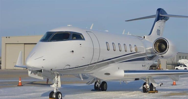 Wed, Nov 4TomorrowFort WorthKFTW · Fort Worth Meacham International AirportChicagoKMDW · Chicago Midway International AirportChallenger 3008—On request4NovFort Worth → ChicagoKFTW → KMDW · TomorrowChallenger 300 · 8 seatsOn request
- Wed, Nov 4TomorrowFort WorthKFTW · Fort Worth Meacham International AirportAbileneKABI · Abilene Regional AirportCessna Citation CJ48—On request4NovFort Worth → AbileneKFTW → KABI · TomorrowCessna Citation CJ4 · 8 seatsOn request
- Wed, Nov 4TomorrowFort WorthKFTW · Fort Worth Meacham International AirportIndianapolisKIND · Indianapolis International AirportCessna Citation CJ48—On request4NovFort Worth → IndianapolisKFTW → KIND · TomorrowCessna Citation CJ4 · 8 seatsOn request
- Wed, Nov 4TomorrowFort WorthKFTW · Fort Worth Meacham International AirportCollege StationKCLL · Easterwood FieldCessna Citation CJ48—On request4NovFort Worth → College StationKFTW → KCLL · TomorrowCessna Citation CJ4 · 8 seatsOn request
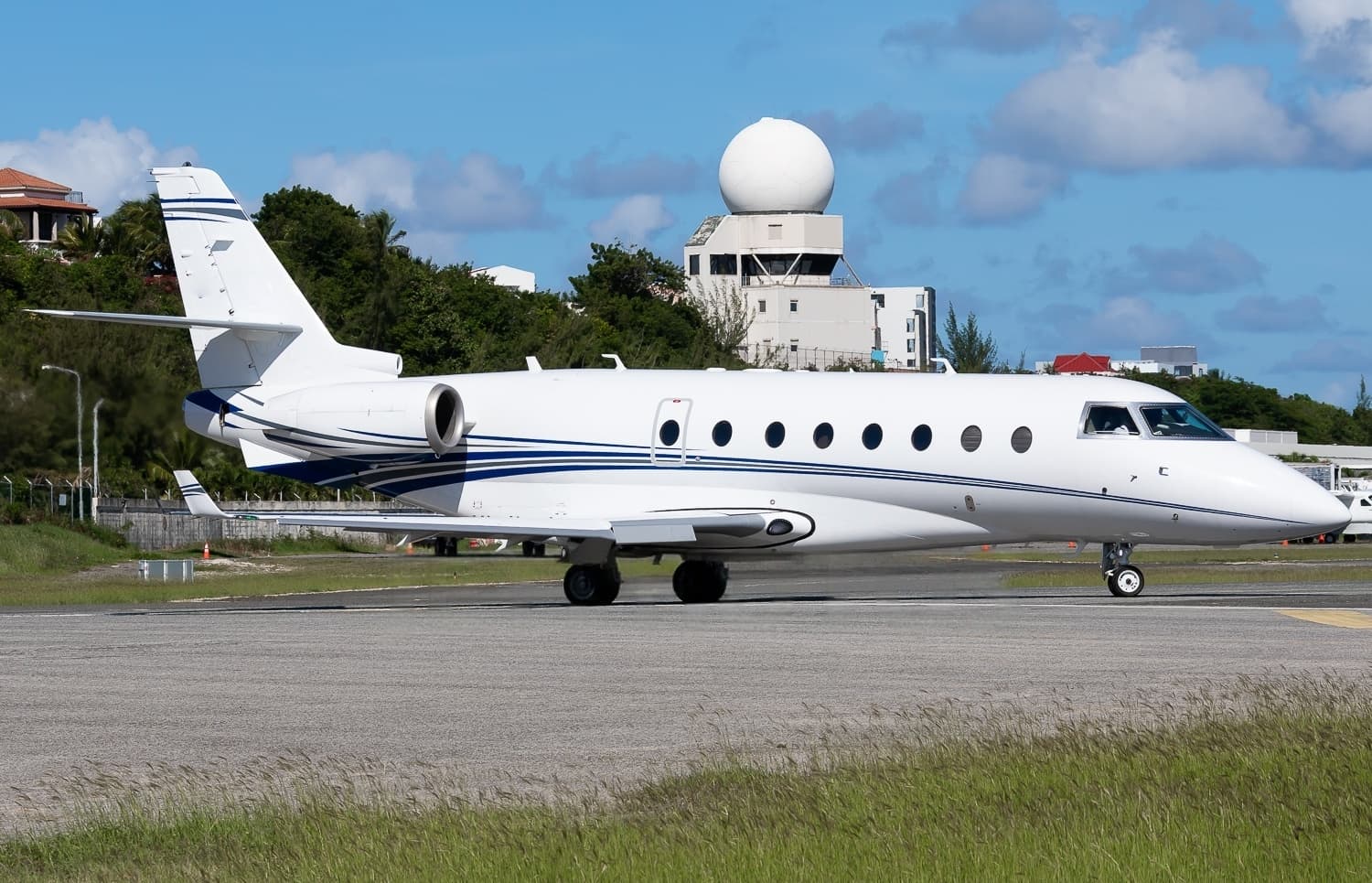 Thu, Nov 5in 2 daysFort WorthKFTW · Fort Worth Meacham International AirportAtlantaKPDK · DeKalb Peachtree AirportGulfstream G2009—$14,0685NovFort Worth → AtlantaKFTW → KPDK · in 2 daysGulfstream G200 · 9 seats$14,068
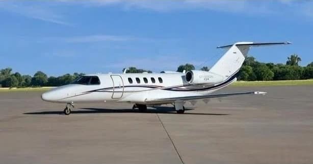 Thu, Nov 5in 2 daysFort WorthKFTW · Fort Worth Meacham International AirportChesterKRST · Rochester International AirportCitation CJ49—$13,7505NovFort Worth → ChesterKFTW → KRST · in 2 daysCitation CJ4 · 9 seats$13,750
- Thu, Nov 506:00Fort WorthKFTW · Fort Worth Meacham International AirportFrederickKFDK · Frederick Municipal AirportCessna Citation CJ48—$20,5705NovFort Worth → FrederickKFTW → KFDK · 06:00Cessna Citation CJ4 · 8 seats$20,570
- Thu, Nov 5in 2 daysFort WorthKFTW · Fort Worth Meacham International AirportHoustonKHOU · William P. Hobby AirportCessna Citation Excel8—$4,7305NovFort Worth → HoustonKFTW → KHOU · in 2 daysCessna Citation Excel · 8 seats$4,730
 KFTW · Fort Worth Meacham International Airport
* Total price incl. 10% service fee, converted to your selected currency. Price subject to operator confirmation.
Empty legs to KFTW
54 arrivals available
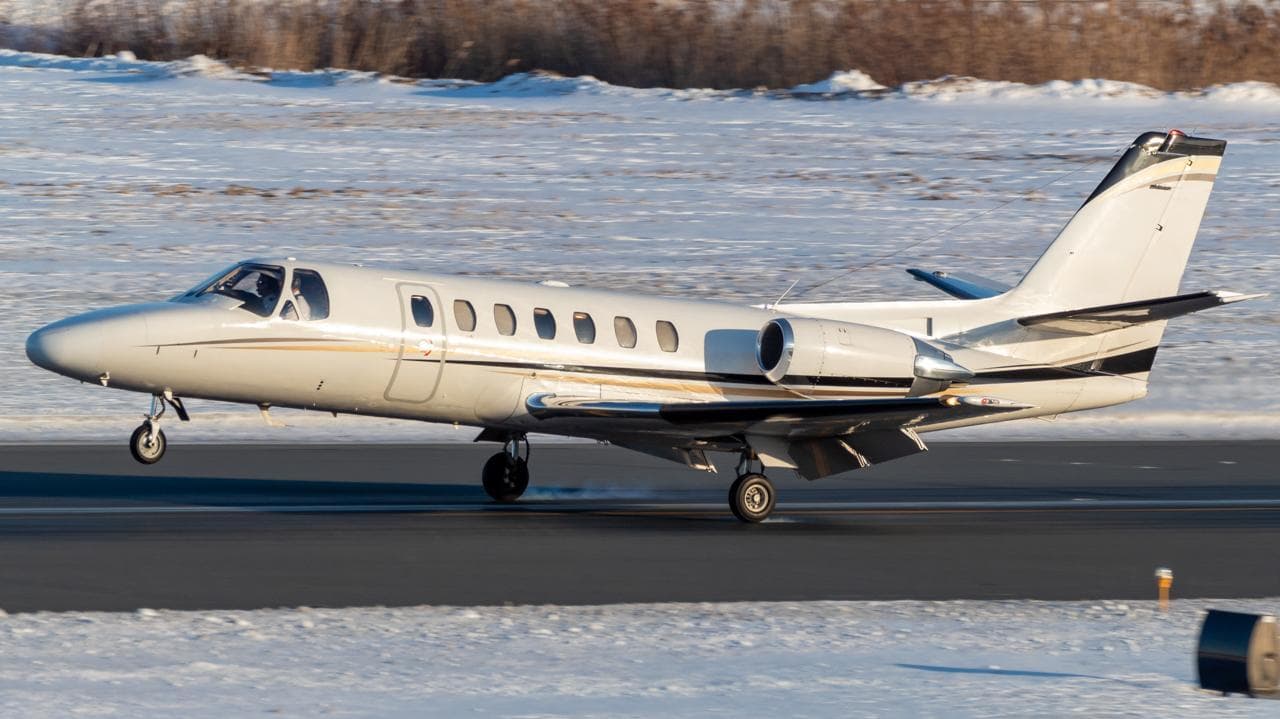 Wed, Nov 4TomorrowHoustonKHOU · William P Hobby AirportFort WorthKFTW · Fort Worth Meacham International AirportCitation Ultra7—$3,8244NovHouston → Fort WorthKHOU → KFTW · TomorrowCitation Ultra · 7 seats$3,824
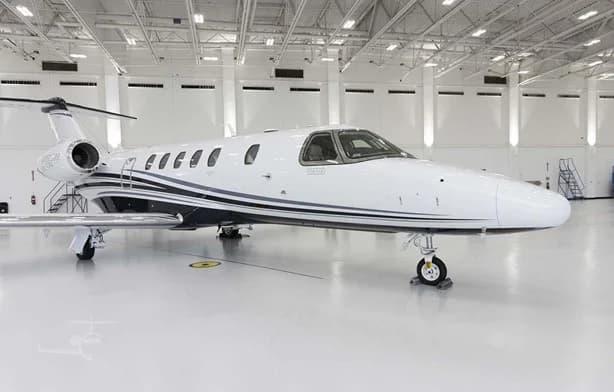 Wed, Nov 4TomorrowSarasotaKSRQ · Sarasota Bradenton International AirportFort WorthKFTW · Fort Worth Meacham International AirportCitation CJ49—$19,1184NovSarasota → Fort WorthKSRQ → KFTW · TomorrowCitation CJ4 · 9 seats$19,118
- Wed, Nov 4TomorrowColorado SpringsKCOS · City of Colorado Springs Municipal AirportFort WorthKFTW · Fort Worth Meacham International AirportCitation X12—$14,1904NovColorado Springs → Fort WorthKCOS → KFTW · TomorrowCitation X · 12 seats$14,190
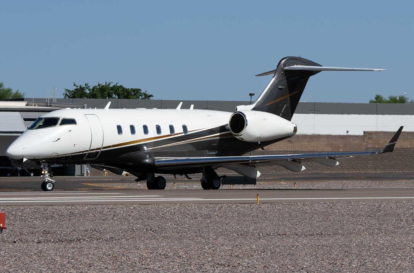 Thu, Nov 5in 2 daysNew OrleansKMSY · Louis Armstrong New Orleans International AirportFort WorthKFTW · Fort Worth Meacham International AirportChallenger 3008—On request5NovNew Orleans → Fort WorthKMSY → KFTW · in 2 daysChallenger 300 · 8 seatsOn request
- Thu, Nov 5in 2 daysAustinKAUS · Austin Bergstrom International AirportFort WorthKFTW · Fort Worth Meacham International AirportCessna Citation CJ48—On request5NovAustin → Fort WorthKAUS → KFTW · in 2 daysCessna Citation CJ4 · 8 seatsOn request
 Thu, Nov 513:00HoustonKHOU · William P Hobby AirportFort WorthKFTW · Fort Worth Meacham International AirportCessna Citation Ultra154m$3,5735NovHouston → Fort WorthKHOU → KFTW · 13:00Cessna Citation Ultra · 1 seat · 54m$3,573
 Thu, Nov 5in 2 daysHoustonKHOU · William P Hobby AirportFort WorthKFTW · Fort Worth Meacham International AirportCitation Ultra7—$4,9155NovHouston → Fort WorthKHOU → KFTW · in 2 daysCitation Ultra · 7 seats$4,915
 Fri, Nov 6in 3 daysHoustonKHOU · William P Hobby AirportFort WorthKFTW · Fort Worth Meacham International AirportGulfstream GIV14—$8,6906NovHouston → Fort WorthKHOU → KFTW · in 3 daysGulfstream GIV · 14 seats$8,690
 Fri, Nov 6in 3 daysMontereyKMRY · Monterey Peninsula AirportFort WorthKFTW · Fort Worth Meacham International AirportGulfstream GV14—$30,2506NovMonterey → Fort WorthKMRY → KFTW · in 3 daysGulfstream GV · 14 seats$30,250
* Total price incl. 10% service fee, converted to your selected currency. Price subject to operator confirmation.
Map: Fort Worth Airport
View the location of Fort Worth – FTW/KFTW. Zoom in to explore the area around the airport.
About the airport
Fort Worth Meacham International Airport (FTW/KFTW) is the key private jet gateway for Fort Worth. PrivJet gives you instant access to charter flights and empty legs: fast, discreet and globally connected.
KFTW airport FAQ
Are there any restrictions at Fort Worth airport (KFTW) today?
There are currently 12 valid NOTAMs for Fort Worth (KFTW). Affected: Obstacle: out of service; Runway: out of service; ILS outer marker: unserviceable. 2 more NOTAMs start in the coming days. For information only, not for flight planning or operational use. Always rely on an official pre-flight briefing. This list may be incomplete or out of date.
What is the weather at Fort Worth airport (KFTW)?
According to the latest weather report for KFTW (METAR, 03 Nov, 01:53 UTC): Good visual conditions (VFR). Wind 11 kt (20 km/h) from south (170°), gusts up to 20 kt, visibility 10 km or more, temperature 26 °C (dew point 19 °C). For information only, not for flight planning. Weather can change quickly; always rely on official reports.
How long are the runways at Fort Worth airport (KFTW)?
Fort Worth (KFTW) has 2 runways: runway 16/34 with 2,287 m (7,502 ft), concrete and runway 17/35 with 1,221 m (4,005 ft), asphalt. The longest is 2,287 m.
What are the radio frequencies at Fort Worth airport (KFTW)?
Frequencies at KFTW: Tower 118.3 MHz, Ground 121.9 MHz and ATIS 120.7 MHz. For information only. Always rely on the published AIP.
What are the airport codes of Fort Worth Meacham International Airport?
The ICAO code is KFTW and the IATA code is FTW. ICAO codes are used by air traffic control and pilots, e.g. in flight plans; IATA codes appear on tickets and baggage tags.
What is the elevation of KFTW airport?
Fort Worth Meacham International Airport sits at 710 ft (216 m) above sea level. Local time zone: America/Chicago.
Where do private jets land at Fort Worth Meacham?
KFTW has 2 private jet terminals or FBOs: Modern Aviation Fort Worth (FTW) and Texas Jet. Your flight confirmation says which one your operator uses.
Can I fly to KFTW by private jet?
Whether a private jet can operate into Fort Worth Meacham International Airport depends on runway length, opening hours, customs and immigration rules as well as slot and handling availability, among other things. PrivJet checks this with the operating carrier for every request.
Are there empty legs from or to KFTW?
There are currently 66 empty legs departing from and 54 arriving at Fort Worth Meacham International Airport. Empty legs are repositioning flights at heavily reduced prices; the list is updated several times a day.