Fort Lauderdale Executive Airport (KFXE / FXE)
Empty legs and charters from Fort Lauderdale
KFXE airport at a glance
- ICAO code
- KFXE
- IATA code
- FXE
- City
- Fort Lauderdale
- Region
- Florida
- Country
- United States
- Elevation
- 13 ft (4 m)
- Time zone
- America/New York (UTC-5)
- Coordinates
- 26.1973° N, 80.1707° W
- Empty legs from
- 100
- Empty legs to
- 100
Private jet terminal & FBOs at Fort Lauderdale Executive
- Signature Aviation FXE1525 NW 56th Street, Fort Lauderdale, FL 33309
- Atlantic Aviation FXE6020 NW 28th Way, Fort Lauderdale, FL 33309
- Banyan Air Service5360 NW 20th Terrace, Fort Lauderdale, FL 33309
- W Aviation2400 W Cypress Creek Rd, Fort Lauderdale, FL 33309
Weather & airport info KFXE
Current weather
Good visual conditions (VFR)observed 03 Nov, 00:53 UTC- Wind
- 6 kt (11 km/h) from north-northwest (340°)
- Visibility
- 10 km or more
- Weather
- Light rain
- Clouds
- broken clouds at 4,500 ft, broken clouds at 6,000 ft, overcast at 9,000 ft
- Temperature
- 23 °C (dew point 22 °C)
- Pressure (QNH)
- 1,016 hPa
Original weather report (METAR)
METAR KFXE 030053Z 34006KT 9SM -RA BKN045 BKN060 OVC090 23/22 A2999 RMK AO2 SLP157 P0016 T02280222
Forecast (TAF)
- 03 Nov, 00:00–03:00 UTC7 kt (13 km/h) from north (350°) · visibility 10 km or more · Light thunderstorm with rain · broken clouds at 2,500 ft
- 03 Nov, 00:00–02:00 UTCtemporarily7 kt (13 km/h) from north-northwest (340°) · visibility 5 km · Thunderstorm with rain · broken clouds at 1,500 ft
- 03 Nov, 03:00–14:00 UTCfrom8 kt (15 km/h) from east (90°) · visibility 10 km or more · scattered clouds at 2,500 ft, broken clouds at 5,000 ft, overcast at 15,000 ft
- 03 Nov, 14:00–00:00 UTCfrom12 kt (22 km/h) from east (100°), gusts up to 22 kt · visibility 10 km or more · scattered clouds at 2,500 ft, broken clouds at 5,000 ft
Original forecast (TAF)
TAF KFXE 022333Z 0300/0324 35007KT 6SM -TSRA BKN025CB TEMPO 0300/0302 34007KT 3SM TSRA BKN015CB FM030300 09008KT P6SM SCT025 BKN050 OVC150 FM031400 10012G22KT P6SM SCT025 BKN050
Airport
- Elevation
- 13 ft (4 m)
- Sunrise / Sunset
- 06:30 / 17:37 local time
Runways
| Runway | Length | Surface | Lighted |
|---|---|---|---|
| 09/27 | 1,829 m (6,002 ft) | asphalt | yes |
| 13/31 | 1,219 m (4,000 ft) | asphalt | yes |
Radio frequencies
- ATIS: 119.85
- Clearance: 127.95
- Ground: 121.75
- Tower: 120.9
- UNICOM: 122.95
For information only, not for flight planning. Weather can change quickly; always rely on official reports. Sources: aviationweather.gov (NOAA), OurAirports.
Airport map KFXE
Full screen →Runways white, taxiways yellow with designators, closed taxiways and runways per NOTAM in red.
Official charts (FAA)
Cycle 2611, valid until 0901Z 11/26/26
Airport diagram (FAA)
Airport diagram (1)
Instrument approaches (3)
Departure procedures (13)
Minimums (2)
Hot spots (1)
LAHSO (1)
Other (19)
- BHHIA THREE (RNAV)
- BHHIA THREE (RNAV), CONT.1
- BHHIA THREE (RNAV), CONT.2
- CPTAN FOUR (RNAV)
- CPTAN FOUR (RNAV), CONT.1
- CPTAN FOUR (RNAV), CONT.2
- DEKAL NINE
- DVALL FOUR
- FORTL NINE
- JESTR TWO (RNAV)
- JESTR TWO (RNAV), CONT.1
- KYAKS THREE (RNAV)
- KYAKS THREE (RNAV), CONT.1
- OLAHS THREE (RNAV)
- OLAHS THREE (RNAV), CONT.1
- OLAHS THREE (RNAV), CONT.2
- TEEKY FOUR (RNAV)
- TEEKY FOUR (RNAV), CONT.1
- TOREZ ONE (RNAV)
For information only, not for navigation. Always use current official charts and NOTAMs.
Current NOTAMs for KFXE(13)
NOTAMs (Notices to Air Missions) announce short-term changes at an airport: closed runways or taxiways, unserviceable approach aids, obstacles, airspace restrictions.
- Out of serviceObstacle11/001· until 31 Jan, 08:04 UTC
A tower near the airport, with its top at 279.9 ft above sea level and 270.0 ft above ground, has its lighting out of service.
Show original text
OBST TOWER LGT (ASR 1030010) 262015.40N0803233.30W (21.5NM WNW FXE) 279.9FT (270.0FT AGL) U/S
- Out of serviceObstacle10/022· until 28 Jan, 05:50 UTC
The lighting on a tower 1.5 nautical miles west-southwest of Fort Lauderdale Executive Airport is out of service. Its top is 117.8 feet above sea level, 107.0 feet above ground.
Show original text
OBST TOWER LGT (ASR 1029116) 261126.00N0801148.10W (1.5NM WSW FXE) 117.8FT (107.0FT AGL) U/S
- Out of serviceTaxiway10/018· until 31 Dec, 17:00 UTC
The taxiway direction sign for taxiway E on taxiway C is out of service.
Show original text
TWY C TWY DIRECTION SIGN FOR TWY E LGT U/S
A0414/26 NOTAMN
Q) KZMA/QMXXX////000/999/2611N08010W005
A) KFXE
B) 2610271948
C) 2612311700
E) TWY C TWY DIRECTION SIGN FOR TWY E LGT U/S
- Out of serviceTaxiwayA0414/26· until 31 Dec, 17:00 UTC
The taxiway direction sign for taxiway E on taxiway C is out of service.
Show original text
TWY C TWY DIRECTION SIGN FOR TWY E LGT U/S
A0414/26 NOTAMN Q) KZMA/QMXXX////000/999/2611N08010W005 A) KFXE B) 2610271948 C) 2612311700 E) TWY C TWY DIRECTION SIGN FOR TWY E LGT U/S
- Out of serviceObstacle10/005· until 11 Jan, 04:00 UTC
An obstacle, a tower, is located 8.0 nautical miles northwest of the airport. Its top is 209.0 ft above sea level, 200.1 ft above ground, and its lighting is out of service.
Show original text
OBST TOWER LGT (ASR 1030023) 261700.40N0801718.00W (8.0NM NW FXE) 209.0FT (200.1FT AGL) U/S
- NoticeProcedure2777/26· until 02 Jan, 15:26 UTC (estimated)
Takeoff minimums and departure procedures have been amended. On runway 9 and 27, there are new temporary obstacles (cranes and rigs) near the runway, with their tops reaching up to 160 ft above sea level and 155 ft above ground.
Show original text
ODP FORT LAUDERDALE EXEC, FORT LAUDERDALE, FL. TAKEOFF MINIMUMS AND (OBSTACLE) DEPARTURE PROCEDURES AMDT 5... TAKEOFF MINIMUMS: RWY 9, 300-1 OR STANDARD WITH MINIMUM CLIMB OF 444 FT PER NM TO 300 (2025-ASO-10876-OE). RWY 27, 300-1 OR STANDARD WITH MINIMUM CLIMB OF 307 FT PER NM TO 300 (2026-ASO-13235-OE). ADD TAKEOFF OBSTACLE NOTES: RWY 9, TEMPORARY CRANE 2926FT FROM DER, 99FT LEFT OF CENTERLINE, 107FT AGL/ 113FT MSL (2026-ASO-11107-OE). TEMPORARY CRANE 5686FT FROM DER, 1677FT LEFT OF CENTERLINE, 155FT AGL/ 160FT MSL (2026-ASO-4518-OE). RWY 27, TEMPORARY CRANES AND RIGS BEGINNING 3994FT FROM DER, 620FT RIGHT OF CENTERLINE, UP TO 146FT AGL/ 150FT MSL (2025-ASO-13127 THRU 13135/13137/13138-OE). RWY 31, TEMPORARY CRANES BEGINNING 1895FT FROM DER, BEGINNING 2FT LEFT OF CENTERLINE, 125FT AGL/ 133FT MSL (2025-ASO-6996/6998/7000-NRA). TEMPORARY CRANES BEGINNING 1231FT FROM DER, BEGINNING 97FT RIGHT OF CENTERLINE, UP TO 125FT AGL/ 134FT MSL (2025-ASO-7002/7006/7008/7010/7012-NRA). TEMPORARY CRANE 190 MSL 3481FT NE OF RWY 27 (2025-ASO-10876-OE). TEMPORARY CRANE 168 MSL 4190FT W OF RWY 9 (2026-ASO-13235-OE). ALL OTHER DATA REMAINS AS PUBLISHED. 2610271526-2701021526EST
Q) KZMA/undefined/NBO/A/000/999/2611N08010W005
A) KFXE
B) 2610271525
C) 2706081523EST
E) FXE FORT LAUDERDALE EXEC, FORT LAUDERDALE, FL.
TAKEOFF MINIMUMS AND (OBSTACLE) DEPARTURE PROCEDURES AMDT 5...
TAKEOFF MINIMUMS: RWY 9, 300-1 OR STANDARD WITH MINIMUM CLIMB OF 444 FT PER NM TO 300 (2025-ASO-10876-OE). RWY 27, 300-1 OR STANDARD WITH MINIMUM CLIMB OF 307 FT PER NM TO 300 (2026-ASO-13235-OE). ADD TAKEOFF OBSTACLE NOTES: RWY 9, TEMPORARY CRANE 2926FT FROM DER, 99FT LEFT OF CENTERLINE, 107FT AGL/ 113FT MSL (2026-ASO-11107-OE). TEMPORARY CRANE 5686FT FROM DER, 1677FT LEFT OF CENTERLINE, 155FT AGL/ 160FT MSL (2026-ASO-4518-OE). RWY 27, TEMPORARY CRANES AND RIGS BEGINNING 3994FT FROM DER, 620FT RIGHT OF CENTERLINE, UP TO 146FT AGL/ 150FT MSL (2025-ASO-13127 THRU 13135/13137/13138-OE). RWY 31, TEMPORARY CRANES BEGINNING 1895FT FROM DER, BEGINNING 2FT LEFT OF CENTERLINE, 125FT AGL/ 133FT MSL (2025-ASO-6996/6998/7000-NRA). TEMPORARY CRANES BEGINNING 1231FT FROM DER, BEGINNING 97FT RIGHT OF CENTERLINE, UP TO 125FT AGL/ 134FT MSL (2025-ASO-7002/7006/7008/7010/7012-NRA). TEMPORARY CRANE 190 MSL 3481FT NE OF RWY 27 (2025-ASO-10876-OE). TEMPORARY CRANE 168 MSL 4190FT W OF RWY 9 (2026-ASO-13235-OE).  ALL OTHER DATA REMAINS AS PUBLISHED.
- NoticeObstacle clearance altitude: changedA0410/26· until 02 Jan, 15:26 UTC
Takeoff minimums and departure procedures have been amended. On runway 9 and 27, there are new temporary obstacles (cranes and rigs) near the runway, with their tops reaching up to 160 ft above sea level and 155 ft above ground.
Show original text
ODP FORT LAUDERDALE EXEC, FORT LAUDERDALE, FL. TAKEOFF MINIMUMS AND (OBSTACLE) DEPARTURE PROCEDURES AMDT 5... TAKEOFF MINIMUMS: RWY 9, 300-1 OR STANDARD WITH MINIMUM CLIMB OF 444 FT PER NM TO 300 (2025-ASO-10876-OE). RWY 27, 300-1 OR STANDARD WITH MINIMUM CLIMB OF 307 FT PER NM TO 300 (2026-ASO-13235-OE). ADD TAKEOFF OBSTACLE NOTES: RWY 9, TEMPORARY CRANE 2926FT FROM DER, 99FT LEFT OF CENTERLINE, 107FT AGL/ 113FT MSL (2026-ASO-11107-OE). TEMPORARY CRANE 5686FT FROM DER, 1677FT LEFT OF CENTERLINE, 155FT AGL/ 160FT MSL (2026-ASO-4518-OE). RWY 27, TEMPORARY CRANES AND RIGS BEGINNING 3994FT FROM DER, 620FT RIGHT OF CENTERLINE, UP TO 146FT AGL/ 150FT MSL (2025-ASO-13127 THRU 13135/13137/13138-OE). RWY 31, TEMPORARY CRANES BEGINNING 1895FT FROM DER, BEGINNING 2FT LEFT OF CENTERLINE, 125FT AGL/ 133FT MSL (2025-ASO-6996/6998/7000-NRA). TEMPORARY CRANES BEGINNING 1231FT FROM DER, BEGINNING 97FT RIGHT OF CENTERLINE, UP TO 125FT AGL/ 134FT MSL (2025-ASO-7002/7006/7008/7010/7012-NRA). TEMPORARY CRANE 190 MSL 3481FT NE OF RWY 27 (2025-ASO-10876-OE). TEMPORARY CRANE 168 MSL 4190FT W OF RWY 9 (2026-ASO-13235-OE). ALL OTHER DATA REMAINS AS PUBLISHED.
A0410/26 NOTAMN
Q) KZMA/QPOCH/I/NBO/A/000/999/2611N08010W005
A) KFXE
B) 2610271526
C) 2701021526
E) ODP FORT LAUDERDALE EXEC, FORT LAUDERDALE, FL. TAKEOFF MINIMUMS AND (OBSTACLE) DEPARTURE PROCEDURES AMDT 5... TAKEOFF MINIMUMS: RWY 9, 300-1 OR STANDARD WITH MINIMUM CLIMB OF 444 FT PER NM TO 300 (2025-ASO-10876-OE). RWY 27, 300-1 OR STANDARD WITH MINIMUM CLIMB OF 307 FT PER NM TO 300 (2026-ASO-13235-OE). ADD TAKEOFF OBSTACLE NOTES: RWY 9, TEMPORARY CRANE 2926FT FROM DER, 99FT LEFT OF CENTERLINE, 107FT AGL/ 113FT MSL (2026-ASO-11107-OE). TEMPORARY CRANE 5686FT FROM DER, 1677FT LEFT OF CENTERLINE, 155FT AGL/ 160FT MSL (2026-ASO-4518-OE). RWY 27, TEMPORARY CRANES AND RIGS BEGINNING 3994FT FROM DER, 620FT RIGHT OF CENTERLINE, UP TO 146FT AGL/ 150FT MSL (2025-ASO-13127 THRU 13135/13137/13138-OE). RWY 31, TEMPORARY CRANES BEGINNING 1895FT FROM DER, BEGINNING 2FT LEFT OF CENTERLINE, 125FT AGL/ 133FT MSL (2025-ASO-6996/6998/7000-NRA). TEMPORARY CRANES BEGINNING 1231FT FROM DER, BEGINNING 97FT RIGHT OF CENTERLINE, UP TO 125FT AGL/ 134FT MSL (2025-ASO-7002/7006/7008/7010/7012-NRA). TEMPORARY CRANE 190 MSL 3481FT NE OF RWY 27 (2025-ASO-10876-OE). TEMPORARY CRANE 168 MSL 4190FT W OF RWY 9 (2026-ASO-13235-OE). ALL OTHER DATA REMAINS AS PUBLISHED.
- NoticeProcedure9382/26· until 07 Nov, 11:03 UTC (estimated)
For the FORT LAUDERDALE TWO DEPARTURE standard departure route from Runway 27, takeoff minimums have changed. A temporary crane, with its top 168 ft above sea level, is located 4190 ft west of Runway 9.
Show original text
SID FORT LAUDERDALE EXEC, FORT LAUDERDALE, FL. FORT LAUDERDALE TWO DEPARTURE... TAKEOFF MINIMUMS: RWY 27, 300-1 OR STANDARD WITH MINIMUM CLIMB OF 307 FT PER NM TO 300 (2026-ASO-13235-OE). TEMPORARY CRANE 168 MSL 4190FT W OF RWY 9 (2026-ASO-13235-OE). ALL OTHER DATA REMAINS AS PUBLISHED. 2610141103-2611071103EST
Q) KZMA/undefined/NBO/A/000/999/2611N08010W005
A) KFXE
B) 2610131527
C) 2705251526EST
E) FXE FORT LAUDERDALE EXEC, FORT LAUDERDALE, FL.
FORT LAUDERDALE TWO DEPARTURE...
TAKEOFF MINIMUMS: RWY 27, 300-1 OR STANDARD WITH MINIMUM CLIMB OF 307 FT PER NM TO 300 (2026-ASO-13235-OE).  TEMPORARY CRANE 168 MSL 4190FT W OF RWY 9 (2026-ASO-13235-OE).  ALL OTHER DATA REMAINS AS PUBLISHED.
5 more NOTAMs
- NoticeProcedure9383/26· until 07 Nov, 11:03 UTC (estimated)
For the FRSBE TWO DEPARTURE (RNAV) and HROCK TWO DEPARTURE (RNAV) standard departure routes from Runway 27, takeoff minimums have changed. A temporary crane, with its top 168 ft above sea level, is located 4190 ft west of Runway 9.
Show original text
SID FORT LAUDERDALE EXEC, FORT LAUDERDALE, FL. FRSBE TWO DEPARTURE (RNAV)... HROCK TWO DEPARTURE (RNAV)... TAKEOFF MINIMUMS: RWY 27, STANDARD WITH MINIMUM CLIMB OF 307 FT PER NM TO 600 (2026-ASO-13235-OE). TEMPORARY CRANE 168 MSL 4190FT W OF RWY 9 (2026-ASO-13235-OE). ALL OTHER DATA REMAINS AS PUBLISHED. 2610141103-2611071103EST
Q) KZMA/undefined/NBO/A/000/999/2611N08010W005
A) KFXE
B) 2610131527
C) 2705251527EST
E) FXE FORT LAUDERDALE EXEC, FORT LAUDERDALE, FL.
FRSBE TWO DEPARTURE (RNAV)...
HROCK TWO DEPARTURE (RNAV)...
TAKEOFF MINIMUMS: RWY 27, STANDARD WITH MINIMUM CLIMB OF 307 FT PER NM TO 600 (2026-ASO-13235-OE).  TEMPORARY CRANE 168 MSL 4190FT W OF RWY 9 (2026-ASO-13235-OE).  ALL OTHER DATA REMAINS AS PUBLISHED.
- NoticeStandard instrument departure: changedA0393/26· until 07 Nov, 11:03 UTC
For the FRSBE TWO DEPARTURE (RNAV) and HROCK TWO DEPARTURE (RNAV) standard departure routes from Runway 27, takeoff minimums have changed. A temporary crane, with its top 168 ft above sea level, is located 4190 ft west of Runway 9.
Show original text
SID FORT LAUDERDALE EXEC, FORT LAUDERDALE, FL. FRSBE TWO DEPARTURE (RNAV)... HROCK TWO DEPARTURE (RNAV)... TAKEOFF MINIMUMS: RWY 27, STANDARD WITH MINIMUM CLIMB OF 307 FT PER NM TO 600 (2026-ASO-13235-OE). TEMPORARY CRANE 168 MSL 4190FT W OF RWY 9 (2026-ASO-13235-OE). ALL OTHER DATA REMAINS AS PUBLISHED.
A0393/26 NOTAMN
Q) KZMA/QPDCH/I/NBO/A/000/999/2611N08010W005
A) KFXE
B) 2610141103
C) 2611071103
E) SID FORT LAUDERDALE EXEC, FORT LAUDERDALE, FL. FRSBE TWO DEPARTURE (RNAV)... HROCK TWO DEPARTURE (RNAV)... TAKEOFF MINIMUMS: RWY 27, STANDARD WITH MINIMUM CLIMB OF 307 FT PER NM TO 600 (2026-ASO-13235-OE). TEMPORARY CRANE 168 MSL 4190FT W OF RWY 9 (2026-ASO-13235-OE). ALL OTHER DATA REMAINS AS PUBLISHED.
- NoticeStandard instrument departure: changedA0395/26· until 07 Nov, 11:03 UTC
For the FORT LAUDERDALE TWO DEPARTURE standard departure route from Runway 27, takeoff minimums have changed. A temporary crane, with its top 168 ft above sea level, is located 4190 ft west of Runway 9.
Show original text
SID FORT LAUDERDALE EXEC, FORT LAUDERDALE, FL. FORT LAUDERDALE TWO DEPARTURE... TAKEOFF MINIMUMS: RWY 27, 300-1 OR STANDARD WITH MINIMUM CLIMB OF 307 FT PER NM TO 300 (2026-ASO-13235-OE). TEMPORARY CRANE 168 MSL 4190FT W OF RWY 9 (2026-ASO-13235-OE). ALL OTHER DATA REMAINS AS PUBLISHED.
A0395/26 NOTAMN
Q) KZMA/QPDCH/I/NBO/A/000/999/2611N08010W005
A) KFXE
B) 2610141103
C) 2611071103
E) SID FORT LAUDERDALE EXEC, FORT LAUDERDALE, FL. FORT LAUDERDALE TWO DEPARTURE... TAKEOFF MINIMUMS: RWY 27, 300-1 OR STANDARD WITH MINIMUM CLIMB OF 307 FT PER NM TO 300 (2026-ASO-13235-OE). TEMPORARY CRANE 168 MSL 4190FT W OF RWY 9 (2026-ASO-13235-OE). ALL OTHER DATA REMAINS AS PUBLISHED.
- Out of serviceInstrument approach procedure9381/26· until 15 Jan, 11:02 UTC (estimated)
For the ILS OR LOC RWY 9, AMDT 5B instrument approach, visibility for all categories is reduced to 3/4 mile. Temporary cranes and rigs up to 150 ft above sea level begin 2798 ft west of Runway 9. A temporary crane, with its top 168 ft above sea level, is located 4190 ft west of Runway 9.
Show original text
IAP FORT LAUDERDALE EXEC, FORT LAUDERDALE, FL. ILS OR LOC RWY 9, AMDT 5B... S-ILS 9 VIS ALL CATS 3/4. S-LOC 9 VIS CATS A/B 3/4. TRUBE FIX MINIMUMS (DUAL VOR RECEIVERS REQUIRED): S-LOC 9 MDA 460/HAT 447 ALL CATS, VIS CATS A/B 3/4, CATS C/D 7/8. RWY 9 HELICOPTER VISIBILITY REDUCTION BELOW 3/4 SM NA. TEMPORARY CRANES AND RIGS UP TO 150 MSL BEGINNING 2798FT W OF RWY 9 (2025-ASO-13127 THRU 13135/13137/13138-OE). TEMPORARY CRANE 168 MSL 4190FT W OF RWY 9 (2026-ASO-13235-OE). 2610141102-2701151102EST
Q) KZMA/QPIXX/I/NBO/A/000/999/2611N08010W005
A) KFXE
B) 2610131529
C) 2705251528EST
E) FXE FORT LAUDERDALE EXEC, FORT LAUDERDALE, FL.
ILS OR LOC RWY 9, AMDT 5B...
S-ILS 9 VIS ALL CATS 3/4. S-LOC 9 VIS CATS A/B 3/4. TRUBE FIX MINIMUMS
(DUAL VOR RECEIVERS REQUIRED): S-LOC 9 MDA 460/HAT 447 ALL CATS, VIS CATS
A/B 3/4, CATS C/D 7/8. RWY 9 HELICOPTER VISIBILITY REDUCTION BELOW 3/4 SM
NA. TEMPORARY CRANES AND RIGS UP TO 150 MSL BEGINNING 2798FT W OF RWY 9
(2025-ASO-13127 THRU 13135/13137/13138-OE).  TEMPORARY CRANE 168 MSL 4190FT W OF RWY 9 (2026-ASO-13235-OE).
- Out of serviceInstrument approach procedure: changedA0392/26· until 15 Jan, 11:02 UTC
For the ILS OR LOC RWY 9, AMDT 5B instrument approach, visibility for all categories is reduced to 3/4 mile. Temporary cranes and rigs up to 150 ft above sea level begin 2798 ft west of Runway 9. A temporary crane, with its top 168 ft above sea level, is located 4190 ft west of Runway 9.
Show original text
IAP FORT LAUDERDALE EXEC, FORT LAUDERDALE, FL. ILS OR LOC RWY 9, AMDT 5B... S-ILS 9 VIS ALL CATS 3/4. S-LOC 9 VIS CATS A/B 3/4. TRUBE FIX MINIMUMS (DUAL VOR RECEIVERS REQUIRED): S-LOC 9 MDA 460/HAT 447 ALL CATS, VIS CATS A/B 3/4, CATS C/D 7/8. RWY 9 HELICOPTER VISIBILITY REDUCTION BELOW 3/4 SM NA. TEMPORARY CRANES AND RIGS UP TO 150 MSL BEGINNING 2798FT W OF RWY 9 (2025-ASO-13127 THRU 13135/13137/13138-OE). TEMPORARY CRANE 168 MSL 4190FT W OF RWY 9 (2026-ASO-13235-OE).
A0392/26 NOTAMN
Q) KZMA/QPICH/I/NBO/A/000/999/2611N08010W005
A) KFXE
B) 2610141102
C) 2701151102
E) IAP FORT LAUDERDALE EXEC, FORT LAUDERDALE, FL. ILS OR LOC RWY 9, AMDT 5B... S-ILS 9 VIS ALL CATS 3/4. S-LOC 9 VIS CATS A/B 3/4. TRUBE FIX MINIMUMS (DUAL VOR RECEIVERS REQUIRED): S-LOC 9 MDA 460/HAT 447 ALL CATS, VIS CATS A/B 3/4, CATS C/D 7/8. RWY 9 HELICOPTER VISIBILITY REDUCTION BELOW 3/4 SM NA. TEMPORARY CRANES AND RIGS UP TO 150 MSL BEGINNING 2798FT W OF RWY 9 (2025-ASO-13127 THRU 13135/13137/13138-OE). TEMPORARY CRANE 168 MSL 4190FT W OF RWY 9 (2026-ASO-13235-OE).
For information only, not for flight planning or operational use. Always rely on an official pre-flight briefing. This list may be incomplete or out of date. Explanations and expanded abbreviations are generated automatically. The original text is authoritative. Source: FAA NOTAM Management Service (SWIM).
Private jet traffic in Fort Lauderdale Executive Airport (last 30 days)
- Arrivals
- 1,502
- Departures
- 1,192
- Different jets
- 820
Most frequent origins: Palm Beach International Airport (45), Teterboro Airport (37), Miami-Opa Locka Executive Airport (36), Boca Raton Airport (36), Tampa International Airport (33).
Most frequent destinations: Miami-Opa Locka Executive Airport (37), Teterboro Airport (32), Palm Beach International Airport (31), Orlando Executive Airport (28), Boca Raton Airport (25).
Most common aircraft types: Hawker 800/900 (221), Bombardier Challenger 600/650 (139), Pilatus PC-12 (136), Learjet 60 (129), Gulfstream G450/GIV (119).
Our own analysis of public ADS-B signals from business jets. Not every flight is received, and jets with a removal request are excluded.
Charter operators based here
Operators with a base at this airport.
- Solairus AviationVan Nuys (KVNY) · Turboprop, Light jet, Midsize jet
- Executive Jet ManagementWhite Plains (Westchester County) (KHPN) · Light jet, Midsize jet, Super midsize jet
- Hera FlightMidsize jet, Super midsize jet, Heavy jet
- Journey AviationBoca Raton (KBCT) · Turboprop, Super midsize jet, Heavy jet
- Presidential AviationLight jet, Midsize jet, Super midsize jet
- Charter AirlinesSuper midsize jet
- A-OK JetsMidsize jet, Super midsize jet, Heavy jet
- Hop-A-Jet Worldwide Jet CharterMidsize jet, Super midsize jet
- True AviationWilkes-Barre (Scranton) (KAVP) · Light jet, Super midsize jet, Heavy jet
- Leviate Air GroupDallas (Love Field) (KDAL) · Light jet, Midsize jet, Super midsize jet
- Makers AirTurboprop
- Tropic Air ChartersHelicopter, Piston aircraft
- ExecuflightMidsize jet, Heavy jet
- Plane TravelTurboprop, Light jet, Piston aircraft
- SurJetMiami (Opa Locka) (KOPF) · Super midsize jet, Heavy jet
- Atlantic Air CharterLight jet, Midsize jet
- Upper JetsMiami (Opa Locka) (KOPF) · Midsize jet, Heavy jet
- Altivion AviationLight jet, Super midsize jet
- Eastern Air ExpressTeterboro (KTEB) · Turboprop
- Florida Jet ServiceMidsize jet, Super midsize jet, Helicopter
- Fly Live CharterLight jet, Piston aircraft
- WEJetMidsize jet, Super midsize jet
- Air FlightPiston aircraft
- Dorato JetsLight jet
- IsraflyMidsize jet
- South Florida Helicopter Charter & ToursHelicopter
- TLC JetBoca Raton (KBCT) · Midsize jet, Super midsize jet
- Choice AirwaysLight jet
- Exjet AviationHeavy jet
- K & A AviationPiston aircraft
Empty legs from KFXE
100 departures available
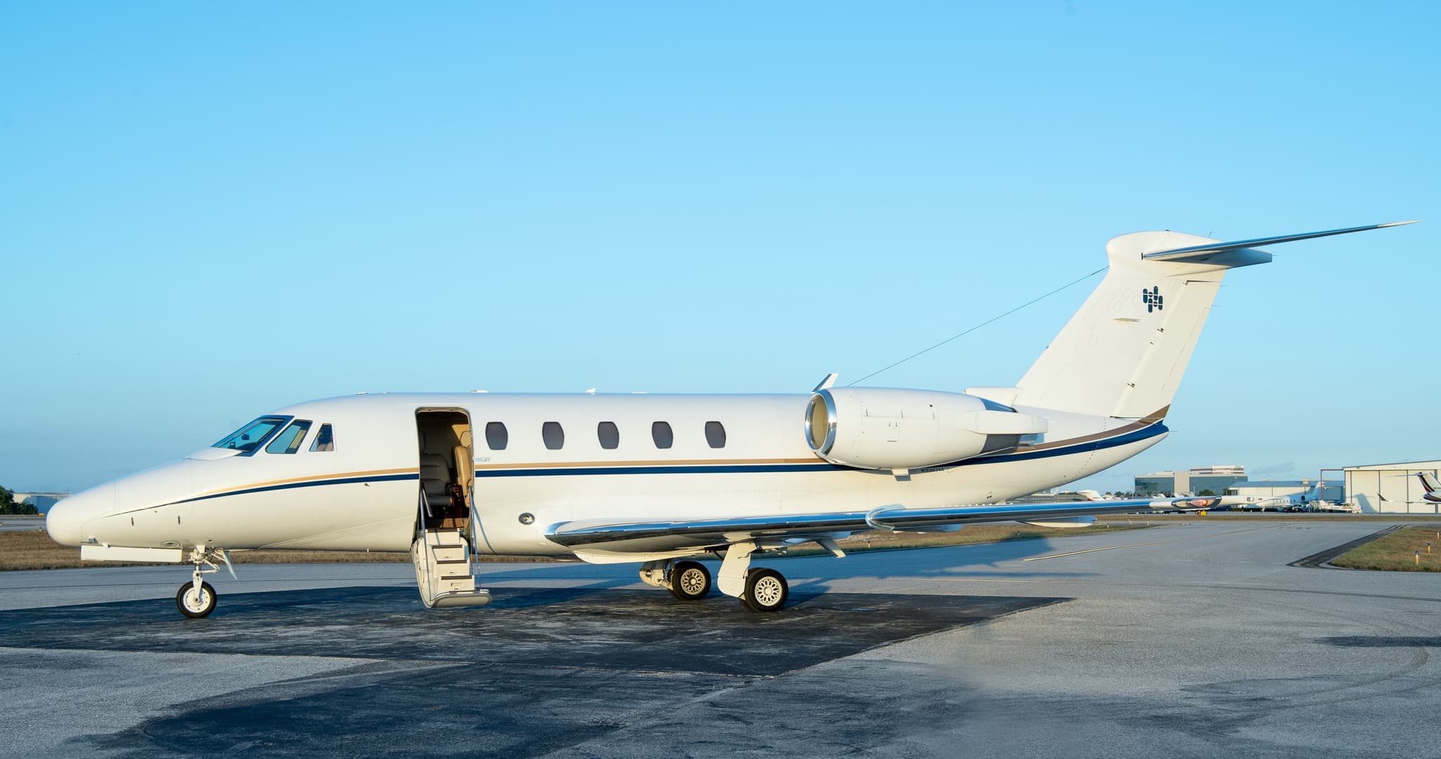 Tue, Nov 3TodayFort LauderdaleKFXE · Fort Lauderdale Executive AirportNassauMYNN · Lynden Pindling International AirportCitation VII9—On request3NovFort Lauderdale → NassauKFXE → MYNN · TodayCitation VII · 9 seatsOn request
 Tue, Nov 3TodayFort LauderdaleKFXE · Fort Lauderdale Executive AirportAtlantaKPDK · DeKalb Peachtree AirportHawker 4006—$8,5703NovFort Lauderdale → AtlantaKFXE → KPDK · TodayHawker 400 · 6 seats$8,570
- Tue, Nov 3TodayFort LauderdaleKFXE · Fort Lauderdale Executive AirportGrand CaymanMWCR · Owen Roberts International AirportHawker 4006—$7,9723NovFort Lauderdale → Grand CaymanKFXE → MWCR · TodayHawker 400 · 6 seats$7,972
- Tue, Nov 3TodayFort LauderdaleKFXE · Fort Lauderdale ExecutiveTorontoCYYZ · Lester B.Pearson IntlChallenger 605——On request3NovFort Lauderdale → TorontoKFXE → CYYZ · TodayChallenger 605On request
- Tue, Nov 305:00Fort LauderdaleKFXE · Fort Lauderdale ExecutiveTorontoCYYZ · Lester B. Pearson IntlBombardier Challenger 60510—On request3NovFort Lauderdale → TorontoKFXE → CYYZ · 05:00Bombardier Challenger 605 · 10 seatsOn request
- Tue, Nov 3TodayFort LauderdaleKFXE · Fort Lauderdale ExecutiveLouisvilleKSDF · Louisville IntlCessna Citation Bravo8—On request3NovFort Lauderdale → LouisvilleKFXE → KSDF · TodayCessna Citation Bravo · 8 seatsOn request
- Tue, Nov 3TodayFort LauderdaleKFXE · Fort Lauderdale Executive AirportOrlandoKISM · Kissimmee Gateway AirportBombardier Challenger 6041245mOn request3NovFort Lauderdale → OrlandoKFXE → KISM · TodayBombardier Challenger 604 · 12 seats · 45mOn request
- Tue, Nov 3TodayFort LauderdaleKFXE · Fort Lauderdale Executive AirportLancasterKLNS · Lancaster AirportBeechcraft Hawker 400XP72h 32mOn request3NovFort Lauderdale → LancasterKFXE → KLNS · TodayBeechcraft Hawker 400XP · 7 seats · 2h 32mOn request
- Tue, Nov 3TodayFort LauderdaleKFXE · Fort Lauderdale Executive AirportKilleenKILE · Skylark FieldBeechcraft Beechjet 400A73h 8m$16,5003NovFort Lauderdale → KilleenKFXE → KILE · TodayBeechcraft Beechjet 400A · 7 seats · 3h 8m$16,500
 KFXE · Fort Lauderdale Executive Airport
 MYNN · Lynden Pindling International Airport
 MWCR · Owen Roberts International Airport
 CYYZ · Lester B.Pearson Intl
* Total price incl. 10% service fee, converted to your selected currency. Price subject to operator confirmation.
Empty legs to KFXE
100 arrivals available
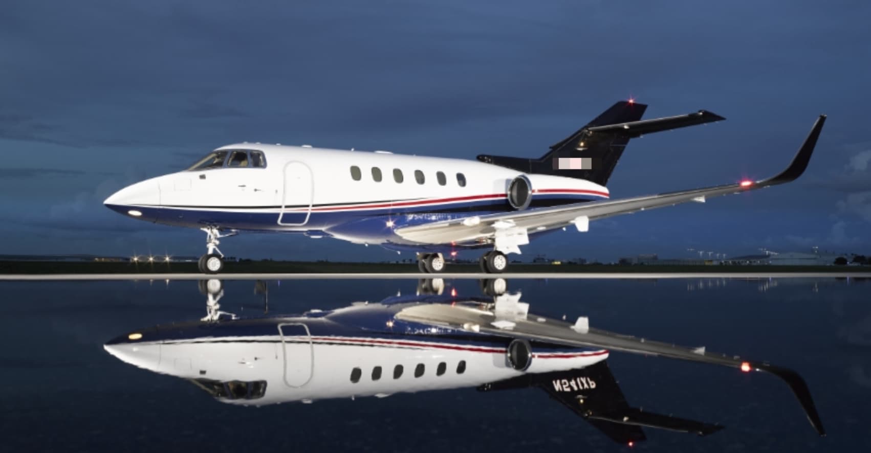 Tue, Nov 3TodaySt. GeorgeKSGU · St George Municipal AirportFort LauderdaleKFXE · Fort Lauderdale Executive AirportHawker 800XP8—On request3NovSt. George → Fort LauderdaleKSGU → KFXE · TodayHawker 800XP · 8 seatsOn request
- Tue, Nov 3TodayTeterboroKTEBFort LauderdaleKFXE · Fort Lauderdale ExecutiveChallenger 60510—On request3NovTeterboro → Fort LauderdaleKTEB → KFXE · TodayChallenger 605 · 10 seatsOn request
- Tue, Nov 3TodayMarsh HarbourMYAM · Marsh Harbour International AirportFort LauderdaleKFXE · Fort Lauderdale Executive AirportBombardier Challenger 6041051mOn request3NovMarsh Harbour → Fort LauderdaleMYAM → KFXE · TodayBombardier Challenger 604 · 10 seats · 51mOn request
- Tue, Nov 3TodayAndrosMYAK · Congo Town AirportFort LauderdaleKFXE · Fort Lauderdale Executive AirportPiper Chieftain61h 18mOn request3NovAndros → Fort LauderdaleMYAK → KFXE · TodayPiper Chieftain · 6 seats · 1h 18mOn request
 Tue, Nov 312:30MelbourneKMLB · Melbourne International AirportFort LauderdaleKFXE · Fort Lauderdale Executive AirportBombardier Learjet 607—On request3NovMelbourne → Fort LauderdaleKMLB → KFXE · 12:30Bombardier Learjet 60 · 7 seatsOn request
 Tue, Nov 3TodayMelbourneKMLB · Melbourne Orlando International AirportFort LauderdaleKFXE · Fort Lauderdale Executive AirportLear 607—On request3NovMelbourne → Fort LauderdaleKMLB → KFXE · TodayLear 60 · 7 seatsOn request
- Tue, Nov 3TodayCharlotte AmalieTIST · Cyril E. King AirportFort LauderdaleKFXE · Fort Lauderdale Executive AirportCitation X12—$14,1903NovCharlotte Amalie → Fort LauderdaleTIST → KFXE · TodayCitation X · 12 seats$14,190
- Wed, Nov 4TomorrowSavannahKSAV · Savannah Hilton Head International AirportFort LauderdaleKFXE · Fort Lauderdale Executive AirportCessna Citation X——On request4NovSavannah → Fort LauderdaleKSAV → KFXE · TomorrowCessna Citation XOn request
- Wed, Nov 4TomorrowCharlestonKCHS · Charleston Air Force Base-International AirportFort LauderdaleKFXE · Fort Lauderdale Executive AirportBeechcraft Beechjet 400A71h 20mOn request4NovCharleston → Fort LauderdaleKCHS → KFXE · TomorrowBeechcraft Beechjet 400A · 7 seats · 1h 20mOn request
 TIST · Cyril E. King Airport
* Total price incl. 10% service fee, converted to your selected currency. Price subject to operator confirmation.
Map: Fort Lauderdale Airport
View the location of Fort Lauderdale – FXE/KFXE. Zoom in to explore the area around the airport.
About the airport
Fort Lauderdale Executive Airport (FXE/KFXE) is the key private jet gateway for Fort Lauderdale. PrivJet gives you instant access to charter flights and empty legs: fast, discreet and globally connected.
KFXE airport FAQ
Are there any restrictions at Fort Lauderdale airport (KFXE) today?
There are currently 13 valid NOTAMs for Fort Lauderdale (KFXE). Affected: Obstacle: out of service; Taxiway; Instrument approach procedure; Instrument approach procedure: changed. For information only, not for flight planning or operational use. Always rely on an official pre-flight briefing. This list may be incomplete or out of date.
What is the weather at Fort Lauderdale airport (KFXE)?
According to the latest weather report for KFXE (METAR, 03 Nov, 00:53 UTC): Good visual conditions (VFR). Wind 6 kt (11 km/h) from north-northwest (340°), visibility 10 km or more, temperature 23 °C (dew point 22 °C). Light rain. For information only, not for flight planning. Weather can change quickly; always rely on official reports.
How long are the runways at Fort Lauderdale airport (KFXE)?
Fort Lauderdale (KFXE) has 2 runways: runway 09/27 with 1,829 m (6,002 ft), asphalt and runway 13/31 with 1,219 m (4,000 ft), asphalt. The longest is 1,829 m.
What are the radio frequencies at Fort Lauderdale airport (KFXE)?
Frequencies at KFXE: Tower 120.9 MHz, Ground 121.75 MHz and ATIS 119.85 MHz. For information only. Always rely on the published AIP.
What are the airport codes of Fort Lauderdale Executive Airport?
The ICAO code is KFXE and the IATA code is FXE. ICAO codes are used by air traffic control and pilots, e.g. in flight plans; IATA codes appear on tickets and baggage tags.
What is the elevation of KFXE airport?
Fort Lauderdale Executive Airport sits at 13 ft (4 m) above sea level. Local time zone: America/New York.
Where do private jets land at Fort Lauderdale Executive?
KFXE has 4 private jet terminals or FBOs: Signature Aviation FXE, Atlantic Aviation FXE, Banyan Air Service and W Aviation. Your flight confirmation says which one your operator uses.
Can I fly to KFXE by private jet?
Whether a private jet can operate into Fort Lauderdale Executive Airport depends on runway length, opening hours, customs and immigration rules as well as slot and handling availability, among other things. PrivJet checks this with the operating carrier for every request.
Are there empty legs from or to KFXE?
There are currently 100 empty legs departing from and 100 arriving at Fort Lauderdale Executive Airport. Empty legs are repositioning flights at heavily reduced prices; the list is updated several times a day.