Grand Rapids Gerald R. Ford Airport (KGRR / GRR)
Empty legs and charters from Grand Rapids
KGRR airport at a glance
- ICAO code
- KGRR
- IATA code
- GRR
- City
- Grand Rapids
- Region
- Michigan
- Country
- United States
- Elevation
- 794 ft (242 m)
- Time zone
- America/Detroit (UTC-5)
- Coordinates
- 42.8808° N, 85.5228° W
- Empty legs from
- 22
- Empty legs to
- 18
Weather & airport info KGRR
Current weather
Good visual conditions (VFR)observed 04 Nov, 04:53 UTC- Wind
- 11 kt (20 km/h) from south-southeast (160°)
- Visibility
- 10 km or more
- Clouds
- broken clouds at 6,500 ft
- Temperature
- 21 °C (dew point 14 °C)
- Pressure (QNH)
- 1,011 hPa
Original weather report (METAR)
METAR KGRR 040453Z 16011KT 10SM BKN065 21/14 A2986 RMK AO2 SLP108 LAST T02060139 402440144 $
Forecast (TAF)
- 04 Nov, 06:00–12:00 UTC10 kt (19 km/h) from south-southeast (160°) · visibility 10 km or more · Showers in the vicinity · broken clouds at 5,000 ft
- 04 Nov, 12:00–15:00 UTCfrom11 kt (20 km/h) from south (170°) · visibility 10 km or more · Light rain · broken clouds at 2,500 ft
- 04 Nov, 15:00–18:00 UTCfrom12 kt (22 km/h) from south (170°), gusts up to 22 kt · visibility 10 km or more · Showers in the vicinity · broken clouds at 2,000 ft
- 04 Nov, 18:00–21:00 UTCfrom14 kt (26 km/h) from south (180°), gusts up to 26 kt · visibility 10 km or more · Light rain showers · broken clouds at 2,500 ft
- 04 Nov, 21:00–06:00 UTCfrom10 kt (19 km/h) from southwest (220°), gusts up to 20 kt · visibility 10 km or more · broken clouds at 2,000 ft
Original forecast (TAF)
TAF KGRR 040540Z 0406/0506 16010KT P6SM VCSH BKN050 WS020/18041KT FM041200 17011KT 6SM -RA BKN025 WS020/19041KT FM041500 17012G22KT P6SM VCSH BKN020 FM041800 18014G26KT 6SM -SHRA BKN025 FM042100 22010G20KT P6SM BKN020
Airport
- Elevation
- 794 ft (242 m)
- Sunrise / Sunset
- 07:20 / 17:31 local time
Runways
| Runway | Length | Surface | Lighted |
|---|---|---|---|
| 08R/26L | 3,048 m (10,001 ft) | concrete | yes |
| 17/35 | 2,591 m (8,501 ft) | concrete | yes |
| 08L/26R | 1,524 m (5,001 ft) | concrete | yes |
Radio frequencies
- ATIS: 118.725
- Clearance: 119.3
- CTAF: 135.65
- Ground: 121.8
- Tower: 135.65
- UNICOM: 122.95
For information only, not for flight planning. Weather can change quickly; always rely on official reports. Sources: aviationweather.gov (NOAA), OurAirports.
Airport map KGRR
Full screen →Runways white, taxiways yellow with designators, closed taxiways and runways per NOTAM in red.
Official charts (FAA)
Cycle 2611, valid until 0901Z 11/26/26
Airport diagram (FAA)
Airport diagram (1)
Instrument approaches (11)
Minimums (2)
Hot spots (1)
For information only, not for navigation. Always use current official charts and NOTAMs.
Current NOTAMs for KGRR(15)
NOTAMs (Notices to Air Missions) announce short-term changes at an airport: closed runways or taxiways, unserviceable approach aids, obstacles, airspace restrictions.
- Out of servicePAPI: unserviceableA6087/26· from 04 Nov, 14:00 UTC · until 04 Nov, 20:00 UTC
The Precision Approach Path Indicator (PAPI) for Runway 26L is out of service. The PAPI helps pilots maintain the correct glide path to the runway.
Show original text
RWY 26L PAPI U/S
A6087/26 NOTAMN
Q) KZAU/QLPAS////000/999/4252N08531W005
A) KGRR
B) 2611041400
C) 2611042000
E) RWY 26L PAPI U/S
- Out of serviceServices11/004· from 04 Nov, 13:00 UTC · until 04 Nov, 22:00 UTC
The Secondary Surveillance Radar (SSR) is out of service. The SSR is a radar system that identifies aircraft and transmits their position and altitude to air traffic control.
Show original text
SVC SSR U/S
- ClosedApron: closedA6115/26· until 14 Nov, 23:59 UTC
A 60 feet wide section of the apron (APN N) is closed. This affects part of the area where aircraft park and are loaded or unloaded.
Show original text
APRON UPS APN N 60FT CLSD
A6115/26 NOTAMN
Q) KZAU/QMNLC////000/999/4252N08531W005
A) KGRR
B) 2610301710
C) 2611142359
E) APRON UPS APN N 60FT CLSD
- Out of serviceInstrument approach procedure3668/26· until 03 Feb, 14:19 UTC (estimated)
For the ILS or LOC runway 35 approaches and the ILS runway 35 (SA CAT I and II) approach, the VIO DME is out of service. An ADF or suitable RNAV system with GPS is required for certain procedures.
Show original text
IAP GERALD R FORD INTL, GRAND RAPIDS, MI. ILS OR LOC RWY 35, AMDT 2C... ILS RWY 35 (SA CAT I AND II), AMDT 2C... S-LOC 35: HONSE FIX MINIMUMS ADF REQUIRED EXCEPT FOR ACFT EQUIPPED WITH SUITABLE RNAV SYSTEM WITH GPS. MISSED APPROACH: CLIMB TO 1300 THEN CLIMBING RIGHT TURN TO 3000 DIRECT KNOBS LOM AND HOLD. (ADF REQUIRED). RADAR REQUIRED FOR PROCEDURE ENTRY EXCEPT FOR ACFT EQUIPPED WITH SUITABLE RNAV SYSTEM WITH GPS, VIO DME OUT OF SERVICE. 2610291403-2706101402EST. 2610291406-2702031419EST
Q) KZAU/QPIXX/I/NBO/A/000/999/4252N08531W005
A) KGRR
B) 2610291405
C) 2706101404EST
E) GRR GERALD R FORD INTL, GRAND RAPIDS, MI.
ILS OR LOC RWY 35, AMDT 2C...
ILS RWY 35 (SA CAT I AND II), AMDT 2C... S-LOC 35: HONSE FIX MINIMUMS ADF REQUIRED EXCEPT FOR ACFT EQUIPPED WITH SUITABLE RNAV SYSTEM WITH GPS. MISSED APPROACH: CLIMB TO 1300 THEN CLIMBING RIGHT TURN TO 3000 DIRECT KNOBS LOM AND HOLD. (ADF REQUIRED). RADAR REQUIRED FOR PROCEDURE ENTRY EXCEPT FOR ACFT EQUIPPED WITH SUITABLE RNAV SYSTEM WITH GPS, VIO DME OUT OF SERVICE. 2610291403-2706101402EST.
- Out of serviceInstrument approach procedure: changedA6101/26· until 03 Feb, 14:19 UTC
For the ILS or LOC runway 35 approaches and the ILS runway 35 (SA CAT I and II) approach, the VIO DME is out of service. An ADF or suitable RNAV system with GPS is required for certain procedures.
Show original text
IAP GERALD R FORD INTL, GRAND RAPIDS, MI. ILS OR LOC RWY 35, AMDT 2C... ILS RWY 35 (SA CAT I AND II), AMDT 2C... S-LOC 35: HONSE FIX MINIMUMS ADF REQUIRED EXCEPT FOR ACFT EQUIPPED WITH SUITABLE RNAV SYSTEM WITH GPS. MISSED APPROACH: CLIMB TO 1300 THEN CLIMBING RIGHT TURN TO 3000 DIRECT KNOBS LOM AND HOLD. (ADF REQUIRED). RADAR REQUIRED FOR PROCEDURE ENTRY EXCEPT FOR ACFT EQUIPPED WITH SUITABLE RNAV SYSTEM WITH GPS, VIO DME OUT OF SERVICE. 2610291403-2706101402EST.
A6101/26 NOTAMN
Q) KZAU/QPICH/I/NBO/A/000/999/4252N08531W005
A) KGRR
B) 2610291406
C) 2702031419
E) IAP GERALD R FORD INTL, GRAND RAPIDS, MI. ILS OR LOC RWY 35, AMDT 2C... ILS RWY 35 (SA CAT I AND II), AMDT 2C... S-LOC 35: HONSE FIX MINIMUMS ADF REQUIRED EXCEPT FOR ACFT EQUIPPED WITH SUITABLE RNAV SYSTEM WITH GPS. MISSED APPROACH: CLIMB TO 1300 THEN CLIMBING RIGHT TURN TO 3000 DIRECT KNOBS LOM AND HOLD. (ADF REQUIRED). RADAR REQUIRED FOR PROCEDURE ENTRY EXCEPT FOR ACFT EQUIPPED WITH SUITABLE RNAV SYSTEM WITH GPS, VIO DME OUT OF SERVICE. 2610291403-2706101402EST.
- NoticeInstrument approach procedure3769/26· until 26 Feb, 18:24 UTC (estimated)
A temporary crane with a height of 1074 ft above mean sea level is located at Gerald R Ford International Airport. For the HONSE minimums, an ADF or DME system is required.
Show original text
IAP GERALD R FORD INTL, GRAND RAPIDS, MI. ILS OR LOC RWY 35, AMDT 2C... HONSE MINIMUMS (ADF OR DME REQUIRED) CIRCLING ALL CATS MDA 1440/HAA 646. TEMPORARY CRANE 1074 MSL, GRR AIRPORT (2023-AGL-13073-NRA). 2610291824-2702261824EST
Q) KZAU/QPIXX/I/NBO/A/000/999/4252N08531W005
A) KGRR
B) 2610291820
C) 2706101820EST
E) GRR GERALD R FORD INTL, GRAND RAPIDS, MI.
ILS OR LOC RWY 35, AMDT 2C...
HONSE MINIMUMS (ADF OR DME REQUIRED) CIRCLING ALL CATS MDA 1440/HAA 646. TEMPORARY CRANE 1074 MSL, GRR AIRPORT (2023-AGL-13073-NRA).
- NoticeInstrument approach procedure: changedA6107/26· until 26 Feb, 18:24 UTC
A temporary crane with a height of 1074 ft above mean sea level is located at Gerald R Ford International Airport. For the HONSE minimums, an ADF or DME system is required.
Show original text
IAP GERALD R FORD INTL, GRAND RAPIDS, MI. ILS OR LOC RWY 35, AMDT 2C... HONSE MINIMUMS (ADF OR DME REQUIRED) CIRCLING ALL CATS MDA 1440/HAA 646. TEMPORARY CRANE 1074 MSL, GRR AIRPORT (2023-AGL-13073-NRA).
A6107/26 NOTAMN
Q) KZAU/QPICH/I/NBO/A/000/999/4252N08531W005
A) KGRR
B) 2610291824
C) 2702261824
E) IAP GERALD R FORD INTL, GRAND RAPIDS, MI. ILS OR LOC RWY 35, AMDT 2C... HONSE MINIMUMS (ADF OR DME REQUIRED) CIRCLING ALL CATS MDA 1440/HAA 646. TEMPORARY CRANE 1074 MSL, GRR AIRPORT (2023-AGL-13073-NRA).
- NoticeInstrument approach procedure3638/26· until 05 Mar, 23:55 UTC (estimated)
A temporary crane, 1074 feet above sea level, is located 2300 feet south of runway 26R. Another temporary crane, 949 feet above sea level, is located 2767 feet north of GRR airport.
Show original text
IAP GERALD R FORD INTL, GRAND RAPIDS, MI. ILS OR LOC RWY 26L, AMDT 21C... ILS OR LOC RWY 35, AMDT 2C... ILS OR LOC RWY 8R, AMDT 7... RNAV (GPS) RWY 26L, AMDT 1D... RNAV (GPS) RWY 8R, AMDT 1D... CIRCLING ALL CATS MDA 1440/HAA 646. VIS CAT C 1 3/4. TEMPORARY CRANE, 1074 MSL, 2300 FT S OF RWY 26R (2023-AGL-13078-NRA). TEMPORARY CRANE 949 MSL 2767 N OF GRR AIRPORT (2023-AGL-13073-NRA). 2610291327-2703052355EST
Q) KZAU/QPIXX/I/NBO/A/000/999/4252N08531W005
A) KGRR
B) 2610291326
C) 2706101325EST
E) GRR GERALD R FORD INTL, GRAND RAPIDS, MI.
ILS OR LOC RWY 26L, AMDT 21C...
ILS OR LOC RWY 35, AMDT 2C...
ILS OR LOC RWY 8R, AMDT 7...
RNAV (GPS) RWY 26L, AMDT 1D...
RNAV (GPS) RWY 8R, AMDT 1D...
CIRCLING ALL CATS MDA 1440/HAA 646. VIS CAT C 1 3/4. TEMPORARY CRANE, 1074 MSL, 2300 FT S OF RWY 26R (2023-AGL-13078-NRA). TEMPORARY CRANE 949 MSL 2767 N OF GRR AIRPORT (2023-AGL-13073-NRA).
7 more NOTAMs
- NoticeInstrument approach procedure: changedA6098/26· until 05 Mar, 23:55 UTC
A temporary crane, with its top at 1074 ft above mean sea level, is located 2300 FT south of runway 26R. Another temporary crane, with its top at 949 ft above mean sea level, is located 2767 N of the airport.
Show original text
IAP GERALD R FORD INTL, GRAND RAPIDS, MI. ILS OR LOC RWY 26L, AMDT 21C... ILS OR LOC RWY 35, AMDT 2C... ILS OR LOC RWY 8R, AMDT 7... RNAV (GPS) RWY 26L, AMDT 1D... RNAV (GPS) RWY 8R, AMDT 1D... CIRCLING ALL CATS MDA 1440/HAA 646. VIS CAT C 1 3/4. TEMPORARY CRANE, 1074 MSL, 2300 FT S OF RWY 26R (2023-AGL-13078-NRA). TEMPORARY CRANE 949 MSL 2767 N OF GRR AIRPORT (2023-AGL-13073-NRA).
A6098/26 NOTAMN
Q) KZAU/QPICH/I/NBO/A/000/999/4252N08531W005
A) KGRR
B) 2610291327
C) 2703052355
E) IAP GERALD R FORD INTL, GRAND RAPIDS, MI. ILS OR LOC RWY 26L, AMDT 21C... ILS OR LOC RWY 35, AMDT 2C... ILS OR LOC RWY 8R, AMDT 7... RNAV (GPS) RWY 26L, AMDT 1D... RNAV (GPS) RWY 8R, AMDT 1D... CIRCLING ALL CATS MDA 1440/HAA 646. VIS CAT C 1 3/4. TEMPORARY CRANE, 1074 MSL, 2300 FT S OF RWY 26R (2023-AGL-13078-NRA). TEMPORARY CRANE 949 MSL 2767 N OF GRR AIRPORT (2023-AGL-13073-NRA).
- NoticeInstrument approach procedure3628/26· until 05 Mar, 23:55 UTC (estimated)
For the RNAV (GPS) Runway 17 instrument approach, there are new values for decision altitude and minimum visibility. A temporary crane is located 2658 feet west of runway 17, its top is 1074 feet above mean sea level.
Show original text
IAP GERALD R FORD INTL, GRAND RAPIDS, MI. RNAV (GPS) RWY 17, AMDT 1D... LNAV/VNAV DA 1285/HAT 497, VIS ALL CATS 1 3/8. LNAV MDA 1380/HAT 592, VIS CAT C/D 1 3/4. CIRCLING ALL CATS MDA 1440/HAA 646, VIS CAT C 1 3/4. VDP 1.69 TO RWY17. TEMPORARY CRANE 1074 MSL, 2658 FT W OF RWY 17 (2023-AGL-13078-NRA). 2610291317-2703052355EST
Q) KZAU/QPIXX/I/NBO/A/000/999/4252N08531W005
A) KGRR
B) 2610291317
C) 2706101316EST
E) GRR GERALD R FORD INTL, GRAND RAPIDS, MI.
RNAV (GPS) RWY 17, AMDT 1D...
LNAV/VNAV DA 1285/HAT 497, VIS ALL CATS 1 3/8. LNAV MDA 1380/HAT 592, VIS CAT C/D 1 3/4. CIRCLING ALL CATS MDA 1440/HAA 646, VIS CAT C 1 3/4. VDP 1.69 TO RWY17. TEMPORARY CRANE 1074 MSL, 2658 FT W OF RWY 17 (2023-AGL-13078-NRA).
- NoticeInstrument approach procedure: changedA6096/26· until 05 Mar, 23:55 UTC
For the RNAV (GPS) Runway 17 instrument approach, there are new values for decision altitude and minimum visibility. A temporary crane is located 2658 feet west of runway 17, its top is 1074 feet above mean sea level.
Show original text
IAP GERALD R FORD INTL, GRAND RAPIDS, MI. RNAV (GPS) RWY 17, AMDT 1D... LNAV/VNAV DA 1285/HAT 497, VIS ALL CATS 1 3/8. LNAV MDA 1380/HAT 592, VIS CAT C/D 1 3/4. CIRCLING ALL CATS MDA 1440/HAA 646, VIS CAT C 1 3/4. VDP 1.69 TO RWY17. TEMPORARY CRANE 1074 MSL, 2658 FT W OF RWY 17 (2023-AGL-13078-NRA).
A6096/26 NOTAMN
Q) KZAU/QPICH/I/NBO/A/000/999/4252N08531W005
A) KGRR
B) 2610291317
C) 2703052355
E) IAP GERALD R FORD INTL, GRAND RAPIDS, MI. RNAV (GPS) RWY 17, AMDT 1D... LNAV/VNAV DA 1285/HAT 497, VIS ALL CATS 1 3/8. LNAV MDA 1380/HAT 592, VIS CAT C/D 1 3/4. CIRCLING ALL CATS MDA 1440/HAA 646, VIS CAT C 1 3/4. VDP 1.69 TO RWY17. TEMPORARY CRANE 1074 MSL, 2658 FT W OF RWY 17 (2023-AGL-13078-NRA).
- NoticeOther3594/26· permanent
The approach chart for the Instrument Landing System (ILS) or Localizer (LOC) Runway 35, Amendment 2C, and for ILS Runway 35 (SA CAT I-II), Amendment 2C, is incorrect. Significant data changes were not applied. For a corrected copy, see the 26-07 TERM SAFETY ALERT on the FAA website.
Show original text
CHART GERALD R FORD INTL, GRAND RAPIDS, MI. ILS OR LOC RWY 35, AMDT 2C ... ILS RWY 35 (SA CAT I-II), AMDT 2C ... CORRECT CHART: SIGNIFICANT DATA CHANGES NOT APPLIED. FOR A CORRECTED COPY SEE 26-07 TERM SAFETY ALERT AT HTTPS://WWW.FAA.GOV/AIR_TRAFFIC/FLIGHT_INFO/AERONAV/SAFETY_ALERTS/.
Q) KZAU/QXXXX/I/NBO/A/000/999/4252N08531W025
A) KGRR
B) 2610291223
C) PERM
E) CHART GERALD R FORD INTL, GRAND RAPIDS, MI.
ILS OR LOC RWY 35, AMDT 2C ...
ILS RWY 35 (SA CAT I-II), AMDT 2C ...
CORRECT CHART: SIGNIFICANT DATA CHANGES NOT APPLIED. FOR A CORRECTED COPY SEE 26-07 TERM SAFETY ALERT AT HTTPS://WWW.FAA.GOV/AIR_TRAFFIC/FLIGHT_INFO/AERONAV/SAFETY_ALERTS/.
- NoticeOtherA6091/26· permanent
The approach chart for the Instrument Landing System (ILS) or Localizer (LOC) Runway 35, Amendment 2C, and for ILS Runway 35 (SA CAT I-II), Amendment 2C, is incorrect. Significant data changes were not applied. For a corrected copy, see the 26-07 TERM SAFETY ALERT on the FAA website.
Show original text
CHART GERALD R FORD INTL, GRAND RAPIDS, MI. ILS OR LOC RWY 35, AMDT 2C ... ILS RWY 35 (SA CAT I-II), AMDT 2C ... CORRECT CHART: SIGNIFICANT DATA CHANGES NOT APPLIED. FOR A CORRECTED COPY SEE 26-07 TERM SAFETY ALERT AT HTTPS://WWW.FAA.GOV/AIR_TRAFFIC/FLIGHT_INFO/AERONAV/SAFETY_ALERTS/.
A6091/26 NOTAMN
Q) KZAU/QXXXX////000/999/4252N08531W005
A) KGRR
B) 2610291224
C) PERM
E) CHART GERALD R FORD INTL, GRAND RAPIDS, MI. ILS OR LOC RWY 35, AMDT 2C ... ILS RWY 35 (SA CAT I-II), AMDT 2C ... CORRECT CHART: SIGNIFICANT DATA CHANGES NOT APPLIED. FOR A CORRECTED COPY SEE 26-07 TERM SAFETY ALERT AT HTTPS://WWW.FAA.GOV/AIR_TRAFFIC/FLIGHT_INFO/AERONAV/SAFETY_ALERTS/.
- NoticeInstrument approach procedure: changed2275/26· permanent
The instrument approach procedure RNAV (GPS) Runway 17, Amendment 1D, has been updated. The new version is RNAV (GPS) Runway 17, Amendment 1E.
Show original text
IAP GERALD R FORD INTL, GRAND RAPIDS, MI. RNAV (GPS) RWY 17, AMDT 1D... LNAV/VNAV CATS A/B VISIBILITY RVR 6000. THIS IS RNAV (GPS) RWY 17, AMDT 1E.
Q) KZAU/QPICH/I/NBO/A/000/999/4252N08531W005
A) KGRR
B) 2610131545
C) PERM
E) GRR GERALD R FORD INTL, GRAND RAPIDS, MI.
RNAV (GPS) RWY 17, AMDT 1D...
LNAV/VNAV CATS A/B VISIBILITY RVR 6000.
THIS IS RNAV (GPS) RWY 17, AMDT 1E.
- NoticeInstrument approach procedure: changedA6054/26· permanent
The instrument approach procedure RNAV (GPS) Runway 17, Amendment 1D, has been updated. The new version is RNAV (GPS) Runway 17, Amendment 1E.
Show original text
IAP GERALD R FORD INTL, GRAND RAPIDS, MI. RNAV (GPS) RWY 17, AMDT 1D... LNAV/VNAV CATS A/B VISIBILITY RVR 6000. THIS IS RNAV (GPS) RWY 17, AMDT 1E.
A6054/26 NOTAMN
Q) KZAU/QPICH/I/NBO/A/000/999/4252N08531W005
A) KGRR
B) 2610290905
C) PERM
E) IAP GERALD R FORD INTL, GRAND RAPIDS, MI. RNAV (GPS) RWY 17, AMDT 1D... LNAV/VNAV CATS A/B VISIBILITY RVR 6000. THIS IS RNAV (GPS) RWY 17, AMDT 1E.
For information only, not for flight planning or operational use. Always rely on an official pre-flight briefing. This list may be incomplete or out of date. Explanations and expanded abbreviations are generated automatically. The original text is authoritative. Source: FAA NOTAM Management Service (SWIM).
Private jet traffic in Gerald R. Ford International Airport (last 30 days)
- Arrivals
- 646
- Departures
- 516
- Different jets
- 303
Most frequent origins: Chicago Executive Airport (16), Teterboro Airport (16), General Mitchell International Airport (13), Oakland County International Airport (13), Dupage Airport (10).
Most frequent destinations: Oakland County International Airport (16), Teterboro Airport (15), General Mitchell International Airport (13), Cherry Capital Airport (13), West Michigan Regional Airport (10).
Most common aircraft types: Cessna Citation Latitude (113), Cessna Citation Excel/XLS (98), Pilatus PC-12 (94), Learjet 45 (82), Embraer Phenom 300 (61).
Monday is the busiest day.
Our own analysis of public ADS-B signals from business jets. Not every flight is received, and jets with a removal request are excluded.
Charter operators based here
Operators with a base at this airport.
- Northern JetTurboprop, Light jet, Midsize jet
- Pentastar Aviation CharterLight jet, Midsize jet, Super midsize jet
- Otter Air ServicesTurboprop, Light jet
- Ward AviationLight jet, Midsize jet
- Executive Air TransportTurboprop
Empty legs from KGRR
22 departures available
- Wed, Nov 4TodayGrand RapidsKGRR · Gerald R. Ford International AirportLatrobeKLBE · Arnold Palmer Regional AirportPilatus PC-24——On request4NovGrand Rapids → LatrobeKGRR → KLBE · TodayPilatus PC-24On request
 Wed, Nov 4TodayGrand RapidsKGRR · Gerald R. Ford International AirportWestchesterKHPN · Westchester County AirportChallenger 3008—On request4NovGrand Rapids → WestchesterKGRR → KHPN · TodayChallenger 300 · 8 seatsOn request
- Thu, Nov 5TomorrowGrand RapidsKGRR · Gerald R. Ford International AirportLatrobeKLBE · Arnold Palmer Regional AirportPilatus PC-2481h 18mOn request5NovGrand Rapids → LatrobeKGRR → KLBE · TomorrowPilatus PC-24 · 8 seats · 1h 18mOn request
- Thu, Nov 5TomorrowGrand RapidsKGRR · Gerald R. Ford International AirportRochesterKRST · Rochester International AirportPilatus PC-12 NGX61h 42mOn request5NovGrand Rapids → RochesterKGRR → KRST · TomorrowPilatus PC-12 NGX · 6 seats · 1h 42mOn request
- Fri, Nov 6in 2 daysGrand RapidsKGRR · Gerald R. Ford International AirportManisteeKMBL · Manistee County Blacker AirportCessna CitationJet5—$6,7106NovGrand Rapids → ManisteeKGRR → KMBL · in 2 daysCessna CitationJet · 5 seats$6,710
- Fri, Nov 6in 2 daysGrand RapidsKGRR · Gerald R. FordManisteeKMBL · Manistee Co. - BlackerMidsize Jet6—On request6NovGrand Rapids → ManisteeKGRR → KMBL · in 2 daysMidsize Jet · 6 seatsOn request
- Fri, Nov 618:30Grand RapidsKGRR · Gerald R. FordTitusvilleKTIX · Space Coast RegionalBombardier Learjet 608—$23,5956NovGrand Rapids → TitusvilleKGRR → KTIX · 18:30Bombardier Learjet 60 · 8 seats$23,595
- Fri, Nov 6in 2 daysGrand RapidsKGRR · Gerald R. Ford International AirportDubuqueKDBQ · Dubuque Regional AirportCessna Citation M271h 12mOn request6NovGrand Rapids → DubuqueKGRR → KDBQ · in 2 daysCessna Citation M2 · 7 seats · 1h 12mOn request
 Fri, Nov 6in 2 daysGrand RapidsKGRR · Gerald R. Ford International AirportTitusvilleKTIX · Space Coast Regional AirportLear 607—$18,6126NovGrand Rapids → TitusvilleKGRR → KTIX · in 2 daysLear 60 · 7 seats$18,612
 KGRR · Gerald R. Ford International Airport
* Total price incl. 10% service fee, converted to your selected currency. Price subject to operator confirmation.
Empty legs to KGRR
18 arrivals available
 Thu, Nov 515:06Fond du LacKFLD · Fond du Lac County AirportGrand RapidsKGRR · Gerald R. Ford International AirportCessna Citation XLS136m$1,6655NovFond du Lac → Grand RapidsKFLD → KGRR · 15:06Cessna Citation XLS · 1 seat · 36m$1,665
- Thu, Nov 5TomorrowAnn ArborKARB · Ann Arbor Municipal AirportGrand RapidsKGRR · Gerald R. Ford International AirportPilatus PC-12 NGX642mOn request5NovAnn Arbor → Grand RapidsKARB → KGRR · TomorrowPilatus PC-12 NGX · 6 seats · 42mOn request
- Fri, Nov 6in 2 daysDubuqueKDBQ · Dubuque Regional AirportGrand RapidsKGRR · Gerald R. Ford International AirportCessna Citation M271h 6mOn request6NovDubuque → Grand RapidsKDBQ → KGRR · in 2 daysCessna Citation M2 · 7 seats · 1h 6mOn request
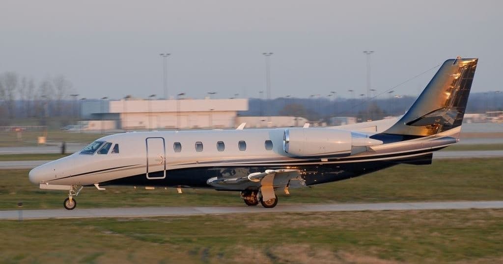 Sun, Nov 8in 4 daysIowa CityKIOW · Iowa City Municipal AirportGrand RapidsKGRR · Gerald R. Ford International AirportCitation XLS8—On request8NovIowa City → Grand RapidsKIOW → KGRR · in 4 daysCitation XLS · 8 seatsOn request
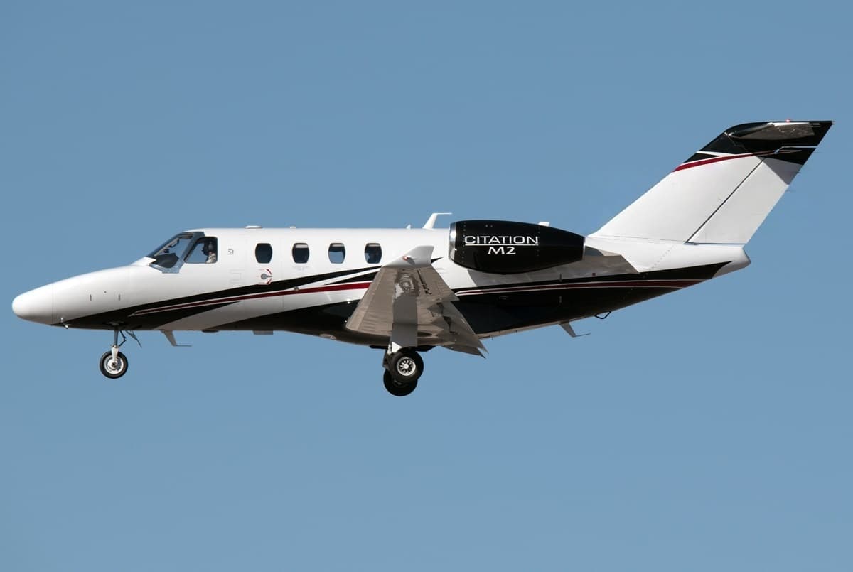 Mon, Nov 9in 5 daysChicagoKORD · Chicago O'Hare International AirportGrand RapidsKGRR · Gerald R. Ford International AirportCitation M26—On request9NovChicago → Grand RapidsKORD → KGRR · in 5 daysCitation M2 · 6 seatsOn request
- Fri, Nov 20in 16 daysPittsburghKPIT · Pittsburgh International AirportGrand RapidsKGRR · Gerald R. Ford International AirportBeechcraft Hawker 400XP71h 6mOn request20NovPittsburgh → Grand RapidsKPIT → KGRR · in 16 daysBeechcraft Hawker 400XP · 7 seats · 1h 6mOn request
- Mon, Nov 23in 19 daysMitchellKMHE · Mitchell Municipal AirportGrand RapidsKGRR · Gerald R. Ford International AirportCessna Citation XLS Gen291h 42mOn request23NovMitchell → Grand RapidsKMHE → KGRR · in 19 daysCessna Citation XLS Gen2 · 9 seats · 1h 42mOn request
- Tue, Nov 24in 20 daysMidlandKMAF · Midland International Air and Space Port AirportGrand RapidsKGRR · Gerald R. Ford International AirportPilatus PC-2482h 54mOn request24NovMidland → Grand RapidsKMAF → KGRR · in 20 daysPilatus PC-24 · 8 seats · 2h 54mOn request
- Tue, Nov 24in 20 daysWest Palm BeachKPBI · Palm Beach International AirportGrand RapidsKGRR · Gerald R. Ford International AirportCessna Citation M273h 30mOn request24NovWest Palm Beach → Grand RapidsKPBI → KGRR · in 20 daysCessna Citation M2 · 7 seats · 3h 30mOn request
* Total price incl. 10% service fee, converted to your selected currency. Price subject to operator confirmation.
Map: Grand Rapids Airport
View the location of Grand Rapids – GRR/KGRR. Zoom in to explore the area around the airport.
About the airport
Gerald R. Ford International Airport (GRR/KGRR) is the key private jet gateway for Grand Rapids. PrivJet gives you instant access to charter flights and empty legs: fast, discreet and globally connected.
KGRR airport FAQ
Are there any restrictions at Grand Rapids airport (KGRR) today?
There are currently 13 valid NOTAMs for Grand Rapids (KGRR). Affected: Apron: closed; Instrument approach procedure; Instrument approach procedure: changed. 2 more NOTAMs start in the coming days. For information only, not for flight planning or operational use. Always rely on an official pre-flight briefing. This list may be incomplete or out of date.
What is the weather at Grand Rapids airport (KGRR)?
According to the latest weather report for KGRR (METAR, 04 Nov, 04:53 UTC): Good visual conditions (VFR). Wind 11 kt (20 km/h) from south-southeast (160°), visibility 10 km or more, temperature 21 °C (dew point 14 °C). For information only, not for flight planning. Weather can change quickly; always rely on official reports.
How long are the runways at Grand Rapids airport (KGRR)?
Grand Rapids (KGRR) has 3 runways: runway 08R/26L with 3,048 m (10,001 ft), concrete, runway 17/35 with 2,591 m (8,501 ft), concrete and runway 08L/26R with 1,524 m (5,001 ft), concrete. The longest is 3,048 m.
What are the radio frequencies at Grand Rapids airport (KGRR)?
Frequencies at KGRR: Tower 135.65 MHz, Ground 121.8 MHz and ATIS 118.725 MHz. For information only. Always rely on the published AIP.
What are the airport codes of Gerald R. Ford International Airport?
The ICAO code is KGRR and the IATA code is GRR. ICAO codes are used by air traffic control and pilots, e.g. in flight plans; IATA codes appear on tickets and baggage tags.
What is the elevation of KGRR airport?
Gerald R. Ford International Airport sits at 794 ft (242 m) above sea level. Local time zone: America/Detroit.
Can I fly to KGRR by private jet?
Whether a private jet can operate into Gerald R. Ford International Airport depends on runway length, opening hours, customs and immigration rules as well as slot and handling availability, among other things. PrivJet checks this with the operating carrier for every request.
Are there empty legs from or to KGRR?
There are currently 22 empty legs departing from and 18 arriving at Gerald R. Ford International Airport. Empty legs are repositioning flights at heavily reduced prices; the list is updated several times a day.