Manassas Regional Harry P. Davis field Airport (KHEF / MNZ)
Empty legs and charters from Manassas
KHEF airport at a glance
- ICAO code
- KHEF
- IATA code
- MNZ
- City
- Manassas
- Region
- Virginia
- Country
- United States
- Elevation
- 192 ft (59 m)
- Time zone
- America/New York (UTC-5)
- Coordinates
- 38.7214° N, 77.5154° W
- Empty legs from
- 17
- Empty legs to
- 17
Weather & airport info KHEF
Current weather
No current weather report is available for this airport.
Airport
- Elevation
- 192 ft (59 m)
- Sunrise / Sunset
- 06:38 / 17:08 local time
Runways
| Runway | Length | Surface | Lighted |
|---|---|---|---|
| 16L/34R | 1,890 m (6,200 ft) | asphalt | yes |
| 16R/34L | 1,132 m (3,715 ft) | asphalt | yes |
Radio frequencies
- ATIS: 125.175
- Clearance: 120.2
- CTAF: 133.1
- Ground: 121.8
- Tower: 133.1
For information only, not for flight planning. Weather can change quickly; always rely on official reports. Sources: aviationweather.gov (NOAA), OurAirports.
Airport map KHEF
Full screen →Runways white, taxiways yellow with designators, closed taxiways and runways per NOTAM in red.
Official charts (FAA)
Cycle 2611, valid until 0901Z 11/26/26
Airport diagram (FAA)
Airport diagram (1)
Instrument approaches (5)
Departure procedures (6)
Minimums (2)
Other (15)
For information only, not for navigation. Always use current official charts and NOTAMs.
Current NOTAMs for KHEF(15)
NOTAMs (Notices to Air Missions) announce short-term changes at an airport: closed runways or taxiways, unserviceable approach aids, obstacles, airspace restrictions.
- Out of serviceObstacle10/068· until 06 Dec, 03:15 UTC
A tower 1.3 nautical miles north of the airport is out of service. Its top is 343 feet above sea level, 132 feet above ground.
Show original text
OBST TOWER LGT (ASR 1324229) 384435.60N0773037.50W (1.3NM N HEF) 343FT (132FT AGL) U/S
- Out of serviceObstacle lights: unserviceable10/045· until 11 Feb, 20:46 UTC
An obstacle, a tower, has its lighting out of service. The tower's top is 939.0 feet above sea level, 496.1 feet above ground, and it is located 9.6 nautical miles east-northeast of the airport.
Show original text
OBST TOWER LGT (ASR 1065763) 384716.30N0771946.40W (9.6NM ENE HEF) 939.0FT (496.1FT AGL) U/S
10/045 NOTAMN<br/>
<b>Q) </b>KZDC/QOLAS/IV/M/E/000/010/3843N07730W005<br/>
<b>A) </b>KHEF<br/>
<b>B) </b>2610142046<br/>
<b>C) </b>2702112046<br/>
<b>E) </b> TOWER LGT (ASR 1065763) 384716.30N0771946.40W (9.6NM ENE HEF) 939.0FT (496.1FT AGL) U/S<br/>
- ClosedApron10/041· until 30 Sept, 23:00 UTC
The east apron between taxiway E and taxiway Y is closed to helicopter operations.
Show original text
APRON EAST APN BTN TWY E AND TXL Y CLSD TO HEL OPS
- ClosedApron10/027· until 30 Sept, 21:00 UTC
The east apron area between taxiway E and taxiway Y is closed.
Show original text
APRON EAST APN BTN TWY E AND TXL Y CLSD
- ClosedApron10/025· until 30 Sept, 21:00 UTC
Taxiway Z between the terminal apron and taxiway Y is closed.
Show original text
APRON TXL Z BTN TERMINAL APN AND TXL Y CLSD
- Out of serviceWind indicator10/005· until 06 Nov, 23:00 UTC
The windcone lighting for runway 16L at the airport is out of service.
Show original text
AD AP WINDCONE FOR RWY 16L LGT U/S
10/005 NOTAMR
Q) KZDC/QFWXX/V/M/A/000/999/3843N07730W005
A) KHEF
B) 2610012111
C) 2611062300

E) AP WINDCONE FOR RWY 16L LGT U/S
- NoticeAirspace11/003· until 02 Feb, 05:00 UTC
The airspace in an area northeast and southeast of the airport is closed for unmanned aircraft systems (drones) up to a height of 275 feet above ground.
Show original text
AIRSPACE UAS WI AN AREA DEFINED AS 384419N0773054W (1NM NE HEF) TO 384439N0773011W (.8NM SE HEF) TO 384425N0772959W (.8NM SE HEF) TO 384355N0773027W (.8NM SE HEF) TO POINT OF ORIGIN SFC-275FT AGL
- NoticeAirspace11/004· until 02 Feb, 05:00 UTC
The airspace in an area west and northwest of the airport is restricted for unmanned aircraft systems (drones) up to 250 feet above ground.
Show original text
AIRSPACE UAS WI AN AREA DEFINED AS 384432N0773307W (1.7NM WNW HEF) TO 384453N0773216W (1NM NW HEF) TO 384418N0773149W (.7NM N HEF) TO 384341N0773219W (.9NM W HEF) TO POINT OF ORIGIN SFC-250FT AGL
7 more NOTAMs
- NoticeAirspace11/002· until 02 Feb, 05:00 UTC
The airspace over an area 1.6 nautical miles north to north-northeast of the airport is closed for unmanned aircraft systems (drones) up to 300 feet above ground.
Show original text
AIRSPACE UAS WI AN AREA DEFINED AS 384554N0773053W (1.6NM N HEF) TO 384523N0773043W (1.6NM N HEF) TO 384540N0773038W (1.6NM NNE HEF) TO 384528N0773105W (1.6NM NNE HEF) TO 384545N0773107W (1.6NM NNE HEF) TO POINT OF ORIGIN SFC-300FT AGL
- NoticeApron10/080· until 31 Dec, 23:00 UTC
Apron taxilane Y DIRECTION SIGN for taxilane F and taxilane G not STD SIGN CRACK
Show original text
APRON TXL Y DIRECTION SIGN FOR TXL F AND TXL G NOT STD SIGN CRACK
- NoticeAerodrome10/074· until 04 Nov, 23:59 UTC
The airport's Aircraft Rescue and Fire Fighting (ARFF) services are now Index B. This indicates the available fire protection and rescue capability.
Show original text
AD AP ARFF NOW INDEX B
- NoticeOther3295/26· until 21 Jan, 09:01 UTC
For the WAYNZ TWO Arrival (RNAV) at Manassas Regional/Harry P. Davis Field, disregard the note about landing north using runway 1C/R transition and landing south using runway 19L/C/R transition. Expect runway assignment 10 nautical miles prior to DAFIX.
Show original text
MANASSAS REGIONAL/HARRY P. DAVIS FIELD, WASHINGTON, DC. WAYNZ TWO ARRIVAL (RNAV)... DISREGARD NOTE: LANDING NORTH USE RWY 1C/R TRANSITION, LANDING SOUTH USE RWY 19L/C/R TRANSITION, EXPECT RWY ASSIGNMENT 10 NM PRIOR TO DAFIX.
- NoticeObstacle10/049· until 30 Nov, 22:00 UTC
A crane is an obstacle near the airport (0.8 nautical miles north of HEF). Its top is 425 feet above sea level, 220 feet above ground. It is flagged and lighted.
Show original text
OBST CRANE (ASN 2026-AEA-9162-OE) 384402N0773103W (0.8NM N HEF) 425FT (220FT AGL) FLAGGED AND LGTD
10/049 NOTAMR
Q) KZDC/QOBXX/IV/M//000//3843N07730W005
A) KHEF
B) 2610200500
C) 2611302200
E) CRANE (ASN 2026-AEA-9162-OE) 384402N0773103W (0.8NM N HEF) 425FT (220FT AGL) FLAGGED AND LGTD
- NoticeApron: work in progress10/032· until 04 Dec, 21:00 UTC
On the apron, taxiway E, work in progress (WIP) construction is taking place. The area is lit and barricaded.
Show original text
APRON TXL E WIP CONST ADJ LGTD AND BARRICADED
10/032 NOTAMN
Q) KZDC/QMNHW/IV/BO/A/000/999/3843N07730W005
A) KHEF
B) 2610102101
C) 2612042100

E) TXL E WIP CONST ADJ LGTD AND BARRICADED
- NoticeObstacle10/031· until 29 Jan, 21:00 UTC
Obstacle: crane (ASN 2024-AEA-13334-OE) (0.9 NM north-northeast of HEF) 410 ft above sea level (187 ft above ground) flagged and lighted
Show original text
OBST CRANE (ASN 2024-AEA-13334-OE) 384409N0773037W (0.9NM NNE HEF) 410FT (187FT AGL) FLAGGED AND LGTD
10/031 NOTAMN
Q) KZDC/QOBXX/IV/M//000//3843N07730W005
A) KHEF
B) 2610101357
C) 2701292100
E) CRANE (ASN 2024-AEA-13334-OE) 384409N0773037W (0.9NM NNE HEF) 410FT (187FT AGL) FLAGGED AND LGTD
For information only, not for flight planning or operational use. Always rely on an official pre-flight briefing. This list may be incomplete or out of date. Explanations and expanded abbreviations are generated automatically. The original text is authoritative. Source: FAA NOTAM Management Service (SWIM).
Private jet traffic in Manassas Regional Harry P. Davis field (last 30 days)
- Arrivals
- 631
- Departures
- 587
- Different jets
- 391
Most frequent origins: Burlington Alamance Regional Airport (48), Allegheny County Airport (32), Teterboro Airport (24), Roanoke Regional Woodrum Field (19), Reading Regional Carl A Spaatz Field (15).
Most frequent destinations: Burlington Alamance Regional Airport (48), Reading Regional Carl A Spaatz Field (48), Richmond International Airport (20), Allegheny County Airport (20), Teterboro Airport (18).
Most common aircraft types: Pilatus PC-12 (374), Cessna Citation Excel/XLS (53), Bombardier Challenger 600/650 (48), Cessna Citation CJ2 (43), Embraer Phenom 300 (40).
Thursday is the busiest day.
Our own analysis of public ADS-B signals from business jets. Not every flight is received, and jets with a removal request are excluded.
Charter operators based here
Operators with a base at this airport.
- Executive Jet ManagementWhite Plains (Westchester County) (KHPN) · Light jet, Midsize jet, Super midsize jet
- Jet Aviation Flight ServicesTeterboro (KTEB) · Light jet, Super midsize jet, Heavy jet
- Chantilly AirSuper midsize jet
- Kingdom Air CharterTurboprop
- SkyNet Air CharterLight jet
Empty legs from KHEF
17 departures available
- Fri, Nov 1310:42ManassasKHEF · Manassas Regional Airport/Harry P. Davis FieldDullesKIAD · Washington Dulles International AirportCessna Citation CJ26—$7,81013NovManassas → DullesKHEF → KIAD · 10:42Cessna Citation CJ2 · 6 seats$7,810
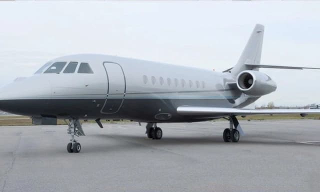 Sun, Nov 15in 12 daysManassasKHEF · Manassas Regional Harry P. Davis fieldNew YorkKTEB · Teterboro AirportFalcon 2000LX EASy9—On request15NovManassas → New YorkKHEF → KTEB · in 12 daysFalcon 2000LX EASy · 9 seatsOn request
- Sun, Nov 15in 12 daysManassasKHEF · Manassas Regional Harry P. Davis fieldTeterboroKTEB · Teterboro AirportDassault Falcon 200010—On request15NovManassas → TeterboroKHEF → KTEB · in 12 daysDassault Falcon 2000 · 10 seatsOn request
- Sun, Nov 1520:54ManassasKHEF · Manassas Regional Airport/Harry P. Davis FieldTeterboroKTEB · Teterboro AirportDassault Falcon 2000EX EASy10—$8,25015NovManassas → TeterboroKHEF → KTEB · 20:54Dassault Falcon 2000EX EASy · 10 seats$8,250
- Sun, Nov 15in 12 daysManassasKHEF · Manassas Regional Harry P. Davis fieldTeterboroKTEB · Teterboro AirportEmbraer Phenom 300E7—$5,39015NovManassas → TeterboroKHEF → KTEB · in 12 daysEmbraer Phenom 300E · 7 seats$5,390
- Mon, Nov 1601:54ManassasKHEF · Manassas RegionalTeterboroKTEBDassault Falcon 2000EX EASy10—On request16NovManassas → TeterboroKHEF → KTEB · 01:54Dassault Falcon 2000EX EASy · 10 seatsOn request
- Sun, Nov 22in 19 daysManassasKHEF · Manassas Regional Harry P. Davis fieldMiamiKOPF · Miami-Opa Locka Executive AirportCessna Citation CJ48—On request22NovManassas → MiamiKHEF → KOPF · in 19 daysCessna Citation CJ4 · 8 seatsOn request
- Fri, Dec 4in 31 daysManassasKHEF · Manassas Regional Harry P. Davis fieldTeterboroKTEB · Teterboro AirportEmbraer Phenom 300E7—$7,0404DecManassas → TeterboroKHEF → KTEB · in 31 daysEmbraer Phenom 300E · 7 seats$7,040
 Fri, Dec 421:00ManassasKHEF · Manassas Regional Harry P. Davis fieldTeterboroKTEB · Teterboro AirportBombardier Challenger 300142mOn request4DecManassas → TeterboroKHEF → KTEB · 21:00Bombardier Challenger 300 · 1 seat · 42mOn request
 KHEF · Manassas Regional Airport/Harry P. Davis Field
* Total price incl. 10% service fee, converted to your selected currency. Price subject to operator confirmation.
Empty legs to KHEF
17 arrivals available
- Sun, Nov 812:45HarrisburgKCXY · Capital City AirportManassasKHEF · Manassas Regional Airport/Harry P. Davis FieldCessna Citation CJ26—$5,6108NovHarrisburg → ManassasKCXY → KHEF · 12:45Cessna Citation CJ2 · 6 seats$5,610
 Tue, Nov 1005:45HarrisburgKCXY · Capital City AirportManassasKHEF · Manassas Regional Airport/Harry P. Davis FieldCessna Citation CJ27—$3,44710NovHarrisburg → ManassasKCXY → KHEF · 05:45Cessna Citation CJ2 · 7 seats$3,447
- Thu, Nov 12in 9 daysNew YorkKTEB · Teterboro AirportManassasKHEF · Manassas Regional Harry P. Davis fieldFalcon 2000LX EASy9—On request12NovNew York → ManassasKTEB → KHEF · in 9 daysFalcon 2000LX EASy · 9 seatsOn request
- Thu, Nov 12in 9 daysTeterboroKTEB · Teterboro AirportManassasKHEF · Manassas Regional Harry P. Davis fieldDassault Falcon 200010—On request12NovTeterboro → ManassasKTEB → KHEF · in 9 daysDassault Falcon 2000 · 10 seatsOn request
- Thu, Nov 1212:27TeterboroKTEB · Teterboro AirportManassasKHEF · Manassas Regional Airport/Harry P. Davis FieldDassault Falcon 2000EX EASy10—$7,81012NovTeterboro → ManassasKTEB → KHEF · 12:27Dassault Falcon 2000EX EASy · 10 seats$7,810
- Thu, Nov 12in 9 daysTeterboroKTEB · Teterboro AirportManassasKHEF · Manassas Regional Harry P. Davis fieldEmbraer Phenom 300E7—$4,95012NovTeterboro → ManassasKTEB → KHEF · in 9 daysEmbraer Phenom 300E · 7 seats$4,950
- Thu, Nov 19in 16 daysAtlantaKRYY · Cobb County-Mc Collum FieldManassasKHEF · Manassas Regional Harry P. Davis fieldCessna Citation Sovereign91h 30mOn request19NovAtlanta → ManassasKRYY → KHEF · in 16 daysCessna Citation Sovereign · 9 seats · 1h 30mOn request
- Sun, Nov 29in 26 daysPhiladelphiaKPHL · Philadelphia International AirportManassasKHEF · Manassas Regional Harry P. Davis fieldCessna Citation CJ48—On request29NovPhiladelphia → ManassasKPHL → KHEF · in 26 daysCessna Citation CJ4 · 8 seatsOn request
- Sun, Nov 29in 26 daysFort LauderdaleKFLL · Fort Lauderdale Hollywood International AirportManassasKHEF · Manassas Regional Harry P. Davis fieldCessna Citation CJ48—On request29NovFort Lauderdale → ManassasKFLL → KHEF · in 26 daysCessna Citation CJ4 · 8 seatsOn request
* Total price incl. 10% service fee, converted to your selected currency. Price subject to operator confirmation.
Map: Manassas Airport
View the location of Manassas – MNZ/KHEF. Zoom in to explore the area around the airport.
About the airport
Manassas Regional Harry P. Davis field (MNZ/KHEF) is the key private jet gateway for Manassas. PrivJet gives you instant access to charter flights and empty legs: fast, discreet and globally connected.
KHEF airport FAQ
Are there any restrictions at Manassas airport (KHEF) today?
There are currently 15 valid NOTAMs for Manassas (KHEF). Affected: Apron: closed; Obstacle: out of service; Obstacle lights: unserviceable; Wind indicator. For information only, not for flight planning or operational use. Always rely on an official pre-flight briefing. This list may be incomplete or out of date.
How long are the runways at Manassas airport (KHEF)?
Manassas (KHEF) has 2 runways: runway 16L/34R with 1,890 m (6,200 ft), asphalt and runway 16R/34L with 1,132 m (3,715 ft), asphalt. The longest is 1,890 m.
What are the radio frequencies at Manassas airport (KHEF)?
Frequencies at KHEF: Tower 133.1 MHz, Ground 121.8 MHz and ATIS 125.175 MHz. For information only. Always rely on the published AIP.
What are the airport codes of Manassas Regional Harry P. Davis field?
The ICAO code is KHEF and the IATA code is MNZ. ICAO codes are used by air traffic control and pilots, e.g. in flight plans; IATA codes appear on tickets and baggage tags.
What is the elevation of KHEF airport?
Manassas Regional Harry P. Davis field sits at 192 ft (59 m) above sea level. Local time zone: America/New York.
Can I fly to KHEF by private jet?
Whether a private jet can operate into Manassas Regional Harry P. Davis field depends on runway length, opening hours, customs and immigration rules as well as slot and handling availability, among other things. PrivJet checks this with the operating carrier for every request.
Are there empty legs from or to KHEF?
There are currently 17 empty legs departing from and 17 arriving at Manassas Regional Harry P. Davis field. Empty legs are repositioning flights at heavily reduced prices; the list is updated several times a day.