George Bush Intercontinental Houston Airport (KIAH / IAH)
Empty legs and charters from Houston
KIAH airport at a glance
- ICAO code
- KIAH
- IATA code
- IAH
- City
- Houston
- Region
- Texas
- Country
- United States
- Elevation
- 97 ft (30 m)
- Time zone
- America/Chicago (UTC-6)
- Coordinates
- 29.9844° N, 95.3414° W
- Empty legs from
- 17
- Empty legs to
- 13
Weather & airport info KIAH
Current weather
No current weather report is available for this airport.
Airport
- Elevation
- 97 ft (30 m)
- Sunrise / Sunset
- 06:36 / 17:33 local time
Runways
| Runway | Length | Surface | Lighted |
|---|---|---|---|
| 15L/33R | 3,658 m (12,001 ft) | concrete | yes |
| 09/27 | 3,048 m (10,000 ft) | asphalt | yes |
| 15R/33L | 3,048 m (10,000 ft) | concrete | yes |
| 08R/26L | 2,866 m (9,402 ft) | concrete | yes |
| 08L/26R | 2,743 m (9,000 ft) | concrete | yes |
Radio frequencies
- Approach: 120.05
- ATIS: 124.05
- Clearance: 128.1
- Ground: 118.575
- Tower: 29.02
- Tower: 120.725
- UNICOM: 122.95
For information only, not for flight planning. Weather can change quickly; always rely on official reports. Sources: aviationweather.gov (NOAA), OurAirports.
Airport map KIAH
Full screen →Runways white, taxiways yellow with designators, closed taxiways and runways per NOTAM in red.
Closed per NOTAM: RWY 8R/26L, TWY CC*, TWY EA* (* partly closed)
Official charts (FAA)
Cycle 2611, valid until 0901Z 11/26/26
Airport diagram (FAA)
Airport diagram (1)
Instrument approaches (38)
- ILS OR LOC RWY 08L
- ILS OR LOC RWY 08R
- ILS OR LOC RWY 09
- ILS OR LOC RWY 15R
- ILS OR LOC RWY 26L
- ILS OR LOC RWY 26R
- ILS OR LOC RWY 27
- ILS OR LOC RWY 33R
- ILS RWY 08L (SA CAT I)
- ILS RWY 26L (SA CAT I)
- ILS RWY 26R (SA CAT I)
- ILS RWY 27 (SA CAT I)
- ILS RWY 08R (SA CAT I - II)
- ILS RWY 09 (SA CAT I - II)
- ILS RWY 08L (CAT II - III)
- ILS RWY 26L (CAT II - III)
- ILS RWY 26R (CAT II - III)
- ILS RWY 27 (CAT II - III)
- GLS RWY 08L
- GLS RWY 08R
- GLS RWY 09
- GLS RWY 26L
- GLS RWY 26R
- GLS RWY 27
- RNAV (RNP) Y RWY 08L
- RNAV (RNP) Y RWY 08R
- RNAV (RNP) Y RWY 09
- RNAV (RNP) Y RWY 26L
- RNAV (RNP) Y RWY 26R
- RNAV (RNP) Y RWY 27
- RNAV (GPS) RWY 15R
- RNAV (GPS) RWY 33R
- RNAV (GPS) Z RWY 08L
- RNAV (GPS) Z RWY 08R
- RNAV (GPS) Z RWY 09
- RNAV (GPS) Z RWY 26L
- RNAV (GPS) Z RWY 26R
- RNAV (GPS) Z RWY 27
Departure procedures (31)
- ALEXANDRIA THREE
- ALEXANDRIA THREE, CONT.1
- BLTWY SEVEN (RNAV)
- BNDTO SIX (RNAV)
- BNDTO SIX (RNAV), CONT.1
- CRIED ONE
- EL DORADO ONE
- FLYZA FIVE (RNAV)
- FLYZA FIVE (RNAV), CONT.1
- GIFFA ONE
- GUMBY THREE (RNAV)
- GUMBY THREE (RNAV), CONT.1
- HOODO SEVEN (RNAV)
- HOODO SEVEN (RNAV), CONT.1
- INDIE EIGHT (RNAV)
- JUNCTION ONE
- LAKE CHARLES FIVE
- LEONA FOUR
- LEONA FOUR, CONT.1
- LUFKIN FOUR
- LUFKIN FOUR, CONT.1
- LURIC EIGHT (RNAV)
- MMUGS FOUR (RNAV)
- MMUGS FOUR (RNAV), CONT.1
- PITZZ FIVE (RNAV)
- PITZZ FIVE (RNAV), CONT.1
- RITAA SEVEN (RNAV)
- RITAA SEVEN (RNAV), CONT.1
- STRYA EIGHT (RNAV)
- STYCK EIGHT (RNAV)
- WYLSN EIGHT (RNAV)
Minimums (1)
LAHSO (1)
Other (30)
- BAZBL TWO (RNAV)
- DOOBI THREE (RNAV)
- DRLLR FIVE (RNAV)
- DRLLR FIVE (RNAV), CONT.1
- DUUUK FOUR
- GESNR TWO (RNAV)
- GESNR TWO (RNAV), CONT.1
- GILCO FIVE
- GILCO FIVE, CONT.1
- GUSHR THREE (RNAV)
- HTOWN THREE (RNAV)
- HUDZY FIVE
- HUDZY FIVE, CONT.1
- LINKK ONE (RNAV)
- LINKK ONE (RNAV), CONT.1
- MSCOT FOUR (RNAV)
- NNCEE TWO (RNAV)
- NNCEE TWO (RNAV), CONT.1
- OHIIO FOUR
- RIICE ONE
- RIICE ONE, CONT.1
- SKNRD FIVE (RNAV)
- SKNRD FIVE (RNAV), CONT.1
- SOULL ONE (RNAV)
- SOULL ONE (RNAV), CONT.1
- TEJAS FIVE (RNAV)
- TEJAS FIVE (RNAV), CONT.1
- TTORO THREE (RNAV)
- ZEEKK THREE (RNAV)
- ZEEKK THREE (RNAV), CONT.1
For information only, not for navigation. Always use current official charts and NOTAMs.
Current NOTAMs for KIAH(53)
NOTAMs (Notices to Air Missions) announce short-term changes at an airport: closed runways or taxiways, unserviceable approach aids, obstacles, airspace restrictions.
- ClosedRunway: closedA5187/26· until 03 Nov, 13:00 UTC
Runway 08R/26L is closed. This means this runway cannot be used at Houston airport.
Show original text
RWY 08R/26L CLSD
A5187/26 NOTAMN
Q) KZHU/QMRLC////000/999/2959N09520W005
A) KIAH
B) 2611030200
C) 2611031300
E) RWY 08R/26L CLSD
- ClosedTaxiway: closedA5188/26· until 03 Nov, 13:00 UTC
Taxiway CC between taxiway NE and taxiway NP is closed. This means this section of the taxiway cannot be used.
Show original text
TWY CC BTN TWY NE AND TWY NP CLSD
A5188/26 NOTAMN
Q) KZHU/QMXLC////000/999/2959N09520W005
A) KIAH
B) 2611030200
C) 2611031300
E) TWY CC BTN TWY NE AND TWY NP CLSD
- Out of serviceObstacle11/009· until 17 Nov, 05:25 UTC
The lighting on a tower 9.1 nautical miles northeast of the airport is out of service. Its top is 308.1 ft above sea level, 210.0 ft above ground.
Show original text
OBST TOWER LGT (ASR 1253001) 300540.50N0951321.10W (9.1NM NE IAH) 308.1FT (210.0FT AGL) U/S
- ClosedApron: closedA5174/26· until 13 Mar, 12:00 UTC
The apron taxiway RC W is closed for 1000 feet. This may lead to changes in taxi routes for aircraft.
Show original text
APRON TXL RC W 1000FT CLSD
A5174/26 NOTAMN
Q) KZHU/QMNLC////000/999/2959N09520W005
A) KIAH
B) 2611020400
C) 2703131200
E) APRON TXL RC W 1000FT CLSD
- Out of serviceObstacle11/002· until 01 Feb, 23:59 UTC
The lighting of a tower 10 nautical miles south of George Bush Intercontinental airport is out of service. Its top is 337 feet above sea level, 249 feet above ground.
Show original text
OBST TOWER LGT (ASR 1323158) 294933.00N0952236.00W (10NM S IAH) 337FT (249FT AGL) U/S
- Out of serviceObstacle10/300· until 22 Jan, 23:00 UTC
The lighting of a tower 7 nautical miles north-northwest of T41 is out of service. Its top is 230 feet above sea level, 226 feet above ground.
Show original text
OBST TOWER LGT (ASR UNKNOWN) 294558.43N0950512.37W (7NM NNW T41) 230FT (226FT AGL) U/S
- Out of serviceObstacle10/296· until 21 Jan, 04:00 UTC
A tower light 13.9 nautical miles northeast of the airport is out of service. Its top is 362.2 ft above sea level, 265.1 ft above ground.
Show original text
OBST TOWER LGT (ASR 1234793) 300853.50N0950913.60W (13.9NM NE IAH) 362.2FT (265.1FT AGL) U/S
- Out of serviceObstacle lights: unserviceableA5023/26· until 07 Dec, 12:31 UTC
A tower light 3 nautical miles south of the airport is out of service. Its top is 226 ft above sea level, 154 ft above ground.
Show original text
TOWER LGT (ASR 1224261) 295615.80N0951913.20W (3NM S IAH) 226FT (154FT AGL) U/S
A5023/26 NOTAMN
Q) KZHU/QOLAS/IV/M/AE/000/999/2956N09519W001
A) KIAH
B) 2610231231
C) 2612071231
E) TOWER LGT (ASR 1224261) 295615.80N0951913.20W (3NM S IAH) 226FT (154FT AGL) U/S
45 more NOTAMs
- Out of serviceObstacle10/284· until 20 Jan, 23:59 UTC
A tower light 10.7 nautical miles east-northeast of the airport is out of service. The tower is 245 feet above sea level, 178 feet above ground.
Show original text
OBST TOWER LGT (ASN 2021-ASW-19059-OE) 300332N0950926W (10.7NM ENE IAH) 245FT (178FT AGL) U/S
- Out of serviceStandard instrument departure: not available8866/26· until 09 Nov, 17:00 UTC
The HOODO SEVEN DEPARTURE (RNAV) standard departure route (SID) is only available for aircraft equipped with a suitable RNAV system with GPS, as the TBD VOR/DME is out of service.
Show original text
SID GEORGE BUSH INTCNTL/HOUSTON, HOUSTON, TX. HOODO SEVEN DEPARTURE (RNAV)... DEPARTURE PROCEDURE NA EXCEPT FOR ACFT EQUIPPED WITH SUITABLE RNAV SYSTEM WITH GPS, TBD VOR/DME OUT OF SERVICE. 2610131300-2611091700EST
Q) KZHU/QPDAU/I/NBO/A/000/999/2959N09520W005
A) KIAH
B) 2602191109
C) 2610011108EST
E) IAH GEORGE BUSH INTCNTL/HOUSTON, HOUSTON, TX.
HOODO SEVEN DEPARTURE (RNAV)...
DEPARTURE PROCEDURE NA EXCEPT FOR ACFT EQUIPPED WITH SUITABLE RNAV SYSTEM WITH GPS,
TBD VOR/DME U/S.
- Out of serviceStandard instrument departure: changedA4792/26· until 09 Nov, 17:00 UTC
The HOODO SEVEN DEPARTURE (RNAV) standard departure route (SID) is only available for aircraft equipped with a suitable RNAV system with GPS, as the TBD VOR/DME is out of service.
Show original text
SID GEORGE BUSH INTCNTL/HOUSTON, HOUSTON, TX. HOODO SEVEN DEPARTURE (RNAV)... DEPARTURE PROCEDURE NA EXCEPT FOR ACFT EQUIPPED WITH SUITABLE RNAV SYSTEM WITH GPS, TBD VOR/DME OUT OF SERVICE.
A4792/26 NOTAMN
Q) KZHU/QPDCH/I/NBO/A/000/999/2959N09520W005
A) KIAH
B) 2610131300
C) 2611091700
E) SID GEORGE BUSH INTCNTL/HOUSTON, HOUSTON, TX. HOODO SEVEN DEPARTURE (RNAV)... DEPARTURE PROCEDURE NA EXCEPT FOR ACFT EQUIPPED WITH SUITABLE RNAV SYSTEM WITH GPS, TBD VOR/DME OUT OF SERVICE.
- Out of serviceObstacle10/115· until 30 Nov, 17:00 UTC
A tower light (ASR 1054786) 6.1 nautical miles northwest of the airport is out of service. The top of the obstacle is 466.2 ft above sea level, 370.1 ft above ground.
Show original text
OBST TOWER LGT (ASR 1054786) 300254.40N0952556.30W (6.1NM NW IAH) 466.2FT (370.1FT AGL) U/S
- ClosedApron: closedA4738/26· until 31 Dec, 23:59 UTC
The apron middle taxiway adjacent to taxiway NG is closed to aircraft with a wingspan of more than 214 feet.
Show original text
APRON MIDDLE TXL ADJ TWY NG CLSD TO ACFT WINGSPAN MORE THAN 214FT
A4738/26 NOTAMN
Q) KZHU/QMNLC////000/999/2959N09520W005
A) KIAH
B) 2610061849
C) 2612312359
E) APRON MIDDLE TXL ADJ TWY NG CLSD TO ACFT WINGSPAN MORE THAN 214FT
- ClosedApron: closedA4737/26· until 31 Dec, 23:59 UTC
The apron west taxiway adjacent to taxiway NG is closed to aircraft with a wingspan of more than 118 feet.
Show original text
APRON WEST TXL ADJ TWY NG CLSD TO ACFT WINGSPAN MORE THAN 118FT
A4737/26 NOTAMN
Q) KZHU/QMNLC////000/999/2959N09520W005
A) KIAH
B) 2610061848
C) 2612312359
E) APRON WEST TXL ADJ TWY NG CLSD TO ACFT WINGSPAN MORE THAN 118FT
- ClosedApron: closedA4736/26· until 31 Dec, 23:59 UTC
The apron east taxiway adjacent to taxiway NG is closed to aircraft with a wingspan of more than 118 ft.
Show original text
APRON EAST TXL ADJ TWY NG CLSD TO ACFT WINGSPAN MORE THAN 118FT
A4736/26 NOTAMN
Q) KZHU/QMNLC////000/999/2959N09520W005
A) KIAH
B) 2610061847
C) 2612312359
E) APRON EAST TXL ADJ TWY NG CLSD TO ACFT WINGSPAN MORE THAN 118FT
- Out of serviceObstacle10/080· until 31 Dec, 23:59 UTC
The lighting on a tower 2.8 nautical miles south of the airport is out of service. Its top is 237 feet above sea level, 160 feet above ground.
Show original text
OBST TOWER LGT (ASN 1999-ASW-2057-OE) 295614N0952035W (2.8NM S IAH) 237FT (160FT AGL) U/S
10/080 NOTAMN<BR>
<B>Q) </B>KZHU/QOLAS/IV/M/AE/000/003/2959N09520W005<BR>
<B>A) </B>KIAH<BR>
<B>B) </B>2610051842<BR>
<B>C) </B>2612312359<BR>
<B>E) </B> TOWER LGT (ASN 1999-ASW-2057-OE) 295614N0952035W (2.8NM S IAH) 237FT (160FT AGL) U/S<BR>
- ClosedTaxiway: closedA4601/26· until 31 Dec, 23:00 UTC
Taxiway EA between taxiway EE and taxiway NB is closed.
Show original text
TWY EA BTN TWY EE AND TWY NB CLSD
A4601/26 NOTAMN
Q) KZHU/QMXLC////000/999/2959N09520W005
A) KIAH
B) 2609281756
C) 2612312300
E) TWY EA BTN TWY EE AND TWY NB CLSD
- Out of serviceObstacle09/269· until 23 Dec, 23:00 UTC
A tower 6 nautical miles north-northeast of the airport, with its top 293 feet above sea level (278 feet above ground), has its lights out of service.
Show original text
OBST TOWER LGT (ASR UNKNOWN) 294328.31N0951330.08W (6NM NNE HOU) 293FT (278FT AGL) U/S
- Out of serviceObstacle09/257· until 24 Dec, 23:59 UTC
An obstacle, a tower with a height of 466 feet above ground, is out of service. The tower's lighting is not working.
Show original text
OBST TOWER LGT (ASR UNKNOWN) 294904.80N0950603.60W (8NM WNW HPY) UNKNOWN (466FT AGL) U/S
- NoticeAirspace11/015· from 03 Nov, 13:00 UTC · until 03 Nov, 23:30 UTC
Airspace NUMEROUS drones (UAS) within an area defined as 6.48 NM radius of a defined point (5 NM southwest of IAH) surface- 400 ft above ground
Show original text
AIRSPACE NUMEROUS UAS WI AN AREA DEFINED AS 6.48NM RADIUS OF 295611N0952552W (5NM SW IAH) SFC-400FT AGL
- NoticeAirspace11/016· from 03 Nov, 13:00 UTC · until 04 Nov, 02:00 UTC
In the airspace near the airport, there are numerous unmanned aircraft systems (UAS) within a 6.48 nautical mile radius, from the surface up to 400 feet above ground.
Show original text
AIRSPACE NUMEROUS UAS WI AN AREA DEFINED AS 6.48NM RADIUS OF 295045N0953155W (7.5NM ENE IWS) SFC-400FT AGL
- NoticeAirspace11/017· from 03 Nov, 13:00 UTC · until 03 Nov, 23:30 UTC
There are numerous unmanned aircraft systems (UAS) within an area defined as a 6.48 nautical mile radius, 3.7 nautical miles northwest of the airport, from the surface to 400 feet above ground.
Show original text
AIRSPACE NUMEROUS UAS WI AN AREA DEFINED AS 6.48NM RADIUS OF 300122N0952434W (3.7NM NW IAH) SFC-400FT AGL
- NoticeTaxiway11/012· until 20 Nov, 12:00 UTC
The surface painted holding position signs on taxiway FK, between the approach end of runway 26R and taxiway FA, are not standard.
Show original text
TWY FK SFC PAINTED HLDG PSN SIGNS BTN APCH END RWY 26R AND TWY FA NOT STD
- NoticeApron11/001· until 14 Mar, 23:59 UTC
On the apron taxiway RB, 70 feet west of the taxiway RB bridge, there is an irregular surface steel plate.
Show original text
APRON TXL RB 70FT WEST OF TXL RB BRIDGE IRREGULAR SFC STEEL PLATE
- NoticeAirspace10/401· until 14 Mar, 03:00 UTC
In the airspace near the airport, within a defined area, there are unmanned aircraft systems (drones) from the surface up to 400 feet above ground.
Show original text
AIRSPACE UAS WI AN AREA DEFINED AS 301420.30N0950928.60W (10.5NM SW 6R3) TO 300730.70N0950642.60W (14.6NM NE IAH) TO 300349.40N0951157.40W (8.8NM NE IAH) TO 300457.60N0951719.50W (6.5NM NNE IAH) TO 300202.20N0952026.10W (3.0NM N IAH) TO 300200.20N0952357.50W (4.2NM NW IAH) TO 300409.30N0953123.80W (1.6NM ENE DWH) TO 300825.60N0953342.70W (4.7NM N DWH) TO 301238.30N0953028.70W (9.2NM N DWH) TO 301253.90N0952534.90W (8.3NM S CXO) TO 301238.50N0952520.80W (8.6NM S CXO) TO 301250.20N0952506.80W (8.3NM S CXO) TO 301241.10N0952453W (8.5NM S CXO) TO 301258.30N0952442.10W (8.2NM S CXO) TO POINT OF ORIGIN SFC-400FT AGL
- NoticeAirspace10/402· until 14 Mar, 03:00 UTC
In the airspace near the airport, within a defined area, there are unmanned aircraft systems (drones) from the surface up to 400 feet above ground.
Show original text
AIRSPACE UAS WI AN AREA DEFINED AS 295720N0950526.20W (12.4NM NW HPY) TO 295645.40N0950147W (10.4NM NNW HPY) TO 295506.20N0950000.30W (8.3NM NNW HPY) TO 295020.60N0945920.10W (3.7NM NW HPY) TO 294205.20N0950725.60W (3.7NM WNW T41) TO 294604.90N0951038W (8.4NM NW T41) TO 294607.40N0951620.80W (7.4NM N HOU) TO 294838.70N0951606.40W (9.9NM N HOU) TO 295236.50N0951114.50W (10.3NM SE IAH) TO 295229.10N0951047.60W (10.7NM SE IAH) TO 295251.90N0951047.30W (10.5NM ESE IAH) TO 295248.10N0951021W (10.8NM ESE IAH) TO 295311.30N0951028.50W (10.5NM ESE IAH) TO POINT OF ORIGIN SFC-400FT AGL
- NoticeRunway10/376· until 30 Nov, 23:00 UTC
The center line markings for runway 15R/33L are not standard. This might affect guidance during takeoff or landing.
Show original text
RWY 15R/33L CL MARKINGS NOT STD
- NoticeTaxiway10/368· until 06 Nov, 12:00 UTC
The center line markings for taxiway WC between the approach end of runway 15R and taxiway WP are not standard. This might affect guidance while taxiing.
Show original text
TWY WC CL MARKINGS BTN APCH END RWY 15R AND TWY WP NOT STD
- NoticeTaxiway10/359· until 20 Nov, 23:00 UTC
Taxiway SF edge MARKINGS between taxiway NB and taxiway SF east BRIDGE not STD
Show original text
TWY SF EDGE MARKINGS BTN TWY NB AND TWY SF EAST BRIDGE NOT STD
- NoticeRunway10/332· until 20 Nov, 23:00 UTC
The runway 08L/26R centerline markings are obscured.
Show original text
RWY 08L/26R CL MARKINGS OBSC
- NoticeRunway10/302· until 20 Nov, 23:00 UTC
The runway 09/27 centerline markings are obscured.
Show original text
RWY 09/27 CL MARKINGS OBSC
- NoticeStandard instrument departure: changed1596/26· until 22 Oct, 11:25 UTC (estimated)
For the STYCK EIGHT DEPARTURE (RNAV) standard departure route (SID) at George Bush Intercontinental/Houston Airport, the minimum obstruction clearance altitude (MOCA) for the DOLEY transition and the WTSON transition from STYCK to DOLEY and STYCK to WTSON is 2200 ft.
Show original text
SID GEORGE BUSH INTCNTL/HOUSTON, HOUSTON, TX. STYCK EIGHT DEPARTURE (RNAV)... DOLEY TRANSITION,WTSON TRANSITION FROM STYCK TO DOLEY AND STYCK TO WTSON MOCA 2200. ALL OTHER DATA REMAINS AS PUBLISHED. 2610221125-2810221125EST
Q) KZHU/QPDCH/I/NBO/A/000/999/2959N09520W005
A) KIAH
B) 2610221046
C) 2706031046EST
E) IAH GEORGE BUSH INTCNTL/HOUSTON, HOUSTON, TX.
STYCK EIGHT DEPARTURE (RNAV)...
DOLEY TRANSITION,WTSON TRANSITION FROM STYCK TO DOLEY AND STYCK TO WTSON MOCA 2200FT.
ALL OTHER DATA REMAINS AS PUBLISHED.
- NoticeStandard instrument departure: changedA4992/26· until 22 Oct, 11:25 UTC
For the STYCK EIGHT DEPARTURE (RNAV) standard departure route (SID) at George Bush Intercontinental/Houston Airport, the minimum obstruction clearance altitude (MOCA) for the DOLEY transition and the WTSON transition from STYCK to DOLEY and STYCK to WTSON is 2200 ft.
Show original text
SID GEORGE BUSH INTCNTL/HOUSTON, HOUSTON, TX. STYCK EIGHT DEPARTURE (RNAV)... DOLEY TRANSITION,WTSON TRANSITION FROM STYCK TO DOLEY AND STYCK TO WTSON MOCA 2200. ALL OTHER DATA REMAINS AS PUBLISHED.
A4992/26 NOTAMN
Q) KZHU/QPDCH/I/NBO/A/000/999/2959N09520W005
A) KIAH
B) 2610221125
C) 2810221125
E) SID GEORGE BUSH INTCNTL/HOUSTON, HOUSTON, TX. STYCK EIGHT DEPARTURE (RNAV)... DOLEY TRANSITION,WTSON TRANSITION FROM STYCK TO DOLEY AND STYCK TO WTSON MOCA 2200. ALL OTHER DATA REMAINS AS PUBLISHED.
- NoticeTaxiway10/264· until 30 Nov, 23:00 UTC
Taxiway SB between taxiway SF and taxiway SC at George Bush Intercontinental/Houston Airport has an irregular surface.
Show original text
TWY SB BTN TWY SF AND TWY SC IRREGULAR SFC
A4972/26 NOTAMN
Q) KZHU/QMXXX////000/999/2959N09520W005
A) KIAH
B) 2610211600
C) 2611302300
E) TWY SB BTN TWY SF AND TWY SC IRREGULAR SFC
- NoticeTaxiwayA4972/26· until 30 Nov, 23:00 UTC
Taxiway SB between taxiway SF and taxiway SC at George Bush Intercontinental/Houston Airport has an irregular surface.
Show original text
TWY SB BTN TWY SF AND TWY SC IRREGULAR SFC
A4972/26 NOTAMN Q) KZHU/QMXXX////000/999/2959N09520W005 A) KIAH B) 2610211600 C) 2611302300 E) TWY SB BTN TWY SF AND TWY SC IRREGULAR SFC
- NoticeTaxiway10/262· until 30 Nov, 23:00 UTC
Taxiway SF between taxiway SA and taxiway SB has an irregular surface on the east side.
Show original text
TWY SF BTN TWY SA AND TWY SB EAST SIDE IRREGULAR SFC
A4970/26 NOTAMN
Q) KZHU/QMXXX////000/999/2959N09520W005
A) KIAH
B) 2610211544
C) 2611302300
E) TWY SF BTN TWY SA AND TWY SB EAST SIDE IRREGULAR SFC
- NoticeTaxiwayA4970/26· until 30 Nov, 23:00 UTC
Taxiway SF between taxiway SA and taxiway SB has an irregular surface on the east side.
Show original text
TWY SF BTN TWY SA AND TWY SB EAST SIDE IRREGULAR SFC
A4970/26 NOTAMN Q) KZHU/QMXXX////000/999/2959N09520W005 A) KIAH B) 2610211544 C) 2611302300 E) TWY SF BTN TWY SA AND TWY SB EAST SIDE IRREGULAR SFC
- NoticeProcedure713/26· until 01 Jan, 14:15 UTC (estimated)
ODP GEORGE BUSH INTCNTL/HOUSTON, HOUSTON, TX. TAKEOFF MINIMUMS and (obstacle) DEPARTURE PROCEDURES amendment 2... TAKEOFF obstacle NOTES: runway 33L, TEMPORARY CONSTRUCTION VEHICLE, 5088 ft from DER, 174 ft LEFT of CENTERLINE, 145 AGL/236 MSL (2026-ASW-11485-OE), runway 33R, TEMPORARY CONSTRUCTION VEHICLE, 5475 ft from DER, 1174 ft LEFT of CENTERLINE, 145 AGL/236 MSL (2026-ASW-11485-OE). except WHEN ADVISED by ATCT THAT THIS crane is DOWN. all OTHER DATA REMAINS as PUBLISHED. 20 Oct 14:15 UTC -2701011415EST
Show original text
ODP GEORGE BUSH INTCNTL/HOUSTON, HOUSTON, TX. TAKEOFF MINIMUMS AND (OBSTACLE) DEPARTURE PROCEDURES AMDT 2... TAKEOFF OBSTACLE NOTES: RWY 33L, TEMPORARY CONSTRUCTION VEHICLE, 5088FT FROM DER, 174FT LEFT OF CENTERLINE, 145 AGL/236 MSL (2026-ASW-11485-OE), RWY 33R, TEMPORARY CONSTRUCTION VEHICLE, 5475FT FROM DER, 1174FT LEFT OF CENTERLINE, 145 AGL/236 MSL (2026-ASW-11485-OE). EXCEPT WHEN ADVISED BY ATCT THAT THIS CRANE IS DOWN. ALL OTHER DATA REMAINS AS PUBLISHED. 2610201415-2701011415EST
Q) KZHU/undefined/NBO/A/000/999/2959N09520W005
A) KIAH
B) 2609031850
C) 2704151845EST
E) IAH GEORGE BUSH INTCNTL/HOUSTON, HOUSTON, TX.
TAKEOFF MINIMUMS AND (OBSTACLE) DEPARTURE PROCEDURES AMDT 2...
TAKEOFF OBSTACLE NOTES: RWY 33L, TEMPORARY CONSTRUCTION VEHICLE, 5088FT FROM DER, 174FT LEFT OF CENTERLINE, 145 AGL/236 MSL (2026-ASW-11485-OE), RWY 33R, TEMPORARY CONSTRUCTION VEHICLE, 5475FT FROM DER, 1174FT LEFT OF CENTERLINE, 145 AGL/236 MSL (2026-ASW-11485-OE). EXCEPT WHEN ADVISED BY ATCT THAT THIS CRANE IS DOWN. ALL OTHER DATA REMAINS AS PUBLISHED.
- NoticeInstrument approach procedure714/26· until 01 Jan, 14:15 UTC (estimated)
A temporary construction vehicle, with its top at 236 feet above mean sea level, is located 4276 feet southwest of runway 8L at George Bush Intercontinental airport. The visibility for the approach to runway 8L must be increased if the approach lighting system is out of service, unless advised by air traffic control that this crane is down.
Show original text
IAP GEORGE BUSH INTCNTL/HOUSTON, HOUSTON, TX. RNAV (RNP) Y RWY 8L, AMDT 1... RNP 0.30 DA 540/HAT 446 ALL CATS. VIS RVR 4500 ALL CATS. FOR INOP ALS, INCREASE RNP 0.30 ALL CATS VISIBILITY TO 1 3/8 SM. EXCEPT WHEN ADVISED BY ATCT THAT THIS CRANE IS DOWN. TEMPORARY CONSTRUCTION VEHICLE, 236 MSL, 4276FT SW OF RWY 8L (2026-ASW-11485-OE). 2610201415-2701011415EST
Q) KZHU/QPIXX/I/NBO/A/000/999/2959N09520W005
A) KIAH
B) 2609031854
C) 2704151851EST
E) IAH GEORGE BUSH INTCNTL/HOUSTON, HOUSTON, TX.
RNAV (RNP) Y RWY 8L, AMDT 1...
RNP 0.30 DA 540/HAT 446 ALL CATS. VIS RVR 4500 ALL CATS.
FOR INOP ALS, INCREASE RNP 0.30 ALL CATS VISIBILITY TO 1 3/8 SM.
EXCEPT WHEN ADVISED BY ATCT THAT THIS CRANE IS DOWN.
TEMPORARY CONSTRUCTION VEHICLE, 236 MSL, 4276FT SW OF RWY 8L (2026-ASW-11485-OE).
- NoticeInstrument approach procedure715/26· until 01 Jan, 14:15 UTC (estimated)
A temporary construction vehicle, with its top at 236 feet above mean sea level, is located 5159 feet northwest of runway 8R at George Bush Intercontinental airport. Temporary cranes, with their top at 393 feet above mean sea level, begin 2742 feet southeast of runway 8R.
Show original text
IAP GEORGE BUSH INTCNTL/HOUSTON, HOUSTON, TX. RNAV (RNP) Y RWY 8R, AMDT 1B... RNP 0.13 DA 458/HAT 363 ALL CATS. RNP 0.14 DA 509/HAT 414 ALL CATS. RNP 0.30 DA 549/HAT 454 ALL CATS. TEMPORARY CONSTRUCTION VEHICLE, 236 MSL, 5159FT NW OF RWY 8R (2026-ASW-11485-OE), TEMPORARY CRANES, 393 MSL, BEGINNING 2742FT SE OF RWY 8R (2025-ASW-4522 THRU 4525-NRA).. 2610201415-2701011415EST
Q) KZHU/QPIXX/I/NBO/A/000/999/2959N09520W005
A) KIAH
B) 2609031956
C) 2704151954EST
E) IAH GEORGE BUSH INTCNTL/HOUSTON, HOUSTON, TX.
RNAV (RNP) Y RWY 8R, AMDT 1B...
RNP 0.13 DA 458/HAT 363 ALL CATS.
RNP 0.14 DA 509/HAT 414 ALL CATS.
RNP 0.30 DA 549/HAT 454 ALL CATS.
TEMPORARY CONSTRUCTION VEHICLE, 236 MSL, 5159FT NW OF RWY 8R (2026-ASW-11485-OE), TEMPORARY CRANES, 393 MSL, BEGINNING 2742FT SE OF RWY 8R (2025-ASW-4522 THRU 4525-NRA)..
- NoticeInstrument approach procedure: changedA4943/26· until 01 Jan, 14:15 UTC
A temporary construction vehicle, with its top at 236 feet above mean sea level, is located 4276 feet southwest of runway 8L at George Bush Intercontinental airport. The visibility for the approach to runway 8L must be increased if the approach lighting system is out of service, unless advised by air traffic control that this crane is down.
Show original text
IAP GEORGE BUSH INTCNTL/HOUSTON, HOUSTON, TX. RNAV (RNP) Y RWY 8L, AMDT 1... RNP 0.30 DA 540/HAT 446 ALL CATS. VIS RVR 4500 ALL CATS. FOR INOP ALS, INCREASE RNP 0.30 ALL CATS VISIBILITY TO 1 3/8 SM. EXCEPT WHEN ADVISED BY ATCT THAT THIS CRANE IS DOWN. TEMPORARY CONSTRUCTION VEHICLE, 236 MSL, 4276FT SW OF RWY 8L (2026-ASW-11485-OE).
A4943/26 NOTAMN
Q) KZHU/QPICH/I/NBO/A/000/999/2959N09520W005
A) KIAH
B) 2610201415
C) 2701011415
E) IAP GEORGE BUSH INTCNTL/HOUSTON, HOUSTON, TX. RNAV (RNP) Y RWY 8L, AMDT 1... RNP 0.30 DA 540/HAT 446 ALL CATS. VIS RVR 4500 ALL CATS. FOR INOP ALS, INCREASE RNP 0.30 ALL CATS VISIBILITY TO 1 3/8 SM. EXCEPT WHEN ADVISED BY ATCT THAT THIS CRANE IS DOWN. TEMPORARY CONSTRUCTION VEHICLE, 236 MSL, 4276FT SW OF RWY 8L (2026-ASW-11485-OE).
- NoticeInstrument approach procedure: changedA4944/26· until 01 Jan, 14:15 UTC
A temporary construction vehicle, with its top at 236 feet above mean sea level, is located 5159 feet northwest of runway 8R at George Bush Intercontinental airport. Temporary cranes, with their top at 393 feet above mean sea level, begin 2742 feet southeast of runway 8R.
Show original text
IAP GEORGE BUSH INTCNTL/HOUSTON, HOUSTON, TX. RNAV (RNP) Y RWY 8R, AMDT 1B... RNP 0.13 DA 458/HAT 363 ALL CATS. RNP 0.14 DA 509/HAT 414 ALL CATS. RNP 0.30 DA 549/HAT 454 ALL CATS. TEMPORARY CONSTRUCTION VEHICLE, 236 MSL, 5159FT NW OF RWY 8R (2026-ASW-11485-OE), TEMPORARY CRANES, 393 MSL, BEGINNING 2742FT SE OF RWY 8R (2025-ASW-4522 THRU 4525-NRA)..
A4944/26 NOTAMN
Q) KZHU/QPICH/I/NBO/A/000/999/2959N09520W005
A) KIAH
B) 2610201415
C) 2701011415
E) IAP GEORGE BUSH INTCNTL/HOUSTON, HOUSTON, TX. RNAV (RNP) Y RWY 8R, AMDT 1B... RNP 0.13 DA 458/HAT 363 ALL CATS. RNP 0.14 DA 509/HAT 414 ALL CATS. RNP 0.30 DA 549/HAT 454 ALL CATS. TEMPORARY CONSTRUCTION VEHICLE, 236 MSL, 5159FT NW OF RWY 8R (2026-ASW-11485-OE), TEMPORARY CRANES, 393 MSL, BEGINNING 2742FT SE OF RWY 8R (2025-ASW-4522 THRU 4525-NRA)..
- NoticeObstacle clearance altitude: changedA4945/26· until 01 Jan, 14:15 UTC
ODP GEORGE BUSH INTCNTL/HOUSTON, HOUSTON, TX. TAKEOFF MINIMUMS and (obstacle) DEPARTURE PROCEDURES amendment 2... TAKEOFF obstacle NOTES: runway 33L, TEMPORARY CONSTRUCTION VEHICLE, 5088 ft from DER, 174 ft LEFT of CENTERLINE, 145 AGL/236 MSL (2026-ASW-11485-OE), runway 33R, TEMPORARY CONSTRUCTION VEHICLE, 5475 ft from DER, 1174 ft LEFT of CENTERLINE, 145 AGL/236 MSL (2026-ASW-11485-OE). except WHEN ADVISED by ATCT THAT THIS crane is DOWN. all OTHER DATA REMAINS as PUBLISHED.
Show original text
ODP GEORGE BUSH INTCNTL/HOUSTON, HOUSTON, TX. TAKEOFF MINIMUMS AND (OBSTACLE) DEPARTURE PROCEDURES AMDT 2... TAKEOFF OBSTACLE NOTES: RWY 33L, TEMPORARY CONSTRUCTION VEHICLE, 5088FT FROM DER, 174FT LEFT OF CENTERLINE, 145 AGL/236 MSL (2026-ASW-11485-OE), RWY 33R, TEMPORARY CONSTRUCTION VEHICLE, 5475FT FROM DER, 1174FT LEFT OF CENTERLINE, 145 AGL/236 MSL (2026-ASW-11485-OE). EXCEPT WHEN ADVISED BY ATCT THAT THIS CRANE IS DOWN. ALL OTHER DATA REMAINS AS PUBLISHED.
A4945/26 NOTAMN
Q) KZHU/QPOCH/I/NBO/A/000/999/2959N09520W005
A) KIAH
B) 2610201415
C) 2701011415
E) ODP GEORGE BUSH INTCNTL/HOUSTON, HOUSTON, TX. TAKEOFF MINIMUMS AND (OBSTACLE) DEPARTURE PROCEDURES AMDT 2... TAKEOFF OBSTACLE NOTES: RWY 33L, TEMPORARY CONSTRUCTION VEHICLE, 5088FT FROM DER, 174FT LEFT OF CENTERLINE, 145 AGL/236 MSL (2026-ASW-11485-OE), RWY 33R, TEMPORARY CONSTRUCTION VEHICLE, 5475FT FROM DER, 1174FT LEFT OF CENTERLINE, 145 AGL/236 MSL (2026-ASW-11485-OE). EXCEPT WHEN ADVISED BY ATCT THAT THIS CRANE IS DOWN. ALL OTHER DATA REMAINS AS PUBLISHED.
- NoticeProcedure684/26· until 01 Jun, 14:09 UTC (estimated)
Temporary cranes and construction equipment, with their top at 150 feet above ground and up to 240 feet above ground, begin 3186 feet from the runway end, 1239 feet right of the centerline for runway 27 at George Bush Intercontinental airport. This does not apply when air traffic control advises that this crane is down.
Show original text
ODP GEORGE BUSH INTCNTL/HOUSTON, HOUSTON, TX. TAKEOFF MINIMUMS AND (OBSTACLE) DEPARTURE PROCEDURES AMDT 2... TAKEOFF OBSTACLE NOTES: RWY 27, TEMPORARY CRANES AND CONSTRUCTION EQUIPMENT, BEGINNING 3186FT FROM DER, BEGINNING 1239FT RIGHT OF CENTERLINE, 150 AGL/ UP TO 240 AGL (2026-ASW-3873 THRU 3879-NRA). EXCEPT WHEN ADVISED BY ATCT THAT THIS CRANE IS DOWN. ALL OTHER DATA REMAINS AS PUBLISHED. 2610201409-2706011409EST
Q) KZHU/undefined/NBO/A/000/999/2959N09520W005
A) KIAH
B) 2610201408
C) 2706011408EST
E) IAH GEORGE BUSH INTCNTL/HOUSTON, HOUSTON, TX.
TAKEOFF MINIMUMS AND (OBSTACLE) DEPARTURE PROCEDURES AMDT 2...
TAKEOFF OBSTACLE NOTES: RWY 27, TEMPORARY CRANES AND CONSTRUCTION EQUIPMENT, BEGINNING 3186FT FROM DER, BEGINNING 1239FT RIGHT OF CENTERLINE, 150 AGL/ UP TO 240 AGL (2026-ASW-3873 THRU 3879-NRA). EXCEPT WHEN ADVISED BY ATCT THAT THIS CRANE IS DOWN. ALL OTHER DATA REMAINS AS PUBLISHED.
- NoticeObstacle clearance altitude: changedA4942/26· until 01 Jun, 14:09 UTC
On runway 27, there are temporary cranes and construction equipment, starting 3186 feet from the departure end of the runway and 1239 feet right of the centerline. Their height is 150 feet above ground up to 240 feet above ground, unless air traffic control advises that this crane is down.
Show original text
ODP GEORGE BUSH INTCNTL/HOUSTON, HOUSTON, TX. TAKEOFF MINIMUMS AND (OBSTACLE) DEPARTURE PROCEDURES AMDT 2... TAKEOFF OBSTACLE NOTES: RWY 27, TEMPORARY CRANES AND CONSTRUCTION EQUIPMENT, BEGINNING 3186FT FROM DER, BEGINNING 1239FT RIGHT OF CENTERLINE, 150 AGL/ UP TO 240 AGL (2026-ASW-3873 THRU 3879-NRA). EXCEPT WHEN ADVISED BY ATCT THAT THIS CRANE IS DOWN. ALL OTHER DATA REMAINS AS PUBLISHED.
A4942/26 NOTAMN
Q) KZHU/QPOCH/I/NBO/A/000/999/2959N09520W005
A) KIAH
B) 2610201409
C) 2706011409
E) ODP GEORGE BUSH INTCNTL/HOUSTON, HOUSTON, TX. TAKEOFF MINIMUMS AND (OBSTACLE) DEPARTURE PROCEDURES AMDT 2... TAKEOFF OBSTACLE NOTES: RWY 27, TEMPORARY CRANES AND CONSTRUCTION EQUIPMENT, BEGINNING 3186FT FROM DER, BEGINNING 1239FT RIGHT OF CENTERLINE, 150 AGL/ UP TO 240 AGL (2026-ASW-3873 THRU 3879-NRA). EXCEPT WHEN ADVISED BY ATCT THAT THIS CRANE IS DOWN. ALL OTHER DATA REMAINS AS PUBLISHED.
- NoticeObstacle10/233· until 18 Jan, 23:59 UTC
An unlit tower, with its top 265 feet above sea level and 235 feet above ground, is located 8.8 nautical miles northwest of the airport and is an obstacle.
Show original text
OBST TOWER (ASN UNKNOWN) 294937.80N0950713.70W (8.8NM NW HPY) 265FT (235FT AGL) NOT LGTD
- NoticeTaxiway10/227· until 30 Nov, 23:00 UTC
The surface painted holding position signs on taxiway WZ between runway 15L/33R and taxiway WA are obscured.
Show original text
TWY WZ SFC PAINTED HLDG PSN SIGNS BTN RWY 15L/33R AND TWY WA OBSC
- NoticeTaxiway10/198· until 30 Nov, 23:00 UTC
Taxiway FJ surface PAINTED holding position SIGNS between runway 08L/26R and taxiway FA FADED
Show original text
TWY FJ SFC PAINTED HLDG PSN SIGNS BTN RWY 08L/26R AND TWY FA FADED
- NoticeTaxiway10/197· until 30 Nov, 23:00 UTC
The surface painted holding position signs on taxiway FK between the approach end of runway 26R and taxiway FA at George Bush Intercontinental/Houston Airport are faded.
Show original text
TWY FK SFC PAINTED HLDG PSN SIGNS BTN APCH END RWY 26R AND TWY FA FADED
- NoticeInstrument approach procedure8647/26· until 31 Dec, 15:39 UTC (estimated)
A temporary crane is located 4726 feet east of runway 15R; its top is 345 feet above mean sea level. This affects the RNAV (GPS) approach procedure for runway 15R.
Show original text
IAP GEORGE BUSH INTCNTL/HOUSTON, HOUSTON, TX. RNAV (GPS) RWY 15R, AMDT 2C... LNAV/VNAV DA 466/HAT 371 ALL CATS. TEMPORARY CRANE, 345 MSL, BEGINNING 4726FT EAST OF RWY 15R (2024-ASW-7790 THRU 7796-NRA). 2610091539-2612311539EST
Q) KZHU/QPIXX/I/NBO/A/000/999/2959N09520W005
A) KIAH
B) 2610091538
C) 2705211538EST
E) IAH GEORGE BUSH INTCNTL/HOUSTON, HOUSTON, TX.
RNAV (GPS) RWY 15R, AMDT 2C...
LNAV/VNAV DA 466/HAT 371 ALL CATS.
TEMPORARY CRANE, 345 MSL, BEGINNING 4726FT EAST OF RWY 15R (2024-ASW-7790 THRU 7796-NRA).
- NoticeInstrument approach procedure: changedA4773/26· until 31 Dec, 15:39 UTC
A temporary crane, with its top at 345 feet above mean sea level, is located 4726 feet east of runway 15R and may affect approach procedures.
Show original text
IAP GEORGE BUSH INTCNTL/HOUSTON, HOUSTON, TX. RNAV (GPS) RWY 15R, AMDT 2C... LNAV/VNAV DA 466/HAT 371 ALL CATS. TEMPORARY CRANE, 345 MSL, BEGINNING 4726FT EAST OF RWY 15R (2024-ASW-7790 THRU 7796-NRA).
A4773/26 NOTAMN
Q) KZHU/QPICH/I/NBO/A/000/999/2959N09520W005
A) KIAH
B) 2610091539
C) 2612311539
E) IAP GEORGE BUSH INTCNTL/HOUSTON, HOUSTON, TX. RNAV (GPS) RWY 15R, AMDT 2C... LNAV/VNAV DA 466/HAT 371 ALL CATS. TEMPORARY CRANE, 345 MSL, BEGINNING 4726FT EAST OF RWY 15R (2024-ASW-7790 THRU 7796-NRA).
- NoticeAirspace09/318· until 06 Sept, 23:59 UTC
Unmanned aircraft systems (UAS) are present within an area defined as a 3.3 nautical mile radius, 5.8 nautical miles east of DWH, from the surface up to 400 feet above ground. This means drones or similar aerial objects are active in this area.
Show original text
AIRSPACE UAS WI AN AREA DEFINED AS 3.3NM RADIUS OF 300353.70N0952626.70W (5.8NM E DWH) SFC-400FT AGL
- NoticeAirspace10/023· until 05 Nov, 20:04 UTC
An area of airspace near the airport is restricted for unmanned aircraft systems (UAS), from the surface up to 400 feet above ground.
Show original text
AIRSPACE UAS WI AN AREA DEFINED AS 301648.10N0950940.10W (9.2NM SW 6R3) TO 301634N0951056.70W (10.3NM WSW 6R3) TO 301554.20N0951200.10W (11.4NM WSW 6R3) TO 301455.60N0951239.20W (12.3NM ESE CXO) TO 301348.30N0951247.40W (12.8NM ESE CXO) TO 301244N0951223.20W (13.4NM SW 6R3) TO 301153.70N0951130.80W (13.5NM SW 6R3) TO 301126.20N0951019.20W (13.1NM SW 6R3) TO 301126.20N0950901W (12.4NM SSW 6R3) TO 301153.70N0950749.50W (11.4NM SSW 6R3) TO 301244N0950657.10W (10.3NM SSW 6R3) TO 301348.30N0950632.80W (9.2NM SSW 6R3) TO 301455.60N0950641W (8.4NM SW 6R3) TO 301554.20N0950720.10W (8.1NM SW 6R3) TO 301634N0950823.50W (8.4NM SW 6R3) TO POINT OF ORIGIN SFC-400FT AGL
For information only, not for flight planning or operational use. Always rely on an official pre-flight briefing. This list may be incomplete or out of date. Explanations and expanded abbreviations are generated automatically. The original text is authoritative. Source: FAA NOTAM Management Service (SWIM).
Private jet traffic in George Bush Intercontinental Houston Airport (last 30 days)
- Arrivals
- 501
- Departures
- 408
- Different jets
- 322
Most frequent origins: Dallas Love Field (21), Austin Bergstrom International Airport (18), Will Rogers World Airport (13), Fort Worth Meacham International Airport (11), San Antonio International Airport (11).
Most frequent destinations: Dallas Love Field (26), Austin Bergstrom International Airport (12), San Antonio International Airport (12), Will Rogers World Airport (12), William P Hobby Airport (11).
Most common aircraft types: Embraer Phenom 300 (82), Gulfstream G280 (65), Gulfstream G600 (60), Cessna Citation Latitude (53), Embraer Legacy 450/Praetor 500 (48).
Monday is the busiest day.
Our own analysis of public ADS-B signals from business jets. Not every flight is received, and jets with a removal request are excluded.
Charter operators based here
Operators with a base at this airport.
- Solairus AviationVan Nuys (KVNY) · Turboprop, Light jet, Midsize jet
- East Texas CharterTurboprop, Light jet, Midsize jet
- CommuteAirSuper midsize jet, Heavy jet
Empty legs from KIAH
17 departures available
- Tue, Nov 3TodayHoustonKIAH · George Bush Intercontinental Houston AirportSan AntonioKSAT · San Antonio International AirportBeechcraft Hawker 400XP——On request3NovHouston → San AntonioKIAH → KSAT · TodayBeechcraft Hawker 400XPOn request
- Fri, Nov 6in 3 daysHoustonKIAH · George Bush Intercontinental Houston AirportHoustonKHOU · William P Hobby AirportEmbraer Phenom 300E7—$7,7006NovHouston → HoustonKIAH → KHOU · in 3 daysEmbraer Phenom 300E · 7 seats$7,700
- Sun, Nov 823:30HoustonKIAH · George Bush Intercontinental Houston AirportLas VegasKLAS · Harry Reid International AirportBombardier Learjet 607—$9,7908NovHouston → Las VegasKIAH → KLAS · 23:30Bombardier Learjet 60 · 7 seats$9,790
- Mon, Nov 905:30HoustonKIAH · George Bush Intercontinental HoustonLas VegasKLAS · Las Vegas/McCarran InternationalLearjet 607—€7,6909NovHouston → Las VegasKIAH → KLAS · 05:30Learjet 60 · 7 seats€7,690
- Mon, Nov 9in 6 daysHoustonKIAH · George Bush Intercontinental Houston AirportLas VegasKLAS · Harry Reid International AirportLearjet Lear 607—$16,6999NovHouston → Las VegasKIAH → KLAS · in 6 daysLearjet Lear 60 · 7 seats$16,699
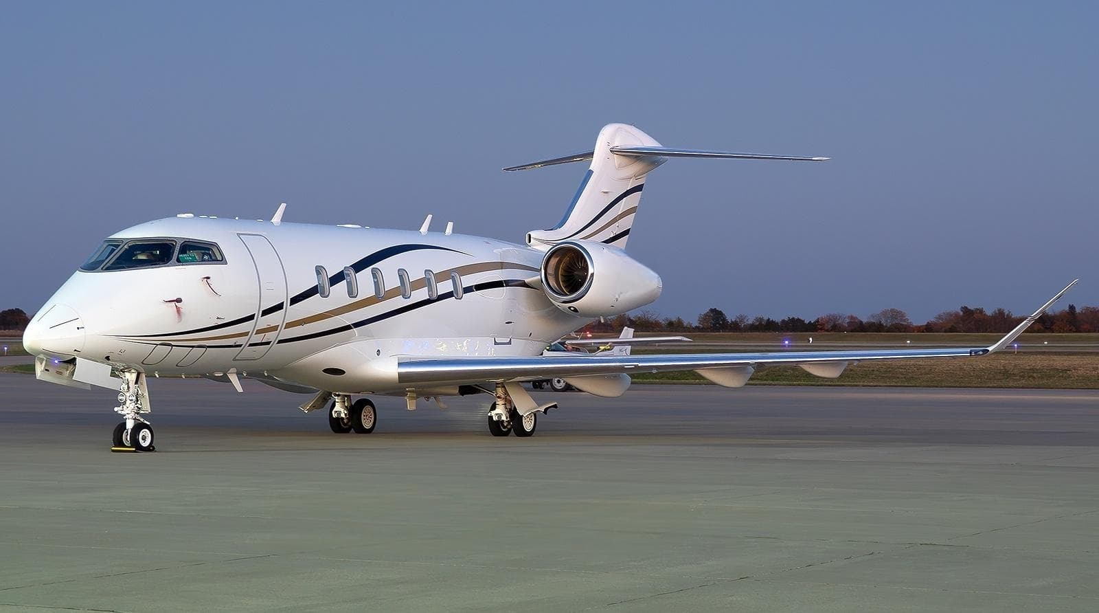 Wed, Nov 11in 8 daysHoustonKIAH · George Bush Intercontinental Houston AirportSt LouisKSUS · Spirit of St Louis AirportChallenger 35010—$33,60511NovHouston → St LouisKIAH → KSUS · in 8 daysChallenger 350 · 10 seats$33,605
- Sun, Nov 15in 12 daysHoustonKIAH · George Bush Intercontinental Houston AirportConcordKJQF · Concord Regional AirportPilatus PC-248—$8,91015NovHouston → ConcordKIAH → KJQF · in 12 daysPilatus PC-24 · 8 seats$8,910
- Sun, Nov 15in 12 daysHoustonKIAH · George Bush Intercontinental Houston AirportRock HillKUZA · Rock Hill - York County AirportBeechcraft Hawker 900XP8—$13,53015NovHouston → Rock HillKIAH → KUZA · in 12 daysBeechcraft Hawker 900XP · 8 seats$13,530
- Mon, Nov 16in 13 daysHoustonKIAH · George Bush Intercontinental Houston AirportVan NuysKVNY · Van Nuys AirportBeechcraft Hawker 900XP8—$17,49016NovHouston → Van NuysKIAH → KVNY · in 13 daysBeechcraft Hawker 900XP · 8 seats$17,490
 KIAH · George Bush Intercontinental Houston Airport
* Total price incl. 10% service fee, converted to your selected currency. Price subject to operator confirmation.
Empty legs to KIAH
13 arrivals available
- Tue, Nov 3TodaySanta BarbaraKSBA · Santa Barbara MunHoustonKIAH · George Bush Intercontinental HFalcon 900B——On request3NovSanta Barbara → HoustonKSBA → KIAH · TodayFalcon 900BOn request
- Tue, Nov 3TodayDetroitKDET · Coleman A. Young Municipal AirportHoustonKIAH · George Bush Intercontinental Houston AirportDassault Falcon 900B152h 54mOn request3NovDetroit → HoustonKDET → KIAH · TodayDassault Falcon 900B · 15 seats · 2h 54mOn request
 Wed, Nov 4TomorrowSanta BarbaraKSBA · Santa Barbara Municipal AirportHoustonKIAH · George Bush Intercontinental Houston AirportFalcon 90014—$31,0204NovSanta Barbara → HoustonKSBA → KIAH · TomorrowFalcon 900 · 14 seats$31,020
- Wed, Nov 4TomorrowSanta BarbaraKSBA · Santa Barbara Municipal AirportHoustonKIAH · George Bush Intercontinental Houston AirportFalcon 900B8—€27,6854NovSanta Barbara → HoustonKSBA → KIAH · TomorrowFalcon 900B · 8 seats€27,685
- Wed, Nov 4TomorrowVan NuysKVNY · Van Nuys AirportHoustonKIAH · George Bush Intercontinental Houston AirportBombardier Global 5000123h€20,6954NovVan Nuys → HoustonKVNY → KIAH · TomorrowBombardier Global 5000 · 12 seats · 3h€20,695
- Thu, Nov 517:12TeterboroKTEB · Teterboro AirportHoustonKIAH · George Bush Intercontinental Houston AirportEmbraer Legacy 60013—$46,3105NovTeterboro → HoustonKTEB → KIAH · 17:12Embraer Legacy 600 · 13 seats$46,310
- Thu, Nov 5in 2 daysNashvilleKBNA · Nashville International AirportHoustonKIAH · George Bush Intercontinental Houston AirportGulfstream G20091h 48mOn request5NovNashville → HoustonKBNA → KIAH · in 2 daysGulfstream G200 · 9 seats · 1h 48mOn request
- Tue, Nov 24in 21 daysNaplesKAPF · Naples Municipal AirportHoustonKIAH · George Bush Intercontinental Houston AirportCessna Citation XLS8—$15,95024NovNaples → HoustonKAPF → KIAH · in 21 daysCessna Citation XLS · 8 seats$15,950
- Sun, Dec 13in 40 daysSan AntonioKSAT · San Antonio International AirportHoustonKIAH · George Bush Intercontinental Houston AirportBeechcraft Beechjet 400A748mOn request13DecSan Antonio → HoustonKSAT → KIAH · in 40 daysBeechcraft Beechjet 400A · 7 seats · 48mOn request
* Total price incl. 10% service fee, converted to your selected currency. Price subject to operator confirmation.
Map: Houston Airport
View the location of Houston – IAH/KIAH. Zoom in to explore the area around the airport.
About the airport
George Bush Intercontinental Houston Airport (IAH/KIAH) is the key private jet gateway for Houston. PrivJet gives you instant access to charter flights and empty legs: fast, discreet and globally connected.
KIAH airport FAQ
Are there any restrictions at Houston airport (KIAH) today?
There are currently 50 valid NOTAMs for Houston (KIAH). According to NOTAM, at least one runway or the aerodrome itself is closed. Affected: Runway: closed; Taxiway: closed; Apron: closed; Obstacle: out of service and 3 more. 3 more NOTAMs start in the coming days. For information only, not for flight planning or operational use. Always rely on an official pre-flight briefing. This list may be incomplete or out of date.
How long are the runways at Houston airport (KIAH)?
Houston (KIAH) has 5 runways: runway 15L/33R with 3,658 m (12,001 ft), concrete, runway 09/27 with 3,048 m (10,000 ft), asphalt, runway 15R/33L with 3,048 m (10,000 ft), concrete, runway 08R/26L with 2,866 m (9,402 ft), concrete and runway 08L/26R with 2,743 m (9,000 ft), concrete. The longest is 3,658 m.
What are the radio frequencies at Houston airport (KIAH)?
Frequencies at KIAH: Tower 29.02 / 120.725 MHz, Ground 118.575 MHz and ATIS 124.05 MHz. For information only. Always rely on the published AIP.
What are the airport codes of George Bush Intercontinental Houston Airport?
The ICAO code is KIAH and the IATA code is IAH. ICAO codes are used by air traffic control and pilots, e.g. in flight plans; IATA codes appear on tickets and baggage tags.
What is the elevation of KIAH airport?
George Bush Intercontinental Houston Airport sits at 97 ft (30 m) above sea level. Local time zone: America/Chicago.
Can I fly to KIAH by private jet?
Whether a private jet can operate into George Bush Intercontinental Houston Airport depends on runway length, opening hours, customs and immigration rules as well as slot and handling availability, among other things. PrivJet checks this with the operating carrier for every request.
Are there empty legs from or to KIAH?
There are currently 17 empty legs departing from and 13 arriving at George Bush Intercontinental Houston Airport. Empty legs are repositioning flights at heavily reduced prices; the list is updated several times a day.