Wichita Mid Continent Airport (KICT / ICT)
Empty legs and charters from Wichita
KICT airport at a glance
- ICAO code
- KICT
- IATA code
- ICT
- City
- Wichita
- Region
- Kansas
- Country
- United States
- Elevation
- 1,333 ft (406 m)
- Time zone
- America/Chicago (UTC-6)
- Coordinates
- 37.6499° N, 97.4331° W
- Empty legs from
- 2
- Empty legs to
- 4
Weather & airport info KICT
Current weather
Marginal visual conditions (MVFR)observed 03 Nov, 13:53 UTC- Wind
- 12 kt (22 km/h) from north-northwest (330°), gusts up to 23 kt
- Visibility
- 10 km or more
- Clouds
- overcast at 1,600 ft
- Temperature
- 15 °C (dew point 13 °C)
- Pressure (QNH)
- 1,006 hPa
Original weather report (METAR)
METAR KICT 031353Z 33012G23KT 10SM OVC016 15/13 A2969 RMK AO2 SLP048 T01500128
Forecast (TAF)
- 03 Nov, 13:00–02:00 UTCfrom21 kt (39 km/h) from north-northwest (330°), gusts up to 31 kt · visibility 10 km or more · overcast at 1,500 ft
- 04 Nov, 02:00–05:00 UTCfrom11 kt (20 km/h) from northwest (320°) · visibility 10 km or more · broken clouds at 5,000 ft
- 04 Nov, 05:00–12:00 UTCfrom6 kt (11 km/h) from northwest (310°) · visibility 10 km or more · scattered clouds at 7,000 ft
Original forecast (TAF)
TAF KICT 031147Z 0312/0412 34005KT P6SM VCSH OVC015 FM031300 33021G31KT P6SM OVC015 FM040200 32011KT P6SM BKN050 FM040500 31006KT P6SM SCT070
Airport
- Elevation
- 1,333 ft (406 m)
- Sunrise / Sunset
- 06:56 / 17:29 local time
Runways
| Runway | Length | Surface | Lighted |
|---|---|---|---|
| 01L/19R | 3,140 m (10,302 ft) | concrete | yes |
| 01R/19L | 2,226 m (7,302 ft) | concrete | yes |
| 14/32 | 1,921 m (6,301 ft) | concrete | yes |
Radio frequencies
- Approach: 32.71
- Approach: 125.5
- ATIS: 125.15
- Clearance: 125.7
- Ground: 121.9
- Tower: 118.2
- UNICOM: 122.95
For information only, not for flight planning. Weather can change quickly; always rely on official reports. Sources: aviationweather.gov (NOAA), OurAirports.
Airport map KICT
Full screen →Runways white, taxiways yellow with designators, closed taxiways and runways per NOTAM in red.
Closed per NOTAM: RWY 1R/19L
Official charts (FAA)
Cycle 2611, valid until 0901Z 11/26/26
Airport diagram (FAA)
Airport diagram (1)
Instrument approaches (18)
- ILS OR LOC RWY 01L
- ILS OR LOC RWY 01R
- ILS OR LOC RWY 19L
- ILS OR LOC RWY 19R
- ILS RWY 01L (SA CAT I)
- ILS RWY 01L (CAT II)
- RNAV (RNP) Z RWY 01L
- RNAV (RNP) Z RWY 14
- RNAV (RNP) Z RWY 19L
- RNAV (RNP) Z RWY 19R
- RNAV (GPS) RWY 01R
- RNAV (GPS) RWY 32
- RNAV (GPS) Y RWY 01L
- RNAV (GPS) Y RWY 14
- RNAV (GPS) Y RWY 19L
- RNAV (GPS) Y RWY 19R
- VOR RWY 14
- NDB RWY 01R
Minimums (2)
Hot spots (1)
For information only, not for navigation. Always use current official charts and NOTAMs.
Current NOTAMs for KICT(16)
NOTAMs (Notices to Air Missions) announce short-term changes at an airport: closed runways or taxiways, unserviceable approach aids, obstacles, airspace restrictions.
- ClosedRunway: closedA3901/26· until 05 Nov, 23:00 UTC
Runway 01R/19L at Wichita Dwight D. Eisenhower National Airport is closed.
Show original text
RWY 01R/19L CLSD
A3901/26 NOTAMN
Q) KZKC/QMRLC////000/999/3738N09725W005
A) KICT
B) 2611021515
C) 2611052300
E) RWY 01R/19L CLSD
- Out of serviceWind indicator: not availableA3913/26· until 03 Nov, 20:30 UTC
The microburst and wind shear detection system at Wichita airport is not available. This system warns of sudden, strong winds.
Show original text
SVC MBST/WS DETECTION SYSTEM NOT AVBL
A3913/26 NOTAMN
Q) KZKC/QFWAU////000/999/3738N09725W005
A) KICT
B) 2611031300
C) 2611032030
E) SVC MBST/WS DETECTION SYSTEM NOT AVBL
- Out of serviceILS: unserviceableA3902/26· until 05 Nov, 15:00 UTC
The Instrument Landing System (ILS) for runway 01R is out of service. The ILS guides aircraft to the runway in poor visibility.
Show original text
ICT NAV ILS RWY 01R U/S
A3902/26 NOTAMN
Q) KZKC/QICAS////000/999/3738N09725W005
A) KICT
B) 2611021530
C) 2611051500
E) ICT NAV ILS RWY 01R U/S
- Out of serviceILS: unserviceableA3903/26· until 05 Nov, 15:00 UTC
The instrument landing system (ILS) for runway 19L at ICT airport is out of service. The ILS guides aircraft to the runway in poor visibility.
Show original text
ICT NAV ILS RWY 19L U/S
A3903/26 NOTAMN
Q) KZKC/QICAS////000/999/3738N09725W005
A) KICT
B) 2611021530
C) 2611051500
E) ICT NAV ILS RWY 19L U/S
- Out of servicePAPI: unserviceableA3904/26· until 05 Nov, 15:00 UTC
The Precision Approach Path Indicators (PAPI) for runway 19L are out of service. These lights help pilots maintain the correct approach angle to the runway.
Show original text
RWY 19L PAPI U/S
A3904/26 NOTAMN
Q) KZKC/QLPAS////000/999/3738N09725W005
A) KICT
B) 2611021530
C) 2611051500
E) RWY 19L PAPI U/S
- Out of serviceApproach lighting: unserviceableA3905/26· until 05 Nov, 15:00 UTC
The approach lighting system (ALS) for runway 19L is out of service. Approach lighting helps pilots find the runway in poor visibility.
Show original text
RWY 19L ALS U/S
A3905/26 NOTAMN
Q) KZKC/QLAAS////000/999/3738N09725W005
A) KICT
B) 2611021530
C) 2611051500
E) RWY 19L ALS U/S
- Out of serviceApproach lighting: unserviceableA3906/26· until 05 Nov, 15:00 UTC
The approach lighting system (ALS) for runway 01R is out of service. Approach lighting helps pilots find the runway in poor visibility.
Show original text
RWY 01R ALS U/S
A3906/26 NOTAMN
Q) KZKC/QLAAS////000/999/3738N09725W005
A) KICT
B) 2611021530
C) 2611051500
E) RWY 01R ALS U/S
- Out of servicePAPI: unserviceableA3899/26· until 06 Nov, 20:00 UTC
The Precision Approach Path Indicator (PAPI) for runway 19L is out of service. This system helps pilots maintain the correct glide path to the runway.
Show original text
RWY 19L PAPI U/S
A3899/26 NOTAMN
Q) KZKC/QLPAS////000/999/3738N09725W005
A) KICT
B) 2611020406
C) 2611062000
E) RWY 19L PAPI U/S
8 more NOTAMs
- Out of serviceTaxiwayA3898/26· until 05 Nov, 21:00 UTC
The holding position sign light for taxiway E1 is out of service. This means the lighting at the holding position of taxiway E1 is not working.
Show original text
TWY E1 HLDG PSN SIGN LGT U/S
A3898/26 NOTAMN
Q) KZKC/QMXXX////000/999/3738N09725W005
A) KICT
B) 2611020052
C) 2611052100
E) TWY E1 HLDG PSN SIGN LGT U/S
- Out of serviceObstacle10/664· until 27 Feb, 06:15 UTC
An obstacle, a tower, has its light out of service 9.3 nautical miles north-northwest of the airport. Its top is 1598.1 feet above sea level, 230.0 feet above ground.
Show original text
OBST TOWER LGT (ASR 1037574) 374744.80N0973002.50W (9.3NM NNW ICT) 1598.1FT (230.0FT AGL) U/S
- Out of serviceApproach lighting: unserviceableA3825/26· until 04 Nov, 20:00 UTC
The approach lighting system (ALS) for runway 01L is out of service.
Show original text
RWY 01L ALS U/S
A3825/26 NOTAMN
Q) KZKC/QLAAS////000/999/3738N09725W005
A) KICT
B) 2610280843
C) 2611042000
E) RWY 01L ALS U/S
- Out of serviceObstacle lights: unserviceableA3764/26· until 10 Dec, 18:45 UTC
The lighting on a tower 10 nautical miles northwest of the airport is out of service. Its top is 2549 feet above sea level, 1154 feet above ground.
Show original text
TOWER LGT (ASR 1032119) 374746.70N0973200.50W (10NM NW ICT) 2549FT (1154FT AGL) U/S
A3764/26 NOTAMN
Q) KZKC/QOLAS/IV/M/E/000/999/3747N09732W001
A) KICT
B) 2610261245
C) 2612101845
E) TOWER LGT (ASR 1032119) 374746.70N0973200.50W (10NM NW ICT) 2549FT (1154FT AGL) U/S
- NoticeILSA3907/26· until 05 Nov, 15:00 UTC
The Instrument Landing System (ILS) for runway 19L is unusable from the decision altitude (DA) to the touchdown zone (TDZ). The ILS guides aircraft to the runway in poor visibility.
Show original text
ICT NAV ILS RWY 19L UNUSABLE DA TO TDZ
A3907/26 NOTAMN
Q) KZKC/QICXX////000/999/3738N09725W005
A) KICT
B) 2611021535
C) 2611051500
E) ICT NAV ILS RWY 19L UNUSABLE DA TO TDZ
- NoticeObstacle11/008· until 08 Nov, 23:59 UTC
There are dirt piles 1000 ft southeast of the approach end of runway 19L. Their top is 5 ft above ground and they are neither flagged nor lighted.
Show original text
OBST DIRT PILES (ASN UNKNOWN) 373931N0972506W (1000FT SE APCH END RWY 19L) UNKNOWN (5FT AGL) NOT FLAGGED OR LGTD
- NoticeAir/ground facility: operating frequency changed10/657· permanent
The frequency for remote transmit/receive 307.9 has been changed to 317.425. Pilots must use the new frequency.
Show original text
COM REMOTE TRANS/REC 307.9 CHANGED TO 317.425
10/657 NOTAMN
Q) KZKC/QCACF/IV/B/AE/000/999/3738N09725W025
A) KICT
B) 2610291922
C) PERM
E) REMOTE TRANS/REC 307.9 CHANGED TO 317.425
- Out of serviceILS category II: not availableA3826/26· until 04 Nov, 20:00 UTC
The instrument landing system (ILS) for runway 01L is not available for Category II approaches. The ILS guides aircraft to the runway in poor visibility.
Show original text
ICT NAV ILS RWY 01L CAT II NA
A3826/26 NOTAMN
Q) KZKC/QITAU////000/999/3738N09725W005
A) KICT
B) 2610280844
C) 2611042000
E) ICT NAV ILS RWY 01L CAT II NA
For information only, not for flight planning or operational use. Always rely on an official pre-flight briefing. This list may be incomplete or out of date. Explanations and expanded abbreviations are generated automatically. The original text is authoritative. Source: FAA NOTAM Management Service (SWIM).
Private jet traffic in Wichita Mid Continent Airport (last 30 days)
- Arrivals
- 978
- Departures
- 631
- Different jets
- 593
Most frequent origins: Charles B. Wheeler Downtown Airport (21), Teterboro Airport (14), Dallas Love Field (14), Minneapolis-St Paul International/Wold-Chamberlain Airport (13), Washington Dulles International Airport (12).
Most frequent destinations: Charles B. Wheeler Downtown Airport (27), Liberal Mid-America Regional Airport (15), Dallas Love Field (10), Centennial Airport (9), Harry Reid International Airport (8).
Most common aircraft types: Beechcraft King Air 90 (186), Cessna Citation Excel/XLS (129), Cessna Citation CJ3 (121), Cessna Citation Latitude (85), Beechcraft King Air 200/250 (79).
Thursday is the busiest day.
Our own analysis of public ADS-B signals from business jets. Not every flight is received, and jets with a removal request are excluded.
Charter operators based here
Operators with a base at this airport.
- Executive Jet ManagementWhite Plains (Westchester County) (KHPN) · Light jet, Midsize jet, Super midsize jet
- Wheels UpDenver (Rocky Mountain Metropolitan) (KBJC) · Turboprop, Light jet, Midsize jet
- Clemens AviationWichita (Colonel James Jabara) (KAAO) · Light jet
- Aero CharterSt Louis (Spirit of St Louis) (KSUS) · Turboprop, Light jet, Midsize jet
Empty legs from KICT
2 departures available
- Fri, Nov 27in 24 daysWichitaKICT · Wichita Mid Continent AirportMilwaukeeKMKE · General Mitchell International AirportCessna Citation CJ48—On request27NovWichita → MilwaukeeKICT → KMKE · in 24 daysCessna Citation CJ4 · 8 seatsOn request
- Sun, Nov 2902:00WichitaKICT · Dwight D. Eisenhower NatlGypsumKEGE · Eagle County RegionalCessna Citation Bravo8—On request29NovWichita → GypsumKICT → KEGE · 02:00Cessna Citation Bravo · 8 seatsOn request
 KICT · Wichita Mid Continent Airport
* Total price incl. 10% service fee, converted to your selected currency. Price subject to operator confirmation.
Empty legs to KICT
4 arrivals available
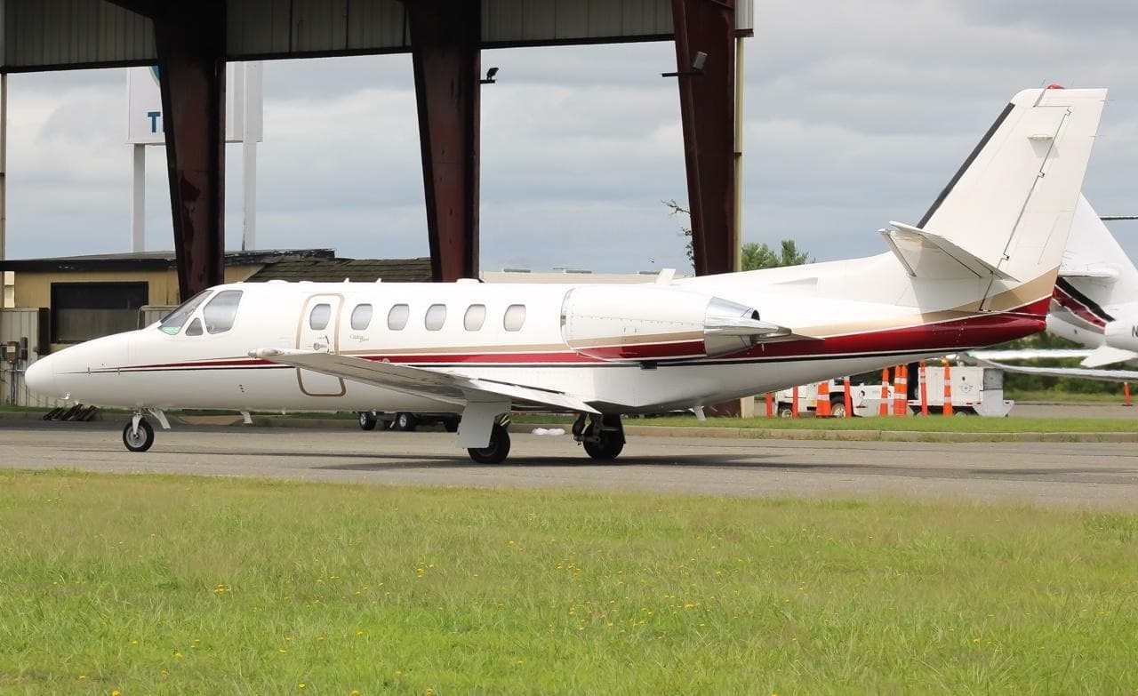 Thu, Nov 26in 23 daysFayettevilleKXNA · Northwest Arkansas Regional AirportWichitaKICT · Wichita Mid Continent AirportCitation Bravo8—On request26NovFayetteville → WichitaKXNA → KICT · in 23 daysCitation Bravo · 8 seatsOn request
 Fri, Nov 2700:24Fayetteville/Springdale/RogersKXNA · Northwest Arkansas National AirportWichitaKICT · Wichita Eisenhower National AirportCessna Citation Bravo8—$7,73227NovFayetteville/Springdale/Rogers → WichitaKXNA → KICT · 00:24Cessna Citation Bravo · 8 seats$7,732
- Sat, Dec 5in 32 daysSeattleKBFI · Boeing Field King County International AirportWichitaKICT · Wichita Mid Continent AirportCessna Citation Excel83h 24mOn request5DecSeattle → WichitaKBFI → KICT · in 32 daysCessna Citation Excel · 8 seats · 3h 24mOn request
- Mon, Dec 7in 34 daysMilwaukeeKMKE · General Mitchell International AirportWichitaKICT · Wichita Mid Continent AirportCessna Citation CJ48—On request7DecMilwaukee → WichitaKMKE → KICT · in 34 daysCessna Citation CJ4 · 8 seatsOn request
* Total price incl. 10% service fee, converted to your selected currency. Price subject to operator confirmation.
Map: Wichita Airport
View the location of Wichita – ICT/KICT. Zoom in to explore the area around the airport.
About the airport
Wichita Mid Continent Airport (ICT/KICT) is the key private jet gateway for Wichita. PrivJet gives you instant access to charter flights and empty legs: fast, discreet and globally connected.
KICT airport FAQ
Are there any restrictions at Wichita airport (KICT) today?
There are currently 16 valid NOTAMs for Wichita (KICT). According to NOTAM, at least one runway or the aerodrome itself is closed. Affected: Runway: closed; Wind indicator: not available; ILS: unserviceable; PAPI: unserviceable and 5 more. For information only, not for flight planning or operational use. Always rely on an official pre-flight briefing. This list may be incomplete or out of date.
What is the weather at Wichita airport (KICT)?
According to the latest weather report for KICT (METAR, 03 Nov, 13:53 UTC): Marginal visual conditions (MVFR). Wind 12 kt (22 km/h) from north-northwest (330°), gusts up to 23 kt, visibility 10 km or more, temperature 15 °C (dew point 13 °C). For information only, not for flight planning. Weather can change quickly; always rely on official reports.
How long are the runways at Wichita airport (KICT)?
Wichita (KICT) has 3 runways: runway 01L/19R with 3,140 m (10,302 ft), concrete, runway 01R/19L with 2,226 m (7,302 ft), concrete and runway 14/32 with 1,921 m (6,301 ft), concrete. The longest is 3,140 m.
What are the radio frequencies at Wichita airport (KICT)?
Frequencies at KICT: Tower 118.2 MHz, Ground 121.9 MHz and ATIS 125.15 MHz. For information only. Always rely on the published AIP.
What are the airport codes of Wichita Mid Continent Airport?
The ICAO code is KICT and the IATA code is ICT. ICAO codes are used by air traffic control and pilots, e.g. in flight plans; IATA codes appear on tickets and baggage tags.
What is the elevation of KICT airport?
Wichita Mid Continent Airport sits at 1,333 ft (406 m) above sea level. Local time zone: America/Chicago.
Can I fly to KICT by private jet?
Whether a private jet can operate into Wichita Mid Continent Airport depends on runway length, opening hours, customs and immigration rules as well as slot and handling availability, among other things. PrivJet checks this with the operating carrier for every request.
Are there empty legs from or to KICT?
There are currently 2 empty legs departing from and 4 arriving at Wichita Mid Continent Airport. Empty legs are repositioning flights at heavily reduced prices; the list is updated several times a day.