Wilmington New Castle Airport (KILG / ILG)
Empty legs and charters from Wilmington
KILG airport at a glance
- ICAO code
- KILG
- IATA code
- ILG
- City
- Wilmington
- Region
- Delaware
- Country
- United States
- Elevation
- 80 ft (24 m)
- Time zone
- America/New York (UTC-5)
- Coordinates
- 39.6787° N, 75.6065° W
- Empty legs from
- 30
- Empty legs to
- 40
Weather & airport info KILG
Current weather
Good visual conditions (VFR)observed 03 Nov, 15:51 UTC- Wind
- 7 kt (13 km/h) from southwest (230°)
- Visibility
- 10 km or more
- Clouds
- no significant clouds
- Temperature
- 18 °C (dew point 12 °C)
- Pressure (QNH)
- 1,027 hPa
Original weather report (METAR)
METAR KILG 031551Z 23007KT 10SM CLR 18/12 A3033 RMK AO2 SLP271 T01830122 PNO $
Forecast (TAF)
- 03 Nov, 15:00–00:00 UTCfrom6 kt (11 km/h) from south-southwest (200°) · visibility 10 km or more · scattered clouds at 10,000 ft
- 04 Nov, 00:00–12:00 UTCfrom2 kt (4 km/h) from variable directions · visibility 10 km or more · scattered clouds at 20,000 ft
Original forecast (TAF)
TAF KILG 031359Z 0314/0412 19006KT P6SM OVC100 FM031500 20006KT P6SM SCT100 FM040000 VRB02KT P6SM SCT200
Airport
- Elevation
- 80 ft (24 m)
- Sunrise / Sunset
- 06:33 / 16:58 local time
Runways
| Runway | Length | Surface | Lighted |
|---|---|---|---|
| 09/27 | 2,217 m (7,275 ft) | asphalt | yes |
| 01/19 | 2,137 m (7,012 ft) | asphalt | yes |
| 14/32 | 1,403 m (4,602 ft) | asphalt | yes |
Radio frequencies
- ATIS: 123.95
- Clearance: 119.95
- CTAF: 126
- Ground: 121.7
- Tower: 126
- UNICOM: 122.95
For information only, not for flight planning. Weather can change quickly; always rely on official reports. Sources: aviationweather.gov (NOAA), OurAirports.
Airport map KILG
Full screen →Runways white, taxiways yellow with designators, closed taxiways and runways per NOTAM in red.
Official charts (FAA)
Cycle 2611, valid until 0901Z 11/26/26
Airport diagram (FAA)
Airport diagram (1)
Instrument approaches (7)
Minimums (2)
Hot spots (1)
LAHSO (1)
For information only, not for navigation. Always use current official charts and NOTAMs.
Current NOTAMs for KILG(7)
NOTAMs (Notices to Air Missions) announce short-term changes at an airport: closed runways or taxiways, unserviceable approach aids, obstacles, airspace restrictions.
- Out of serviceObstacle lights: unserviceable10/083· until 17 Feb, 05:23 UTC
A tower 1.8 nautical miles west of the airport is out of service. Its top is 224.7 feet above sea level, 188.0 feet above ground.
Show original text
OBST TOWER LGT (ASR 1034571) 394043.30N0753848.90W (1.8NM W ILG) 224.7FT (188.0FT AGL) U/S
10/083 NOTAMN<br/>
<b>Q) </b>KZDC/QOLAS/IV/M/AE/000/003/3940N07536W005<br/>
<b>A) </b>KILG<br/>
<b>B) </b>2610200523<br/>
<b>C) </b>2702170523<br/>
<b>E) </b> TOWER LGT (ASR 1034571) 394043.30N0753848.90W (1.8NM W ILG) 224.7FT (188.0FT AGL) U/S<br/>
- ClosedTaxiway: closed10/068· until 30 Nov, 20:00 UTC
The runup pad for runway 27 on taxiway N at New Castle Airport is closed.
Show original text
TWY N RUNUP PAD FOR RWY 27 CLSD
10/068 NOTAMN
Q) KZDC/QMXLC/IV/M/A/000/999/3940N07536W005
A) KILG
B) 2610161056
C) 2611302000

E) TWY N RUNUP PAD FOR RWY 27 CLSD
- Out of serviceObstacle10/056· until 29 Nov, 03:53 UTC
The obstacle tower light (ASR 1280249) 8.9 nautical miles northeast of New Castle airport is out of service. Its top is 863 feet above sea level, 496 feet above ground.
Show original text
OBST TOWER LGT (ASR 1280249) 394856.20N0753148.00W (8.9NM NE ILG) 863FT (496FT AGL) U/S
- Out of serviceObstacle10/050· until 13 Jan, 23:59 UTC
The lighting of a tower near New Castle Airport is out of service. Its top is 262 ft above sea level, 205 ft above ground.
Show original text
OBST TOWER LGT (ASR 1327818) 393755.90N0754401.40W (6.5NM WSW ILG) 262FT (205FT AGL) U/S
10/050 NOTAMN<BR>
<B>Q) </B>KZDC/QOLAS/IV/M/E/000/003/3940N07536W005<BR>
<B>A) </B>KILG<BR>
<B>B) </B>2610131712<BR>
<B>C) </B>2701132359<BR>
<B>E) </B> TOWER LGT (ASR 1327818) 393755.90N0754401.40W (6.5NM WSW ILG) 262FT (205FT AGL) U/S<BR>
- Out of serviceILS: unserviceable10/002· until 16 Apr, 23:59 UTC (estimated)
The Instrument Landing System (ILS) for runway 01 is out of service. The ILS guides aircraft to the runway in poor visibility.
Show original text
NAV ILS RWY 01 OM U/S
10/002 NOTAMR
Q) KZDC/QICAS/IV/NBO/A/000/999/3940N07536W025
A) KILG
B) 2610011352
C) 2704162359EST

E) ILS RWY 01 OM U/S
- NoticeObstacle11/007· until 05 Nov, 05:00 UTC
An unlit stack (chimney), whose top is 509 feet above sea level and 489 feet above ground, is located 5.4 nautical miles east of the airport.
Show original text
OBST STACK (ASN UNKNOWN) 394134N0752912W (5.4NM E ILG) 509FT (489FT AGL) NOT LGTD
- NoticeAerodrome: concentration of birds10/067· until 15 Nov, 20:00 UTC
At New Castle Airport, there is increased bird activity from gulls, geese, and starlings.
Show original text
AD AP BIRD ACT GULLS GEESE STARLINGS
10/067 NOTAMR
Q) KZDC/QFAHX/IV/NBO/A/000/999/3940N07536W005
A) KILG
B) 2610161051
C) 2611152000

E) AP BIRD ACT GULLS GEESE STARLINGS
For information only, not for flight planning or operational use. Always rely on an official pre-flight briefing. This list may be incomplete or out of date. Explanations and expanded abbreviations are generated automatically. The original text is authoritative. Source: FAA NOTAM Management Service (SWIM).
Private jet traffic in New Castle Airport (last 30 days)
- Arrivals
- 382
- Departures
- 347
- Different jets
- 259
Most frequent origins: Teterboro Airport (19), Philadelphia International Airport (14), Washington Dulles International Airport (12), Laurence G Hanscom Field (8), Westchester County Airport (7).
Most frequent destinations: Teterboro Airport (14), Westchester County Airport (12), Philadelphia International Airport (10), Laurence G Hanscom Field (9), Cincinnati Municipal Airport Lunken Field (8).
Most common aircraft types: Embraer Phenom 300 (63), Dassault Falcon 2000 (46), Dassault Falcon 900 (45), Pilatus PC-12 (39), Cessna Citation Excel/XLS (34).
Our own analysis of public ADS-B signals from business jets. Not every flight is received, and jets with a removal request are excluded.
Charter operators based here
Operators with a base at this airport.
- Solairus AviationVan Nuys (KVNY) · Turboprop, Light jet, Midsize jet
- Executive Jet ManagementWhite Plains (Westchester County) (KHPN) · Light jet, Midsize jet, Super midsize jet
- flyExclusiveKinston (Regional Jetport) (KISO) · Turboprop, Light jet, Midsize jet
- Jet Aviation Flight ServicesTeterboro (KTEB) · Light jet, Super midsize jet, Heavy jet
- Fly AllianceOrlando Executive (KORL) · Light jet, Midsize jet, Super midsize jet
- Alerion AviationWest Palm Beach (President Donald J Trump Intl) (KDJT) · Turboprop, Super midsize jet, Heavy jet
- flyAdvancedLight jet, Midsize jet, Heavy jet
- Ace Transport ServiceTurboprop, Midsize jet, Piston aircraft
- Horizon HelicoptersHelicopter
- Kennedy CampusSuper midsize jet
Empty legs from KILG
30 departures available
- Tue, Nov 3TodayWilmingtonKILG · New Castle AirportAlbanyKALB · Albany International AirportCirrus SR22——On request3NovWilmington → AlbanyKILG → KALB · TodayCirrus SR22On request
 Tue, Nov 3TodayWilmingtonKILG · New Castle AirportEast HamptonKJPX · Town of East Hampton AirportChallenger 3008—On request3NovWilmington → East HamptonKILG → KJPX · TodayChallenger 300 · 8 seatsOn request
- Wed, Nov 4TomorrowWilmingtonKILG · New Castle AirportBedfordKBED · Laurence G Hanscom FieldChallenger 3008—On request4NovWilmington → BedfordKILG → KBED · TomorrowChallenger 300 · 8 seatsOn request
 Thu, Nov 507:30WilmingtonKILG · New Castle AirportBuffaloKBUF · Buffalo Niagara International AirportBombardier Challenger 604154m$5,8825NovWilmington → BuffaloKILG → KBUF · 07:30Bombardier Challenger 604 · 1 seat · 54m$5,882
- Sat, Nov 705:00WilmingtonKILG · New Castle CountyDenverKBJC · Rocky Mountain MetropolitanDassault Falcon 509—$37,8137NovWilmington → DenverKILG → KBJC · 05:00Dassault Falcon 50 · 9 seats$37,813
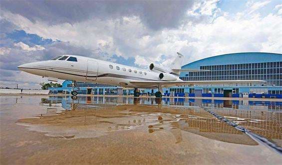 Sat, Nov 7in 4 daysWilmingtonKILG · New Castle AirportDenverKBJC · Rocky Mountain Metropolitan AirportFalcon 509—$32,3137NovWilmington → DenverKILG → KBJC · in 4 daysFalcon 50 · 9 seats$32,313
- Thu, Nov 12in 9 daysWilmingtonKILG · New Castle AirportOcalaKOCF · Ocala International Jim Taylor FieldCessna Citation CJ3——On request12NovWilmington → OcalaKILG → KOCF · in 9 daysCessna Citation CJ3On request
- Sat, Nov 28in 25 daysWilmingtonKILG · New Castle AirportBrunswickKSSI · St. Simons Island Airport at McKinnon FieldCessna Citation XLS——On request28NovWilmington → BrunswickKILG → KSSI · in 25 daysCessna Citation XLSOn request
- Sat, Nov 2821:48WilmingtonKILG · New Castle CountyBedfordKBED · Laurence G. Hanscom FieldEmbraer Phenom 1006—On request28NovWilmington → BedfordKILG → KBED · 21:48Embraer Phenom 100 · 6 seatsOn request
 KILG · New Castle Airport
* Total price incl. 10% service fee, converted to your selected currency. Price subject to operator confirmation.
Empty legs to KILG
40 arrivals available
- Tue, Nov 3TodayCharlestonKCHS · Charleston Air Force Base-International AirportWilmingtonKILG · New Castle AirportDassault Falcon 900LX——On request3NovCharleston → WilmingtonKCHS → KILG · TodayDassault Falcon 900LXOn request
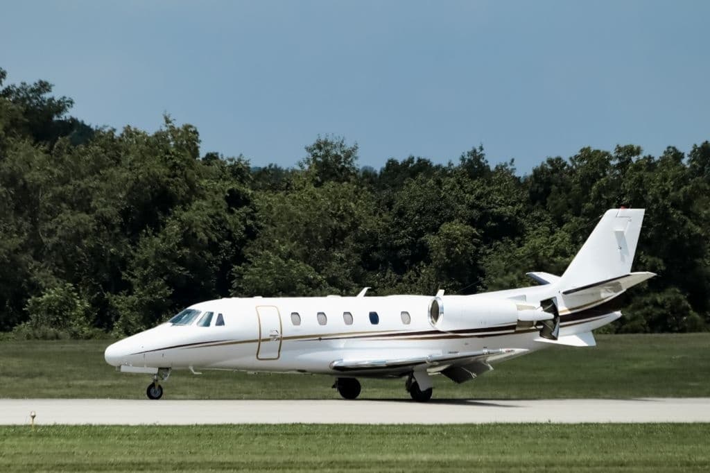 Tue, Nov 3TodayNew YorkKTEB · Teterboro AirportWilmingtonKILG · New Castle AirportCitation XLS9—On request3NovNew York → WilmingtonKTEB → KILG · TodayCitation XLS · 9 seatsOn request
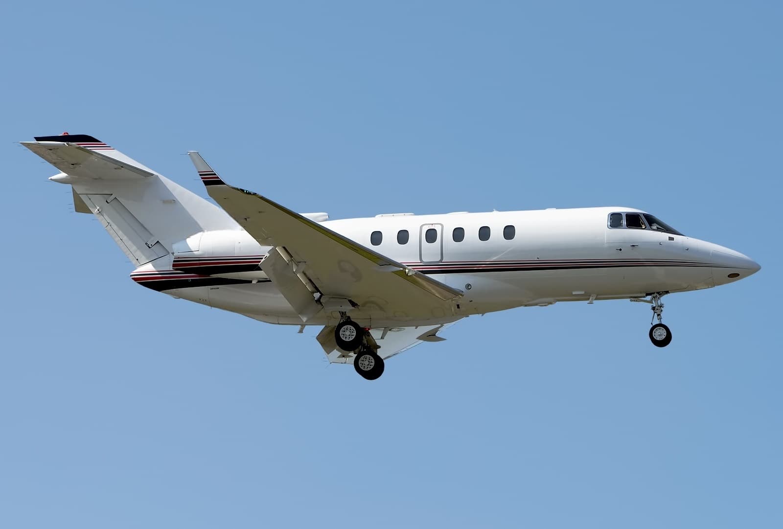 Wed, Nov 4TomorrowStuartKSUA · Witham FieldWilmingtonKILG · New Castle AirportHawker 800XP8—$16,0854NovStuart → WilmingtonKSUA → KILG · TomorrowHawker 800XP · 8 seats$16,085
- Thu, Nov 5in 2 daysNewburghKSWF · Stewart International AirportWilmingtonKILG · New Castle AirportCessna Citation XLS——On request5NovNewburgh → WilmingtonKSWF → KILG · in 2 daysCessna Citation XLSOn request
- Thu, Nov 521:15WinchesterKOKV · Winchester Regional AirportWilmingtonKILG · Wilmington AirportCessna Citation XLS+8—$9,0205NovWinchester → WilmingtonKOKV → KILG · 21:15Cessna Citation XLS+ · 8 seats$9,020
- Fri, Nov 6in 3 daysOkaoAYOF · Okao AirportWilmingtonKILG · New Castle AirportBombardier Global 600014—$154,0006NovOkao → WilmingtonAYOF → KILG · in 3 daysBombardier Global 6000 · 14 seats$154,000
- Fri, Nov 614:42South BendKSBN · South Bend Regional AirportWilmingtonKILG · New Castle AirportBombardier Challenger 60411h 24m$9,5586NovSouth Bend → WilmingtonKSBN → KILG · 14:42Bombardier Challenger 604 · 1 seat · 1h 24m$9,558
 Fri, Nov 6in 3 daysSouth BendKSBN · South Bend Regional AirportWilmingtonKILG · New Castle AirportChallenger 60410—$8,8246NovSouth Bend → WilmingtonKSBN → KILG · in 3 daysChallenger 604 · 10 seats$8,824
- Fri, Nov 13in 10 daysCharlestonKCHS · Charleston Air Force Base-International AirportWilmingtonKILG · New Castle AirportBombardier Learjet 60XR7—On request13NovCharleston → WilmingtonKCHS → KILG · in 10 daysBombardier Learjet 60XR · 7 seatsOn request
 AYOF · Okao Airport
* Total price incl. 10% service fee, converted to your selected currency. Price subject to operator confirmation.
Map: Wilmington Airport
View the location of Wilmington – ILG/KILG. Zoom in to explore the area around the airport.
About the airport
New Castle Airport (ILG/KILG) is the key private jet gateway for Wilmington. PrivJet gives you instant access to charter flights and empty legs: fast, discreet and globally connected.
KILG airport FAQ
Are there any restrictions at Wilmington airport (KILG) today?
There are currently 7 valid NOTAMs for Wilmington (KILG). Affected: Taxiway: closed; Obstacle lights: unserviceable; Obstacle: out of service; ILS: unserviceable. For information only, not for flight planning or operational use. Always rely on an official pre-flight briefing. This list may be incomplete or out of date.
What is the weather at Wilmington airport (KILG)?
According to the latest weather report for KILG (METAR, 03 Nov, 15:51 UTC): Good visual conditions (VFR). Wind 7 kt (13 km/h) from southwest (230°), visibility 10 km or more, temperature 18 °C (dew point 12 °C). For information only, not for flight planning. Weather can change quickly; always rely on official reports.
How long are the runways at Wilmington airport (KILG)?
Wilmington (KILG) has 3 runways: runway 09/27 with 2,217 m (7,275 ft), asphalt, runway 01/19 with 2,137 m (7,012 ft), asphalt and runway 14/32 with 1,403 m (4,602 ft), asphalt. The longest is 2,217 m.
What are the radio frequencies at Wilmington airport (KILG)?
Frequencies at KILG: Tower 126 MHz, Ground 121.7 MHz and ATIS 123.95 MHz. For information only. Always rely on the published AIP.
What are the airport codes of New Castle Airport?
The ICAO code is KILG and the IATA code is ILG. ICAO codes are used by air traffic control and pilots, e.g. in flight plans; IATA codes appear on tickets and baggage tags.
What is the elevation of KILG airport?
New Castle Airport sits at 80 ft (24 m) above sea level. Local time zone: America/New York.
Can I fly to KILG by private jet?
Whether a private jet can operate into New Castle Airport depends on runway length, opening hours, customs and immigration rules as well as slot and handling availability, among other things. PrivJet checks this with the operating carrier for every request.
Are there empty legs from or to KILG?
There are currently 30 empty legs departing from and 40 arriving at New Castle Airport. Empty legs are repositioning flights at heavily reduced prices; the list is updated several times a day.