Little Rock Adams Field Airport (KLIT / LIT)
Empty legs and charters from Little Rock
KLIT airport at a glance
- ICAO code
- KLIT
- IATA code
- LIT
- City
- Little Rock
- Region
- Arkansas
- Country
- United States
- Elevation
- 262 ft (80 m)
- Time zone
- America/Chicago (UTC-6)
- Coordinates
- 34.7294° N, 92.2243° W
- Empty legs from
- 15
- Empty legs to
- 18
Weather & airport info KLIT
Current weather
Marginal visual conditions (MVFR)observed 03 Nov, 08:53 UTC- Wind
- 18 kt (33 km/h) from south (190°), gusts up to 27 kt
- Visibility
- 10 km or more
- Clouds
- overcast at 2,200 ft
- Temperature
- 23 °C (dew point 18 °C)
- Pressure (QNH)
- 1,013 hPa
Original weather report (METAR)
METAR KLIT 030853Z 19018G27KT 10SM OVC022 23/18 A2990 RMK AO2 PK WND 20027/0852 RAB0757E07 SLP124 P0000 60000 T02280183 58008
Forecast (TAF)
- 03 Nov, 10:00–13:00 UTCfrom12 kt (22 km/h) from south-southeast (150°), gusts up to 18 kt · visibility 10 km or more · Mist, showers in the vicinity · broken clouds at 2,000 ft, overcast at 4,000 ft
- 03 Nov, 13:00–22:00 UTCfrom14 kt (26 km/h) from south-southeast (160°), gusts up to 22 kt · visibility 8 km · Light rain showers, mist, thunderstorm in the vicinity · broken clouds at 1,500 ft, overcast at 2,500 ft
- 03 Nov, 16:00–22:00 UTCpossible, 30 % probabilityvisibility 5 km · Light thunderstorm with rain, mist · broken clouds at 800 ft, overcast at 1,500 ft
- 03 Nov, 22:00–03:00 UTCfrom8 kt (15 km/h) from south-southwest (210°), gusts up to 16 kt · visibility 10 km or more · scattered clouds at 2,500 ft, broken clouds at 4,000 ft, overcast at 10,000 ft
- 04 Nov, 03:00–06:00 UTCfrom6 kt (11 km/h) from west-southwest (250°) · visibility 10 km or more · scattered clouds at 2,500 ft, overcast at 5,000 ft
Original forecast (TAF)
TAF KLIT 030520Z 0306/0406 16008G15KT P6SM SCT025 BKN040 OVC080 FM031000 15012G18KT 6SM BR VCSH BKN020 OVC040 FM031300 16014G22KT 5SM -SHRA BR VCTS BKN015 OVC025CB PROB30 0316/0322 3SM -TSRA BR BKN008 OVC015CB FM032200 21008G16KT P6SM SCT025 BKN040 OVC100 FM040300 25006KT P6SM SCT025 OVC050
Airport
- Elevation
- 262 ft (80 m)
- Sunrise / Sunset
- 06:31 / 17:13 local time
Runways
| Runway | Length | Surface | Lighted |
|---|---|---|---|
| 04L/22R | 2,522 m (8,273 ft) | concrete | yes |
| 04R/22L | 2,515 m (8,251 ft) | concrete | yes |
| 18/36 | 1,897 m (6,224 ft) | concrete | yes |
Radio frequencies
- ATIS: 125.65
- Clearance: 118.95
- Ground: 121.9
- Tower: 118.7
- UNICOM: 122.95
For information only, not for flight planning. Weather can change quickly; always rely on official reports. Sources: aviationweather.gov (NOAA), OurAirports.
Airport map KLIT
Full screen →Runways white, taxiways yellow with designators, closed taxiways and runways per NOTAM in red.
Official charts (FAA)
Cycle 2611, valid until 0901Z 11/26/26
Airport diagram (FAA)
Airport diagram (1)
Instrument approaches (12)
Minimums (2)
For information only, not for navigation. Always use current official charts and NOTAMs.
Current NOTAMs for KLIT(7)
NOTAMs (Notices to Air Missions) announce short-term changes at an airport: closed runways or taxiways, unserviceable approach aids, obstacles, airspace restrictions.
- Out of serviceTerminal area surveillance radar: unserviceableA2835/26· from 03 Nov, 13:00 UTC · until 03 Nov, 14:00 UTC
The Terminal Area Radar (TAR) and Secondary Surveillance Radar (SSR) at Bill and Hillary Clinton National/Adams Field airport are out of service. These radar systems are used for air traffic monitoring.
Show original text
SVC TAR/SSR U/S
A2835/26 NOTAMN
Q) KZME/QCTAS////000/999/3443N09213W005
A) KLIT
B) 2611031300
C) 2611031400
E) SVC TAR/SSR U/S
- Out of serviceObstacle lights: unserviceableA2797/26· until 10 Dec, 13:03 UTC
The lighting on an obstacle tower 2.8 nautical miles north of the airport is out of service. Its top is 504 feet above sea level, 258 feet above ground.
Show original text
TOWER LGT (ASR 1038497) 344621.10N0921444.60W (2.8NM N LIT) 504FT (258FT AGL) U/S
A2797/26 NOTAMN
Q) KZME/QOLAS/IV/M/AE/000/999/3446N09214W001
A) KLIT
B) 2610261303
C) 2612101303
E) TOWER LGT (ASR 1038497) 344621.10N0921444.60W (2.8NM N LIT) 504FT (258FT AGL) U/S
- Out of serviceTACAN10/061· until 31 Mar, 20:00 UTC
The TACAN azimuth navigation system at the airport is out of service. This system helps aircraft with navigation.
Show original text
LIT NAV TACAN AZM U/S
A2795/26 NOTAMN
Q) KZME/QNNXX////000/999/3443N09213W005
A) KLIT
B) 2610261138
C) 2703312000
E) LIT NAV TACAN AZM U/S
- Out of serviceTACANA2795/26· until 31 Mar, 20:00 UTC
The TACAN azimuth navigation aid at Bill and Hillary Clinton National/Adams Field Airport is out of service. TACAN is a navigation system for military aircraft.
Show original text
LIT NAV TACAN AZM U/S
A2795/26 NOTAMN Q) KZME/QNNXX////000/999/3443N09213W005 A) KLIT B) 2610261138 C) 2703312000 E) LIT NAV TACAN AZM U/S
- Out of serviceObstacle09/118· until 30 Nov, 23:59 UTC
Obstacle light on tower (ASR 1040546) (4.5 NM west of LIT) 590.2 ft above sea level (230.0 ft above ground) out of service
Show original text
OBST TOWER LGT (ASR 1040546) 344329.30N0921857.50W (4.5NM W LIT) 590.2FT (230.0FT AGL) U/S
- NoticeObstacle: erectedA2808/26· from 04 Nov, 13:00 UTC · until 04 Nov, 21:00 UTC
An obstacle, a crane, is located 1.1 nautical miles east of the airport. Its top is 361 feet above sea level, 91 feet above ground, and it is flagged.
Show original text
OBST CRANE (ASN 2025-ASW-4272-OE) 344346N0921210W (1.1NM E LIT) 361FT (91FT AGL) FLAGGED
A2808/26 NOTAMN
Q) KZME/QOBCE/IV/M/AE/000/999/3443N09213W005
A) KLIT
B) 2611041300
C) 2611042100
E) OBST CRANE (ASN 2025-ASW-4272-OE) 344346N0921210W (1.1NM E LIT) 361FT (91FT AGL) FLAGGED
- NoticeObstacle: erectedA2807/26· from 03 Nov, 13:00 UTC · until 03 Nov, 21:00 UTC
Near the airport, 1.1 nautical miles east of LIT, there is an obstacle: a crane. Its top is 361 feet above sea level, 91 feet above ground, and it is flagged.
Show original text
OBST CRANE (ASN 2025-ASW-4272-OE) 344346N0921210W (1.1NM E LIT) 361FT (91FT AGL) FLAGGED
A2807/26 NOTAMN
Q) KZME/QOBCE/IV/M/AE/000/999/3443N09213W005
A) KLIT
B) 2611031300
C) 2611032100
E) OBST CRANE (ASN 2025-ASW-4272-OE) 344346N0921210W (1.1NM E LIT) 361FT (91FT AGL) FLAGGED
For information only, not for flight planning or operational use. Always rely on an official pre-flight briefing. This list may be incomplete or out of date. Explanations and expanded abbreviations are generated automatically. The original text is authoritative. Source: FAA NOTAM Management Service (SWIM).
Private jet traffic in Adams Field (last 30 days)
- Arrivals
- 878
- Departures
- 859
- Different jets
- 507
Most frequent origins: Springdale Municipal Airport (33), Dallas Love Field (31), Drake Field (15), Louis Armstrong New Orleans International Airport (15), DeKalb Peachtree Airport (15).
Most frequent destinations: Dallas Love Field (41), Springdale Municipal Airport (41), Drake Field (36), DeKalb Peachtree Airport (18), Northwest Florida Beaches International Airport (17).
Most common aircraft types: Embraer Phenom 300 (184), Beechcraft King Air 200/250 (122), Pilatus PC-12 (109), Cessna Citation Excel/XLS (109), Cessna Citation Latitude (91).
Our own analysis of public ADS-B signals from business jets. Not every flight is received, and jets with a removal request are excluded.
Charter operators based here
Operators with a base at this airport.
- JetTech ManagementLexington (Blue Grass) (KLEX) · Turboprop, Light jet, Midsize jet
- Airborne Flying ServicesTurboprop
- AirResource CharterTurboprop
Empty legs from KLIT
15 departures available
 Sun, Nov 823:12Little RockKLIT · Adams FieldHoustonKHOU · William P Hobby AirportCessna Citation Excel11h 18m$7,8858NovLittle Rock → HoustonKLIT → KHOU · 23:12Cessna Citation Excel · 1 seat · 1h 18m$7,885
- Mon, Nov 9in 6 daysLittle RockKLIT · Bill & Hillary Clinton National Airport/Adams FieldHoustonKHOU · William P Hobby AirportCessna Citation XLS+8—$8,6909NovLittle Rock → HoustonKLIT → KHOU · in 6 daysCessna Citation XLS+ · 8 seats$8,690
- Mon, Nov 904:12Little RockKLIT · Bill & Hillary ClintonHoustonKHOU · William P HobbyCessna Citation Excel9—$9,6809NovLittle Rock → HoustonKLIT → KHOU · 04:12Cessna Citation Excel · 9 seats$9,680
- Tue, Nov 10in 7 daysLittle RockKLIT · Bill & Hillary Clinton National Airport/Adams FieldIndianapolisKTYQ · Indianapolis Executive AirportCitation CJ38—$9,66710NovLittle Rock → IndianapolisKLIT → KTYQ · in 7 daysCitation CJ3 · 8 seats$9,667
- Thu, Nov 12in 9 daysLittle RockKLIT · Bill & Hillary Clinton National Airport/Adams FieldIndianapolisKTYQ · Indianapolis Executive AirportCitation CJ1/CJ36—On request12NovLittle Rock → IndianapolisKLIT → KTYQ · in 9 daysCitation CJ1/CJ3 · 6 seatsOn request
- Thu, Nov 1917:24Little RockKLIT · Bill & Hillary Clinton National Airport/Adams FieldBentonvilleKVBT · Bentonville Municipal-Louise M Thaden FieldPilatus PC-12 NG8—$2,42019NovLittle Rock → BentonvilleKLIT → KVBT · 17:24Pilatus PC-12 NG · 8 seats$2,420
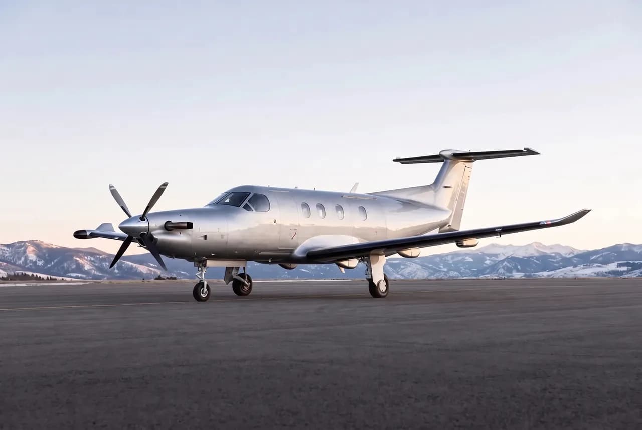 Fri, Nov 2014:24Little RockKLIT · Bill & Hillary Clinton National Airport/Adams FieldBentonvilleKVBT · Bentonville Municipal-Louise M Thaden FieldPilatus PC 12 NG8—$1,23920NovLittle Rock → BentonvilleKLIT → KVBT · 14:24Pilatus PC 12 NG · 8 seats$1,239
- Sun, Nov 2209:24Little RockKLIT · Bill & Hillary Clinton National Airport/Adams FieldBentonvilleKVBT · Bentonville Municipal-Louise M Thaden FieldPilatus PC 12 NG8—$1,13122NovLittle Rock → BentonvilleKLIT → KVBT · 09:24Pilatus PC 12 NG · 8 seats$1,131
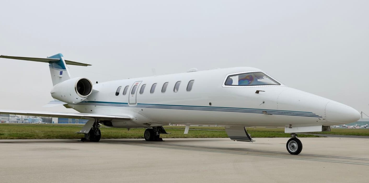 Wed, Nov 25in 22 daysNorth Little RockKLIT · Adams FieldFort CollinsKFNL · Northern Colorado Regional AirportLearjet 759—$14,06125NovNorth Little Rock → Fort CollinsKLIT → KFNL · in 22 daysLearjet 75 · 9 seats$14,061
 KLIT · Adams Field
* Total price incl. 10% service fee, converted to your selected currency. Price subject to operator confirmation.
Empty legs to KLIT
18 arrivals available
 Tue, Nov 3TodayWestchesterKHPN · Westchester County AirportNorth Little RockKLIT · Adams FieldGulfstream GIV14—On request3NovWestchester → North Little RockKHPN → KLIT · TodayGulfstream GIV · 14 seatsOn request
- Wed, Nov 4TomorrowLincolnKLNKLittle RockKLIT · Bill Hillary Clinton Natl AdCessna Citation CJ1—1h 46m$3,8504NovLincoln → Little RockKLNK → KLIT · TomorrowCessna Citation CJ1 · 1h 46m$3,850
- Wed, Nov 411:54LincolnKLNK · Lincoln AirportLittle RockKLIT · Adams FieldCessna Citation CJ5—$3,8504NovLincoln → Little RockKLNK → KLIT · 11:54Cessna Citation CJ · 5 seats$3,850
- Fri, Nov 6in 3 daysGreensboroKGSO · Piedmont Triad International AirportLittle RockKLIT · Bill & Hillary Clinton National Airport/Adams FieldCitation CJ1/CJ36—On request6NovGreensboro → Little RockKGSO → KLIT · in 3 daysCitation CJ1/CJ3 · 6 seatsOn request
- Thu, Nov 1905:36BentonvilleKVBT · Bentonville Municipal-Louise M Thaden FieldLittle RockKLIT · Bill & Hillary Clinton National Airport/Adams FieldPilatus PC-12 NG8—$1,43019NovBentonville → Little RockKVBT → KLIT · 05:36Pilatus PC-12 NG · 8 seats$1,430
 Fri, Nov 2023:18MiamiKOPF · Miami-Opa Locka Executive AirportLittle RockKLIT · Adams FieldCessna Citation V12h 42m$10,71820NovMiami → Little RockKOPF → KLIT · 23:18Cessna Citation V · 1 seat · 2h 42m$10,718
- Sat, Nov 2118:42HoustonKHOU · William P HobbyLittle RockKLIT · Bill & Hillary ClintonCessna Citation V7—$5,89921NovHouston → Little RockKHOU → KLIT · 18:42Cessna Citation V · 7 seats$5,899
- Sat, Nov 2108:36BentonvilleKVBT · Bentonville Municipal-Louise M Thaden FieldLittle RockKLIT · Bill & Hillary Clinton National Airport/Adams FieldPilatus PC 12 NG8—$77921NovBentonville → Little RockKVBT → KLIT · 08:36Pilatus PC 12 NG · 8 seats$779
 Sat, Nov 2106:18MiamiKOPF · Miami-Opa Locka Executive AirportLittle RockKLIT · Bill & Hillary Clinton National Airport/Adams FieldCessna Citation V7—$11,04221NovMiami → Little RockKOPF → KLIT · 06:18Cessna Citation V · 7 seats$11,042
* Total price incl. 10% service fee, converted to your selected currency. Price subject to operator confirmation.
Map: Little Rock Airport
View the location of Little Rock – LIT/KLIT. Zoom in to explore the area around the airport.
About the airport
Adams Field (LIT/KLIT) is the key private jet gateway for Little Rock. PrivJet gives you instant access to charter flights and empty legs: fast, discreet and globally connected.
KLIT airport FAQ
Are there any restrictions at Little Rock airport (KLIT) today?
There are currently 4 valid NOTAMs for Little Rock (KLIT). Affected: Obstacle lights: unserviceable; TACAN; Obstacle: out of service. 3 more NOTAMs start in the coming days. For information only, not for flight planning or operational use. Always rely on an official pre-flight briefing. This list may be incomplete or out of date.
What is the weather at Little Rock airport (KLIT)?
According to the latest weather report for KLIT (METAR, 03 Nov, 08:53 UTC): Marginal visual conditions (MVFR). Wind 18 kt (33 km/h) from south (190°), gusts up to 27 kt, visibility 10 km or more, temperature 23 °C (dew point 18 °C). For information only, not for flight planning. Weather can change quickly; always rely on official reports.
How long are the runways at Little Rock airport (KLIT)?
Little Rock (KLIT) has 3 runways: runway 04L/22R with 2,522 m (8,273 ft), concrete, runway 04R/22L with 2,515 m (8,251 ft), concrete and runway 18/36 with 1,897 m (6,224 ft), concrete. The longest is 2,522 m.
What are the radio frequencies at Little Rock airport (KLIT)?
Frequencies at KLIT: Tower 118.7 MHz, Ground 121.9 MHz and ATIS 125.65 MHz. For information only. Always rely on the published AIP.
What are the airport codes of Adams Field?
The ICAO code is KLIT and the IATA code is LIT. ICAO codes are used by air traffic control and pilots, e.g. in flight plans; IATA codes appear on tickets and baggage tags.
What is the elevation of KLIT airport?
Adams Field sits at 262 ft (80 m) above sea level. Local time zone: America/Chicago.
Can I fly to KLIT by private jet?
Whether a private jet can operate into Adams Field depends on runway length, opening hours, customs and immigration rules as well as slot and handling availability, among other things. PrivJet checks this with the operating carrier for every request.
Are there empty legs from or to KLIT?
There are currently 15 empty legs departing from and 18 arriving at Adams Field. Empty legs are repositioning flights at heavily reduced prices; the list is updated several times a day.