Lincoln Airport (KLNK / LNK)
Empty legs and charters from Lincoln
KLNK airport at a glance
- ICAO code
- KLNK
- IATA code
- LNK
- City
- Lincoln
- Region
- Nebraska
- Country
- United States
- Elevation
- 1,219 ft (372 m)
- Time zone
- America/Chicago (UTC-6)
- Coordinates
- 40.8510° N, 96.7592° W
- Empty legs from
- 75
- Empty legs to
- 90
Weather & airport info KLNK
Current weather
Marginal visual conditions (MVFR)observed 03 Nov, 16:54 UTC- Wind
- 22 kt (41 km/h) from north (350°), gusts up to 28 kt
- Visibility
- 10 km or more
- Clouds
- overcast at 1,400 ft
- Temperature
- 12 °C (dew point 11 °C)
- Pressure (QNH)
- 1,008 hPa
Original weather report (METAR)
METAR KLNK 031654Z 35022G28KT 10SM OVC014 12/11 A2975 RMK AO2 PK WND 36031/1629 SLP070 T01220106
Forecast (TAF)
- 03 Nov, 18:00–23:00 UTC19 kt (35 km/h) from north-northwest (330°), gusts up to 32 kt · visibility 10 km or more · Light rain showers · overcast at 1,400 ft
- 03 Nov, 18:00–22:00 UTCtemporarilyvisibility 5 km · Light rain showers · overcast at 800 ft
- 03 Nov, 23:00–02:00 UTCfrom17 kt (31 km/h) from north-northwest (330°), gusts up to 30 kt · visibility 8 km · Light drizzle · overcast at 1,200 ft
- 04 Nov, 02:00–16:00 UTCfrom11 kt (20 km/h) from northwest (310°), gusts up to 22 kt · visibility 10 km or more · overcast at 1,300 ft
- 04 Nov, 16:00–18:00 UTCfrom12 kt (22 km/h) from west-northwest (290°), gusts up to 22 kt · visibility 10 km or more · broken clouds at 2,500 ft
Original forecast (TAF)
TAF KLNK 031720Z 0318/0418 33019G32KT 6SM -SHRA OVC014 TEMPO 0318/0322 3SM -SHRA OVC008 FM032300 33017G30KT 5SM -DZ OVC012 FM040200 31011G22KT P6SM OVC013 FM041600 29012G22KT P6SM BKN025
Airport
- Elevation
- 1,219 ft (372 m)
- Sunrise / Sunset
- 06:59 / 17:21 local time
Runways
| Runway | Length | Surface | Lighted |
|---|---|---|---|
| 18/36 | 3,932 m (12,901 ft) | asphalt/concrete | yes |
| 14/32 | 2,636 m (8,649 ft) | asphalt/concrete | yes |
| 17/35 | 1,768 m (5,801 ft) | asphalt/concrete | yes |
Radio frequencies
- ATIS: 118.05
- Clearance: 120.7
- CTAF: 118.5
- Ground: 121.9
- Tower: 118.5
- UNICOM: 122.95
For information only, not for flight planning. Weather can change quickly; always rely on official reports. Sources: aviationweather.gov (NOAA), OurAirports.
Airport map KLNK
Full screen →Runways white, taxiways yellow with designators, closed taxiways and runways per NOTAM in red.
Closed per NOTAM: TWY C, TWY D*, TWY B, TWY K* (* partly closed)
Official charts (FAA)
Cycle 2611, valid until 0901Z 11/26/26
Airport diagram (FAA)
Airport diagram (1)
Instrument approaches (14)
Minimums (2)
Hot spots (1)
For information only, not for navigation. Always use current official charts and NOTAMs.
Current NOTAMs for KLNK(12)
NOTAMs (Notices to Air Missions) announce short-term changes at an airport: closed runways or taxiways, unserviceable approach aids, obstacles, airspace restrictions.
- Out of serviceTerminal area surveillance radar: unserviceableA0776/26· from 05 Nov, 14:00 UTC · until 05 Nov, 21:00 UTC
The Terminal Area Radar (TAR) and Secondary Surveillance Radar (SSR) are out of service. These systems are used for monitoring air traffic.
Show original text
SVC TAR/SSR U/S
A0776/26 NOTAMN
Q) KZMP/QCTAS////000/999/4051N09645W005
A) KLNK
B) 2611051400
C) 2611052100
E) SVC TAR/SSR U/S
- ClosedTaxiway: closedA0772/26· until 01 Jan, 13:00 UTC
Taxiway C is closed.
Show original text
TWY C CLSD
A0772/26 NOTAMN
Q) KZMP/QMXLC////000/999/4051N09645W005
A) KLNK
B) 2611021300
C) 2901011300
E) TWY C CLSD
- ClosedTaxiway: closedA0773/26· until 01 Jan, 13:00 UTC
Taxiway D between runway 14/32 and the approach end of runway 18 is closed.
Show original text
TWY D BTN RWY 14/32 AND APCH END RWY 18 CLSD
A0773/26 NOTAMN
Q) KZMP/QMXLC////000/999/4051N09645W005
A) KLNK
B) 2611021300
C) 2901011300
E) TWY D BTN RWY 14/32 AND APCH END RWY 18 CLSD
- ClosedTaxiway: closedA0774/26· until 01 Jan, 13:00 UTC
Taxiway B is closed.
Show original text
TWY B CLSD
A0774/26 NOTAMN
Q) KZMP/QMXLC////000/999/4051N09645W005
A) KLNK
B) 2611021300
C) 2901011300
E) TWY B CLSD
- Out of serviceObstacle11/002· until 01 Feb, 23:59 UTC
The lighting of a tower obstacle 9.6 nautical miles southeast of Lincoln Airport is out of service. Its top is 1597.8 ft above sea level, 236.9 ft above ground.
Show original text
OBST TOWER LGT (ASR 1046577) 404529.00N0963510.00W (9.6NM SE LNK) 1597.8FT (236.9FT AGL) U/S
- Out of serviceObstacle10/032· until 01 Dec, 23:59 UTC
The lighting on a tower near Lincoln airport is out of service. The top of the obstacle is 1603.0 ft above sea level, 408.8 ft above ground.
Show original text
OBST TOWER LGT (ASR 1041792) 404917.00N0963944.00W (4.7NM ESE LNK) 1603.0FT (408.8FT AGL) U/S
10/032 NOTAMN<BR>
<B>Q) </B>KZMP/QOLAS/IV/M/AE/000/017/4051N09645W005<BR>
<B>A) </B>KLNK<BR>
<B>B) </B>2610302232<BR>
<B>C) </B>2612012359<BR>
<B>E) </B> TOWER LGT (ASR 1041792) 404917.00N0963944.00W (4.7NM ESE LNK) 1603.0FT (408.8FT AGL) U/S<BR>
- Out of serviceObstacle10/020· until 24 Jan, 14:30 UTC
An obstacle, a tower with a height of 1913.1 ft above sea level (473.1 ft above ground), has its light out of service. It is located 11.4 nautical miles southeast of Lincoln airport.
Show original text
OBST TOWER LGT (ASR 1031771) 404239.50N0963523.30W (11.4NM SE LNK) 1913.1FT (473.1FT AGL) U/S
- Out of serviceObstacle10/016· until 16 Nov, 23:00 UTC
An obstacle tower light (ASR 1042540) 6.2 nautical miles south-southeast of the airport is out of service. Its top is 1459.0 ft above sea level, 215.9 ft above ground.
Show original text
OBST TOWER LGT (ASR 1042540) 404528.00N0964154.00W (6.2NM SSE LNK) 1459.0FT (215.9FT AGL) U/S
10/016 NOTAMN<BR>
<B>Q) </B>KZMP/QOLAS/IV/M/E/000/015/4051N09645W005<BR>
<B>A) </B>KLNK<BR>
<B>B) </B>2610170841<BR>
<B>C) </B>2611162300<BR>
<B>E) </B> TOWER LGT (ASR 1042540) 404528.00N0964154.00W (6.2NM SSE LNK) 1459.0FT (215.9FT AGL) U/S<BR>
4 more NOTAMs
- ClosedTaxiway: closedA0743/26· until 27 May, 00:01 UTC
Taxiway K between runway 18/36 and taxiway D is closed.
Show original text
TWY K BTN RWY 18/36 AND TWY D CLSD
A0743/26 NOTAMN
Q) KZMP/QMXLC////000/999/4051N09645W005
A) KLNK
B) 2609301849
C) 2705270001
E) TWY K BTN RWY 18/36 AND TWY D CLSD
- ClosedTaxiway: closedA0742/26· until 27 May, 00:01 UTC
Taxiway S is closed.
Show original text
TWY S CLSD
A0742/26 NOTAMN
Q) KZMP/QMXLC////000/999/4051N09645W005
A) KLNK
B) 2609301848
C) 2705270001
E) TWY S CLSD
- ClosedApron: closedA0740/26· until 27 May, 00:01 UTC
Apron taxiway G between Juliet and Echo is closed.
Show original text
APRON TXL G BTN JULIET AND ECHO CLSD
A0740/26 NOTAMN
Q) KZMP/QMNLC////000/999/4051N09645W005
A) KLNK
B) 2609301847
C) 2705270001
E) APRON TXL G BTN JULIET AND ECHO CLSD
- Out of serviceObstacle lights: unserviceable09/032· until 28 Jan, 13:33 UTC
The lighting of an obstacle tower (ASR 1267813) 18.5 nautical miles southeast of LNK is out of service. Its top is 1741.8 feet above sea level, 297.9 feet above ground.
Show original text
OBST TOWER LGT (ASR 1267813) 403634.80N0963023.50W (18.5NM SE LNK) 1741.8FT (297.9FT AGL) U/S
09/032 NOTAMN<br/>
<b>Q) </b>KZMP/QOLAS/IV/M/E/000/018/4051N09645W005<br/>
<b>A) </b>KLNK<br/>
<b>B) </b>2609301333<br/>
<b>C) </b>2701281333<br/>
<b>E) </b> TOWER LGT (ASR 1267813) 403634.80N0963023.50W (18.5NM SE LNK) 1741.8FT (297.9FT AGL) U/S<br/>
For information only, not for flight planning or operational use. Always rely on an official pre-flight briefing. This list may be incomplete or out of date. Explanations and expanded abbreviations are generated automatically. The original text is authoritative. Source: FAA NOTAM Management Service (SWIM).
Private jet traffic in Lincoln Airport (last 30 days)
- Arrivals
- 623
- Departures
- 594
- Different jets
- 383
Most frequent origins: Eppley Airfield (22), Centennial Airport (11), Scottsdale Airport (9), Chicago Executive Airport (7), Des Moines International Airport (7).
Most frequent destinations: Eppley Airfield (27), Scottsdale Airport (12), Centennial Airport (10), Des Moines International Airport (9), Charles B. Wheeler Downtown Airport (8).
Most common aircraft types: Cessna Citation Excel/XLS (140), Cessna Citation V/Ultra/Encore (111), Pilatus PC-12 (82), Beechcraft King Air 90 (82), Cessna Citation CJ2 (69).
Our own analysis of public ADS-B signals from business jets. Not every flight is received, and jets with a removal request are excluded.
Charter operators based here
Operators with a base at this airport.
- Silverhawk AviationTurboprop, Light jet, Midsize jet
- CommuteAirHouston (Bush Intercontinental) (KIAH) · Super midsize jet, Heavy jet
Empty legs from KLNK
75 departures available
- Tue, Nov 3TodayLincolnKLNKDestinKDTS · Destin Ft Walton BeachCessna Citation Ultra—2h 52m$5,5003NovLincoln → DestinKLNK → KDTS · TodayCessna Citation Ultra · 2h 52m$5,500
 Wed, Nov 4TomorrowLincolnKLNK · Lincoln AirportNew YorkKTEB · Teterboro AirportGulfstream G55013—On request4NovLincoln → New YorkKLNK → KTEB · TomorrowGulfstream G550 · 13 seatsOn request
- Wed, Nov 4TomorrowLincolnKLNKKearneyKEAR · Kearney RegionalCessna Citation Ultra—50m$1,6504NovLincoln → KearneyKLNK → KEAR · TomorrowCessna Citation Ultra · 50m$1,650
- Wed, Nov 4TomorrowLincolnKLNKLittle RockKLIT · Bill Hillary Clinton Natl AdCessna Citation CJ1—1h 46m$3,8504NovLincoln → Little RockKLNK → KLIT · TomorrowCessna Citation CJ1 · 1h 46m$3,850
- Wed, Nov 411:24LincolnKLNK · Lincoln AirportNorfolkKOFK · Karl Stefan Memorial AirportCessna Citation Excel8—$4,9504NovLincoln → NorfolkKLNK → KOFK · 11:24Cessna Citation Excel · 8 seats$4,950
- Wed, Nov 411:54LincolnKLNK · Lincoln AirportLittle RockKLIT · Adams FieldCessna Citation CJ5—$3,8504NovLincoln → Little RockKLNK → KLIT · 11:54Cessna Citation CJ · 5 seats$3,850
- Thu, Nov 507:30LincolnKLNK · Lincoln AirportNorfolkKOFK · Karl Stefan Memorial AirportCessna Citation Excel8—$4,5105NovLincoln → NorfolkKLNK → KOFK · 07:30Cessna Citation Excel · 8 seats$4,510
- Fri, Nov 615:02LincolnKLNK · Lincoln AirportNorfolkKOFK · Karl Stefan Memorial AirportBeechcraft King Air C90GTi6—$1,7606NovLincoln → NorfolkKLNK → KOFK · 15:02Beechcraft King Air C90GTi · 6 seats$1,760
- Fri, Nov 613:53LincolnKLNK · Lincoln AirportOmahaKOMA · Eppley AirfieldBeechcraft King Air C90GTi6—$1,7606NovLincoln → OmahaKLNK → KOMA · 13:53Beechcraft King Air C90GTi · 6 seats$1,760
 KLNK
* Total price incl. 10% service fee, converted to your selected currency. Price subject to operator confirmation.
Empty legs to KLNK
90 arrivals available
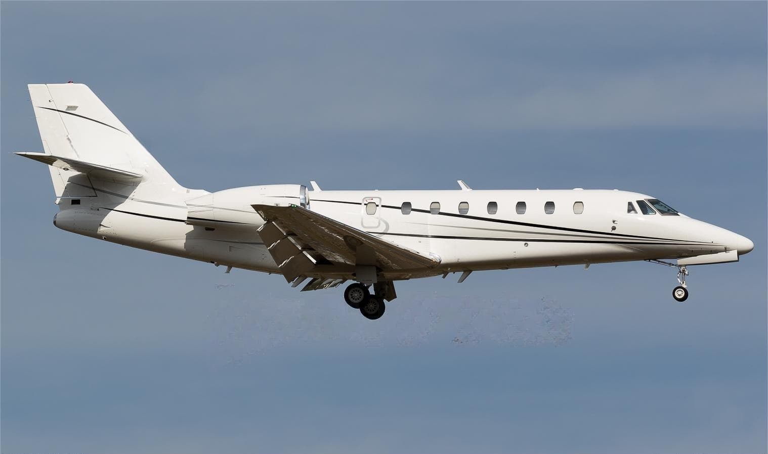 Tue, Nov 3TodaySan AntonioKSAT · San Antonio International AirportLincolnKLNK · Lincoln AirportCitation Sovereign9—$17,7103NovSan Antonio → LincolnKSAT → KLNK · TodayCitation Sovereign · 9 seats$17,710
- Tue, Nov 3TodayLawrenceKLWC · Lawrence MunLincolnKLNKCessna Citation Ultra—55m$1,6503NovLawrence → LincolnKLWC → KLNK · TodayCessna Citation Ultra · 55m$1,650
- Tue, Nov 3TodayWarsawKASW · Warsaw Municipal AirportLincolnKLNK · Lincoln AirportBombardier Challenger 605121h 36mOn request3NovWarsaw → LincolnKASW → KLNK · TodayBombardier Challenger 605 · 12 seats · 1h 36mOn request
 Wed, Nov 4TomorrowWarsawKASW · Warsaw Municipal AirportLincolnKLNK · Lincoln AirportChallenger 60512—On request4NovWarsaw → LincolnKASW → KLNK · TomorrowChallenger 605 · 12 seatsOn request
- Wed, Nov 417:56OmahaKOMA · Eppley AirfieldLincolnKLNK · Lincoln AirportBeechcraft King Air C90GTi6—$1,7604NovOmaha → LincolnKOMA → KLNK · 17:56Beechcraft King Air C90GTi · 6 seats$1,760
- Wed, Nov 417:48KearneyKEAR · Kearney Regional AirportLincolnKLNK · Lincoln AirportCessna Citation Ultra8—$1,6504NovKearney → LincolnKEAR → KLNK · 17:48Cessna Citation Ultra · 8 seats$1,650
- Wed, Nov 418:21Fort LauderdaleKFLL · Fort Lauderdale Hollywood International AirportLincolnKLNK · Lincoln AirportCessna Citation Excel9—$8,2504NovFort Lauderdale → LincolnKFLL → KLNK · 18:21Cessna Citation Excel · 9 seats$8,250
- Thu, Nov 5in 2 daysKearneyKEAR · Kearney RegionalLincolnKLNKCessna Citation Ultra—50m$1,6505NovKearney → LincolnKEAR → KLNK · in 2 daysCessna Citation Ultra · 50m$1,650
- Thu, Nov 5in 2 daysSouth BendKSBN · South Bend IntlLincolnKLNKCessna Citation Ultra—1h 55m$3,8505NovSouth Bend → LincolnKSBN → KLNK · in 2 daysCessna Citation Ultra · 1h 55m$3,850
* Total price incl. 10% service fee, converted to your selected currency. Price subject to operator confirmation.
Map: Lincoln Airport
View the location of Lincoln – LNK/KLNK. Zoom in to explore the area around the airport.
About the airport
Lincoln Airport (LNK/KLNK) is the key private jet gateway for Lincoln. PrivJet gives you instant access to charter flights and empty legs: fast, discreet and globally connected.
KLNK airport FAQ
Are there any restrictions at Lincoln airport (KLNK) today?
There are currently 11 valid NOTAMs for Lincoln (KLNK). Affected: Taxiway: closed; Apron: closed; Obstacle: out of service; Obstacle lights: unserviceable. 1 more NOTAM starts in the coming days. For information only, not for flight planning or operational use. Always rely on an official pre-flight briefing. This list may be incomplete or out of date.
What is the weather at Lincoln airport (KLNK)?
According to the latest weather report for KLNK (METAR, 03 Nov, 16:54 UTC): Marginal visual conditions (MVFR). Wind 22 kt (41 km/h) from north (350°), gusts up to 28 kt, visibility 10 km or more, temperature 12 °C (dew point 11 °C). For information only, not for flight planning. Weather can change quickly; always rely on official reports.
How long are the runways at Lincoln airport (KLNK)?
Lincoln (KLNK) has 3 runways: runway 18/36 with 3,932 m (12,901 ft), asphalt/concrete, runway 14/32 with 2,636 m (8,649 ft), asphalt/concrete and runway 17/35 with 1,768 m (5,801 ft), asphalt/concrete. The longest is 3,932 m.
What are the radio frequencies at Lincoln airport (KLNK)?
Frequencies at KLNK: Tower 118.5 MHz, Ground 121.9 MHz and ATIS 118.05 MHz. For information only. Always rely on the published AIP.
What are the airport codes of Lincoln Airport?
The ICAO code is KLNK and the IATA code is LNK. ICAO codes are used by air traffic control and pilots, e.g. in flight plans; IATA codes appear on tickets and baggage tags.
What is the elevation of KLNK airport?
Lincoln Airport sits at 1,219 ft (372 m) above sea level. Local time zone: America/Chicago.
Can I fly to KLNK by private jet?
Whether a private jet can operate into Lincoln Airport depends on runway length, opening hours, customs and immigration rules as well as slot and handling availability, among other things. PrivJet checks this with the operating carrier for every request.
Are there empty legs from or to KLNK?
There are currently 75 empty legs departing from and 90 arriving at Lincoln Airport. Empty legs are repositioning flights at heavily reduced prices; the list is updated several times a day.