Midland International Air and Space Port Airport (KMAF / MAF)
Empty legs and charters from Midland
KMAF airport at a glance
- ICAO code
- KMAF
- IATA code
- MAF
- City
- Midland
- Region
- Texas
- Country
- United States
- Elevation
- 2,871 ft (875 m)
- Time zone
- America/Chicago (UTC-6)
- Coordinates
- 31.9425° N, 102.2020° W
- Empty legs from
- 34
- Empty legs to
- 38
Weather & airport info KMAF
Current weather
Good visual conditions (VFR)observed 03 Nov, 13:53 UTC- Wind
- 6 kt (11 km/h) from northwest (320°)
- Visibility
- 10 km or more
- Clouds
- no significant clouds
- Temperature
- 12 °C (dew point 7 °C)
- Pressure (QNH)
- 1,019 hPa
Original weather report (METAR)
METAR KMAF 031353Z 32006KT 10SM CLR 12/07 A3008 RMK AO2 SLP156 T01220067 $
Forecast (TAF)
- 03 Nov, 12:00–00:00 UTC14 kt (26 km/h) from north-northwest (330°) · visibility 10 km or more · no significant clouds
- 04 Nov, 00:00–12:00 UTCfrom5 kt (9 km/h) from northeast (50°) · visibility 10 km or more · no significant clouds
Original forecast (TAF)
TAF KMAF 031120Z 0312/0412 33014KT P6SM SKC FM040000 05005KT P6SM SKC
Airport
- Elevation
- 2,871 ft (875 m)
- Sunrise / Sunset
- 07:06 / 17:57 local time
Runways
| Runway | Length | Surface | Lighted |
|---|---|---|---|
| 16R/34L | 2,896 m (9,501 ft) | asphalt | yes |
| 10/28 | 2,530 m (8,302 ft) | asphalt | yes |
| 04/22 | 1,404 m (4,605 ft) | asphalt | yes |
| 16L/34R | 1,294 m (4,247 ft) | asphalt | yes |
Radio frequencies
- ATIS: 126.8
- Clearance: 118.05
- CTAF: 118.7
- Ground: 121.9
- Tower: 118.7
- UNICOM: 122.95
For information only, not for flight planning. Weather can change quickly; always rely on official reports. Sources: aviationweather.gov (NOAA), OurAirports.
Airport map KMAF
Full screen →Runways white, taxiways yellow with designators, closed taxiways and runways per NOTAM in red.
Closed per NOTAM: TWY U
Official charts (FAA)
Cycle 2611, valid until 0901Z 11/26/26
Airport diagram (FAA)
Airport diagram (1)
Instrument approaches (11)
Minimums (2)
Hot spots (1)
For information only, not for navigation. Always use current official charts and NOTAMs.
Current NOTAMs for KMAF(17)
NOTAMs (Notices to Air Missions) announce short-term changes at an airport: closed runways or taxiways, unserviceable approach aids, obstacles, airspace restrictions.
- Out of serviceServices11/001· from 05 Nov, 06:00 UTC · until 05 Nov, 08:00 UTC
The remote communication outlet for frequency 122.6 is out of service.
Show original text
COM REMOTE COM OUTLET 122.6 U/S
- Out of serviceServices11/002· from 05 Nov, 06:00 UTC · until 05 Nov, 08:00 UTC
The remote communication outlet for frequencies 121.5 and 243 is out of service.
Show original text
COM REMOTE COM OUTLET 121.5, 243 U/S
- Out of serviceRunway10/135· until 01 Dec, 06:00 UTC
The lighting for the 8000 feet distance remaining sign on runway 34L is out of service.
Show original text
RWY 34L 8000FT DIST REMAINING SIGN LGT U/S
- Out of serviceRunwayA1995/26· until 01 Dec, 06:00 UTC
The lighting for the 1000 feet distance remaining sign on runway 16R is out of service. This may make orientation more difficult in darkness or poor visibility.
Show original text
RWY 16R 1000FT DIST REMAINING SIGN LGT U/S
A1995/26 NOTAMN
Q) KZFW/QMRXX////000/999/3156N10212W005
A) KMAF
B) 2610312114
C) 2612010600
E) RWY 16R 1000FT DIST REMAINING SIGN LGT U/S
- Out of serviceRunway10/134· until 01 Dec, 06:00 UTC
The lighting for the runway 22 holding position sign on the left side of runway 16R/34L is out of service.
Show original text
RWY 22 HLDG PSN SIGN AT RWY 16R/34L LEFT SIDE LGT U/S
- ClosedTaxiway: closedA1994/26· until 01 Dec, 06:00 UTC
Taxiway U is closed.
Show original text
TWY U CLSD
A1994/26 NOTAMN
Q) KZFW/QMXLC////000/999/3156N10212W005
A) KMAF
B) 2610312113
C) 2612010600
E) TWY U CLSD
- Out of serviceDaylight markings10/131· until 01 Dec, 06:00 UTC
The lighting for the runway 16R distance remaining sign, indicating 2000 feet, is out of service.
Show original text
RWY 16R 2000FT DIST REMAINING SIGN LGT U/S
10/131 NOTAMR
Q) KZFW/QMMXX/V/M/A/000/999/3156N10212W005
A) KMAF
B) 2610312112
C) 2612010600

E) RWY 16R 2000FT DIST REMAINING SIGN LGT U/S
- Out of serviceRunway10/132· until 01 Dec, 06:00 UTC
The lighting for the holding position sign at runway 28, on the left side of runway 16R/34L, is out of service. This may affect the sign's visibility.
Show original text
RWY 28 HLDG PSN SIGN AT RWY 16R/34L LEFT SIDE LGT U/S
9 more NOTAMs
- Out of serviceRunway10/129· until 01 Dec, 06:00 UTC
The lighting for the runway 16R distance remaining sign, indicating 3000 feet, is out of service.
Show original text
RWY 16R 3000FT DIST REMAINING SIGN LGT U/S
- Out of serviceRunway10/130· until 01 Dec, 06:00 UTC
The lighting for the runway 34L distance remaining sign, indicating 7000 feet, is out of service.
Show original text
RWY 34L 7000FT DIST REMAINING SIGN LGT U/S
- Out of serviceRunway10/128· until 01 Dec, 06:00 UTC
The lighting for the 6000 feet distance remaining sign on runway 34L is out of service. This may affect the visibility of the sign.
Show original text
RWY 34L 6000FT DIST REMAINING SIGN LGT U/S
- Out of serviceTaxiway10/127· until 01 Dec, 06:00 UTC
The lighting for taxiway W holding position sign for the approach end of runway 34R is out of service. This may make orientation on the taxiway more difficult.
Show original text
TWY W HLDG PSN SIGN FOR APCH END RWY 34R LGT U/S
- Out of serviceTaxiway10/125· until 01 Dec, 06:00 UTC
The lighting for taxiway C holding position sign on the southeast side for runway 16L/34R is out of service. This may make orientation on the taxiway more difficult.
Show original text
TWY C HLDG PSN SIGN SOUTHEAST SIDE FOR RWY 16L/34R LGT U/S
- Out of servicePilot-controlled lighting: unserviceableA1806/26· until 31 Dec, 23:59 UTC
The Pilot Controlled Lighting (PCL) system is out of service, except for the medium intensity lights which can be activated on request.
Show original text
SVC PCL ALL U/S EXC MEDIUM INTST ON CONS
A1806/26 NOTAMN
Q) KZFW/QLGAS////000/999/3156N10212W005
A) KMAF
B) 2609301818
C) 2612312359
E) SVC PCL ALL U/S EXC MEDIUM INTST ON CONS
- NoticeObstacle: erectedA1974/26· until 08 Nov, 23:00 UTC
An obstacle, a crane with an unknown identification, is present. It is located 0.93 nautical miles west of the approach end of runway 04, its top is 100 feet above ground and it is flagged.
Show original text
OBST CRANE (ASN UNKNOWN) 315550N1021317W (0.93NM W APCH END RWY 04) UNKNOWN (100FT AGL) FLAGGED
A1974/26 NOTAMN
Q) KZFW/QOBCE/IV/M/AE/000/999/3156N10212W005
A) KMAF
B) 2611021400
C) 2611082300
D) DLY 1400-2300
E) OBST CRANE (ASN UNKNOWN) 315550N1021317W (0.93NM W APCH END RWY 04)
UNKNOWN (100FT AGL) FLAGGED
Hours: DLY 1400-2300
- NoticeAirspace11/006· until 01 Dec, 21:00 UTC
Airspace drones (UAS) within an area defined as 3 NM radius of MAF270016 surface- 200 ft above ground
Show original text
AIRSPACE UAS WI AN AREA DEFINED AS 3NM RADIUS OF MAF270016 SFC-200FT AGL
- NoticeObstacle10/126· until 01 Dec, 06:00 UTC
An unknown obstacle (a stack) is located 0.46 nautical miles southeast of the approach end of runway 10. Its top is 50 feet above ground and it is not lighted.
Show original text
OBST STACK (ASN UNKNOWN) 315629N1021239W (0.46NM SE APCH END RWY 10) UNKNOWN (50FT AGL) NOT LGTD
For information only, not for flight planning or operational use. Always rely on an official pre-flight briefing. This list may be incomplete or out of date. Explanations and expanded abbreviations are generated automatically. The original text is authoritative. Source: FAA NOTAM Management Service (SWIM).
Private jet traffic in Midland International Air and Space Port Airport (last 30 days)
- Arrivals
- 623
- Departures
- 5
- Different jets
- 319
Most frequent origins: Fort Worth Meacham International Airport (47), Dallas Love Field (38), Austin Bergstrom International Airport (31), Centennial Airport (15), Addison Airport (14).
Most common aircraft types: Embraer Phenom 300 (50), Cessna Citation V/Ultra/Encore (43), Beechcraft King Air 200/250 (41), Bombardier Challenger 300 (38), Cessna Citation CJ3 (30).
Sunday is the busiest day.
Our own analysis of public ADS-B signals from business jets. Not every flight is received, and jets with a removal request are excluded.
Charter operators based here
Operators with a base at this airport.
- Air 7Camarillo (KCMA) · Turboprop, Light jet, Midsize jet
- Flightime + Haskin AviationTurboprop, Light jet, Midsize jet
Empty legs from KMAF
34 departures available
- Thu, Nov 503:10MidlandKMAF · Midland International Air and Space PortLajitasKT89 · Lajitas International AirportBombardier Learjet 758—$4,6205NovMidland → LajitasKMAF → KT89 · 03:10Bombardier Learjet 75 · 8 seats$4,620
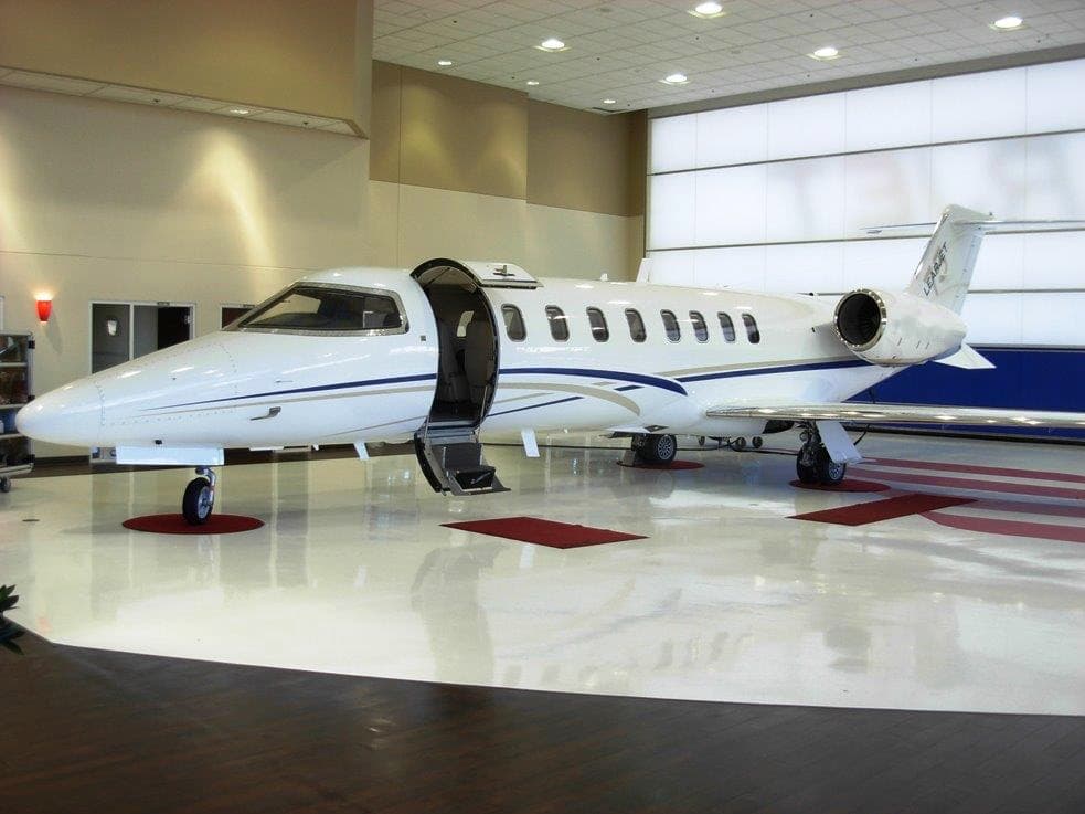 Thu, Nov 509:10MidlandKMAF · Midland International Air and Space Port AirportLajitasT89 · Lajitas International AirportBombardier Learjet 75142mOn request5NovMidland → LajitasKMAF → T89 · 09:10Bombardier Learjet 75 · 1 seat · 42mOn request
- Mon, Nov 9in 6 daysMidlandKMAF · Midland International Air and Space Port AirportDenverKAPA · Centennial AirportBombardier Learjet 60XR7—On request9NovMidland → DenverKMAF → KAPA · in 6 daysBombardier Learjet 60XR · 7 seatsOn request
- Mon, Nov 9in 6 daysMidlandKMAF · Midland International Air and Space Port AirportDenverKBJC · Rocky Mountain Metropolitan AirportEmbraer Phenom 300E7—$7,7009NovMidland → DenverKMAF → KBJC · in 6 daysEmbraer Phenom 300E · 7 seats$7,700
 Mon, Nov 915:00MidlandKMAF · Midland International Air and Space Port AirportDenverKAPA · Centennial AirportBombardier Learjet 6011h 30m$10,7809NovMidland → DenverKMAF → KAPA · 15:00Bombardier Learjet 60 · 1 seat · 1h 30m$10,780
- Mon, Nov 9in 6 daysMidlandKMAF · Midland International Air and Space Port AirportDenverKAPA · Centennial AirportLearjet Lear 607—$8,6569NovMidland → DenverKMAF → KAPA · in 6 daysLearjet Lear 60 · 7 seats$8,656
- Tue, Nov 10in 7 daysMidlandKMAF · Midland International Air and Space PortDenverKAPA · Centennial AirportBombardier Learjet 607—$13,75010NovMidland → DenverKMAF → KAPA · in 7 daysBombardier Learjet 60 · 7 seats$13,750
- Tue, Nov 1021:30MidlandKMAF · Midland International Air and Space PortDallasKDAL · Dallas Love FieldBombardier Challenger 60410—$18,92010NovMidland → DallasKMAF → KDAL · 21:30Bombardier Challenger 604 · 10 seats$18,920
 Thu, Nov 12in 9 daysMidlandKMAF · Midland International Air and Space Port AirportHoustonKHOU · William P Hobby AirportLearjet 607—$7,37012NovMidland → HoustonKMAF → KHOU · in 9 daysLearjet 60 · 7 seats$7,370
 KMAF · Midland International Air and Space Port
* Total price incl. 10% service fee, converted to your selected currency. Price subject to operator confirmation.
Empty legs to KMAF
38 arrivals available
- Thu, Nov 516:00HoustonKTME · Houston Executive AirportMidlandKMAF · Midland International Air and Space PortBombardier Learjet 758—$7,9205NovHouston → MidlandKTME → KMAF · 16:00Bombardier Learjet 75 · 8 seats$7,920
- Sat, Nov 7in 4 daysSt John'sTAPA · V.C. Bird International AirportMidlandKMAF · Midland International Air and Space Port AirportLearjet 607—$40,3707NovSt John's → MidlandTAPA → KMAF · in 4 daysLearjet 60 · 7 seats$40,370
- Sat, Nov 723:00OaklandKOAK · Metropolitan Oakland International AirportMidlandKMAF · Midland International Air and Space Port AirportHawker 9008—$11,8807NovOakland → MidlandKOAK → KMAF · 23:00Hawker 900 · 8 seats$11,880
 Sun, Nov 8in 5 daysSt John'sTAPA · V.C. Bird International AirportMidlandKMAF · Midland International Air and Space Port AirportLearjet 608—$44,3308NovSt John's → MidlandTAPA → KMAF · in 5 daysLearjet 60 · 8 seats$44,330
- Sun, Nov 8in 5 daysAustinKAUS · Austin Bergstrom International AirportMidlandKMAF · Midland International Air and Space Port AirportBombardier Learjet 60XR7—On request8NovAustin → MidlandKAUS → KMAF · in 5 daysBombardier Learjet 60XR · 7 seatsOn request
- Sun, Nov 807:57AtlantaKFTY · Fulton County Airport Brown FieldMidlandKMAF · Midland International Air and Space PortBombardier Learjet 607—$25,3008NovAtlanta → MidlandKFTY → KMAF · 07:57Bombardier Learjet 60 · 7 seats$25,300
- Sun, Nov 8in 5 daysSouth BendKSBN · South Bend Regional AirportMidlandKMAF · Midland International Air and Space Port AirportEmbraer Phenom 300E7—$7,3708NovSouth Bend → MidlandKSBN → KMAF · in 5 daysEmbraer Phenom 300E · 7 seats$7,370
- Sun, Nov 8in 5 daysHoustonKHOU · William P Hobby AirportMidlandKMAF · Midland International Air and Space Port AirportHawker 9008—$13,2008NovHouston → MidlandKHOU → KMAF · in 5 daysHawker 900 · 8 seats$13,200
- Sun, Nov 8in 5 daysHoustonKSGR · Sugar Land Regional AirportMidlandKMAF · Midland International Air and Space Port AirportCessna CitationJet5—$6,8208NovHouston → MidlandKSGR → KMAF · in 5 daysCessna CitationJet · 5 seats$6,820
 TAPA · V.C. Bird International Airport
* Total price incl. 10% service fee, converted to your selected currency. Price subject to operator confirmation.
Map: Midland Airport
View the location of Midland – MAF/KMAF. Zoom in to explore the area around the airport.
About the airport
Midland International Air and Space Port Airport (MAF/KMAF) is the key private jet gateway for Midland. PrivJet gives you instant access to charter flights and empty legs: fast, discreet and globally connected.
KMAF airport FAQ
Are there any restrictions at Midland airport (KMAF) today?
There are currently 15 valid NOTAMs for Midland (KMAF). Affected: Taxiway: closed; Runway: out of service; Runway; Daylight markings and 2 more. 2 more NOTAMs start in the coming days. For information only, not for flight planning or operational use. Always rely on an official pre-flight briefing. This list may be incomplete or out of date.
What is the weather at Midland airport (KMAF)?
According to the latest weather report for KMAF (METAR, 03 Nov, 12:53 UTC): Good visual conditions (VFR). Wind 7 kt (13 km/h) from northwest (320°), visibility 10 km or more, temperature 11 °C (dew point 7 °C). For information only, not for flight planning. Weather can change quickly; always rely on official reports.
How long are the runways at Midland airport (KMAF)?
Midland (KMAF) has 4 runways: runway 16R/34L with 2,896 m (9,501 ft), asphalt, runway 10/28 with 2,530 m (8,302 ft), asphalt, runway 04/22 with 1,404 m (4,605 ft), asphalt and runway 16L/34R with 1,294 m (4,247 ft), asphalt. The longest is 2,896 m.
What are the radio frequencies at Midland airport (KMAF)?
Frequencies at KMAF: Tower 118.7 MHz, Ground 121.9 MHz and ATIS 126.8 MHz. For information only. Always rely on the published AIP.
What are the airport codes of Midland International Air and Space Port Airport?
The ICAO code is KMAF and the IATA code is MAF. ICAO codes are used by air traffic control and pilots, e.g. in flight plans; IATA codes appear on tickets and baggage tags.
What is the elevation of KMAF airport?
Midland International Air and Space Port Airport sits at 2,871 ft (875 m) above sea level. Local time zone: America/Chicago.
Can I fly to KMAF by private jet?
Whether a private jet can operate into Midland International Air and Space Port Airport depends on runway length, opening hours, customs and immigration rules as well as slot and handling availability, among other things. PrivJet checks this with the operating carrier for every request.
Are there empty legs from or to KMAF?
There are currently 34 empty legs departing from and 38 arriving at Midland International Air and Space Port Airport. Empty legs are repositioning flights at heavily reduced prices; the list is updated several times a day.