Orlando Airport (KMCO / MCO)
Empty legs and charters from Orlando
KMCO airport at a glance
- ICAO code
- KMCO
- IATA code
- MCO
- City
- Orlando
- Region
- Florida
- Country
- United States
- Elevation
- 96 ft (29 m)
- Time zone
- America/New York (UTC-5)
- Coordinates
- 28.4294° N, 81.3090° W
- Empty legs from
- 54
- Empty legs to
- 43
Weather & airport info KMCO
Current weather
Good visual conditions (VFR)observed 03 Nov, 22:53 UTC- Wind
- 8 kt (15 km/h) from east (100°)
- Visibility
- 10 km or more
- Clouds
- scattered clouds at 4,300 ft, scattered clouds at 18,000 ft, broken clouds at 25,000 ft
- Temperature
- 26 °C (dew point 21 °C)
- Pressure (QNH)
- 1,017 hPa
Original weather report (METAR)
METAR KMCO 032253Z 10008KT 10SM SCT043 SCT180 BKN250 26/21 A3002
Forecast (TAF)
- 04 Nov, 00:00–14:00 UTC5 kt (9 km/h) from east-northeast (70°) · visibility 10 km or more · scattered clouds at 2,500 ft, scattered clouds at 12,000 ft, broken clouds at 25,000 ft
- 04 Nov, 14:00–19:00 UTCfrom10 kt (19 km/h) from east (100°) · visibility 10 km or more · scattered clouds at 3,500 ft, broken clouds at 25,000 ft
- 04 Nov, 19:00–00:00 UTCfrom10 kt (19 km/h) from east (90°) · visibility 10 km or more · Showers in the vicinity · scattered clouds at 3,500 ft, scattered clouds at 10,000 ft
- 05 Nov, 00:00–06:00 UTCfrom4 kt (7 km/h) from east (90°) · visibility 10 km or more · few clouds at 4,000 ft, scattered clouds at 25,000 ft
Original forecast (TAF)
TAF KMCO 032320Z 0400/0506 07005KT P6SM SCT025 SCT120 BKN250 FM041400 10010KT P6SM SCT035 BKN250 FM041900 09010KT P6SM VCSH SCT035 SCT100 FM050000 09004KT P6SM FEW040 SCT250
Airport
- Elevation
- 96 ft (29 m)
- Sunrise / Sunset
- 06:39 / 17:38 local time
Runways
| Runway | Length | Surface | Lighted |
|---|---|---|---|
| 18L/36R | 3,659 m (12,005 ft) | asphalt/concrete | yes |
| 18R/36L | 3,659 m (12,004 ft) | concrete | yes |
| 17R/35L | 3,048 m (10,000 ft) | concrete | yes |
| 17L/35R | 2,744 m (9,001 ft) | asphalt | yes |
Radio frequencies
- ATIS: 121.25
- Clearance: 134.7
- Ground: 121.8
- Tower: 118.45
- UNICOM: 122.95
For information only, not for flight planning. Weather can change quickly; always rely on official reports. Sources: aviationweather.gov (NOAA), OurAirports.
Airport map KMCO
Full screen →Runways white, taxiways yellow with designators, closed taxiways and runways per NOTAM in red.
Closed per NOTAM: TWY E1* (* partly closed)
Official charts (FAA)
Cycle 2611, valid until 0901Z 11/26/26
Airport diagram (FAA)
Airport diagram (1)
Instrument approaches (28)
- ILS OR LOC RWY 17L
- ILS OR LOC RWY 17R
- ILS OR LOC RWY 18R
- ILS OR LOC RWY 35L
- ILS OR LOC RWY 35R
- ILS OR LOC RWY 36L
- ILS OR LOC RWY 36R
- ILS RWY 17L (SA CAT I)
- ILS RWY 35L (SA CAT I)
- ILS RWY 35R (SA CAT I)
- ILS RWY 36R (SA CAT I)
- ILS RWY 17R (CAT II)
- ILS RWY 17L (CAT II - III)
- ILS RWY 35L (CAT II - III)
- ILS RWY 35R (CAT II - III)
- ILS RWY 36R (CAT II - III)
- RNAV (RNP) Z RWY 17L
- RNAV (RNP) Z RWY 18R
- RNAV (RNP) Z RWY 35R
- RNAV (RNP) Z RWY 36L
- RNAV (GPS) RWY 17R
- RNAV (GPS) RWY 18L
- RNAV (GPS) RWY 35L
- RNAV (GPS) RWY 36R
- RNAV (GPS) Y RWY 17L
- RNAV (GPS) Y RWY 18R
- RNAV (GPS) Y RWY 35R
- RNAV (GPS) Y RWY 36L
Departure procedures (17)
- CITRUS ONE
- DDANY THREE (RNAV)
- DDANY THREE (RNAV), CONT.1
- FATHE FOUR (RNAV)
- FATHE FOUR (RNAV), CONT.1
- FATHE FOUR (RNAV), CONT.2
- FSHUN FOUR (RNAV)
- FSHUN FOUR (RNAV), CONT.1
- JEEMY FOUR (RNAV)
- JEEMY FOUR (RNAV), CONT.1
- MZULO THREE (RNAV)
- MZULO THREE (RNAV), CONT.1
- ORLANDO SIX
- OSPRY ONE (RNAV)
- OSPRY ONE (RNAV), CONT.1
- RDSOX ONE (RNAV)
- RDSOX ONE (RNAV), CONT.1
Minimums (1)
Other (24)
- ALYNA FOUR (RNAV)
- BITHO SEVEN
- GRNCH FIVE (RNAV)
- GRNCH FIVE (RNAV), CONT.1
- GTOUT ONE (RNAV)
- JAFAR THREE (RNAV)
- JAFAR THREE (RNAV), CONT.1
- JOKRS FOUR (RNAV)
- JOKRS FOUR (RNAV), CONT.1
- LEESE THREE
- LEESE THREE, CONT.1
- MINEE SIX
- MINEE SIX, CONT.1
- MUNGI ONE (RNAV)
- MUNGI ONE (RNAV), CONT.1
- PRICY FIVE (RNAV)
- PRICY FIVE (RNAV), CONT.1
- PRICY FIVE (RNAV), CONT.2
- SHREK TWO (RNAV)
- SLOAO ONE (RNAV)
- SNFLD THREE (RNAV)
- SNFLD THREE (RNAV), CONT.1
- RNAV DP AAUP
- RNAV DP AAUP, CONT.1
For information only, not for navigation. Always use current official charts and NOTAMs.
Current NOTAMs for KMCO(41)
NOTAMs (Notices to Air Missions) announce short-term changes at an airport: closed runways or taxiways, unserviceable approach aids, obstacles, airspace restrictions.
- ClosedRunway: closedA3574/26· from 07 Nov, 13:00 UTC · until 20 Nov, 22:00 UTC
Runway 17L/35R is closed.
Show original text
RWY 17L/35R CLSD
A3574/26 NOTAMN
Q) KZJX/QMRLC////000/999/2825N08118W005
A) KMCO
B) 2611071300
C) 2611202200
E) RWY 17L/35R CLSD
- ClosedTaxiway: closedA3572/26· from 07 Nov, 13:00 UTC · until 20 Nov, 22:00 UTC
Taxiway N closed
Show original text
TWY N CLSD
A3572/26 NOTAMN
Q) KZJX/QMXLC////000/999/2825N08118W005
A) KMCO
B) 2611071300
C) 2611202200
E) TWY N CLSD
- ClosedTaxiway: closedA3573/26· from 07 Nov, 13:00 UTC · until 20 Nov, 22:00 UTC
Taxiway F between taxiway N and taxiway E6 is closed, lit, and barricaded.
Show original text
TWY F BTN TWY N AND TWY E6 CLSD LGTD AND BARRICADED
A3573/26 NOTAMN
Q) KZJX/QMXLC////000/999/2825N08118W005
A) KMCO
B) 2611071300
C) 2611202200
E) TWY F BTN TWY N AND TWY E6 CLSD LGTD AND BARRICADED
- ClosedTaxiway: closedA3575/26· from 07 Nov, 13:00 UTC · until 20 Nov, 22:00 UTC
Taxiway J between taxiway L and taxiway N is closed, lit, and barricaded. This may lead to changes in taxiing at the airport.
Show original text
TWY J BTN TWY L AND TWY N CLSD LGTD AND BARRICADED
A3575/26 NOTAMN
Q) KZJX/QMXLC////000/999/2825N08118W005
A) KMCO
B) 2611071300
C) 2611202200
E) TWY J BTN TWY L AND TWY N CLSD LGTD AND BARRICADED
- Out of servicePAPI: unserviceableA3550/26· from 07 Nov, 10:00 UTC · until 20 Nov, 20:00 UTC
The PAPI (Precision Approach Path Indicator) for runway 17L is out of service. The PAPI helps pilots maintain the correct glide path to the runway.
Show original text
RWY 17L PAPI U/S
A3550/26 NOTAMN
Q) KZJX/QLPAS////000/999/2825N08118W005
A) KMCO
B) 2611071000
C) 2611202000
E) RWY 17L PAPI U/S
- Out of servicePAPI: unserviceableA3551/26· from 07 Nov, 10:00 UTC · until 20 Nov, 20:00 UTC
The PAPI (Precision Approach Path Indicator) for runway 35R is out of service. The PAPI helps pilots maintain the correct glide path to the runway.
Show original text
RWY 35R PAPI U/S
A3551/26 NOTAMN
Q) KZJX/QLPAS////000/999/2825N08118W005
A) KMCO
B) 2611071000
C) 2611202000
E) RWY 35R PAPI U/S
- Out of serviceApproach lighting: unserviceableA3552/26· from 07 Nov, 10:00 UTC · until 20 Nov, 20:00 UTC
The Approach Lighting System (ALS) for runway 17L is out of service. The approach lighting helps pilots with orientation during approach, especially in poor visibility.
Show original text
RWY 17L ALS U/S
A3552/26 NOTAMN
Q) KZJX/QLAAS////000/999/2825N08118W005
A) KMCO
B) 2611071000
C) 2611202000
E) RWY 17L ALS U/S
- Out of serviceApproach lighting: unserviceableA3553/26· from 07 Nov, 10:00 UTC · until 20 Nov, 20:00 UTC
The Approach Lighting System (ALS) for runway 35R is out of service. The approach lighting helps pilots with orientation during approach, especially in poor visibility.
Show original text
RWY 35R ALS U/S
A3553/26 NOTAMN
Q) KZJX/QLAAS////000/999/2825N08118W005
A) KMCO
B) 2611071000
C) 2611202000
E) RWY 35R ALS U/S
33 more NOTAMs
- Out of serviceILS: unserviceableA3554/26· from 07 Nov, 10:00 UTC · until 20 Nov, 20:00 UTC
The Instrument Landing System (ILS) for runway 17L is out of service. The ILS is a navigation system that guides aircraft to the runway in poor visibility.
Show original text
MCO NAV ILS RWY 17L U/S
A3554/26 NOTAMN
Q) KZJX/QICAS////000/999/2825N08118W005
A) KMCO
B) 2611071000
C) 2611202000
E) MCO NAV ILS RWY 17L U/S
- Out of serviceILS: unserviceableA3555/26· from 07 Nov, 10:00 UTC · until 20 Nov, 20:00 UTC
The Instrument Landing System (ILS) for runway 35R is out of service. The ILS is a navigation system that guides aircraft to the runway in poor visibility.
Show original text
MCO NAV ILS RWY 35R U/S
A3555/26 NOTAMN
Q) KZJX/QICAS////000/999/2825N08118W005
A) KMCO
B) 2611071000
C) 2611202000
E) MCO NAV ILS RWY 35R U/S
- ClosedTaxiway: closedA3597/26· from 05 Nov, 03:00 UTC · until 05 Nov, 10:00 UTC
Taxiway E between Taxiway C and Taxiway E1 at Orlando International Airport is closed, lighted, and barricaded.
Show original text
TWY E BTN TWY C AND TWY E1 CLSD LGTD AND BARRICADED
A3597/26 NOTAMN
Q) KZJX/QMXLC////000/999/2825N08118W005
A) KMCO
B) 2611050300
C) 2611051000
E) TWY E BTN TWY C AND TWY E1 CLSD LGTD AND BARRICADED
- ClosedTaxiway: closedA3598/26· from 04 Nov, 03:00 UTC · until 04 Nov, 11:00 UTC
Taxiway H is closed between taxiway H1 and taxiway H2.
Show original text
TWY H BTN TWY H1 AND TWY H2 CLSD
A3598/26 NOTAMN
Q) KZJX/QMXLC////000/999/2825N08118W005
A) KMCO
B) 2611040300
C) 2611041100
E) TWY H BTN TWY H1 AND TWY H2 CLSD
- ClosedTaxiway: closedA3599/26· from 04 Nov, 03:00 UTC · until 04 Nov, 11:00 UTC
Taxiway H1 is closed between the approach end of runway 17R and taxiway G.
Show original text
TWY H1 BTN APCH END RWY 17R AND TWY G CLSD
A3599/26 NOTAMN
Q) KZJX/QMXLC////000/999/2825N08118W005
A) KMCO
B) 2611040300
C) 2611041100
E) TWY H1 BTN APCH END RWY 17R AND TWY G CLSD
- Out of serviceObstacle11/020· until 17 Nov, 23:59 UTC
A tower light is out of service. The tower is located 3.2 nautical miles west-northwest of the airport, its top is 352.7 feet above sea level and 255.9 feet above ground.
Show original text
OBST TOWER LGT (ASR 1050844) 282653.20N0812155.20W (3.2NM WNW MCO) 352.7FT (255.9FT AGL) U/S
- Out of serviceRunway end identifier lights: unserviceableA3558/26· until 05 Nov, 20:00 UTC
The runway end identification lighting (RWY END ID LGT) for runway 36L is out of service. These lights help pilots identify the end of the runway.
Show original text
RWY 36L RWY END ID LGT U/S
A3558/26 NOTAMN
Q) KZJX/QLIAS////000/999/2825N08118W005
A) KMCO
B) 2611010131
C) 2611052000
E) RWY 36L RWY END ID LGT U/S
- Out of serviceServices10/222· until 05 Nov, 20:00 UTC (estimated)
The remote transmitter and receiver for frequency 125.225 are out of service. This may affect communication.
Show original text
COM REMOTE TRANS/REC 125.225 U/S
- Out of serviceObstacle10/218· until 26 Feb, 07:51 UTC
A tower, 7.1 nautical miles west of the airport, is out of service. Its top is 329.7 ft above sea level, 233.9 ft above ground.
Show original text
OBST TOWER LGT (ASR 1228559) 282656.90N0812627.90W (7.1NM W MCO) 329.7FT (233.9FT AGL) U/S
- ClosedTaxiway: closed10/175· until 18 Nov, 22:00 UTC
Taxiway E1 between taxiway F and taxiway B9 at Orlando International Airport is closed, lit, and barricaded.
Show original text
TWY E1 BTN TWY F AND TWY B9 CLSD LGTD AND BARRICADED
A3455/26 NOTAMN
Q) KZJX/QMXLC////000/999/2825N08118W005
A) KMCO
B) 2610261355
C) 2611182200
E) TWY E1 BTN TWY F AND TWY B9 CLSD LGTD AND BARRICADED
- ClosedTaxiway: closedA3455/26· until 18 Nov, 22:00 UTC
Taxiway E1 between taxiway F and taxiway B9 at Orlando International Airport is closed, lit, and barricaded.
Show original text
TWY E1 BTN TWY F AND TWY B9 CLSD LGTD AND BARRICADED
A3455/26 NOTAMN Q) KZJX/QMXLC////000/999/2825N08118W005 A) KMCO B) 2610261355 C) 2611182200 E) TWY E1 BTN TWY F AND TWY B9 CLSD LGTD AND BARRICADED
- Out of serviceObstacle09/135· until 23 Dec, 19:02 UTC
An obstacle tower near the airport (2.2 nautical miles west-northwest of MCO) has its light out of service. Its top is 199.8 ft above sea level, 107.0 ft above ground.
Show original text
OBST TOWER LGT (ASR 1020301) 282654.00N0812044.00W (2.2NM WNW MCO) 199.8FT (107.0FT AGL) U/S
- NoticeObstacle: erectedA3582/26· from 09 Nov, 12:00 UTC · until 09 Nov, 20:30 UTC
A crane near Orlando International Airport is an obstacle to air traffic. Its top is 148 feet above sea level, 55 feet above ground, and it is flagged.
Show original text
OBST CRANE (ASN UNKNOWN) 282659N0811952W (1.7NM NW MCO) 148FT (55FT AGL) FLAGGED
A3582/26 NOTAMN
Q) KZJX/QOBCE/IV/M/AE/000/999/2825N08118W005
A) KMCO
B) 2611091200
C) 2611092030
E) OBST CRANE (ASN UNKNOWN) 282659N0811952W (1.7NM NW MCO)
 148FT (55FT AGL) FLAGGED
- NoticeObstacle: erectedA3535/26· from 06 Nov, 02:00 UTC · until 06 Nov, 11:00 UTC
A crane (ASN 2024-ASO-8790-OE) 2.6 nautical miles east-northeast of Orlando International Airport is an obstacle. Its top is 335 feet above sea level, 220 feet above ground, and it is flagged and lighted.
Show original text
OBST CRANE (ASN 2024-ASO-8790-OE) 282654N0811553W (2.6NM ENE MCO) 335FT (220FT AGL) FLAGGED AND LGTD
A3535/26 NOTAMN
Q) KZJX/QOBCE/IV/M/AE/000/999/2825N08118W005
A) KMCO
B) 2611060200
C) 2611061100
E) OBST CRANE (ASN 2024-ASO-8790-OE) 282654N0811553W (2.6NM ENE MCO) 335FT (220FT AGL) FLAGGED AND LGTD
- NoticeObstacle: erectedA3528/26· from 05 Nov, 02:00 UTC · until 05 Nov, 11:00 UTC
An obstacle, a crane, is located 1.7 nautical miles northeast of the airport. Its top is 179 feet above sea level, 90 feet above ground, and it is flagged and lighted.
Show original text
OBST CRANE (ASN 2026-ASO-463-OE) 282658N0811710W (1.7NM NE MCO) 179FT (90FT AGL) FLAGGED AND LGTD
A3528/26 NOTAMN
Q) KZJX/QOBCE/IV/M/AE/000/999/2825N08118W005
A) KMCO
B) 2611050200
C) 2611051100
E) OBST CRANE (ASN 2026-ASO-463-OE) 282658N0811710W (1.7NM NE MCO) 179FT (90FT AGL) FLAGGED AND LGTD
- NoticeObstacle: erectedA3537/26· from 04 Nov, 12:00 UTC · until 04 Nov, 22:00 UTC
A crane is an obstacle 0.96 nautical miles south-southwest of Orlando International airport. Its top is 136 feet above sea level, 54 feet above ground, flagged and lighted.
Show original text
OBST CRANE (ASN UNKNOWN) 282455N0811903W (0.96NM SSW MCO) 136FT (54FT AGL) FLAGGED AND LGTD
A3537/26 NOTAMN
Q) KZJX/QOBCE/IV/M/AE/000/999/2825N08118W005
A) KMCO
B) 2611041200
C) 2611042200
E) OBST CRANE (ASN UNKNOWN) 282455N0811903W (0.96NM SSW MCO)
 136FT (54FT AGL) FLAGGED AND LGTD
- NoticeObstacle: erectedA3529/26· from 04 Nov, 02:00 UTC · until 04 Nov, 11:00 UTC
A crane is located 1.7 nautical miles northeast of Orlando International airport. Its top is 179 ft above sea level, 90 ft above ground, and it is flagged and lighted.
Show original text
OBST CRANE (ASN 2026-ASO-463-OE) 282658N0811710W (1.7NM NE MCO) 179FT (90FT AGL) FLAGGED AND LGTD
A3529/26 NOTAMN
Q) KZJX/QOBCE/IV/M/AE/000/999/2825N08118W005
A) KMCO
B) 2611040200
C) 2611041100
E) OBST CRANE (ASN 2026-ASO-463-OE) 282658N0811710W (1.7NM NE MCO) 179FT (90FT AGL) FLAGGED AND LGTD
- NoticeInstrument approach procedure4939/26· until 03 Nov, 16:15 UTC (estimated)
For the instrument approach to runway 35L, the non-precision approach minimum descent altitude is 440 ft above sea level (352 ft above threshold) for all categories. The required visibility for categories C/D is 3000 ft runway visual range.
Show original text
IAP ORLANDO INTL, ORLANDO, FL. ILS OR LOC RWY 35L, AMDT 8A... S-LOC 35L MDA 440/HAT 352 ALL CATS, VIS CAT C/D RVR 3000. 2611031615-2811031615EST
Q) KZMA/QPIXX/I/NBO/A/000/999/2825N08118W005
A) KMCO
B) 2611031609
C) 2706151608EST
E) MCO ORLANDO INTL, ORLANDO, FL.
ILS OR LOC  RWY 35L, AMDT 8A...
S-LOC 35L MDA 440/HAT 352 ALL CATS, VIS CAT C/D RVR 3000.
- NoticeInstrument approach procedure: changedA3591/26· until 03 Nov, 16:15 UTC
For the instrument approach to runway 35L, the non-precision approach minimum descent altitude is 440 ft above sea level (352 ft above threshold) for all categories. The required visibility for categories C/D is 3000 ft runway visual range.
Show original text
IAP ORLANDO INTL, ORLANDO, FL. ILS OR LOC RWY 35L, AMDT 8A... S-LOC 35L MDA 440/HAT 352 ALL CATS, VIS CAT C/D RVR 3000.
A3591/26 NOTAMN
Q) KZJX/QPICH/I/NBO/A/000/999/2825N08118W005
A) KMCO
B) 2611031615
C) 2811031615
E) IAP ORLANDO INTL, ORLANDO, FL. ILS OR LOC RWY 35L, AMDT 8A... S-LOC 35L MDA 440/HAT 352 ALL CATS, VIS CAT C/D RVR 3000.
- NoticeAirspace11/018· until 05 Nov, 20:00 UTC
The airspace within a 4.4 nautical mile radius of Orlando International Airport is restricted for unmanned aircraft systems (drones) up to 200 feet above ground.
Show original text
AIRSPACE UAS WI AN AREA DEFINED AS 4.4NM RADIUS OF MCO SFC-200FT AGL DLY 1330-2000
- NoticeObstacle: erected10/204· until 18 Dec, 12:00 UTC
A crane 0.2 nautical miles east-northeast of Orlando International airport is an obstacle. Its top is 265 ft above sea level, 173 ft above ground, and it is flagged and lighted.
Show original text
OBST CRANE (ASN 2025-ASO-13170-NRA) 282552N0811820W (0.2NM ENE MCO) 265FT (173FT AGL) FLAGGED AND LGTD MON-FRI 0500-1200
A3488/26 NOTAMN
Q) KZJX/QOBCE/IV/M/AE/000/999/2825N08118W005
A) KMCO
B) 2611020500
C) 2612181200
E) OBST CRANE (ASN 2025-ASO-13170-NRA) 282552N0811820W (0.2NM ENE MCO) 265FT (173FT AGL) FLAGGED AND LGTD MON-FRI 0500-1200
- NoticeObstacle: erectedA3488/26· until 18 Dec, 12:00 UTC
A crane 0.2 nautical miles east-northeast of Orlando International airport is an obstacle. Its top is 265 ft above sea level, 173 ft above ground, and it is flagged and lighted.
Show original text
OBST CRANE (ASN 2025-ASO-13170-NRA) 282552N0811820W (0.2NM ENE MCO) 265FT (173FT AGL) FLAGGED AND LGTD MON-FRI 0500-1200
A3488/26 NOTAMN Q) KZJX/QOBCE/IV/M/AE/000/999/2825N08118W005 A) KMCO B) 2611020500 C) 2612181200 E) OBST CRANE (ASN 2025-ASO-13170-NRA) 282552N0811820W (0.2NM ENE MCO) 265FT (173FT AGL) FLAGGED AND LGTD MON-FRI 0500-1200
- NoticeObstacle: erected10/196· until 13 Mar, 23:30 UTC
A crane near the airport, 1.4 nautical miles west-northwest of Orlando International, is an obstacle. Its top is 252 feet above sea level, 160 feet above ground, and it is flagged and lighted.
Show original text
OBST CRANE (ASN 2025-ASO-4436-NRA) 282621N0811960W (1.4NM WNW MCO) 252FT (160FT AGL) FLAGGED AND LGTD
A3481/26 NOTAMN
Q) KZJX/QOBCE/IV/M/AE/000/999/2825N08118W005
A) KMCO
B) 2611011130
C) 2703132330
D) DLY 1130-2330
E) OBST CRANE (ASN 2025-ASO-4436-NRA) 282621N0811960W (1.4NM WNW MCO) 252FT (160FT AGL) FLAGGED AND LGTD
Hours: DLY 1130-2330
- NoticeObstacle: erected10/197· until 13 Mar, 23:30 UTC
A crane near the airport, 1.3 nautical miles west-northwest of Orlando International, is an obstacle. Its top is 252 feet above sea level, 160 feet above ground, and it is flagged and lighted.
Show original text
OBST CRANE (ASN 2025-ASO-4441-NRA) 282621N0811951W (1.3NM WNW MCO) 252FT (160FT AGL) FLAGGED AND LGTD
A3482/26 NOTAMN
Q) KZJX/QOBCE/IV/M/AE/000/999/2825N08118W005
A) KMCO
B) 2611011130
C) 2703132330
D) DLY 1130-2330
E) OBST CRANE (ASN 2025-ASO-4441-NRA) 282621N0811951W (1.3NM WNW MCO) 252FT (160FT AGL) FLAGGED AND LGTD
Hours: DLY 1130-2330
- NoticeObstacle: erected10/198· until 13 Mar, 23:30 UTC
A crane is located 1.4 nautical miles west-northwest of the airport. Its top is 232 feet above mean sea level, 140 feet above ground, and it is flagged and lighted.
Show original text
OBST CRANE (ASN 2025-ASO-4447-NRA) 282625N0812001W (1.4NM WNW MCO) 232FT (140FT AGL) FLAGGED AND LGTD
A3484/26 NOTAMN Q) KZJX/QOBCE/IV/M/AE/000/999/2825N08118W005 A) KMCO B) 2611011130 C) 2703132330 D) DLY 1130-2330 E) OBST CRANE (ASN 2025-ASO-4447-NRA) 282625N0812001W (1.4NM WNW MCO) 232FT (140FT AGL) FLAGGED AND LGTD
Hours: DLY 1130-2330
- NoticeObstacle: erected10/199· until 13 Mar, 23:30 UTC
A crane near the airport, 1.4 nautical miles west-northwest of Orlando International, is an obstacle. Its top is 232 feet above sea level, 140 feet above ground, and it is flagged and lighted.
Show original text
OBST CRANE (ASN 2025-ASO-4448-NRA) 282625N0811954W (1.4NM WNW MCO) 232FT (140FT AGL) FLAGGED AND LGTD
A3483/26 NOTAMN
Q) KZJX/QOBCE/IV/M/AE/000/999/2825N08118W005
A) KMCO
B) 2611011130
C) 2703132330
D) DLY 1130-2330
E) OBST CRANE (ASN 2025-ASO-4448-NRA) 282625N0811954W (1.4NM WNW MCO) 232FT (140FT AGL) FLAGGED AND LGTD
Hours: DLY 1130-2330
- NoticeObstacle: erectedA3481/26· until 13 Mar, 23:30 UTC
A crane near the airport, 1.4 nautical miles west-northwest of Orlando International, is an obstacle. Its top is 252 feet above sea level, 160 feet above ground, and it is flagged and lighted.
Show original text
OBST CRANE (ASN 2025-ASO-4436-NRA) 282621N0811960W (1.4NM WNW MCO) 252FT (160FT AGL) FLAGGED AND LGTD
A3481/26 NOTAMN Q) KZJX/QOBCE/IV/M/AE/000/999/2825N08118W005 A) KMCO B) 2611011130 C) 2703132330 D) DLY 1130-2330 E) OBST CRANE (ASN 2025-ASO-4436-NRA) 282621N0811960W (1.4NM WNW MCO) 252FT (160FT AGL) FLAGGED AND LGTD
Hours: DLY 1130-2330
- NoticeObstacle: erectedA3482/26· until 13 Mar, 23:30 UTC
A crane is located 1.3 nautical miles west-northwest of the airport. Its top is 252 feet above mean sea level, 160 feet above ground, and it is flagged and lighted.
Show original text
OBST CRANE (ASN 2025-ASO-4441-NRA) 282621N0811951W (1.3NM WNW MCO) 252FT (160FT AGL) FLAGGED AND LGTD
A3482/26 NOTAMN Q) KZJX/QOBCE/IV/M/AE/000/999/2825N08118W005 A) KMCO B) 2611011130 C) 2703132330 D) DLY 1130-2330 E) OBST CRANE (ASN 2025-ASO-4441-NRA) 282621N0811951W (1.3NM WNW MCO) 252FT (160FT AGL) FLAGGED AND LGTD
Hours: DLY 1130-2330
- NoticeObstacle: erectedA3483/26· until 13 Mar, 23:30 UTC
A crane near the airport, 1.4 nautical miles west-northwest of Orlando International, is an obstacle. Its top is 232 feet above sea level, 140 feet above ground, and it is flagged and lighted.
Show original text
OBST CRANE (ASN 2025-ASO-4448-NRA) 282625N0811954W (1.4NM WNW MCO) 232FT (140FT AGL) FLAGGED AND LGTD
A3483/26 NOTAMN Q) KZJX/QOBCE/IV/M/AE/000/999/2825N08118W005 A) KMCO B) 2611011130 C) 2703132330 D) DLY 1130-2330 E) OBST CRANE (ASN 2025-ASO-4448-NRA) 282625N0811954W (1.4NM WNW MCO) 232FT (140FT AGL) FLAGGED AND LGTD
Hours: DLY 1130-2330
- NoticeObstacle: erectedA3484/26· until 13 Mar, 23:30 UTC
A crane is located 1.4 nautical miles west-northwest of the airport. Its top is 232 feet above mean sea level, 140 feet above ground, and it is flagged and lighted.
Show original text
OBST CRANE (ASN 2025-ASO-4447-NRA) 282625N0812001W (1.4NM WNW MCO) 232FT (140FT AGL) FLAGGED AND LGTD
A3484/26 NOTAMN
Q) KZJX/QOBCE/IV/M/AE/000/999/2825N08118W005
A) KMCO
B) 2611011130
C) 2703132330
D) DLY 1130-2330
E) OBST CRANE (ASN 2025-ASO-4447-NRA) 282625N0812001W (1.4NM WNW MCO) 232FT (140FT AGL) FLAGGED AND LGTD
Hours: DLY 1130-2330
- NoticeRunway10/203· until 18 Jan, 12:00 UTC
Runway 18L/36R CL MARKINGS OBSC
Show original text
RWY 18L/36R CL MARKINGS OBSC
- NoticeRunway10/182· until 07 Nov, 12:00 UTC
The center line markings for runway 17L/35R at Orlando International Airport are obscured.
Show original text
RWY 17L/35R CL MARKINGS OBSC
- NoticeObstacle10/028· until 26 Feb, 23:59 UTC
Near the airport, 1.6 nautical miles south of Orlando International, there is a lit obstacle: a silo, its top is 147 ft above sea level, 65 ft above ground.
Show original text
OBST SILO (ASN 2024-ASO-5804-NRA) 282410N0811848W (1.6NM S MCO) 147FT (65FT AGL) LGTD
10/028 NOTAMR
Q) KZMA/QOBXX/IV/M//000//2825N08118W005
A) KMCO
B) 2610051410
C) 2702262359
E) SILO (ASN 2024-ASO-5804-NRA) 282410N0811848W (1.6NM S MCO) 147FT (65FT AGL) LGTD
For information only, not for flight planning or operational use. Always rely on an official pre-flight briefing. This list may be incomplete or out of date. Explanations and expanded abbreviations are generated automatically. The original text is authoritative. Source: FAA NOTAM Management Service (SWIM).
Private jet traffic in Orlando International Airport (last 30 days)
- Arrivals
- 786
- Departures
- 742
- Different jets
- 644
Most frequent origins: Miami-Opa Locka Executive Airport (30), Teterboro Airport (27), Tampa Executive Airport (21), Fort Lauderdale Hollywood International Airport (20), Palm Beach International Airport (17).
Most frequent destinations: Miami-Opa Locka Executive Airport (32), Palm Beach International Airport (28), Teterboro Airport (24), Fort Lauderdale Executive Airport (18), Naples Municipal Airport (17).
Most common aircraft types: Cessna Citation Latitude (108), Bombardier Challenger 350/3500 (84), Pilatus PC-12 (83), Embraer Phenom 300 (76), Cessna Citation CJ4 (66).
Our own analysis of public ADS-B signals from business jets. Not every flight is received, and jets with a removal request are excluded.
Charter operators based here
Operators with a base at this airport.
- Executive Jet ManagementWhite Plains (Westchester County) (KHPN) · Light jet, Midsize jet, Super midsize jet
- Fly AllianceOrlando Executive (KORL) · Light jet, Midsize jet, Super midsize jet
- Elite AirSt Petersburg (St Pete-Clearwater International) (KPIE) · Turboprop, Light jet, Midsize jet
- MIA JetsMidsize jet, Super midsize jet
- National Air Cargo HoldingsHeavy jet
- Jet The WorldMiami International (KMIA) · Midsize jet
- Integra JetMidsize jet
Empty legs from KMCO
54 departures available
- Wed, Nov 4TodayOrlandoKMCO · Orlando IntlNashvilleKBNA · Nashville IntlGlobal 5000——On request4NovOrlando → NashvilleKMCO → KBNA · TodayGlobal 5000On request
- Wed, Nov 414:01OrlandoKMCO · Orlando IntlDallasKDAL · Dallas Love FieldBombardier Challenger 3008—$29,5984NovOrlando → DallasKMCO → KDAL · 14:01Bombardier Challenger 300 · 8 seats$29,598
- Wed, Nov 4TodayOrlandoKMCO · Orlando International AirportIndianapolisKIND · Indianapolis International AirportGulfstream G-V122h 6mOn request4NovOrlando → IndianapolisKMCO → KIND · TodayGulfstream G-V · 12 seats · 2h 6mOn request
- Thu, Nov 5TomorrowOrlandoKMCO · Orlando International AirportAtlantaKATL · Hartsfield Jackson Atlanta International AirportHawker 9008—$14,4105NovOrlando → AtlantaKMCO → KATL · TomorrowHawker 900 · 8 seats$14,410
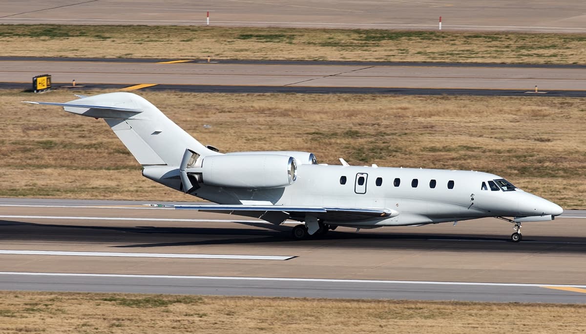 Fri, Nov 6in 2 daysOrlandoKMCO · Orlando International AirportProvidencialesMBPV · Providenciales AirportCitation X8—On request6NovOrlando → ProvidencialesKMCO → MBPV · in 2 daysCitation X · 8 seatsOn request
- Fri, Nov 6in 2 daysOrlandoKMCO · Orlando International AirportFort LauderdaleKFLL · Fort Lauderdale Hollywood International AirportCessna CitationJet5—$4,7306NovOrlando → Fort LauderdaleKMCO → KFLL · in 2 daysCessna CitationJet · 5 seats$4,730
- Fri, Nov 6in 2 daysOrlandoKMCO · Orlando International AirportFort LauderdaleKFLL · Fort Lauderdale Hollywood International AirportEmbraer Phenom 300E7—$4,8406NovOrlando → Fort LauderdaleKMCO → KFLL · in 2 daysEmbraer Phenom 300E · 7 seats$4,840
- Fri, Nov 6in 2 daysOrlandoKMCO · Orlando International AirportNashvilleKM77 · Howard County AirportHawker 9008—$13,6406NovOrlando → NashvilleKMCO → KM77 · in 2 daysHawker 900 · 8 seats$13,640
- Fri, Nov 6in 2 daysOrlandoKMCO · Orlando International AirportFort LauderdaleKFLL · Fort Lauderdale Hollywood International AirportPilatus PC-248—$5,1706NovOrlando → Fort LauderdaleKMCO → KFLL · in 2 daysPilatus PC-24 · 8 seats$5,170
 KMCO · Orlando Intl
 MBPV · Providenciales Airport
* Total price incl. 10% service fee, converted to your selected currency. Price subject to operator confirmation.
Empty legs to KMCO
43 arrivals available
- Thu, Nov 5TomorrowMiamiKTMB · Miami Executive AirportOrlandoKMCO · Orlando International AirportCessna CitationJet5—$4,6205NovMiami → OrlandoKTMB → KMCO · TomorrowCessna CitationJet · 5 seats$4,620
- Sat, Nov 7in 3 daysMiamiKOPF · Miami-Opa Locka Executive AirportOrlandoKMCO · Orlando International AirportCessna Citation CJ48—On request7NovMiami → OrlandoKOPF → KMCO · in 3 daysCessna Citation CJ4 · 8 seatsOn request
 Sun, Nov 8in 4 daysScottsdaleKSDL · Scottsdale AirportOrlandoKMCO · Orlando International AirportCitation CJ47—$29,6668NovScottsdale → OrlandoKSDL → KMCO · in 4 daysCitation CJ4 · 7 seats$29,666
 Mon, Nov 9in 5 daysNew YorkKTEB · Teterboro AirportOrlandoKMCO · Orlando International AirportCitation X8—On request9NovNew York → OrlandoKTEB → KMCO · in 5 daysCitation X · 8 seatsOn request
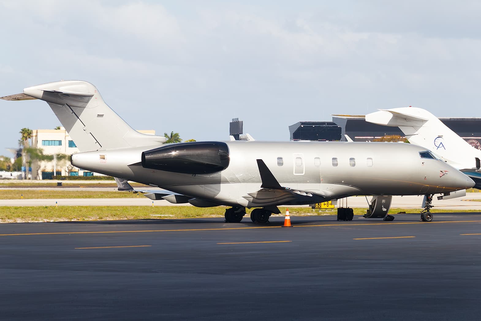 Tue, Nov 10in 6 daysLake CharlesKLCH · Lake Charles Regional AirportOrlandoKMCO · Orlando International AirportChallenger 3009—$15,82110NovLake Charles → OrlandoKLCH → KMCO · in 6 daysChallenger 300 · 9 seats$15,821
 Sat, Nov 14in 10 daysMiamiKOPF · Miami-Opa Locka Executive AirportOrlandoKMCO · Orlando International AirportCitation X8—$8,80014NovMiami → OrlandoKOPF → KMCO · in 10 daysCitation X · 8 seats$8,800
- Sun, Nov 15in 11 daysMiamiKOPF · Miami-Opa Locka Executive AirportOrlandoKMCO · Orlando International AirportCessna Citation CJ48—On request15NovMiami → OrlandoKOPF → KMCO · in 11 daysCessna Citation CJ4 · 8 seatsOn request
 Tue, Nov 17in 13 daysSouth BendKSBN · South Bend Regional AirportOrlandoKMCO · Orlando International AirportGulfstream G2009—On request17NovSouth Bend → OrlandoKSBN → KMCO · in 13 daysGulfstream G200 · 9 seatsOn request
- Wed, Nov 18in 14 daysChicagoKORD · Chicago O'Hare International AirportOrlandoKMCO · Orlando International AirportCessna Citation Excel 560XLS9—On request18NovChicago → OrlandoKORD → KMCO · in 14 daysCessna Citation Excel 560XLS · 9 seatsOn request
* Total price incl. 10% service fee, converted to your selected currency. Price subject to operator confirmation.
Map: Orlando Airport
View the location of Orlando – MCO/KMCO. Zoom in to explore the area around the airport.
About the airport
Orlando International Airport (MCO/KMCO) is the key private jet gateway for Orlando. PrivJet gives you instant access to charter flights and empty legs: fast, discreet and globally connected.
KMCO airport FAQ
Are there any restrictions at Orlando airport (KMCO) today?
There are currently 23 valid NOTAMs for Orlando (KMCO). Affected: Taxiway: closed; Obstacle: out of service; Runway end identifier lights: unserviceable; Services: out of service. 18 more NOTAMs start in the coming days. For information only, not for flight planning or operational use. Always rely on an official pre-flight briefing. This list may be incomplete or out of date.
What is the weather at Orlando airport (KMCO)?
According to the latest weather report for KMCO (METAR, 03 Nov, 22:53 UTC): Good visual conditions (VFR). Wind 8 kt (15 km/h) from east (100°), visibility 10 km or more, temperature 26 °C (dew point 21 °C). For information only, not for flight planning. Weather can change quickly; always rely on official reports.
How long are the runways at Orlando airport (KMCO)?
Orlando (KMCO) has 4 runways: runway 18L/36R with 3,659 m (12,005 ft), asphalt/concrete, runway 18R/36L with 3,659 m (12,004 ft), concrete, runway 17R/35L with 3,048 m (10,000 ft), concrete and runway 17L/35R with 2,744 m (9,001 ft), asphalt. The longest is 3,659 m.
What are the radio frequencies at Orlando airport (KMCO)?
Frequencies at KMCO: Tower 118.45 MHz, Ground 121.8 MHz and ATIS 121.25 MHz. For information only. Always rely on the published AIP.
What are the airport codes of Orlando International Airport?
The ICAO code is KMCO and the IATA code is MCO. ICAO codes are used by air traffic control and pilots, e.g. in flight plans; IATA codes appear on tickets and baggage tags.
What is the elevation of KMCO airport?
Orlando International Airport sits at 96 ft (29 m) above sea level. Local time zone: America/New York.
Can I fly to KMCO by private jet?
Whether a private jet can operate into Orlando International Airport depends on runway length, opening hours, customs and immigration rules as well as slot and handling availability, among other things. PrivJet checks this with the operating carrier for every request.
Are there empty legs from or to KMCO?
There are currently 54 empty legs departing from and 43 arriving at Orlando International Airport. Empty legs are repositioning flights at heavily reduced prices; the list is updated several times a day.